
Moisture and nearby frontal boundary will focus more showers and thunderstorms for portions of the Mid-Atlantic and Northeast today. Rainfall could be locally heavy resulting instances of flash flooding. Meanwhile, the heat lingers for areas of the Southeast and expands across the Western U.S. the next several days. Between these areas, severe thunderstorms possible for the Plains and Midwest. Read More >
Overview
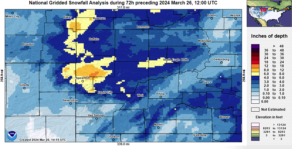
A strong winter storm impacted the region between Saturday, March 23rd and Monday, March 25th. This storm brought several rounds of wintry precipitation, with the majority of precipitation falling over the weekend. Snowfall diminished from west to east Sunday night (3/24) and into the day Monday (3/25). Some areas received minor amounts of freezing drizzle and freezing rain before the precipitation changed over to all snow. The highest snow totals were mainly from the northern slopes of the Black Hills into northwest South Dakota. Gusty northwest winds developed late Sunday night and Monday, which brought blowing and drifting snow.
Snowfall Map
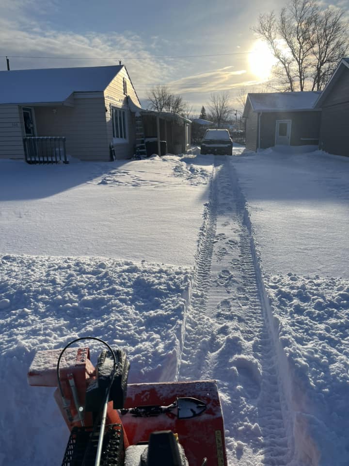
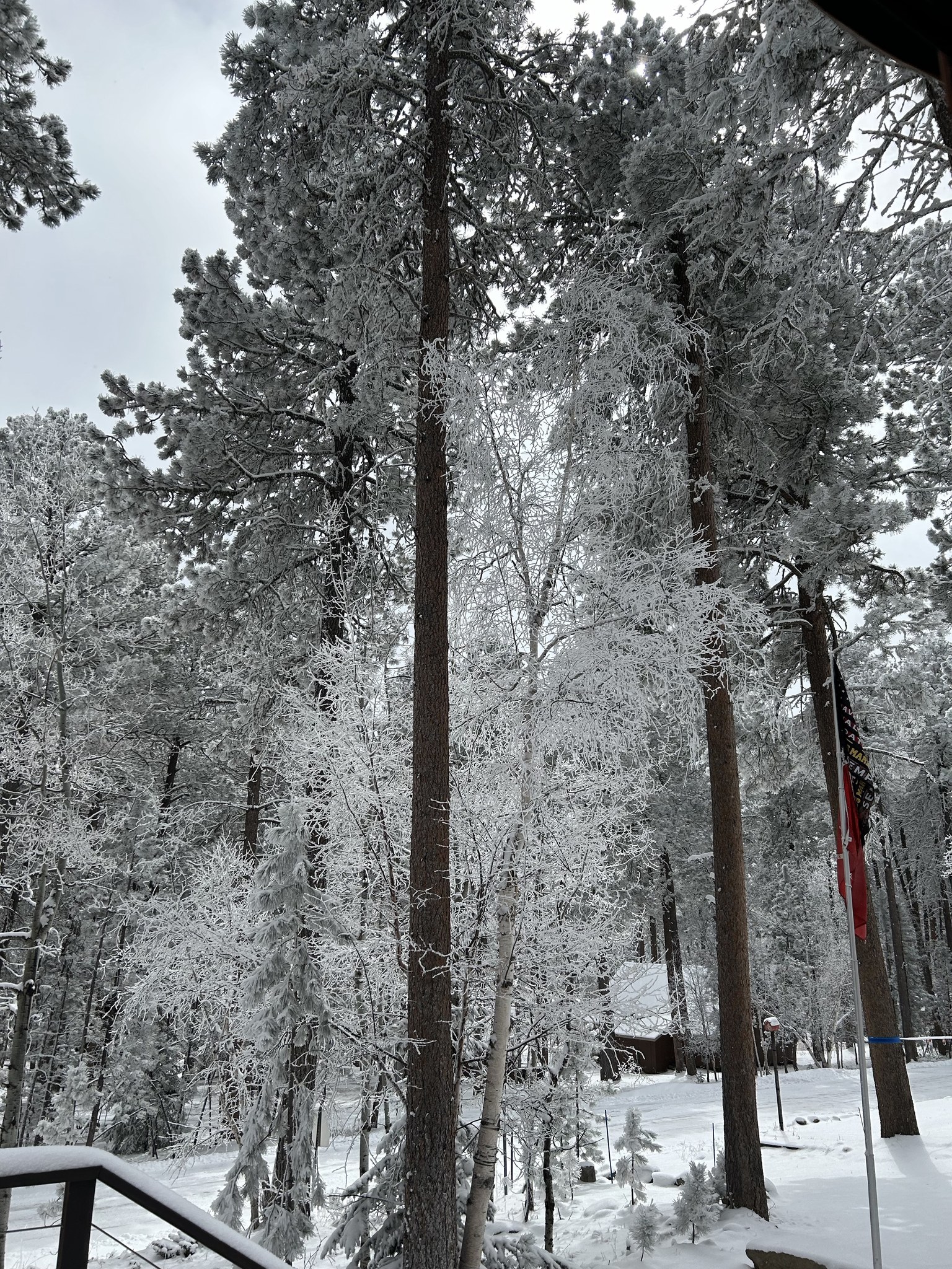
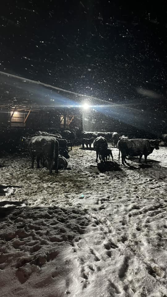
Photos
 |
 |
 |
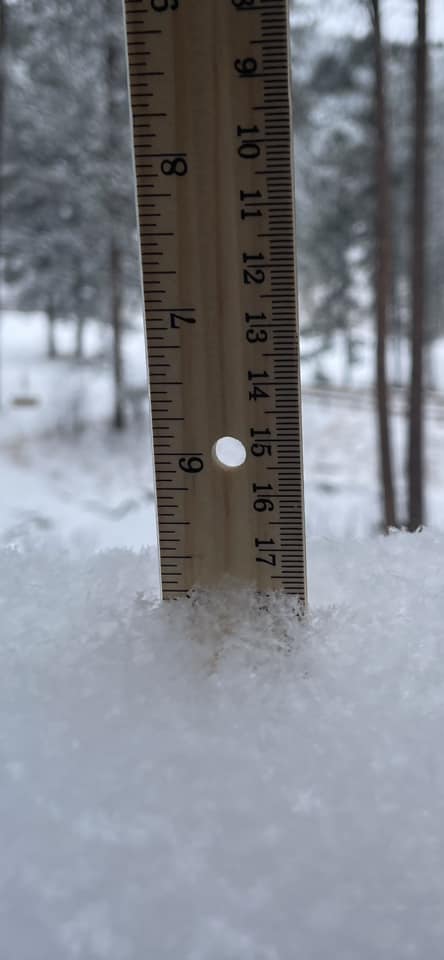 |
| Lemmon, SD (Courtesy: Candice H.) |
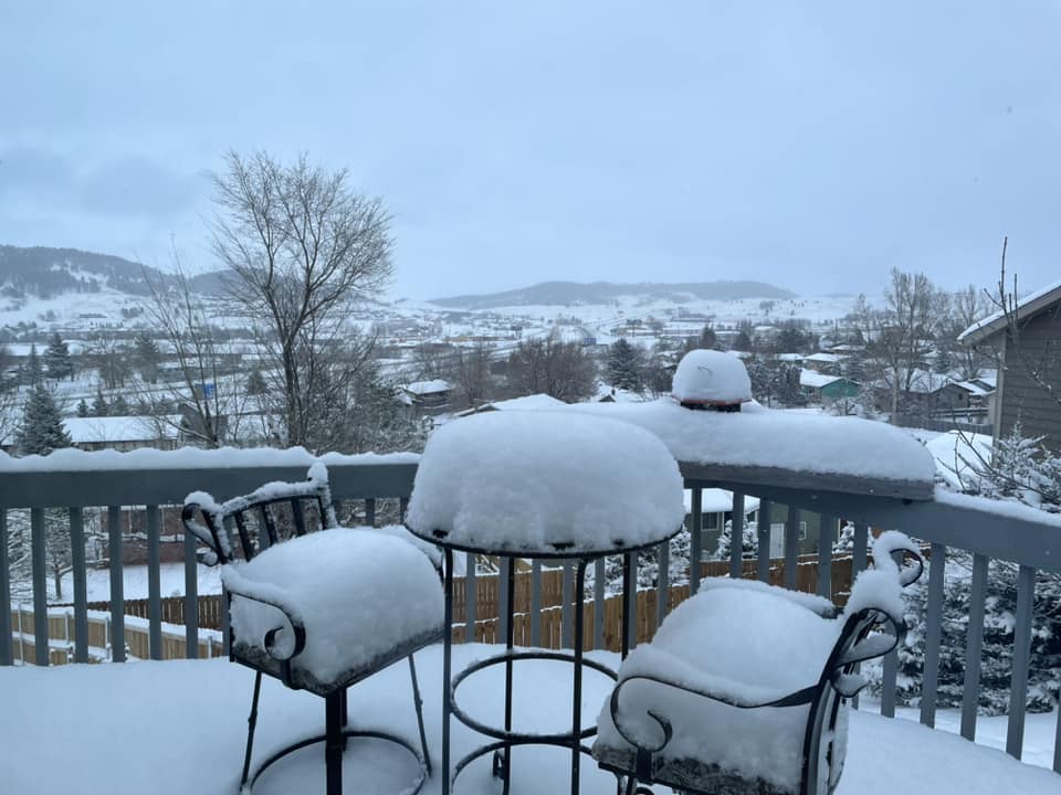
Deer Mountain, SD (Courtesy: Cathy E.) |
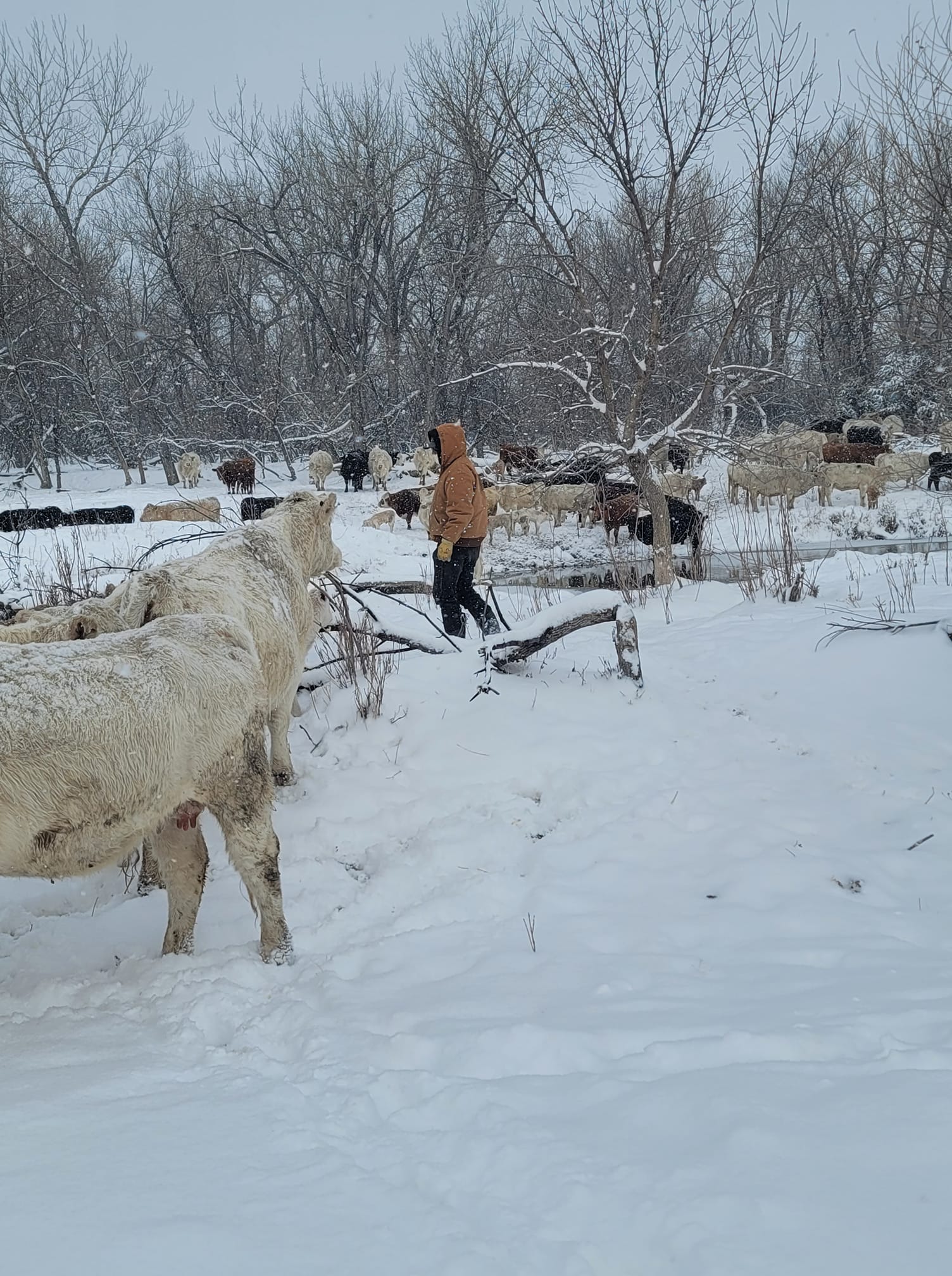
Sturgis, SD (Courtesy: Lane S.) |
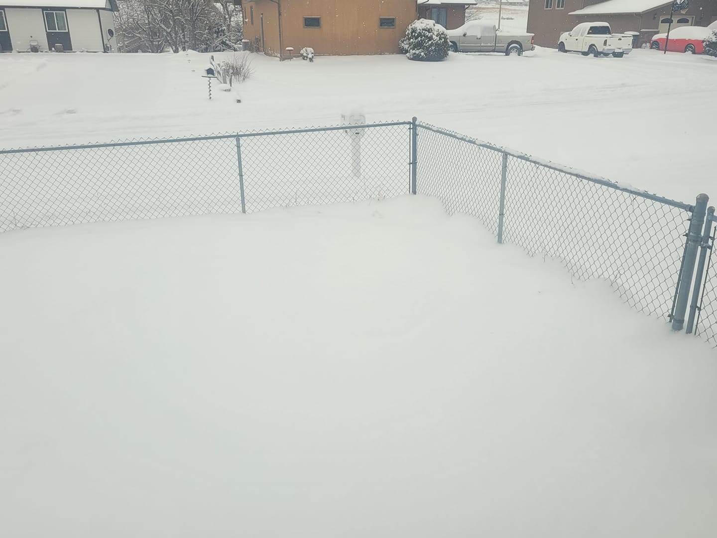
Johnson Siding, SD (Courtesy: Judie S.) |
 |
 |
 |
|
| Sturgis, SD (Courtesy: Corey K.) |
4 south of Wasta, SD (Courtesy: Joel D.) |
Sturgis, SD (Courtesy: Jason N.) |
Radar
Satellite
Storm Reports
Public Information Statement
National Weather Service Rapid City SD
855 AM MDT Tue Mar 26 2024

...Storm Total Snow Amounts March 23 to 25...

**********STORM TOTAL SNOWFALL (AT LEAST 0.5 INCH)**********
LOCATION                TOTAL      TIME/DATE  COMMENTS
                     SNOWFALL       MEASURED
                     (inches)

SOUTH DAKOTA

...Bennett County...
  2 WSW Swett             4.0   700 AM  3/25  CoCoRaHS
  8 E Martin              1.0   700 AM  3/25  Co-Op Observer

...Butte County...
  8 W Belle Fourche       7.0   804 AM  3/25  Public
  Belle Fourche           6.0   808 AM  3/25  Public

...Custer County...
  6 W Hermosa             1.8   700 AM  3/25  CoCoRaHS
  5 ENE Custer            0.7   700 AM  3/25  CoCoRaHS
  Hermosa                 0.5   600 AM  3/25  CoCoRaHS
  7 WSW Folsom            0.5   700 AM  3/25  CoCoRaHS

...Fall River County...
  Oral                    2.0   700 AM  3/25  Co-Op Observer
  Hot Springs             1.7   700 AM  3/25  CoCoRaHS
  14 SSW Provo            1.5  1100 AM  3/25  CoCoRaHS
  1 NNE Edgemont          1.0   700 AM  3/25  Co-Op Observer
  4 W Hot Springs         0.9   700 AM  3/25  CoCoRaHS
  Edgemont                0.5   700 AM  3/25  CoCoRaHS

...Haakon County...
  5 NE Milesville         5.0   700 PM  3/25  Storm total snow
  3 E Midland             2.0   700 AM  3/25  CoCoRaHS
  2 E Cottonwood          2.0   200 PM  3/25  Co-Op Observer

...Harding County...
  3 SSE Harding           8.0   108 PM  3/25  Storm total snow.
  Ludlow                  5.0   730 PM  3/24  Public

...Jackson County...
  11 SE Potato Creek      3.5   700 AM  3/25  CoCoRaHS
  3 WNW Kadoka            3.0   700 AM  3/25  CoCoRaHS

...Lawrence County...
  6 NNW Dwtn Spearfish    8.5   700 AM  3/25  CoCoRaHS
  2 WNW Dwtn Spearfish    8.3   700 AM  3/25  CoCoRaHS
  3 NE Whitewood          7.0   721 PM  3/25  Storm total snow
  1 NNW Dwtn Spearfish    7.0  1000 AM  3/25  Co-Op Observer
  3 SE Saint Onge         6.1   545 AM  3/25  CoCoRaHS
  Lead                    6.0   900 AM  3/25  Co-Op Observer
  2 ENE Cheyenne Cross    5.0   344 PM  3/25  Storm total snow
  3 ESE Cheyenne Cross    5.0   700 AM  3/25  CoCoRaHS
  4 NW Rochford           4.0   332 PM  3/25  Public
  Deadwood                3.0   625 PM  3/24  Public
  1 SW Deadwood           3.0   803 AM  3/25  Public
  O`Neil Pass             3.0   910 AM  3/25  Public

...Meade County...
  Sturgis                10.0   743 PM  3/25  Storm total snow
  1 NNW Piedmont          6.7   347 PM  3/25  Storm total snow
  12 WSW Hereford         6.0   702 PM  3/25  Storm total snow
  2 E Sturgis             5.5   700 PM  3/24  Co-Op Observer
  4 NNW Elm Springs       4.7   600 AM  3/25  CoCoRaHS
  6 WNW Union Center      4.0   700 AM  3/25  CoCoRaHS
  6 NE Summerset          3.5   700 AM  3/25  CoCoRaHS
  7 NNE Ellsworth AFB     3.1   700 AM  3/25  NWS Employee
  4 NNE Summerset         2.5   630 AM  3/25  CoCoRaHS
  6 SSW Fairpoint         2.0   700 AM  3/25  CoCoRaHS
  8 SE Mud Butte          2.0   800 AM  3/25  CoCoRaHS

...Mellette County...
  7 N Wood                1.0   600 AM  3/25  CoCoRaHS
  2 SSW Norris            1.0   700 AM  3/25  CoCoRaHS
  9 N Cedar Butte         1.0   600 AM  3/26  CoCoRaHS

...Oglala Lakota County...
  3 ENE Kyle              4.0   700 AM  3/25  Co-Op Observer

...Pennington County...
  4 W Dwtn Rapid City     5.7   700 AM  3/25  CoCoRaHS
  4 WSW Dwtn Rapid Cit    5.5   747 AM  3/25  Storm total snow so far
  1 N Hisega              5.3   700 AM  3/25  NWS Employee
  1 E Dwtn Rapid City     5.2  1200 PM  3/25  Storm total snow
  3 NE Hisega             5.0   700 AM  3/25  CoCoRaHS
  Johnson Siding          5.0   600 PM  3/25  Storm total snow
  4 NNE Johnson Siding    4.5   800 AM  3/25  CoCoRaHS
  3 NNE Johnson Siding    4.1   700 AM  3/25  CoCoRaHS
  6 W New Underwood       3.3   700 AM  3/25  CoCoRaHS
  1 ESE Pactola Resv      3.3   900 AM  3/25  Co-Op Observer
  4 S Dwtn Rapid City     3.2   700 AM  3/25  NWS Employee
  2 SSE Dwtn Rapid Cit    3.2   700 AM  3/25  CoCoRaHS
  4 NW Dwtn Rapid City    2.5   700 AM  3/25  Co-Op Observer
  19 NNE Creighton        2.5   700 AM  3/25  CoCoRaHS
  Mount Rushmore          2.1  1258 AM  3/25  Co-Op Observer
  12 S Quinn              2.0   800 AM  3/25  CoCoRaHS
  9 NNW Creighton         2.0   247 PM  3/24  snow amount thus far
  4 WNW Rapid City Arp    2.0   700 AM  3/25  CoCoRaHS
  Hill City               1.6   700 AM  3/25  Co-Op Observer
  9 ENE Hayward           0.5   800 AM  3/25  CoCoRaHS

...Perkins County...
  Lodgepole               7.0   715 PM  3/24  Public
  8 WNW Usta              3.5   306 PM  3/24  Trained Spotter
  Lemmon                  2.0   600 PM  3/25  Co-Op Observer

...Todd County...
  4 NW Parmelee           2.0   700 AM  3/25  CoCoRaHS
  16 SSE Mission          2.0   600 AM  3/25  CoCoRaHS

...Ziebach County...
  Dupree                 12.0   600 PM  3/24  Co-Op Observer
  2 W Glad Valley         8.0   816 AM  3/25  Storm total snow.

WYOMING

...Campbell County...
  11 NNE Weston           2.0   700 AM  3/25  CoCoRaHS
  8 WSW Rozet             1.3   700 AM  3/25  CoCoRaHS
  Wright                  1.0   700 AM  3/25  CoCoRaHS
  4 SE Gillette           1.0   530 PM  3/24  Co-Op Observer

...Crook County...
  6 SW Beulah             5.0   800 AM  3/25  CoCoRaHS
  Sundance                2.8   600 AM  3/25  CoCoRaHS

...Weston County...
  8 NNW Newcastle         2.0   700 AM  3/25  CoCoRaHS
  4 SE Upton              1.8   700 AM  3/25  CoCoRaHS
  1 WNW Clareton          1.5   700 AM  3/25  CoCoRaHS
  3 E Newcastle           1.5   600 AM  3/25  CoCoRaHS
  1 ESE Newcastle         0.7   900 AM  3/25  Co-Op Observer


...PRELIMINARY SNOW AND SLEET TOTALS (AT LEAST 0.5 INCH) SORTED BY MAGNITUDE...

LOCATION                      SNOWFALL    COMMENTS
                               IN/S/

Dupree SD                      12.0        600 PM 3/24/2024
Sturgis SD                     10.0        743 PM 3/25/2024
6 NNW Dwtn Spearfish SD         8.5        700 AM 3/25/2024
2 WNW Dwtn Spearfish SD         8.3        700 AM 3/25/2024
3 SSE Harding SD                8.0        108 PM 3/25/2024
2 W Glad Valley SD              8.0        816 AM 3/25/2024
3 NE Whitewood SD               7.0        721 PM 3/25/2024
1 NNW Dwtn Spearfish SD         7.0       1000 AM 3/25/2024
Lodgepole SD                    7.0        715 PM 3/24/2024
8 W Belle Fourche SD            7.0        804 AM 3/25/2024
1 NNW Piedmont SD               6.7        347 PM 3/25/2024
3 SE Saint Onge SD              6.1        545 AM 3/25/2024
12 WSW Hereford SD              6.0        702 PM 3/25/2024
Lead SD                         6.0        900 AM 3/25/2024
Belle Fourche SD                6.0        808 AM 3/25/2024
4 W Dwtn Rapid City SD          5.7        700 AM 3/25/2024
4 WSW Dwtn Rapid City SD        5.5        747 AM 3/25/2024
2 E Sturgis SD                  5.5        700 PM 3/24/2024
1 N Hisega SD                   5.3        700 AM 3/25/2024
1 E Dwtn Rapid City SD          5.2       1200 PM 3/25/2024
3 NE Hisega SD                  5.0        700 AM 3/25/2024
2 ENE Cheyenne Crossing SD      5.0        344 PM 3/25/2024
Ludlow SD                       5.0        730 PM 3/24/2024
5 NE Milesville SD              5.0        700 PM 3/25/2024
3 ESE Cheyenne Crossing SD      5.0        700 AM 3/25/2024
Johnson Siding SD               5.0        600 PM 3/25/2024
6 SW Beulah WY                  5.0        800 AM 3/25/2024
4 NNW Elm Springs SD            4.7        600 AM 3/25/2024
4 NNE Johnson Siding SD         4.5        800 AM 3/25/2024
3 NNE Johnson Siding SD         4.1        700 AM 3/25/2024
4 NW Rochford SD                4.0        332 PM 3/25/2024
3 ENE Kyle SD                   4.0        700 AM 3/25/2024
2 WSW Swett SD                  4.0        700 AM 3/25/2024
6 WNW Union Center SD           4.0        700 AM 3/25/2024
6 NE Summerset SD               3.5        700 AM 3/25/2024
11 SE Potato Creek SD           3.5        700 AM 3/25/2024
8 WNW Usta SD                   3.5        306 PM 3/24/2024
6 W New Underwood SD            3.3        700 AM 3/25/2024
1 ESE Pactola Resv SD           3.3        900 AM 3/25/2024
4 S Dwtn Rapid City SD          3.2        700 AM 3/25/2024
2 SSE Dwtn Rapid City SD        3.2        700 AM 3/25/2024
7 NNE Ellsworth AFB SD          3.1        700 AM 3/25/2024
Deadwood SD                     3.0        625 PM 3/24/2024
3 WNW Kadoka SD                 3.0        700 AM 3/25/2024
1 SW Deadwood SD                3.0        803 AM 3/25/2024
O`Neil Pass SD                  3.0        910 AM 3/25/2024
Sundance WY                     2.8        600 AM 3/25/2024
4 NW Dwtn Rapid City SD         2.5        700 AM 3/25/2024
19 NNE Creighton SD             2.5        700 AM 3/25/2024
4 NNE Summerset SD              2.5        630 AM 3/25/2024
Mount Rushmore SD               2.1       1258 AM 3/25/2024
11 NNE Weston WY                2.0        700 AM 3/25/2024
12 S Quinn SD                   2.0        800 AM 3/25/2024
3 E Midland SD                  2.0        700 AM 3/25/2024
Lemmon SD                       2.0        600 PM 3/25/2024
2 E Cottonwood SD               2.0        200 PM 3/25/2024
8 NNW Newcastle WY              2.0        700 AM 3/25/2024
6 SSW Fairpoint SD              2.0        700 AM 3/25/2024
Oral SD                         2.0        700 AM 3/25/2024
8 SE Mud Butte SD               2.0        800 AM 3/25/2024
9 NNW Creighton SD              2.0        247 PM 3/24/2024
4 WNW Rapid City Arpt SD        2.0        700 AM 3/25/2024
4 NW Parmelee SD                2.0        700 AM 3/25/2024
16 SSE Mission SD               2.0        600 AM 3/25/2024
6 W Hermosa SD                  1.8        700 AM 3/25/2024
4 SE Upton WY                   1.8        700 AM 3/25/2024
Hot Springs SD                  1.7        700 AM 3/25/2024
Hill City SD                    1.6        700 AM 3/25/2024
1 WNW Clareton WY               1.5        700 AM 3/25/2024
14 SSW Provo SD                 1.5       1100 AM 3/25/2024
3 E Newcastle WY                1.5        600 AM 3/25/2024
8 WSW Rozet WY                  1.3        700 AM 3/25/2024
7 N Wood SD                     1.0        600 AM 3/25/2024
Wright WY                       1.0        700 AM 3/25/2024
4 SE Gillette WY                1.0        530 PM 3/24/2024
8 E Martin SD                   1.0        700 AM 3/25/2024
2 SSW Norris SD                 1.0        700 AM 3/25/2024
1 NNE Edgemont SD               1.0        700 AM 3/25/2024
4 W Hot Springs SD              0.9        700 AM 3/25/2024
5 ENE Custer SD                 0.7        700 AM 3/25/2024
1 ESE Newcastle WY              0.7        900 AM 3/25/2024
Edgemont SD                     0.5        700 AM 3/25/2024
9 ENE Hayward SD                0.5        800 AM 3/25/2024
Hermosa SD                      0.5        600 AM 3/25/2024
7 WSW Folsom SD                 0.5        700 AM 3/25/2024
 |
Media use of NWS Web News Stories is encouraged! Please acknowledge the NWS as the source of any news information accessed from this site. |
|

