Dangerous heat will expand from the Gulf Coast into the Southern Plains and Desert Southwest through week's end. Additional extreme heat impacting the Pacific Northwest will shift to the northern Plains by the weekend. Tropical Storm Bertha is expected to continue to impact portions of the northwestern Gulf Coast from south central Louisiana to the upper Texas coast today. Read More >
Overview
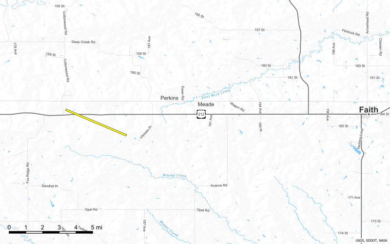
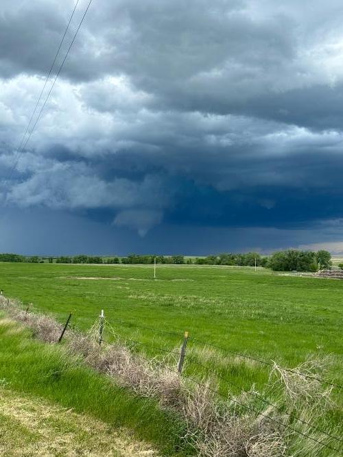
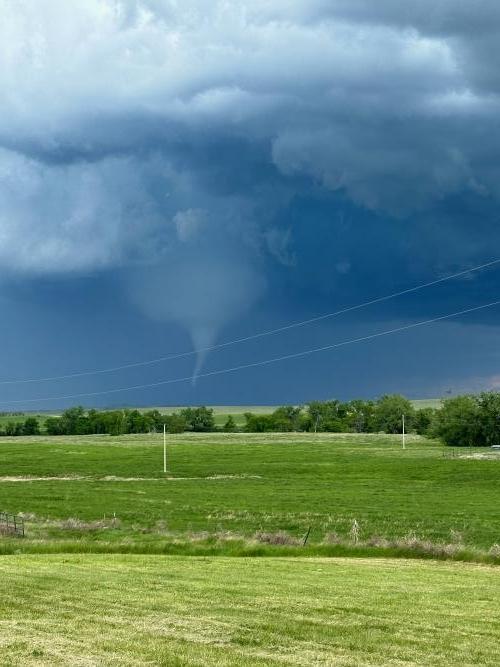
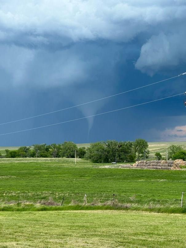
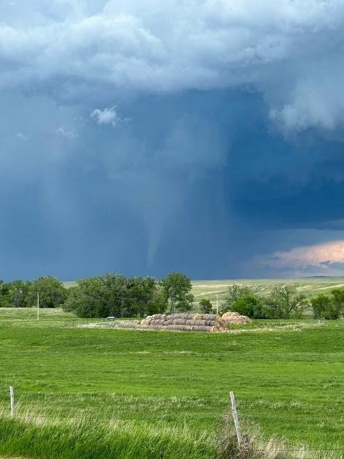
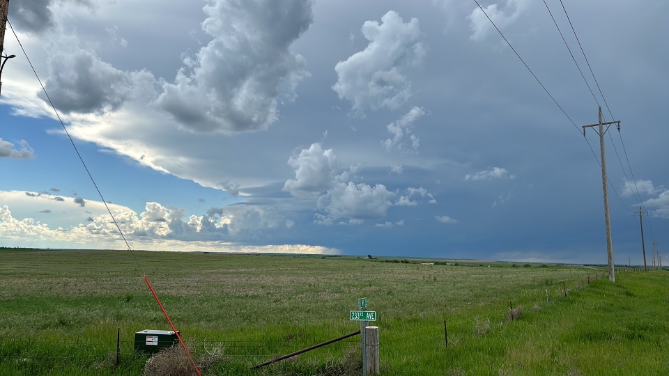
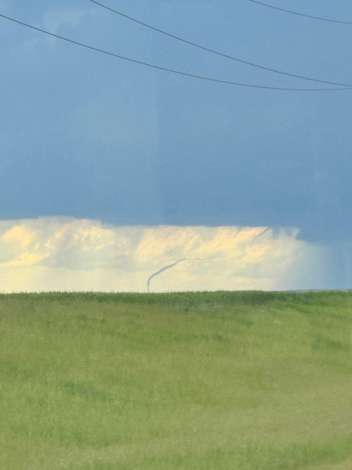
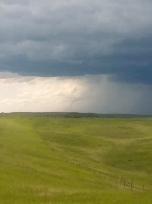
During the afternoon and evening hours of June 2, a cold front moving through the Northern Plains resulted in isolated severe thunderstorms. A severe thunderstorm developed in northwestern South Dakota and produced hail up to tennis ball size and a tornado as it tracked into northern Meade County. Other severe storms produced wind gusts in excess of 60 mph and large hail.
Tornadoes
|
Tornado - 17 Miles W Faith
|
||||||||||||||||
The Enhanced Fujita (EF) Scale classifies tornadoes into the following categories:
| EF0 Weak 65-85 mph |
EF1 Moderate 86-110 mph |
EF2 Significant 111-135 mph |
EF3 Severe 136-165 mph |
EF4 Extreme 166-200 mph |
EF5 Catastrophic 200+ mph |
 |
|||||
Photos & Video
Header
 |
 |
 |
 |
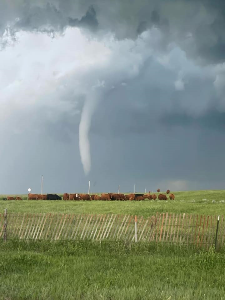
| West of Faith, SD (Courtesy Jerry Senn) |
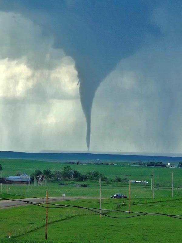
Near Faith, SD (Courtesy JT Vig) |
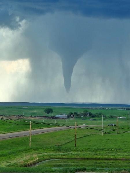
Near Faith, SD (Courtesy JT Vig) |
Near Faith, SD (Courtesy Lisa Surber) |
 |
 |
 |
 |
| Near Faith, SD (Courtesy Lisa Surber) |
Near Faith, SD (Courtesy Lisa Surber) |
Near Faith, SD (Courtesy Lisa Surber) |
Near Faith, SD (Courtesy Steve Dekle) |
 |
 |
||
| Near Faith, SD (Courtesy Steve Dekle) |
Near Faith, SD (Courtesy Xavier Bear Stops) |
Radar
Header
| < |
| NWS Rapid City Doppler Radar Loop June 2, 2024 2 PM MDT through 8 PM MDT |
Storm Reports
The following are unofficial observations taken during the event

***********************PEAK WIND GUST***********************

LOCATION             MAX WIND      TIME/DATE  COMMENTS
                         GUST       MEASURED
                        (mph)

SOUTH DAKOTA

...Tripp County...
  4 SSE Witten             64   701 PM  6/02  Mesonet at SD State


*********************MAXIMUM HAIL SIZE**********************

LOCATION                 HAIL      TIME/DATE  COMMENTS
                         SIZE       MEASURED
                     (inches)

SOUTH DAKOTA

...Meade County...
  12 NE Opal             1.75   320 PM  6/02  Law Enforcement

...Pennington County...
  2 W Rapid City Arpt    1.00   230 PM  6/02  Public
  1 E Dwtn Rapid City    0.75   245 PM  6/02  Public

...Perkins County...
  17 SW Usta             2.50   312 PM  6/02  Trained Spotter
  Shadehill              0.88   333 PM  6/02  Trained Spotter

...Ziebach County...
  1 WNW Red Scaffold     1.00   416 PM  6/02  Trained Spotter
  11 NW Red Scaffold     0.50   358 PM  6/02  Trained Spotter


...MAXIMUM OBSERVED WINDS SORTED BY MAGNITUDE...

LOCATION                      MAX WIND    COMMENTS
                               MPH

4 SSE Witten SD                  64        701 PM 6/02/2024


...MAXIMUM HAIL SIZE SORTED BY MAGNITUDE...

LOCATION                      MAX SIZE    COMMENTS
                               IN/S/

17 SW Usta SD                  2.50        312 PM 6/02/2024
12 NE Opal SD                  1.75        320 PM 6/02/2024
2 W Rapid City Arpt SD         1.00        230 PM 6/02/2024
1 WNW Red Scaffold SD          1.00        416 PM 6/02/2024
Shadehill SD                   0.88        333 PM 6/02/2024
1 E Dwtn Rapid City SD         0.75        245 PM 6/02/2024
11 NW Red Scaffold SD          0.50        358 PM 6/02/2024
 |
Media use of NWS Web News Stories is encouraged! Please acknowledge the NWS as the source of any news information accessed from this site. |
|