
Dangerous heat will expand from the Gulf Coast into the Southern Plains and Desert Southwest through week's end. Additional extreme heat impacting the Pacific Northwest will shift to the northern Plains by the weekend. Tropical Storm Bertha is expected to continue to impact portions of the northwestern Gulf Coast from south central Louisiana to the upper Texas coast today. Read More >
Overview
|
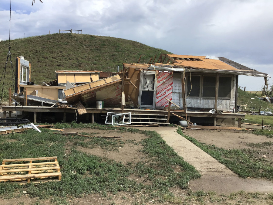
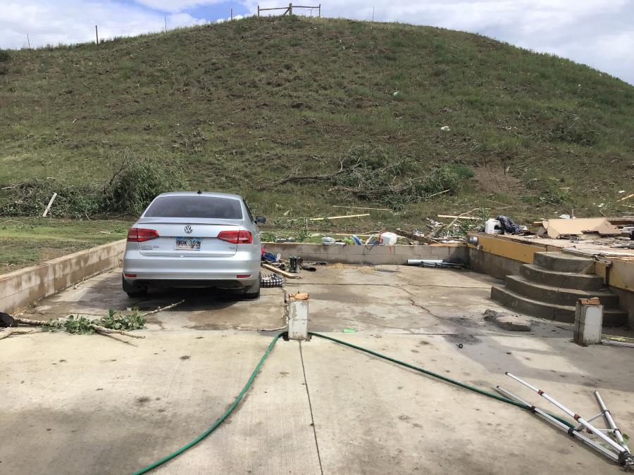
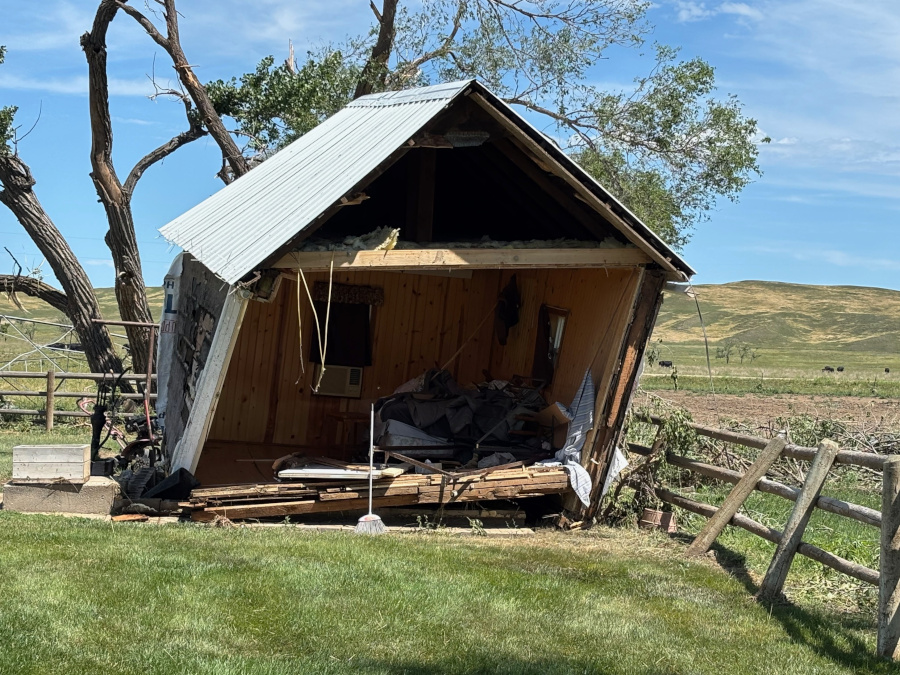
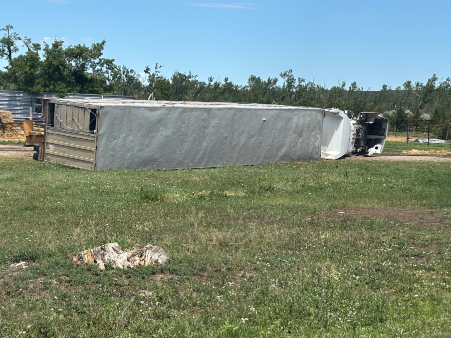
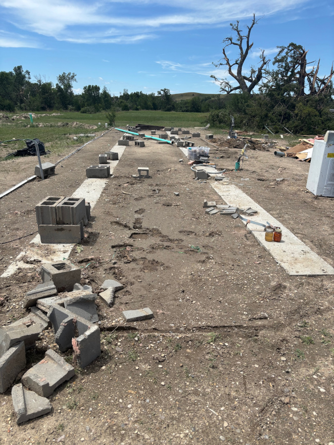
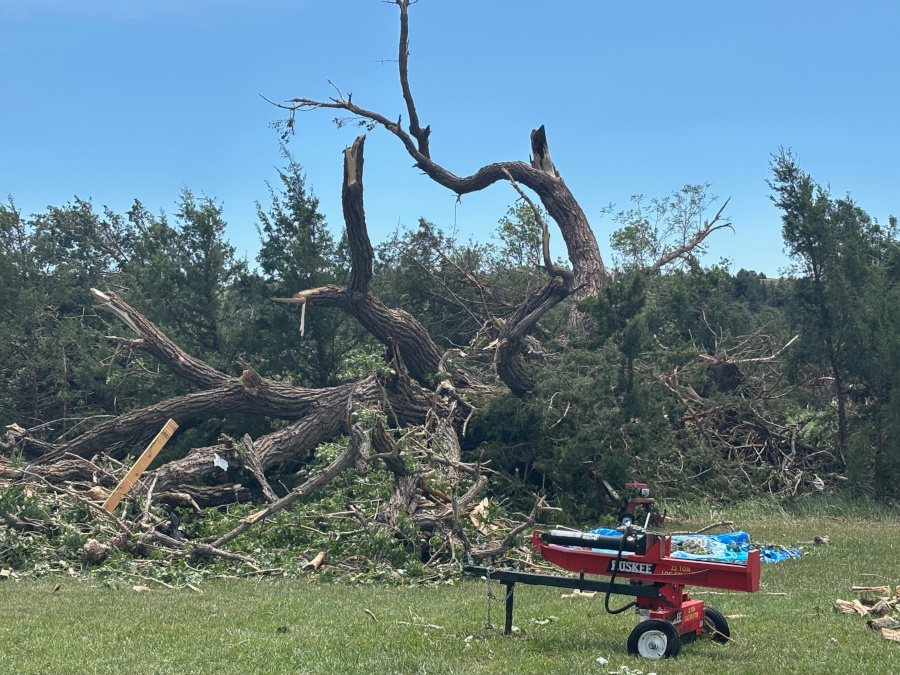
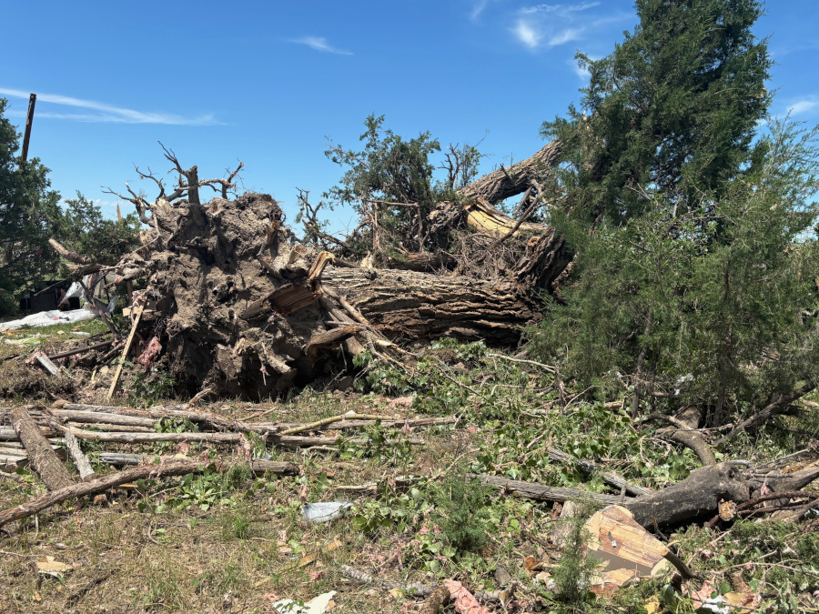
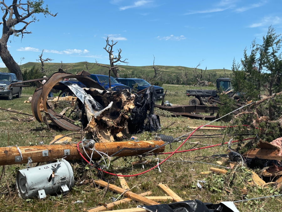
During the afternoon of June 28, 2025, a supercell that started in southeastern Montana tracked into western South Dakota. This storm brought winds over 80 mph and tennis ball to softball sized hail, damaging crops and farm equipment. At times the storm appeared tornadic and warranted a few tornado warnings. As the storm approached Kadoka, it dropped a tornado on the White River Valley area. The EF-2 tornado caused two injuries and significant damage to structures and trees. |
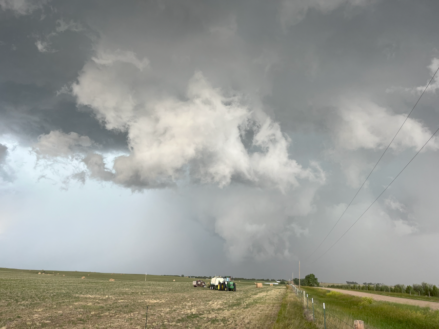
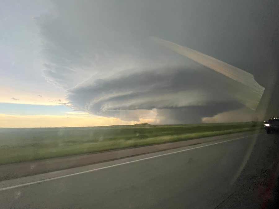 5 miles ENE Kadoka, SD June 28, 2024 648 PM shortly after the tornado began looking to the southwest (Courtesy Maria Bunkers) |
Tornadoes
Select a tornado from the table to zoom into the track and view more information. The default table view is limited to 8 tracks, but can be scrolled by a mouse wheel or dynamically expanded. Additionally, the table can fill the entire window by clicking the small circular expanding arrow icon at the very top right of the table and returned to its original size by clicking the button again. The side information panel that opens over the map can be closed using the "X" on the upper right corner of the pop-up. Zoom into the map and click damage points to see detailed information and pictures from the surveys.
|
NOTE: times shown below are local to your device's time zone. |

The Enhanced Fujita (EF) Scale classifies tornadoes into the following categories:
| EF0 Weak 65-85 mph |
EF1 Moderate 86-110 mph |
EF2 Significant 111-135 mph |
EF3 Severe 136-165 mph |
EF4 Extreme 166-200 mph |
EF5 Catastrophic 200+ mph |
 |
|||||
| Tornadoes that fail to impact any ratable damage indicators on the EF-Scale are rated EF-Unknown (EF-U) | |||||
Supercell Tracks
 |
 |
 |
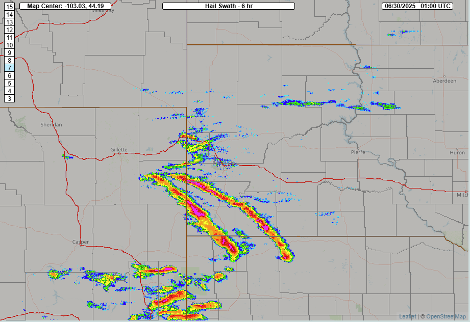 |
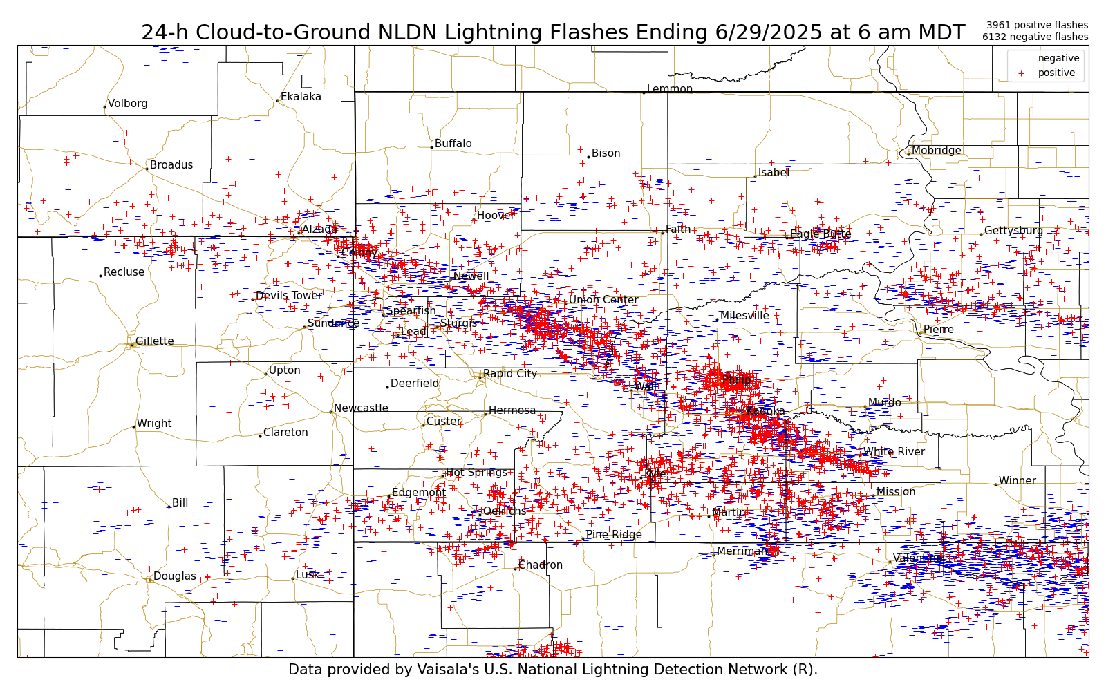
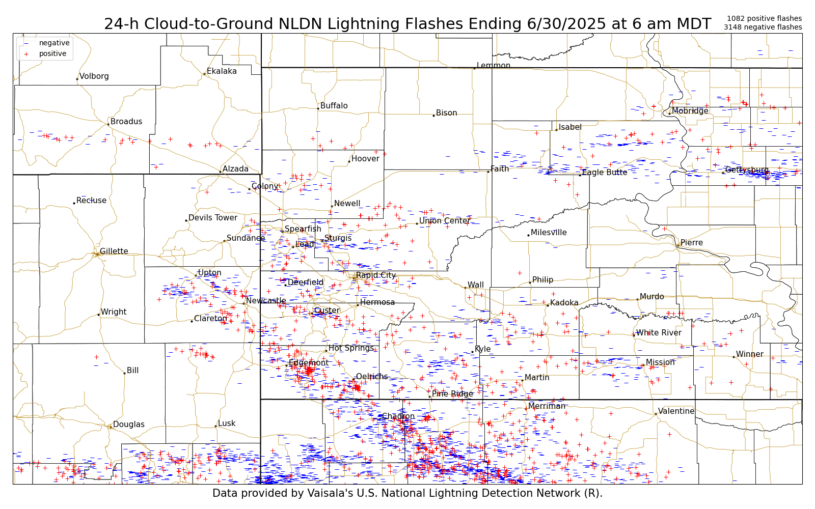
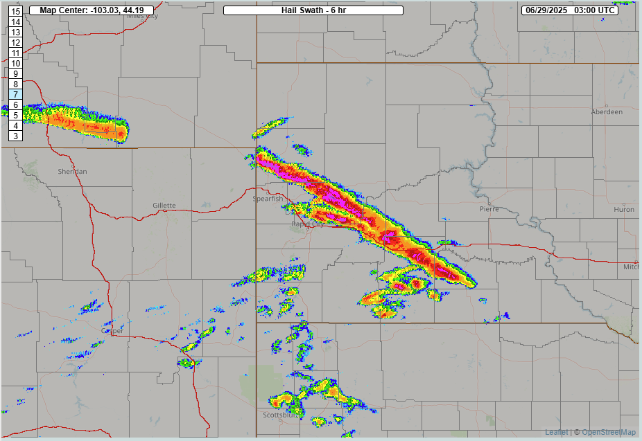
| 24-hour Cloud-to-Ground Lightning Flases Ending June 29, 2025 at 6am MDT | 24-hour Cloud-to-Ground Lightning Flases Ending June 30, 2025 at 6am MDT | 6-hour "Hail Swath" Ending at 900 pm June 28, 2025 | 6-hour "Hail Swath" Ending at 700 pm June 29, 2025 |
Photos & Video
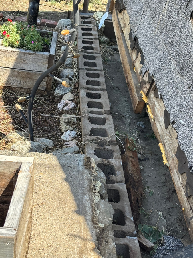
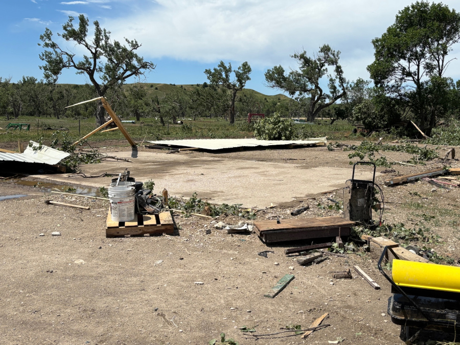
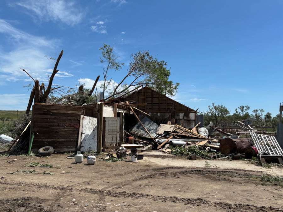
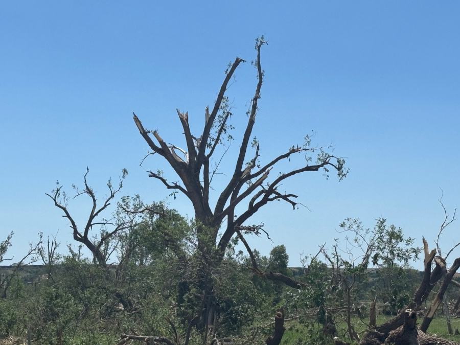
Tornado Damage
 |
 |
 |
 |
 |
 |
 |
 |
 |
 |
 |
 |
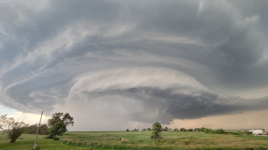
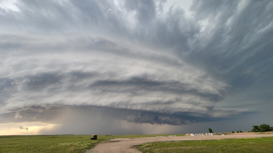
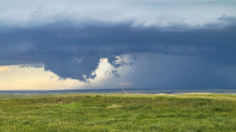
Storm Structure
 |
 |
 |
 |
| Near Kadoka, SD (Courtesy Matthew Bunkers) | Highway 79 and I-90 (Courtesy Matthew Bunkers) | Near Hereford, SD (Courtesy Matthew Bunkers) | Near Elm Springs, SD (Courtesy Matthew Bunkers) |
Time-Lapse of the Supercell (Courtesy Matthew Bunkers)
Social Media
Well, that was something😅 Followed the storm that went through Belle Fourche Reservoir/Nisland/Vale area.. Photo of broken tree branch around Vale/Empire area.. @NWSRapidCity #SDwx pic.twitter.com/nFW011t0J0
— Matt Kerney (@MattKerney) June 28, 2025
Stripped tree leaves & some broken branches.. Hail around golf-ball sized.. @NWSRapidCity #SDwx https://t.co/F4rZEW57Tl pic.twitter.com/Crk9FZrt9x
— Matt Kerney (@MattKerney) June 28, 2025
Very severe weather has hit the Nisland Mesonet station. It reported a 74 mph gust at 3:45pm MDT then 85 at 3:50 sending back these images. It’s unknown what happened next because the station apparently suffered damage at went offline. #SDwx @NWSRapidCity pic.twitter.com/kerPpz7EAH
— South Dakota Mesonet (@SDMesonet) June 28, 2025
@NWSRapidCity This photo just came in a few minutes ago. It was taken at 7:00pm north of Wall. pic.twitter.com/VfwgP38GzU
— Dillon Vogt (@DillonvWx) June 29, 2025
Big lowering near Edgemont, SD @NWSRapidCity 5:41 PM #SDwx pic.twitter.com/GfU5uSfEWB
— Falcon Storm Chasing (@FalcnStormChase) June 29, 2025
0008Z beautiful supercell in SW SD as seen looking NW from the NEb side of the state line NW of CDR, with Tempest Tours. Strong inflow, hard to stand. It is moving SE towards us & CDR. #sdwx #newx @NWSRapidCity @NWSCheyenne pic.twitter.com/pNrzj8TjfR
— Roger Edwards (@SkyPixWeather) June 30, 2025
Radar
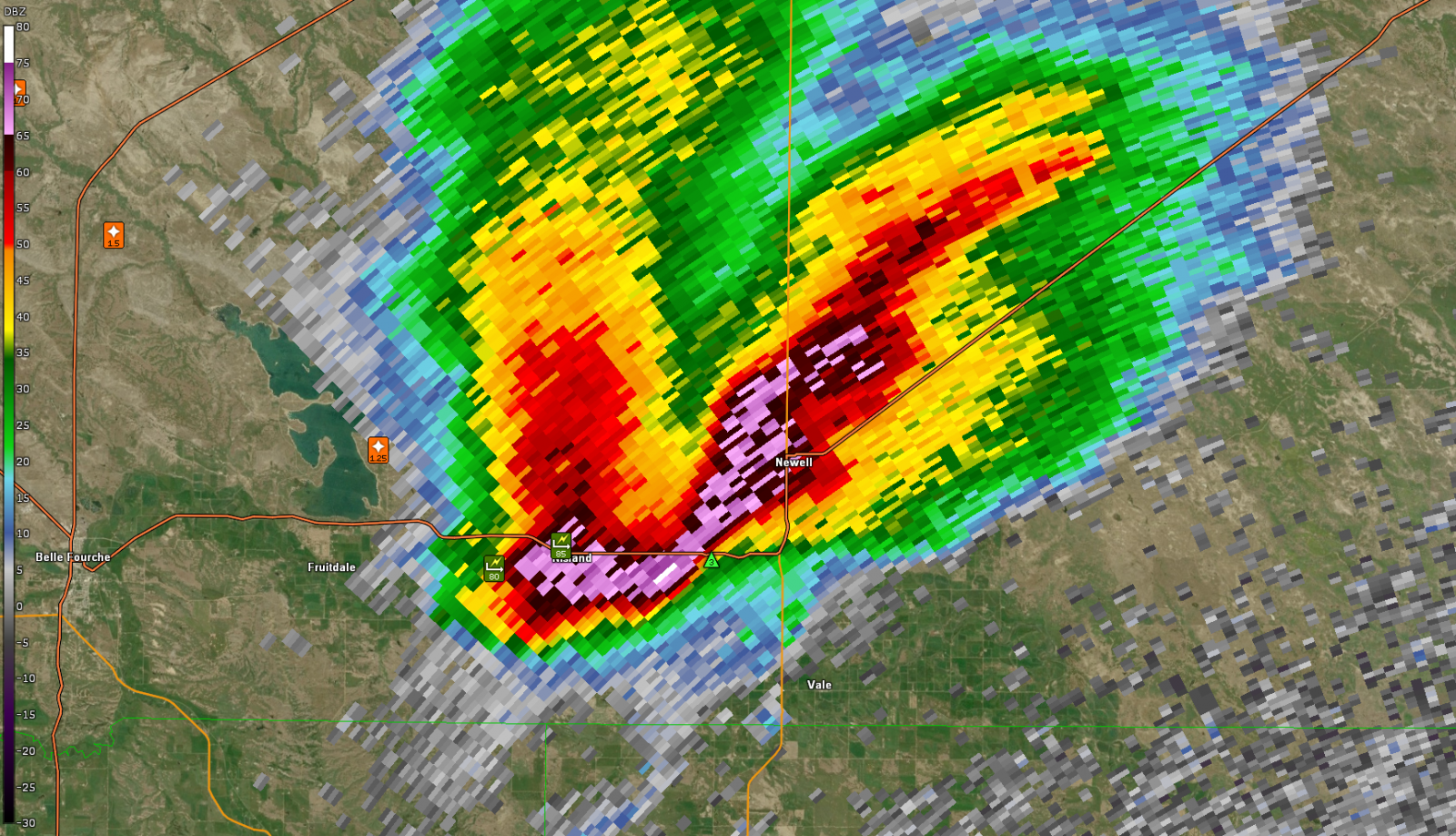 |
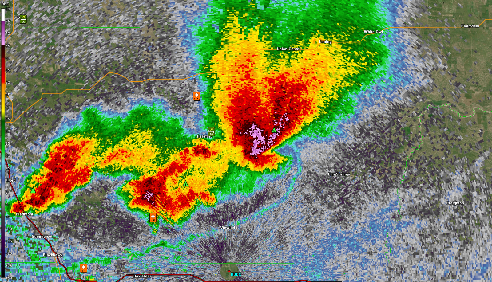 |
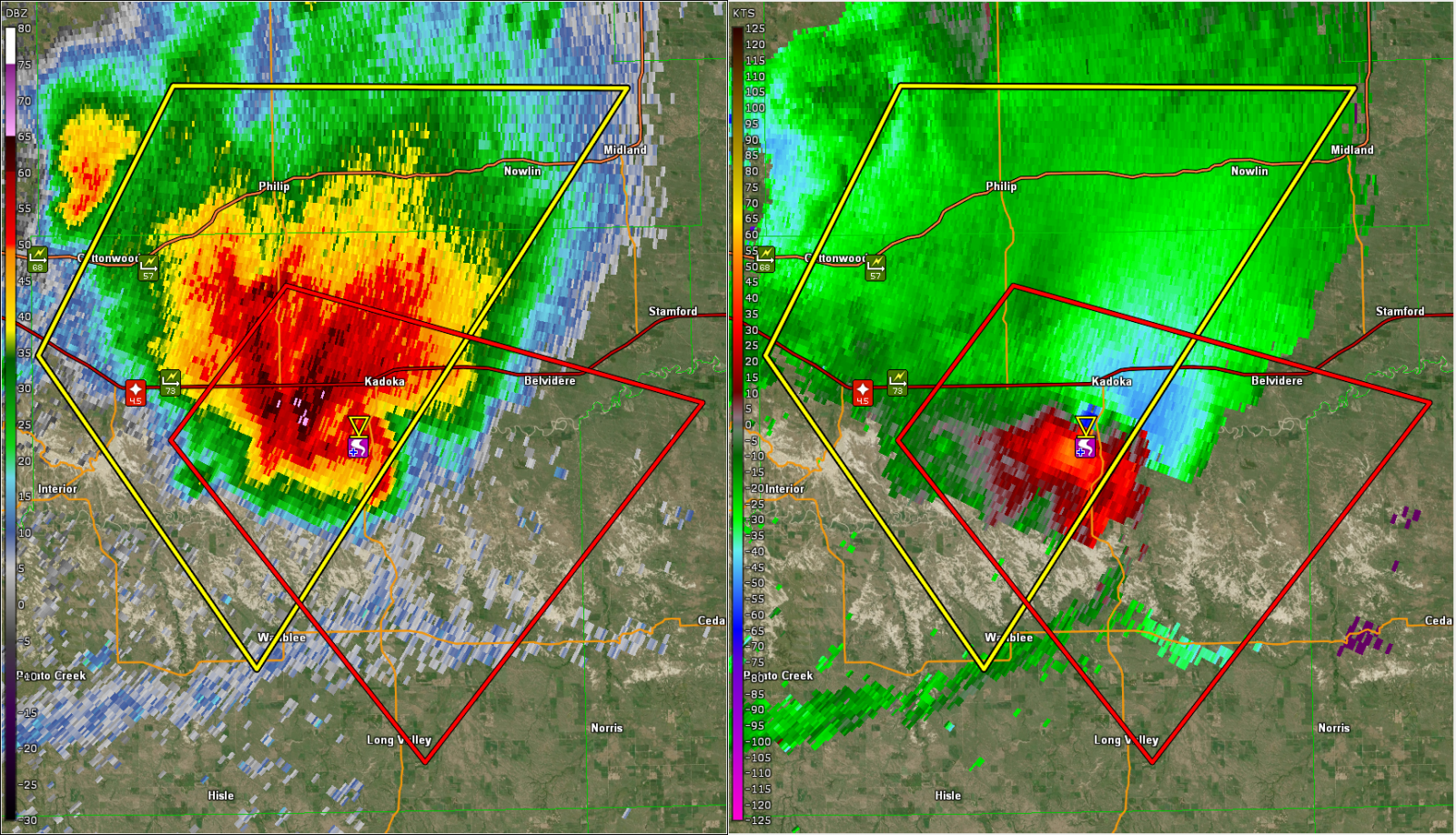 |
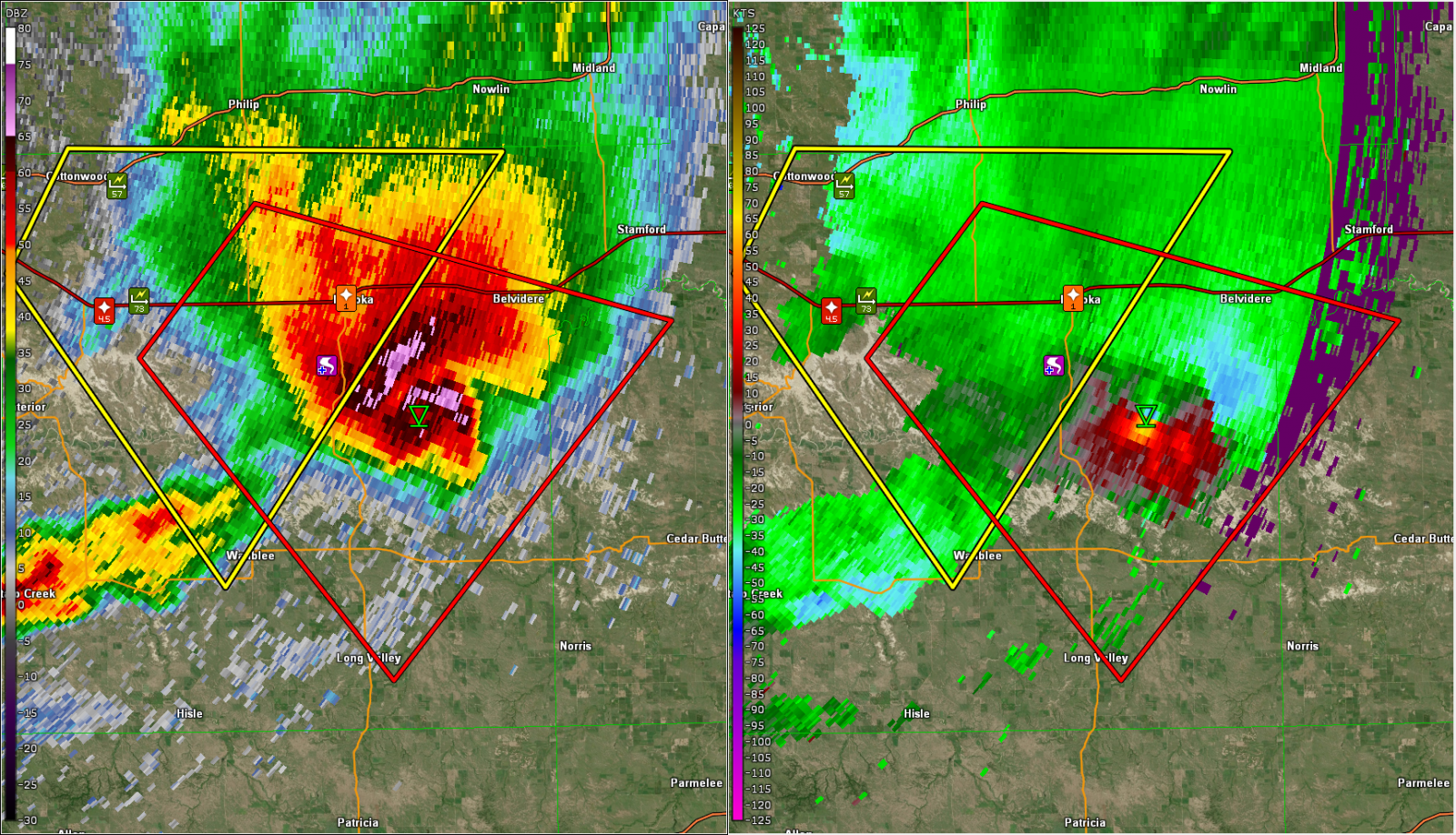 |
| June 28, 2025 350 PM MDT Base Reflectivity from KUDX | June 28, 2025 457 PM MDT Base Reflectivity from KUDX | June 28, 2025 646 PM MDT Base Reflectivity and Storm Relative Velocity from KUDX | June 28, 2025 659 PM MDT Base Reflectivity and Storm Relative Velocity from KUDX |
Time lapse of base reflectivity for the tornadic supercell.
Storm Reports
The following are unofficial observations taken from Saturday
afternoon (June 28, 2025) through Sunday evening (June 29, 2025)

...MAXIMUM OBSERVED WINDS (AT LEAST 50 MPH) SORTED BY MAGNITUDE...

LOCATION                      MAX WIND    COMMENTS
                               MPH

17 NNW New Haven WY              90       1019 PM 6/28/2025
1 NNW Nisland SD                 85        350 PM 6/28/2025
4 E Cactus Flat SD               85        635 PM 6/28/2025
Vale SD                          80        400 PM 6/28/2025
2 W Nisland SD                   80        342 PM 6/28/2025
1 N Hereford SD                  80        442 PM 6/28/2025
3 NNE Harrington SD              73       1145 PM 6/28/2025
11 SW Parmelee SD                71       1150 PM 6/28/2025
6 W Cottonwood SD                68        621 PM 6/28/2025
5 NE Porcupine SD                67       1041 PM 6/28/2025
11 SSE Hereford SD               66        505 PM 6/28/2025
1 S White River SD               65       1210 AM 6/29/2025
6 WSW Long Valley SD             65        740 PM 6/28/2025
7 NW Rockypoint WY               65       1014 PM 6/28/2025
2 E Elm Springs SD               65        520 PM 6/28/2025
13 NW Belle Fourche SD           61       1135 PM 6/28/2025
1 ESE Martin SD                  60       1105 PM 6/28/2025
14 NNW Edgemont SD               60        500 PM 6/29/2025
14 E Ellsworth AFB SD            60        500 PM 6/28/2025
3 NNE Newcastle WY               60        200 PM 6/29/2025
11 SW Oelrichs SD                60        612 PM 6/29/2025
1 W Manderson SD                 60        512 PM 6/29/2025
5 SE Norris SD                   60        724 PM 6/28/2025
6 W Parmelee SD                  59       1145 PM 6/28/2025
3 NW Wasta SD                    59        545 PM 6/28/2025
4 ENE Martin SD                  58       1110 PM 6/28/2025
15 SSE Mission SD                58       1216 AM 6/29/2025
1 NE Midland SD                  57        337 AM 6/29/2025
2 E Cottonwood SD                57        630 PM 6/28/2025
7 ESE Rosebud SD                 56       1210 AM 6/29/2025
Wasta SD                         56        545 PM 6/28/2025
1 NE Winner SD                   55       1255 AM 6/29/2025
2 SSW Custer SD                  54        256 PM 6/29/2025
9 SW Batesland SD                54       1201 AM 6/29/2025
7 E Wanblee SD                   54       1120 PM 6/28/2025
8 NNW Oshoto WY                  54       1025 PM 6/28/2025
4 SSE Witten SD                  53       1246 AM 6/29/2025
1 NNE Faith SD                   52        436 PM 6/29/2025
10 W Edgemont SD                 51       1005 PM 6/28/2025
9 ENE Belvidere SD               51        347 AM 6/29/2025
11 SSW Oelrichs SD               51        610 PM 6/29/2025
3 E Philip SD                    51        318 AM 6/29/2025
3 W Union Center SD              51        100 AM 6/29/2025
4 NNE Colome SD                  50        105 AM 6/29/2025
Union Center SD                  50        105 AM 6/29/2025
1 SSE Pine Ridge SD              50       1145 PM 6/28/2025

...MAXIMUM HAIL SIZE (AT LEAST 0.50 INCH) SORTED BY MAGNITUDE...

LOCATION                      MAX SIZE    COMMENTS
                               IN/S/

18 W Kadoka SD                 4.50        625 PM 6/28/2025
Vale SD                        2.50        400 PM 6/28/2025
1 N Hereford SD                2.50        442 PM 6/28/2025
6 NNW Hereford SD              1.75        435 PM 6/28/2025
2 W Nisland SD                 1.75        342 PM 6/28/2025
11 SW Rockyford SD             1.75        440 PM 6/29/2025
1 WSW Newcastle WY             1.50        540 AM 6/29/2025
7 NNE Ellsworth AFB SD         1.50        455 PM 6/28/2025
10 N Belle Fourche SD          1.50        315 PM 6/28/2025
Edgemont SD                    1.25        525 PM 6/29/2025
4 NNE Fruitdale SD             1.25        335 PM 6/28/2025
Newcastle WY                   1.25        531 AM 6/29/2025
1 NW Kadoka SD                 1.00        650 PM 6/28/2025
13 E Ardmore SD                1.00        620 PM 6/29/2025
14 E Ellsworth AFB SD          1.00        547 PM 6/28/2025
2 SE Custer SD                 1.00        635 AM 6/29/2025
14 ESE Custer SD               1.00        325 PM 6/29/2025
2 WSW Custer SD                1.00        252 PM 6/29/2025
1 W Manderson SD               1.00        512 PM 6/29/2025
14 N Belle Fourche SD          1.00        315 PM 6/28/2025
12 SSW Newcastle WY            1.00        413 PM 6/29/2025
Custer SD                      0.70        307 PM 6/29/2025
6 N Newcastle WY               0.50        150 PM 6/29/2025
 |
Media use of NWS Web News Stories is encouraged! Please acknowledge the NWS as the source of any news information accessed from this site. |
|

