
Dangerous heat will expand from the Gulf Coast into the Southern Plains and Desert Southwest through week's end. Additional extreme heat impacting the Pacific Northwest will shift to the northern Plains by the weekend. Tropical Storm Bertha is expected to continue to impact portions of the northwestern Gulf Coast from south central Louisiana to the upper Texas coast today. Read More >
Overview
|
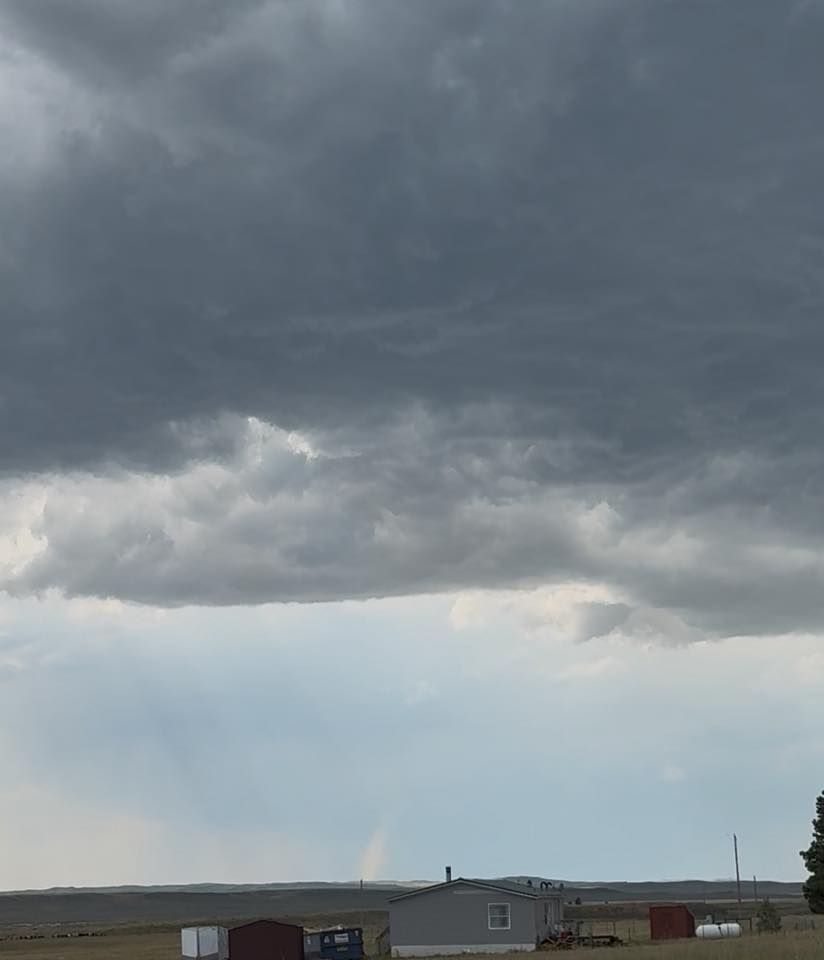
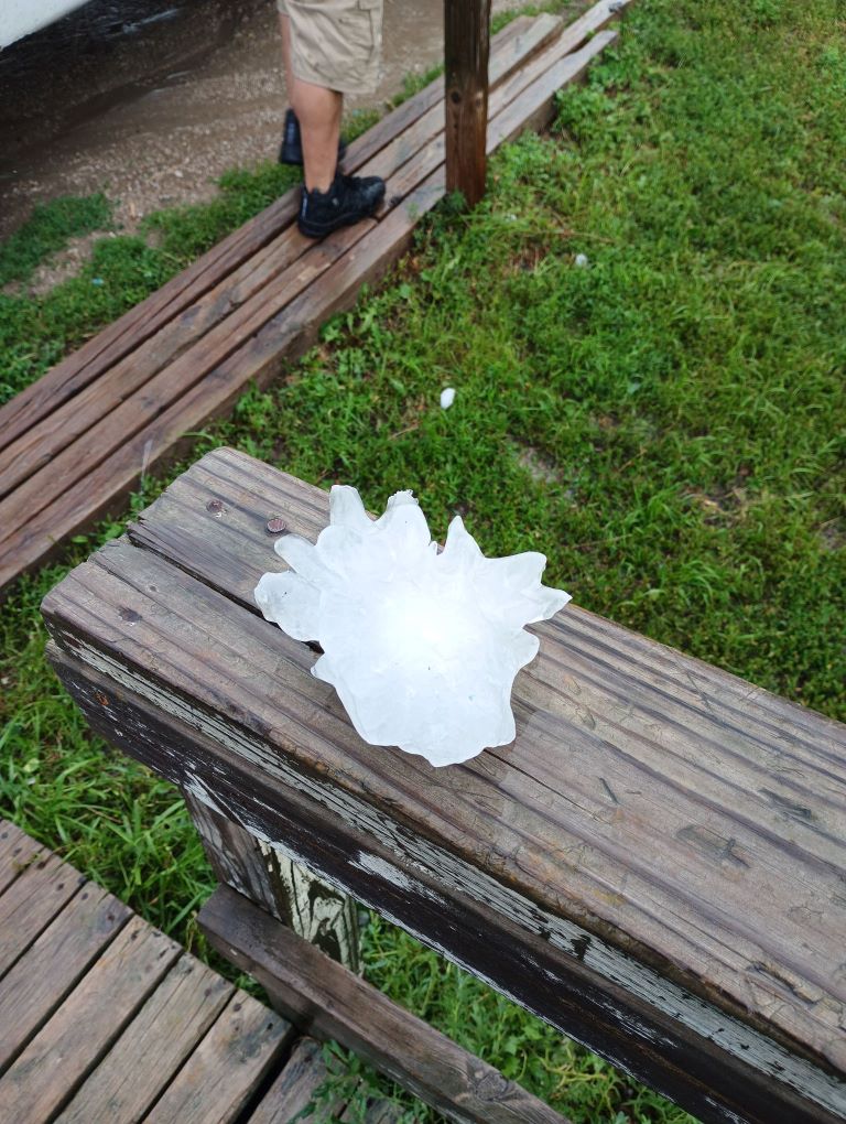
Severe storms produced tornadoes, large hail, and damaging winds during the afternoon and evening hours of July 19 and 20. An EF-1 tornado was confirmed northwest of Moorcroft, Wyoming on July 19 and EF-Unknown tornado was confirmed near Parmelee, South Dakota on July 20. Tennis ball, baseball, and softball sized hail was reported in Parmelee, Grass Mountain, and Saint Francis on July 20. |
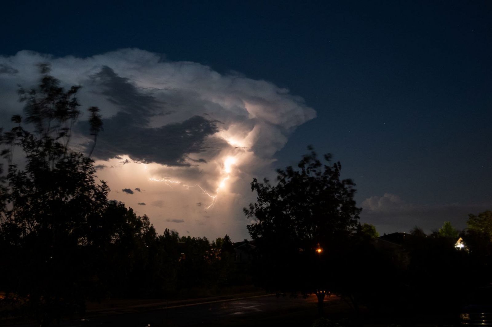 Photo by Em W |
Tornadoes
Select a tornado from the table to zoom into the track and view more information. The default table view is limited to 8 tracks, but can be scrolled by a mouse wheel or dynamically expanded. Additionally, the table can fill the entire window by clicking the small circular expanding arrow icon at the very top right of the table and returned to its original size by clicking the button again. The side information panel that opens over the map can be closed using the "X" on the upper right corner of the pop-up. Zoom into the map and click damage points to see detailed information and pictures from the surveys.
|
NOTE: times shown below are local to your device's time zone. |

The Enhanced Fujita (EF) Scale classifies tornadoes into the following categories:
| EF0 Weak 65-85 mph |
EF1 Moderate 86-110 mph |
EF2 Significant 111-135 mph |
EF3 Severe 136-165 mph |
EF4 Extreme 166-200 mph |
EF5 Catastrophic 200+ mph |
 |
|||||
| Tornadoes that fail to impact any ratable damage indicators on the EF-Scale are rated EF-Unknown (EF-U) | |||||
Photos & Video
 |
 |
 |
 |
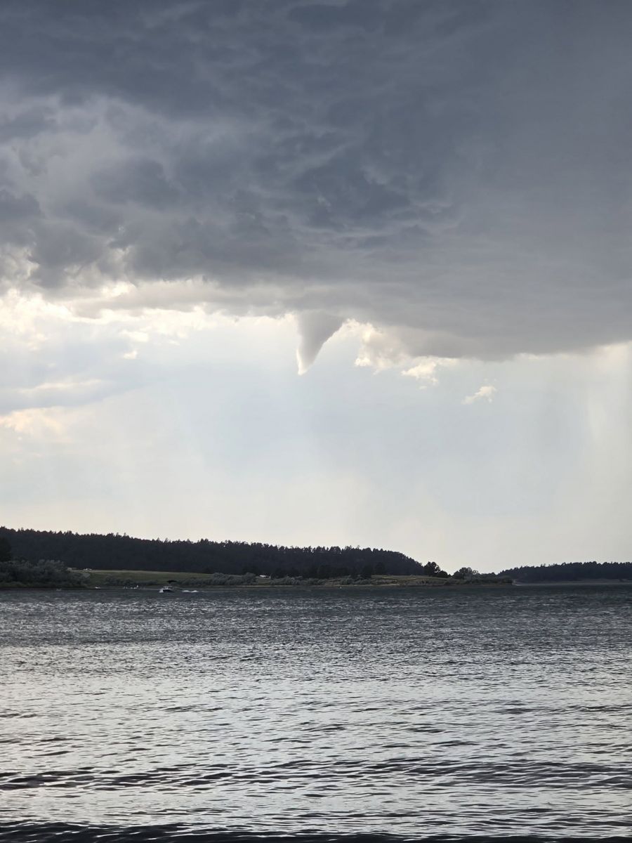
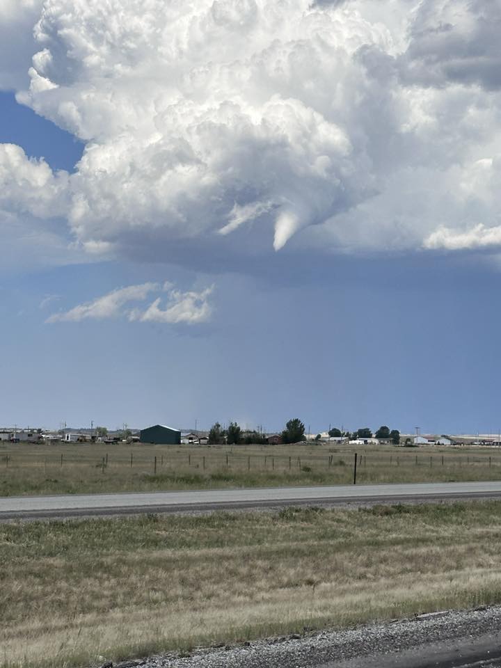
| Funnel Cloud from Keyhole Reservoir July 19, 2025 (Andrea H) |
Tornado northwest of Moorcroft July 19, 2025 (Anthony F) |
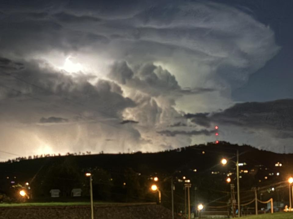
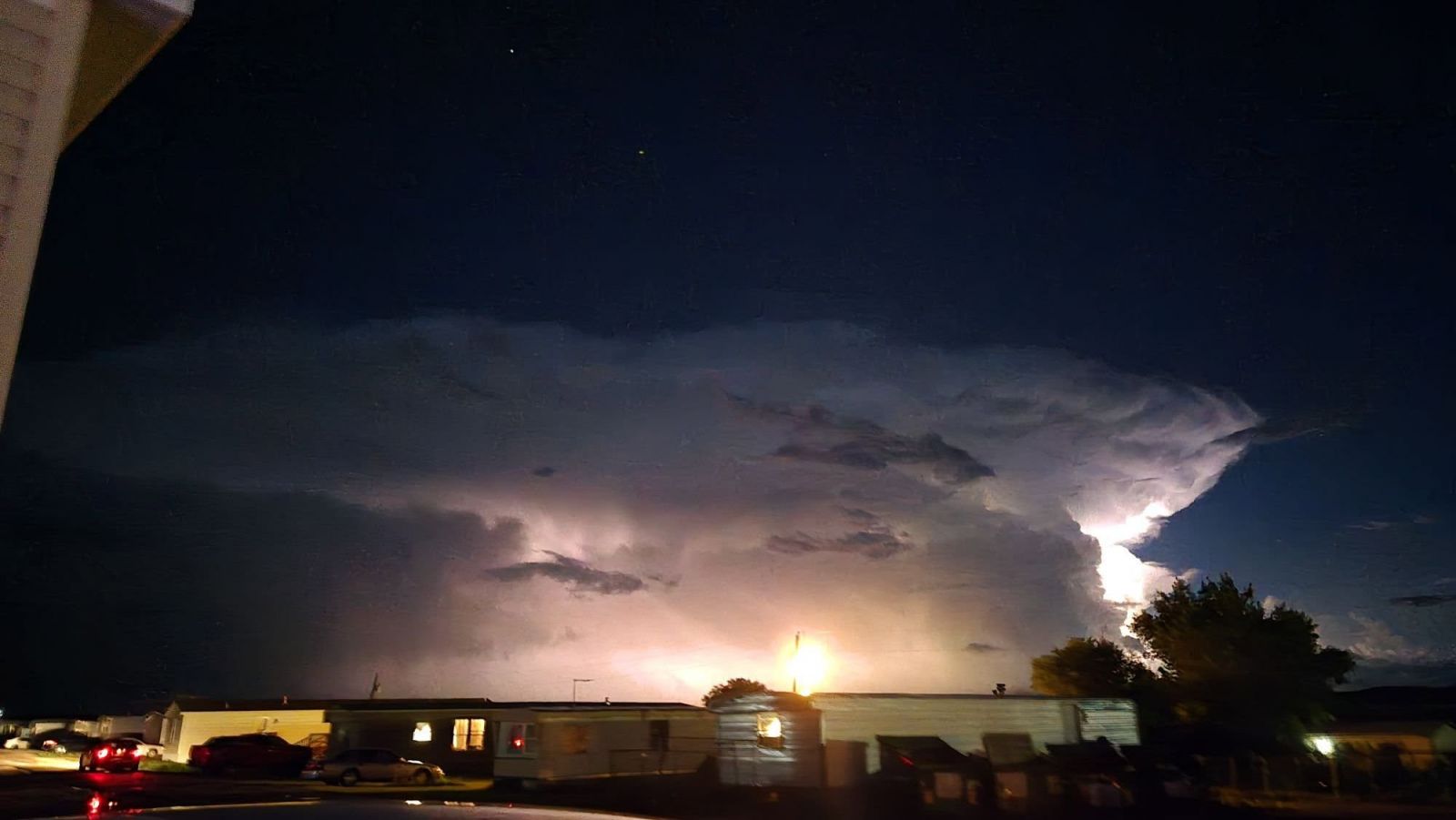
Lightning in Rapid City July 19, 2025 (Jackie S) |
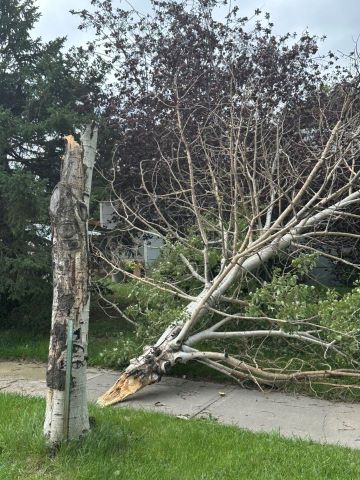
Tree Damage in Rapid Valley July 19, 2025 (Deborah G) |
 |
 |
 |
 |
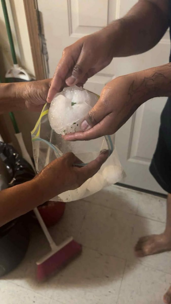
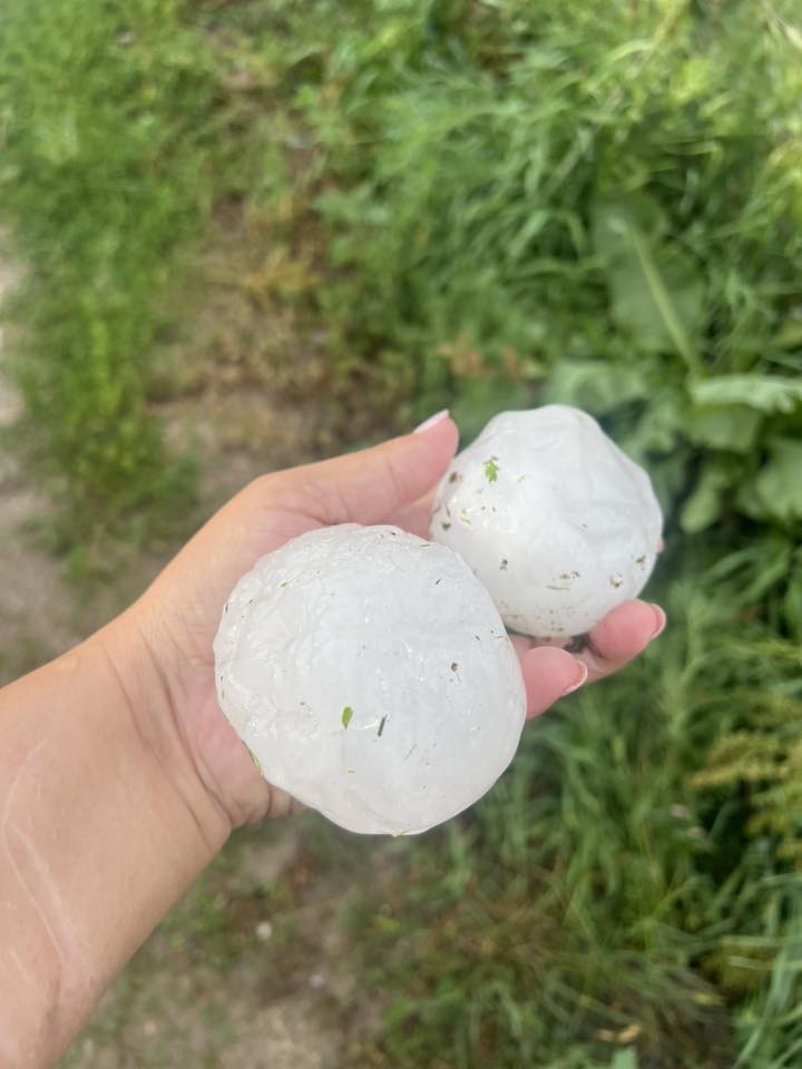
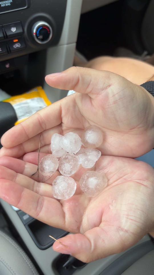
| Hail at Parmelee July 20, 2025 (Victoria O) |
Hail at Parmelee July 20, 2025 (Victoria O) |
Funnel Cloud from Pine Haven July 19, 2025 (Andrea H) |
Funnel Cloud from Keyhole Reservoir July 19, 2025 (Adam T) |
 |
 |
 |
 |
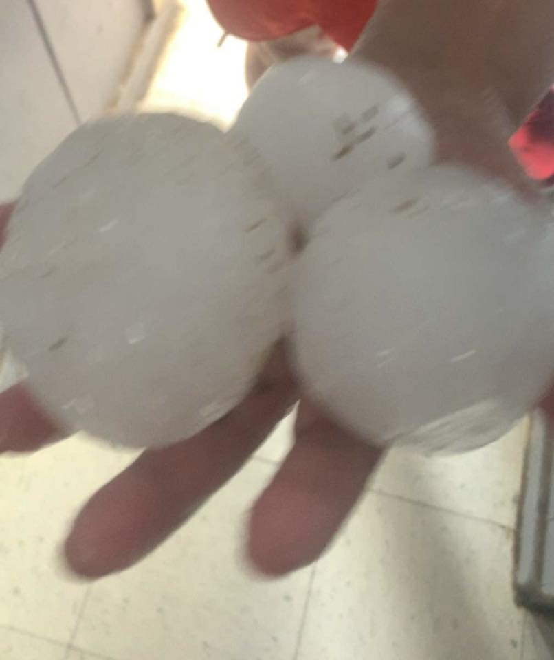
| Hail at Parmelee July 20, 2025 (Elisha Y) |
Hail at Parmelee July 20, 2025 (Elisha Y) |
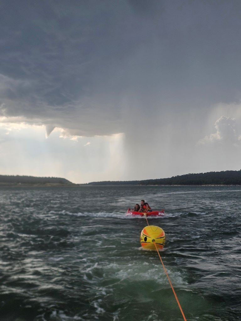
Storm from Box Elder July 19, 2025 (Amber M) |
Hail at Parmelee July 20, 2025 (Viva W) |
 |
 |
 |
 |
| Hail at Buckhorn July 19, 2025 (Sadie N) |
Hail in Rapid City July 19, 2025 (Sarah C) |
Hail at Parmelee July 20, 2025 (Michelle B) |
Hail at Parmelee July 20, 2025 (Viva W) |
Video from Parmelee by Victoria O
Radar
July 20, 2025
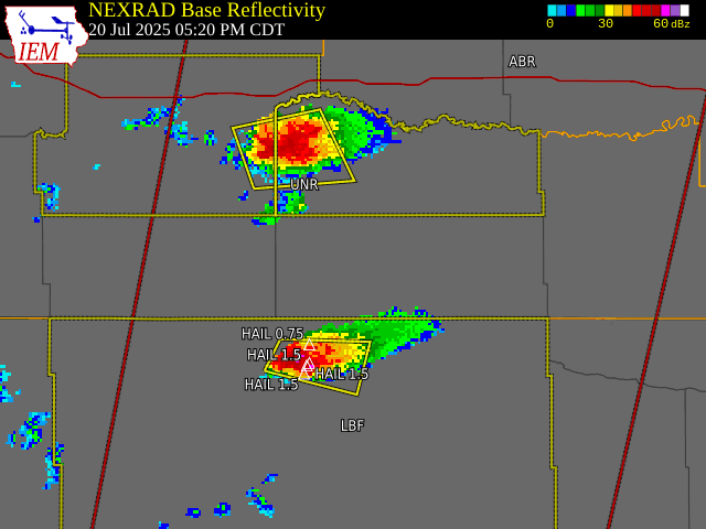 |
| Radar reflectivity, watches and warnings, and local storm reports from July 20, 2025 over south central South Dakota |
Storm Reports
...MAXIMUM HAIL SIZE (AT LEAST 0.50 INCH) SORTED BY MAGNITUDE...
LOCATION MAX SIZE
IN/S/
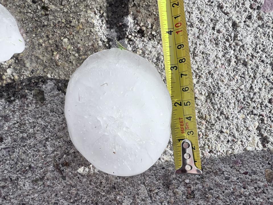
Rosebud SD 4.50 615 PM 7/20/2025
Parmelee SD 4.00 545 PM 7/20/2025
5 NW Saint Francis SD 2.50 604 PM 7/20/2025
Saint Francis SD 2.00 643 PM 7/20/2025
7 ESE Saint Francis SD 1.75 650 PM 7/20/2025
7 N Belvidere SD 1.25 655 PM 7/20/2025
3 SSE SILVER CITY SD 1.00 755 PM 7/19/2025
2 W Black Hawk SD 1.00 724 PM 7/19/2025
1 W O`Neil Pass SD 1.00 648 PM 7/19/2025
4 N Dwtn Rapid City SD 1.00 745 PM 7/19/2025
2 S Ludlow SD 1.00 855 PM 7/20/2025
4 S Dwtn Rapid City SD 1.00 830 PM 7/19/2025
2 N Parmelee SD 1.00 540 PM 7/20/2025
4 NNE Rockerville SD 1.00 825 PM 7/19/2025
5 SW Downtown Rapid City SD 1.00 826 PM 7/19/2025
1 E Piedmont SD 0.75 718 PM 7/19/2025
6 NW Cedar Butte SD 0.75 454 PM 7/20/2025
3 N Downtown Rapid City SD 0.50 738 PM 7/19/2025
Johnson Siding SD 0.50 813 PM 7/19/2025
4 NE Rockerville SD 0.50 826 PM 7/19/2025
5 ESE Norris SD 0.50 520 PM 7/20/2025
...MAXIMUM OBSERVED WINDS (AT LEAST 50 MPH) SORTED BY MAGNITUDE...
LOCATION MAX WIND
MPH
9 SSE Saint Francis SD 70 645 PM 7/20/2025
4 NNE Dwtn Rapid City SD 70 802 PM 7/19/2025
Rapid City Arpt SD 63 753 PM 7/19/2025
Ellsworth AFB SD 62 753 PM 7/19/2025
7 SSW Folsom SD 61 925 PM 7/19/2025
5 S Potato Creek SD 60 1110 PM 7/19/2025
7 N Rockyford SD 60 1008 PM 7/19/2025
4 ENE Black Hawk SD 60 740 PM 7/19/2025
13 WNW Ladner SD 60 945 PM 7/19/2025
1 W Box Elder SD 60 758 PM 7/19/2025
7 E Wanblee SD 58 1156 PM 7/19/2025
4 N Ludlow SD 57 343 AM 7/20/2025
2 N Summerset SD 55 730 PM 7/19/2025
13 NE Newell SD 55 816 PM 7/19/2025
8 NNW Oshoto WY 55 531 PM 7/19/2025
8 SSW Folsom SD 54 920 PM 7/19/2025
1 WNW Caputa SD 50 810 PM 7/19/2025
Ludlow SD 50 850 PM 7/20/2025
8 SE Mud Butte SD 50 850 PM 7/19/2025
...PRELIMINARY RAINFALL TOTALS (AT LEAST 0.50 INCH) SORTED BY MAGNITUDE...
LOCATION TOTAL RAIN
IN/S/
5 W Ellsworth AFB SD 1.55 700 AM 7/20/2025
9 WSW Ladner SD 1.29 800 AM 7/21/2025
14 WNW Lodgepole SD 1.16 800 AM 7/21/2025
4 NW Dwtn Rapid City SD 1.10 700 AM 7/21/2025
3 ESE Lemmon SD 1.09 800 AM 7/21/2025
4 WNW Cedar Butte SD 0.99 800 AM 7/21/2025
9 NW Ludlow SD 0.97 630 AM 7/21/2025
14 S Mission SD 0.94 700 AM 7/21/2025
4 NW Parmelee SD 0.92 700 AM 7/21/2025
4 NNE Johnson Siding SD 0.87 800 AM 7/21/2025
4 NNE Summerset SD 0.85 600 AM 7/20/2025
1 NNW Piedmont SD 0.82 800 AM 7/21/2025
2 N Summerset SD 0.81 800 AM 7/21/2025
Piedmont SD 0.76 700 AM 7/21/2025
3 NNE Johnson Siding SD 0.74 700 AM 7/21/2025
7 ESE Rosebud SD 0.74 800 AM 7/21/2025
4 W Rapid City SD 0.72 800 AM 7/21/2025
1 SSE Box Elder SD 0.72 700 AM 7/20/2025
4 S Dwtn Rapid City SD 0.68 700 AM 7/21/2025
6 NE Summerset SD 0.61 800 AM 7/20/2025
16 SSE Mission SD 0.61 600 AM 7/21/2025
1 SSW Box Elder SD 0.55 700 AM 7/20/2025
4 E Hisega SD 0.52 700 AM 7/21/2025
7 SE Moorcroft WY 0.50 800 AM 7/20/2025
**************PEAK WIND GUST (AT LEAST 50 MPH)**************
LOCATION MAX WIND TIME/DATE COMMENTS
GUST MEASURED
(mph)
SOUTH DAKOTA
...Butte County...
13 NE Newell 55 816 PM 7/19 Mesonet
...Custer County...
7 SSW Folsom 61 925 PM 7/19 Mesonet
8 SSW Folsom 54 920 PM 7/19 Mesonet
...Harding County...
13 WNW Ladner 60 945 PM 7/19 Trained Spotter
4 N Ludlow 57 343 AM 7/20 Mesonet
Ludlow 50 850 PM 7/20 Trained Spotter
...Jackson County...
5 S Potato Creek 60 1110 PM 7/19 Trained Spotter
7 E Wanblee 58 1156 PM 7/19 Mesonet
...Meade County...
Ellsworth AFB 62 753 PM 7/19 Other Federal
4 ENE Black Hawk 60 740 PM 7/19 3/4 inch hail
2 N Summerset 55 730 PM 7/19 Mesonet
8 SE Mud Butte 50 850 PM 7/19 Mesonet
...Oglala Lakota County...
7 N Rockyford 60 1008 PM 7/19 Trained Spotter
...Pennington County...
4 NNE Dwtn Rapid Cit 70 802 PM 7/19 69.6 mph
Rapid City Arpt 63 753 PM 7/19 ASOS
1 W Box Elder 60 758 PM 7/19 Mesonet
1 WNW Caputa 50 810 PM 7/19 Mesonet
...Todd County...
9 SSE Saint Francis 70 645 PM 7/20 Storm Chaser
WYOMING
...Crook County...
8 NNW Oshoto 55 531 PM 7/19 Mesonet
***********MAXIMUM HAIL SIZE (AT LEAST 0.50 MPH)************
LOCATION HAIL TIME/DATE COMMENTS
SIZE MEASURED
(inches)
SOUTH DAKOTA
...Harding County...
2 S Ludlow 1.00 855 PM 7/20 Public
...Jackson County...
7 N Belvidere 1.25 655 PM 7/20 Trained Spotter
...Lawrence County...
1 W O`Neil Pass 1.00 648 PM 7/19 Trained Spotter
...Meade County...
2 W Black Hawk 1.00 724 PM 7/19 Public
1 E Piedmont 0.75 718 PM 7/19 Public
...Mellette County...
6 NW Cedar Butte 0.75 454 PM 7/20 Public
5 ESE Norris 0.50 520 PM 7/20 Trained Spotter
...Pennington County...
3 SSE SILVER CITY 1.00 755 PM 7/19 Trained Spotter
4 N Dwtn Rapid City 1.00 745 PM 7/19 NWS Employee
4 S Dwtn Rapid City 1.00 830 PM 7/19 NWS Employee
4 NNE Rockerville 1.00 825 PM 7/19 Nickel to quarter
5 SW Downtown Rapid 1.00 826 PM 7/19 Public
3 N Downtown Rapid C 0.50 738 PM 7/19 Public
Johnson Siding 0.50 813 PM 7/19 Public
4 NE Rockerville 0.50 826 PM 7/19 Public
...Todd County...
Rosebud 4.50 615 PM 7/20 Trained Spotter
Parmelee 4.00 545 PM 7/20 Most baseball size.
5 NW Saint Francis 2.50 604 PM 7/20 Storm Chaser
Saint Francis 2.00 643 PM 7/20 Trained Spotter
7 ESE Saint Francis 1.75 650 PM 7/20 Public
2 N Parmelee 1.00 540 PM 7/20 Trained Spotter
 |
Media use of NWS Web News Stories is encouraged! Please acknowledge the NWS as the source of any news information accessed from this site. |
|

