
Strong to severe thunderstorms will continue this evening from eastern Texas into the lower Mississippi and Tennessee Valleys/southern Appalachians. The strongest storms could produce a few strong tornadoes (EF2+), damaging wind gusts, large hail, and locally heavy to excessive rainfall which may results in flash and urban flooding. Read More >
Temperature maps are derived from automated surface observations. Precipitation maps are derived from a combination of radar data and automated surface observations.

Mouse-over each day to view maximum and minimum temperature information.
| Maximum Temperature | Current | 1 Day Ago | 2 Days Ago | 3 Days Ago | 4 Days Ago | 5 Days Ago | 6 Days Ago | |
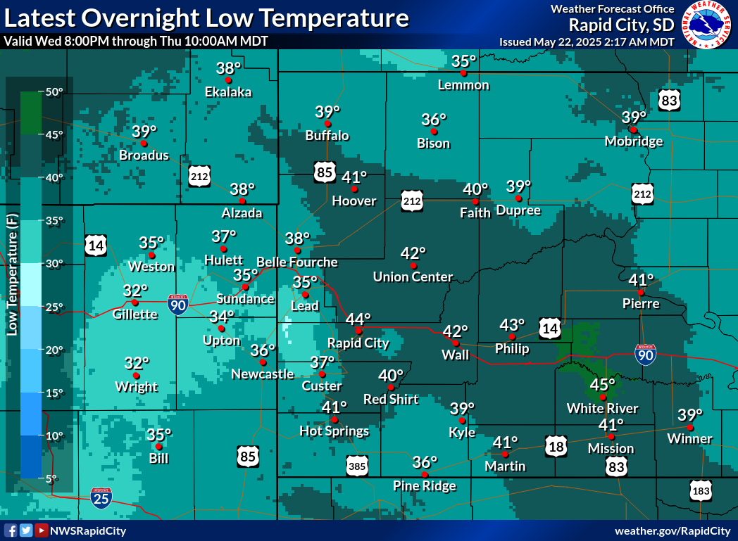
| Minimum Temperature | Current | 1 Day Ago | 2 Days Ago | 3 Days Ago | 4 Days Ago | 5 Days Ago | 6 Days Ago | |
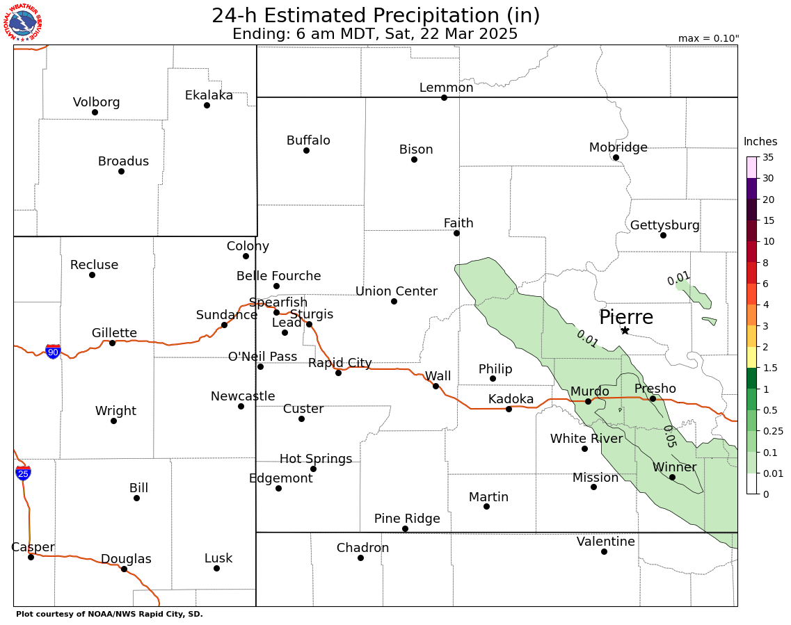
| Daily Precipitation | Current | 1 Day Ago | 2 Days Ago | 3 Days Ago | 4 Days Ago | 5 Days Ago | 6 Days Ago | |
Additional precipitation observations can be obtained from:
24-Hour National Precipitation Maps are a combination of cooperative observer data, Community Collaborative Rain, Hail & Snow (CoCoRaHS) network reports, and Doppler Radar precipitation estimates.
24-hour National Snowfall Maps are created from cooperative observer and Community Collaborative Rain, Hail & Snow (CoCoRaHS) network reports.
National Snow Analyses snow depth, snow water equivalent, and snowpack temperatures maps are provided by the National Operational Hydrologic Remote Sensing Center (NOHRSC).

