
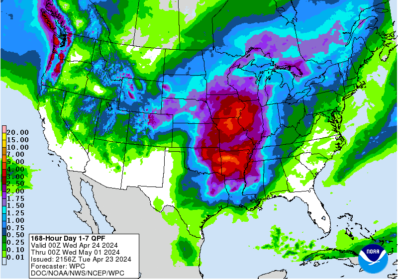
Hazardous heat will continue across the Southern Plains, Gulf Coast and Desert Southwest through the weekend. Additional heat will build into the Great Basin and Northern Plains this weekend. A stalled front is expected to bring periods of heavy to excessive rainfall and flooding from the Tennessee Valley to the Southeast U.S on Friday. Read More >
U.S. Drought Monitor | Click here for a listing of ways to obtain past precipitation
   |
The categories of drought are defined as follows: Abnormally Dry (D0) Moderate Drought (D1) Severe Drought (D2) Extreme Drought (D3) Exceptional Drought (D4) |
 Calculated Soil Moisture Anomaly |
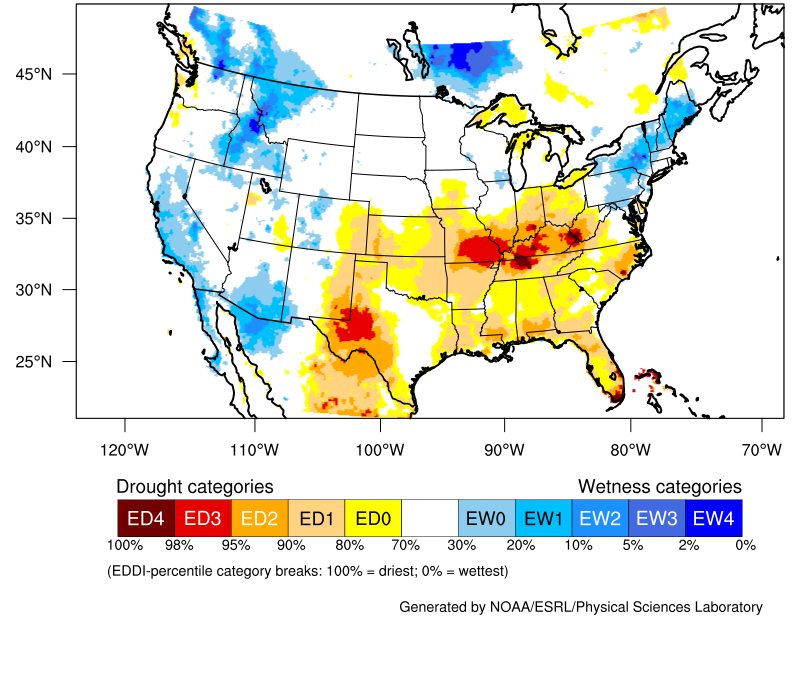 Evaporative Demand Drought Index (EDDI) |
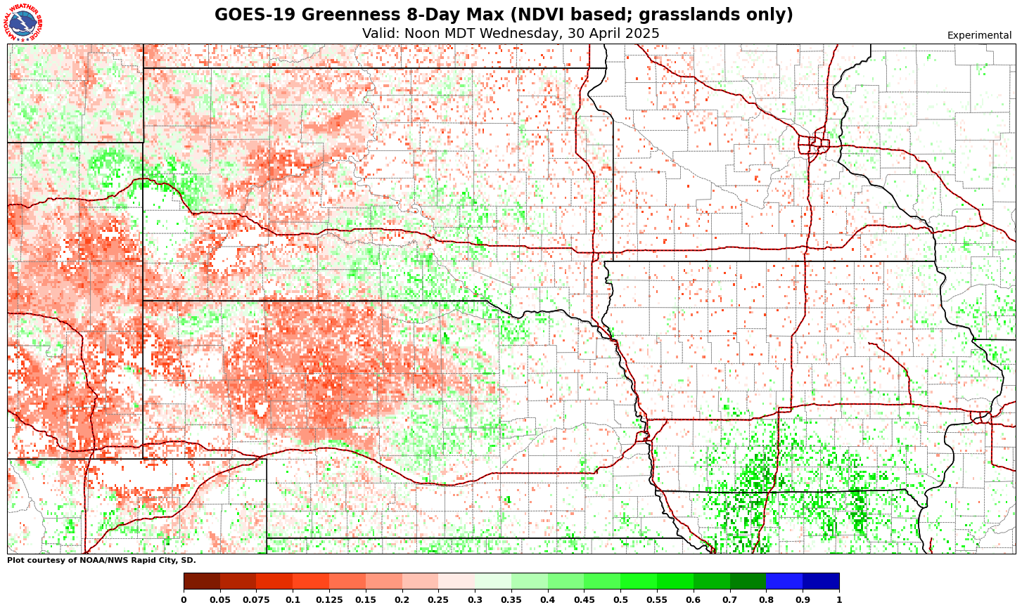 GOES-16 Greenness 8-Day Max (NVDI based) |
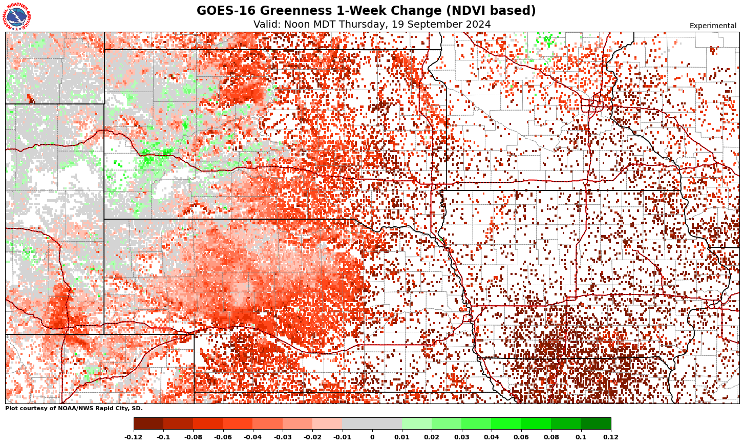 GOES-16 Greenness 5-Day Change (NDVI based) |
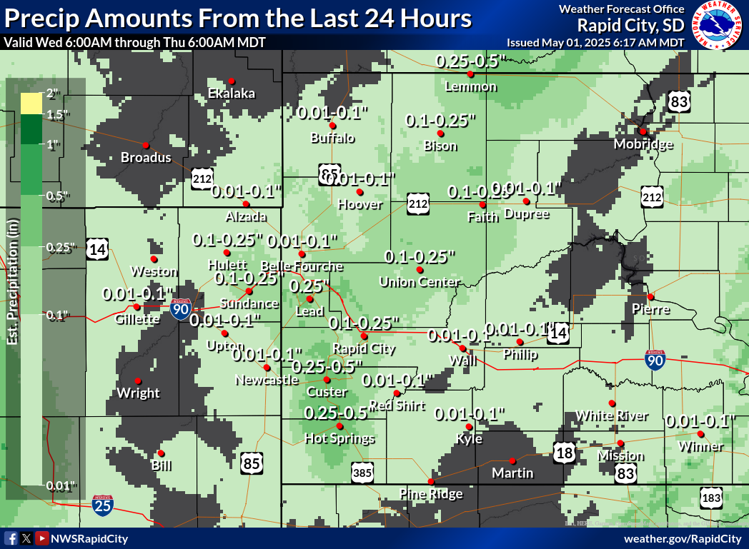 24-Hour Estimated Precipitation |
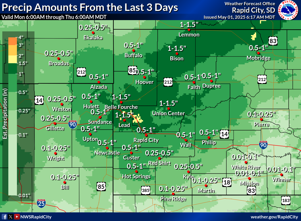 3-Day Estimated Precipitation |
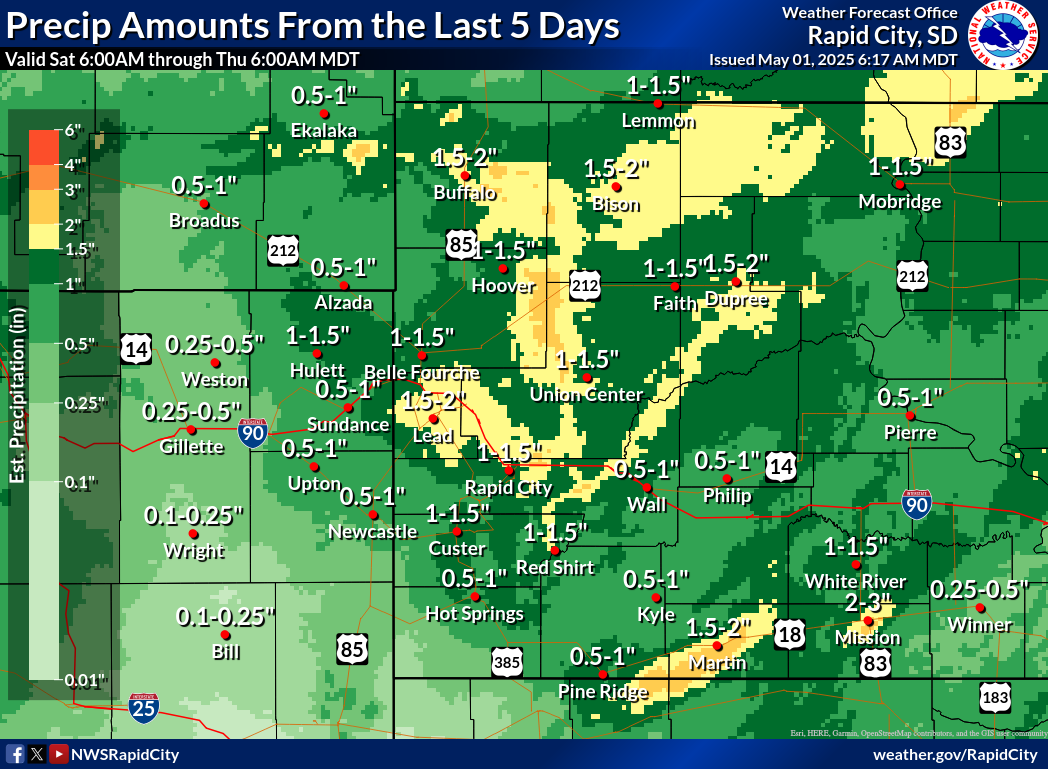 5-Day Estimated Precipitation |
-northern-plains.png) 30-Day Estimated Precipitation |
 7-Day Percent of Normal |
 30-Day Percent of Normal |
 90-Day Percent of Normal |
 120-Day Percent of Normal |
 1 Day Precipitation Forecast |
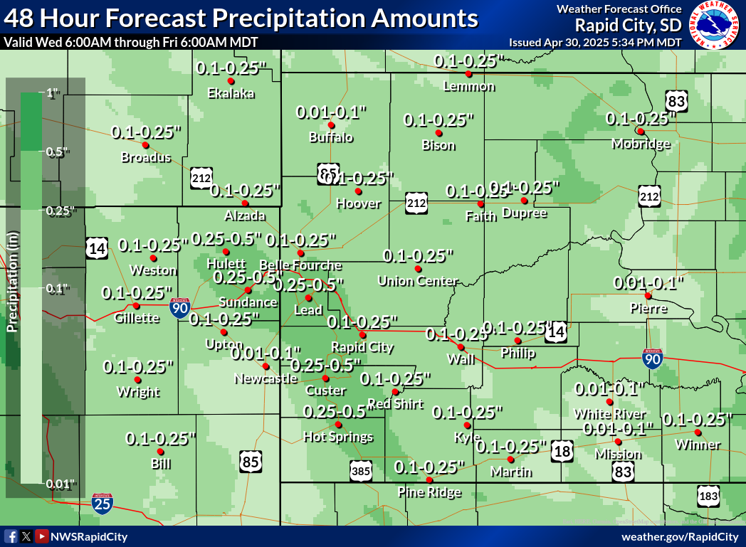 2 Day Precipitation Forecast |
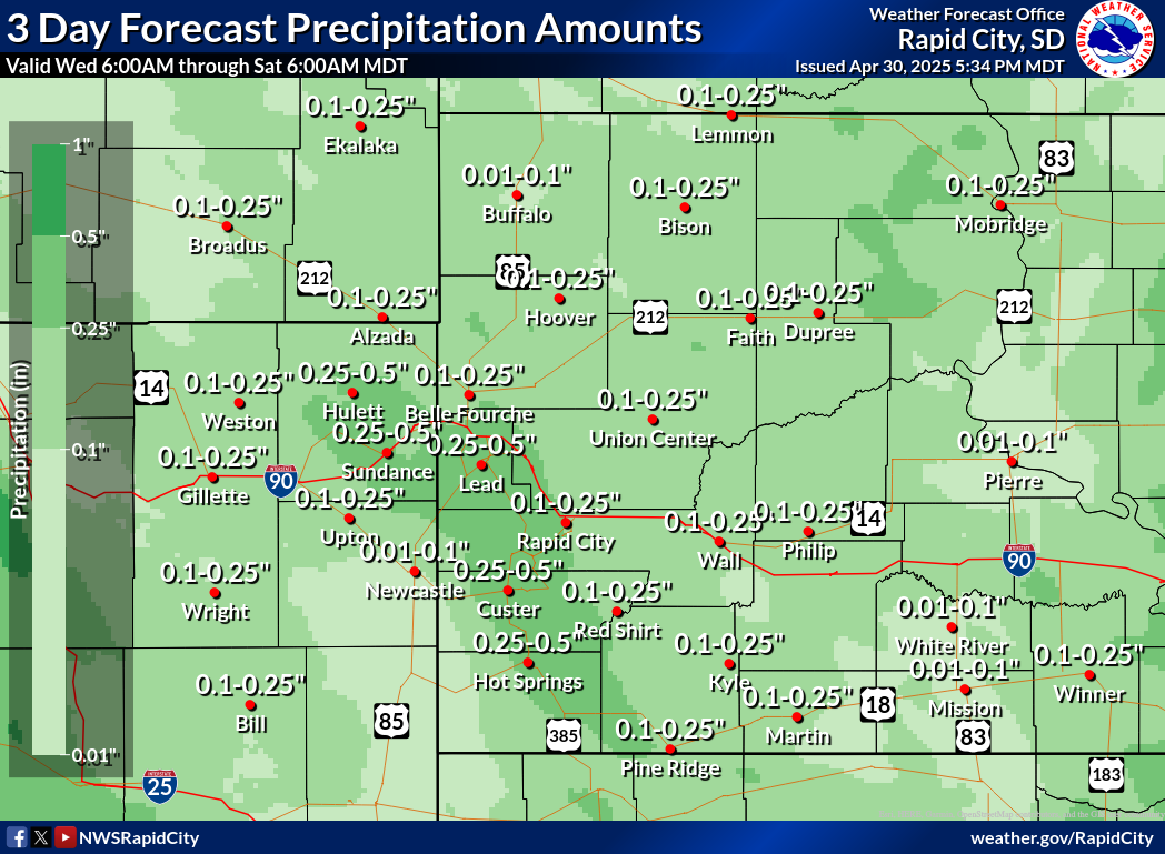 3 Day Precipitation Forecast |
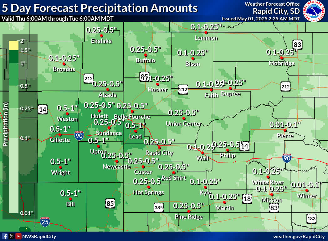 5 Day Precipitation Forecast |
 7 Day Precipitation Forecast |
|
 6-10 Day Precipitation Outlook |
 8-14 Day Precipitation Outlook |
 One Month Precipitation Outlook |
 Three Month Precipitation Outlook |
 7 Day Departure from Normal Temperature |
 14 Day Departure From Normal Temperature |
 30 Day Departure From Normal Temperature |
 60 Day Departure From Normal Temperature |
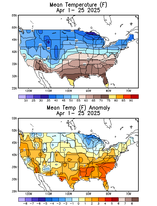 Mean Temperature |
|
|
|
 8-14 Day Temperature Outlook |
|
|
 Three Month Temperature Outlook |
The drought monitor is a multi-agency effort involving NOAA’s National Weather Service (NWS) and the National Centers for Environmental Information (NCEI), United States Department of Agriculture (USDA), State and Regional Climate Centers, and the National Drought Mitigation Center at the University of Nebraska-Lincoln. Information for this statement has been gathered from a number of different federal, state, and local agencies including the NWS and Federal Aviation Administration (FAA) Observing Sites, State Cooperative Extension Services, United States Department of Agriculture, Bureau of Reclamation (USBR), the United States Geological Survey (USGS), and many more.
If you have any questions or comments about this drought information please contact:
Aaron Woodward
Warning Coordination Meteorologist
aaron.woodward@noaa.gov
National Weather Service
300 East Signal Drive
Rapid City South Dakota 57701
605-341-9271 ext. 493


