Flash flooding threatens areas from the Tennessee Valley to the Carolinas as storms repeat along a stalled front. Monsoonal storms may trigger flooding in the Southwest. Dangerous heat expands across the Desert Southwest, Plains, mid-Mississippi Valley and Southern Tier. Critical fire weather for interior Pacific Northwest. Cooler, drier air brings brief relief to the Great Lakes and Northeast. Read More >
|
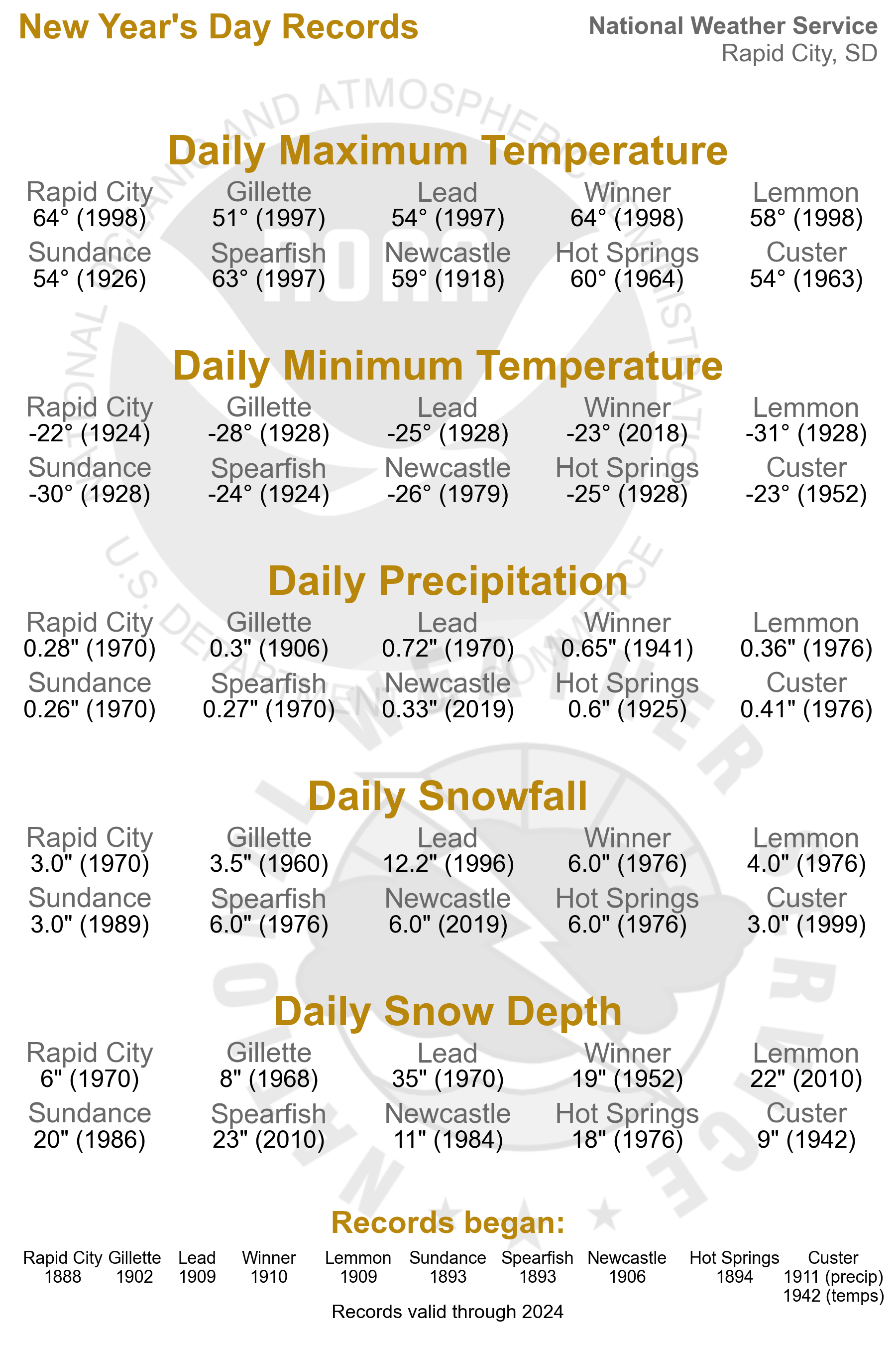
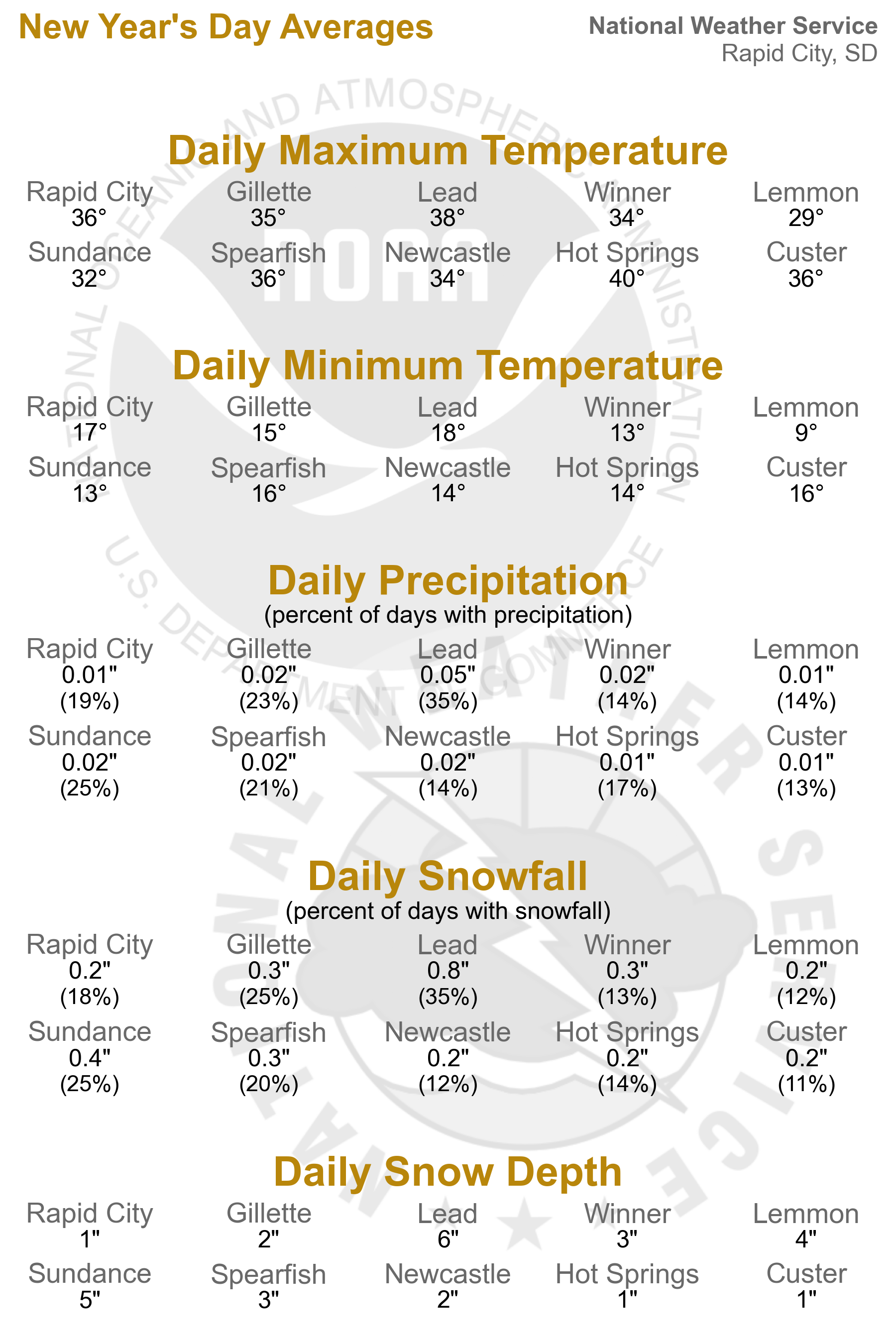
Below is a listing of the climate records on New Year's Day for Rapid City, Gillette, Lead, Winner, Lemmon, Sundance, Spearfish, Newcastle, Hot Springs, and Custer. Record high temperatures have reached the 50s to mid-60s. Of these sites, Lemmon has been the coldest, dipping down to -31 degrees in 1928. In 1970, Lead had a whopping 35 inches of snow on the ground. |