Extreme heat continues across the Southwest as temperatures may top 120 degrees. The heat may expand across the West and south-central U.S. into the middle of the month. Severe thunderstorms capable of severe wind gusts and large hail will be the primary hazards today across the northern Plains into the upper Midwest. Rainfall could be locally heavy across the Eastern U.S. today. Read More >
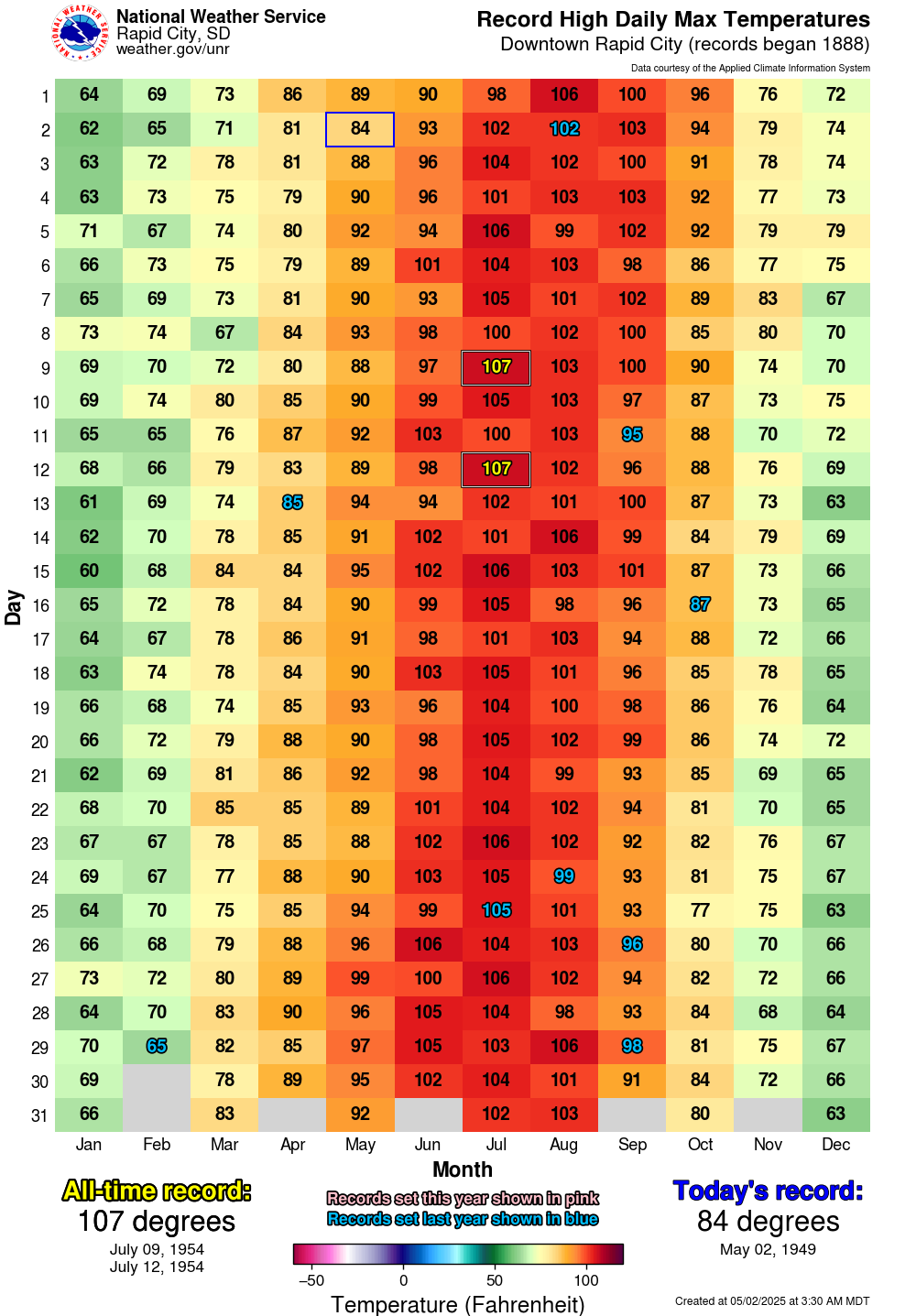
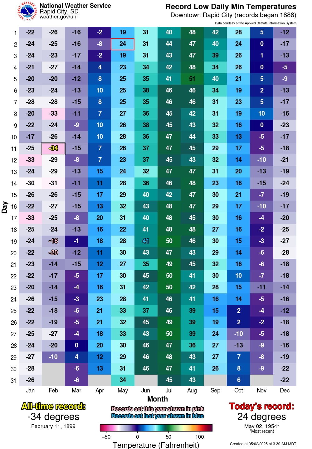
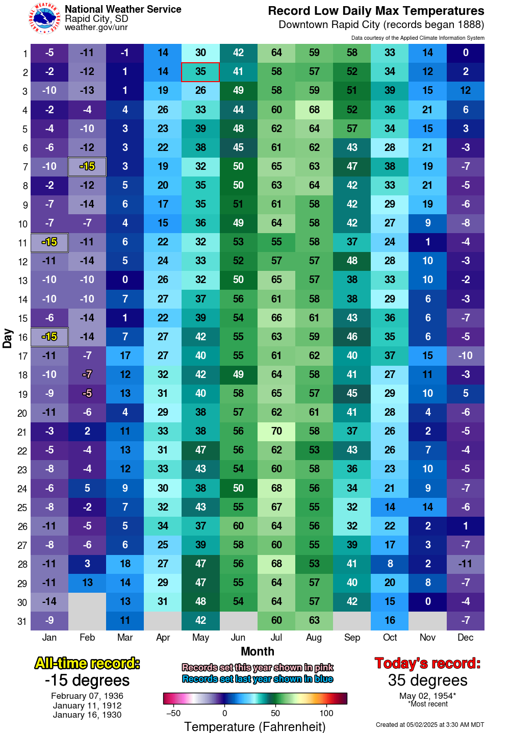
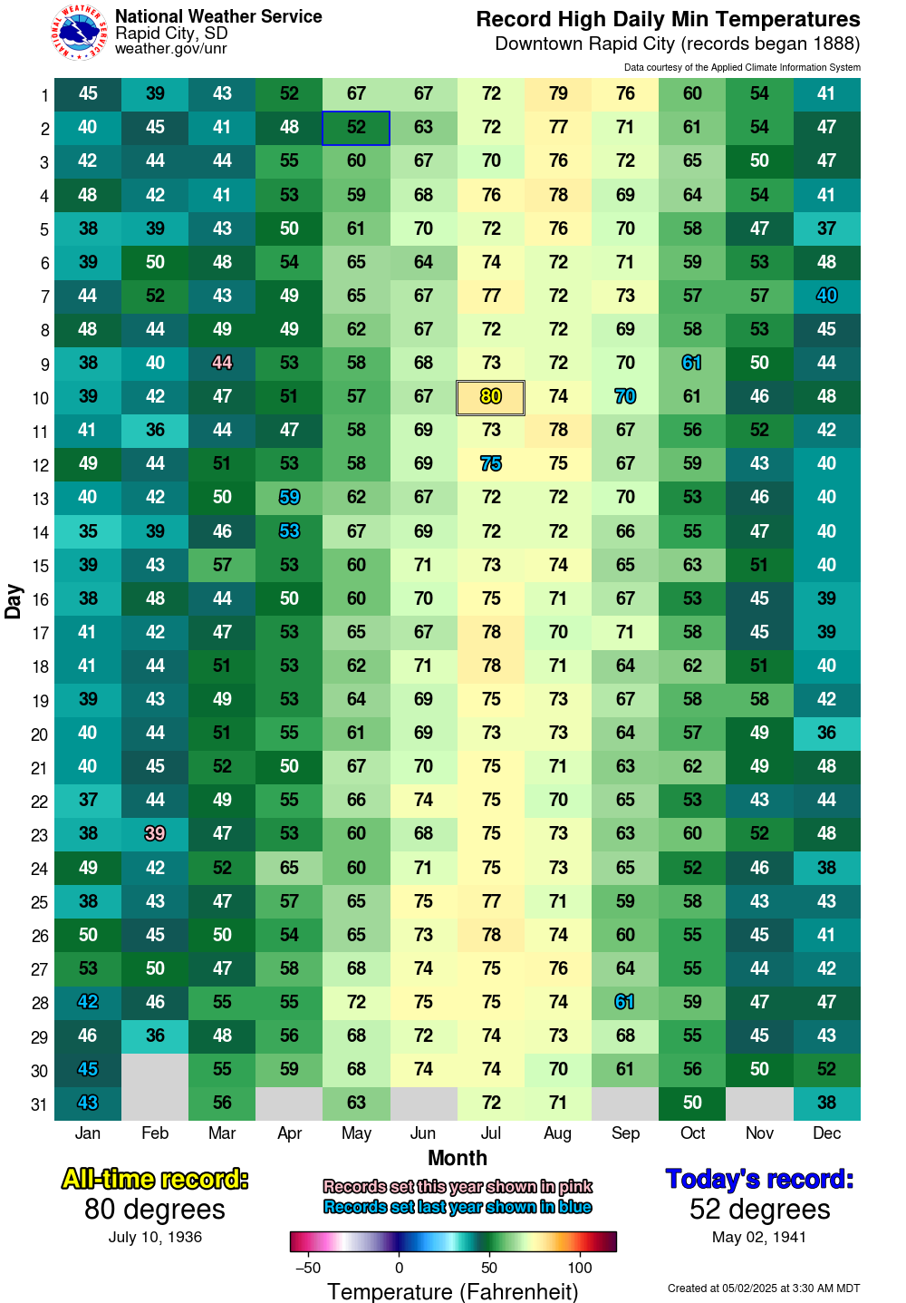
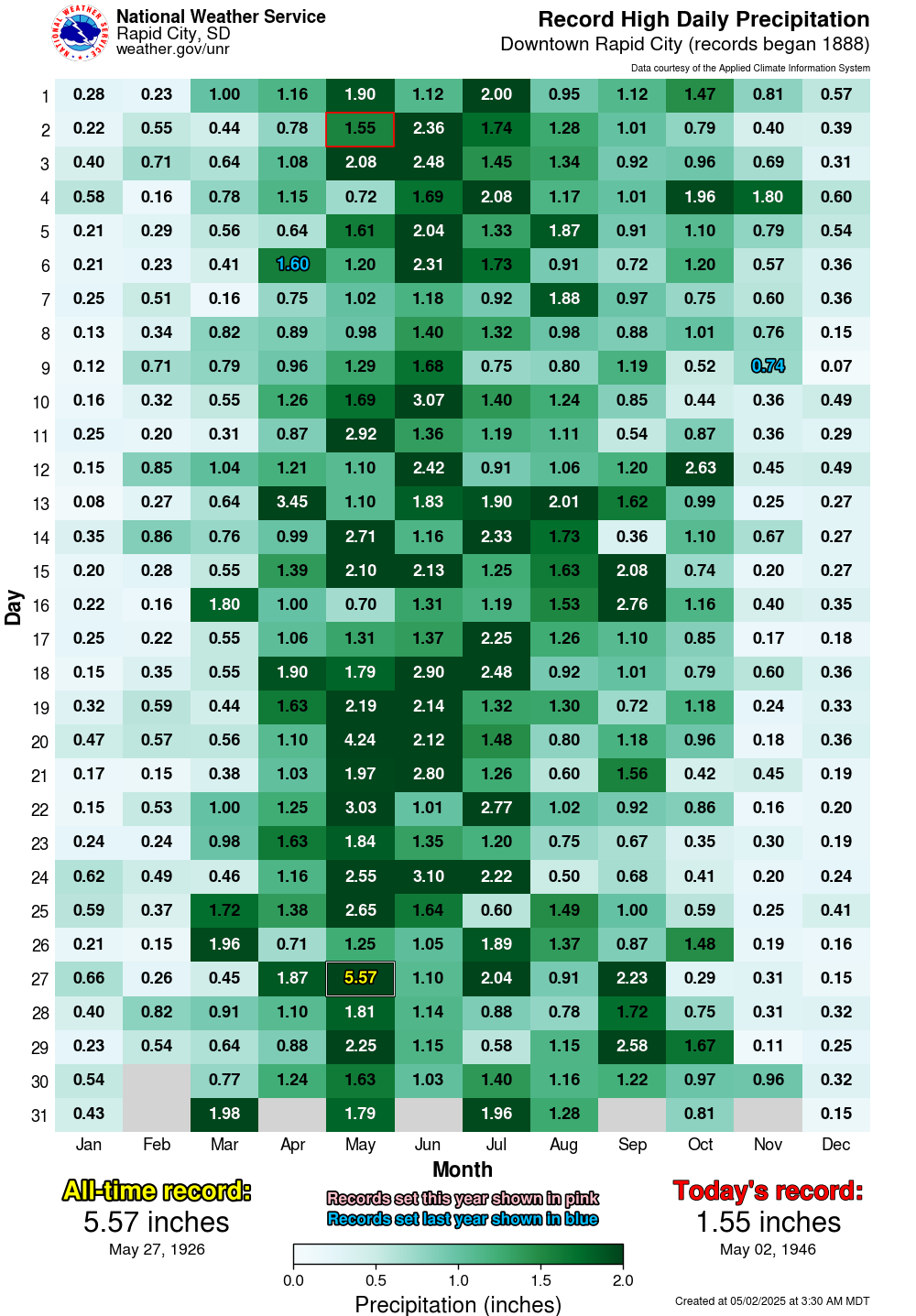
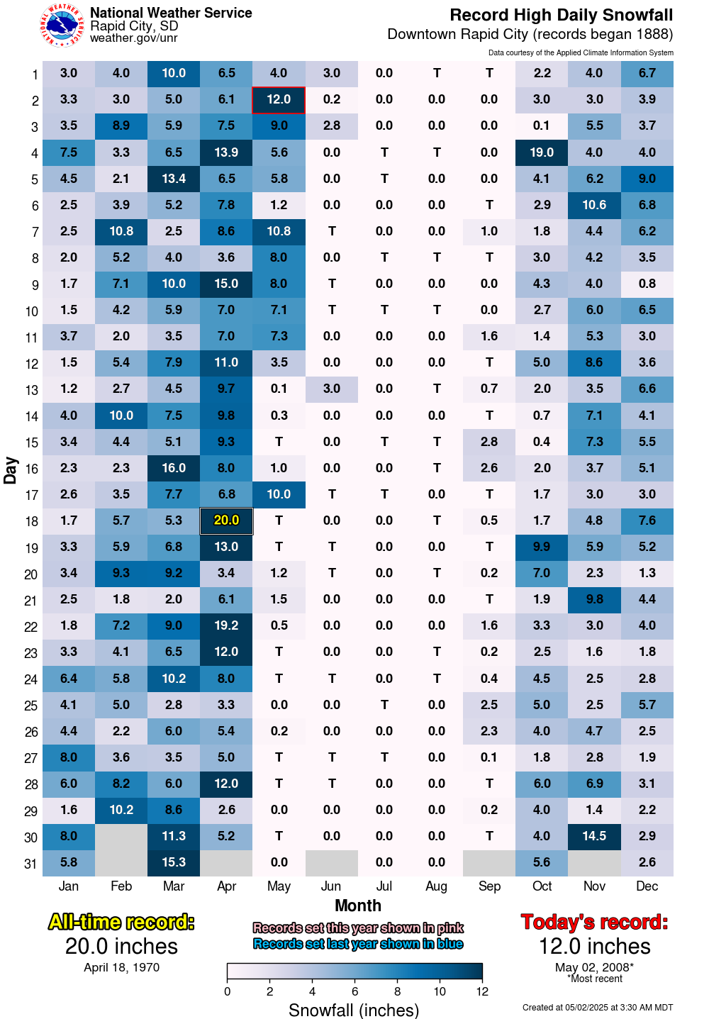
The following graphics show daily records for temperatures, precipitation, and snowfall for each day of the year at several observing sites across western South Dakota and northeastern Wyoming. Many of these sites are maintained by cooperative observers, a program which you can learn more about here. We are in the process of quality controlling past data, so some of these values are subject to change. To view the records, hover over a location on the left and choose the desired tab along the top of the page.