
Heavy lake effect snow will persist downwind of the Great Lakes through early Saturday. Snow squalls with heavy snow and gusty winds will create dangerous travel in the Interior Northeast due to low visibility and slippery roads. A major winter storm will bring moderate to heavy, accumulating snow and gusty winds from the eastern Plains to the western Great Lakes today through Saturday. Read More >
Rapid City, SD
Weather Forecast Office
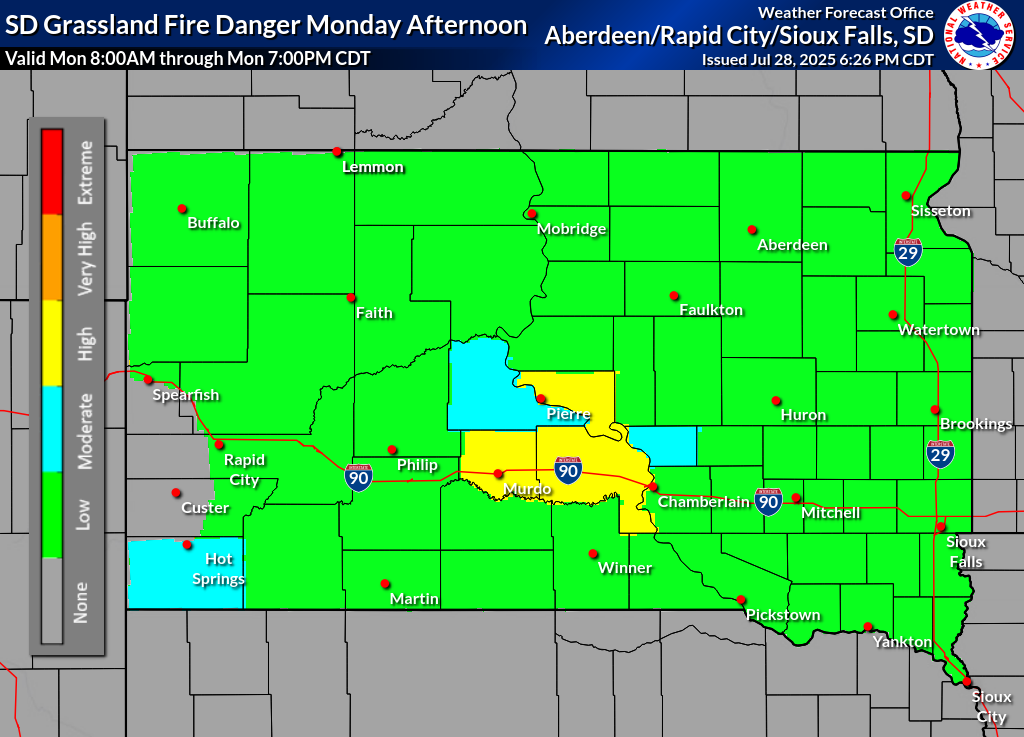
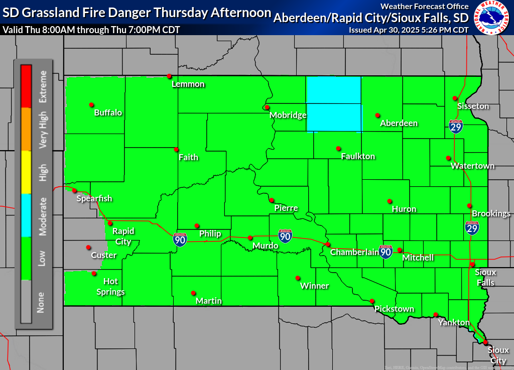
Please use the South Dakota Grassland Fire Danger Map in conjunction with the text products above to assess the Grassland Fire Danger for South Dakota. Please note that text products will be issued daily by 5:00 AM during the fire-weather season or when high, very high, or extreme grassland fire danger is forecast.
What is the Grassland Fire Danger Index?
US Dept of Commerce
National Oceanic and Atmospheric Administration
National Weather Service
Rapid City, SD
300 East Signal Drive
Rapid City, SD 57701-3800
605-341-9271
Comments? Questions? Please Contact Us.

