A slow-moving storm system will continue to produce widespread heavy showers and thunderstorms which may bring excessive rainfall and flooding as it tracks across the Southeast and Mid-Atlantic regions today into Wednesday. Gusty winds and dry fuels under potential record setting temperatures will support widespread critical fire weather in the northern Plains and Upper Midwest today. Read More >
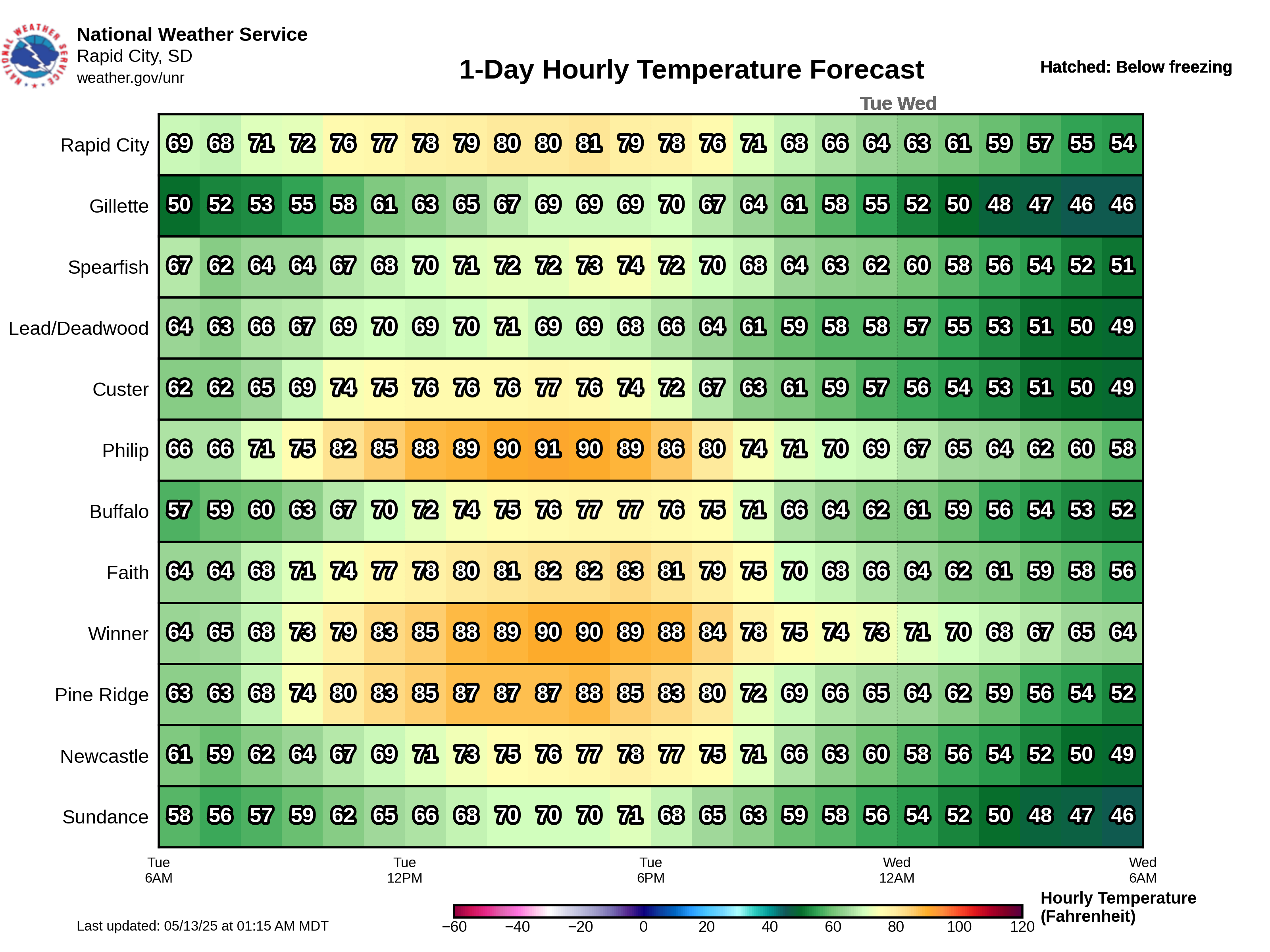
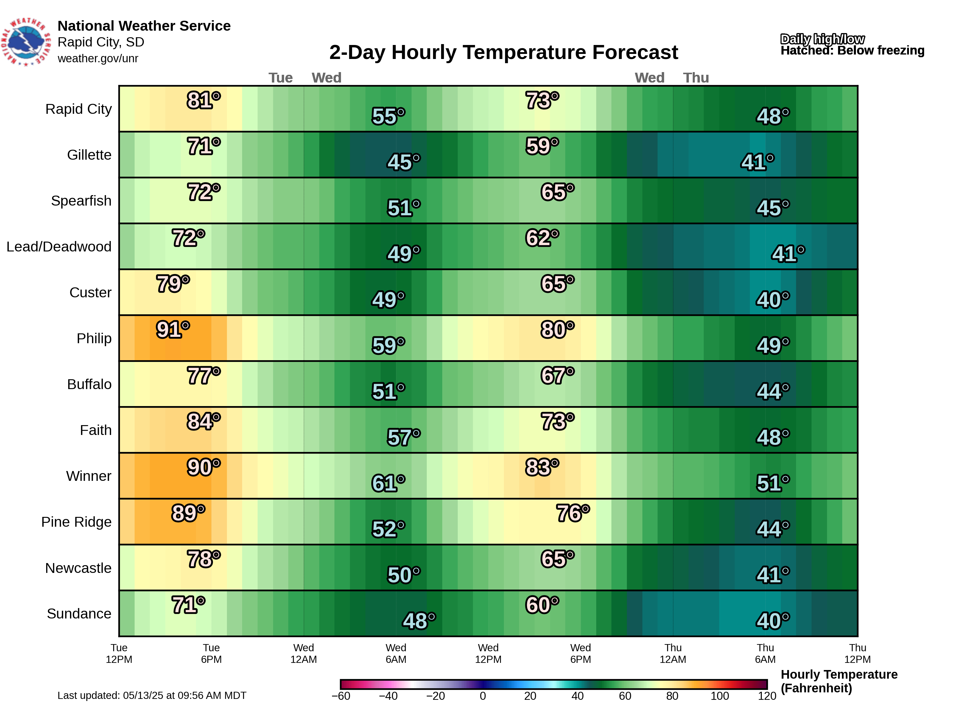
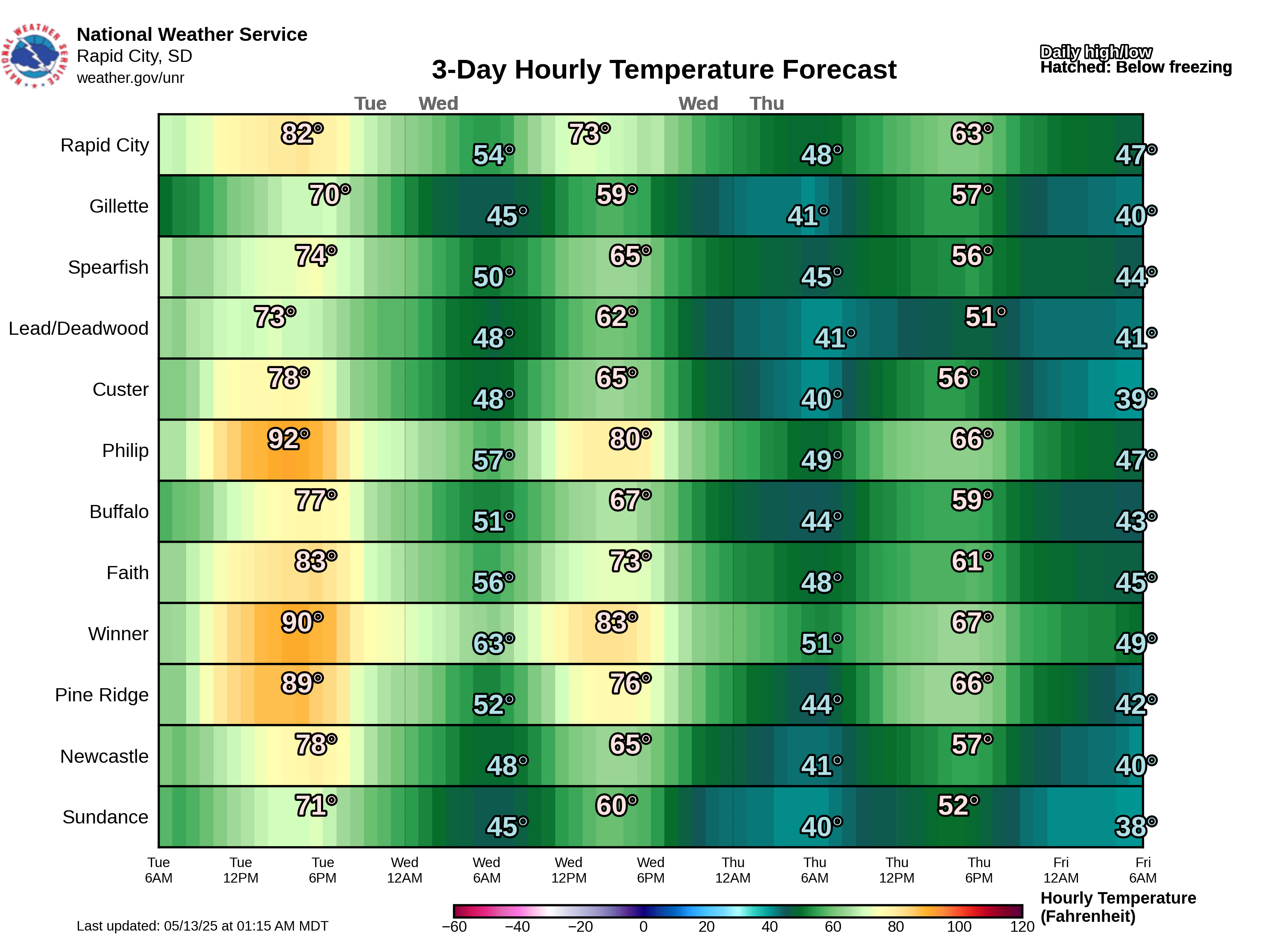
The following graphics provide 1-day, 2-day, and 3-day forecasts of a given forecast element for several selected sites across northeastern Wyoming and western South Dakota. These are divided into two sets of locations.
Forecast timeline graphics for single locations can be found here.