Extreme heat continues today from the central Plains to the lower Mississippi River Valley, over southeast Montana, and from southern California into the Southwest Deserts. Extreme Heat Warnings remain in effect. Severe thunderstorms capable of strong to severe wind gusts and large hail are possible across the Great Lakes into the Ohio Valley today into tonight. Read More >
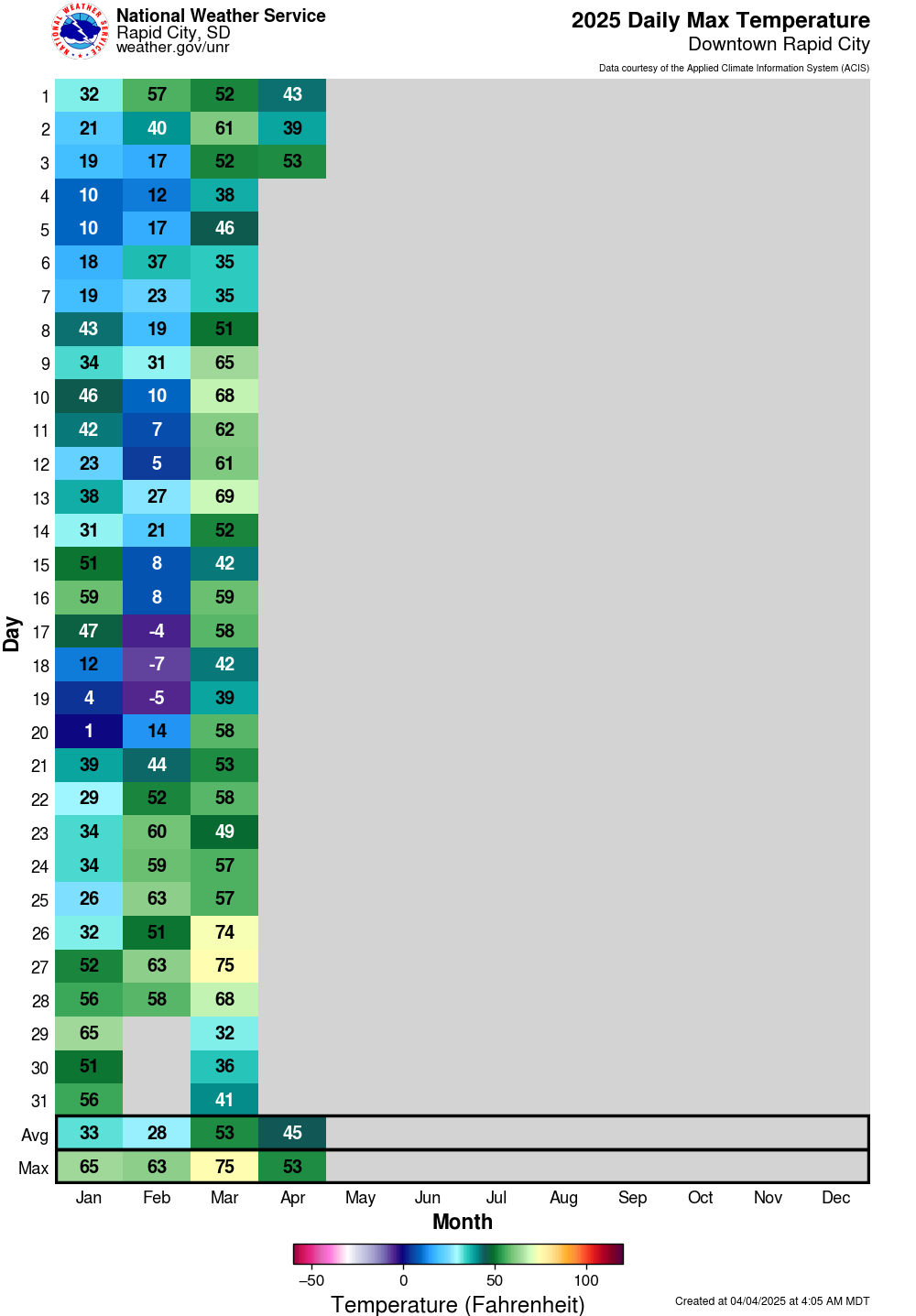
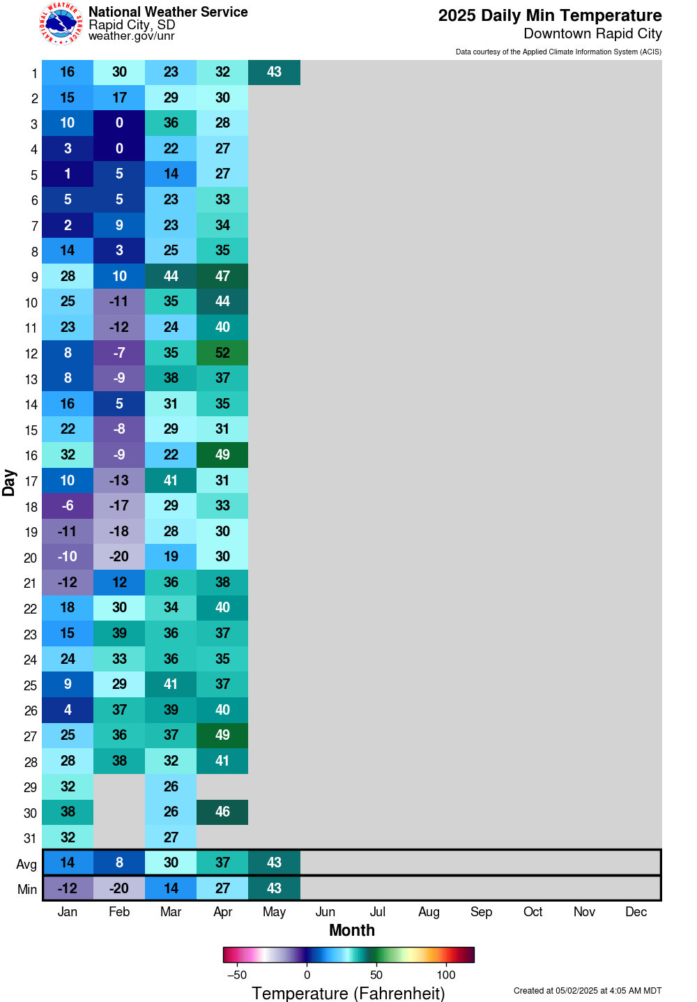
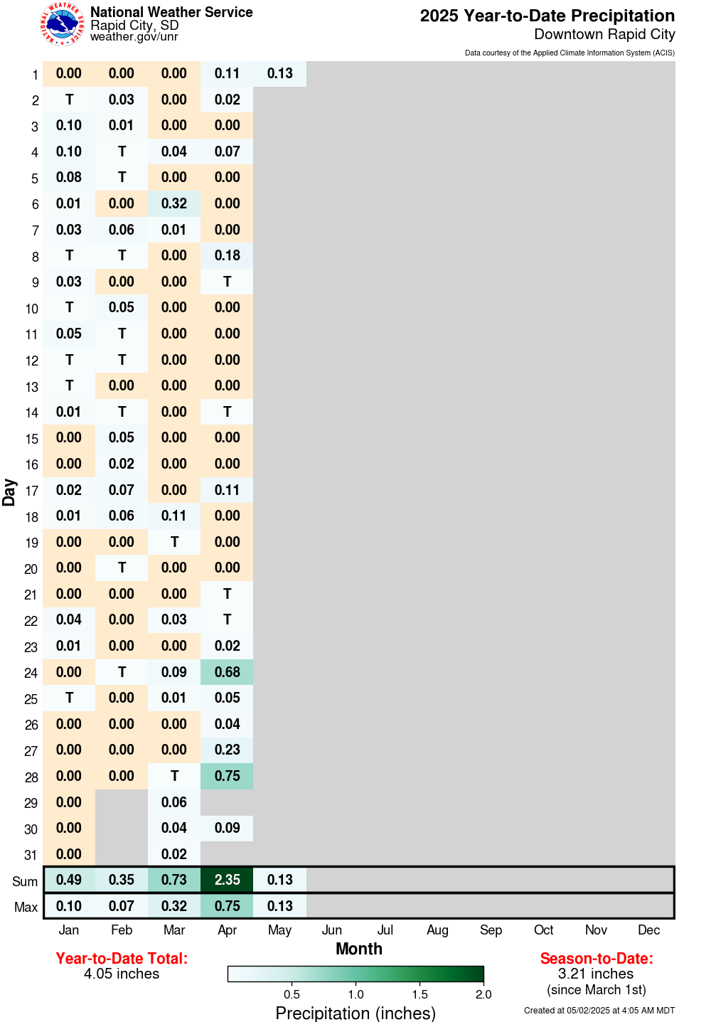
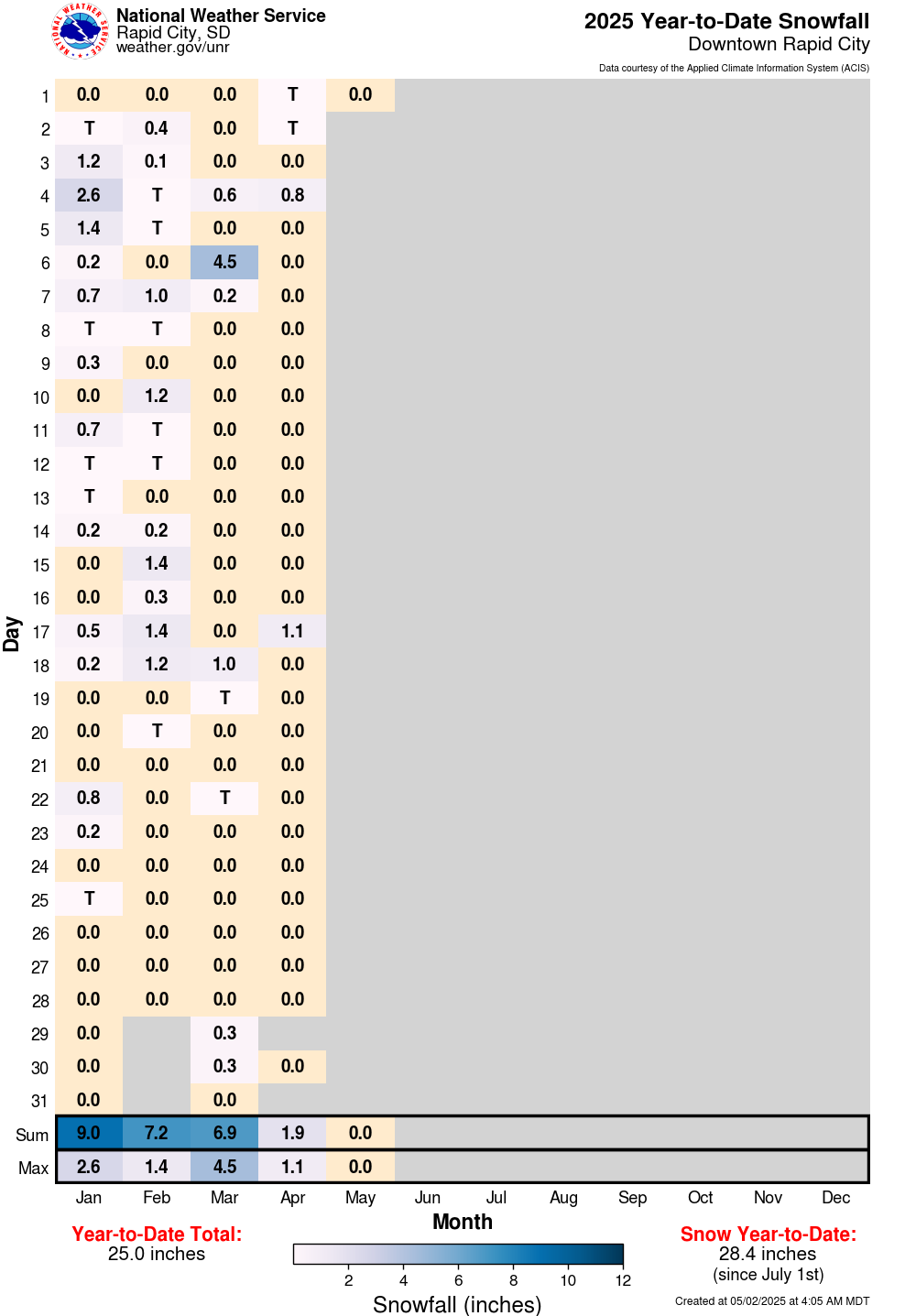
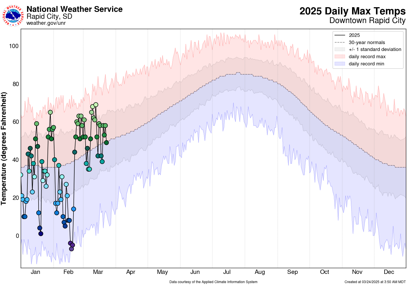
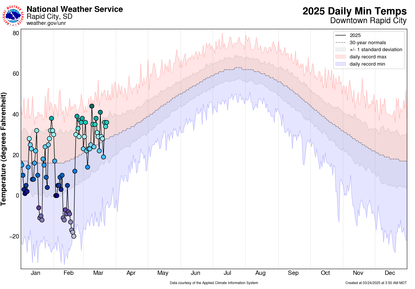
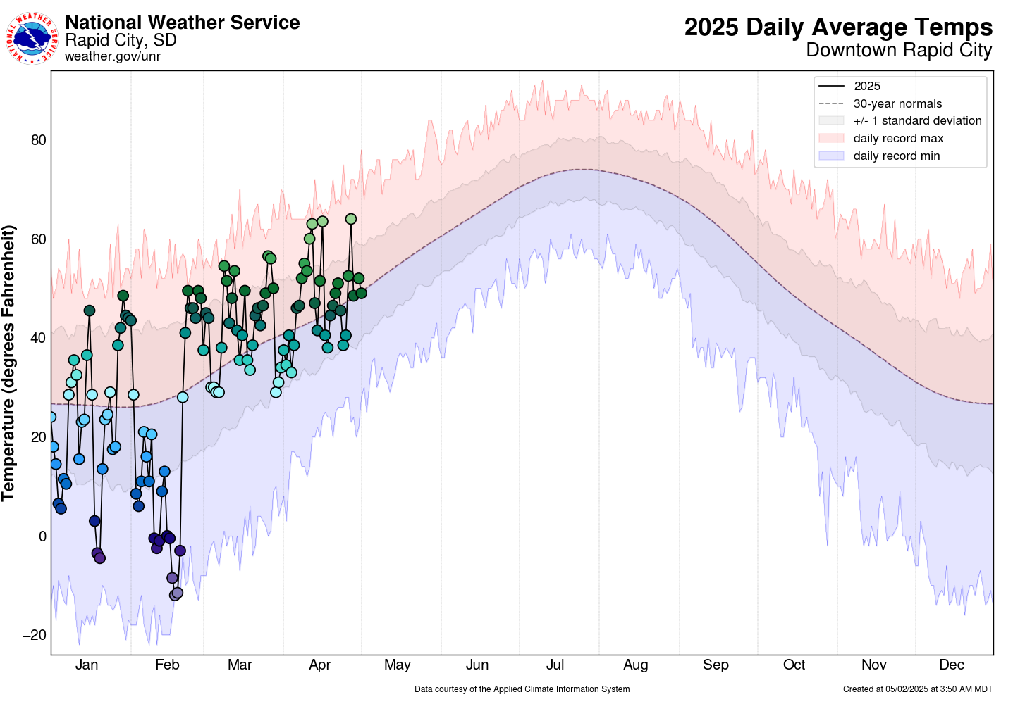
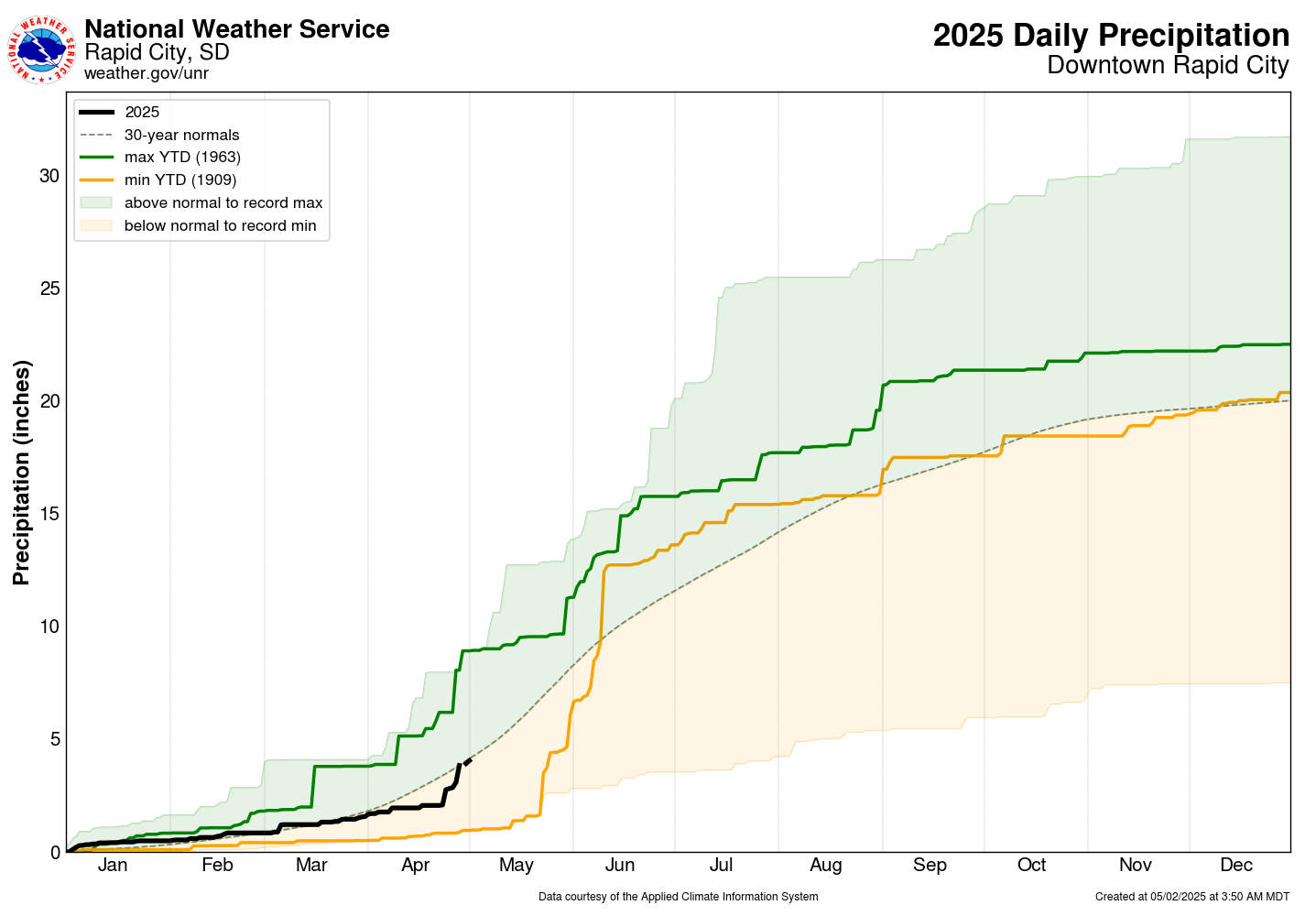
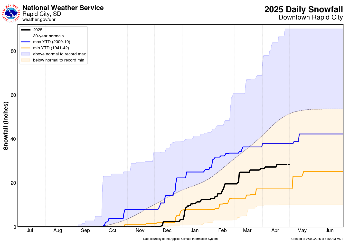
The following graphics show year-to-date observations for temperatures, precipitation, and snowfall for each day of the year and each month at several observing sites across western South Dakota and northeastern Wyoming.
Many of these sites are maintained by cooperative observers, a program which you can learn more about here. We are in the process of quality controlling past data, so some of these values are subject to change. Additionally, some observers do not report daily, so data may be missing at times. To view the observations, hover over a location on the left and choose the desired tab along the top of the page.