
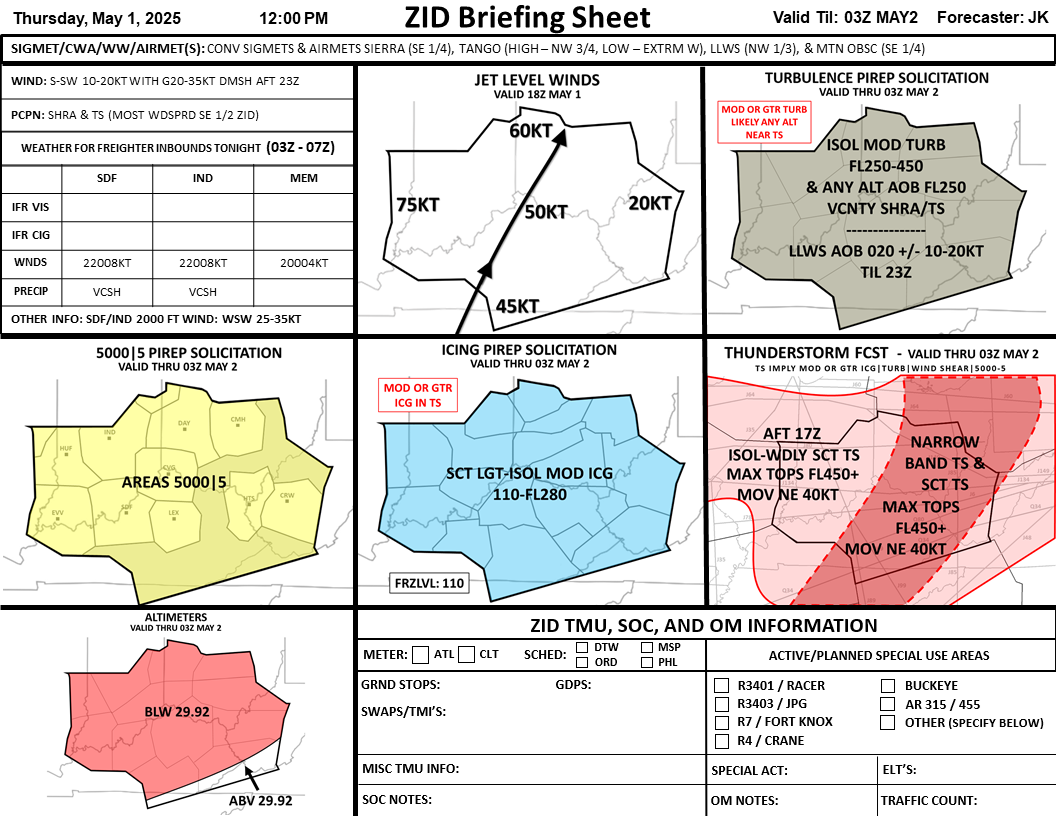
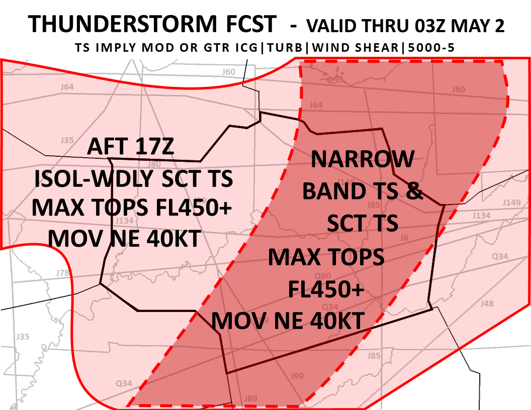
A heat wave over the Southwest will intensify late week, peaking and expanding into the Intermountain West and northern High Plains this weekend. Severe thunderstorms and heavy rain are expected over portions of the Plains and Mississippi Valley tonight, which will shift to parts of the Upper Midwest and mid-Mississippi Valley Friday. Monsoonal showers and flooding persist in the Desert Southwest. Read More >
Indianapolis CWSU
Center Weather Service Unit
For additional information for FAA ATCT and TRACONS, please click on the site in the list below:
US Dept of Commerce
National Oceanic and Atmospheric Administration
National Weather Service
Indianapolis CWSU
C.O.: ARTCC
1850 S. Sigsbee Street
Indianapolis, IN 46241-3640
Comments? Questions? Please Contact Us.

