
An Enhanced Risk (Level 3 of 5) of severe thunderstorms are expected to develop this afternoon across portions of the Central Plains and Missouri Valley today. Large hail, heavy rain, severe gusts (70+ mph), and a few tornadoes are the primary threats. In the Northern Rockies, the combination of gusty winds and dry conditions will lead to locally critical fire weather conditions. Read More >
|
|||||||||||||||||||||||||||||||||||||
| Mountain Rec Forecast Graphics
|
|||
|
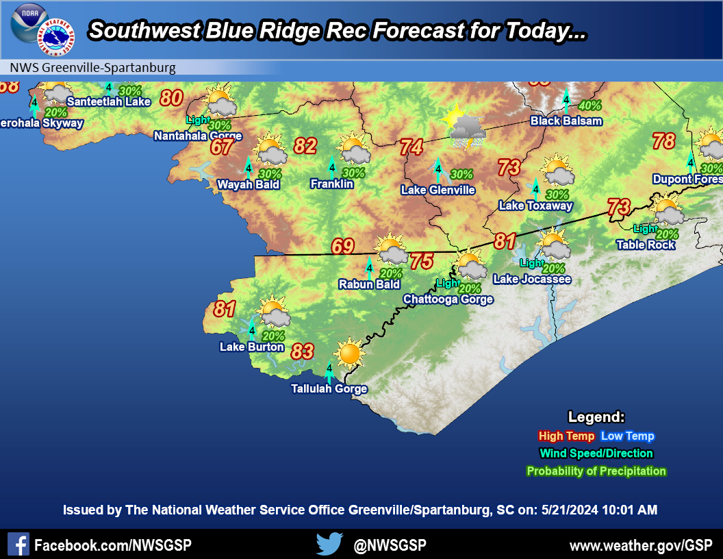
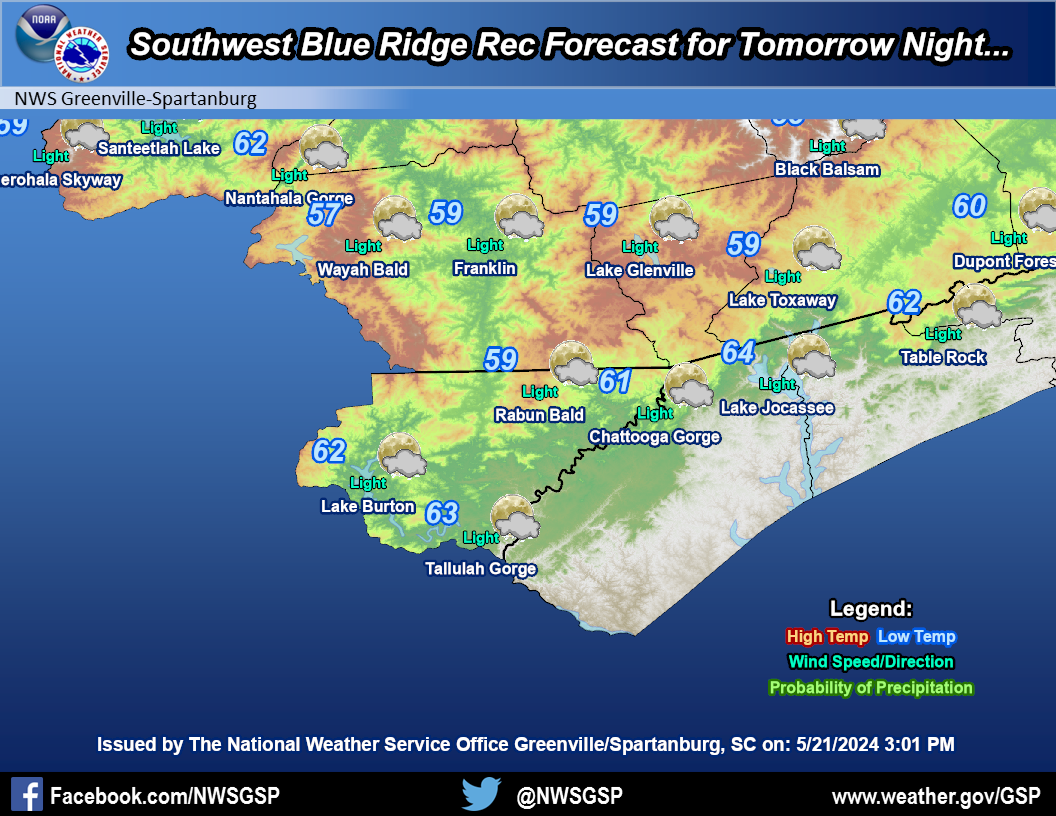
Southwest Blue Ridge
|
|||
|
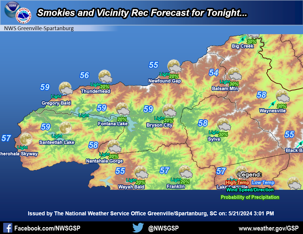
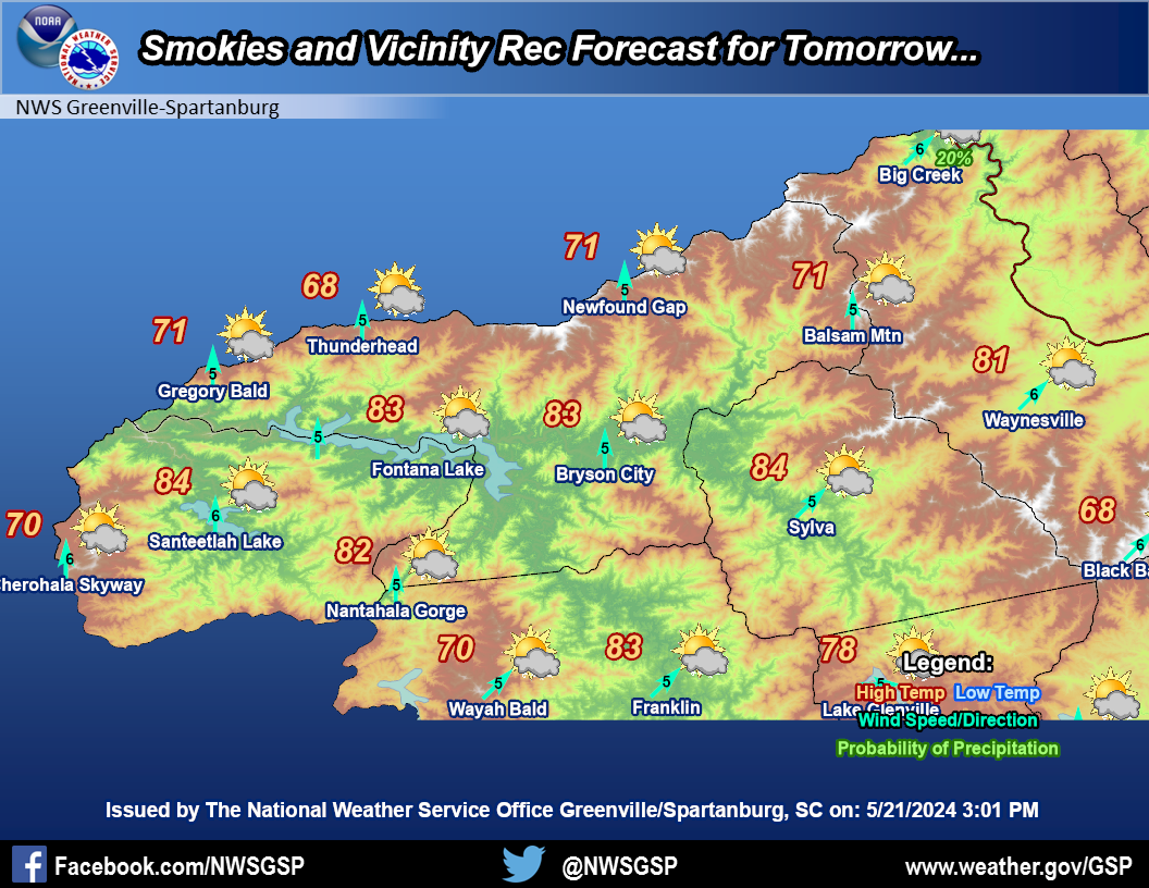
Smokies and Vicinity
|
|||
|
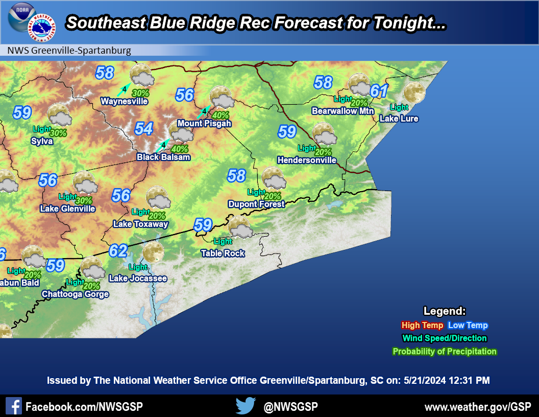
Southeast Blue Ridge
|
|||
|
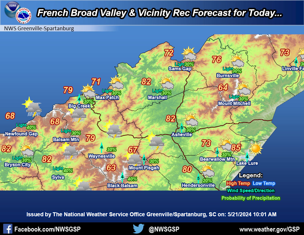
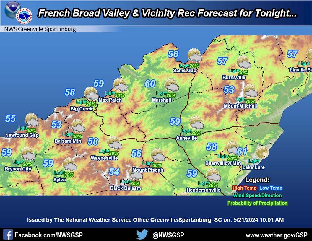
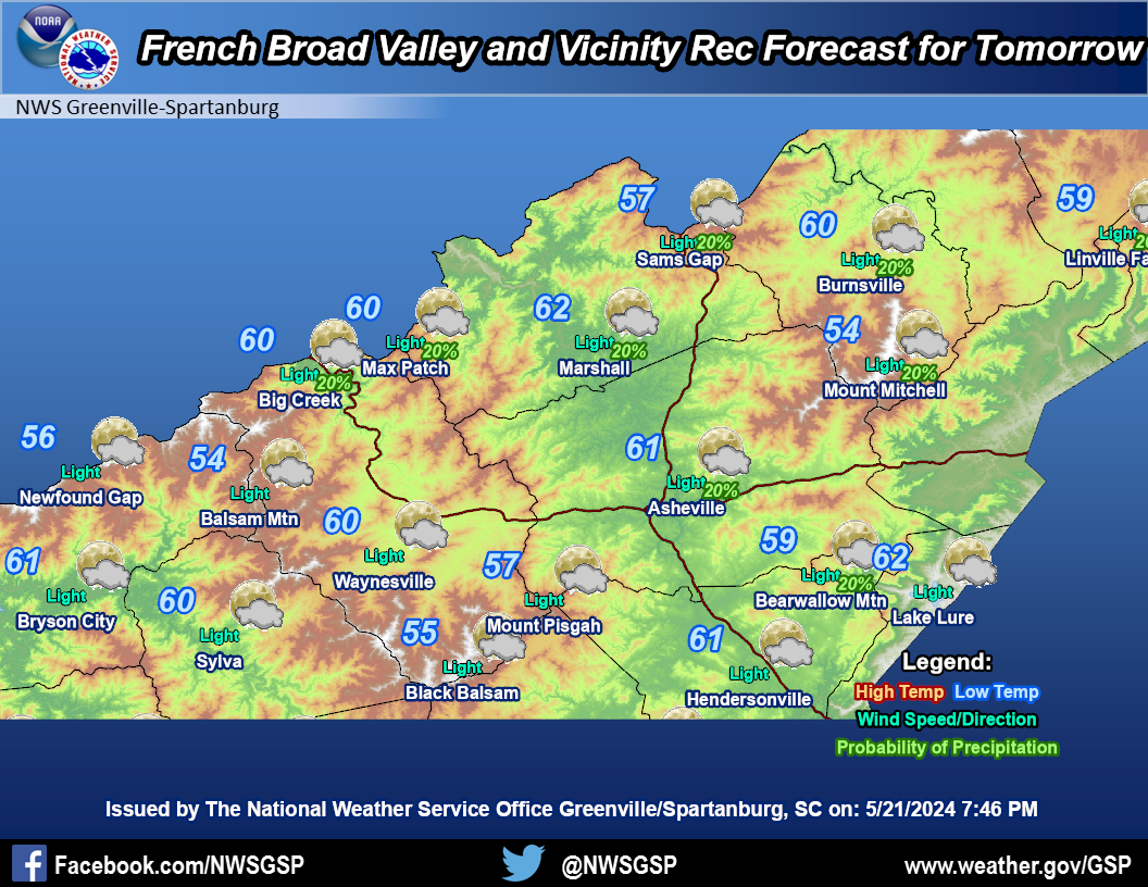
French Broad
Valley & Vicinity |
|||
|
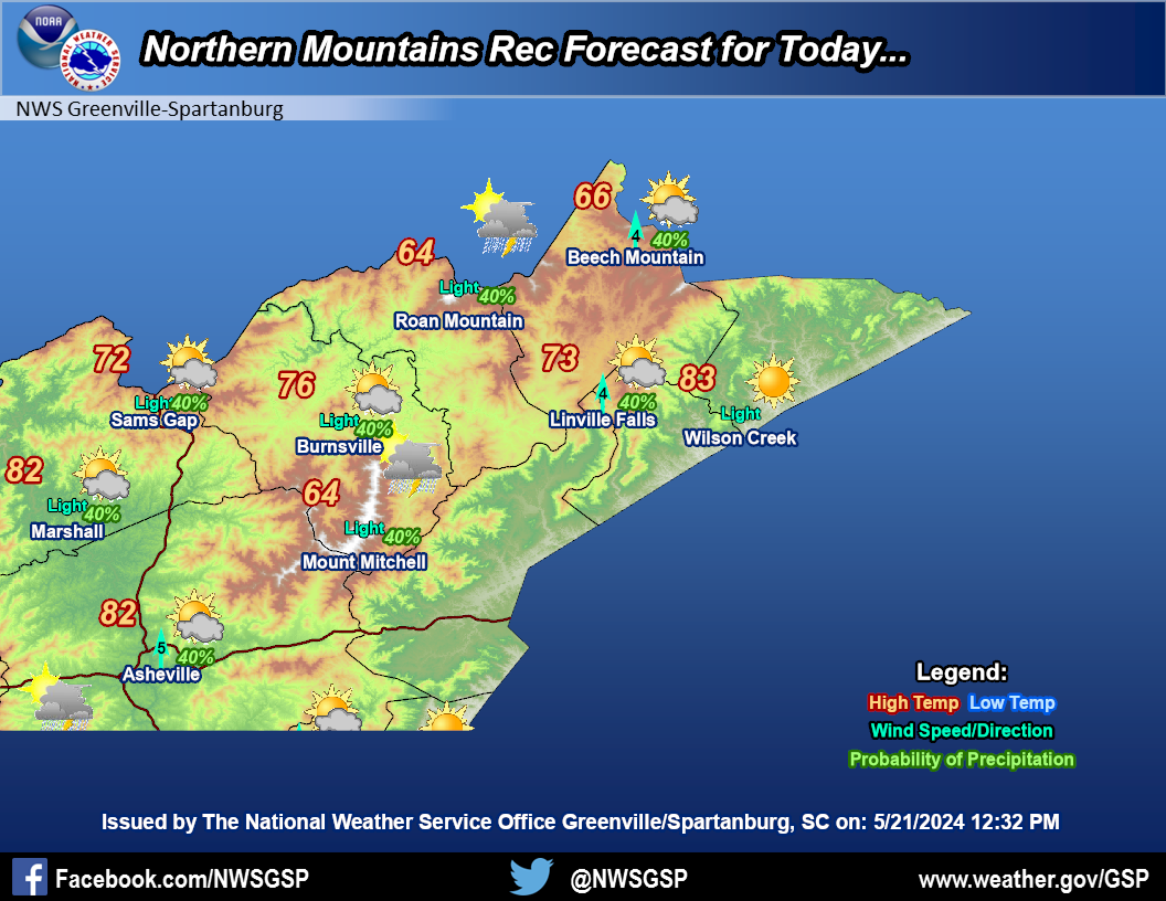
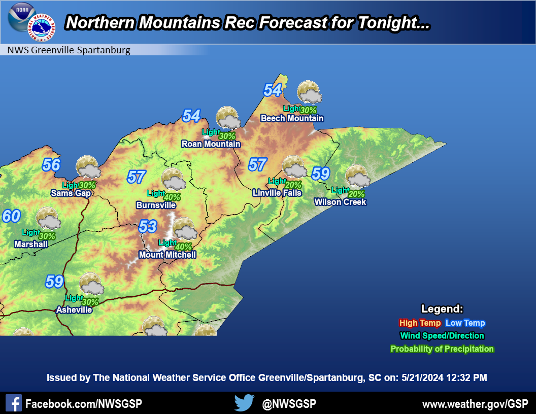
Northern Mountains
|
|||
|
Mountain Weather Observations
|
|
Recreational Forecast
|


 Current Conditions Map
 Follow us on YouTube