×
Click a icon on the map to display the forecast for the mountain top location
Mountain Tops Forecast Points
|
| Kuwohi (née Clingman's Dome) |
6,643 feet |
Graphical Forecast |
Text Forecast |
| Mount Mitchell |
6,684 feet |
Graphical Forecast |
Text Forecast |
| Grandfather Mountain |
5,946 feet |
Graphical Forecast |
Text Forecast |
| Beech Mountain |
5,506 feet |
Graphical Forecast |
Text Forecast |
| Roan Mountain (Summit) |
6,285 feet |
Graphical Forecast |
Text Forecast |
| Mount Pisgah |
5,691 feet |
Graphical Forecast |
Text Forecast |
| Richland Balsam BRP Overlook |
6,053 feet |
Graphical Forecast |
Text Forecast |
| Rabun Bald |
4,696 feet |
Graphical Forecast |
Text Forecast |
| |
| |
| Bearwallow Mountain |
4,202 feet |
Graphical Forecast |
|
| Chimney Rock |
2,280 feet |
Graphical Forecast |
|
| Max Patch |
4,615 feet |
Graphical Forecast |
|
| Sassafras Mountain |
3,565 feet |
Graphical Forecast |
|
| Wayah Bald |
5,333 feet |
Graphical Forecast |
|
| Whiteside Mountain |
4,884 feet |
Graphical Forecast |
|
|
Mountain Rec Forecast Graphics
|
| |
|
|
|
|
Southwest Blue Ridge
|
|
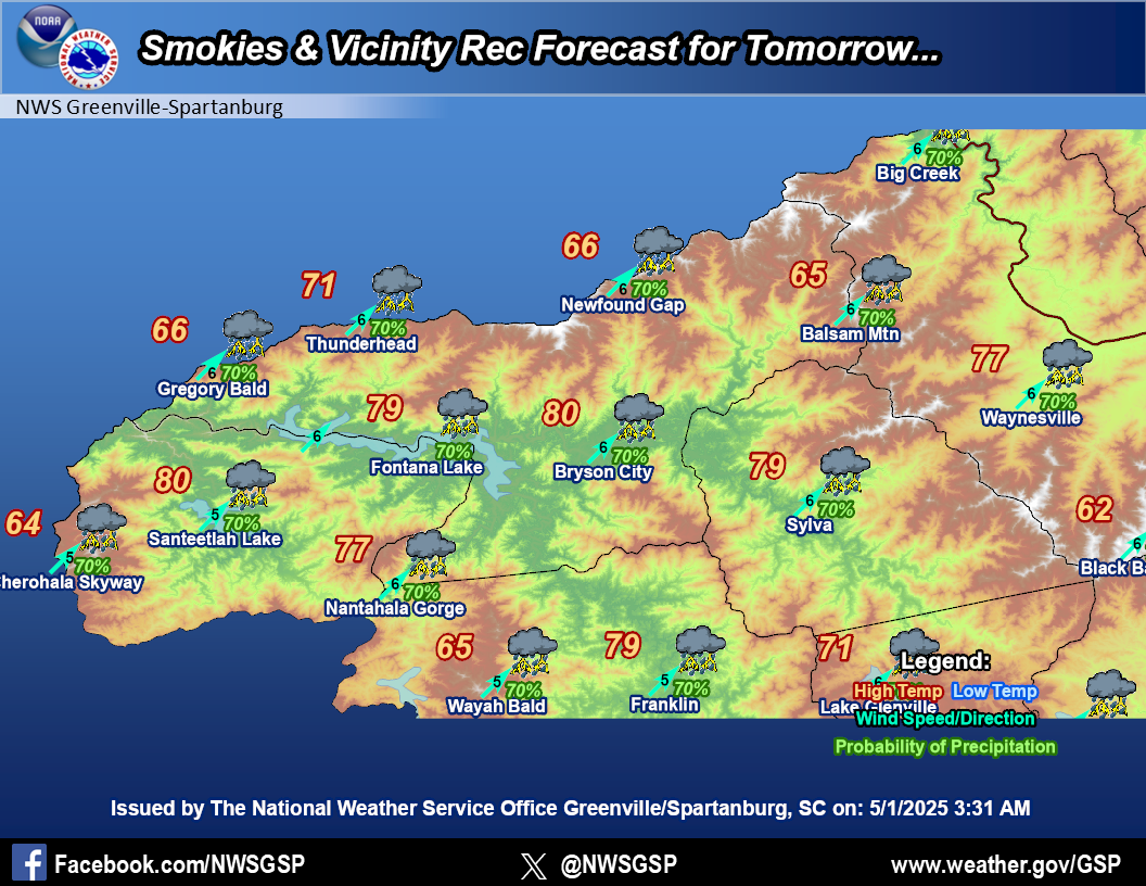
Smokies and Vicinity
|
|
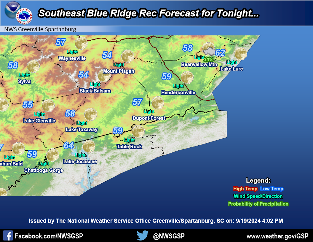
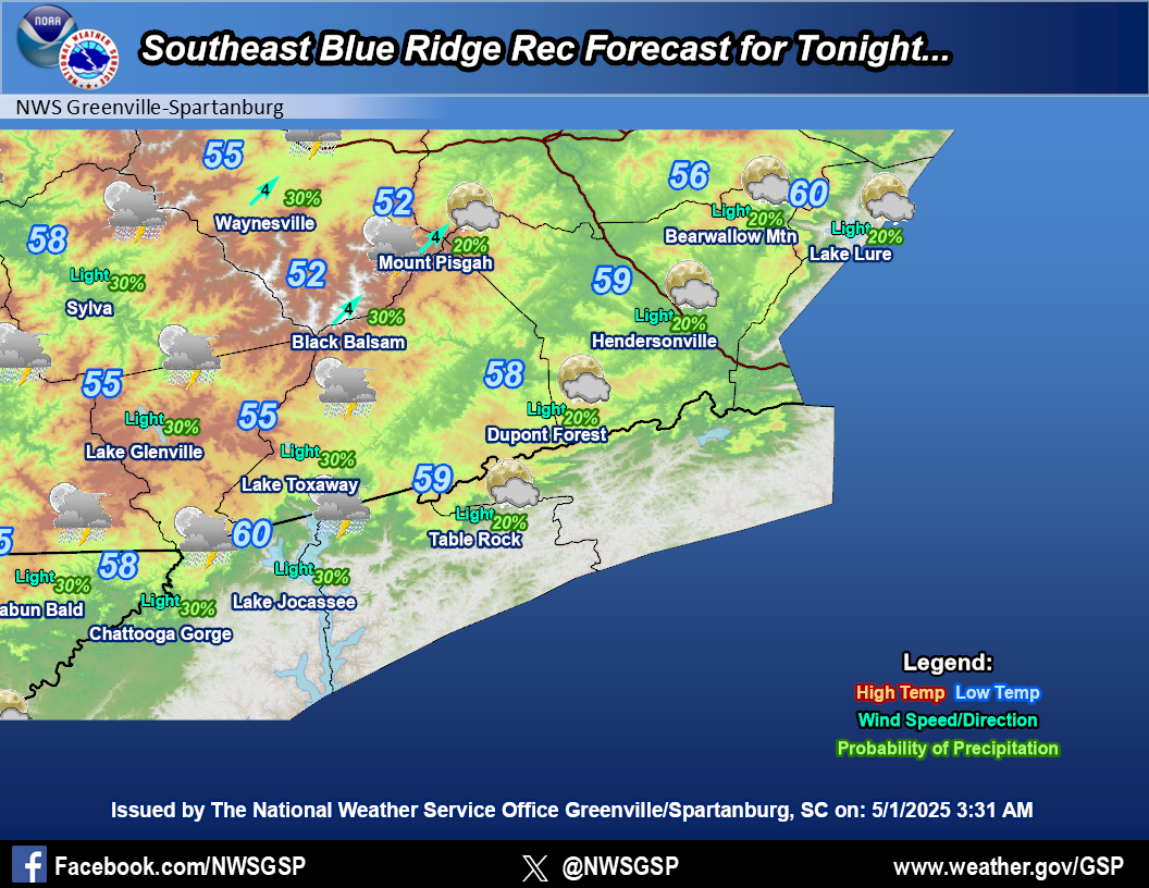
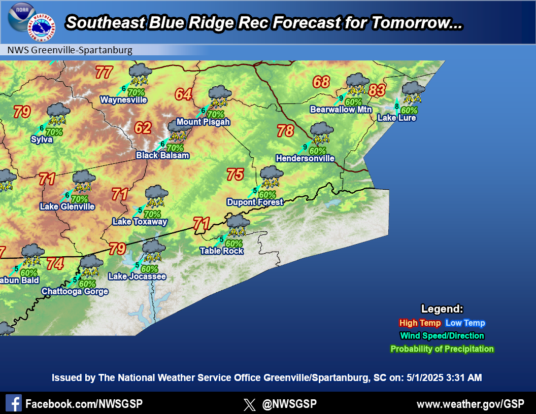
Southeast Blue Ridge
|
|
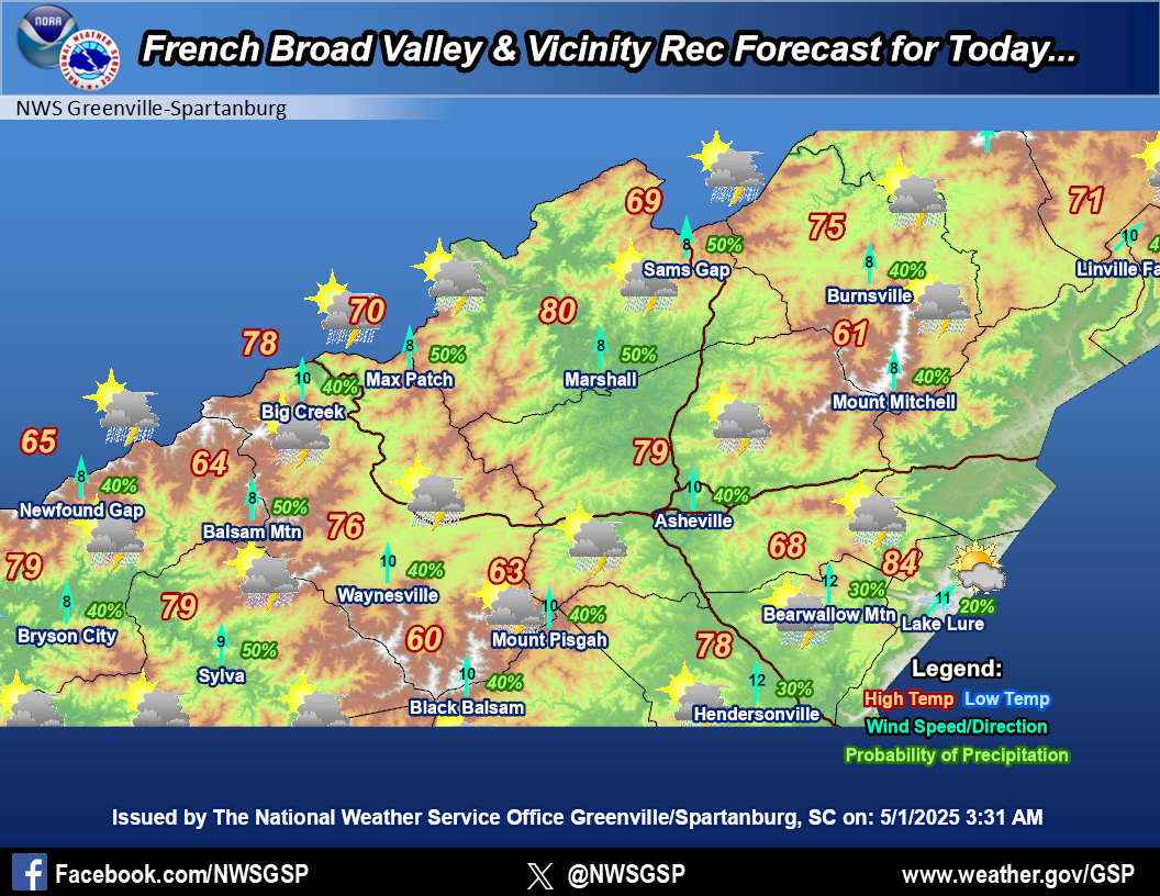
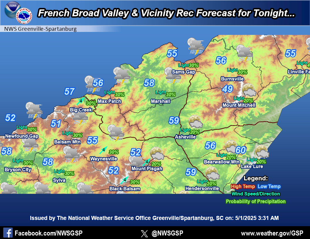
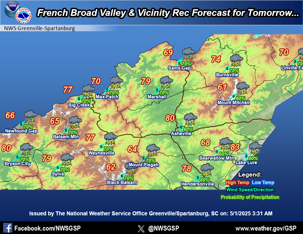
French Broad
Valley & Vicinity
|
|
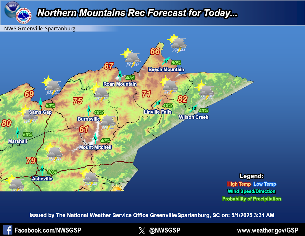
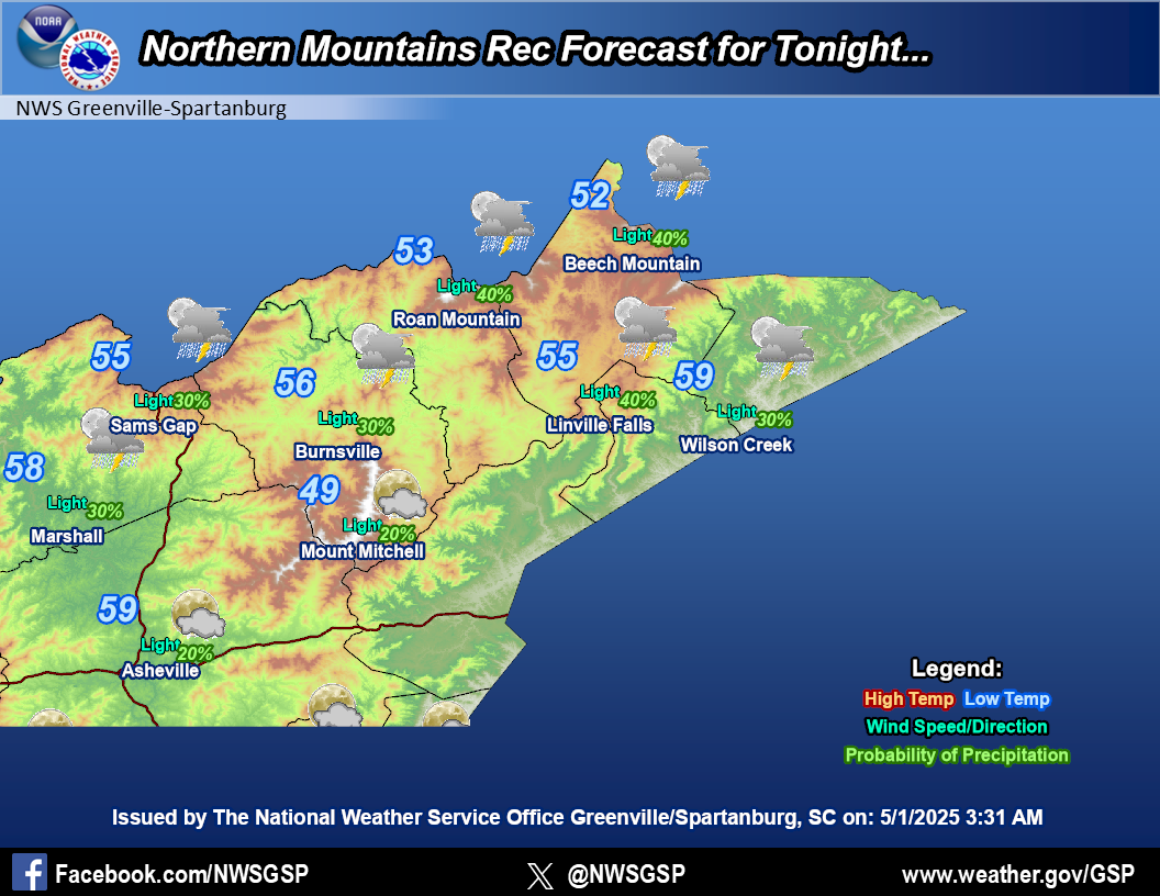
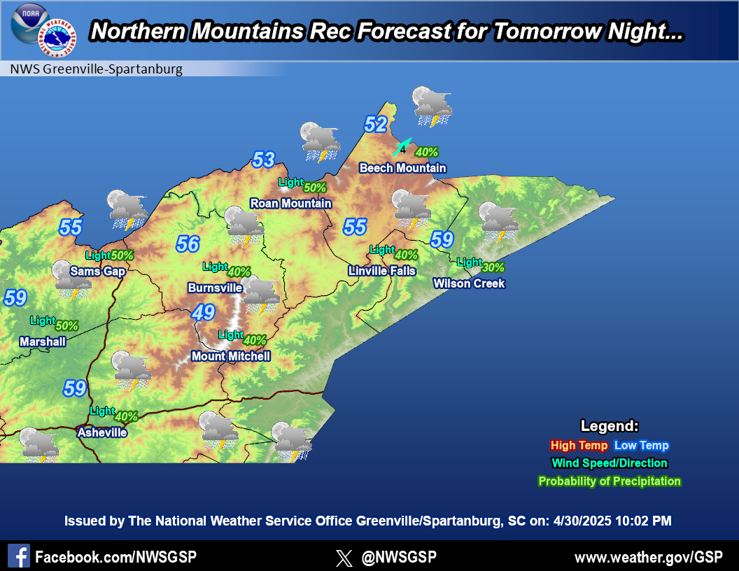
Northern Mountains
|
|
Mountain Weather Observations
|
|
|
|
Recreational Forecast
|
|
|


