
Heat expands across the Desert Southwest, Plains, Mississippi Valley and Midwest into Monday. Fire weather concerns continue for portions of the Intermountain West. Active monsoonal moisture fuels thunderstorms over the Southwest with possible flash flooding. Tropical cyclone Fausto in the Pacific, should weaken as it approaches Hawaii; Dangerous surf, swells and rip currents are expected. Read More >
|
|
|
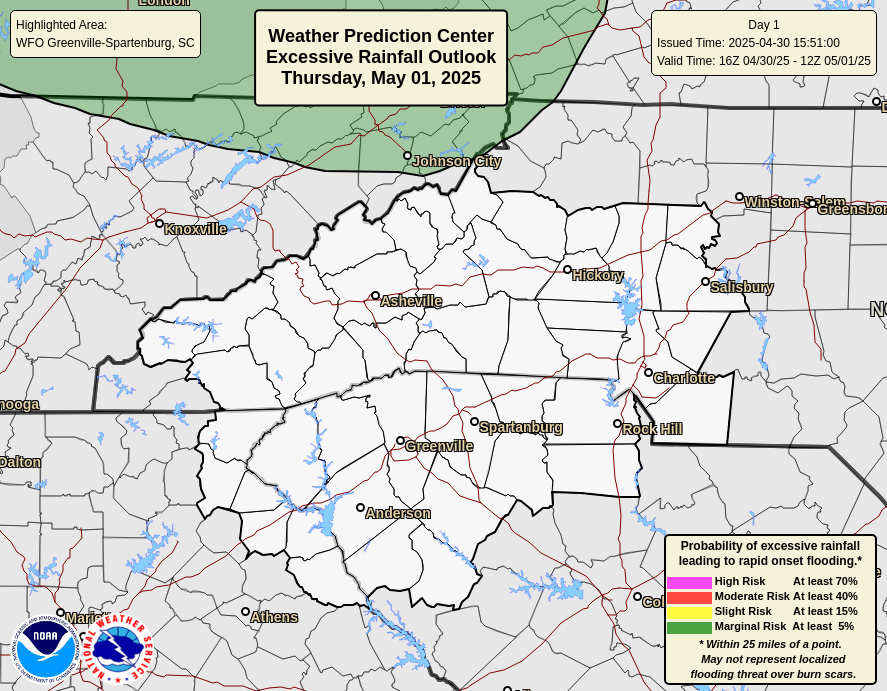
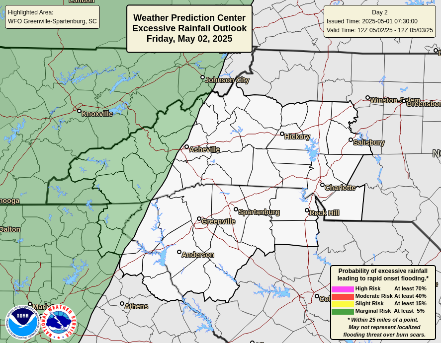
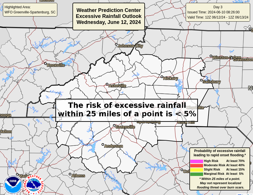
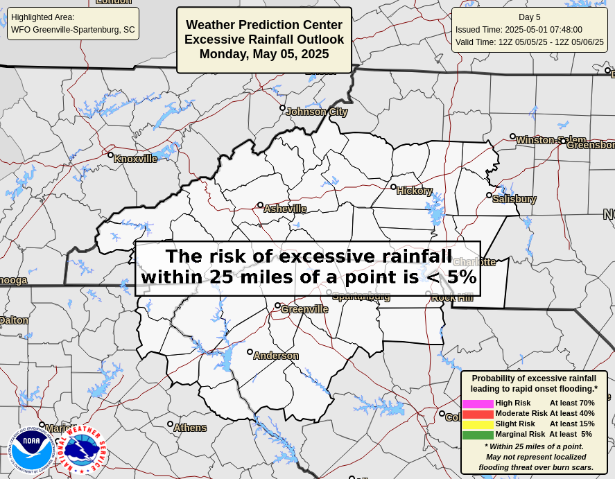
WPC Excessive Rainfall Outlooks (Details)
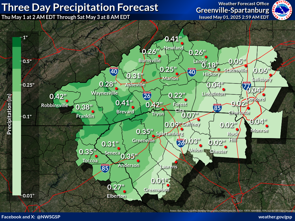
Precipitation Accumulation Forecast (click on thumbnails to display below)
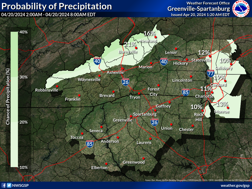
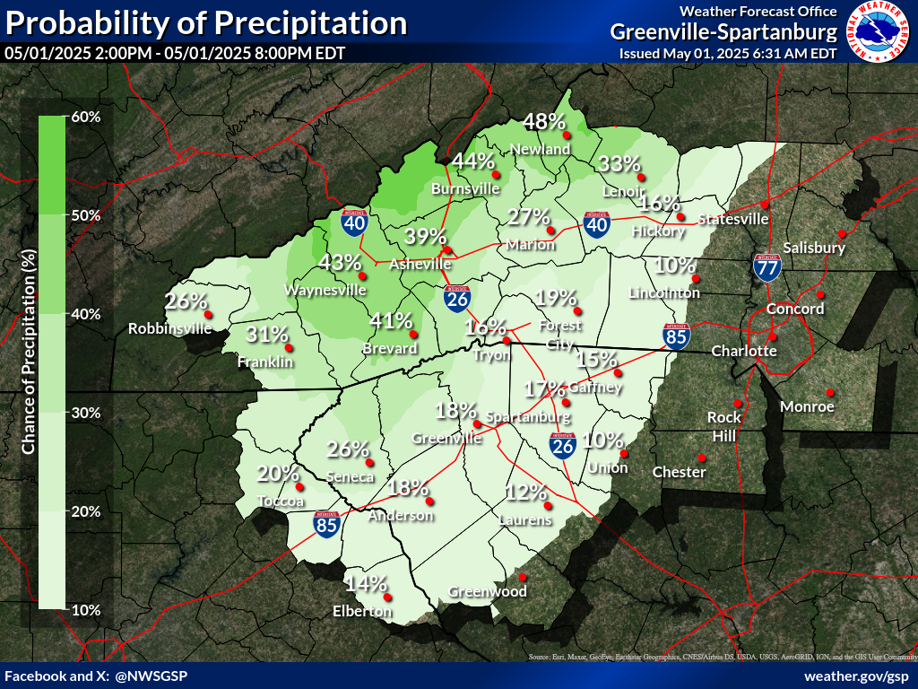
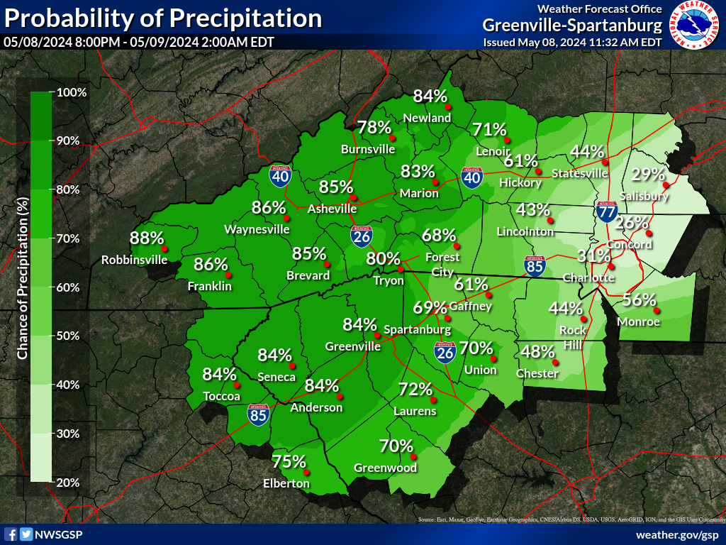
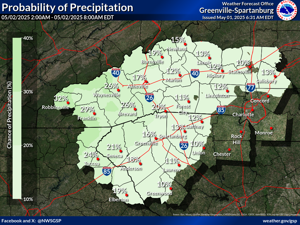
Probability of Precipitation (PoP) (click on thumbnails to display below)
|


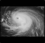 Tropical Weather
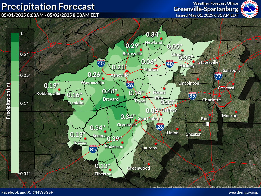


 Hourly Weather