National Weather Service United States Department of Commerce

Severe Thunderstorms in the Northeast and Northern Plains; Critical Fire Weather in the West

Scattered severe thunderstorms capable of damaging wind gusts and hail are forecast across the Northeast U.S. and North Dakota today. Heavy to excessive rainfall is possible over eastern New Mexico into western Texas and over the western Florida peninsula today. Critical fire weather conditions will persist today over parts of the interior Northwest and Great Basin. Read More >

×
Click on the icons below to access individual briefing pages
 

Severe Weather 

Briefing PageSevere Weather

Winter Weather 

Briefing PageWinter Weather

EM 

Briefing PageEM Briefing

Heavy Rain/Flooding 

Briefing PageHeavy Rainfall

Tropical Weather 

Briefing PageTropical Weather

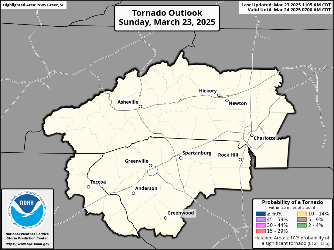
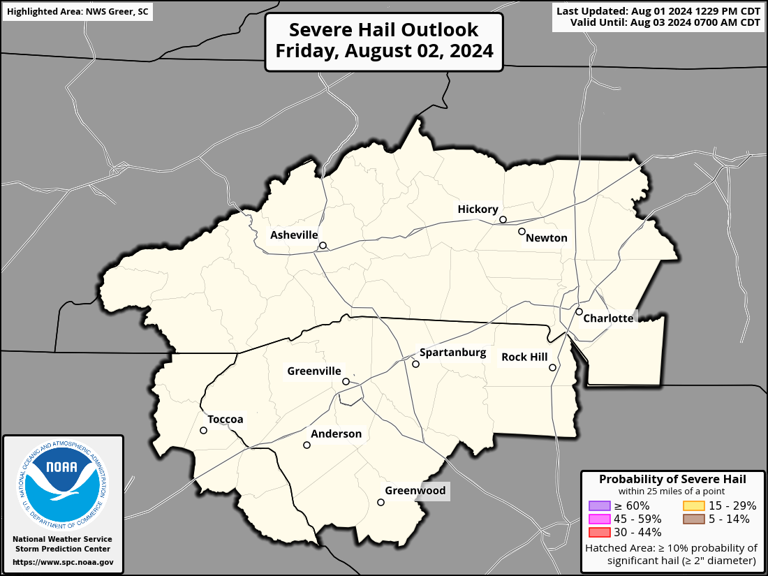
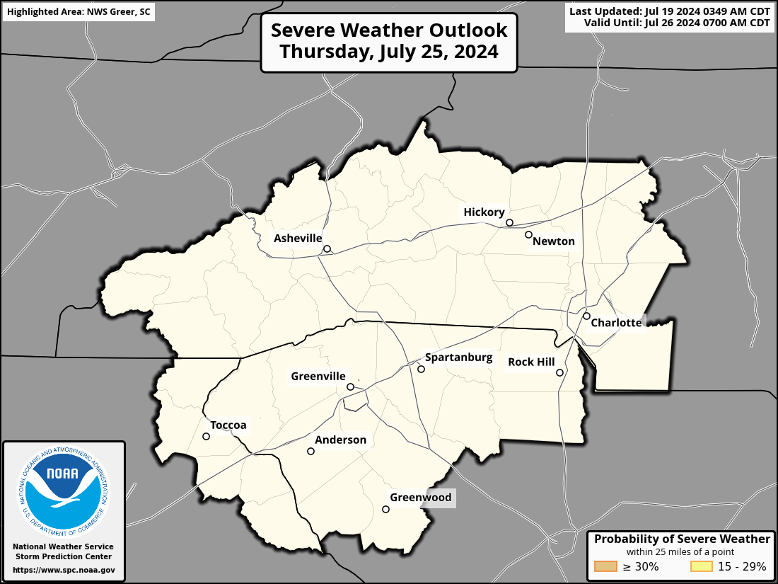
Storm Prediction Center Outlook and Watch Info (Details)

Active Severe Tstorm/
Tornado Watches
Mesoscale Discussions Day 1 Outlook
Valid Mesoscale Discussions Day 1 SPC Convective Outlook
Day 1 Severe Hail Day 1 Severe Wind Day 1 Tornado
SPC Day 1 Severe Hail Probability SPC Day 1 Severe Wind Probability SPC Day 1 Tornado Probability
Day 2 Severe Hail SPC Day 2 Severe Wind SPC Day 2 Tornado
SPC Day 1 Severe Hail Probability SPC Day 1 Severe Wind Probability SPC Day 1 Tornado Probability


Day 3 Day 4 Day 5
Day 3 SPC Convective Outlook Day 4 SPC Convective Outlook Day 5 SPC Convective Outlook
Day 6 Day 7 Day 8
Day 6 SPC Convective Outlook Day 7 SPC Convective Outlook Day 8 SPC Convective Outlook


Radar Loops: Local Radar (KGSP)  | Charlotte Radar | Southeast Radar Loop
Current Severe T-storm/Tornado Watch Graphic     Local Storm Report Map
NWS GSP Text Products:
Tornado Warning | Severe Thunderstorm Warning | Severe Weather Statement |
Special Weather Statement | Flash Flood Warning | Local Storm Reports | Watch County Notification |
Hazardous Weather Outlook | Area Forecast Discussion | Public Information Statement |