| Click on the icons below to access individual briefing pages |
|
|
|
***Click Here for Probabilistic Snowfall Products***
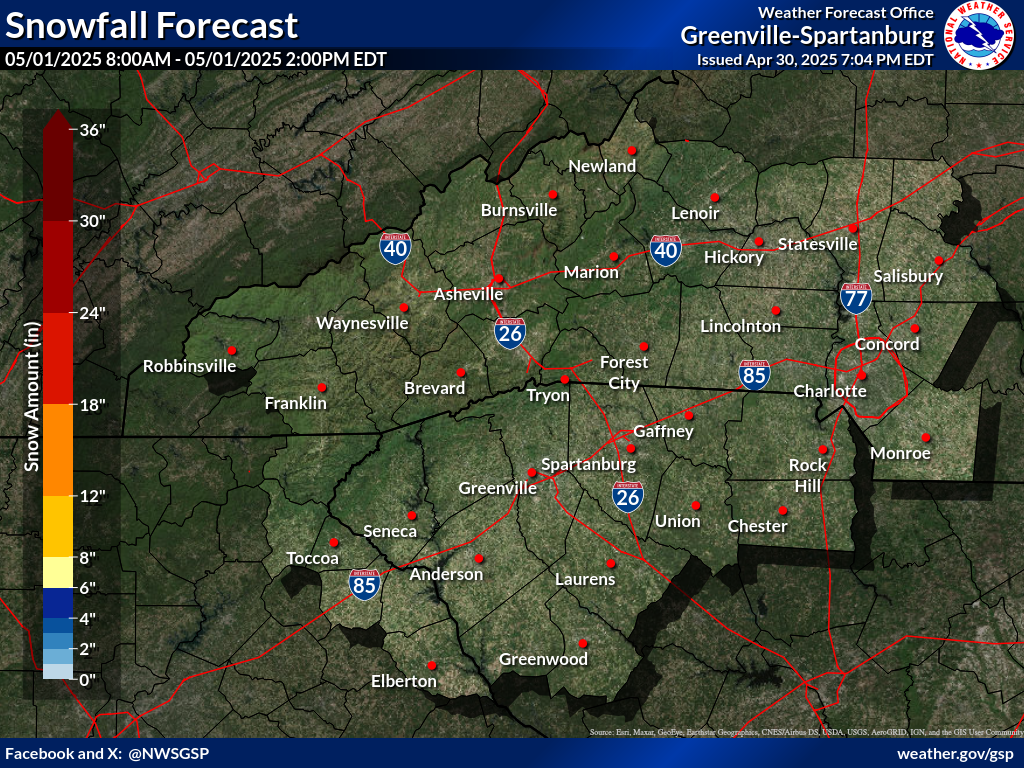
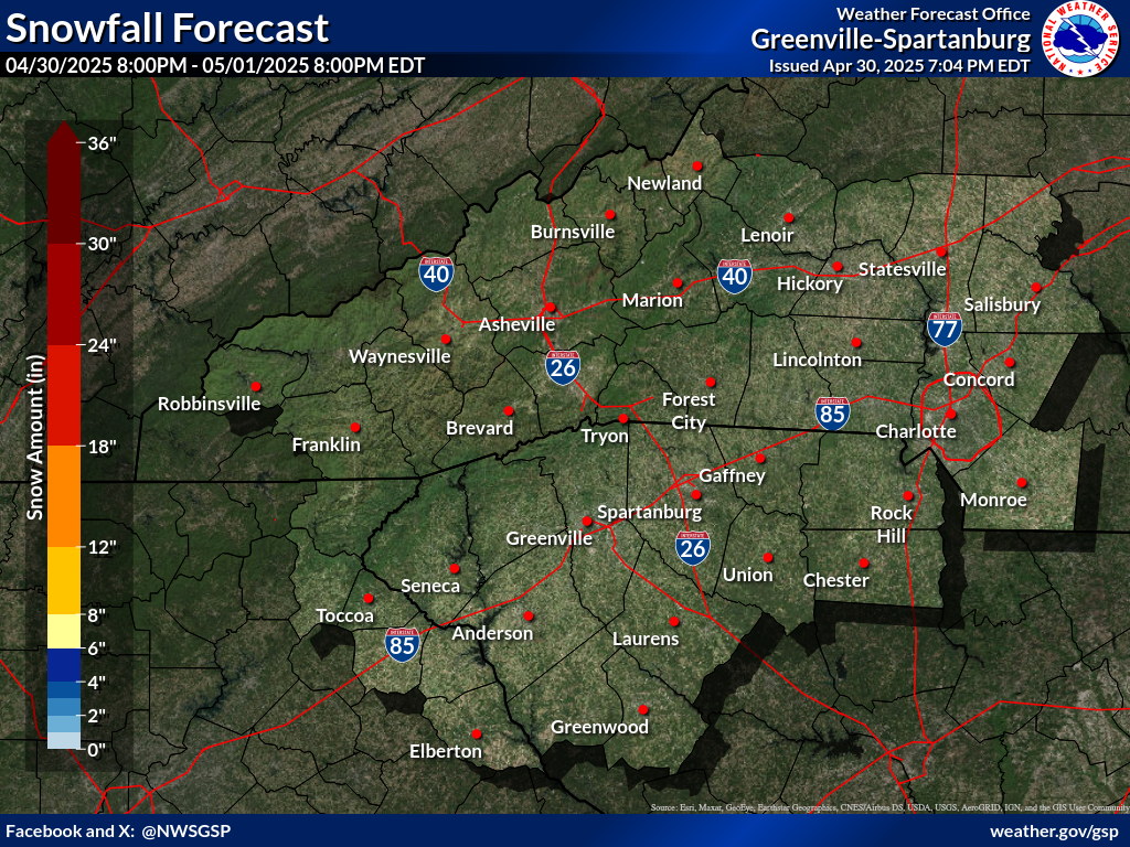
Snowfall Accumulation Forecast (click on thumbnails to display below)
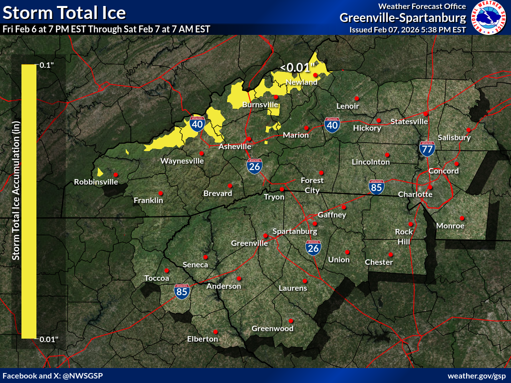
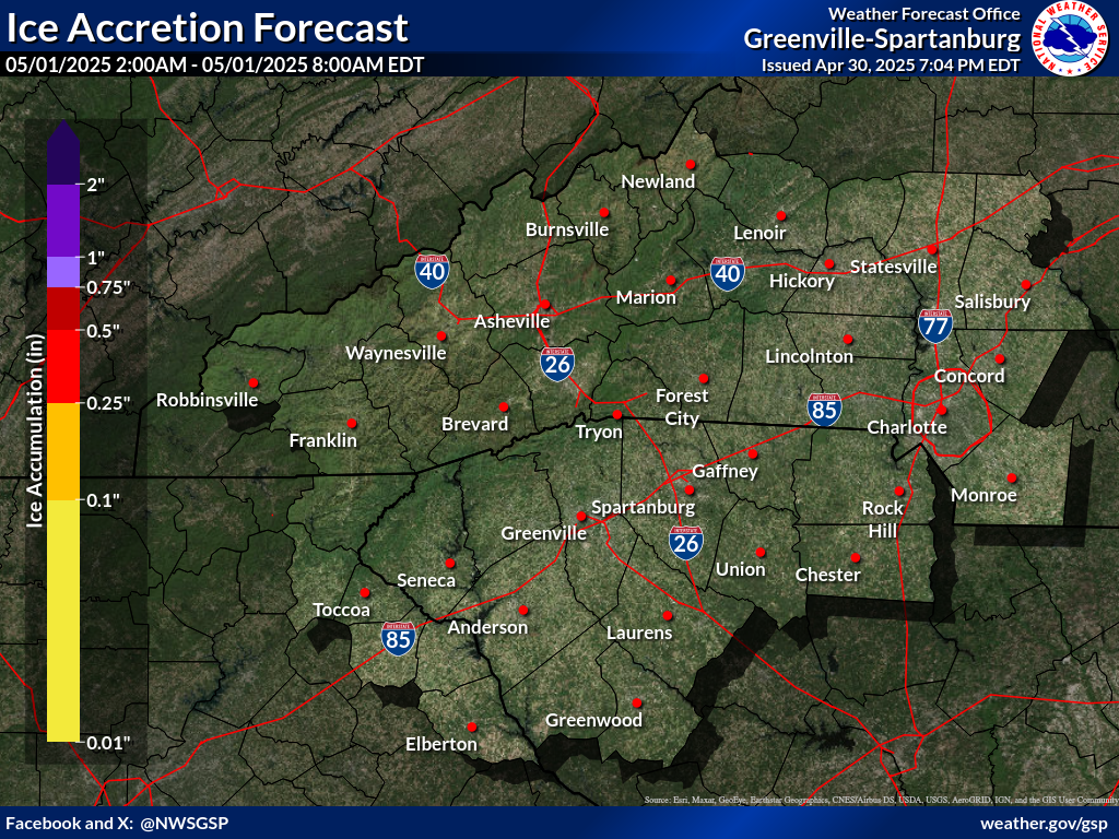
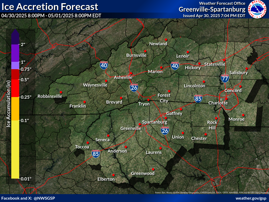
Ice Accumulation Forecast (click on thumbnails to display below)
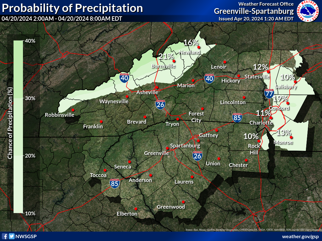
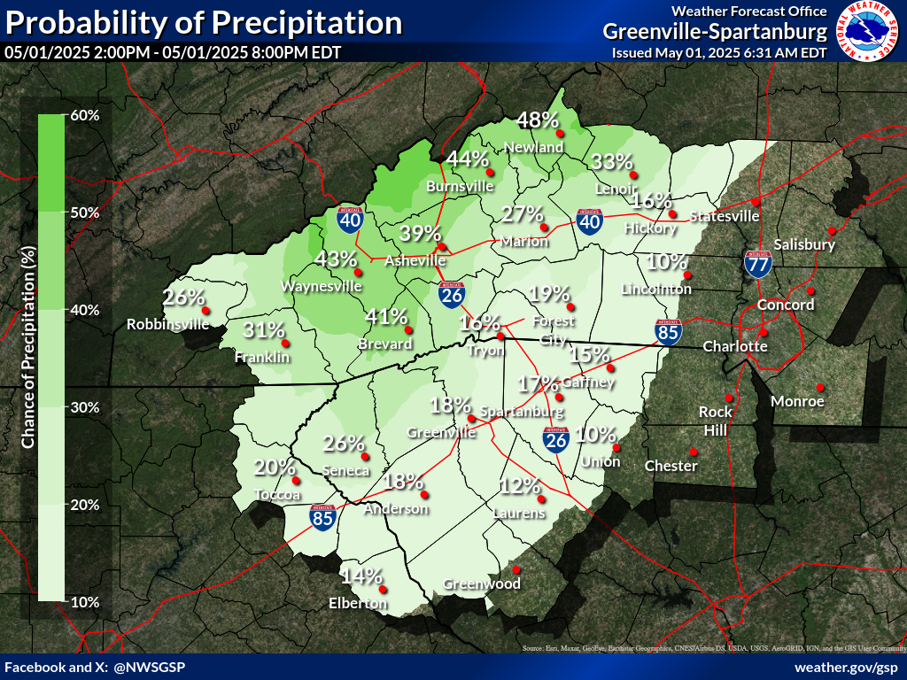
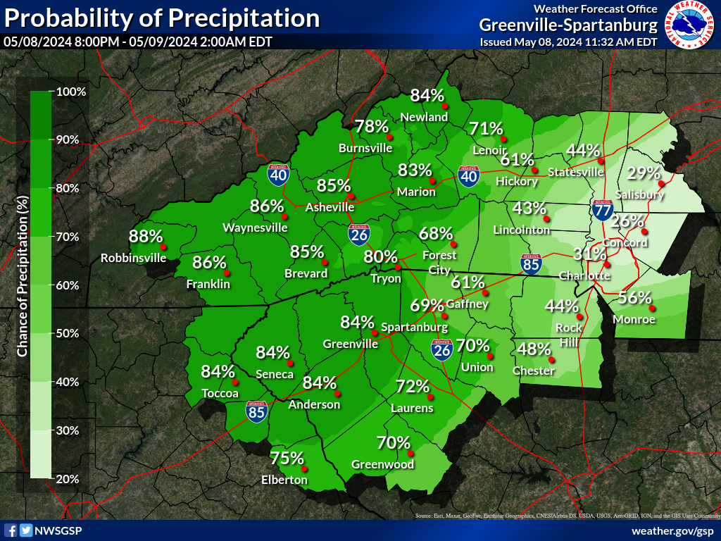
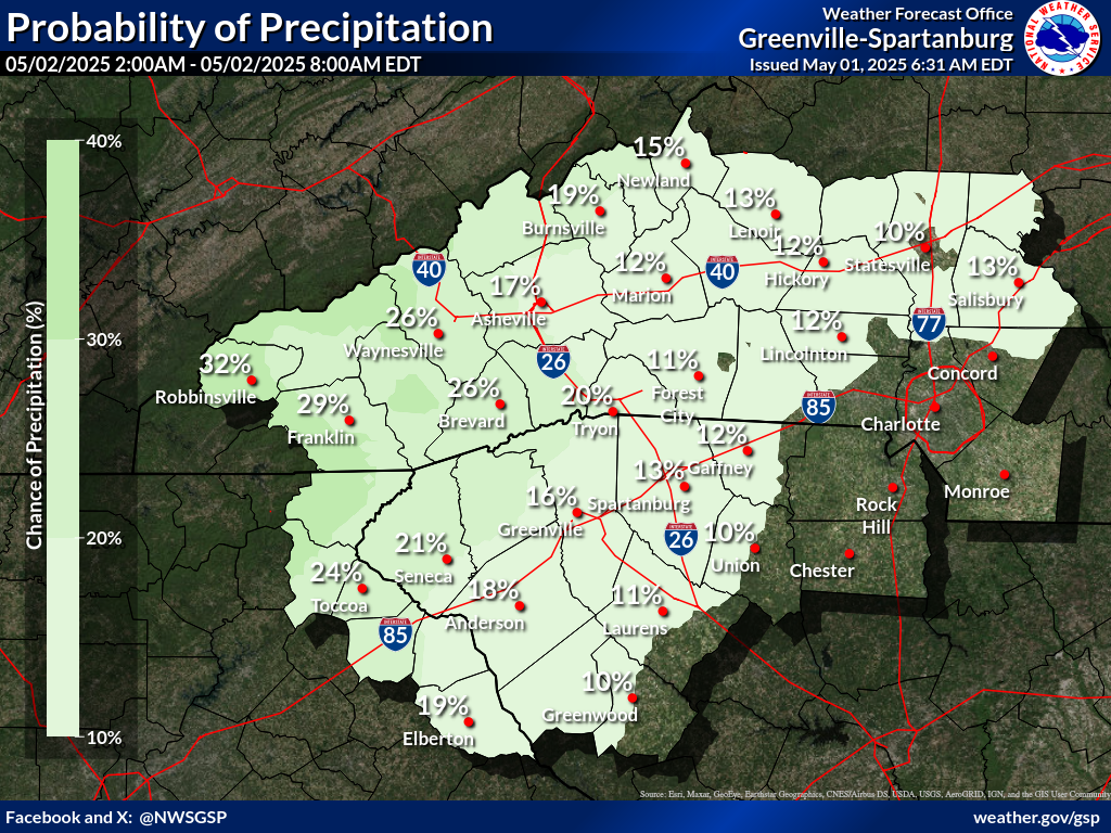
Probability of Precipitation (PoP) (click on thumbnails to display below)
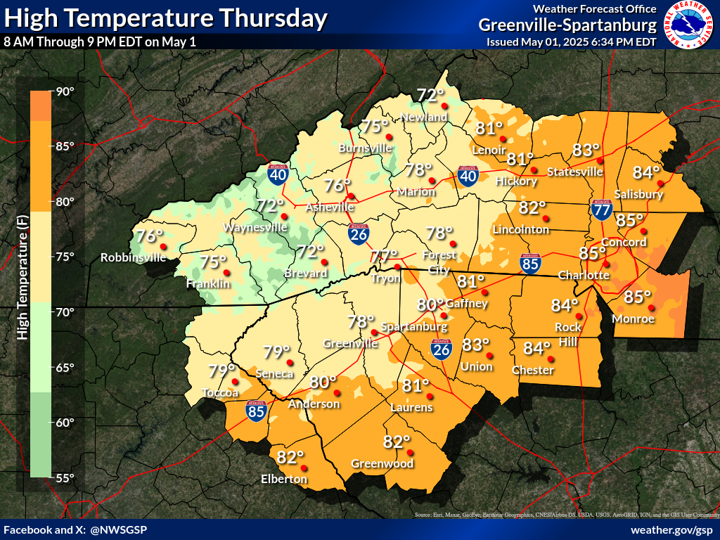
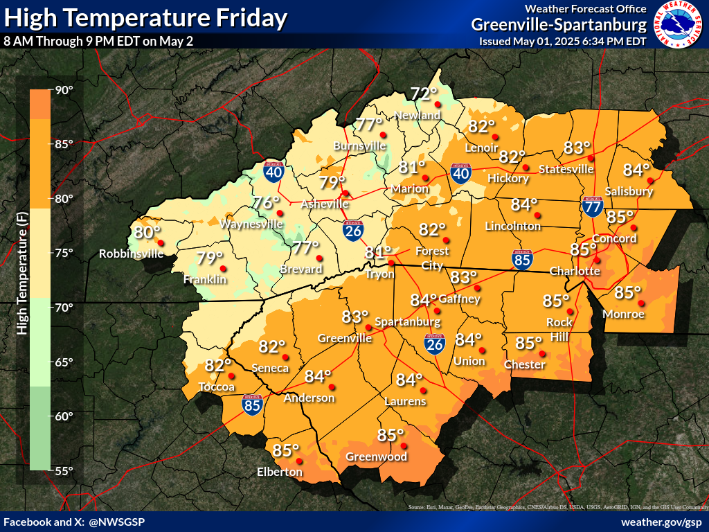
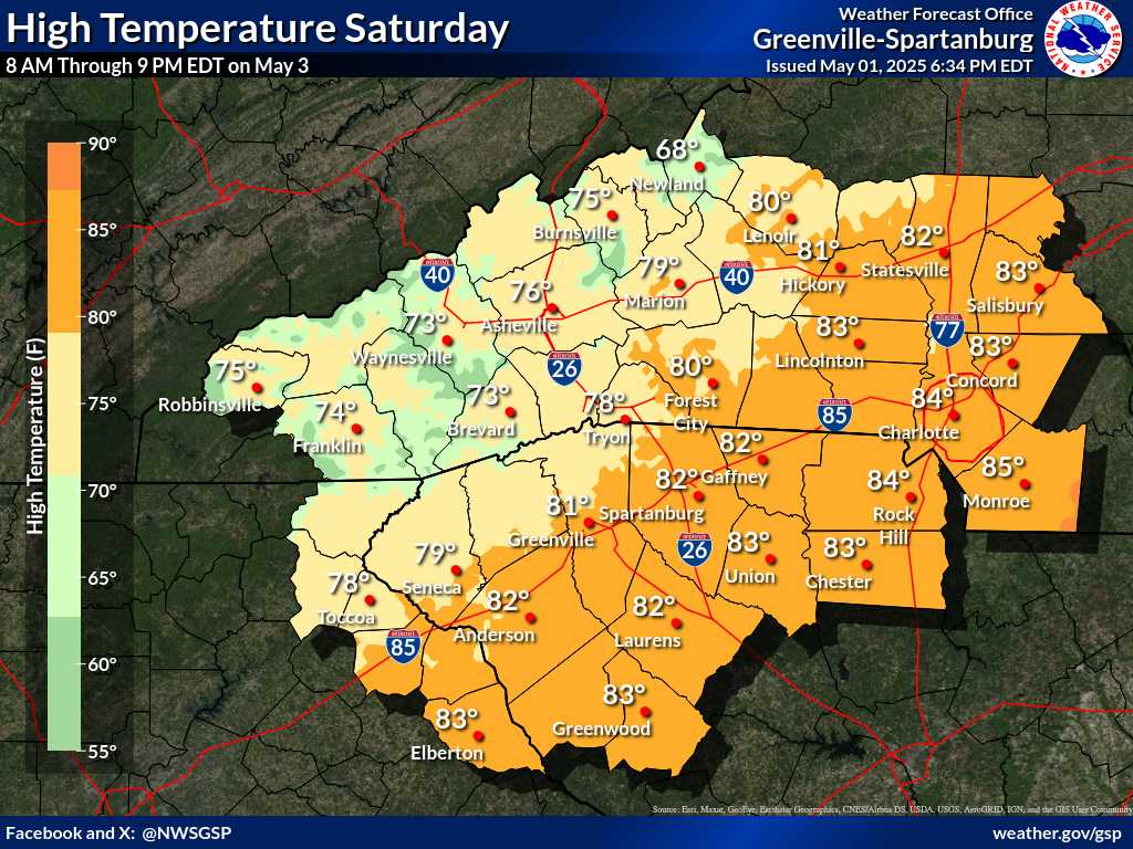
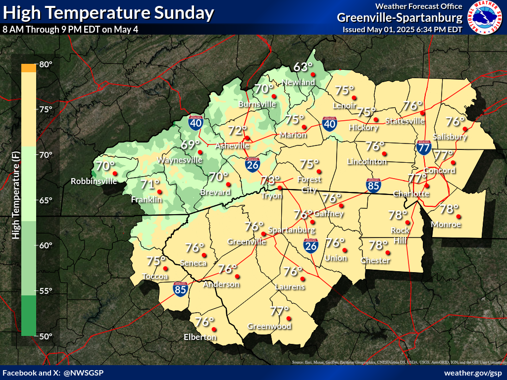
Days 1-4 Max Temperatures(click on thumbnails to display below)
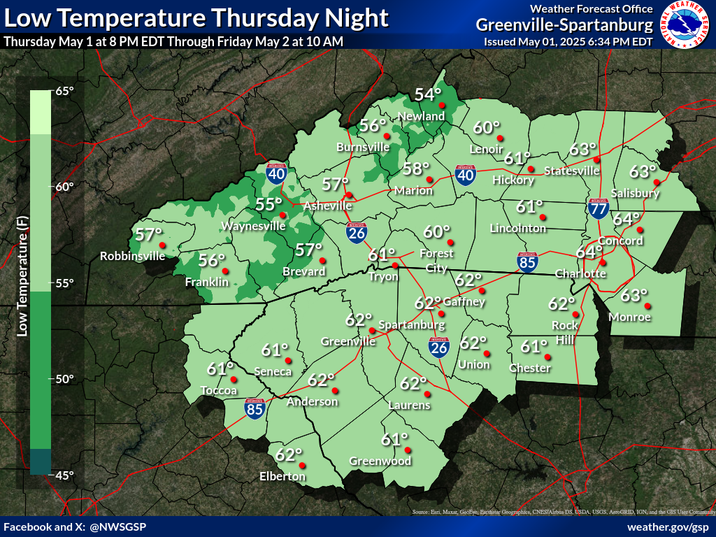
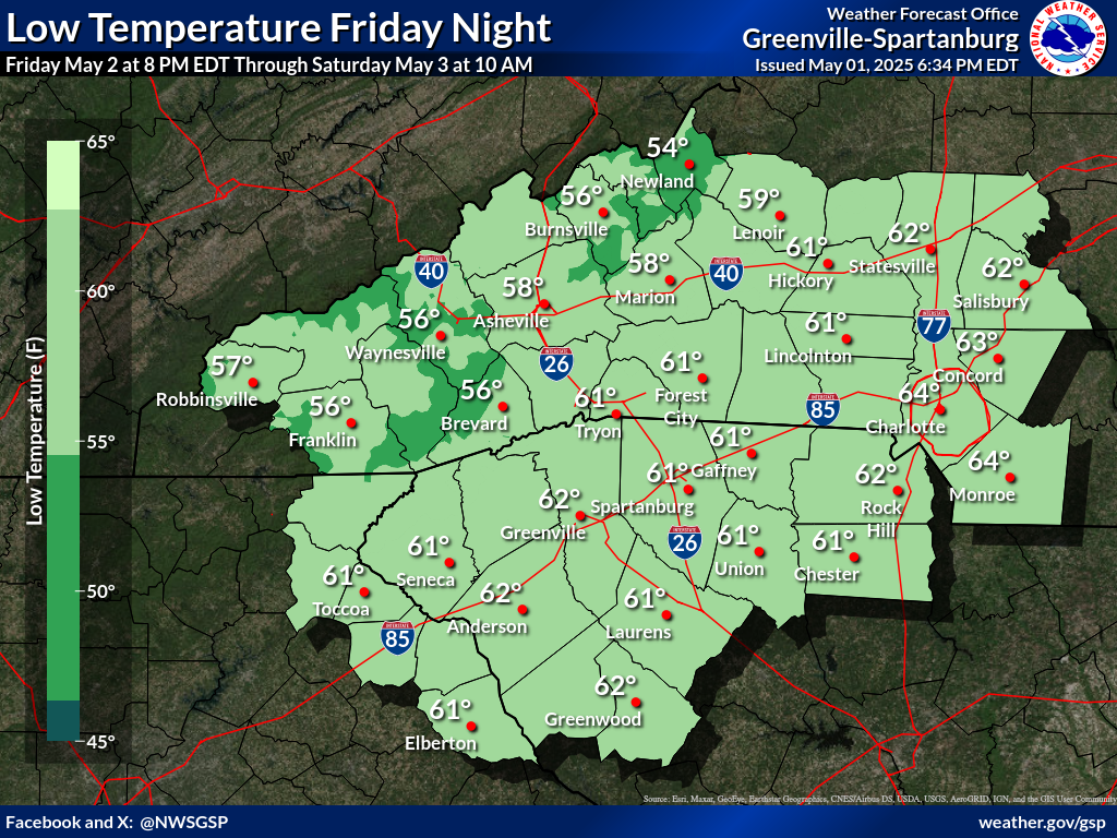
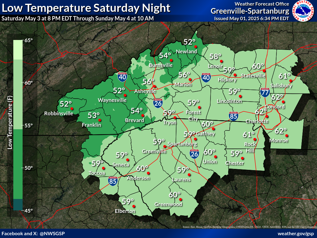
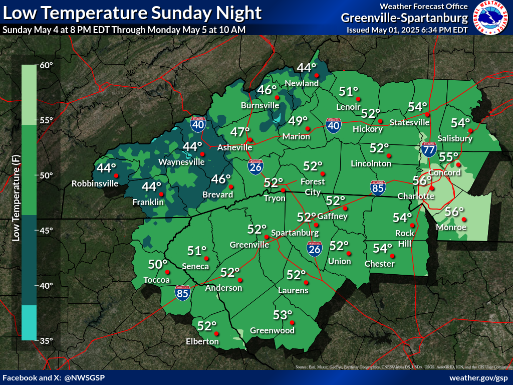
Nights 1-4 Min Temperatures(click on thumbnails to display below)
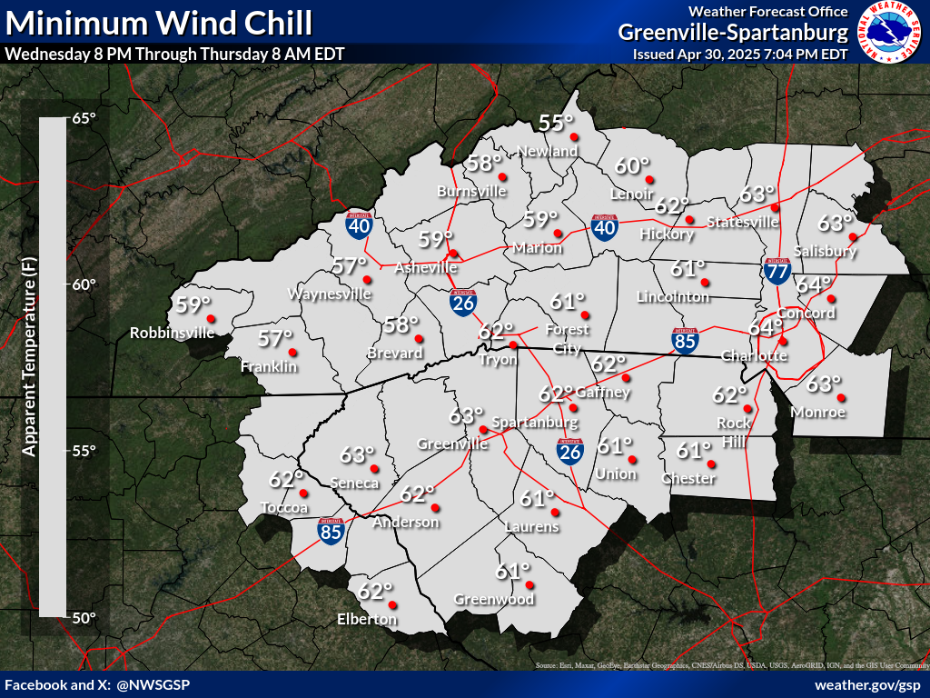
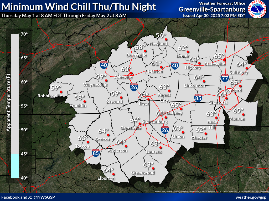
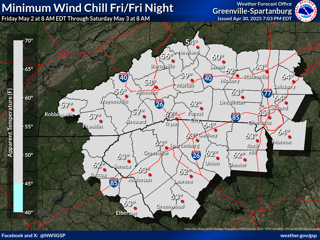
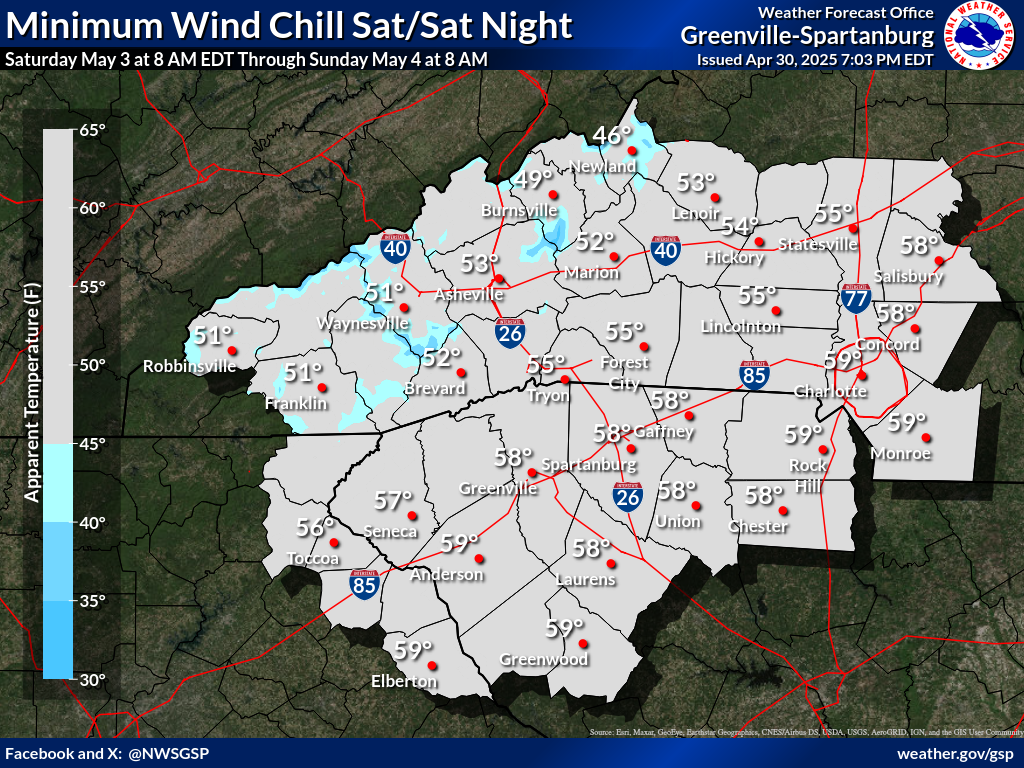
Days 1-4 Min Wind Chill(click on thumbnails to display below)
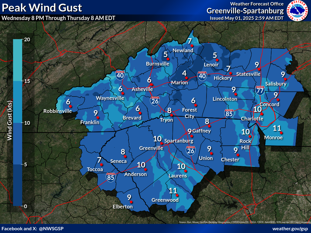
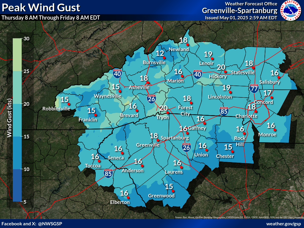
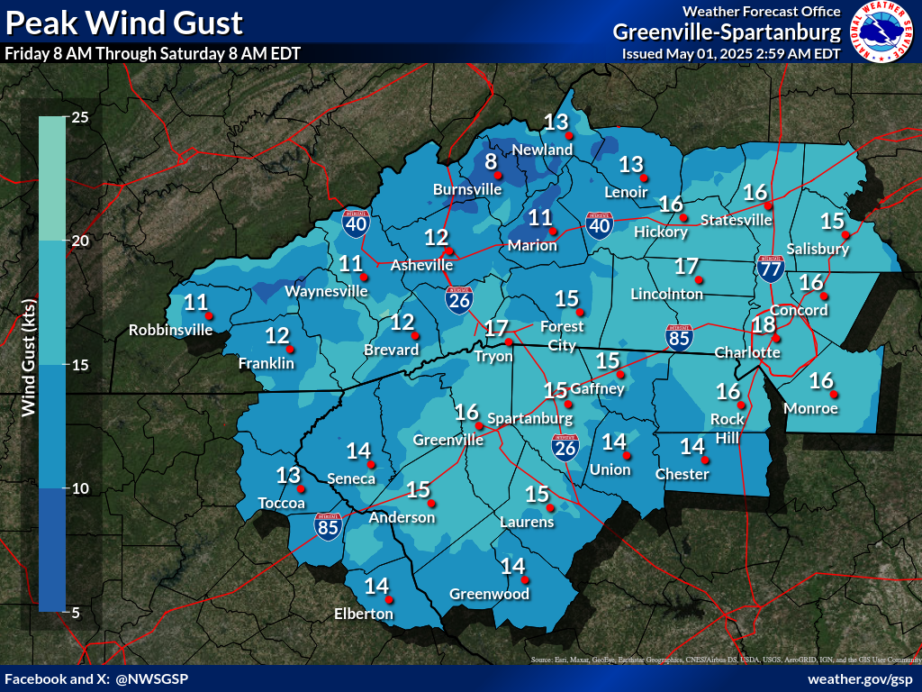
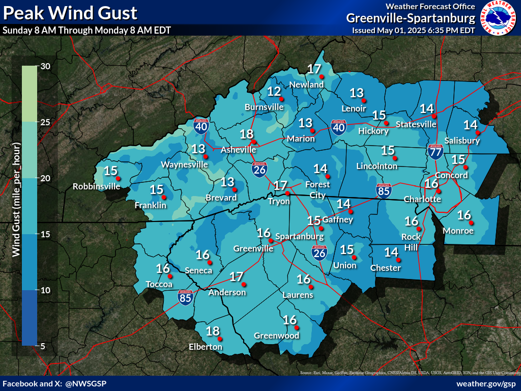
Days 1-4 Max Wind Gusts(click on thumbnails to display below)
|


 Tropical Weather
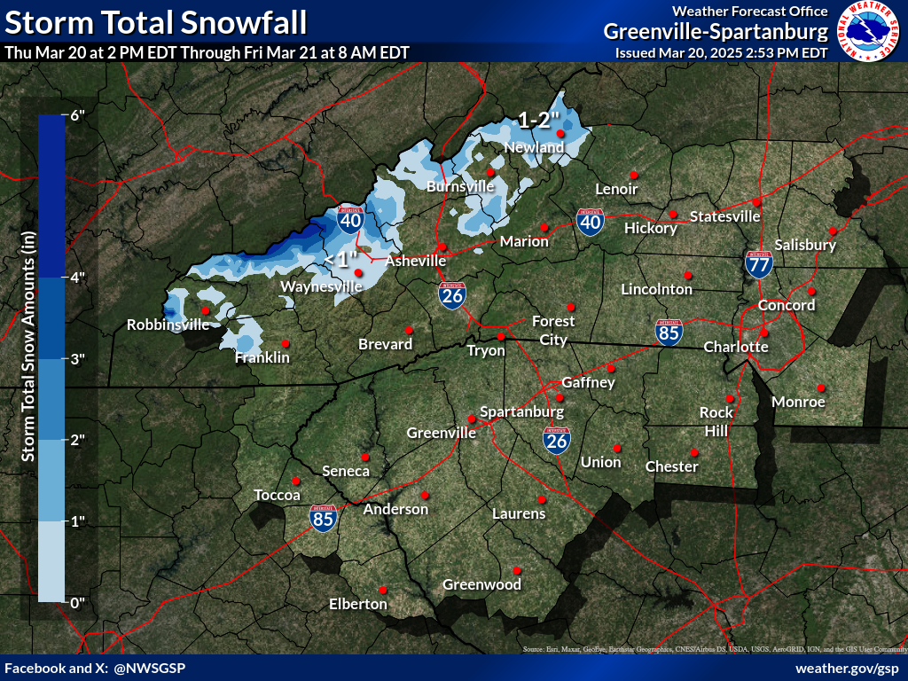


 Hourly Weather