Prior to every flight, pilots should gather all information vital to the nature of the flight. This site is informational in nature and is designed to assist pilots and aircrews for flight planning and weather familiarization. It may be used in conjunction with other preflight information sources needed to satisfy all the requirements of 14 CFR 91.103 and is not to be considered as a sole source of information to meet all preflight action. Pilots can complete their regulatory-compliant preflight briefing by using other automated resources or from Flight Service at www.1800wxbrief.com or by calling 1-800-WX-BRIEF.


.AVIATION /07Z SUNDAY THROUGH THURSDAY/...
As of 200 AM Sunday...

A summer like pattern is in place with high pressure southeast
of the area surface and aloft. This brings VFR conditions with
just a few afternoon cumulus and no further convection beyond
that.

Surface flow will be light south by night and light southwest
by day. Flow aloft will be light to moderate southwest, perhaps
just enough for low level wind shear over the middle Ohio for a
time this morning, and just enough just off the deck to preclude
fog.

FORECAST CONFIDENCE AND ALTERNATE SCENARIOS THROUGH 06Z MONDAY...

FORECAST CONFIDENCE: High.
Click to Read the Full Area Forecast Discussion
AVIATION FORECAST CONFIDENCE
| Updated: 324 AM EDT Sun Apr 28 2024 |
| UTC | 06 | 07 | 08 | 09 | 10 | 11 | 12 | 13 | 14 | 15 | 16 | 17 |
| EDT | 02 | 03 | 04 | 05 | 06 | 07 | 08 | 09 | 10 | 11 | 12 | 13 |
| CRW | H | H | H | H | H | H | H | H | H | H | H | H |
| HTS | H | H | H | H | H | H | H | H | H | H | H | H |
| BKW | H | H | H | H | H | H | H | H | H | H | H | H |
| EKN | H | H | H | H | H | H | H | H | H | H | H | H |
| PKB | H | H | H | H | H | H | H | H | H | H | H | H |
| CKB | H | H | H | H | H | H | H | H | H | H | H | H |
| 1 AM | 2 AM | 3 AM | 4 AM | 5 AM | 6 AM | |
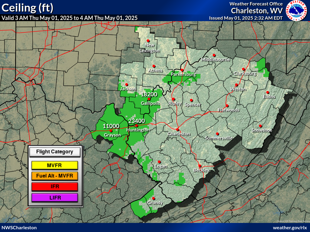 |
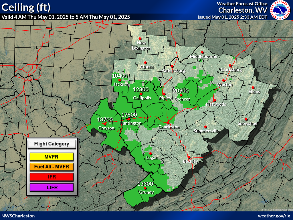 |
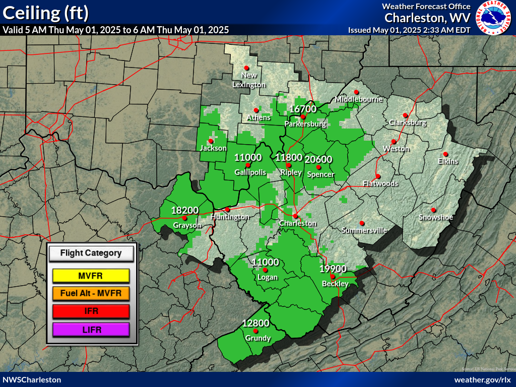 |
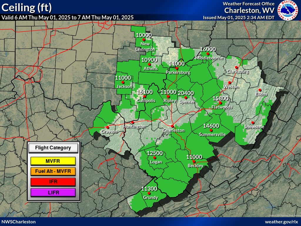 |
 |
 |
 |
| 1 AM | 2 AM | 3 AM | 4 AM | 5 AM | 6 AM | |
 |
 |
 |
 |
 |
 |
|
 Airports with TAFs |
  Airports without TAFs
Additional Local Information |
Regional/National Information |

