National Weather Service United States Department of Commerce


 Fultondale EF-3 Tornado of January 25, 2021

Event Summary for Central Alabama

Central Alabama was involved within a warm sector ahead of an approaching cold front during the night of January 25th, 2021, featuring dew points in the low to mid 60s and surface-based instability reaching as high as 1,200 J/kg. Strong wind shear was in place which, combined with instability, favored a risk for severe storms. Upper-level troughing was displaced well toward the northwest, which helped to limit the number of severe storms, with just one or two occurring throughout the event.

The storm that produced the EF-3 tornado was first tracked from near Interstate 55 in Central Mississippi. As the storm moved across Mississippi and into West Alabama, it exhibited episodes of rotation, but none were strong enough to produce a tornado. As the storm entered Jefferson County, its structure underwent organization. A rotational signature quickly matured, with an associated BWER signature on RADAR. A strong tornado was spawned, affecting populated areas just north of Birmingham. This storm continued eastward into Georgia, with additional occurrences of rotation but no additional tornadoes.

This event will be reviewed as the formation of this tornadic storm was particularly interesting given the overall environment. A few small-scale factors, perhaps not present elsewhere, appear to have come together to allow this storm to produce such a tornado.

**The data below is considered PRELIMINARY.**


Survey Information


EF-3
Estimated Maximum Wind:
150 mph
Injuries/Fatalities:
30+ / 1
Damage Path Length:
10.4 miles
Maximum Path Width:
900 yards
Approximate Start Point/Time:
5 NNW Birmingham
33.5965/-86.8256
at 10:40 PM CST
Approximate End Point/Time:
1 WSW Chalkville
33.6598/-86.6678
at 10:55 PM CST 


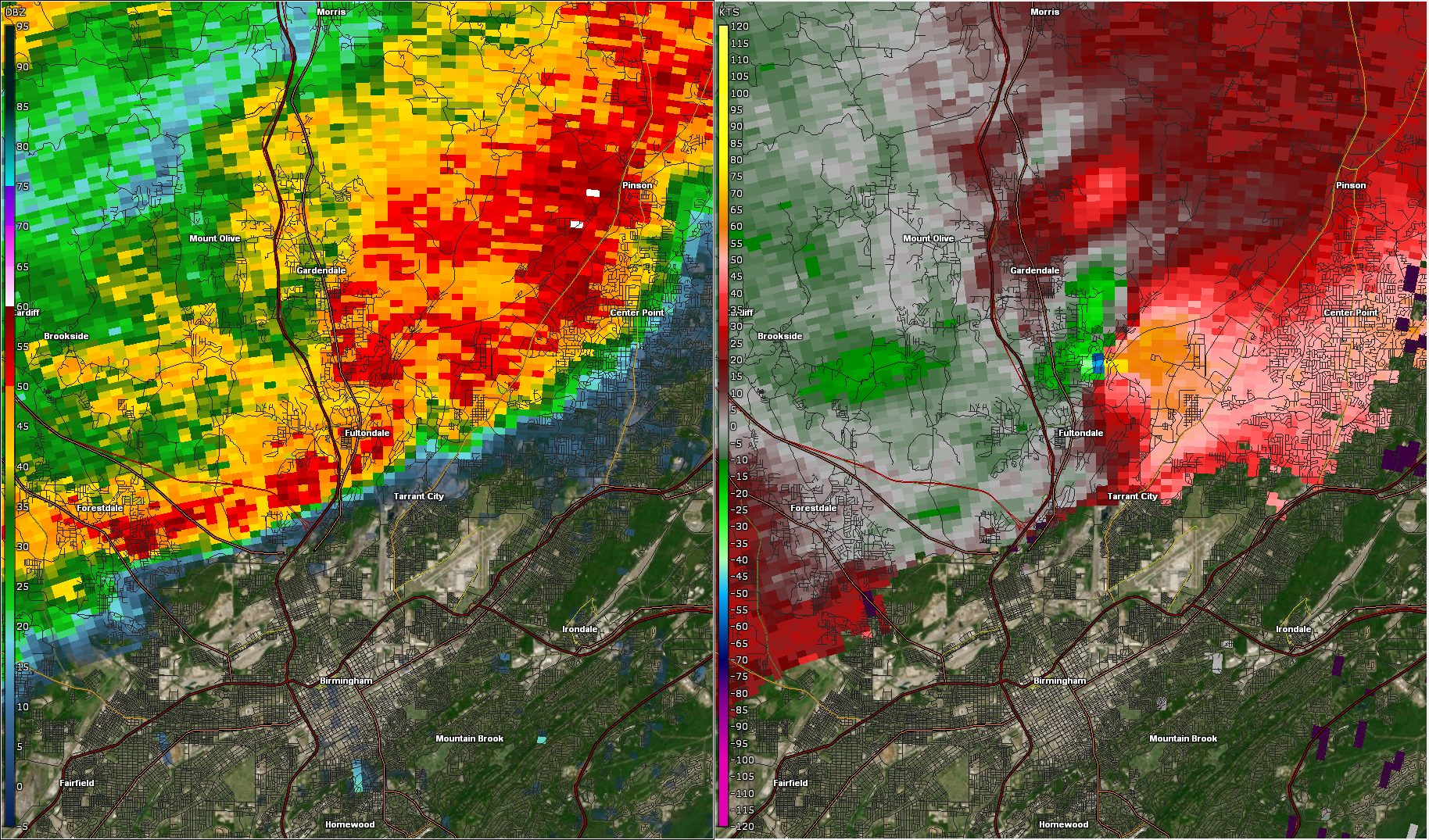
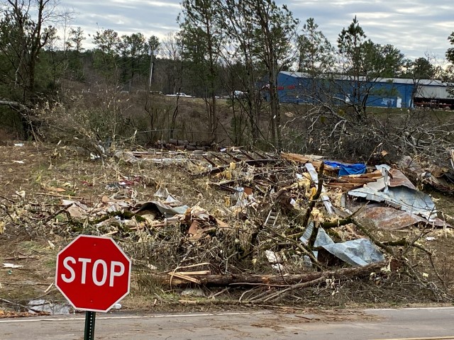
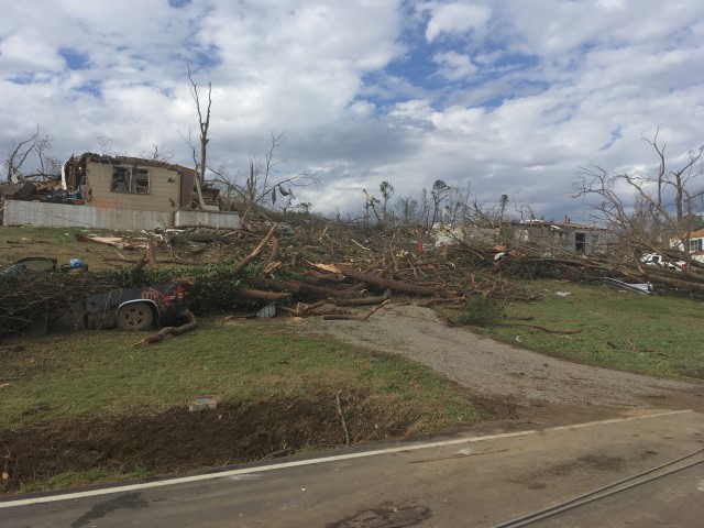
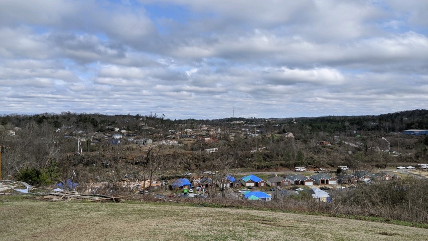
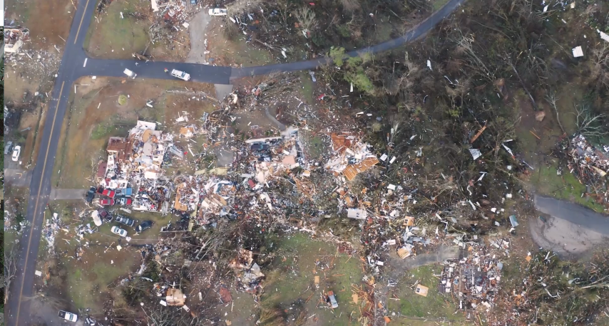
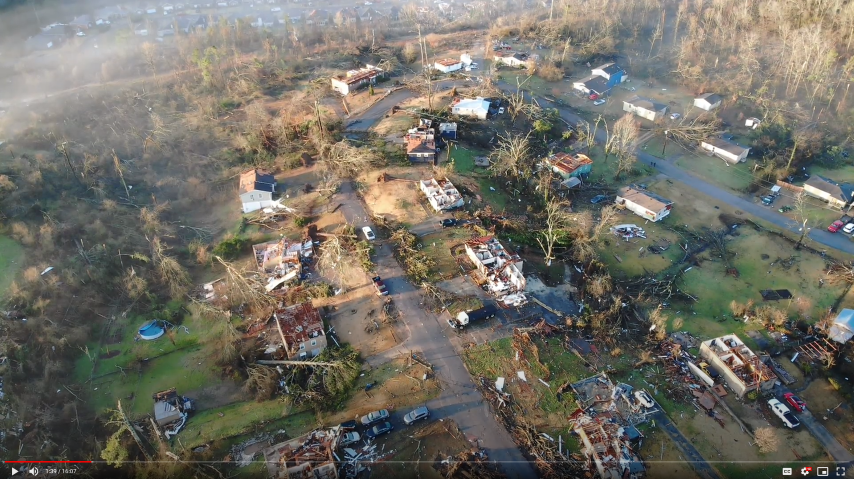
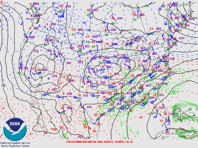
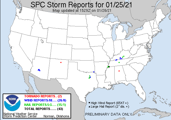
NWS Meteorologists surveyed damage in northern Jefferson County, from Fultondale northeastward to Center Point, and determined it was the result of a strong tornado.

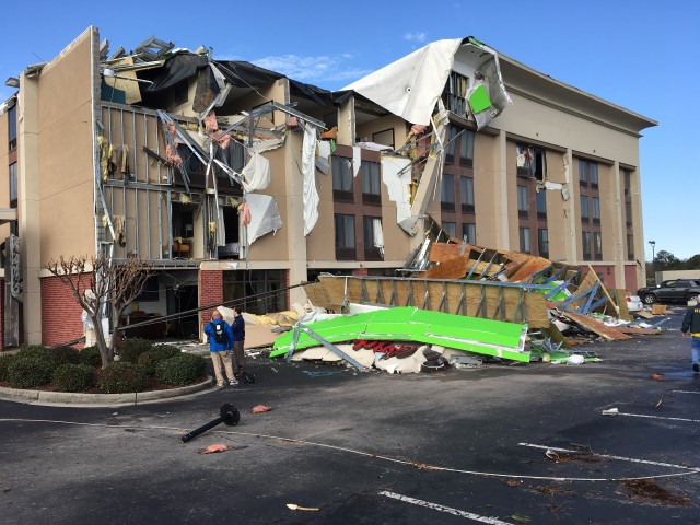
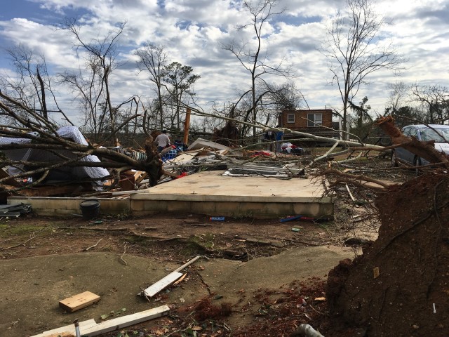
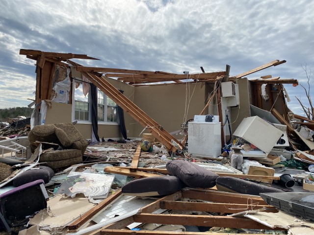
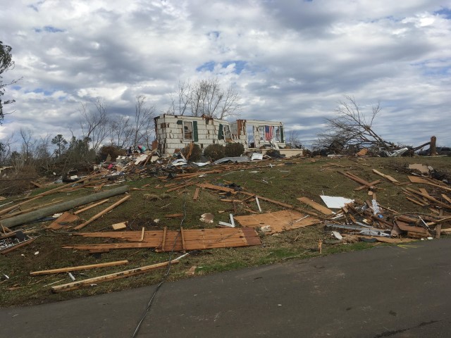
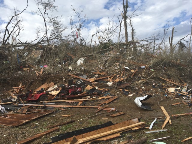
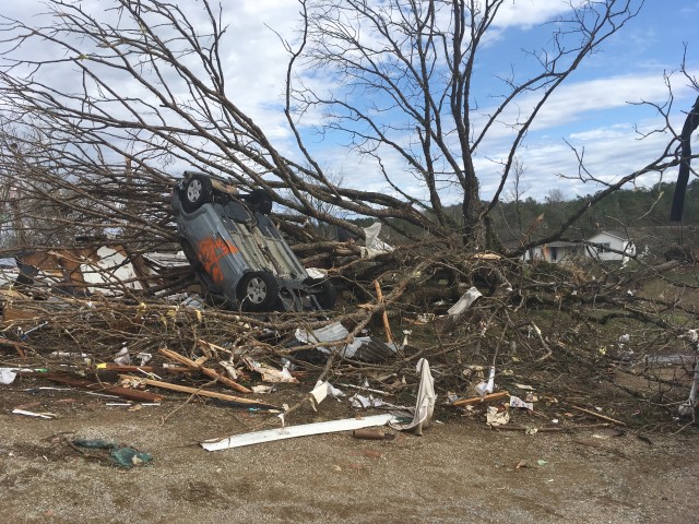
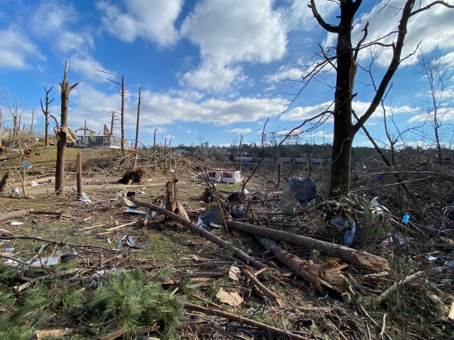
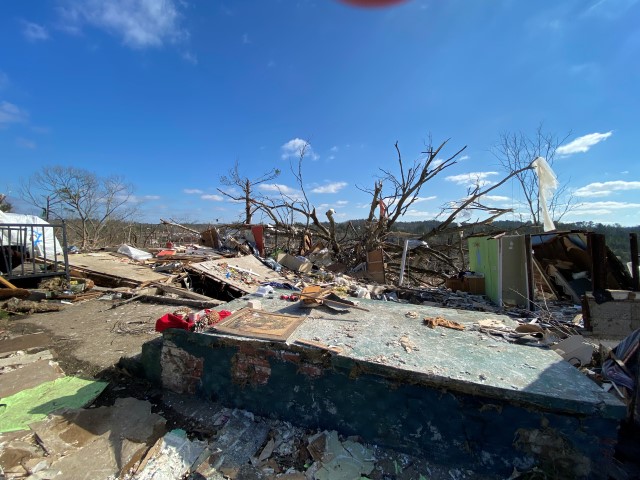
The tornado began along Chapel Hills Parkway, where minor shingle damage occurred. The tornado tracked northeastward across Ellard Road and directly over the Walker Chapel Road overpass on Interstate 65. It was at this interstate exit where the tornado began to intensify rapidly, snapping numerous power poles and causing substantial damage to a hotel. The tornado continued northeastward, crossing Highway 31, causing mostly tree damage along the highway. As the tornado moved into residential areas along Fulton Drive and Lykes Boulevard, substantial damage occurred with several homes being destroyed with at least one being swept off the foundation. There was also significant tree damage in the neighborhood. Several homes along Georgetown Lane suffered significant damage as wind breached garage doors, aiding in complete roof loss in some cases. Other damage included destroyed fences, sheds, and lofting of a hot tub. Numerous trees were uprooted or snapped.

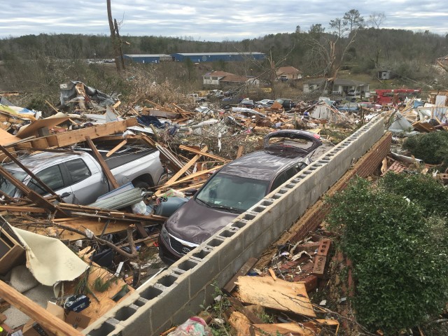
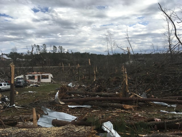
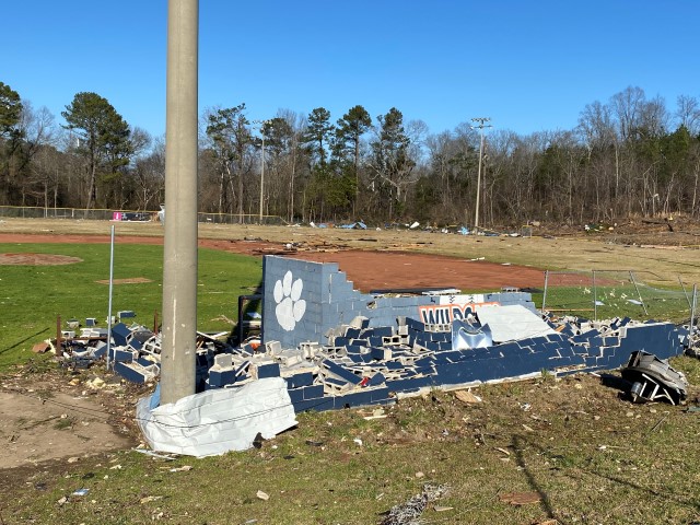
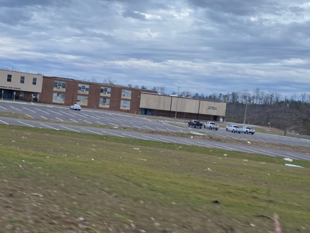
As the tornado continued toward the northeast, it paralleled Carson Road and caused substantial damage to homes along Meida Circle, Darlene Drive, and New Castle Road. Buildings in an industrial area along Carson Road were damaged, including a fleet of vehicles at Hurst Towing. The damage along New Castle Road was widespread with a few trees debarked or snapped half way down the trunk, and debris from homes thrown considerable distances. The tornado began to weaken somewhat after crossing North Pine Hill Road, but still caused minor damage to the Fultondale High School and a wooded area to the east. As it continued eastward crossing Indian Valley Road, several trees were uprooted and a few homes received minor damage. Along Highway 79, dozens of mobile homes were damaged by falling trees in the Rusk Mobile Home Park. The tornado then crossed Highway 75 in Center Point, where trees and power lines were downed near the Jefferson County Multi-Services Facility. The tornado began to weaken further at this point, but still produced a narrow discernable track of EF0 damage just east of Center Point Lake, where trees were uprooted and minor roof and structural damage occurred. Nearing the end of its life cycle, the tornado turned northward before dissipating near Country View Court in the Arrowhead subdivision of Center Point.

Special thanks go to Jefferson County EMA for their assistance. 

The data is PRELIMINARY and may be subject to change.

View Larger Map


Radar Image
Reflectivity (left) and velocity (right) of the tornado as it continued to rip through Fultondale.
Images from KBMX at 1044 PM CST.


Damage Photo
 Hampton Inn damaged.
Damage Photo
 Home destroyed.
Damage Photo
 Home destroyed.
Damage Photo
 Manufactured home destroyed.
Damage Photo
 Home destroyed.
Damage Photo
 Home destroyed.
Damage Photo
 Widespread tree damage.
Damage Photo
 Homes destroyed on New Castle Rd.
Damage Photo
 Tree and home debris.
Damage Photo
 Car tossed.
Damage Photo
 Homes destroyed.
Damage Photo
 Home destroyed.
Damage Photo
 Significant tree damage.
Damage Photo
 Fultondale HS ballfield damaged.
Damage Photo
 Fultondale High School damaged.
Damage Photo
 Looking NE toward Yarbrough Rd.
Damage Photo
 Melba Lane
Courtesy Brett Adair, Live Storms Media
Damage Photo
 Nelda Circle
Courtesy Jefferson County EMA
Damage Photo
 Oak Street & New Castle Road
Courtesy Jefferson County EMA


Severe Weather Episode Data 

250 mb
250 mb Analysis
January 25 at 6 pm

500 mb
500 mb Analysis
January 25 at 6 pm

850 mb
850 mb Analysis
January 25 at 6 pm

250 mb
250 mb Analysis
January 26 at 6 am

500 mb
500 mb Analysis
January 26 at 6 am

850 mb
850 mb Analysis
January 26 at 6 am

Surface
Surface Analysis
January 25 at 6 pm

Surface
Surface Analysis
January 25 at 9 pm

Surface
Surface Analysis
January 26 at 12 am

Severe Threats
Local Severe Outlook
Issued January 25 at 2 pm

KBMX Sounding
KBMX Sounding
January 25 at 6 pm

KBMX Sounding
KBMX Sounding
January 26 at 12 am

Storm Reports
Storm Reports
January 25


Aerial Videos