NWS Birmingham, Alabama
Weather Forecast Office
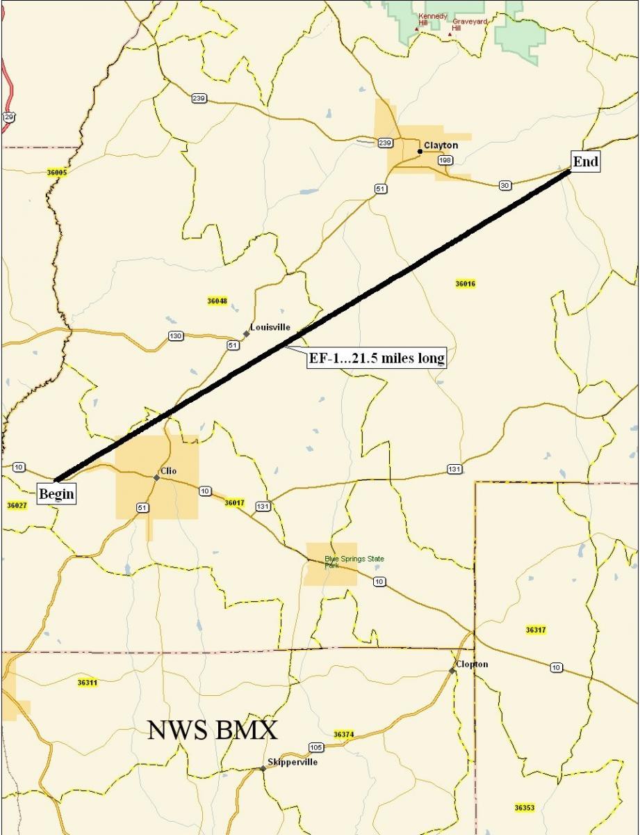
Gaino Tornado - February 17, 2008
|
Rating:
(Click for EF Scale) |
EF-1
|
|
Maximum Wind:
|
100 mph
|
|
Injuries/Fatalities:
|
None
|
|
Path Length:
|
21.39 miles
|
|
Maximum Path Width:
|
75 Yards
|
|
Start:
|
31.71/-85.67 at 417 PM
|
|
End:
|
31.87/-85.36 at 438 PM
|
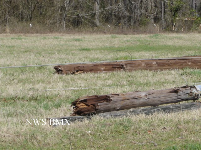
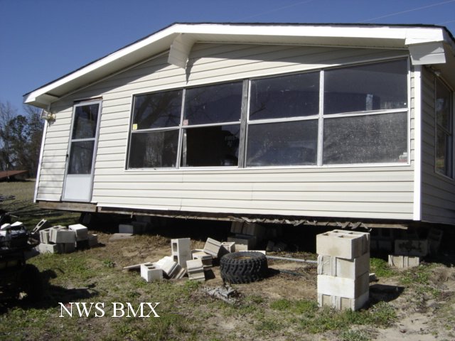
A National Weather Sservice Survey Team has assessed the damage in southeastern Barbour County and determined it was the result of a tornado ranking EF-1 on the Enhanced Fujita Scale...with estimated winds up to 100 mph. The path length was 21.39 miles long and 75 yards wide at its widest point. The tornado touched down near River Road along Highway 10 where it snapped two wooden power poles. It then tracked northeast across John Martin Road before lifting near the intersection of Ccounty Road 79 South and Highway 30. Along the path, numerous trees were uprooted or snapped and several mobile homes sustained minor damage. This damage occurred at approximately 415 pm. A Severe Thunderstorm Warning was in effect from 410 pm until 515 pm. A Tornado Warning was in effect from 405 pm until 445 pm. No injuries were reported.
|
|
||||||||||||||
Current Hazards
National Outlooks
Tropical
Local Storm Reports
Public Information Statement
Graphical Hazardous Weather Outlook
Current Conditions
Drought Monitor
Rivers and Lakes
Regional Weather Roundup
Regional Highs/Lows/Rainfall
Forecasts
Air Quality
Fire Weather
Aviation Weather
Graphical Forecasts
Forecast Discussion
Climate and Past Weather
Past Events
Storm Data
Tornado Database
Daily Rainfall Plots
Local Climate Data
Tropical Cyclone Reports
Warnings and Other Products
Tornado Warnings
Severe Thunderstorm Warnings
Flash Flood Warnings
Winter Weather Warnings
Special Weather Statements
Non-Precipitation Warnings
Flood/River Flood Warnings
Productos en Español
Previsión de 7 DÃas
Conciencia y Preparación
Weather Safety
Severe Safety w/ ASL
NOAA Weather Radio
All-Hazards Awareness Booklet
Severe Weather Preparedness
Severe Safety Rules
Tornado Safety Rules
Awareness Weeks
Severe Weather
Hurricane Preparedness
Summer Safety Campaign
Winter Weather
US Dept of Commerce
National Oceanic and Atmospheric Administration
National Weather Service
NWS Birmingham, Alabama
465 Weathervane Road
Calera, AL 35040
205-664-3010
Comments? Questions? Please Contact Us.