|
|
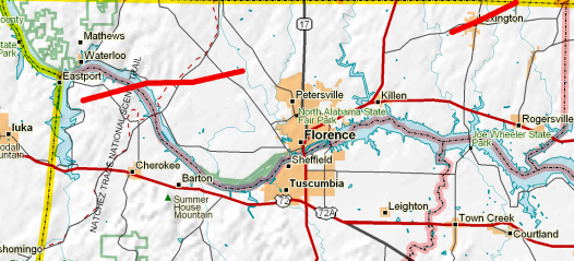
Map showing the track of the tornadoes that touched down on October 18, 2004.
|
| |
Survey Summary
The damage that occurred across northwest Colbert and through Lauderdale County was determined to be primarily F-1 tornado damage. The initial damage path of the tornado was determined to have begun about two miles east of the Riverton community in northwest Colbert County. The initial damage was determined to be F-1 damage with maximum winds estimated to be at 100 miles an hour. The initial damage width of the tornado was determined to be at 200 yards. The F-1 damage path was indicated to be at around a half of a mile.
The tornado quickly weakened to an F-0...with winds estimated to be at around 60 miles an hour...with a 20 yard path width. The tornado lifted and then resumed its path, touching down along the Natchez Trace parkway in far southwest Lauderdale County. The damage path width was at 100 yards and intensity of F-1 with a wind speed of 90 miles an hour. The tornado continued its path for around five miles, increasing to a 150 yard path width and wind speeds at a maximum of 110 miles an hour near Central Heights.
The tornado lifted again and then touched down about two miles southwest of Lexington, reaching F-1 intensity with wind speeds noted at 90 miles an hour and a 150 to 200 yard path width. The tornado continued with F-1 intensity as it traveled east and northeast to the Alabama/Tennessee state line, then into Lawrence County, Tennessee.
The lead times for the tornado warnings issued are:
- Colbert County - 21 minutes
- Lauderdale County - 26 minutes
|
Storm Pictures and Images
Click on the thumbnail to see a larger image. |
 |
 |
|
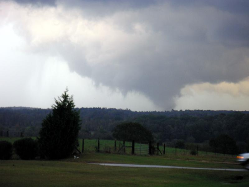
Greg Gaston of Florence caught this image of the funnel cloud nearing the ground, 5 miles east of Highway 43 looking towards Lexington. The tornado would again touch down just southwest of Lexington just a few minutes later.
|
Crandall McKee caught the larger cumulonimbus cloud--as well as some lightning--as the storm approached his location near Central Heights.
|
 |
 |
|
The reflectivity image from the KGWX radar at 4:38pm CDT on 10/18 shows a classic supercell moving eastward across Lauderdale County. The tornado is on the ground at this point, near where the "hook echo" is located in the western portion of the county.
|
The doppler velocity image from the KGWX radar at the same time, showing a distinct inbound-outbound velocity couplet over the same location. These couplets indicate strong rotation, and often a tornado.
|
 |
 |
|
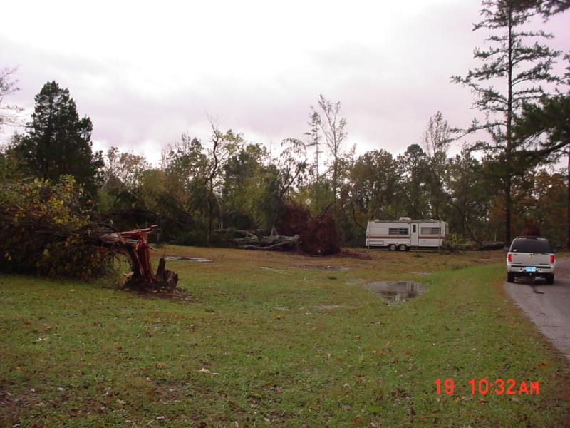
Huge trees were snapped over in a campground next to the Tennessee River near Riverton. Note that, despite all the tree damage, a camper was left untouched.
|
More tree damage along the Tennessee River, near Riverton, in Colbert County.
|
 |
 |
|
The tornado damaged a barn along County Road 6 in western Lauderdale County, between Gravelly Springs and Central Heights.
|
This mobile home near Central Heights was completely destroyed by the tornado. Heavy rainfall the morning of the storm survey (October 19th) caused flash flooding in Lauderdale County as well.
|


 Local Radar
 Weather Map