National Weather Service United States Department of Commerce

Storm surveys have been completed examining storm damage that occurred in the early evening hours on Saturday, March 28th.  Information found in these surveys is described below. All tornado ratings use the Enhanced Fujita Scale.

Eastern DeKalb County
Rating EF-1 Peak Wind 105 mph
Path Length 2.6 miles Peak Path Width 50 yards

Severe thunderstorms developed during the late afternoon of March 28th, 2009 as a cold front moved into the Tennessee Valley. Discrete thunderstorm cells developed intitially then eventually merged into a quasi-linear convective system (QLCS) as the line pushed into northeastern Alabama and southern middle Tennessee during the early evening hours. One of these severe thunderstorms within the line produced an EF-1 tornado in DeKalb County. The tornado touched down around 8:16 pm CDT approximately 5 miles north-northwest of Fort Payne, AL. Numerous large pines and other trees were snapped and uprooted along County Road 610 and Route 885, about 4 miles west of Valley Head, AL. A large tree fell on a house along Route 885 causing significant roof damage. Trees were also uprooted along County Road 608 and additional damage was found near Highway 11 and Bethel Road, just south of Hammondville.

Snapped and uprooted trees Snapped and uprooted trees Tree fallen on house along County Road 885
 
Hytop, AL Reflectivity from 8:11 PM CDT
This is a radar image from 8:11pm as the tornado began to touch down in DeKalb County). The tornado is located within the bowing segment of the line...south of Sylvania and east of Rainsville.
Hytop, AL Storm-Relative Velocity from 8:11 PM CDT
This storm relative velocity image, also from 8:11pm, shows very broad circulation north of the Fort Payne area. The actual tornado circulation is indicated where the brightest green shading is closest to the red shading.

Western Franklin County, TN
Rating EF-1 Peak Wind 90 mph
Path Length 1.5 miles Peak Path Width 60 yards

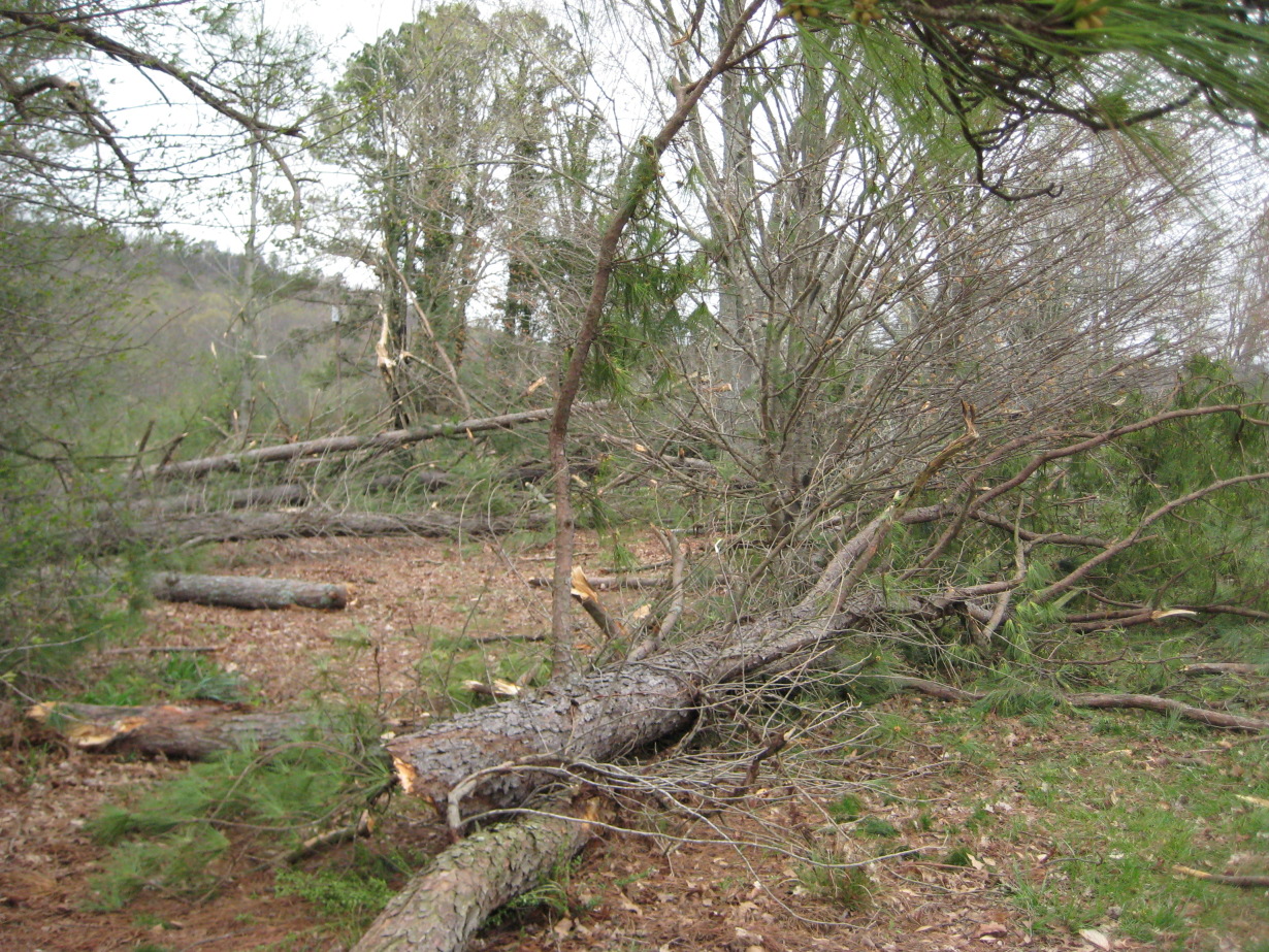
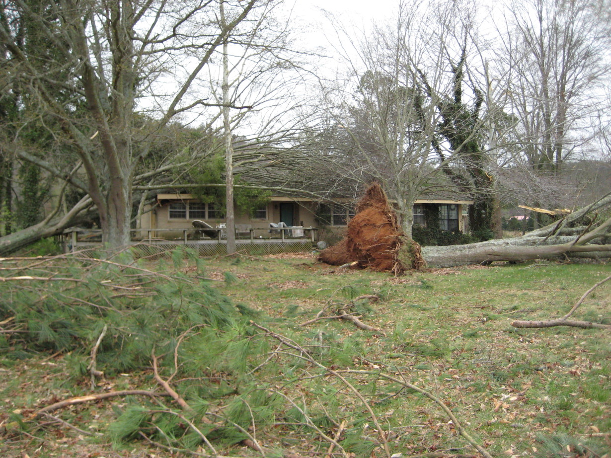
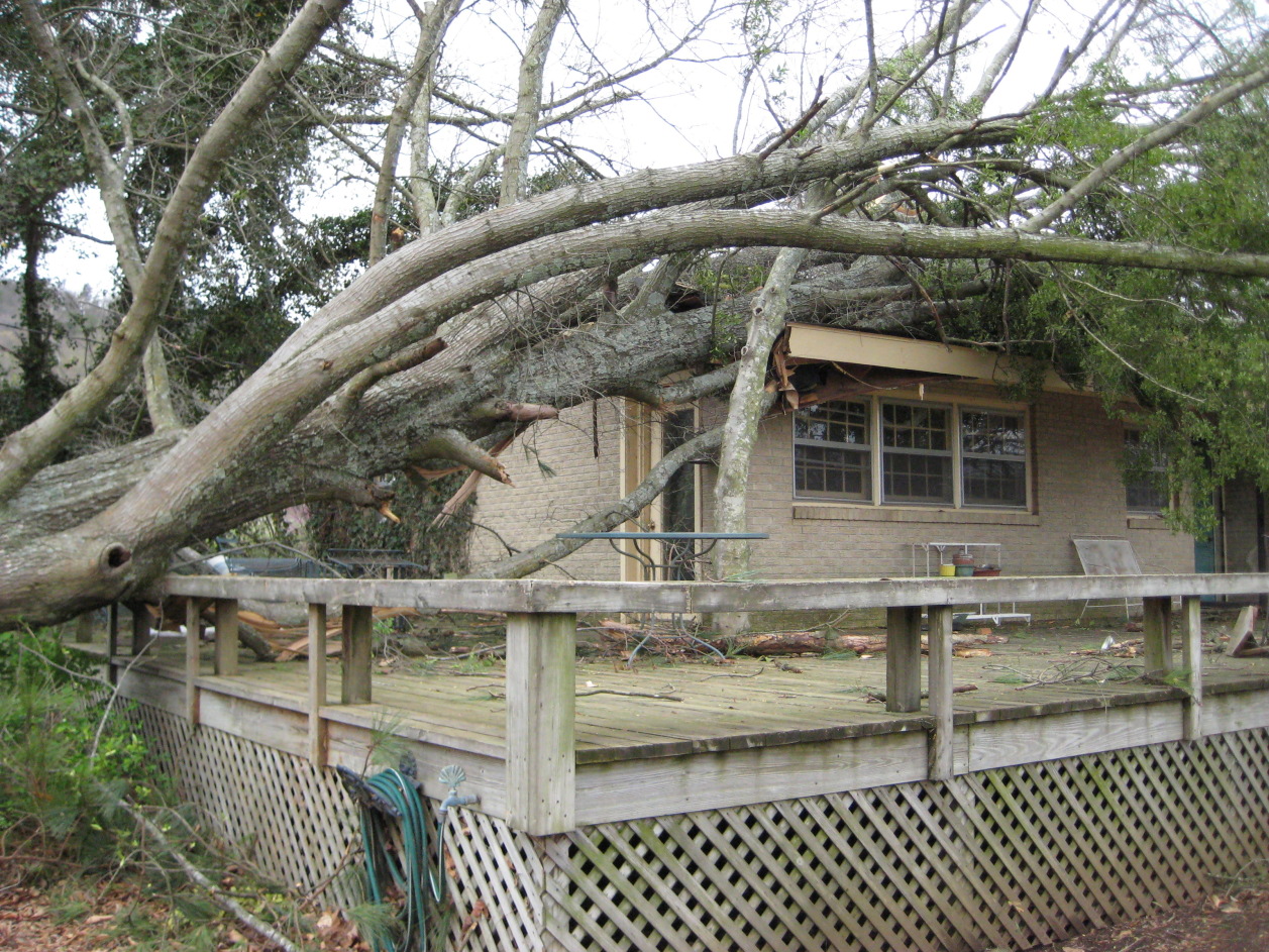
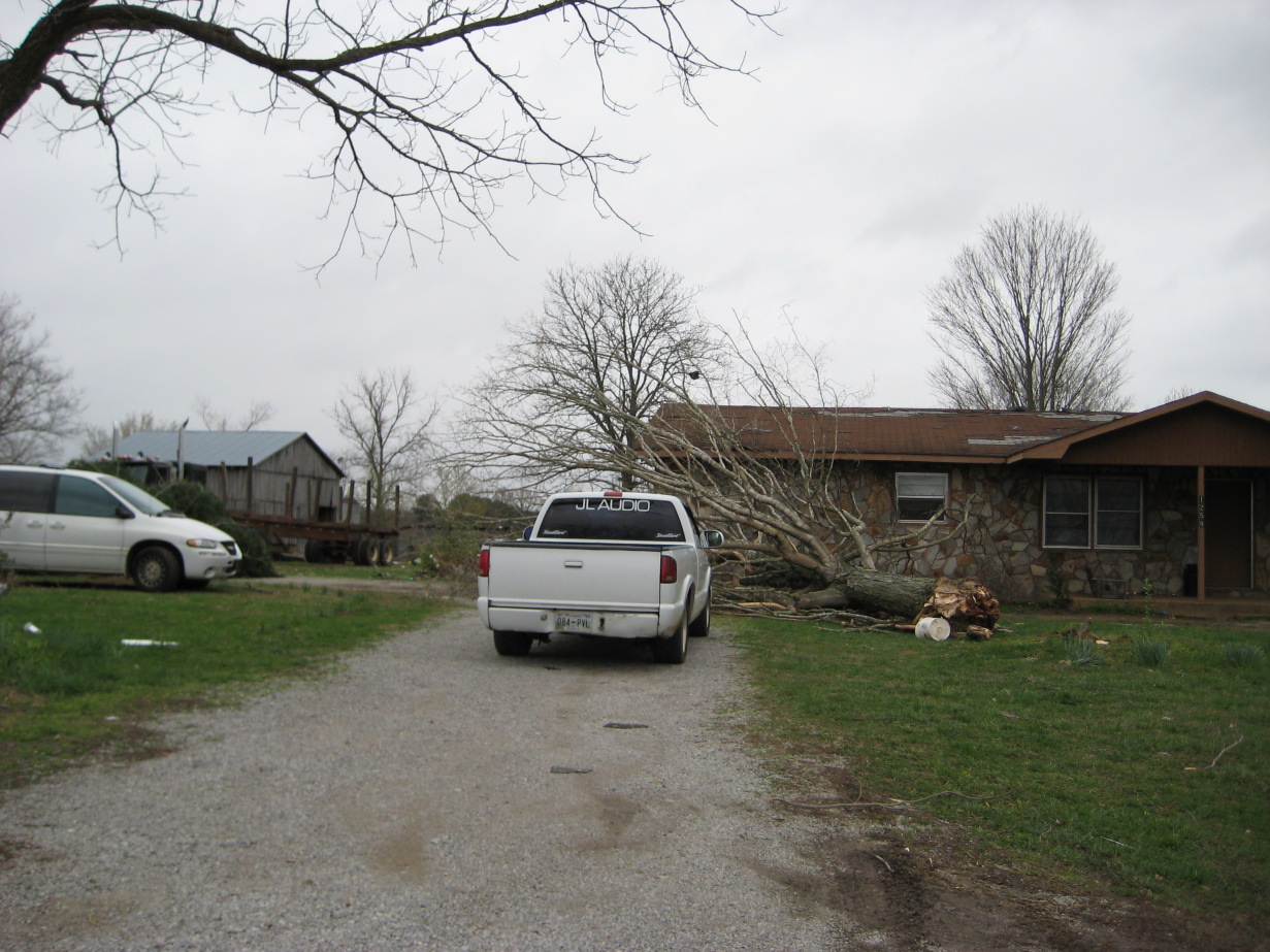
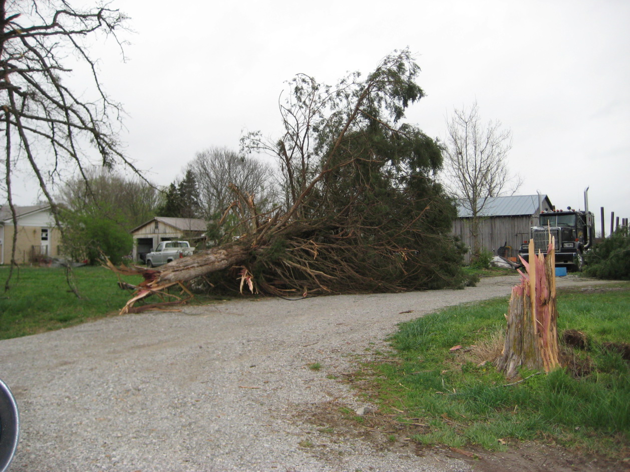
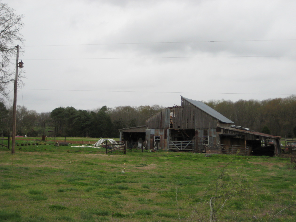
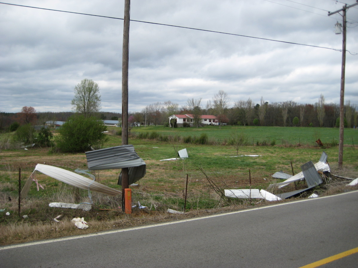
Another thunderstorm within the line produced an EF-1 tornado in Franklin County, Tennessee. The tornado touched down around 7:00 pm CDT approximately 2 miles north-northwest of Huntland, TN. Numerous trees were snapped with several cedar trunks uprooted along a path north of Highway 64 between Huntland and Maxwell. Shingles and roof panels were peeled back on a home and barn along Stratton Road and Pleasant Ridge Road near Branchville.

Snapped tree at house between Huntland and Maxwell Snapped tree at house between Huntland and Maxwell Roof blown off of barn near Branchville
 
Hytop, AL Reflectivity from 7:05 PM CDT
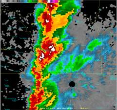
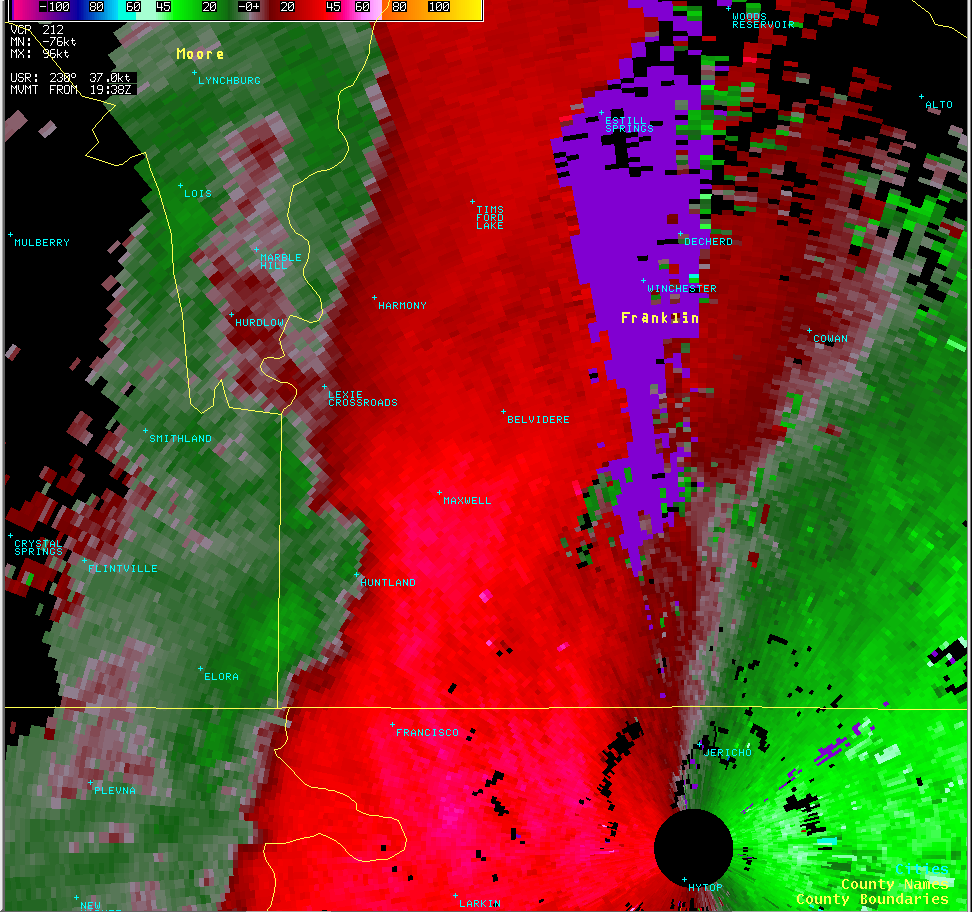
This is a radar image from approximately 7:05pm as the tornado was briefly on the ground in Franklin County.
Hytop, AL Storm-Relative Velocity from 7:05 PM CDT
This storm relative velocity image, also from about 7:05pm, shows a weak circulation northwest of the Huntland community.

Jackson County, AL
Rating EF-0 Peak Wind 85 mph
Path Length 1.6 miles Peak Path Width 40 yards

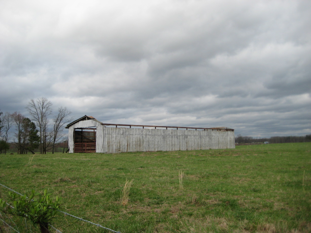
Just prior to the tornado touch down in DeKalb County, a thunderstorm produced a brief tornado in central Jackson County. This tornado touched down at about 8:11 pm approximately 1.5 miles northeast of Pisgah. A roof was completely ripped off a barn along County Road 60 and two houses sustained significant roof damage along County Road 58, just northeast of Pisgah. Debris from the barn roof was thrown nearly 200 yards.

Roof damage at house near Pisgah Roof debris blown away from house Roof blown off of barn along County Road 60
 
Hytop, AL Reflectivity from 8:11 PM CDT
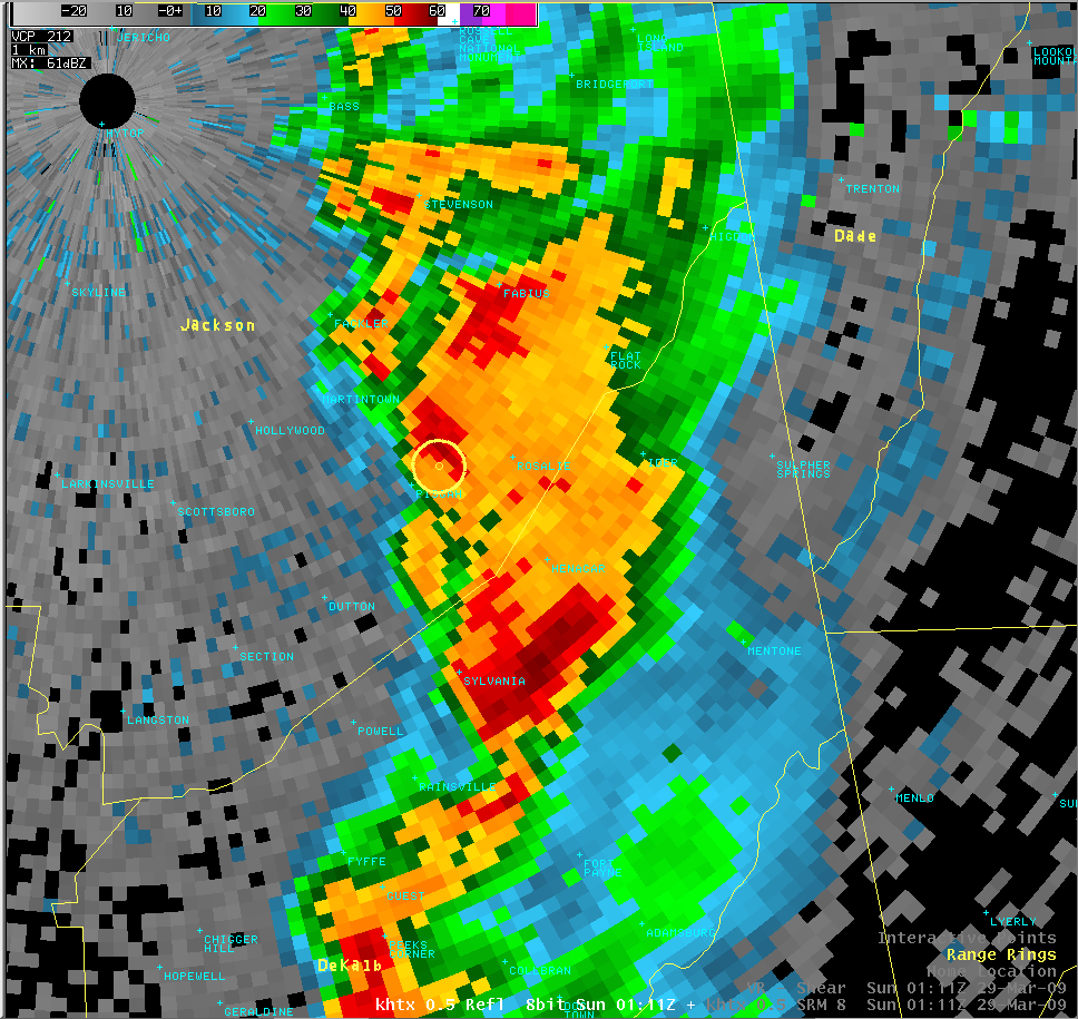
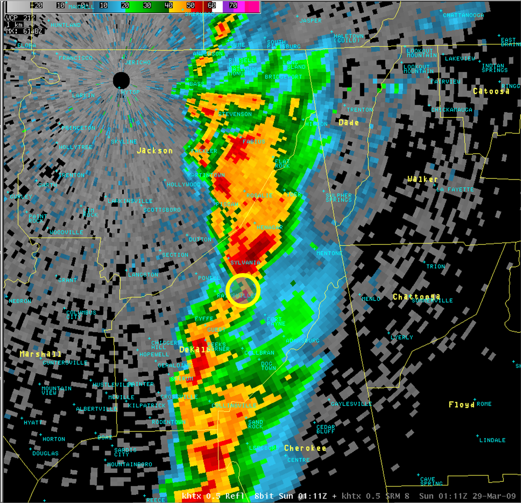
This is a radar image from approximately 8:11pm as the tornado was briefly on the ground in Jackson County. The circle denotes the location of the tornado.
Hytop, AL Storm-Relative Velocity from 8:11 PM CDT
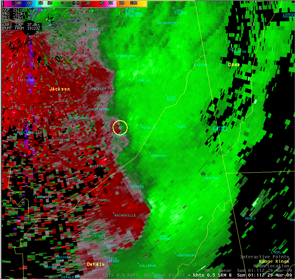
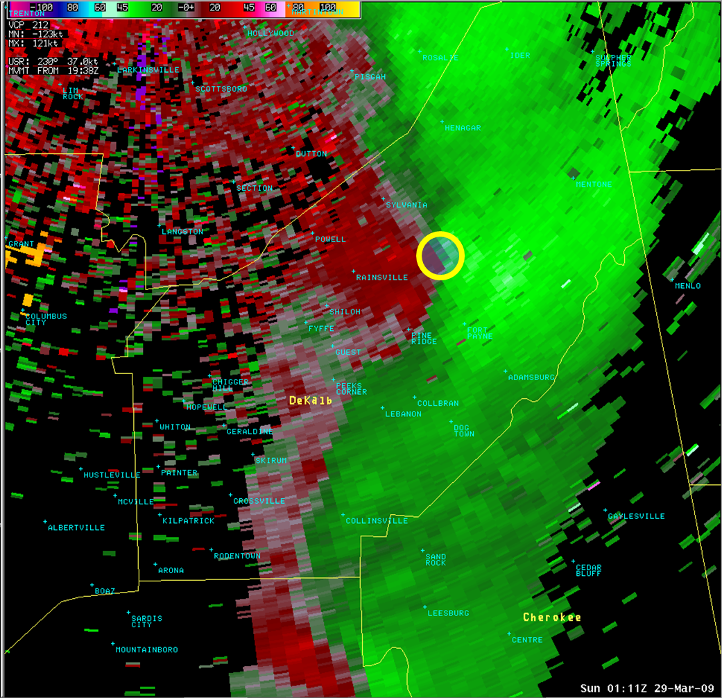
This storm relative velocity image, also from about 8:11pm, shows a weak circulation just northeast of the Pisgah community.