Overview
|
On October 26th 2010, an unusually deep Low pressure system was working its way across the Upper Midwest, pushing a strong cold front across the Mississippi Valley and through the Ohio and Tennessee Valleys. A strong upper level Jet Stream was in place, along with a 50 to 60 mph Low Level Jet feeding Gulf moisture into the area ahead of the front, creating a dynamic environment suitable for a severe weather outbreak that ranged from the Lower Great Lakes region to the Southern Appalachians. During the afternoon, over a dozen Severe Thunderstorm Warnings were issued throughout Eastern Kentucky as a line of storms developed along the front and began racing across Kentucky. |
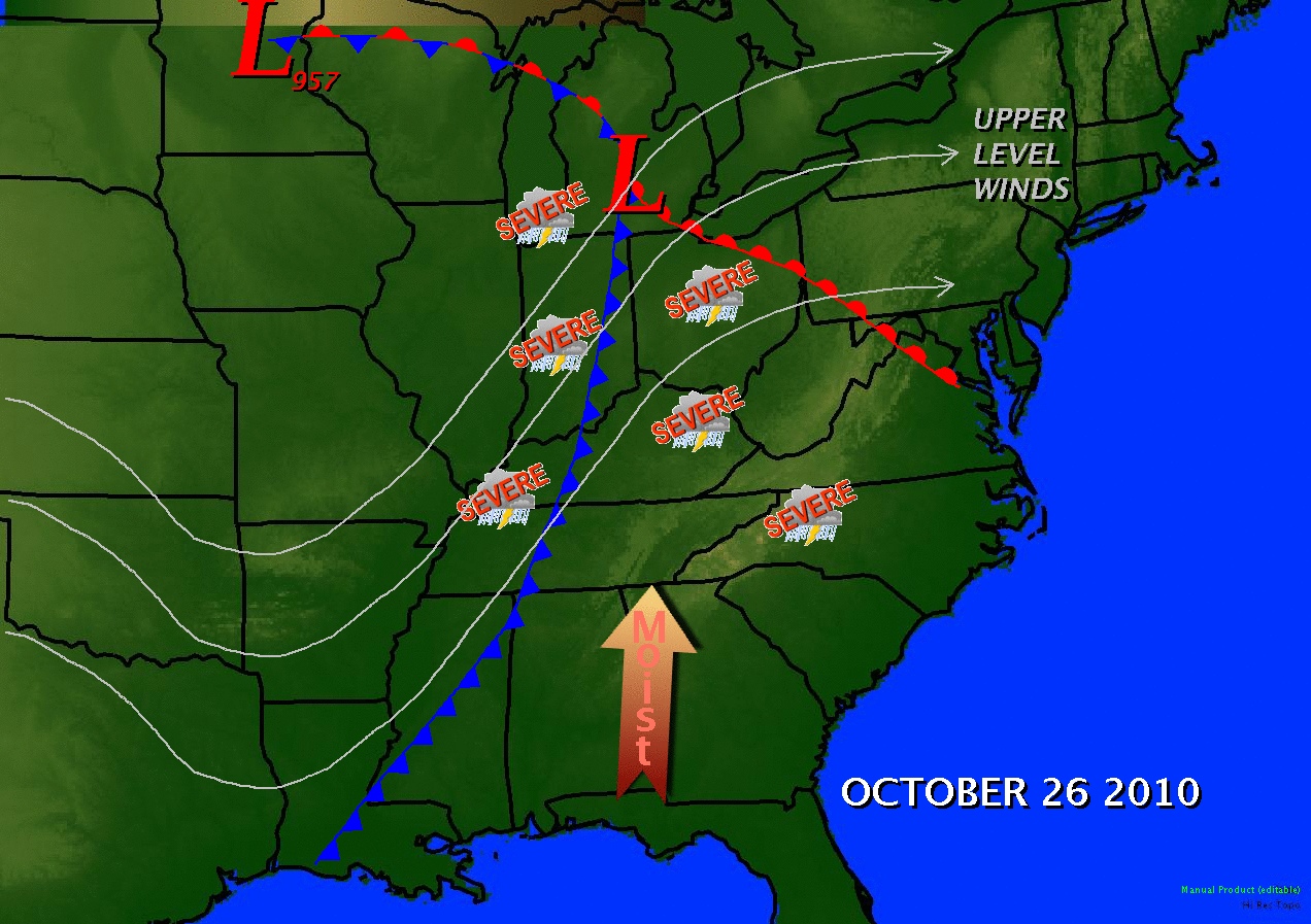 October 26, 2010 weather summary map |
Tornado:
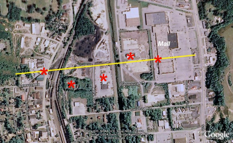
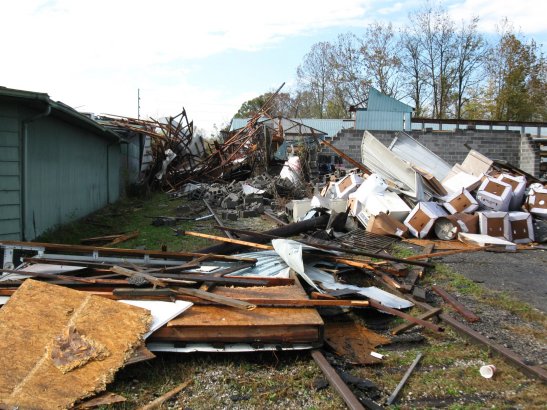
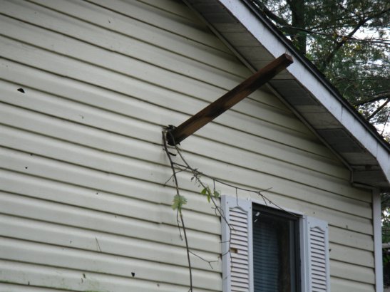
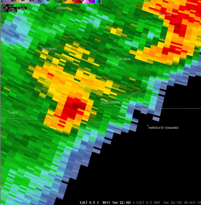
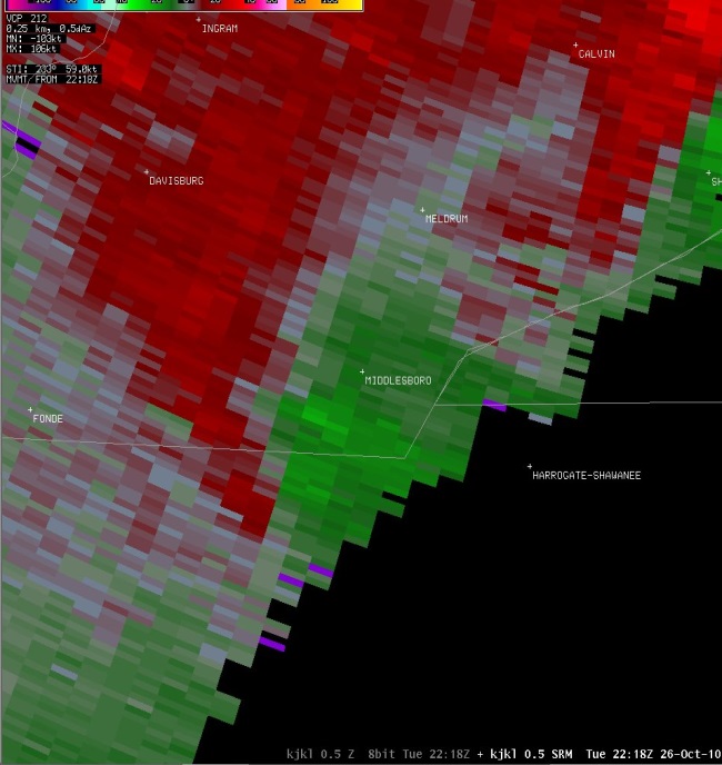
Shortly after 6 pm, a weakening thunderstorm over Bell County developed a tornado that touched down in Middlesboro, tracking about a quarter of a mile through the downtown area. Despite being rated as a weaker tornado than the one which struck Wayne County earlier in the year, the impact was actually greater because the event occurred in a more populated area. Although the tornado was short lived, accounts indicated that the twister was only on the ground for a couple of minutes, the damage along the path from 19th street to 12th street was extensive. Part of the roof on the mall was damaged, 2 cinder block buildings at a lumber yard were demolished, a roof was blown off of another building supplier, and 2 large steel doors were blown off of another business.
The National Weather Service in Jackson, KY conducted a damage survey and confirmed that an EF1 tornado touched down late in the afternoon on Tuesday October 26, 2010 in the city of Middlesboro, Bell County, Kentucky.
Time: Touchdown for approximately 1 to 2 minutes between 6:10 pm EDT and 6:15 pm EDT.
Location: From just West of State Hwy 2079 North of Fleetwood Road, East-Northeast to just West of Hwy 25E in Middlesboro.
EF-Scale: EF-1
Estimated Max Winds: 105 MPH
Path Width: 1/10th to 1/8th of a mile
Path Length: 7/10th of a mile
Injuries: None
Fatalities: None
 |
 |
 |
 |
 |
 |
 |
The Enhanced Fujita (EF) Scale classifies tornadoes into the following categories:
| EF0 Weak 65-85 mph |
EF1 Moderate 86-110 mph |
EF2 Significant 111-135 mph |
EF3 Severe 136-165 mph |
EF4 Extreme 166-200 mph |
EF5 Catastrophic 200+ mph |
 |
|||||
Radar:
 |
 |
 |
Media use of NWS Web News Stories is encouraged! Please acknowledge the NWS as the source of any news information accessed from this site. |
|

