Overview
|
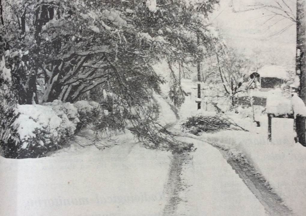
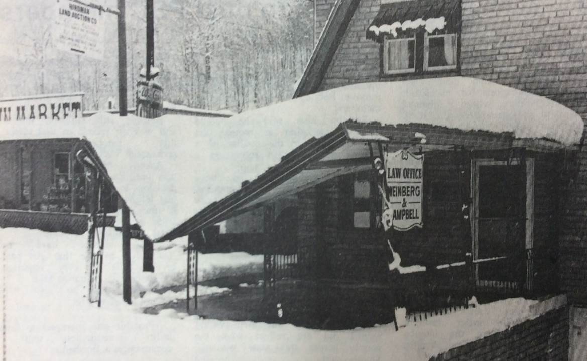
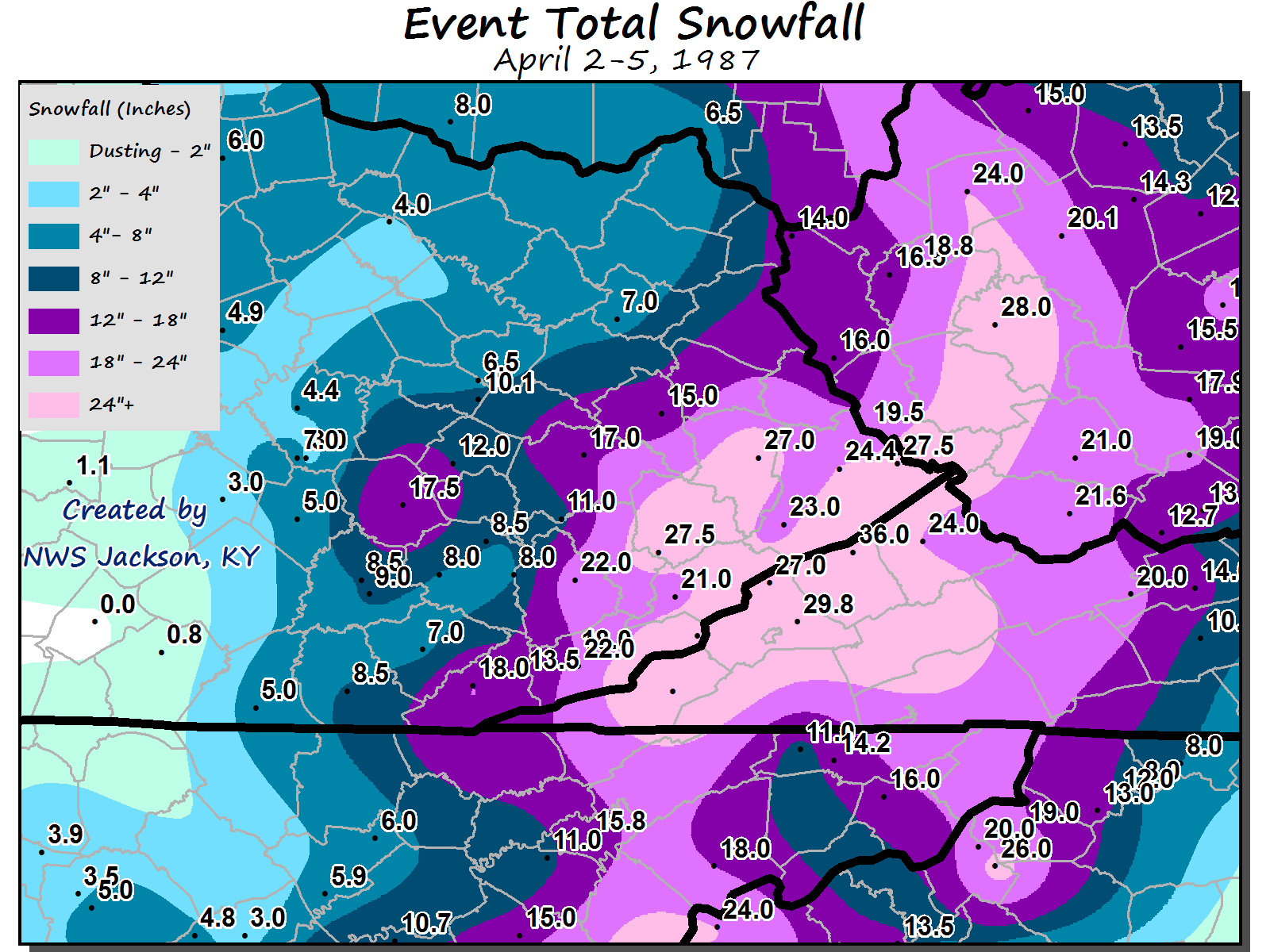
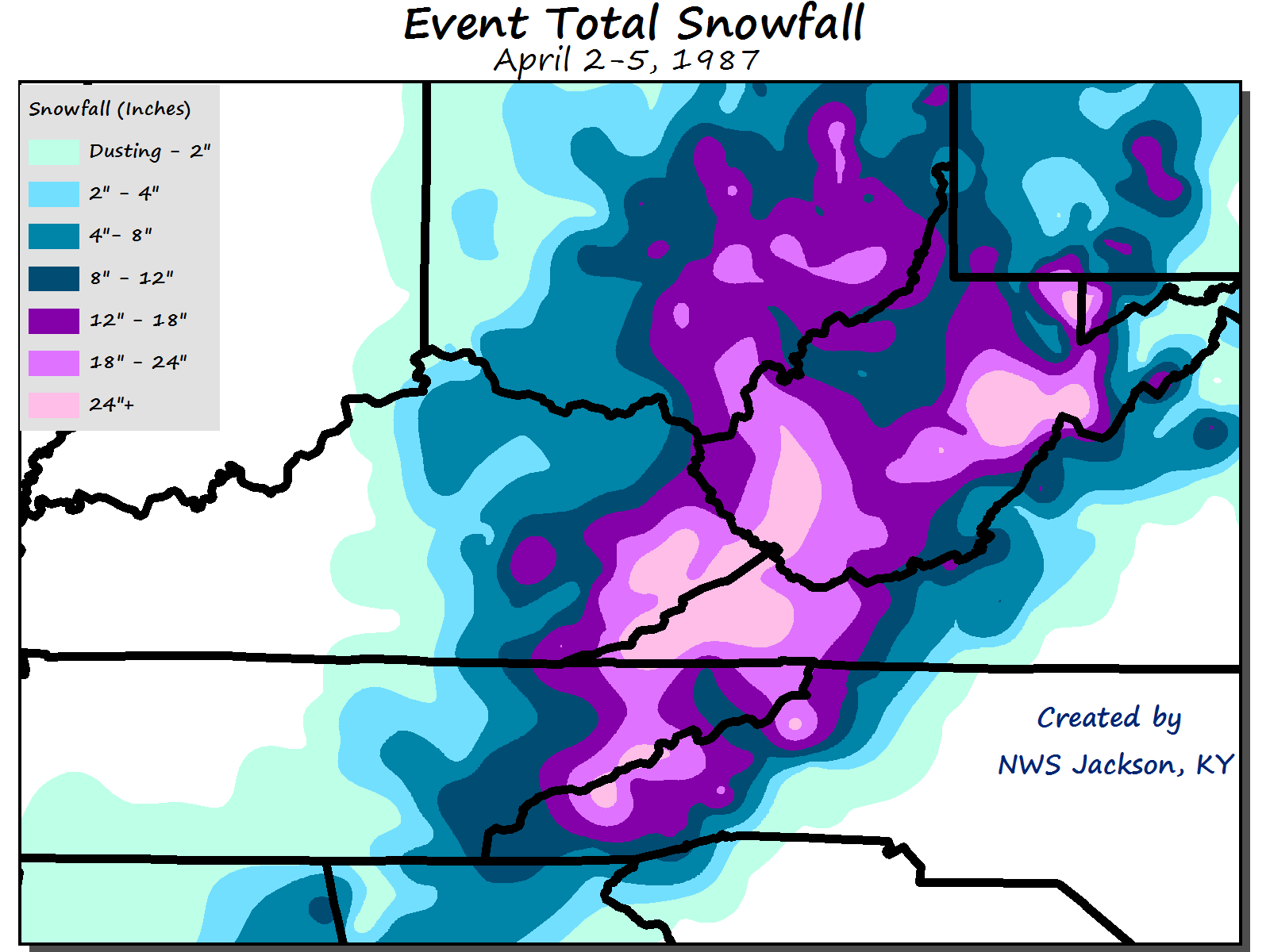
A prolonged and very heavy late season snowstorm caused extensive problems over southeast Kentucky and much of the central and southern Appalachians from late on April 2nd through April 5th. The storm system buried most of southeast Kentucky under 1 to 3 feet of snow, with drifts up to 10 feet reported in Letcher County. The snow began falling across eastern Kentucky during the mid-morning Thursday, April 2. The snow remained light through Thursday evening with 1 to 2 inches of accumulation reported mainly along the Virginia-Kentucky border. By dawn Friday April 3, four inches of snow had fallen over the mountains of far southeast Kentucky. The heavy snow continued and spread northward over eastern Kentucky, and by Friday evening accumulation ranged from 7 inches at the Jackson weather office to over 18 inches in the Kentucky counties along the Virginia border. A second surge of heavy snow fell Saturday afternoon, April 4th, through Sunday morning April 5. By noon April 5th, the storm system had buried most of southeast Kentucky under 1 to 3 feet of snow, with the highest totals in Letcher and Pike Counties. The Jackson weather office reported a storm total of 17.8 inches. Gusty northwest winds produced considerable blowing and drifting, with reports of drifts more than 10 feet deep in parts of Letcher County. The storm had virtually paralyzed southeast Kentucky by the evening of April 3, 1987. The heavy snow had broken many power lines, resulting in more than 18,000 residents without electricity, some until Monday April 6. Emergency shelters were set up at several locations for those without heat. Roads were very hazardous, and even impassable in some areas due to downed trees. Some pictures of the snow taken from area newspapers are included below. |
 |
 |
 |
| Frogtown Road are of Hindman, KY | Hindman, KY | Knott County, KY |
| Photos by Frank Curtis and Courtesy of the Troublesome Creek Times | ||
Snowfall Reports
 |
 |
|
Data Source: NCEI Regional Snowfall Index |
|
Storm total snowfall measurements from observing locations across the region:
Meteorology/Weather Maps
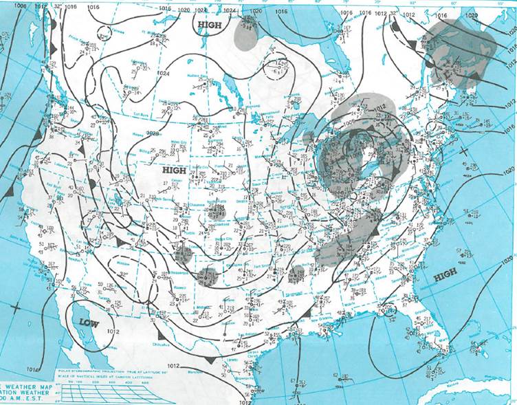
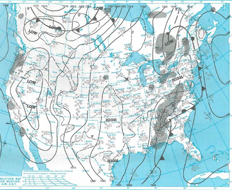
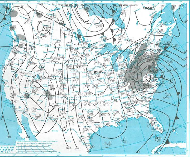
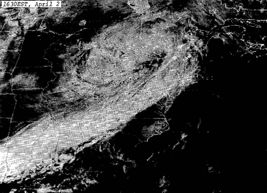
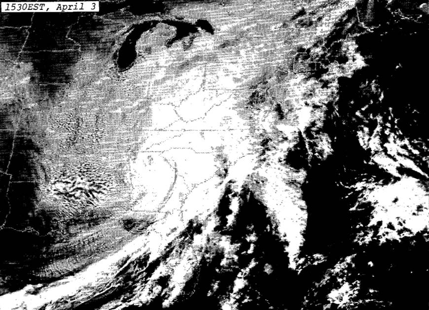
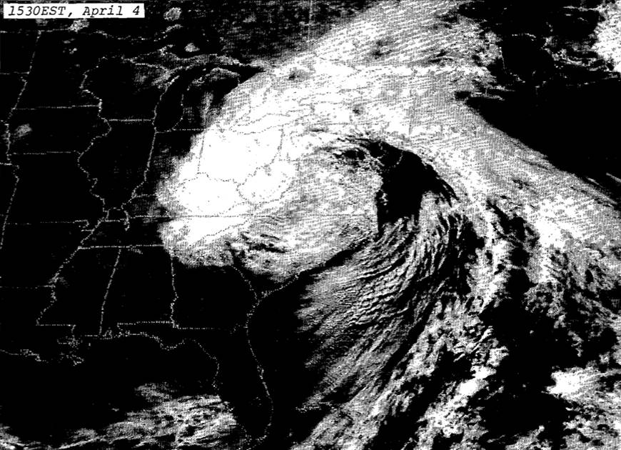
The April 1987 Snowstorm was caused by an unseasonably strong and very slow moving upper level low pressure system which remained located over the southern Appalachian region for several days. Click on the images below to see the U.S. Daily Weather Maps and satellite images for each day of the event.
 |
 |
 |
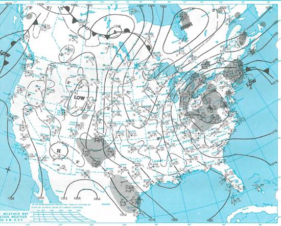 |
| Figure 1: April 2nd Surface Map | Figure 2: April 3rd Surface Map | Figure 3: April 4th Surface Map | Figure 4: April 5th Surface Map |
 |
 |
 |
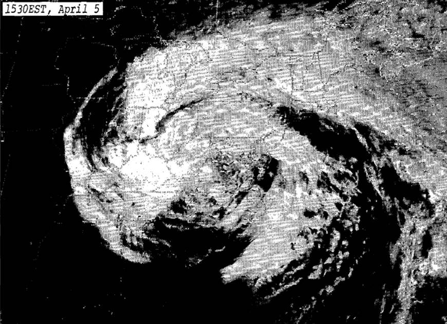 |
| Figure 5: April 2nd Satellite Imagery | Figure 6: April 3rd Satellite Imagery | Figure 7: April 4th Satellite Imagery | Figure 8: April 5th Satellite Imagery |
 |
Media use of NWS Web News Stories is encouraged! Please acknowledge the NWS as the source of any news information accessed from this site. |
|

