|
Wild and Varied Weather Impacts the Southern Panhandle and South Plains of West Texas
December 27, 2007 |
|
A compact but potent storm system moved out of the Rockies and crossed West Texas on Thursday, December 27. Even before reaching the state of Texas the storm dumped up to 10 inches of snow in eastern Colorado. The Texas Panhandle was enveloped by light snow and freezing fog behind a cold front for most of the day - and temperatures remained in the 20s. Further south, the cold front stalled out across the South Plains as strong jet stream energy rounded the storm system in southern New Mexico and moved into West Texas. By late afternoon the front was located roughly along a line from near Muleshoe, to Lubbock, to Aspermont. Temperatures south of the front warmed up into the 50s as the strong westerly winds began to mix down to the surface. A surface trough, or dryline, formed near the New Mexico border and then advanced east into the southern and central South Plains, finally reaching Lubbock County between the hours of 5 and 6 pm. Stations of the West Texas Mesonet to the west of the dryline reported wind gusts as high as 51 mph and very low dewpoints. The NWS observing station at Guadalupe Pass gusted to 78 mph and caused a hazardous material spill when a vehicle was knocked over by the wind. Meanwhile, atmospheric lift increased as the upper-level system moved overhead. This combined with a slightly unstable atmosphere to produce some convective showers across Parmer, Bailey and Castro Counties. With temperatures at the surface just below freezing, these showers produced bursts of heavy snow as they moved quickly across the northern South Plains and Southern Panhandle. Dimmitt recorded 3 inches of snow and the town of Happy (in northern Swisher County) reported 4 inches. The snow, combined with some ice already deposited by the freezing fog, caused treacherous travel conditions in this area, and numerous accidents were reported.
Further south, a line of weak convection formed along the trough/dryline. Although the towering cumulus were too weak to produce any precipitation, they were able to stretch some very strong wind shear at the surface near the stationary front/dryline intersection. This resulted in the development of some weak and short-lived tornadoes mainly across Lubbock County. By evening, dense fog developed along and north of the front, dropping visibility to a quarter mile at times from around Lubbock northward. |
||||||||||||||
 |
||||||||||||||
|
The image above shows the snow pack from the storm as seen by satellite on Friday, December 28th. Click on the image for a larger view (image will appear in a new window).
|
||||||||||||||
|
In the above image the southern edge of the snow swath appears to start just to the west of Muleshoe and runs across Plainview, then northeast through Memphis to near Shamrock. A detailed report of preliminary snowfall totals received by the Lubbock NWS Office can be found HERE. The following four pictures were taken by an off-duty weather service meteorologist traveling from the Panhandle to Lubbock Thursday and Friday morning (click on each image for a large version).
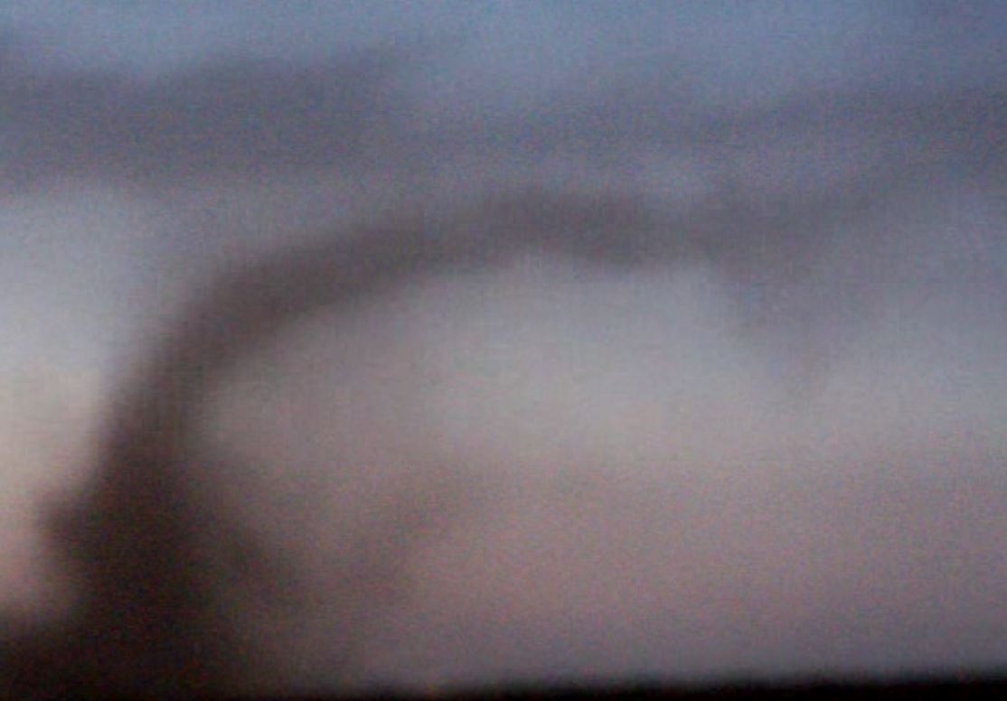
Several funnel clouds and brief tornadoes were reported by the public around Lubbock County between the hours of 5 and 6 pm CST. One of the tornadoes apparently caused shed and minor roof damage in the Lubbock city limits. Another one was reported between Southland and Slaton on U.S. Highway 84 and a possible third tornado was sighted possibly west of the Lubbock Airport. The National Weather Service is still gathering information on these tornadoes and will update the report as additional information is received.
A short movie file was also forwarded to our office courtesy of KLBK TV showing a definite tornado located somewhere east of the City of Lubbock probably around 5:30 pm CST. You can view the file via the link below (the file is large, about 3.3 MB, and is in the Apple Quicktime movie (.MOV) format).
|


