Excessive heat returns for portions of the Plains today where heat indices will likely climb above the century mark. Furthermore, warm temperatures, strong winds and dry fuels may result in rapid spread of wild fires across the western High Plains today. For the east coast, lingering storm with onshore flow will bring high surf, dangerous rip currents and coastal flooding, especially at high tide. Read More >
Milwaukee/Sullivan, WI
Weather Forecast Office
|
Mixed Precipitation and Crashing Temperatures Today Temperatures will continue to crash across southern Wisconsin this afternoon. Freezing temperatures should reach the Milwaukee metro area by early evening. Rain will transition to sleet and freezing rain, eventually becoming all snow before winding down this evening. The mixed precipitation and rapidly falling temperatures are expected to create slick spots, especially on untreated surfaces. This will likely impact the afternoon/evening commute.
Prepare for the possibility of slick roadways and hazardous travel if you'll be out and about this afternoon and evening.
A Winter Weather Advisory has been issued for portions of south-central Wisconsin and is in effect until 8 pm:
This graphic shows the expected times that rain will begin to transition over to mixed precipitation:
Forecast Ice and Snow accumulations Expected ice accumulations for southern Wisconsin:
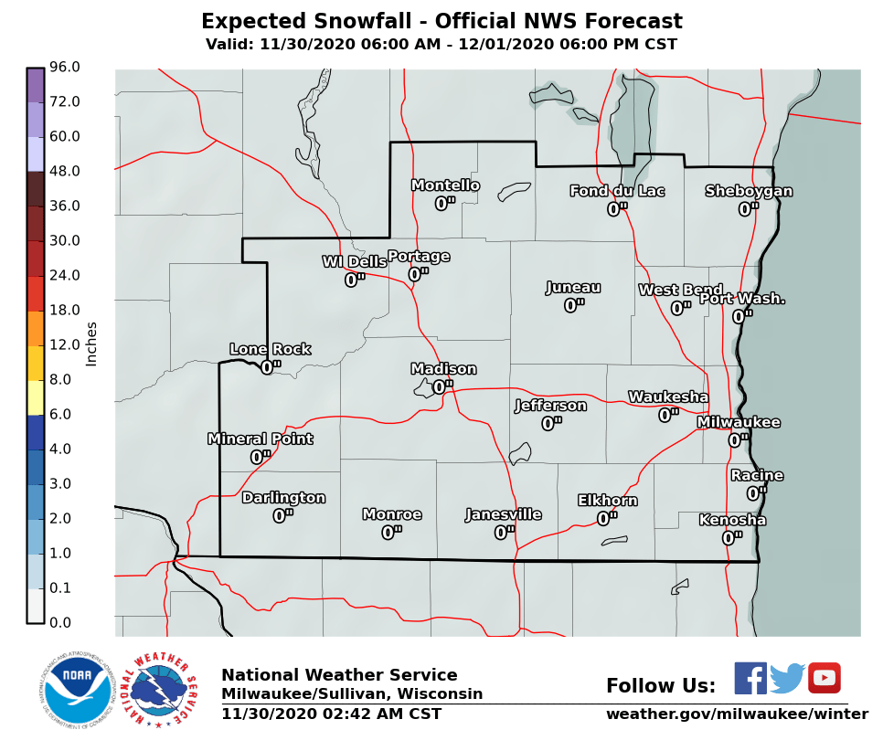
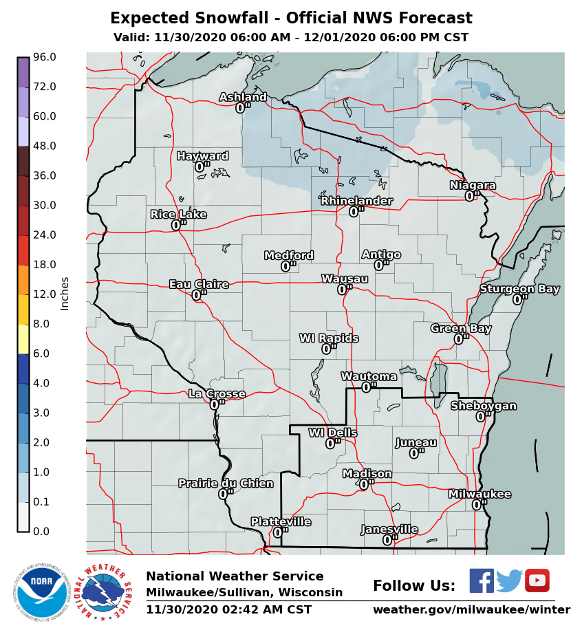
Expected snow accumulations for southern Wisconsin:
DDV NWS Milwaukee/Sullivan |
|
Hazards
National Briefing
Hazardous Weather Outlook
Skywarn
View Local Storm Reports
Submit A Storm Report
Winter Weather
Summer Weather
Beach Hazards
Local Forecasts
Marine
Aviation
Fire
Local Text Products
Local Precip Forecast
Hourly Forecast Graphics
Forecast Discussion
Climate
Daily Climate Graphics
Local Climate Products
Normals/Records MKE/MSN
CoCoRaHS
Historic Events For Srn WI
US Dept of Commerce
National Oceanic and Atmospheric Administration
National Weather Service
Milwaukee/Sullivan, WI
N3533 Hardscrabble Road
Dousman, WI 53118
262-965-2074
Comments? Questions? Please Contact Us.