
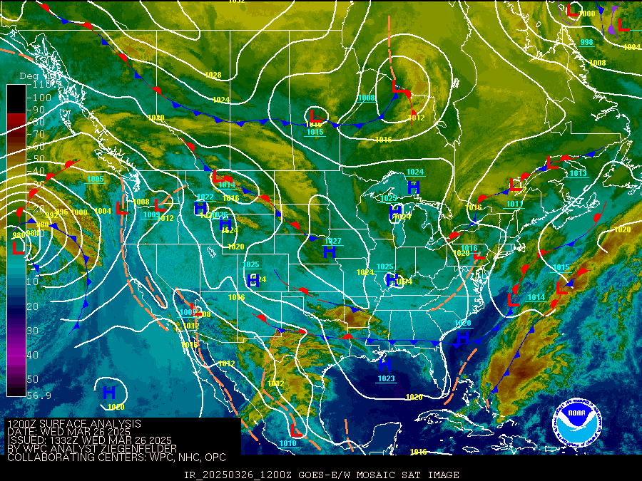
A storm and trailing cold front will continue to slowly move through the Gulf Coast and Southeast U.S. through this weekend with widespread rain showers and isolated thunderstorms. A fast-moving clipper storm may bring several inches of snow to the north-central Plains, Midwest, eastern Great Lakes, and Northeast regions this weekend. Read More >
Omaha/Valley, NE
Weather Forecast Office
| NWS Omaha Hazardous Weather Outlook | ||
|---|---|---|
| Click here to see Text Product. | ||
| Storm Prediction Center Products | |||||
|---|---|---|---|---|---|
|
|||||
| Weather Prediction Center Products | |||
|---|---|---|---|
|
|
||
Warnings/Hazards
Forecast Discussion
Winter Weather
Severe Weather
Fire Weather
Drought
Storm Prediction Center
SubmitReport
Rivers And Lakes
River Forecasts
Missouri River Overview
Platte River Overview
Elkhorn River Overview
Ice Jam Risk
Local Information
Latest Briefing Packet
Weather Monitor
Winter Monitor
Preparedness
Storm Spotters
About Us
Other Useful Links
US Dept of Commerce
National Oceanic and Atmospheric Administration
National Weather Service
Omaha/Valley, NE
6707 North 288th Street
Valley, NE 68064-9443
402-359-5166
Comments? Questions? Please Contact Us.


 Hazardous Weather Images
 National Flood Outlook from HPC
 Terms and abbreviations are used by NWS Offices


