Widespread life-threatening flash and urban flooding continues in south-central Texas, with considerable flooding impacts possible across central Texas. Wildfire smoke is impacting air quality across much of the Great Lakes region into southern New England and the Mid-Atlantic. Monsoonal thunderstorms may produce isolated to scattered flash flooding across the Southwest into the Great Basin. Read More >
Overview
This page provides a variety of information related to the Elkhorn River, including river levels, snow pack information as well as weather forecasting information.
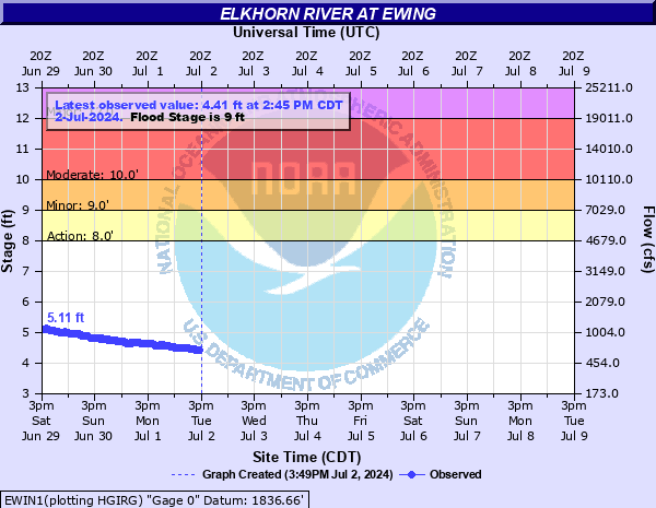
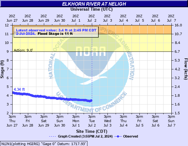
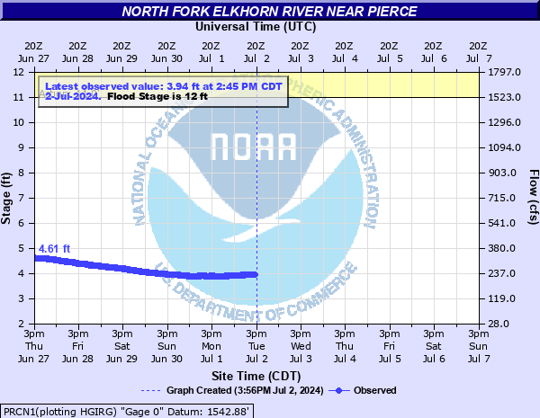
Elkhorn River Hydrographs
| Ewing | Neligh |
|
|
|
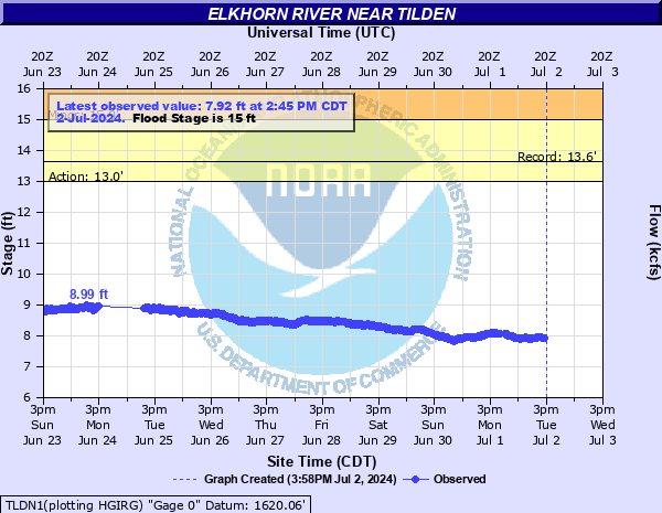
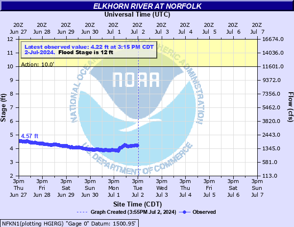
| Tilden | Norfolk |
|
|
|
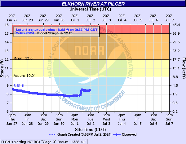
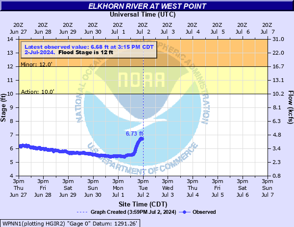
| Pilger | West Point |
|
|
|
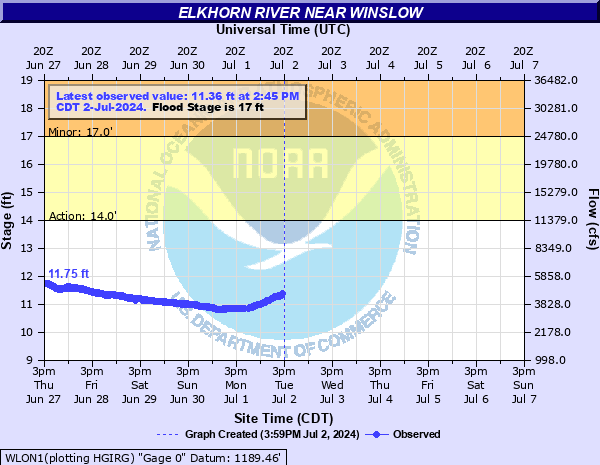
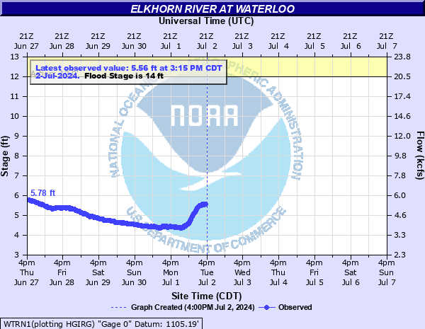
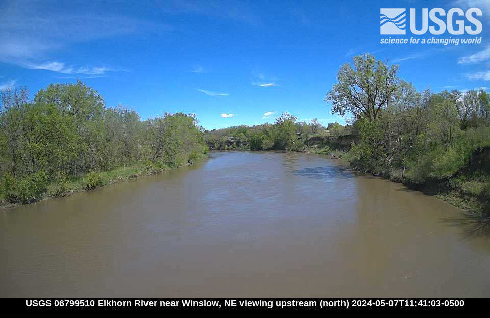
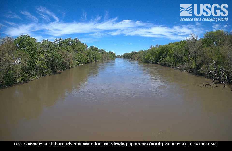
| Winslow | Waterloo |
|
|
|
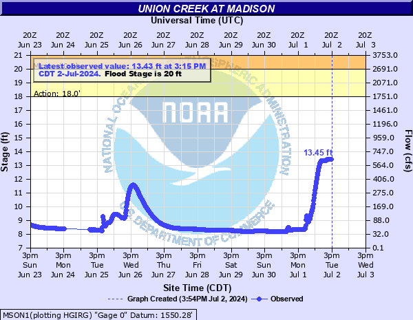
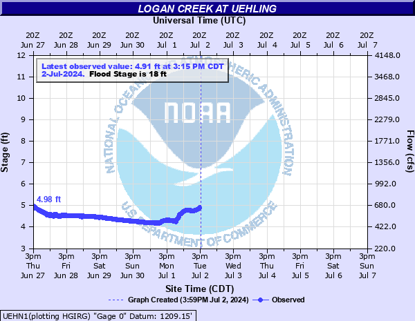
Tributary Hydrographs
Click on a hydrograph to expand the image, click on the text below each image to see stage impacts and historic crests.
|
|
|
|
|
|
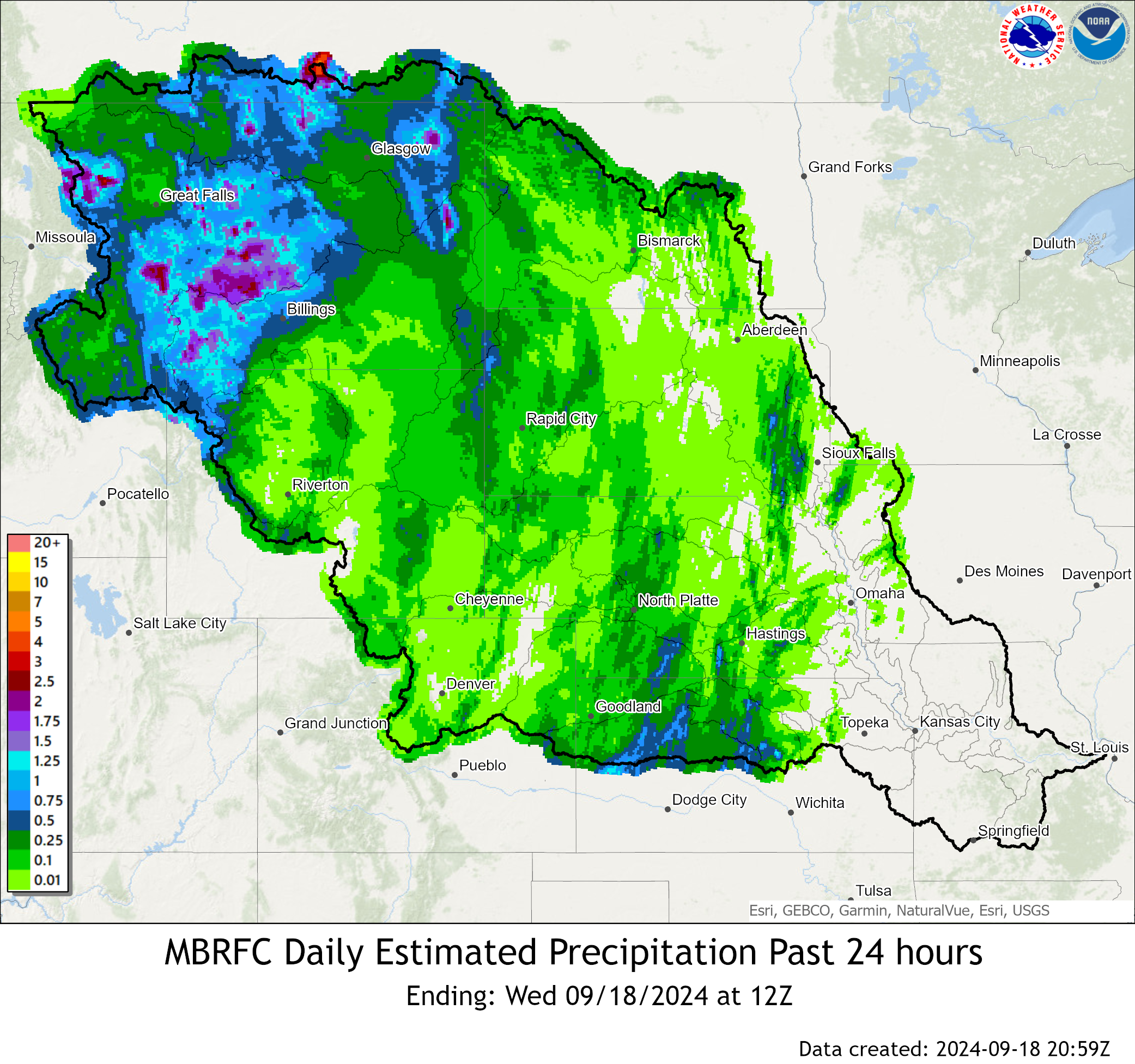
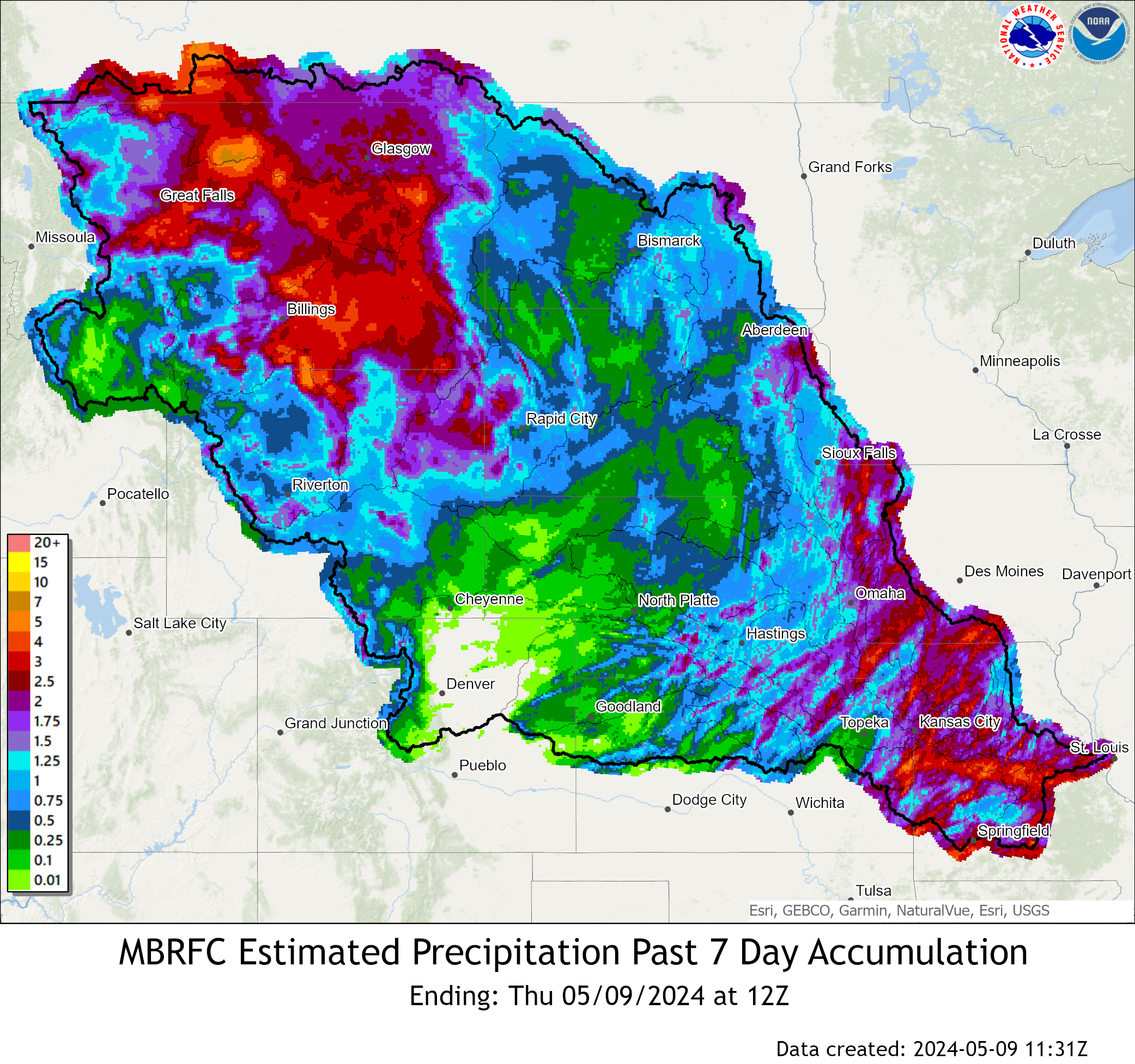
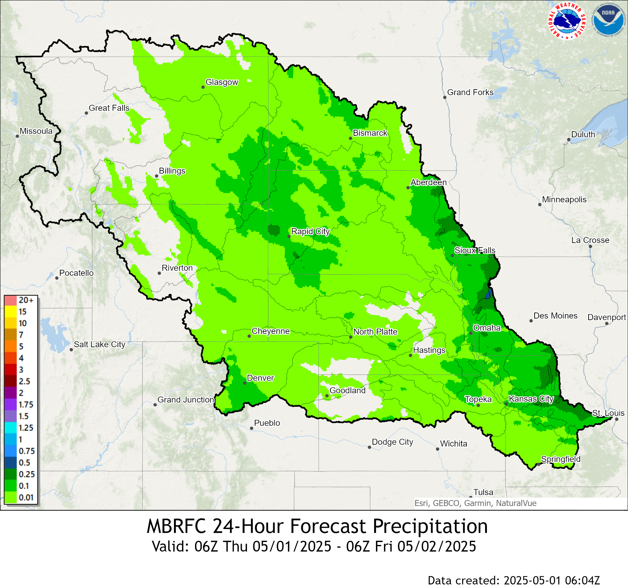
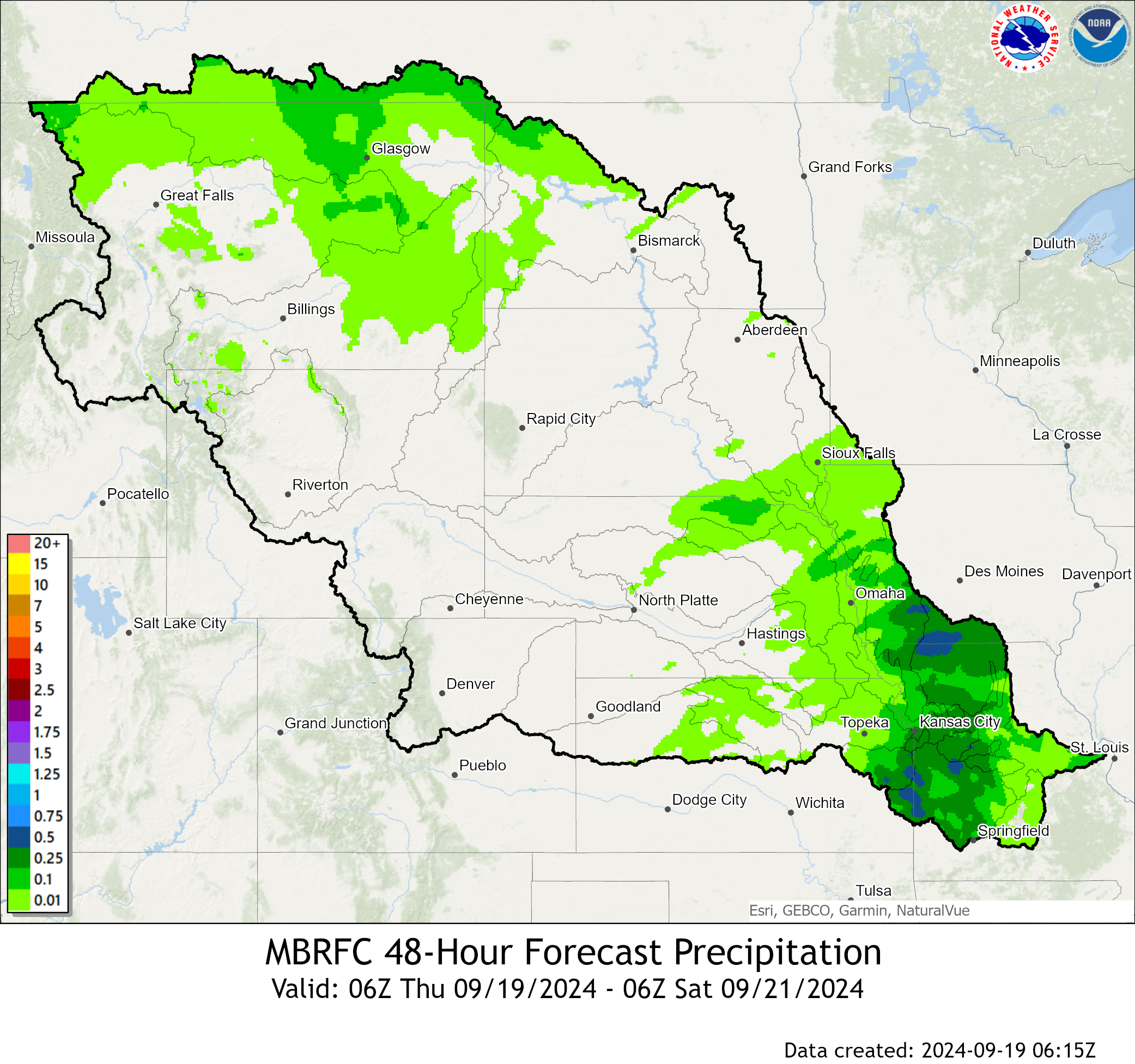
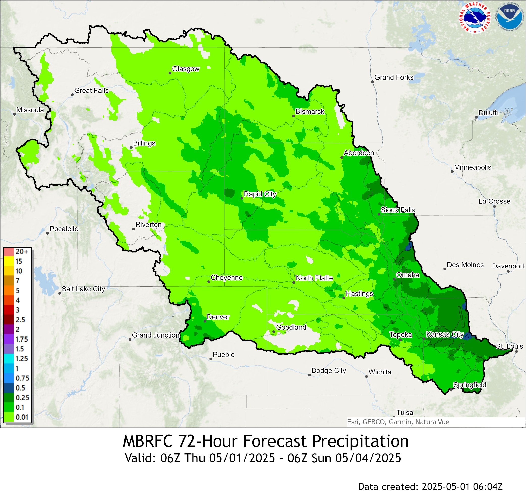
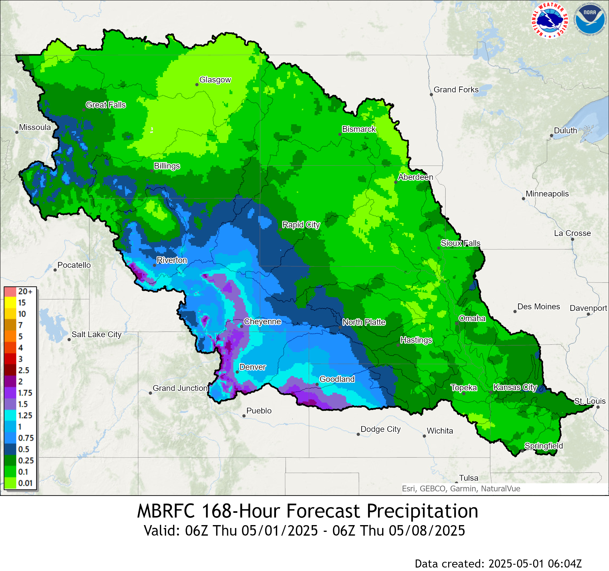
Precipitation:
Click Images to Enlarge
| Past 24 hours of Precipitation (Observed) | Past 7 days of Precipitation (Observed) |
 |
 |
| Expected Accumulation the next 24 hours | Expected Accumulation the next 48 hours |
 |
 |
| Expected Accumulation the next 72 hours | Expected Accumulation the next 7 days |
 |
 |
| 6 to 10 Day Precipitation Outlook | 8 to 14 Day Precipitation Outlook |
 |
 |
| One Month Precipitation Outlook | |
|
|
|
Temperature:
Click Images to Enlarge
| 6 to 10 Day Temperature Outlook | 8 to 14 Day Temperature Outlook |
 |
 |
| One Month Temperature Outlook | Three Month Temperature Outlook |
 |
 |
 |
Media use of NWS Web News Stories is encouraged! Please acknowledge the NWS as the source of any news information accessed from this site. |
|