Heat expands across the Desert Southwest, Plains, Mississippi Valley and Midwest into Monday. Fire weather concerns continue for portions of the Intermountain West. Active monsoonal moisture fuels thunderstorms over the Southwest with possible flash flooding. Tropical cyclone Fausto in the Pacific, should weaken as it approaches Hawaii; Dangerous surf, swells and rip currents are expected. Read More >
Overview
This page provides a variety of information related to the Papillion Creek Watershed, including river levels, snow pack information as well as weather forecasting information.
Papillion Creek Watershed Hydrographs
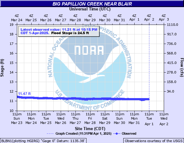
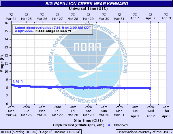
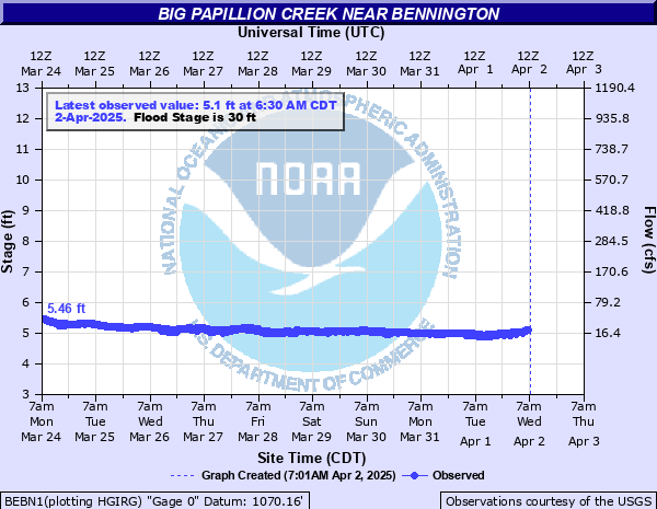
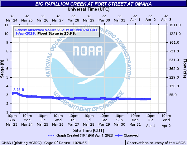
| Big Papillion Creek | |
| Blair | Kennard |
|
|
|
| Bennington | Fort Street |
|
|
|
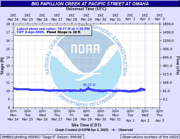
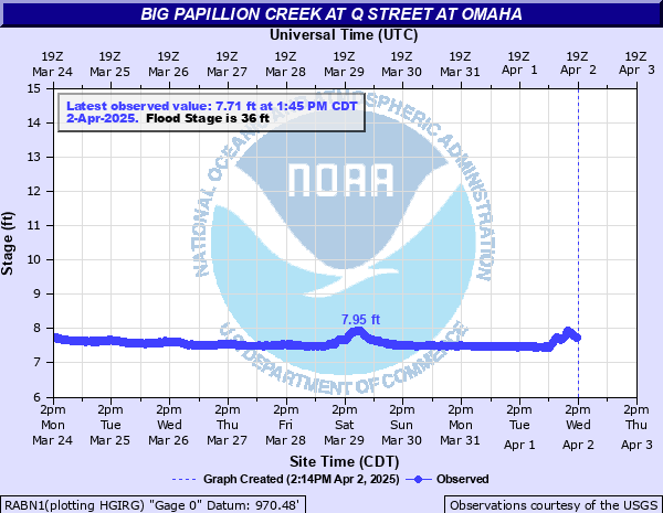
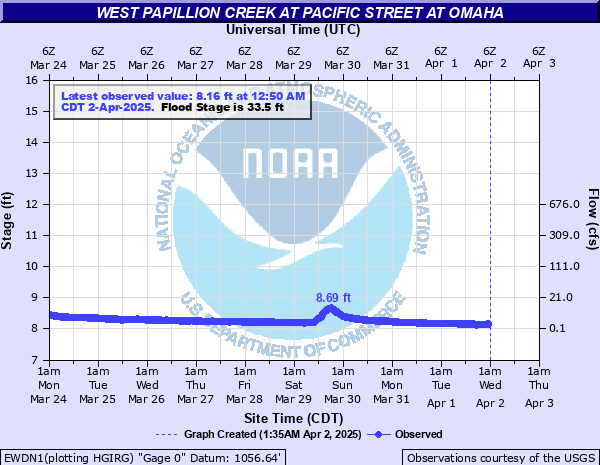
| Pacific Street | Q Street |
|
|
|
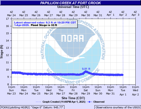
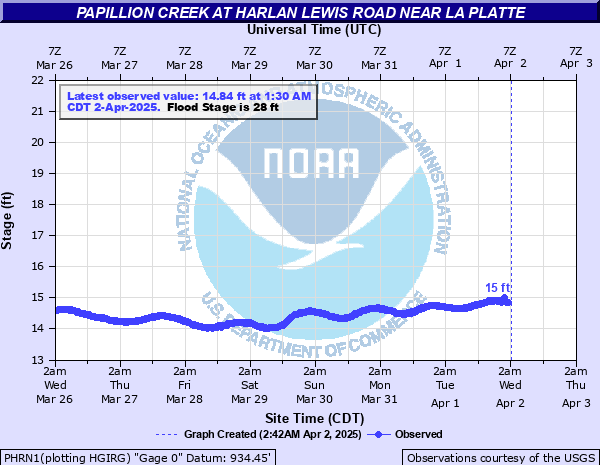
| Fort Crook | Harlan Lewis |
|
|
|
| West Papillion Creek | |
| Elkhorn (West Maple Road) | Pacific Street |
|
|
|
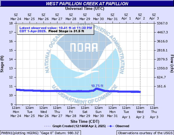
| Papillion | |
|
Papillion, Nebraska - Click Here to go to the gage page
|
|
|
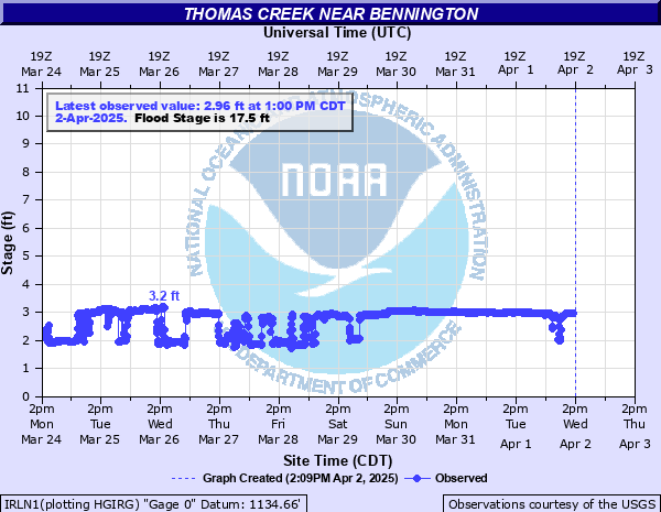
Thomas Creek
|
|
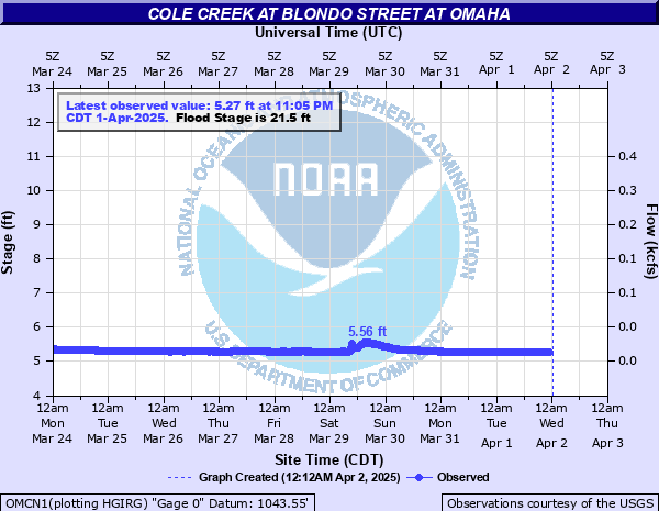
| Cole Creek | |
|
|
|
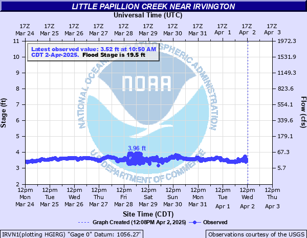
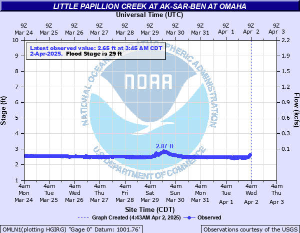
| Little Papillion Creek | |
|
|
|
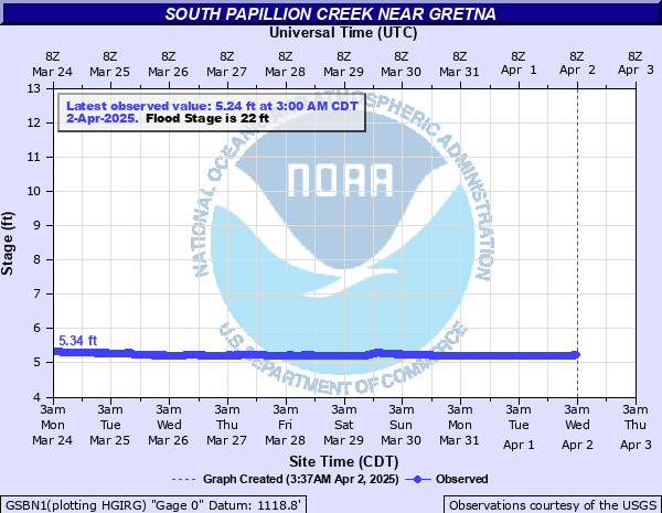
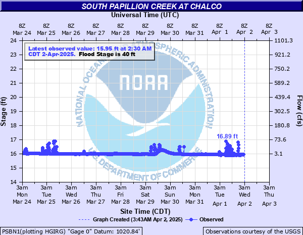
| South Papillion Creek | |
|
|
|
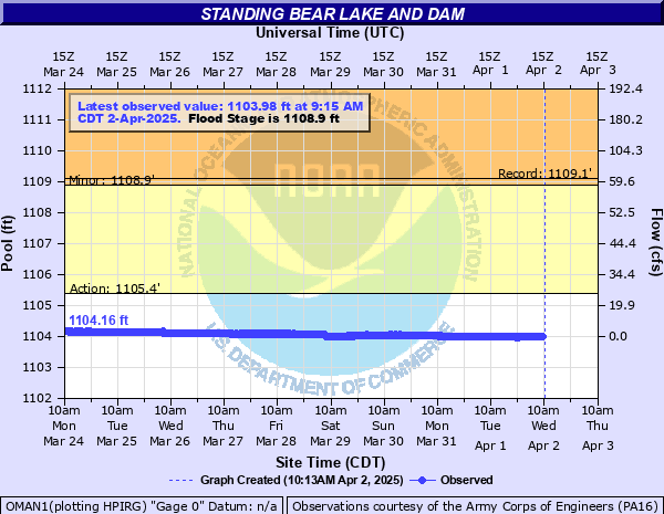
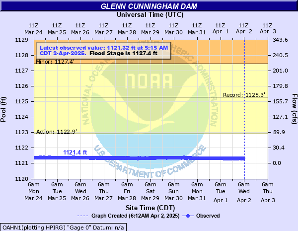
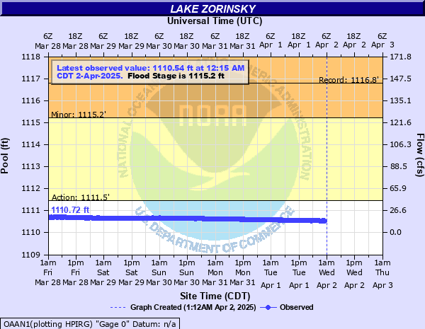
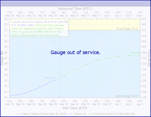
Reservoir Hydrographs
Click on a hydrograph to expand the image, click on the text below each image to see stage impacts and historic crests.
|
|
|
|
|
|
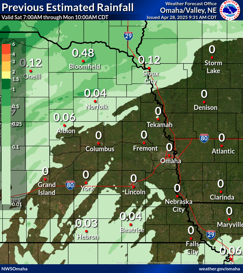
Observed Precipitation:
Click Images to Enlarge
|
Loading…
Forecast Precipitation:
Click Images to Enlarge
| Expected Accumulation the next 24 hours | Expected Accumulation the next 48 hours |
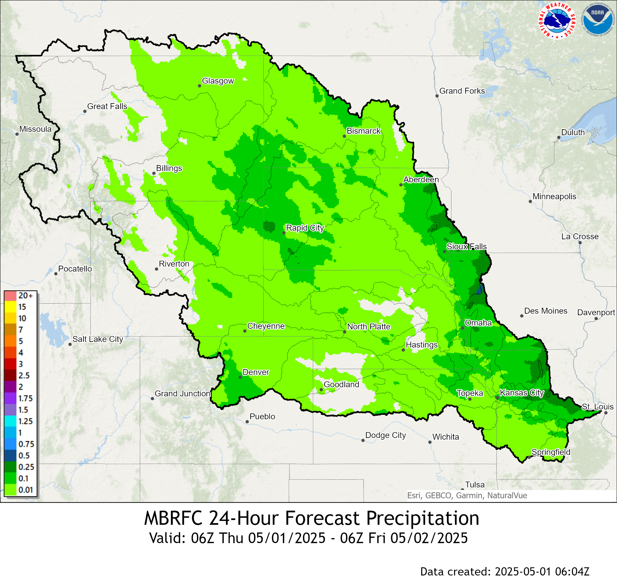 |
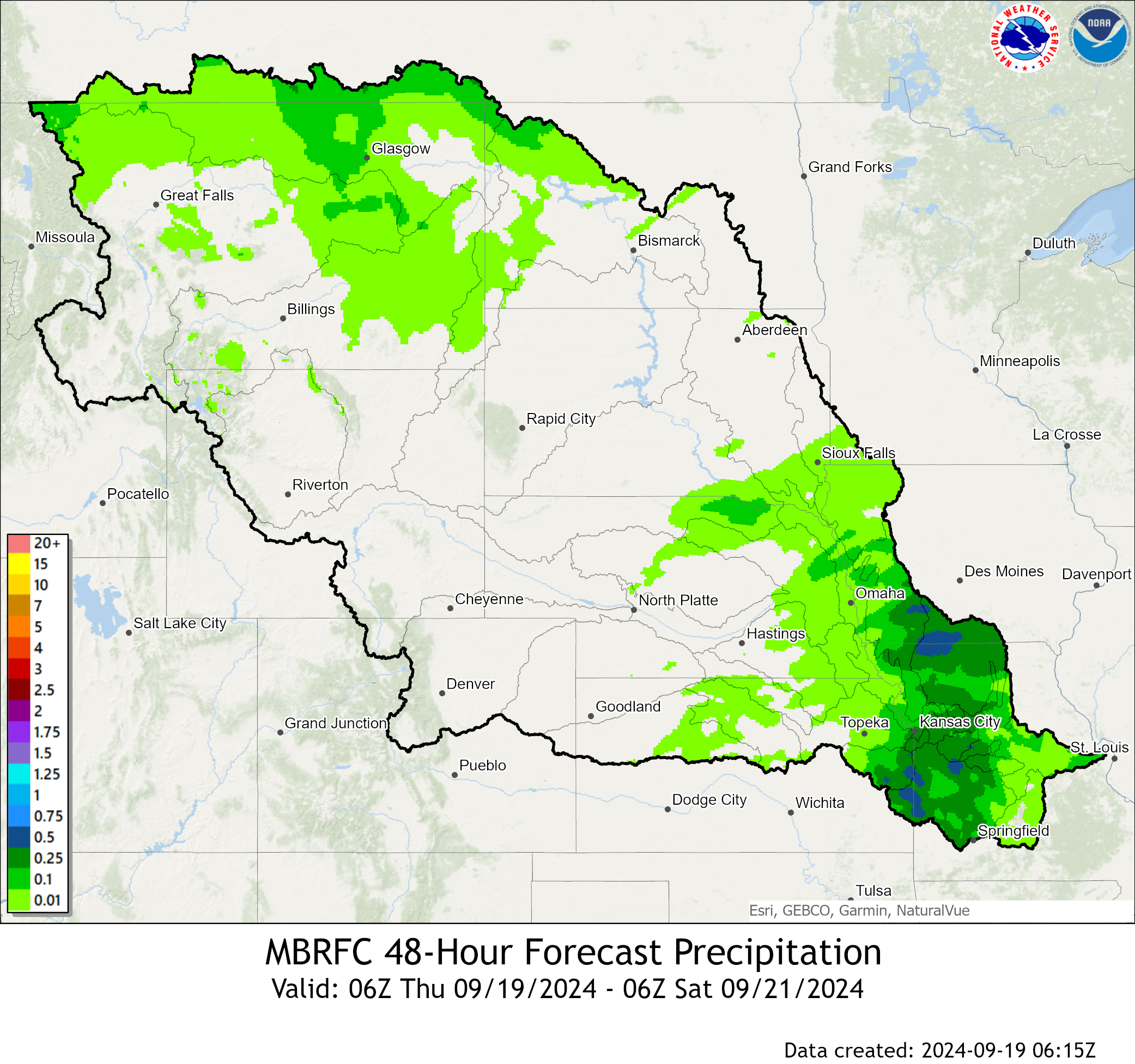 |
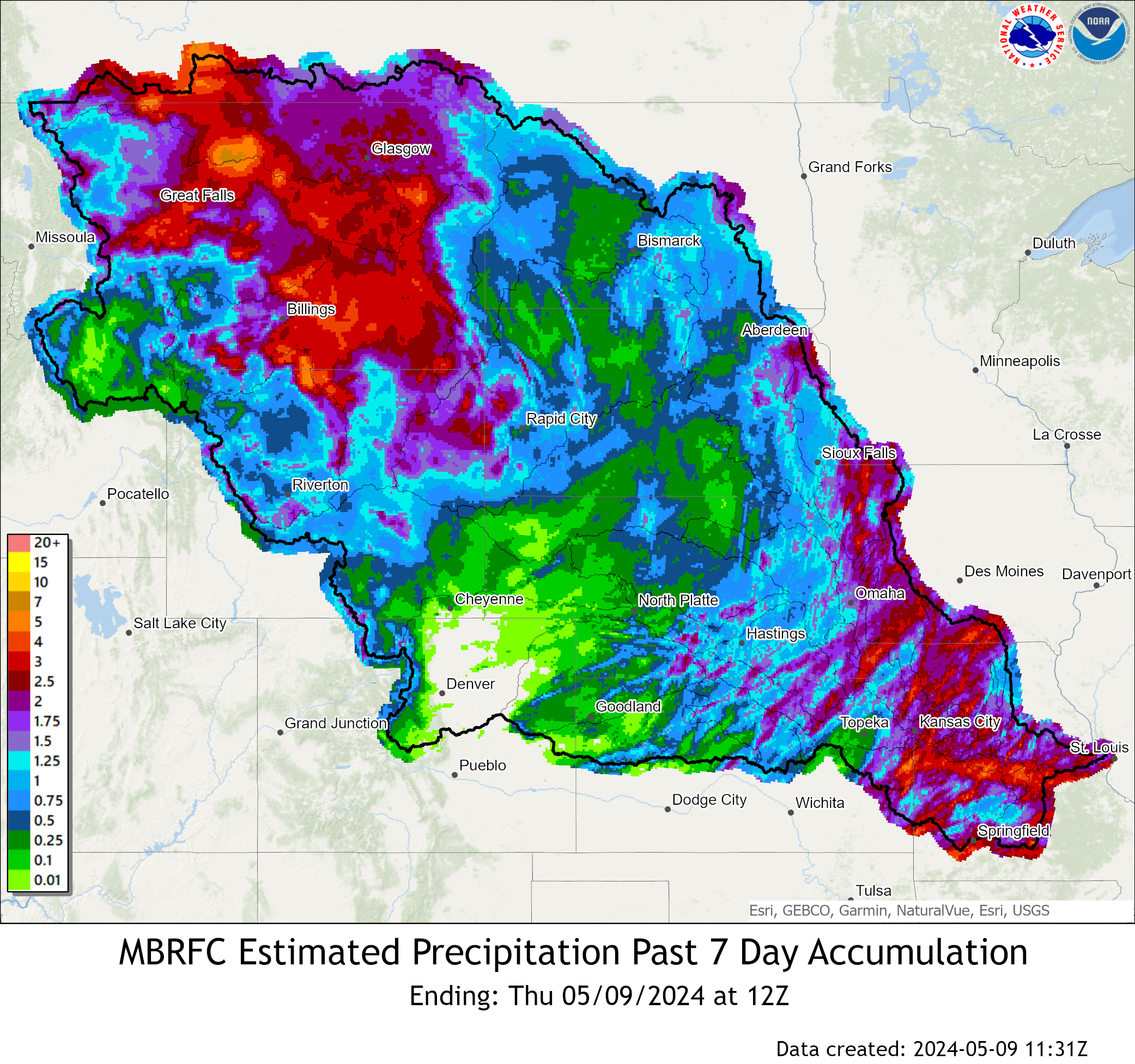
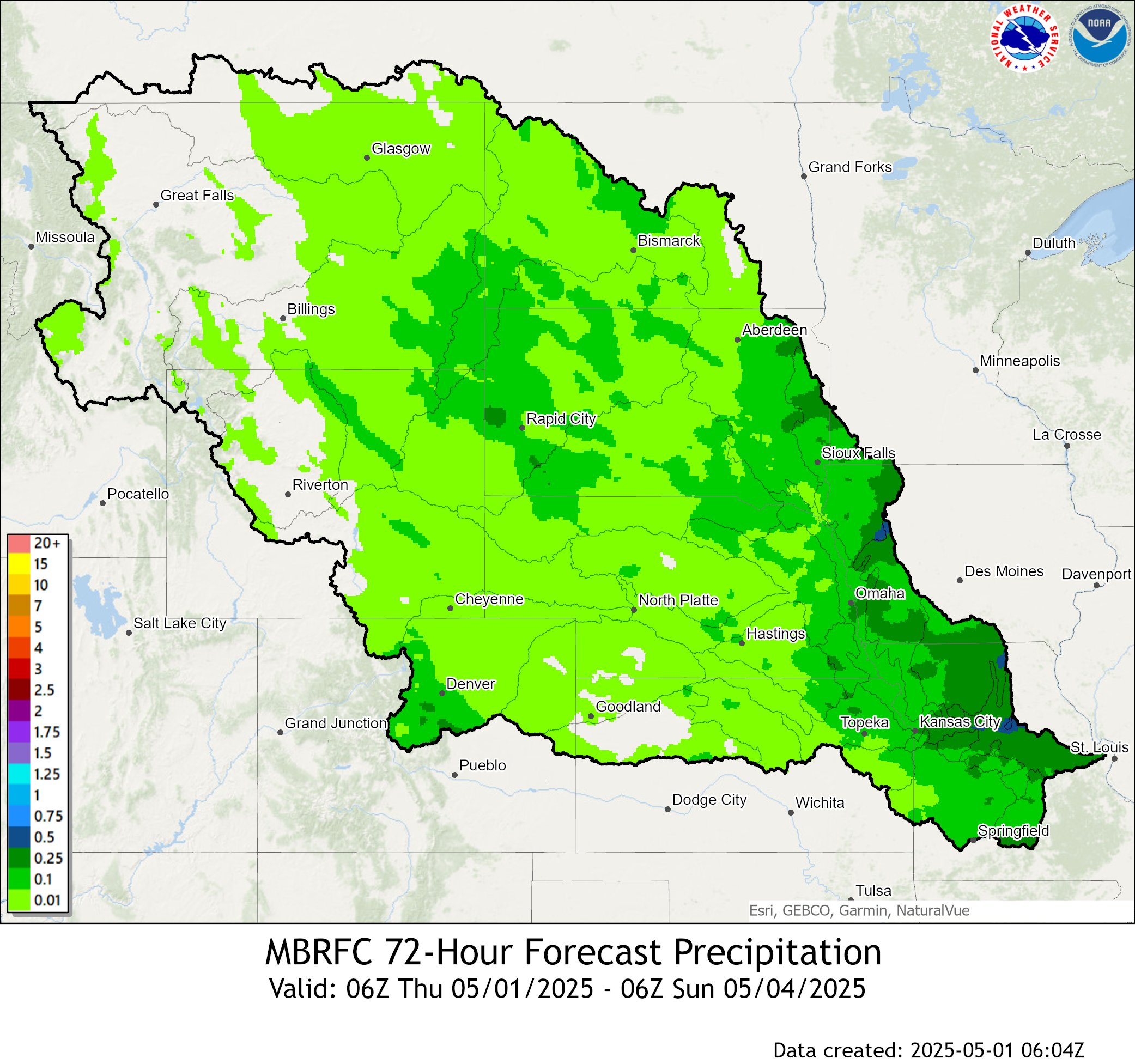
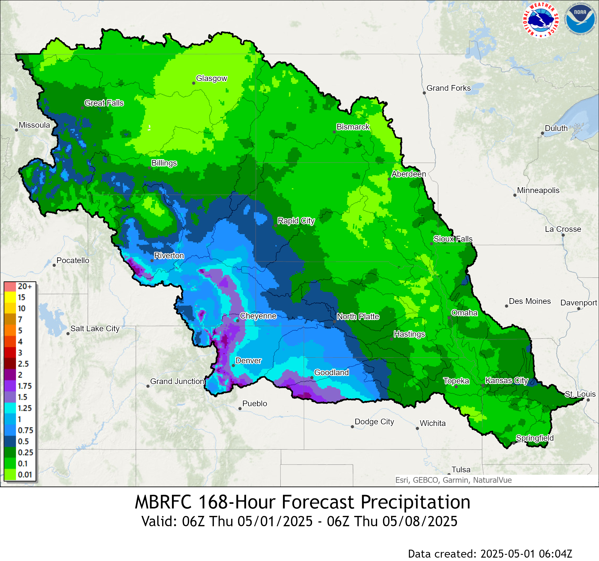
| Expected Accumulation the next 72 hours | Expected Accumulation the next 7 days |
 |
 |
| 6 to 10 Day Precipitation Outlook | 8 to 14 Day Precipitation Outlook |
 |
 |
| One Month Precipitation Outlook | |
|
|
|
Temperature:
Click Images to Enlarge
| 6 to 10 Day Temperature Outlook | 8 to 14 Day Temperature Outlook |
 |
 |
| One Month Temperature Outlook | Three Month Temperature Outlook |
 |
 |
 |
Media use of NWS Web News Stories is encouraged! Please acknowledge the NWS as the source of any news information accessed from this site. |
|