
Numerous severe thunderstorms are expected across a broad region from the Ohio Valley to the Mid-Atlantic and Northeast States today into tonight. Swaths of damaging wind gusts are expected and some tornadoes are possible. Bertha is expected to bring tropical storm conditions to portions of the Gulf Coast from the Florida Panhandle westward to southeastern Louisiana later today and Wednesday. Read More >
NWS Spot Forecasts (for Official Use Only)
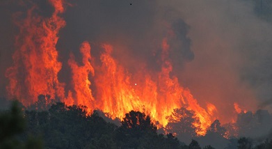
Useful Fire Weather Links
Fire Weather Forecasts
Click a county on the map below to get the most recent text Fire Weather Forecast. | Backup Product
Nebraska Rangeland Fire Danger Maps (click for a larger image)
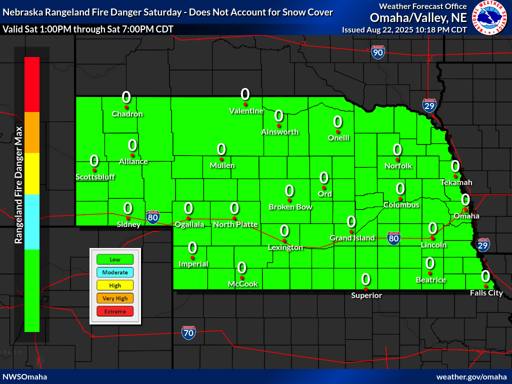 Nebraska Fire Danger Map Day 1 |
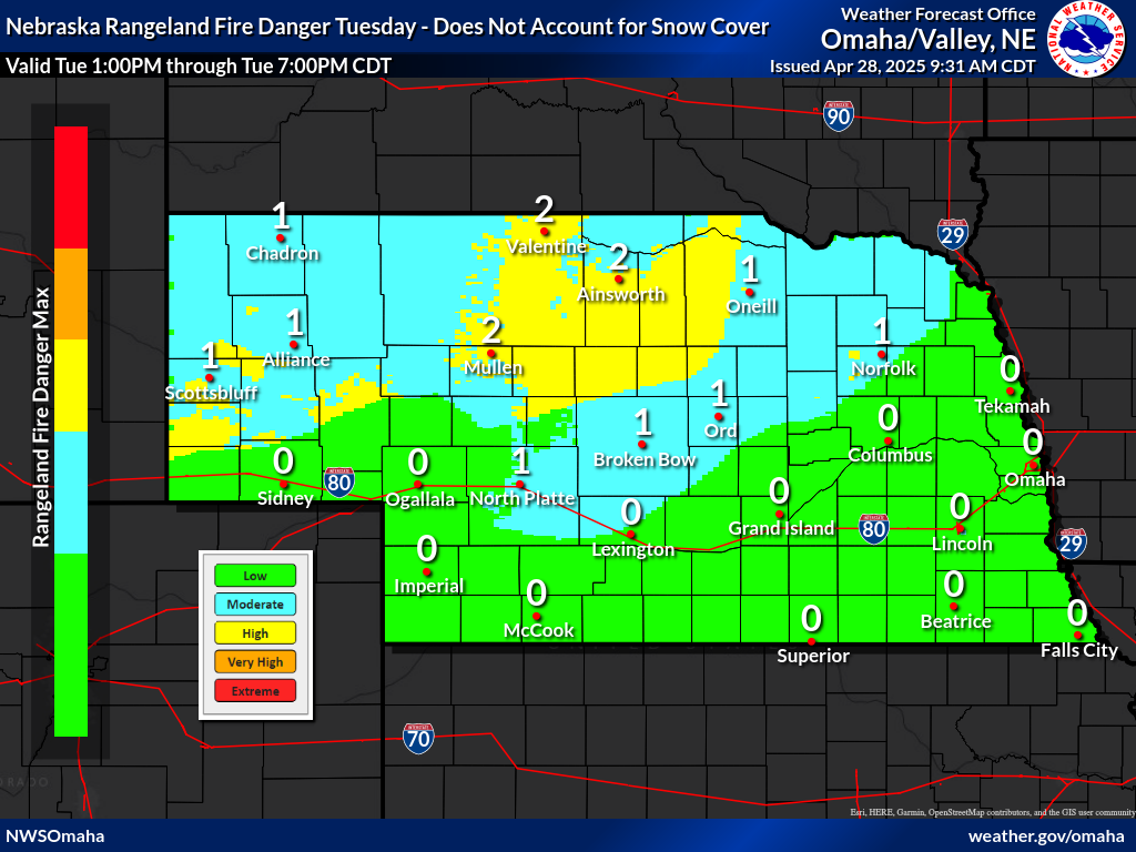 Nebraska Fire Danger Map Day 2 |
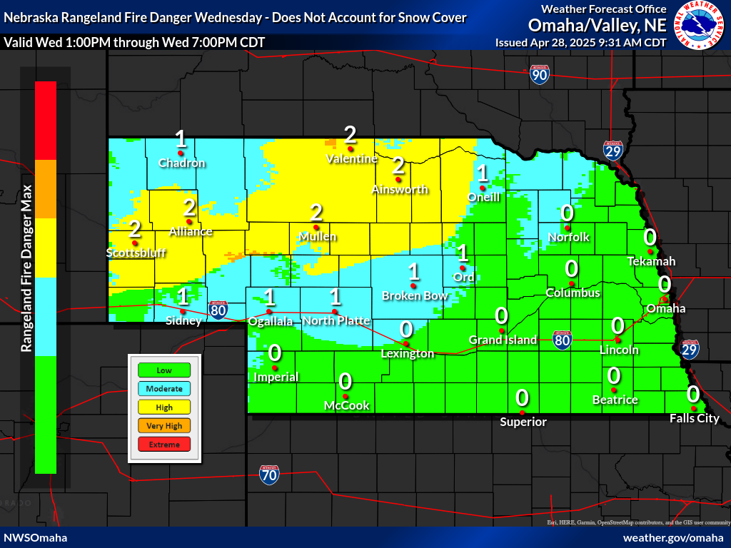 Nebraska Fire Danger Map Day 3 |
Minimum Relative Humidity and Max Wind Gust Maps (click for a larger image)
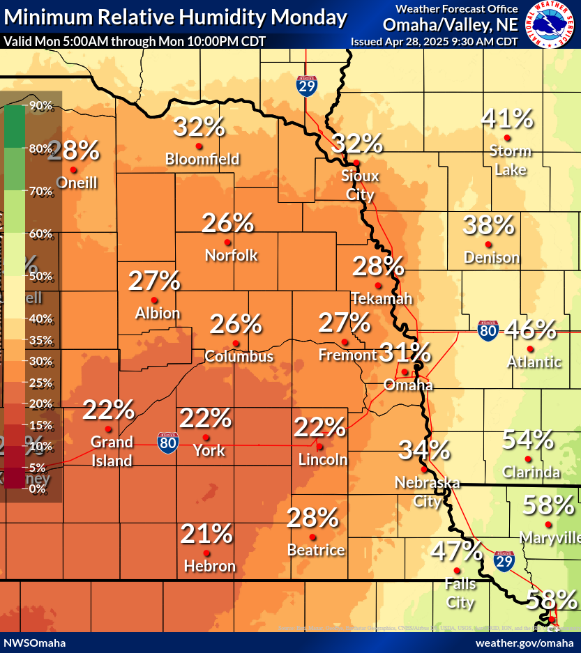 Minimum Humidity Day 1 |
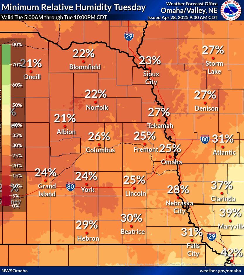 Minimum Humidity Day 2 |
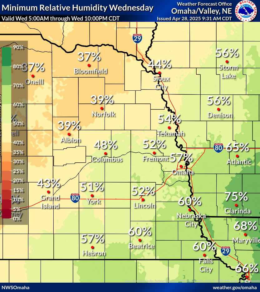 Minimum Humidity Day 3 |
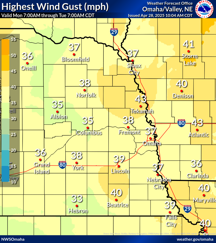 Max Wind Gust Day 1 |
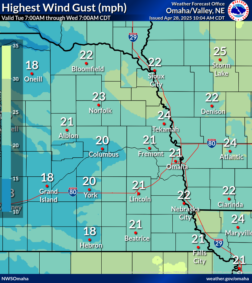 Max Wind Gust Day 2 |
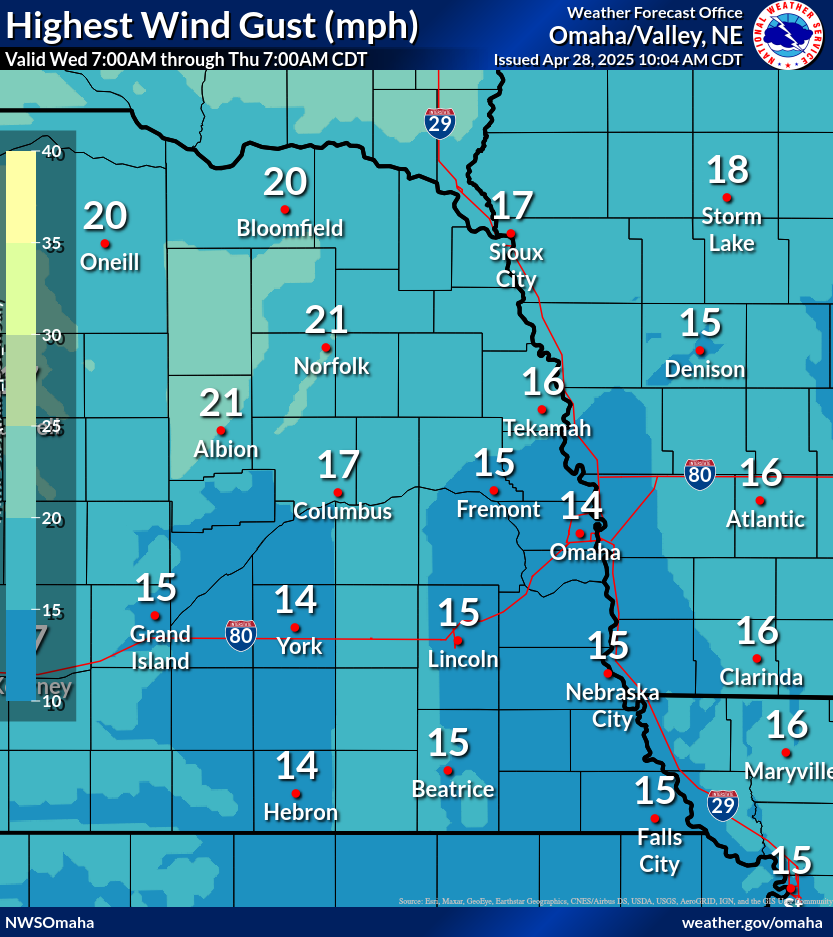 Max Wind Gust Day 3 |
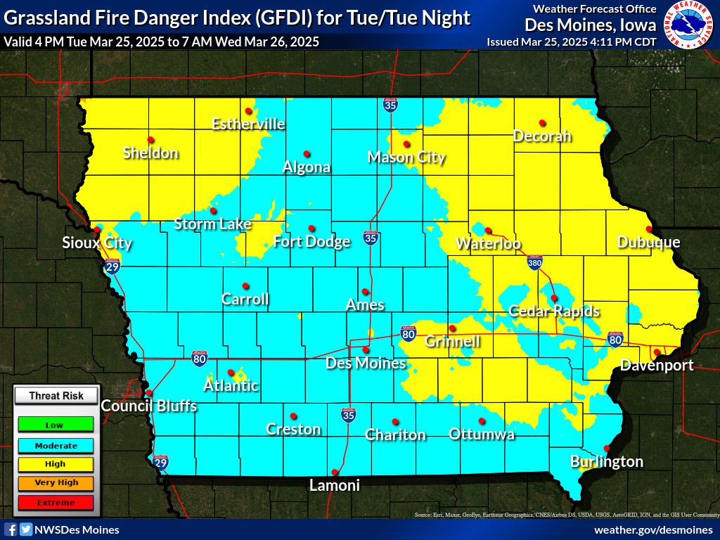
Iowa Grassland Fire Danger Index Maps (click for a larger image)
 Iowa Fire Danger Day 1 |
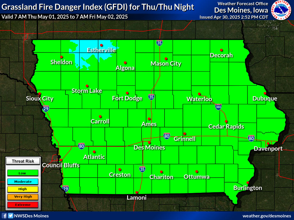 Iowa Fire Danger Day 2 |
Note: Extreme fire danger does not necessarily mean Red Flag Warning Criteria has been met. Check the local NWS office for the area of concern for additional information.
Red Flag Warning Criteria (effective 11/2/2022)
Issued for any of the combinations below.
|
|
|
|
||
Other Miscellaneous Links
Observed WFAS Fire Weather Data (click for a larger image)
|
|
 |
 |
 |
 |
 |
Additional Fire Weather Data
| Next Day Forecasts | Forecast Fire Danger | 10 Minute Average Wind 24-hr Precipitation | Temperatures | Relative Humidity 4-panel: Wind, Rain, Temp, RH |
| USA RAWS Climate Archive |
WRCC (Western Region Climatic Center, RAWS only)
|
| Area Upper Air Soundings | Omaha, NE | North Platte, NE | Topeka, KS |
| SPC Surface Map | Central US Surface Map |
| WPC Surface Maps |
Latest Surface Analysis | Day 1 Forecast | Day 2 Forecast | Day 3 Forecast |
SPC Fire Weather Outlooks (click for a larger image)
 Day 1 Fire Weather Outlook |
 Day 2 Fire Weather Outlook |
 Day 3-8 Fire Weather Outlook |
Partner Links


