National Weather Service United States Department of Commerce

Severe Thunderstorms in the Southern High Plains Saturday; Coastal Flooding in the East

Scattered severe thunderstorms are possible Saturday afternoon into early evening across parts of the southern High Plains. Damaging winds, large hail, isolated tornadoes, and heavy to excessive rainfall are possible. Along the Atlantic Coast, widespread minor to isolated moderate coastal flooding at high tides is forecast through the weekend. Read More >

Click a location below for detailed forecast.

Last Map Update: Fri, Sep 20, 2024 at 9:52:23 pm CDT
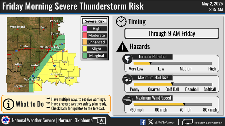
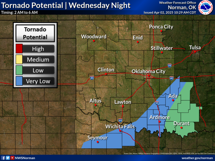
Scattered strong to severe thunderstorms are expected on Sunday afternoon into late evening across portions of western/central Oklahoma and western-north Texas. Damaging winds and large hail are the primary severe hazards.
Scattered showers and storms are expected to increase Saturday afternoon into evening across northwestern Oklahoma, with more widespread coverage on Sunday. A few strong to severe storms are possible.

 Current Weather Observations...
Location Time
(CDT)
Weather Vsby.
(SM)
Temp.
(ºF)
Dewpt.
(ºF)
Hum.
(%)
Wind
(mph)
Wind Chill / Heat Index
(ºF)
Pres.
(in)
Oklahoma City, OK20:52Mostly Clear10866244S 8-29.82
Norman, OK20:45Clear10896443SSE 13-29.80
Stillwater, OK20:53Clear10916745S 1094 [HI]29.79
Lawton, OK20:53Clear10916440SSE 1293 [HI]29.82
Wichita Falls, TX20:52Clear10866346SSE 10-29.82
Ponca City, OK20:53Clear10886851SSE 1292 [HI]29.77
Enid, OK20:55Clear10896139S 10-29.75
Alva, OK21:15Clear10865940W 5-29.80
Woodward, OK21:15Lightning Observed10776057SSE 7-29.87
Gage, OK20:53Mostly Clear10786359SSE 5-29.83
Watonga, OK21:15Lightning Observed10885836S 8-29.85
Clinton, OK20:53Clear10845537SSW 8-29.84
Weatherford, OK21:15Clear10895733S 8-29.83
Altus, OK21:15Clear10915529S 17-29.82
Frederick, OK20:53Clear10905935S 12-29.80
Ardmore, OK20:50Clear10846654CALM-29.82
Ada, OK21:15Clear10876648S 6-29.86

Local Weather History For September 20th...
Lightning struck a tree next to a home in Davis on the afternoon of
September 20, 1992. The lightning jumped from the tree to the home,
where it blew a five-inch diameter hole in the roof, tore siding off,
blew off sheet rock on the bathroom wall, and burned up the phone
lines.

Text Product Selector (Selected product opens in current window)
Weather Observations Area Forecast Discussion Air Quality Forecasts Hydrology Information Frequently Asked Questions Social Media
Observations Discussion Air Quality Hydrology FAQ Social Media
 
Submit a Storm Report Graphical Weather Forecasts Aviation Weather Forecasts Climate Data Storm Data Weather Radio Information
Storm Reports Gridded Forecast Aviation Climate Storm Data Weather Radio  
 
Satellite Information Hourly Weather Forecast Fire Weather Information Past Weather Events StormReady Skywarn/Storm Spotters
Satellite Hourly Forecast Fire Weather Past Events StormReady Storm Spotters