National Weather Service United States Department of Commerce

Severe Thunderstorms in the Central U.S.; Upper Level Low Over California

Scattered severe thunderstorms are possible today across central and eastern Minnesota, Iowa, and western Wisconsin. A few tornadoes, isolated very large hail, and damaging winds may occur. An upper level low will help trigger scattered thunderstorms over portions of central and southern California today along with a few inches of snow in the central Sierra Nevadas. Read More >

Click a location below for detailed forecast.

Last Map Update: Thu, Sep 19, 2024 at 3:24:25 pm CDT
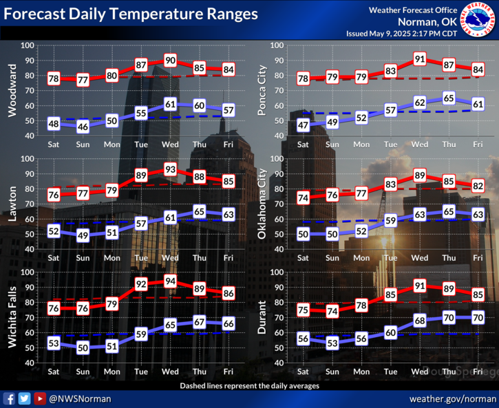
Will feel very hot today with the heat and humidity yielding peak heat index values of 100 to 110 degrees. Record high temperatures are expected to be broken at Lawton and quite possibly at Wichita Falls, OKC, and Stillwater.
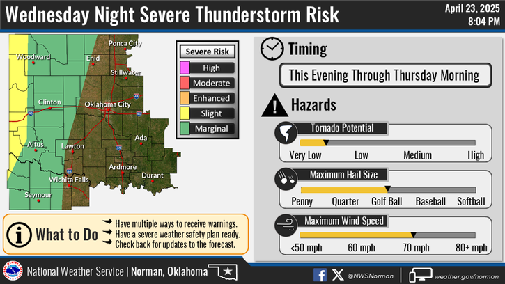
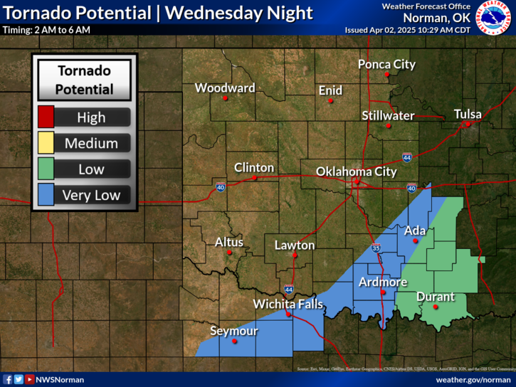
There is a low chance for a few thunderstorms late today into this evening. A few storms that develop could become severe with the potential to produce damaging wind gusts and hail.
Strong to severe storms are possible on Thursday afternoon and evening. Damaging wind gusts and quarter size hail will be the main threat from these storms, along with cloud-to-ground lightning.

 Current Weather Observations...
Location Time
(CDT)
Weather Vsby.
(SM)
Temp.
(ºF)
Dewpt.
(ºF)
Hum.
(%)
Wind
(mph)
Wind Chill / Heat Index
(ºF)
Pres.
(in)
Oklahoma City, OK14:52Partly Cloudy10976940SSW 13G23103 [HI]29.83
Norman, OK14:45Clear10966839SSE 20101 [HI]29.83
Stillwater, OK14:53Clear101026833S 14G25109 [HI]29.80
Lawton, OK14:53Clear101006734SW 14G25105 [HI]29.83
Wichita Falls, TX14:52Mostly Clear101006835VRB 7106 [HI]29.82
Ponca City, OK14:53Clear101026934S 12G22110 [HI]29.77
Enid, OK15:00Clear101026631SW 20107 [HI]29.87
Alva, OK14:55Clear101045721WNW 13G21104 [HI]29.77
Woodward, OK14:55Clear10985120SW 14G1895 [HI]29.87
Gage, OK14:53Clear101025118WNW 1299 [HI]29.84
Watonga, OK14:55Clear101016429SSW 14G26104 [HI]29.84
Clinton, OK14:53Lightning Observed10966333SSW 16G2998 [HI]29.84
Weatherford, OK14:55Clear101006330SW 15102 [HI]29.83
Altus, OK14:55Clear10986634SSW 8G22102 [HI]29.83
Frederick, OK14:53Clear101006532S 20G28104 [HI]29.81
Ardmore, OK14:50Clear10986837SSE 12G17104 [HI]29.83
Ada, OK14:55Clear101006937SSW 12G17107 [HI]29.85

Local Weather History For September 19th...
Tornadoes struck Oklahoma City and Del City on this date in 1965. The
Oklahoma City tornado skimmed the northwest part of the downtown
business district, and the Del City storm struck near Southeast 20th
and Bryant Avenue. Both tornadoes were weak, but what made these
tornadoes unusual, is that they both occurred between 7 and 8 AM.

Text Product Selector (Selected product opens in current window)
Weather Observations Area Forecast Discussion Air Quality Forecasts Hydrology Information Frequently Asked Questions Social Media
Observations Discussion Air Quality Hydrology FAQ Social Media
 
Submit a Storm Report Graphical Weather Forecasts Aviation Weather Forecasts Climate Data Storm Data Weather Radio Information
Storm Reports Gridded Forecast Aviation Climate Storm Data Weather Radio  
 
Satellite Information Hourly Weather Forecast Fire Weather Information Past Weather Events StormReady Skywarn/Storm Spotters
Satellite Hourly Forecast Fire Weather Past Events StormReady Storm Spotters