Heavy lake effect snow will persist downwind of the Great Lakes through early Saturday. Snow squalls with heavy snow and gusty winds will create dangerous travel in the Interior Northeast due to low visibility and slippery roads. A major winter storm will bring moderate to heavy, accumulating snow and gusty winds from the eastern Plains to the western Great Lakes today through Saturday. Read More >
Links | Map | Warnings, Radar, & Satellite | Fire & Thunder Forecasts
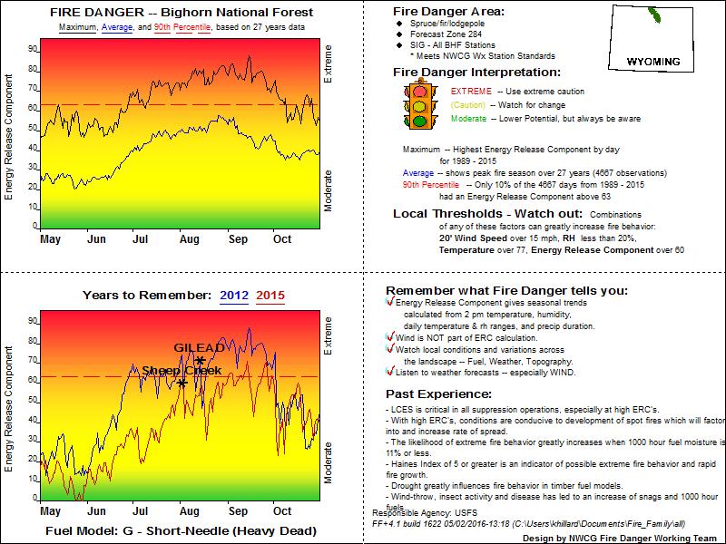
Outlooks and Climate| Fuels and Fire Danger Maps
 |
||
|
||
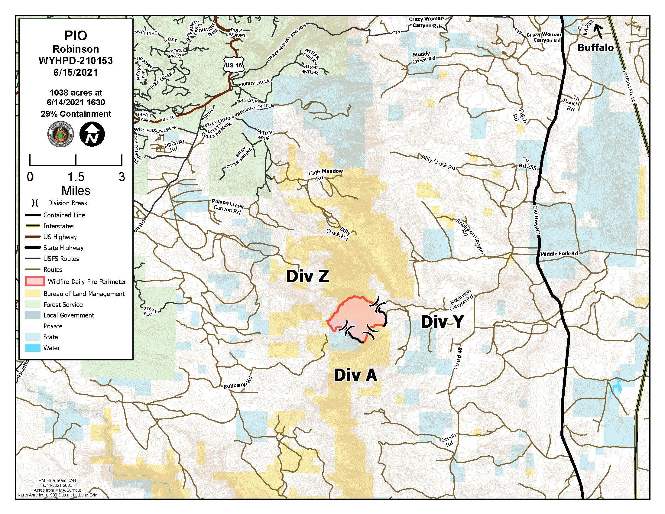
| Robinson Inciweb Page | ||
| WFO Riverton Fire Weather Page | ||
| Fire Weather Planning Forecast For Zone 285 | ||
| Robinson Wildfire Twitter Page | ||
| Click Boxes to Expand Product on Page | ||
|
||
Current Warnings, Radar, and Satellite
(Click thumbnails to expand Images)
 |
|
|
|
|||||||||
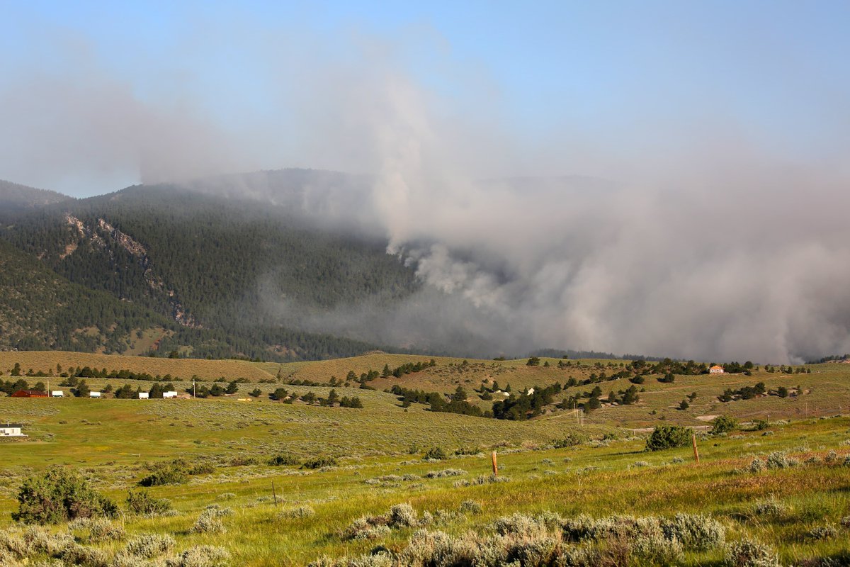
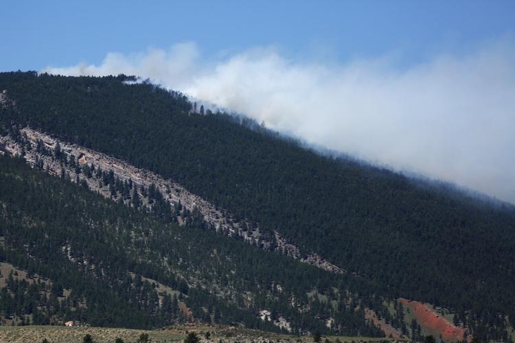
| Pictures from the Robinson Fire | ||
 |
 |
|
|
Photo from BLM |
Photo from Buffalo Bulletin |
|
|
|
|
|
|

|

|

|
 |
|
|
|
|
|
|
Storm Prediction Center Critical Fire Areas and Thunderstorm Forecasts
(Click thumbnails to expand Images)
|
|
|
|
 |
 |
 |
|
|
Day 2 Categorical | Day 3 Categorical |
 |
 |
 |
|
|
|
|
|
|
 |

|
 |
 |
 |
|
|
|
|
|
|
 |

|
 |
 |
 |
Weather Outlook and Climate Information
(Click thumbnails to expand Images)
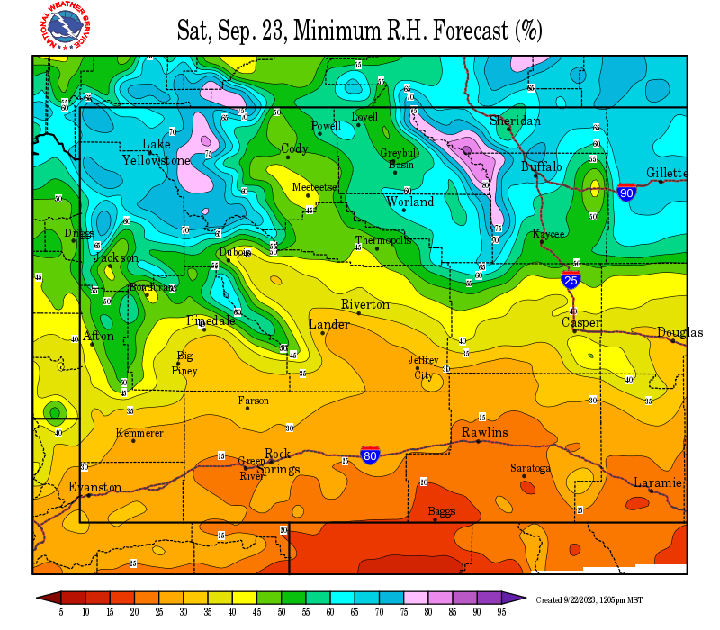
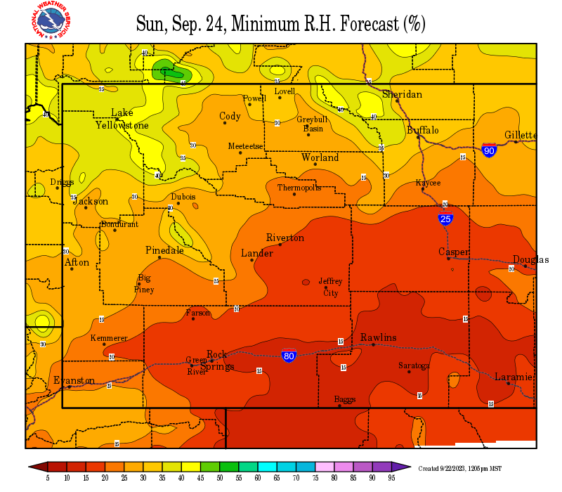
| Local Precipitation, Wind, and Humidity Information (NWS) |
|
|
|
|
|
 |
 |
 |
 |
|
|
|
|
|
 |
 |
 |
 |
|
|
|
|
|
|
|
 |
 |
 |
 |
|
|
|
|
|
 |
 |
 |
 |
USFS Fire Danger Graphics and Fuels
(Click thumbnails to expand Images)
|
|
|
|
 |
 |
 |
|
|
|
|
 |
 |
 |
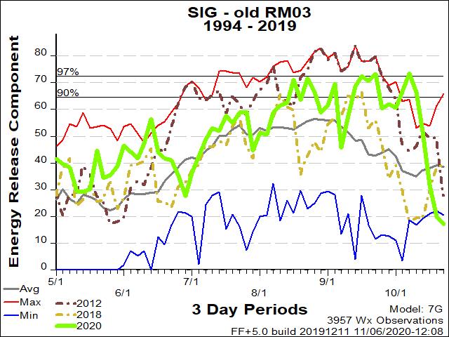
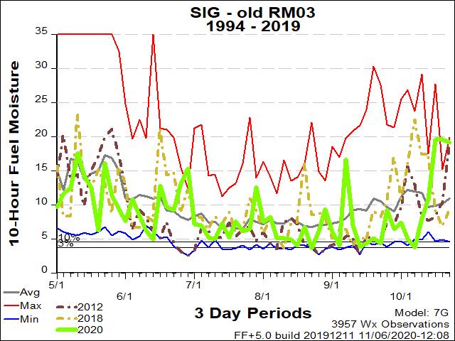
| RM03 ERC Fuels Graph |
|
|
 |
 |
 |
Return to NWS Riverton Homepage
 |
Building a Weather-Ready Nation |