Springfield, MO
Weather Forecast Office

|
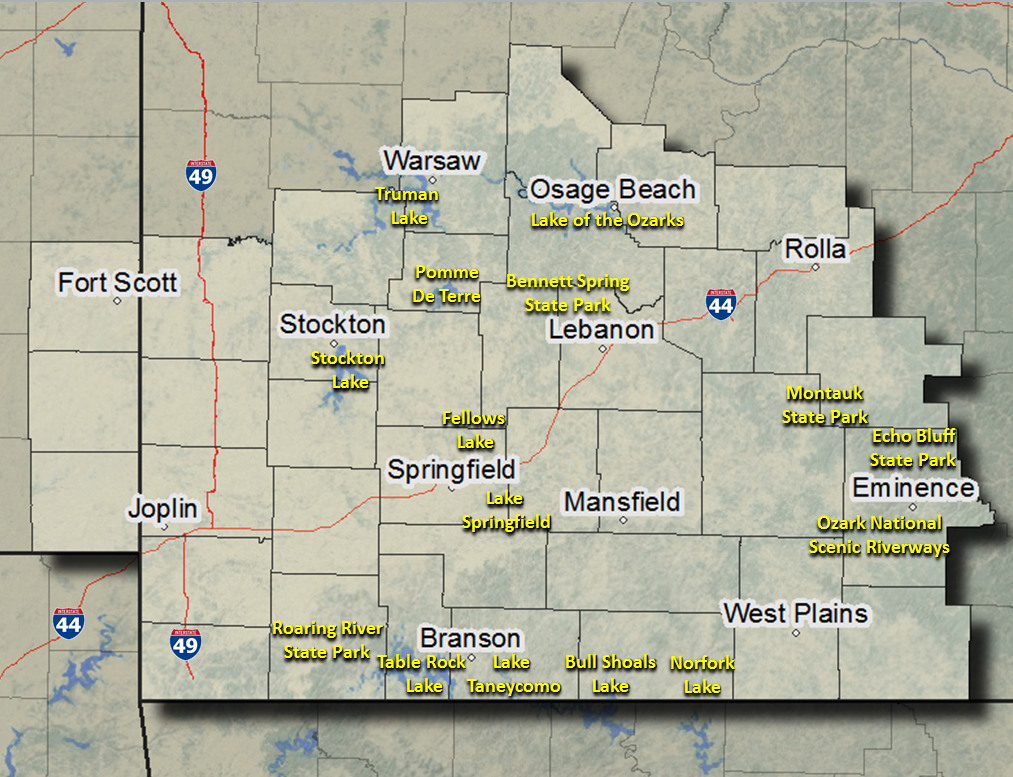
Click on Map Locations to View Point and Click Forecasts
|
The forecast map shows contour lines of predicted UV Index values during the solar noon hour. The map is created daily from National Weather Service forecast data. Click the buttons for Day 2, Day 3, or Day 4 to see the UV Index forecast for following days. You may notice a brief delay as each map loads. (To find the time of solar noon at your location, use the sunrise-sunset-solar noon calculator at the NOAA website.)
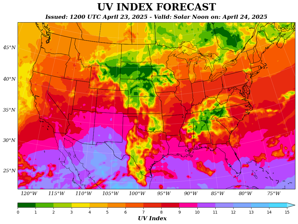
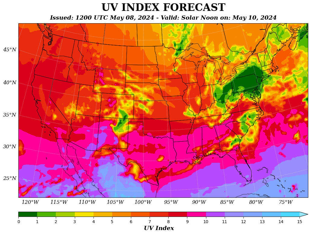
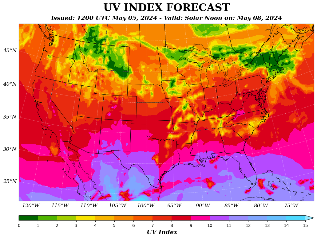
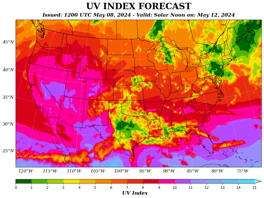
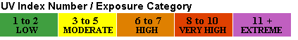
Click here for more information on the UV Index.
Current Hazards
Experimental Graphical Hazardous Weather Outlook
Submit a storm report
Local Storm Reports
Current Conditions
Observations
Lake Levels
Snowfall Analysis
Road Conditions
Satellite
CoCoRaHS
Graphical Conditions
Regional Max/Min Temp and Precip. Table
Precip. Analysis
Forecasts
Forecast Discussion
Fire Weather
Aviation
GIS Forecast Maps
Activity Planner
Severe Weather
Winter Weather
Hurricanes
FAA Center Weather
Space Weather
Climatology
Records and Normals
Monthly Climate Summary
Local
National
Drought
Climate Science
Astronomical Data
US Dept of Commerce
National Oceanic and Atmospheric Administration
National Weather Service
Springfield, MO
Springfield-Branson National Airport
5805 West Highway EE
Springfield, MO 65802-8430
Business: 417-863-8028 Recording: 417-869-4491
Comments? Questions? Please Contact Us.


 Weather Story
 Weather Map
 Local Radar