
A significant winter storm will produce a broad area of moderate to heavy snow from the Midwest through the western Great Lakes. Significant snow accumulations of 6-12 inches, and locally more than 1 foot, and gusty wind may cause hazardous travel conditions. Thunderstorms, some severe, and showers may produce locally heavy rain and isolated flash flooding along the western Gulf Coast. Read More >
Spaceflight Meteorology Group
National Center
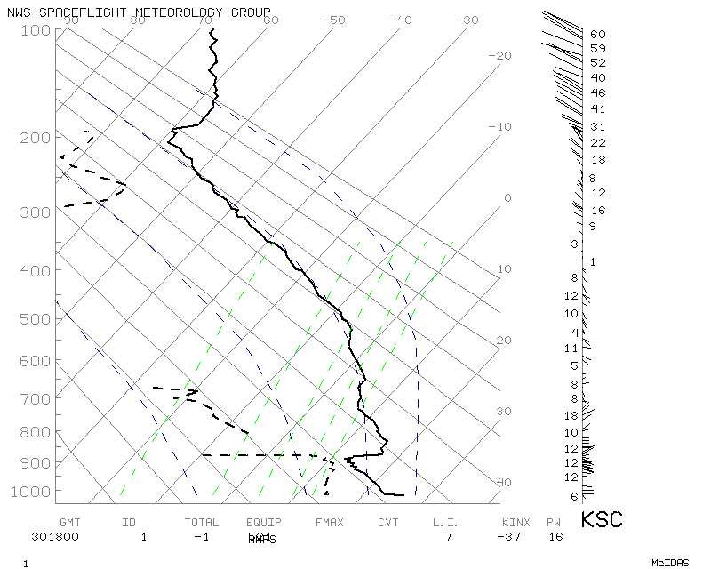
Latest mission support Skew-T Log P diagram from the Cape Canaveral. The most recent daily synoptic rawinsonde plots for KXMR may be found at these highlighted links for early morning and late afternoon.
Y-axis is pressure in millibars. Wind staffs are located to the right hand side of the diagram with speed in knots.
US Dept of Commerce
National Oceanic and Atmospheric Administration
National Weather Service
Spaceflight Meteorology Group
Johnson Space Center / WS8
Houston, TX 77058
Comments? Questions? Please Contact Us.

