
Scattered severe thunderstorms are possible today across central and eastern Minnesota, Iowa, and western Wisconsin. A few tornadoes, isolated very large hail, and damaging winds may occur. An upper level low will help trigger scattered thunderstorms over portions of central and southern California today along with a few inches of snow in the central Sierra Nevadas. Read More >
Topeka, KS
Weather Forecast Office
Overview
|
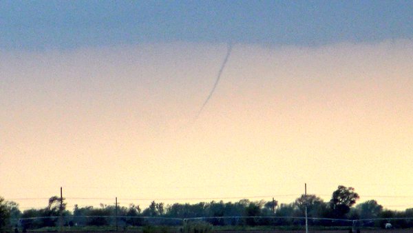
During the early morning hours of the 26th of April severe thunderstorms began to develop across northern KS. A few of these storms produced hail the size of baseballs. Later in the morning the storms went on to produce damaging wind across far northeast KS. The outflow from these thunderstorms became the focus for new convection during the afternoon once the atmosphere was very unstable. Storms became widespread mainly producing large hail, damaging winds, and a few tornadoes. None these tornadoes caused much damage, but the hail and wind did in several locations. The widespread coverage of storms produced heavy rainfall for several hours over the same locations causing localized flash flooding. There were reports of evacuations and swift water rescues mainly in and around Shawnee county. |
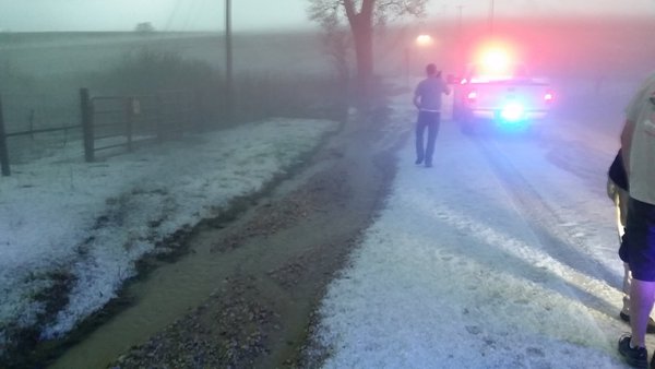
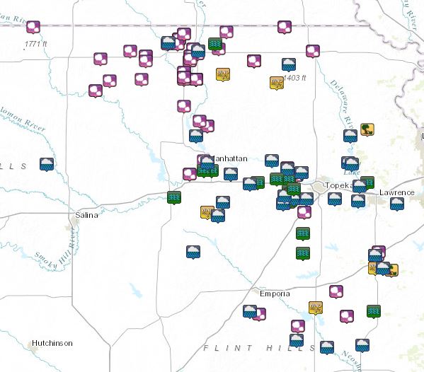 Local Storm Reports |
Wind & Hail:
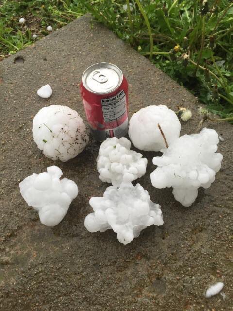
Hail
 |
 |
 |
| Washington, KS Photo credit: @JungleberryBush | Marshall County Photo credit: Pat Bussmann | Shawnee County Photo credit: ksoldani3 |
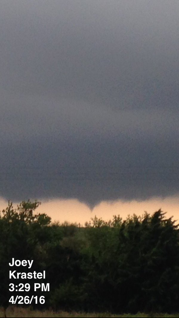
Photos:
 |
 |
 |
| Alta Vista, KS Photo credit: Joey Krastel | Randall, KS Photo credit: Dan Fitts | Lawrence, KS Photo credit: Claire MacLachla |
Radar:
 |
| Radar Loop Ending Arpil 27 at 5am CDT |
Estimated Rainfall: 72 hours ending April 27 at 7am CDT

 |
Media use of NWS Web News Stories is encouraged! Please acknowledge the NWS as the source of any news information accessed from this site. |
|
US Dept of Commerce
National Oceanic and Atmospheric Administration
National Weather Service
Topeka, KS
1116 NE Strait Avenue
Topeka, KS 66616-1667
785-234-2592
Comments? Questions? Please Contact Us.

