Fairbanks, AK
Weather Forecast Office
On December 17th, the National Weather Service radar page received a big upgrade! You can view the new interface here at radar.weather.gov.
During the transition to the new radar web page, there have been noted issues during the transition nationally across the NWS. If you are having issues loading the new radar site, please consider the following web pages below until the issue can be resolved (early this upcoming week of December 21st):
Sorry about any inconveniences this may have caused.
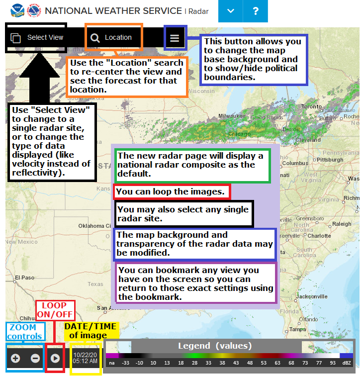
The display has many new features that make some time to get familiar with. Here is a link to a short tutorial and a link to a 15 minute video to take you through the features of the new radar page.
Here is a list of frequently asked questions.
Benefits of this new page include:
- Mobile device friendly.
- High resolution radar.
- Searchable locations with the local forecast.
- Display precipitation type.
- Add radar data to your own GIS software.
...and more!
Quick Reference Guide:
US Dept of Commerce
National Oceanic and Atmospheric Administration
National Weather Service
Fairbanks, AK
UAF-Akasofu Building
Post Office Box 757345
Fairbanks, AK 99775-7345
907-458-3700
Comments? Questions? Please Contact Us.

