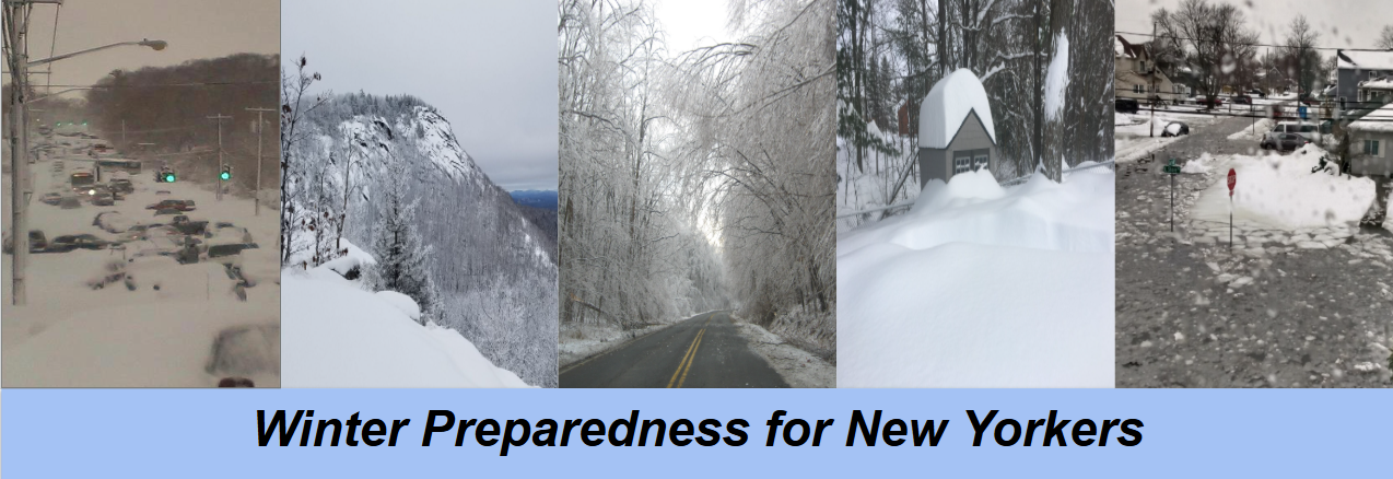
Far left image courtesy of NWS New York (Long Island February 2013), second from left courtesy of NWS Albany (Winter scene from Moxham Mountain, NY), center image courtesy of NWS Albany (Capital District December 2008 ice storm) and fourth from left courtesy of NWS Binghamton (Endwell, NY December 17, 2020), and far right image courtesy of NWS New York (Coastal Flooding in Lindenhurst, NY February 2021)
Winter in New York can be quite complex featuring multiple precipitation types (snow, rain, sleet, and/or freezing rain), extreme cold temperatures, and strong winds. The complex terrain around the state including the Adirondack and Catskill Mountains, the Mohawk and Hudson River Valley, the Atlantic and Long Island coast, and Lake Erie and Ontario can often makes it even more challenging to prepare since weather can change quickly over a short distance and be elevation dependent. This page is a collaboration among the five National Weather Service offices that serve New York State (Upton/New York City, Albany, Binghamton, Buffalo, and Burlington, VT) where we identify the top five most common winter weather hazards and created and recorded short presentations on each one to share insight into what you can expect and how to be prepared. We also share resources from other federal partners including the American Red Cross, the Federal Emergency Management Agency (FEMA) and the Centers for Disease Control and Prevention (CDC) who also provide safety and preparedness information on winter weather.
Hazards & Presentations |
Winter Infographics |
||
|
|
|
|
|
|
|
|
|
|
|
|
|
|
|
|
|
Nor'easters, Blizzards, Heavy Snow Bands & Coastal Flooding
|
|
|
|
|
|
|
|

