Overview
|
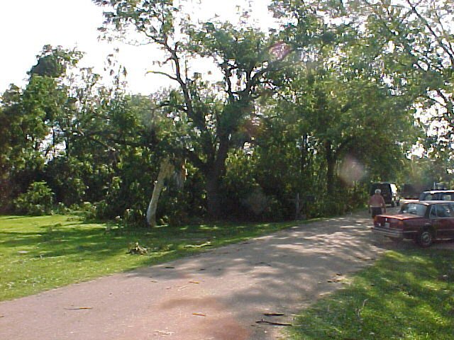
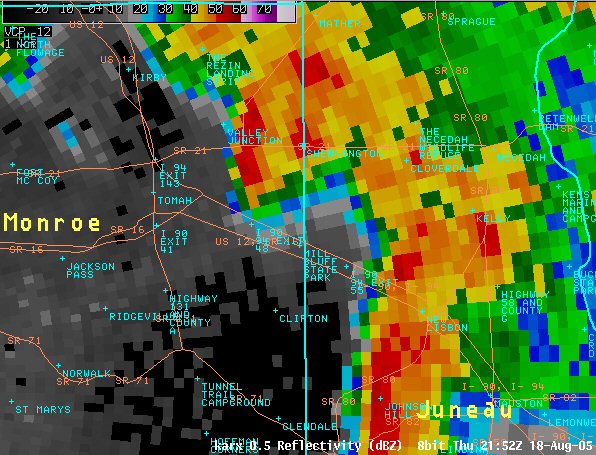
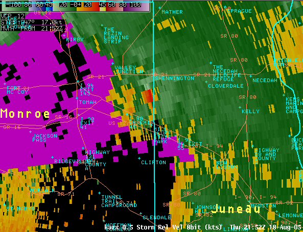
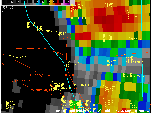
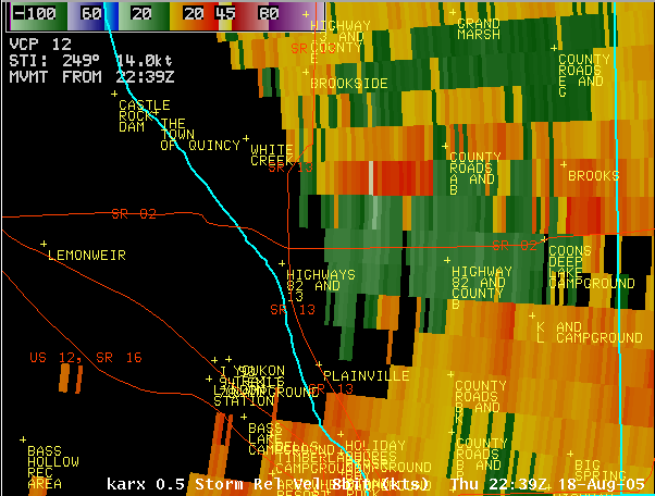
On August 18, 2005, a low pressure system tracked across southern Wisconsin during the afternoon hours. Thunderstorms developed in the early afternoon over southeastern Minnesota and shifted into western Wisconsin by mid afternoon. At the same time, a warm front was shifting through southwest Wisconsin providing a favorable wind profile for thunderstorms with tornadoes. At 2:45 p.m. CDT, the Storm Prediction Center (SPC) in Norman, OK issued a Tornado Watch for southwestern Wisconsin through 9 p.m. |
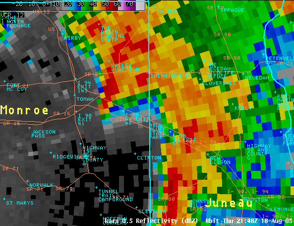
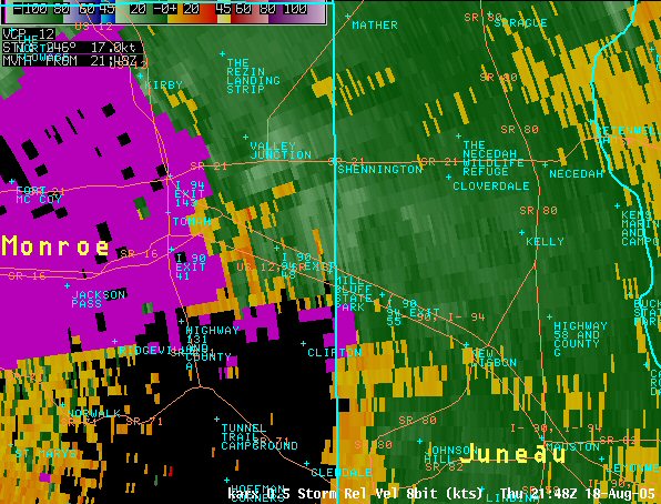
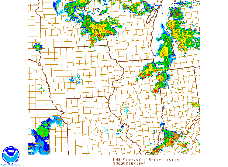 Radar loop from 1:30 p.m. to 10:30 p.m. |
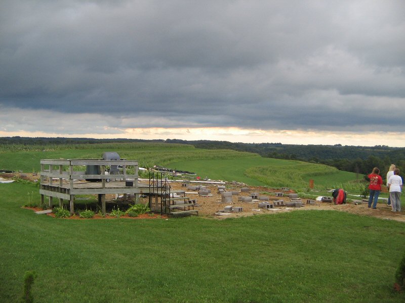
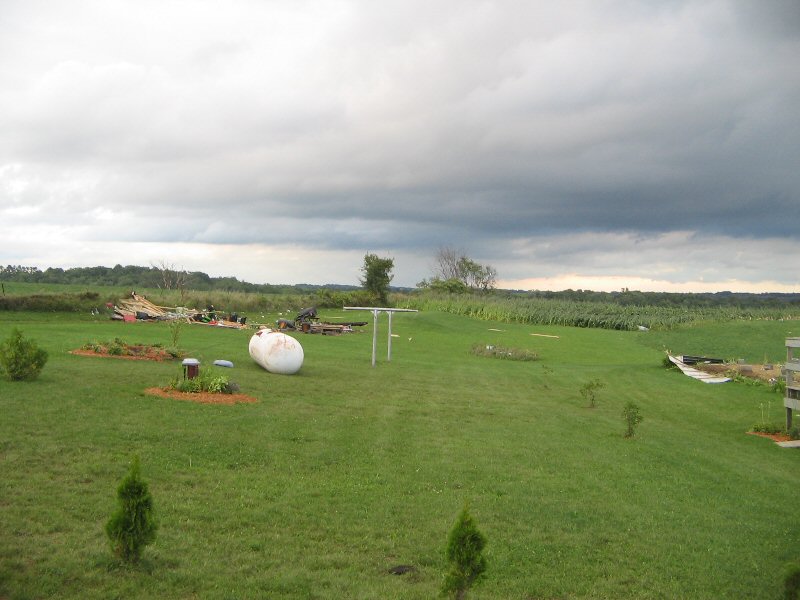
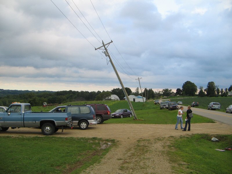
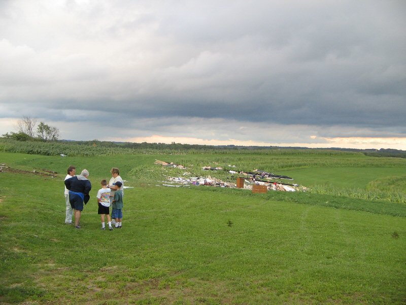
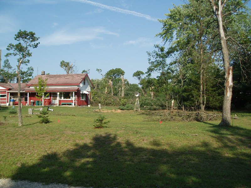
Tornadoes:
|
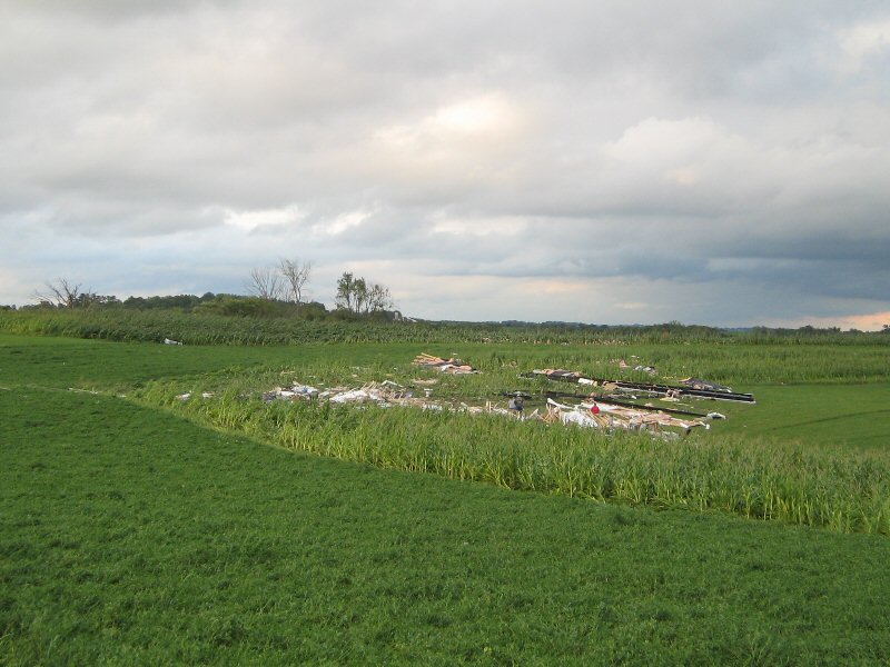
Tornado - 4 miles N of Dexter, MN
Track Map |
||||||||||||||||
|
||||||||||||||||
|
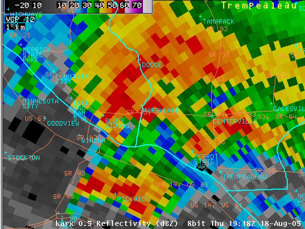
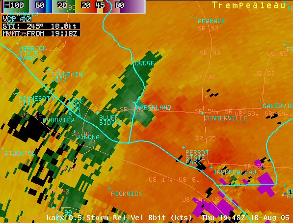
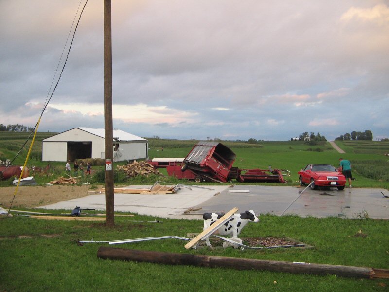
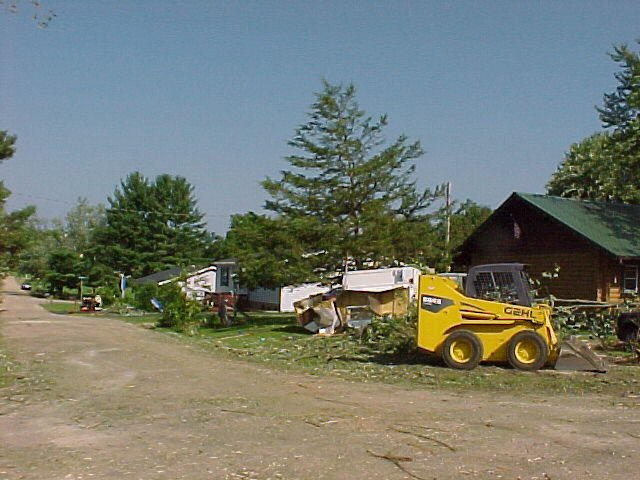
Tornado - Centerville, WI
Track Map |
||||||||||||||||
|
||||||||||||||||
|
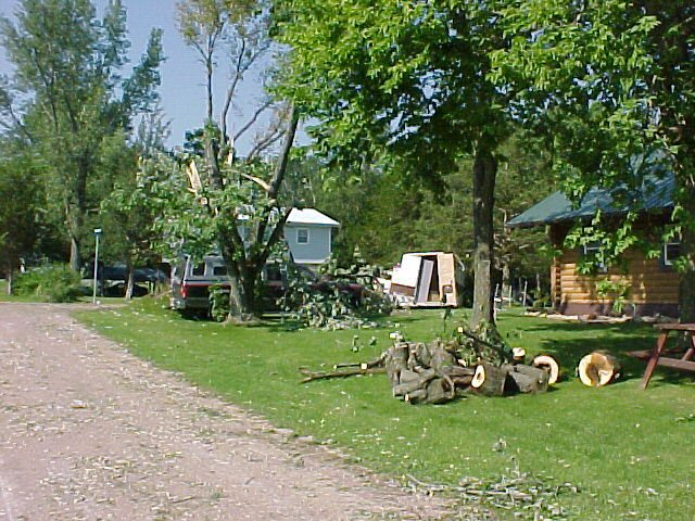
Tornado - 2-3 miles W of Esofea, WI
Track Map 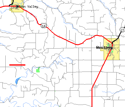 |
||||||||||||||||
|
||||||||||||||||
|
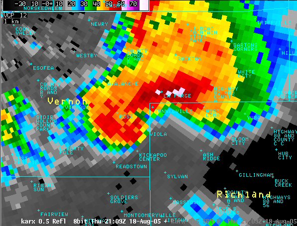
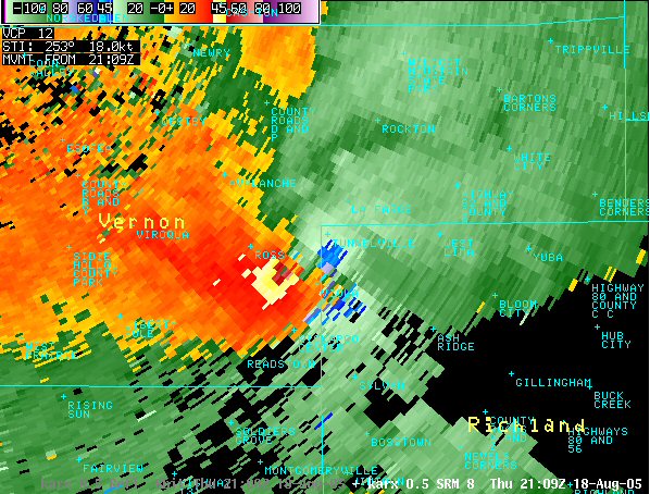
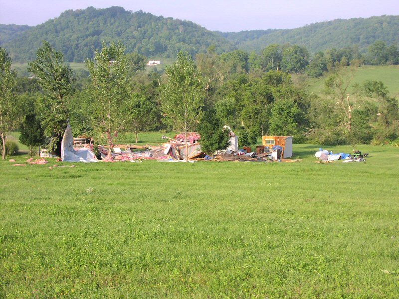
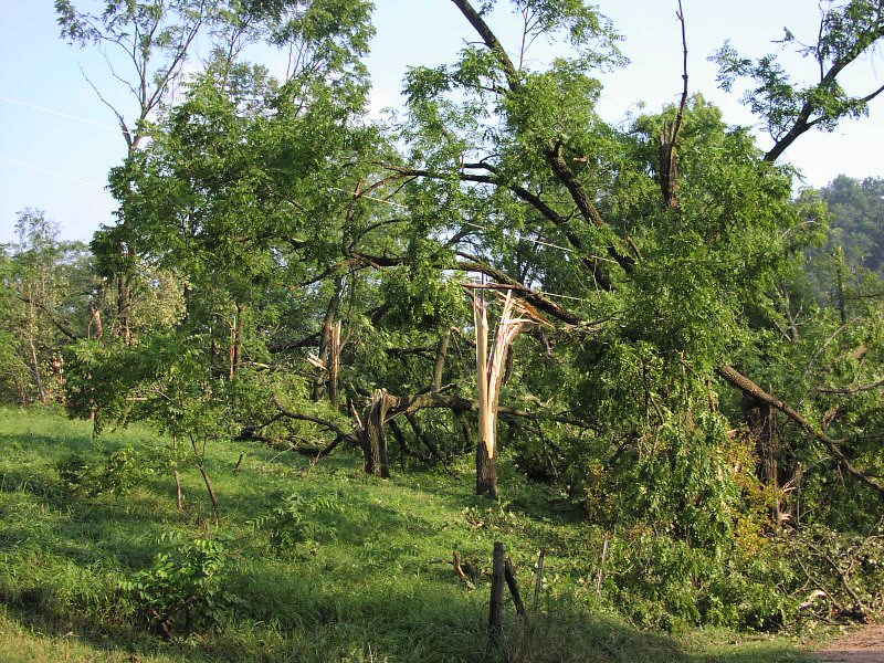
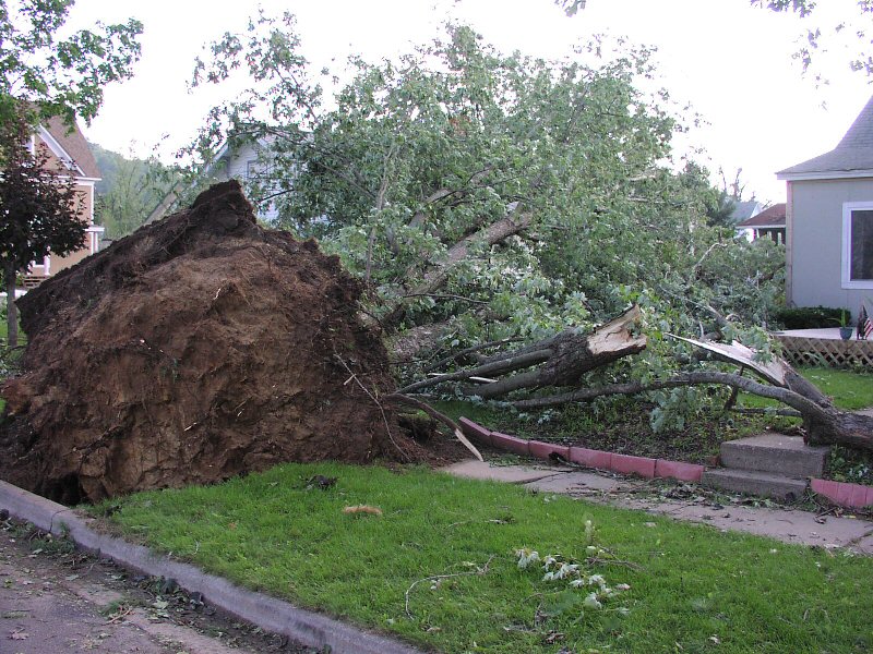
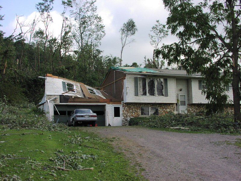
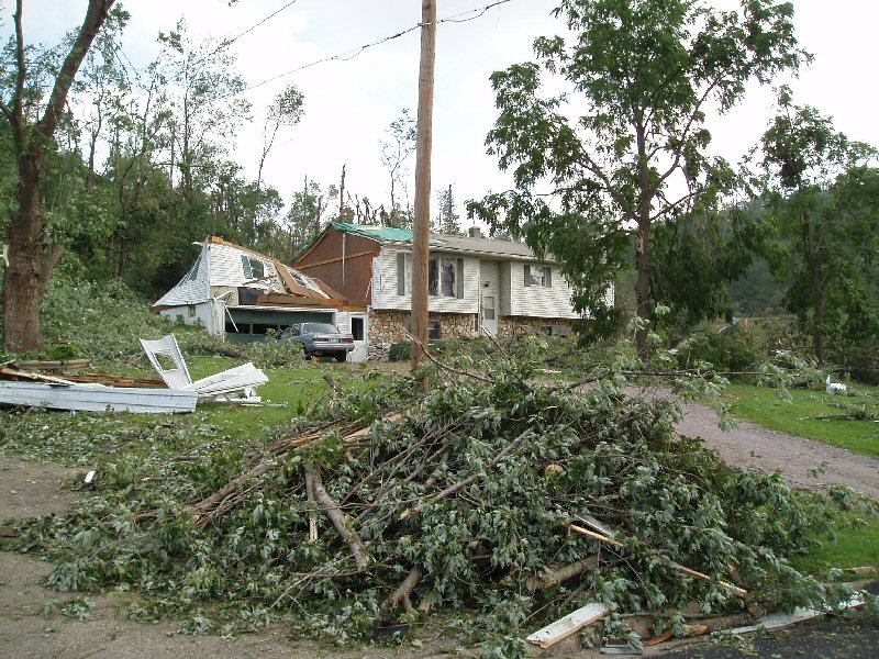
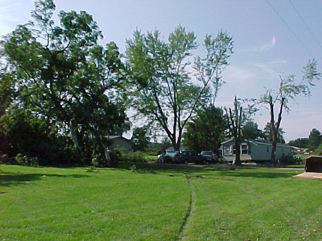
Tornado - Viola, WI
Track Map 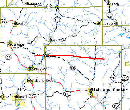 |
||||||||||||||||||||||||
|
||||||||||||||||||||||||
|
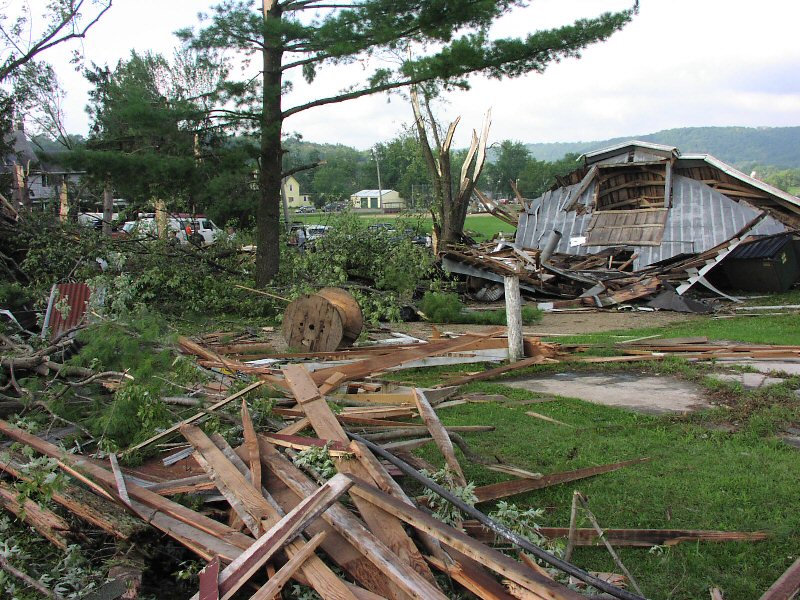
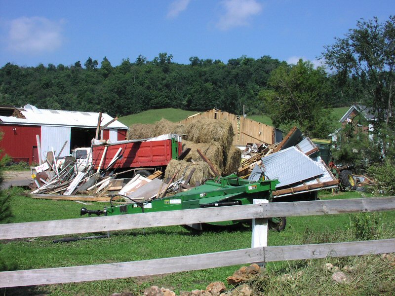
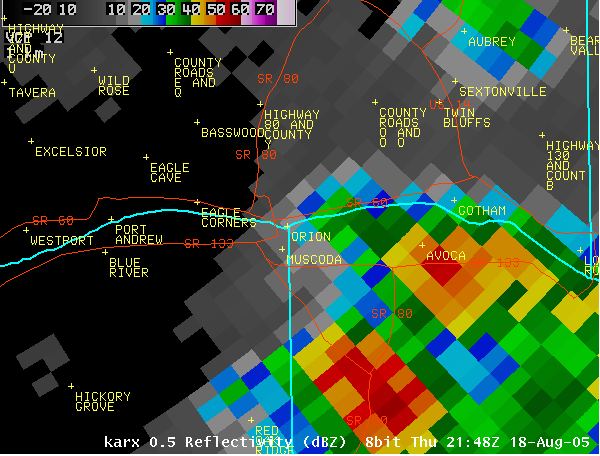
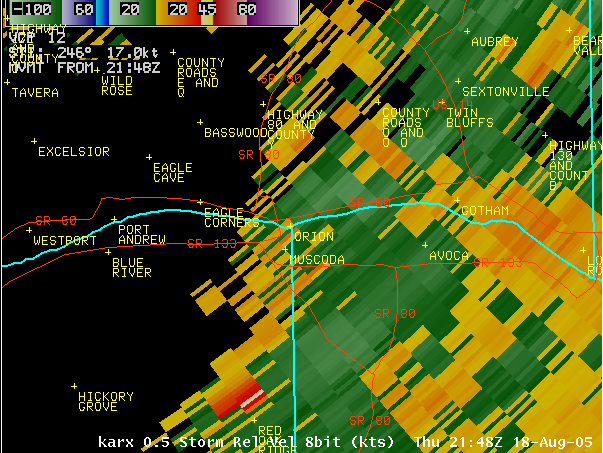
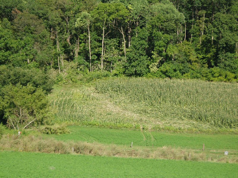
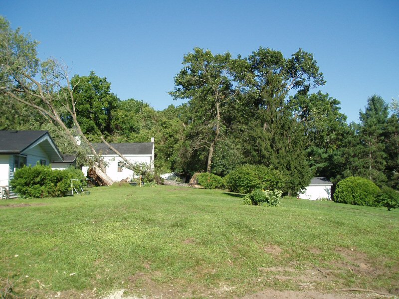
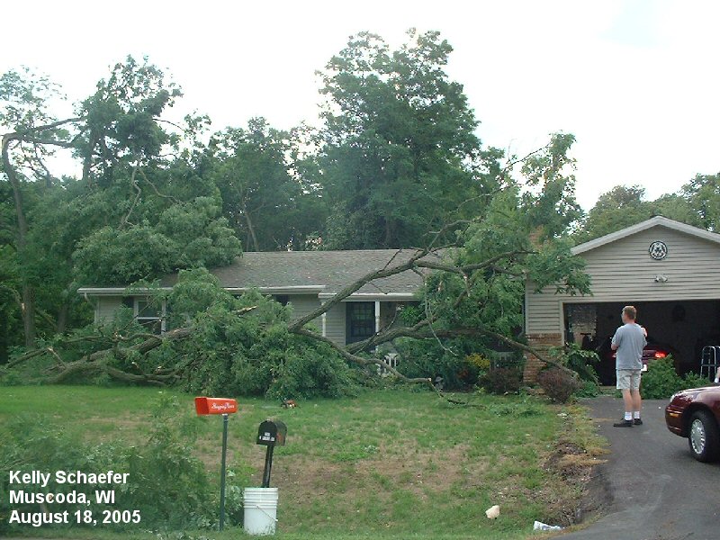
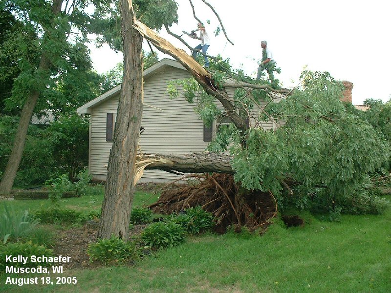
Tornado - Muscoda / Orion, WI
Track Map 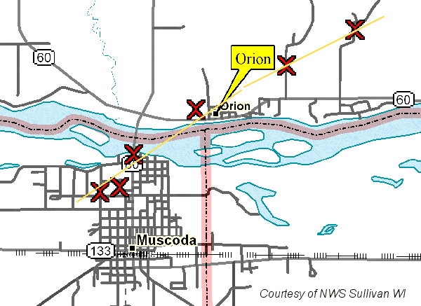 |
||||||||||||||||
|
||||||||||||||||
|
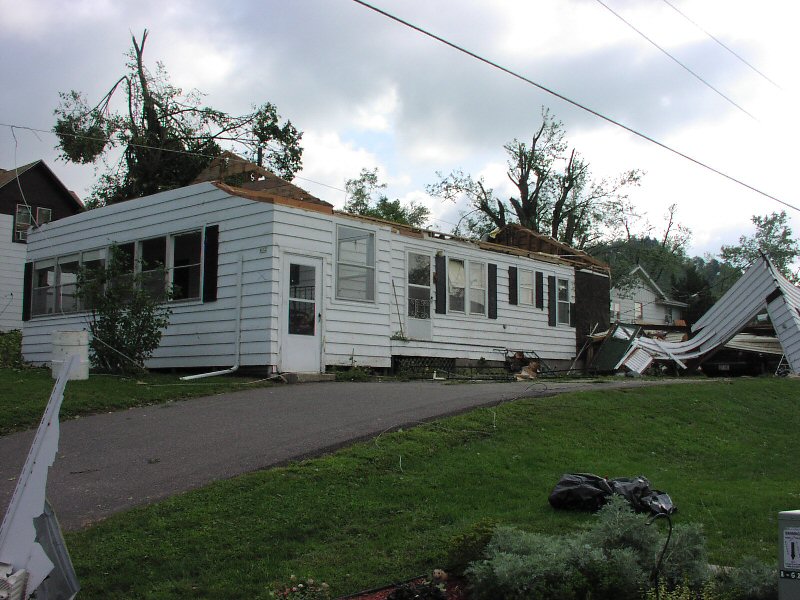
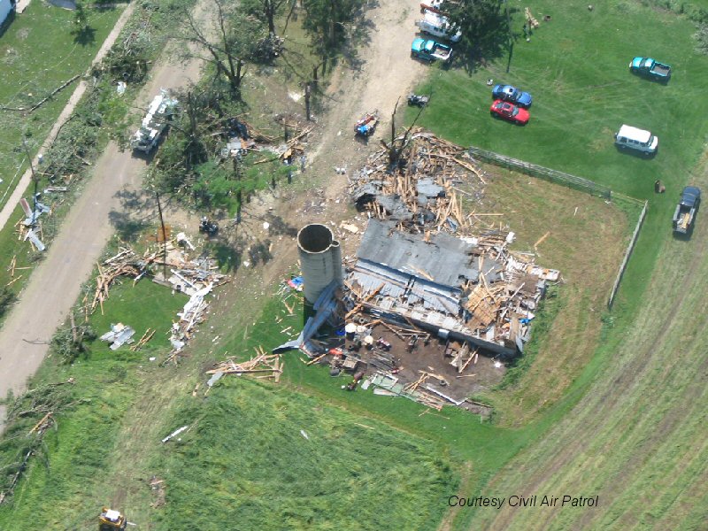
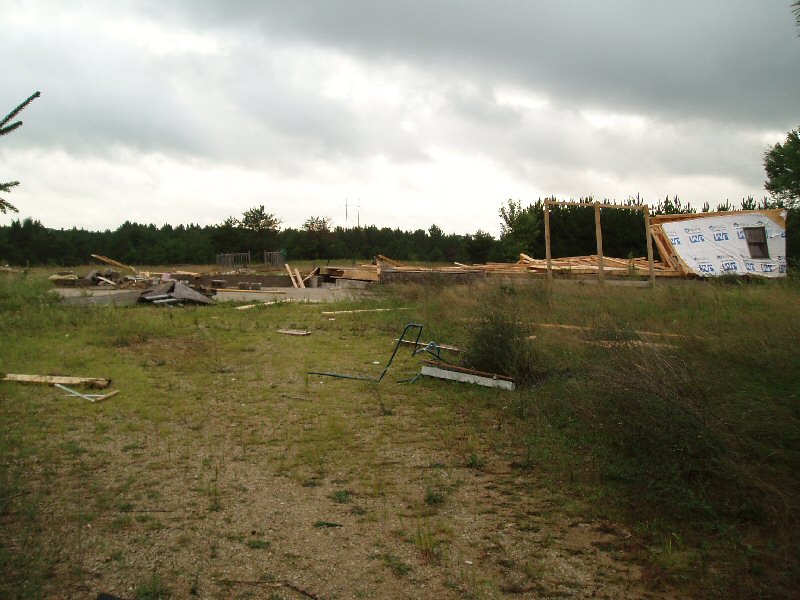
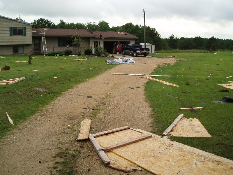
Tornado - 2 miles S of Shennington, WI
Track Map 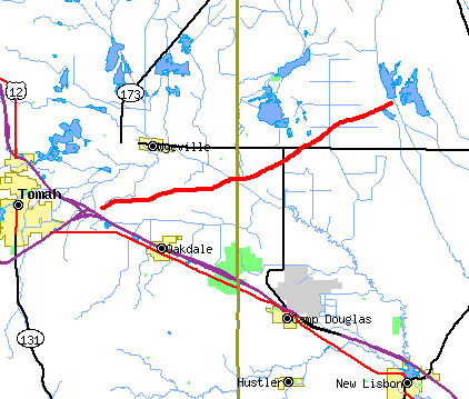 |
||||||||||||||||
|
||||||||||||||||
|
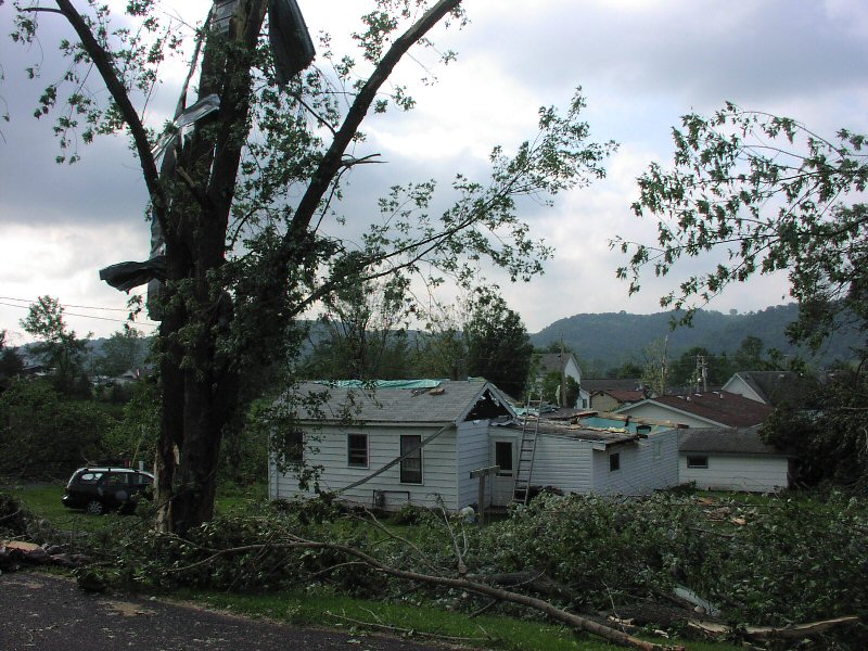
Tornado - LOCATION
Track Map |
||||||||||||||||
|
||||||||||||||||
The Enhanced Fujita (EF) Scale classifies tornadoes into the following categories:
| EF0 Weak 65-85 mph |
EF1 Moderate 86-110 mph |
EF2 Significant 111-135 mph |
EF3 Severe 136-165 mph |
EF4 Extreme 166-200 mph |
EF5 Catastrophic 200+ mph |
 |
|||||
Environment
 |
 |
|
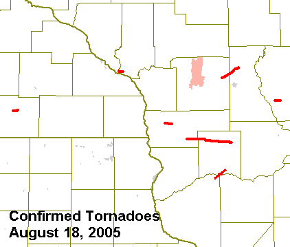
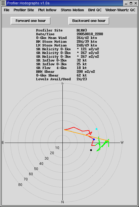
| Map of tornadoes from August 18, 2005 | Hodograph from Blue River, WI | Figure 3: Caption |
 |
Media use of NWS Web News Stories is encouraged! Please acknowledge the NWS as the source of any news information accessed from this site. |
|


 Weather Story
 Weather Map
 Local Radar