
Wildfire smoke continues to impact air quality from the Great Lakes region into New England and the Mid-Atlantic today with widespread Air Quality Alerts in effect. Severe thunderstorms are expected across portions of the Ohio Valley and Lower Great Lakes into the Mid-Atlantic and Northeast, this afternoon into the evening. Monsoonal thunderstorms may bring areas of flooding to the Southwest. Read More >
|
Emergency Management |
Contact NWS La Crosse via phone, radio, email at nws.lacrosse@noaa.gov, or NWSChat (online chat room) |
| Click anywhere on the map for the forecast. Turn the various weather parameters "on and off" using the display options at right. Hover over a highlighted area to see the hazard. |
Map Display Options |
|
Hourly Forecast Forecast Discussion Current Conditions Regional Hazards Storm Reports DSS Packet Hazardous Weather Outlook (Text) Hazardous Weather Outlook (Graphical) |
|
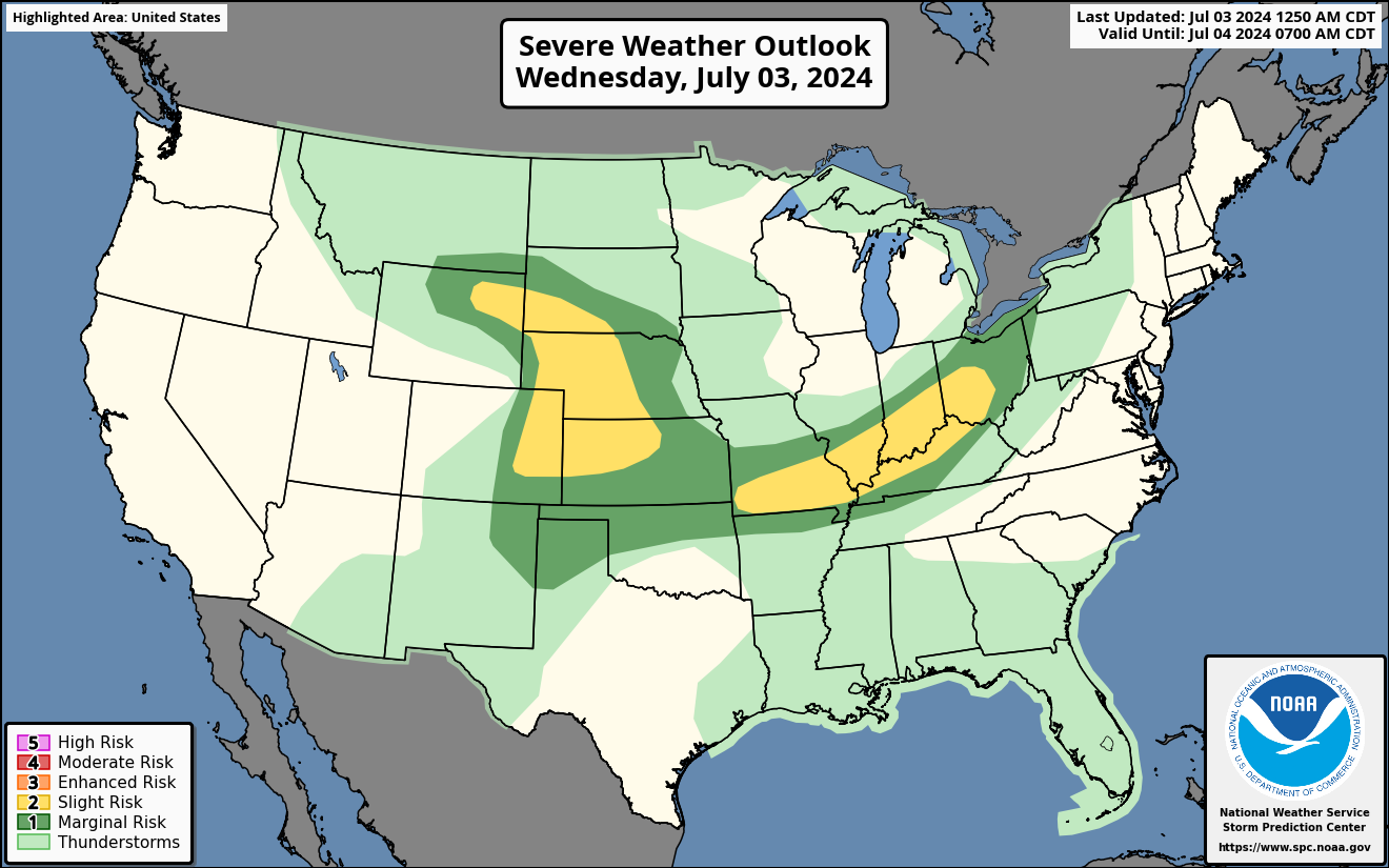
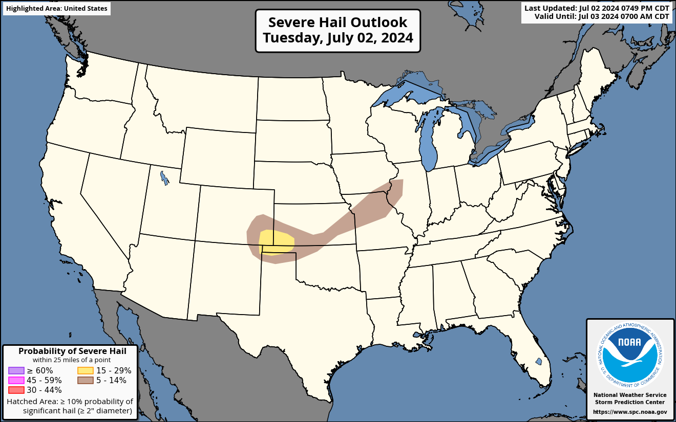
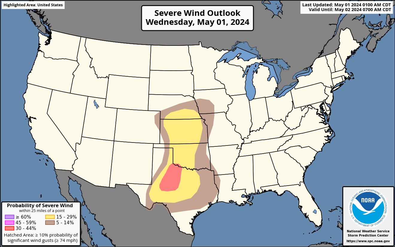
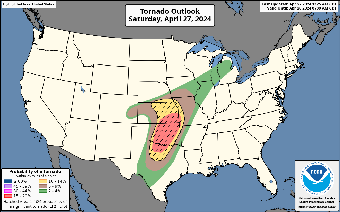
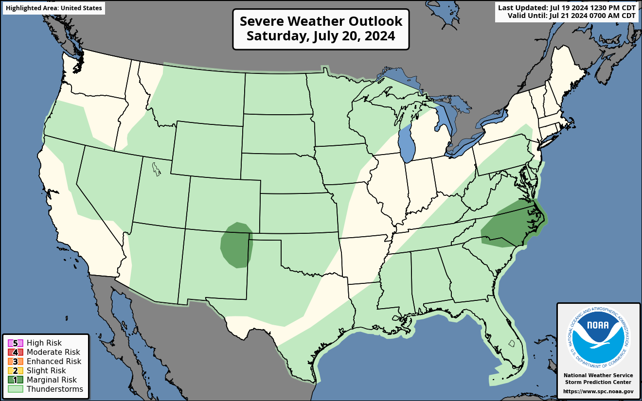
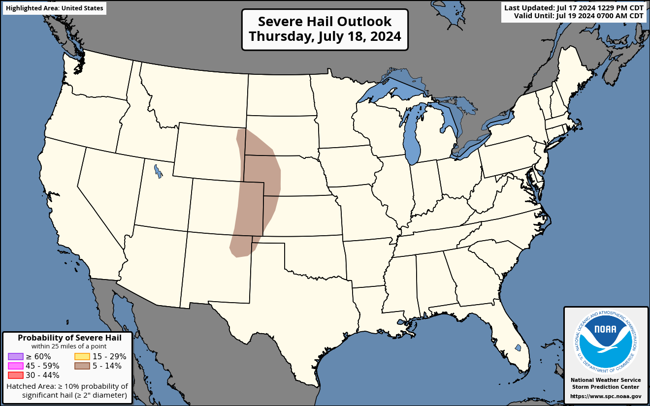
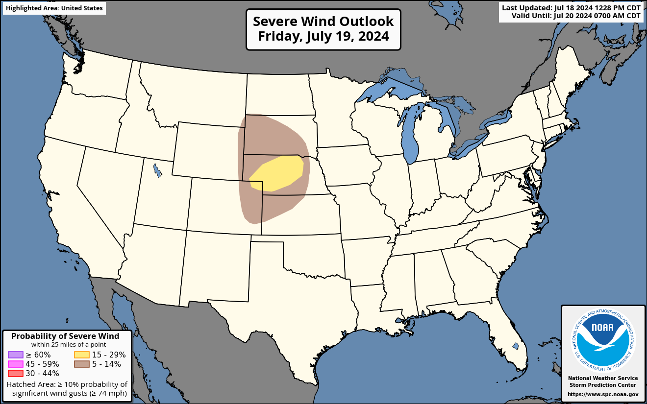
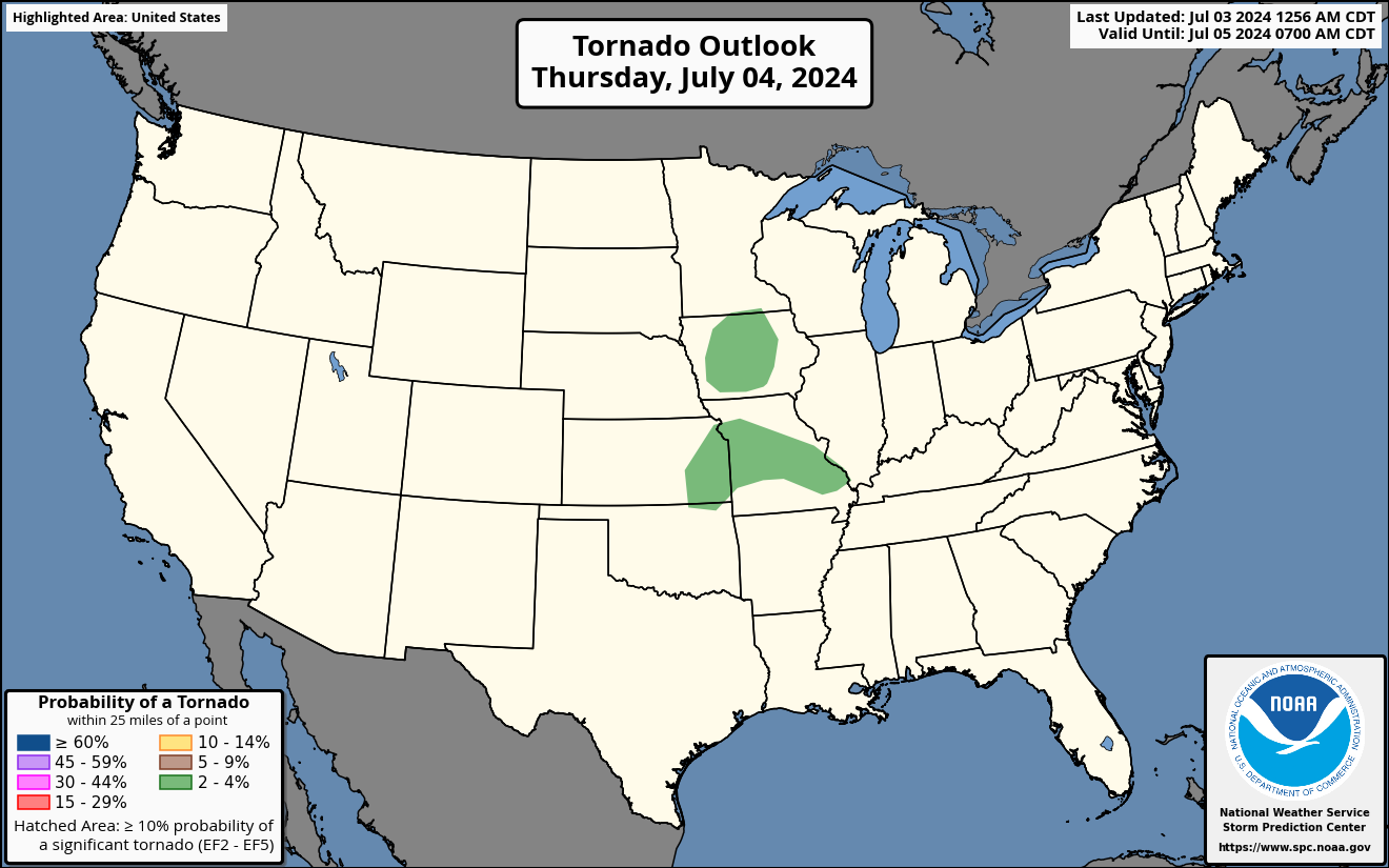
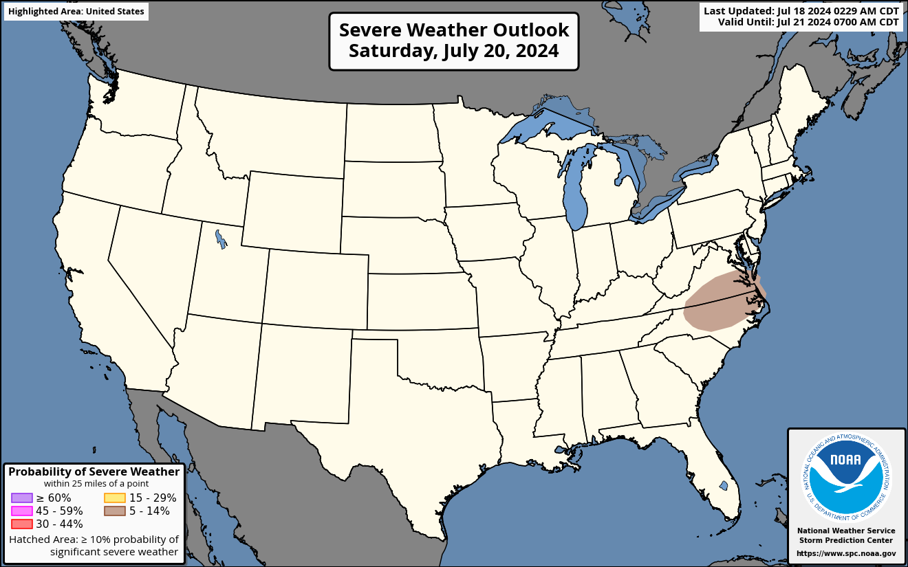
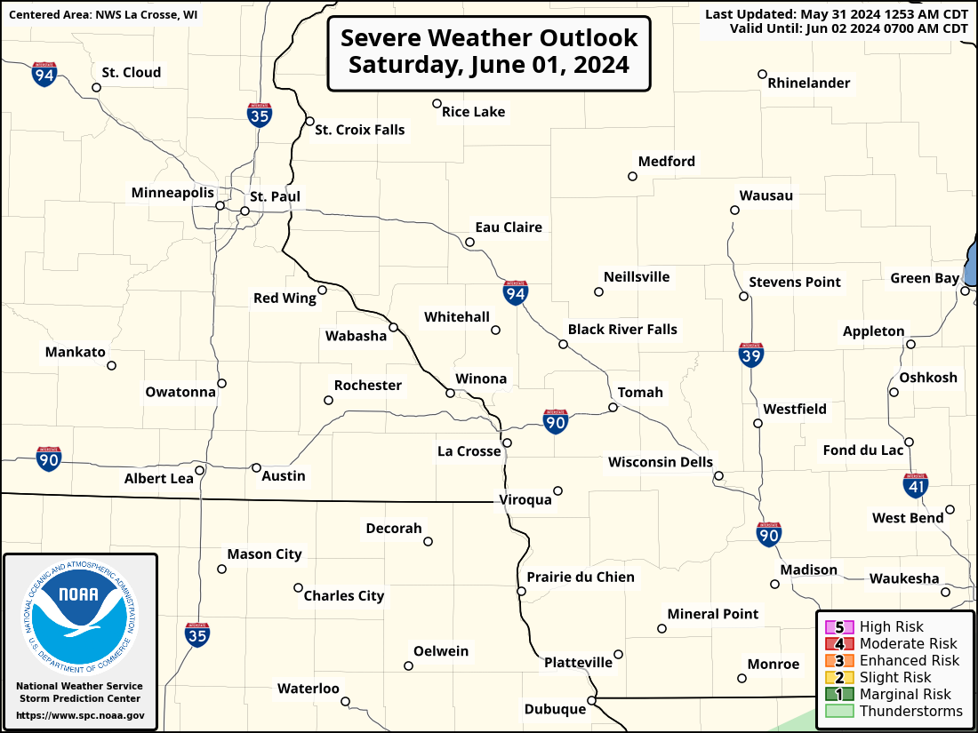
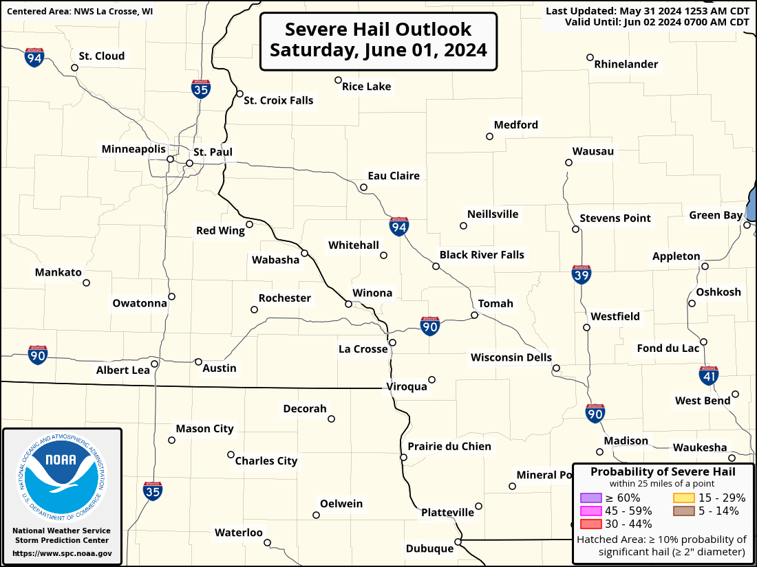
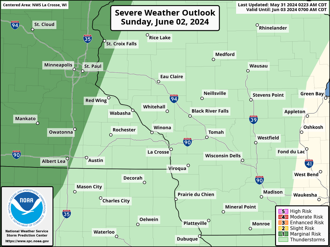
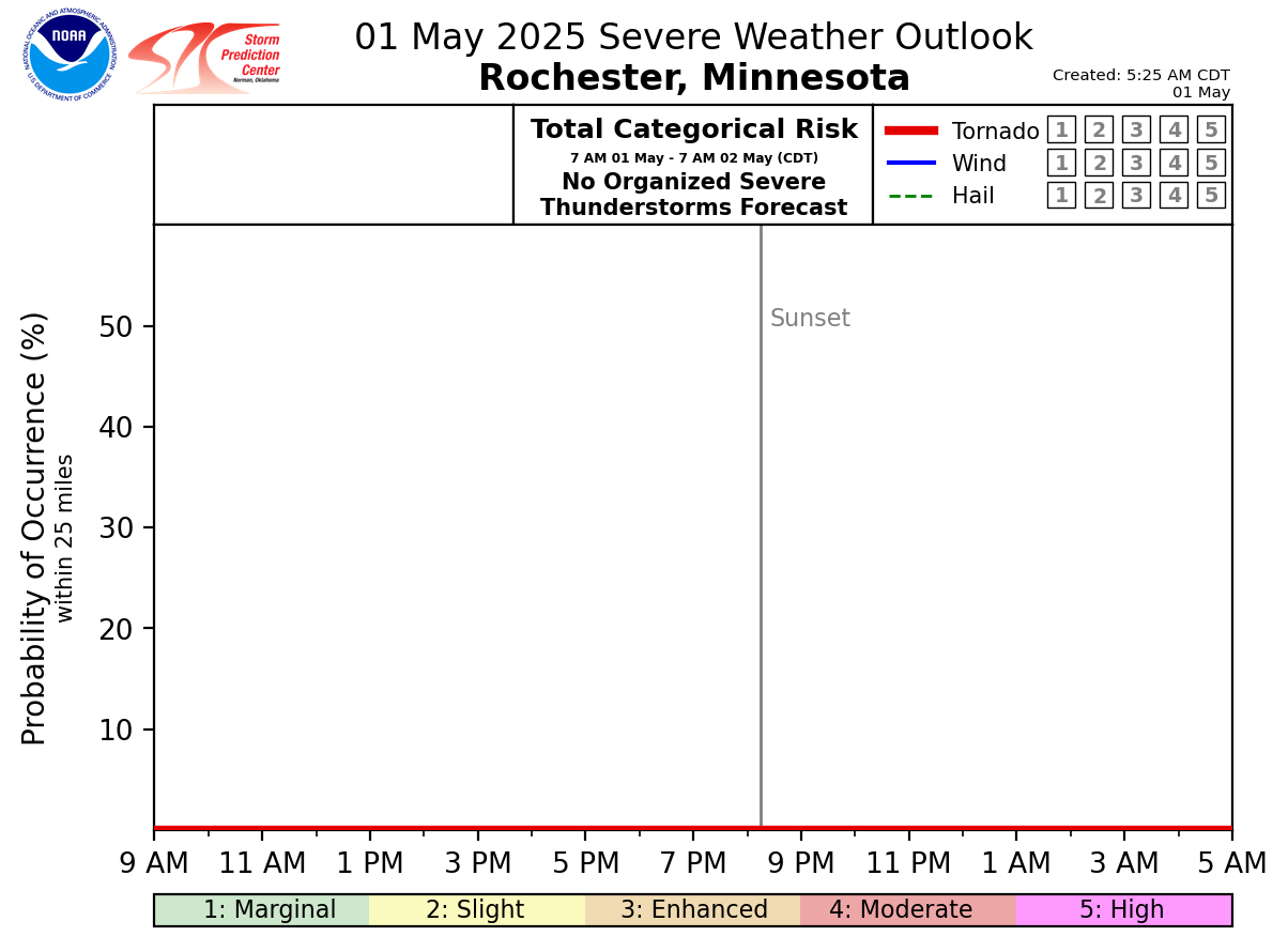
National Severe Weather Outlooks (Explanation of Risk Categories)
| Today / Tonight | Tomorrow / Tomorrow Night | Day 3 | Days 4-8 | ||||||||||||||||||||
|
|
|
 |
||||||||||||||||||||
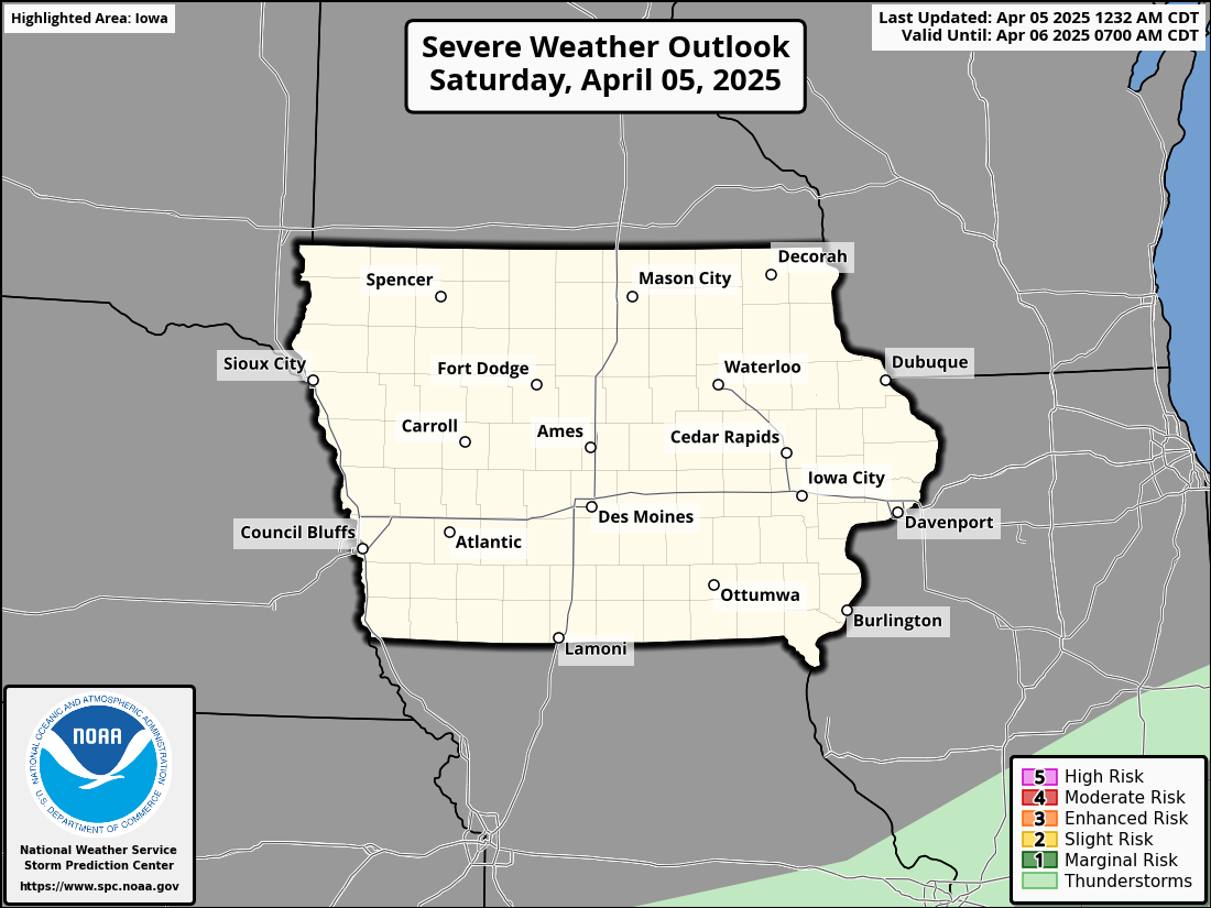
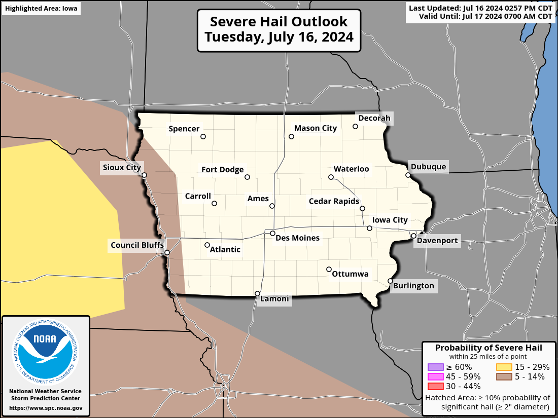
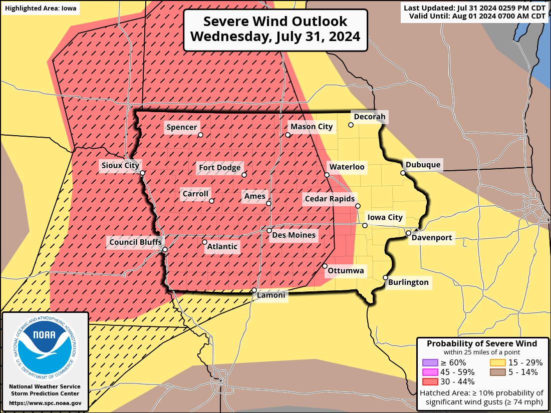
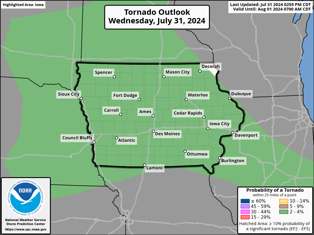
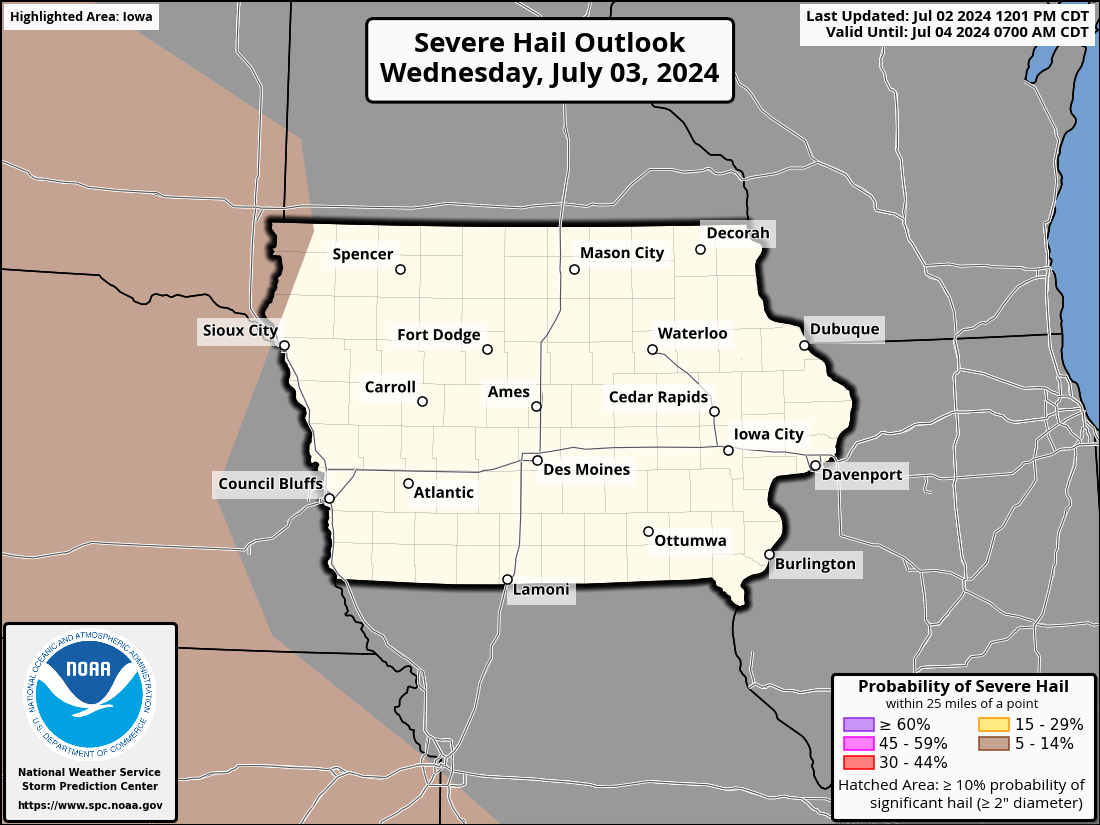
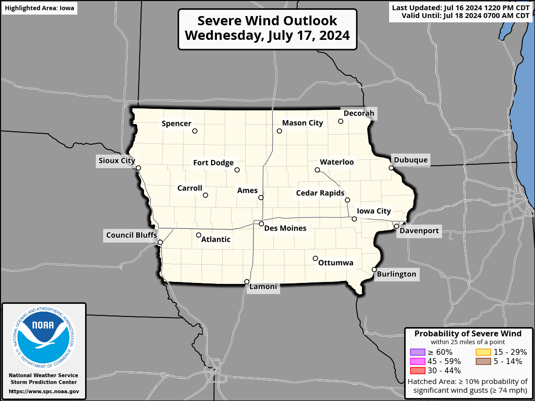
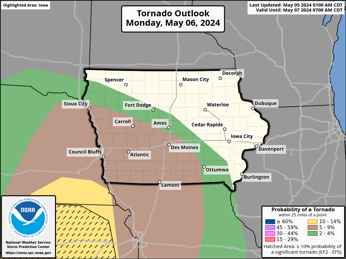
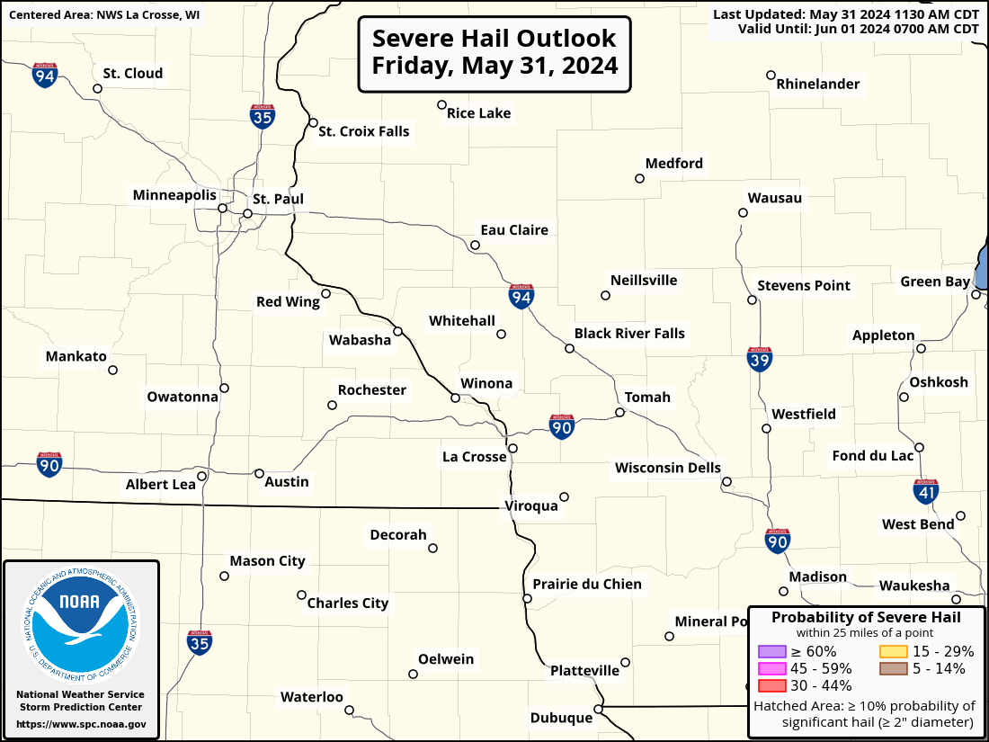
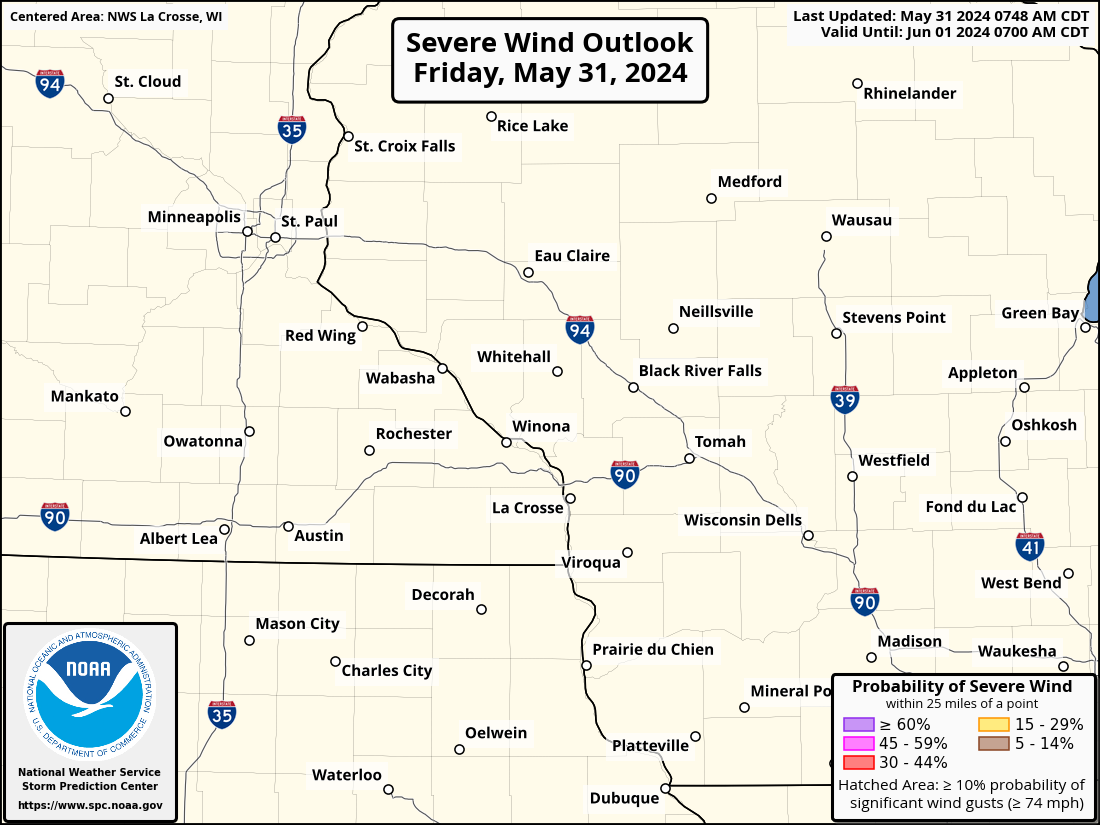
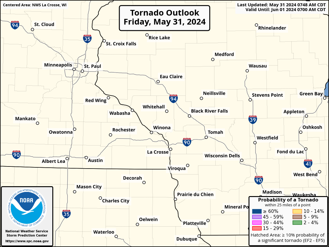
Iowa Severe Weather Outlooks
| Today / Tonight | Tomorrow / Tomorrow Night | Day 3 | |||||||||||||||||
|
|
|
|||||||||||||||||
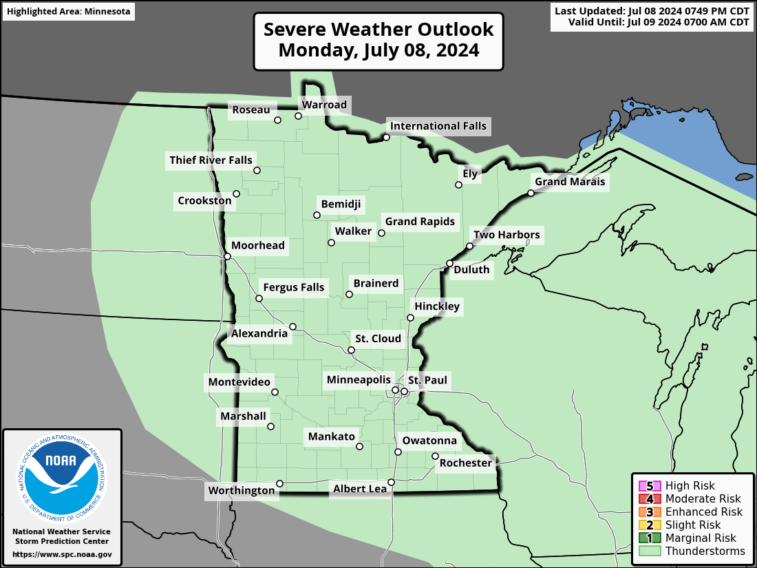
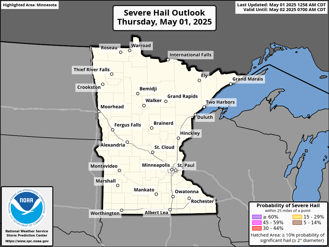
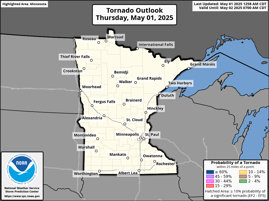
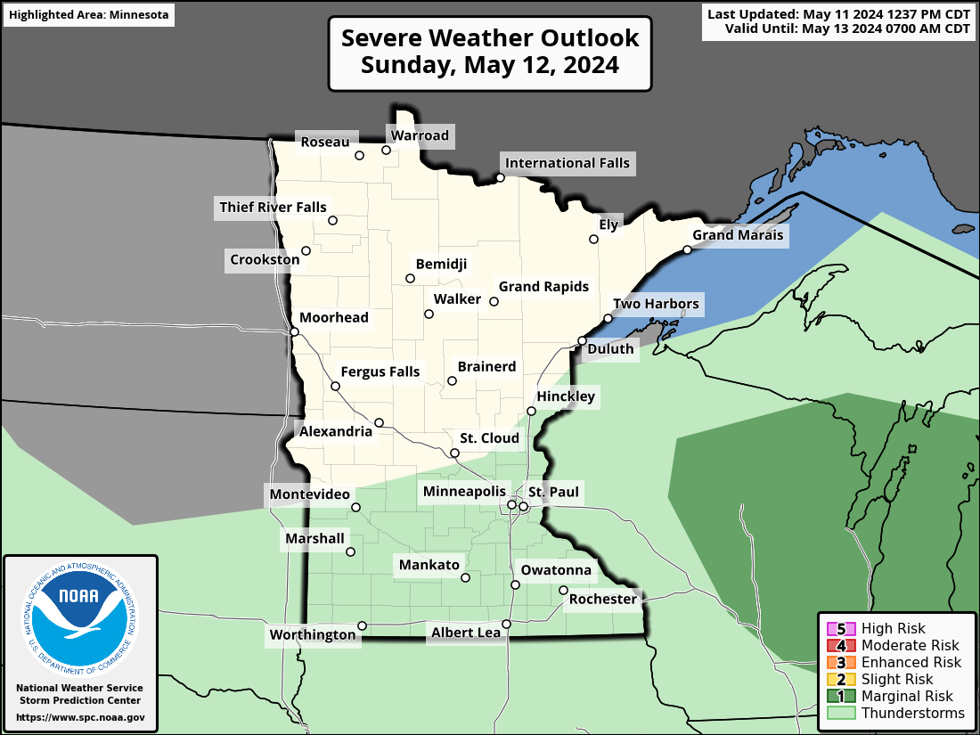
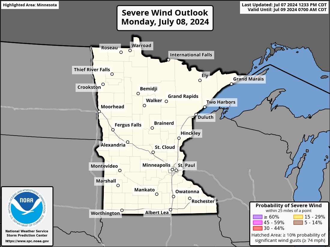
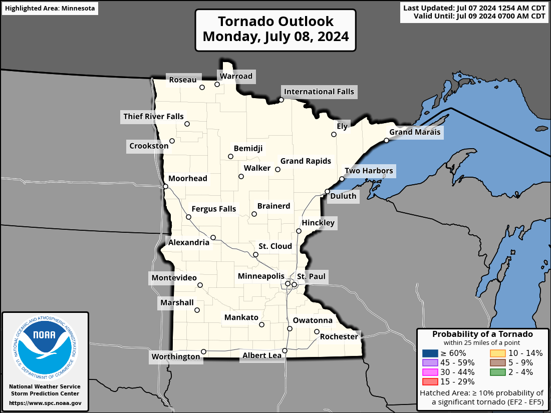
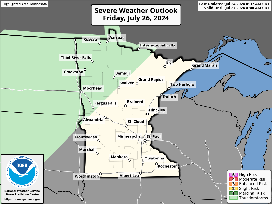
Minnesota Severe Weather Outlooks
| Today / Tonight | Tomorrow / Tomorrow Night | Day 3 | |||||||||||||||||
|
|
|
|||||||||||||||||
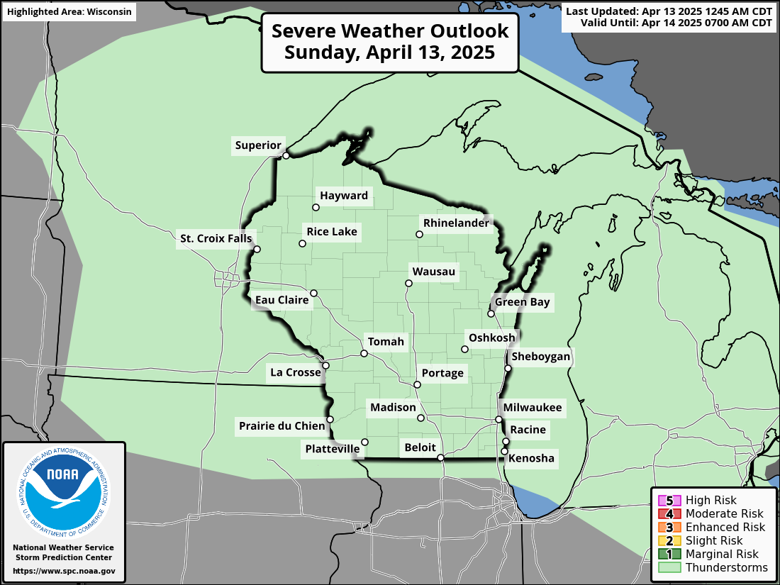
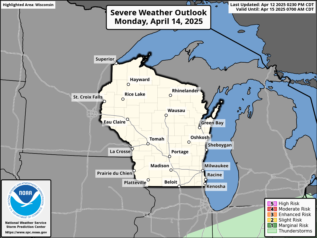
Wisconsin Severe Weather Outlooks
| Today / Tonight | Tomorrow / Tomorrow Night | Day 3 | |||||||||||||||||
|
|
|
|||||||||||||||||
Local Severe Weather Outlooks
| Today / Tonight | Tomorrow / Tomorrow Night | Day 3 | |||||||||||||||||
|
|
|
|||||||||||||||||
| Local Severe Weather Timing Guidance - TODAY | ||
|
|
|
|
| Local Severe Weather Timing Guidance - TOMORROW (images typically populate by 11 AM CDT) | ||
|
|
|
|
Regional Radar Imagery
| Local, Regional, & National Radar | ||||
La Crosse |
Regional Radar |
National Radar |
||
| Neighboring NWS Radars | ||||||||||
Duluth |
Twin Cities |
Des Moines |
Quad Cities |
Milwaukee |
Green Bay |
|||||
Regional Satellite Imagery
| GeoColor | Visible | Visible/IR Sandwich | Day/Night Cloud Micro Combo |
 |
 |
 |
 |
| Fire Temperature | Hot Spot Detection | Infrared | Water Vapor |
 |
 |
 |
 |
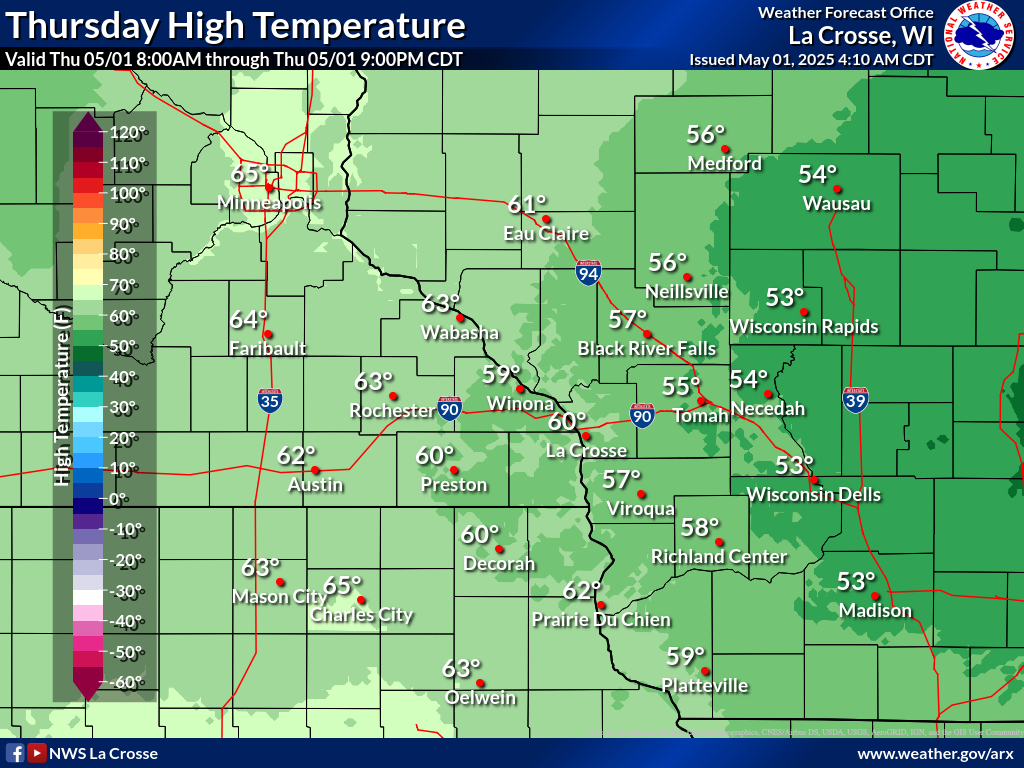
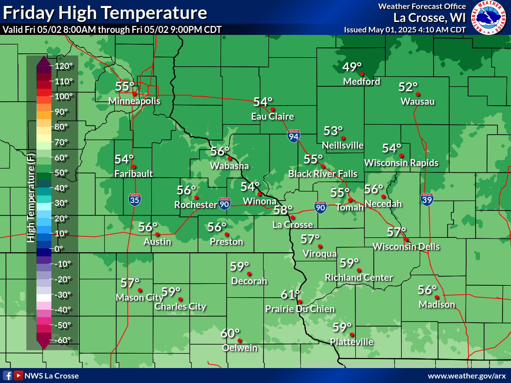
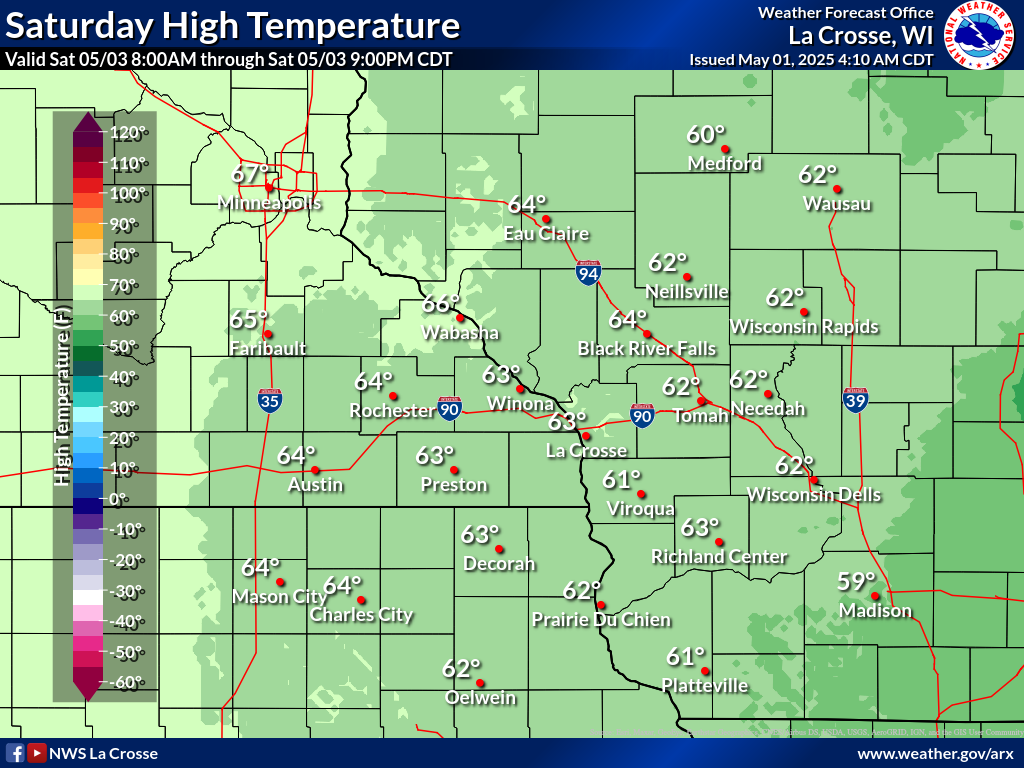
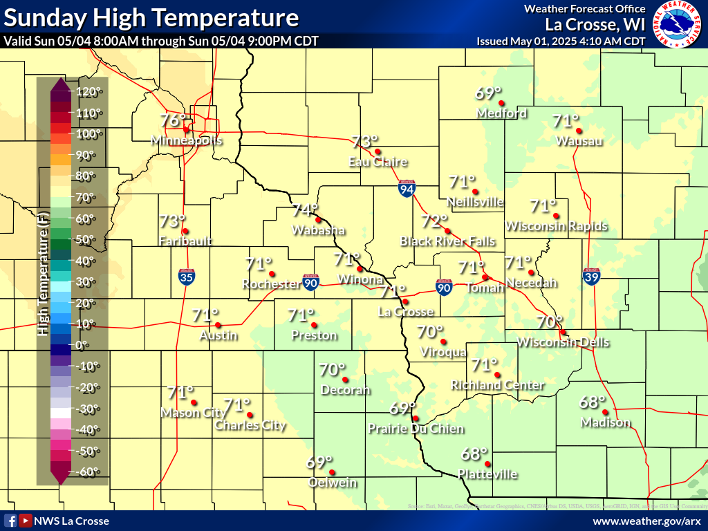
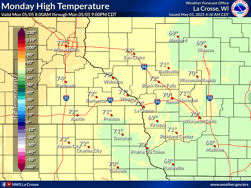
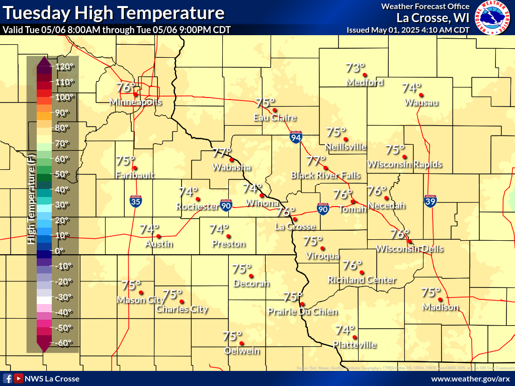
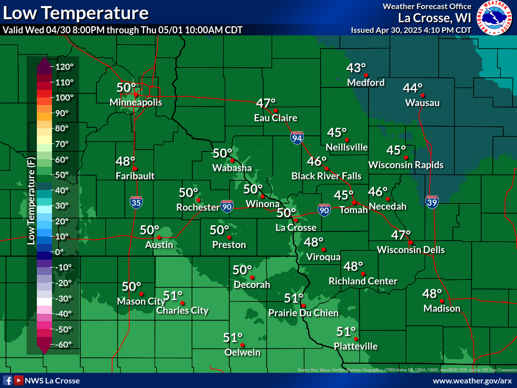
Temperature Forecasts
| Forecast Highs | ||||||
 |
 |
 |
 |
 |
 |
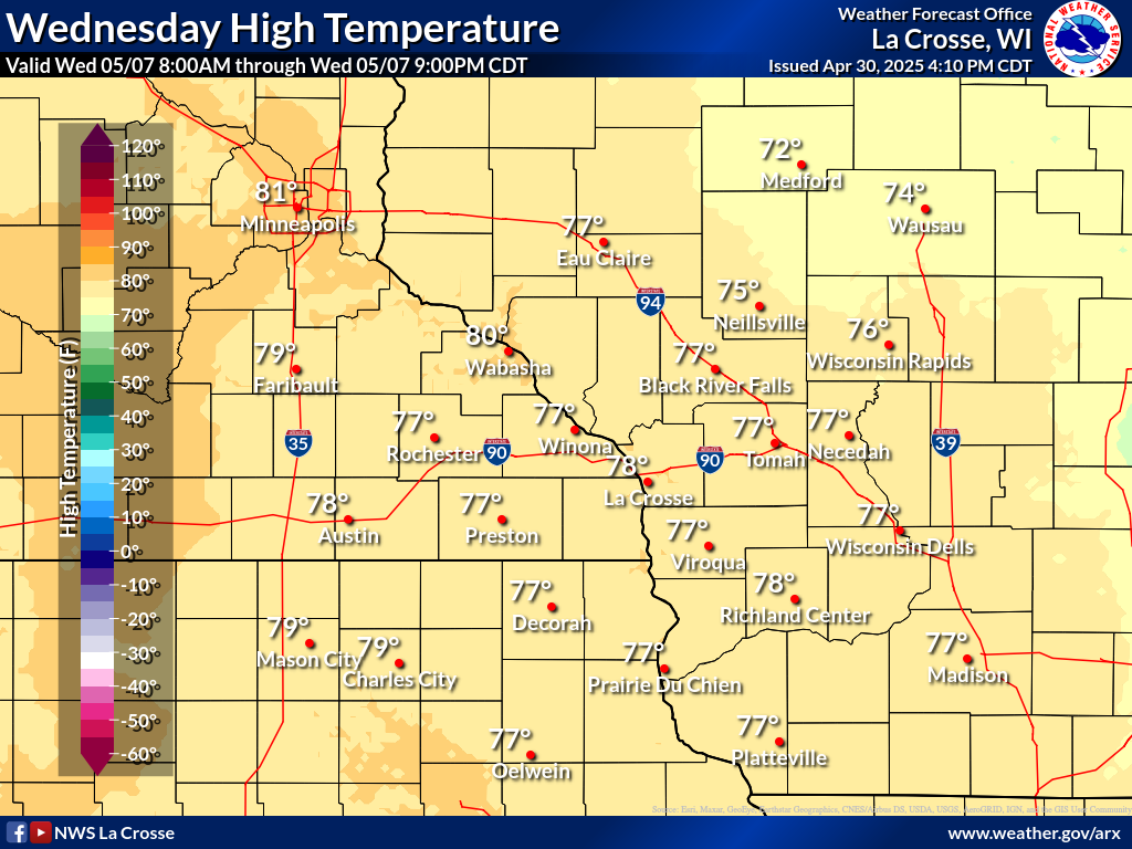 |
| Day 1 | Day 2 | Day 3 | Day 4 | Day 5 | Day 6 | Day 7 |
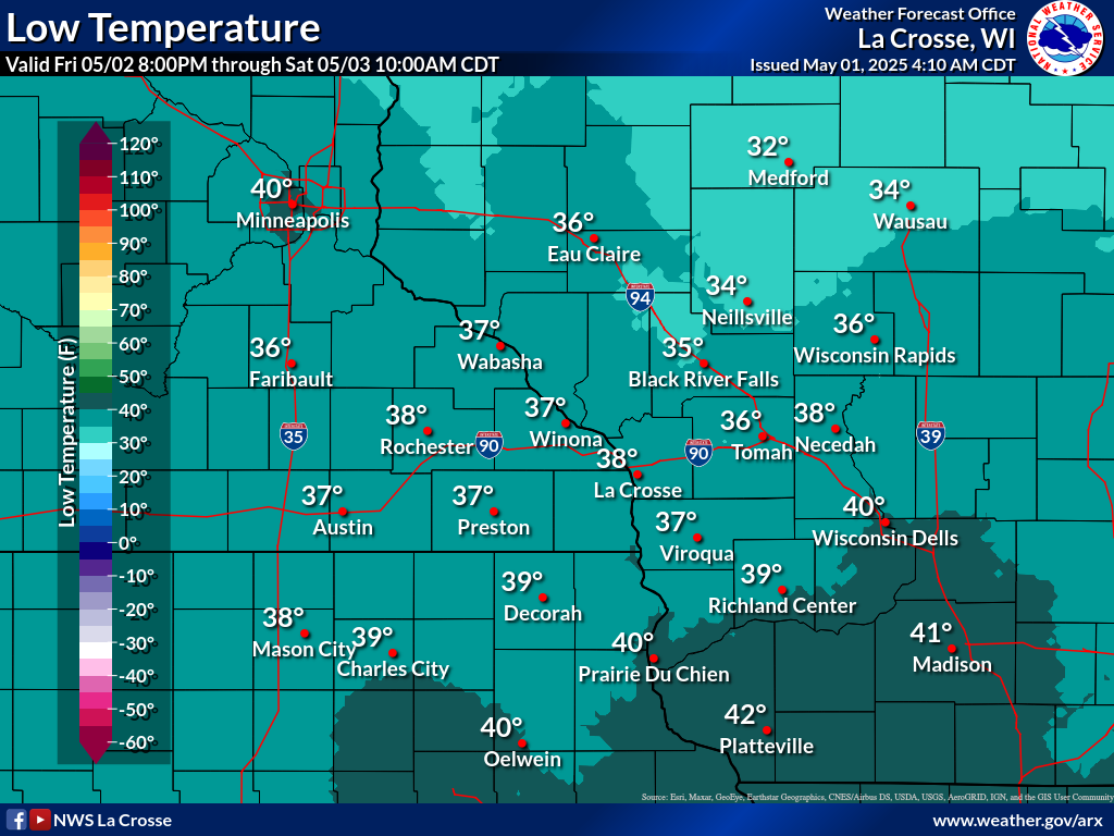
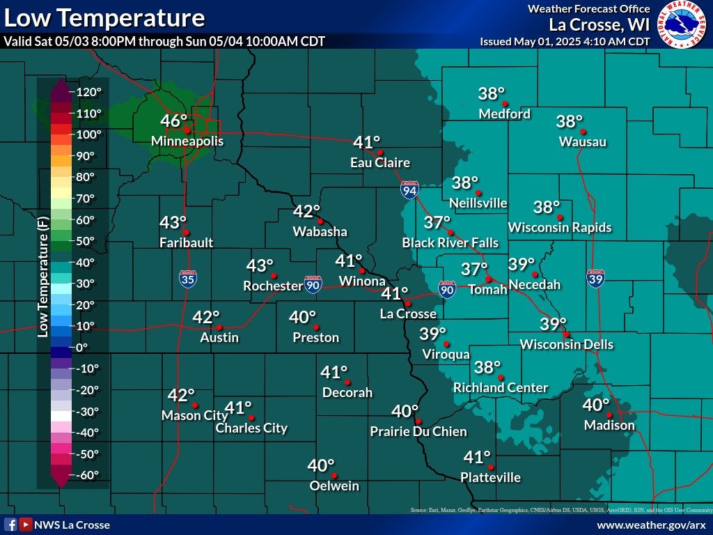
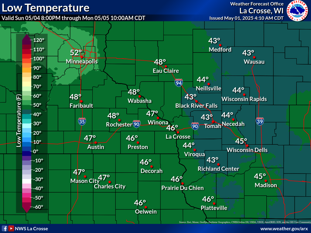
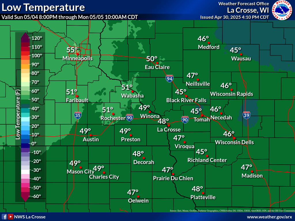
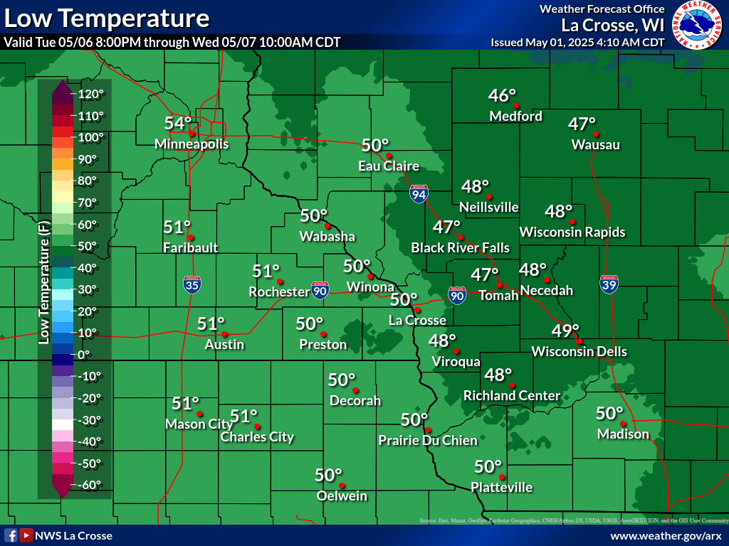
| Forecast Lows | ||||||
 |
 |
 |
 |
 |
 |
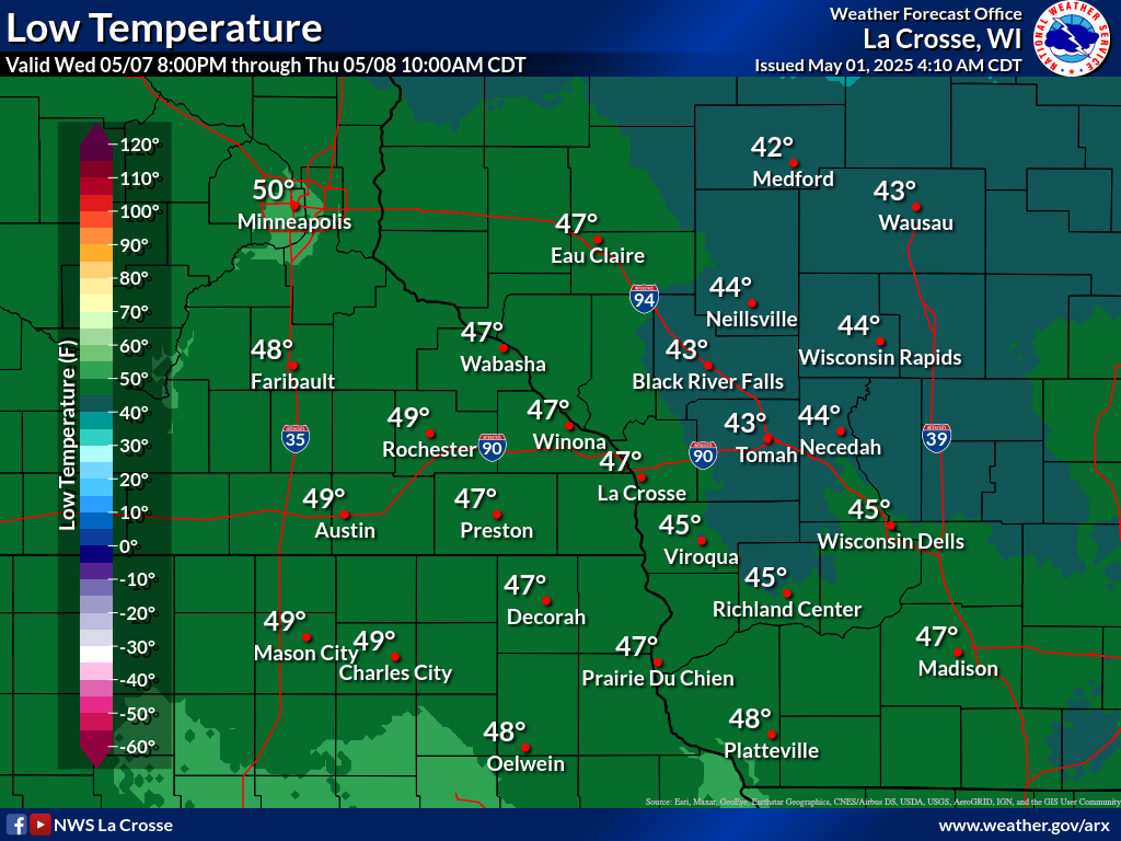 |
| Day 1 | Day 2 | Day 3 | Day 4 | Day 5 | Day 6 | Day 7 |
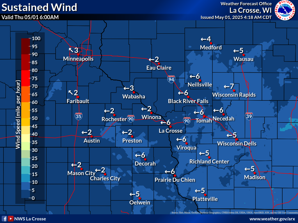
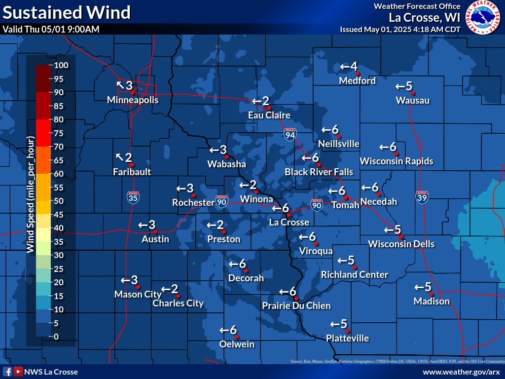
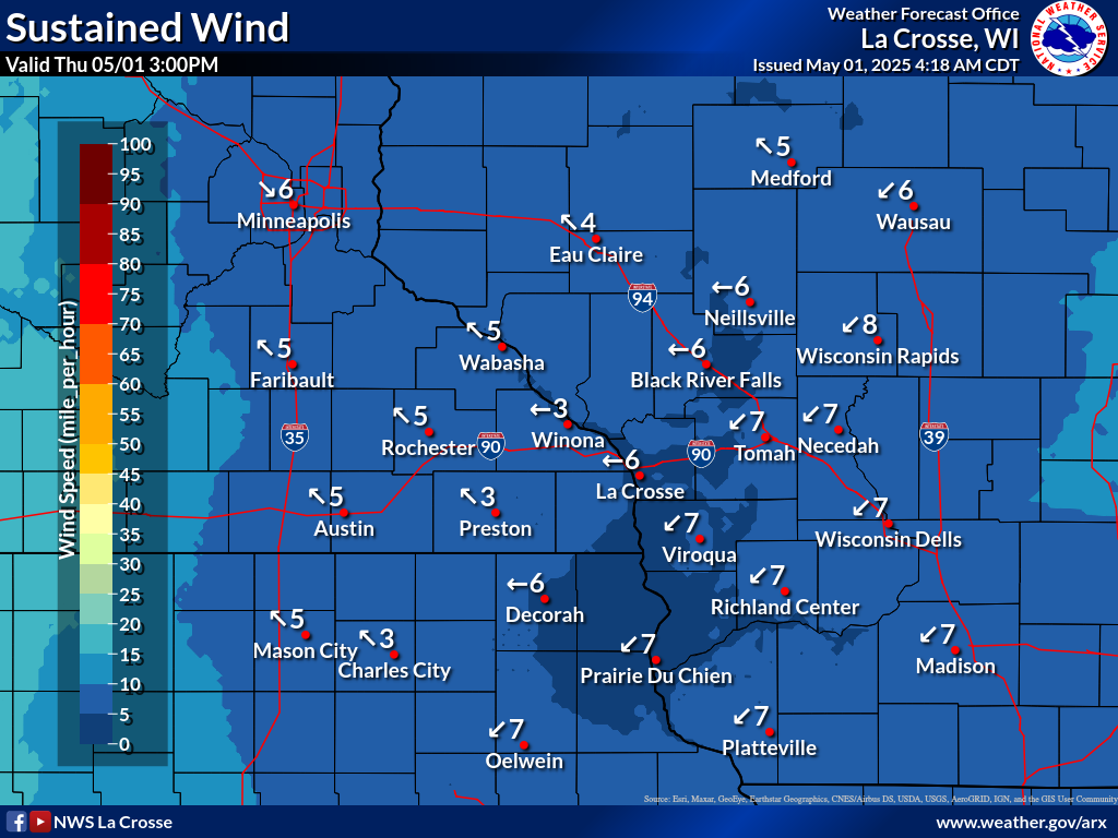
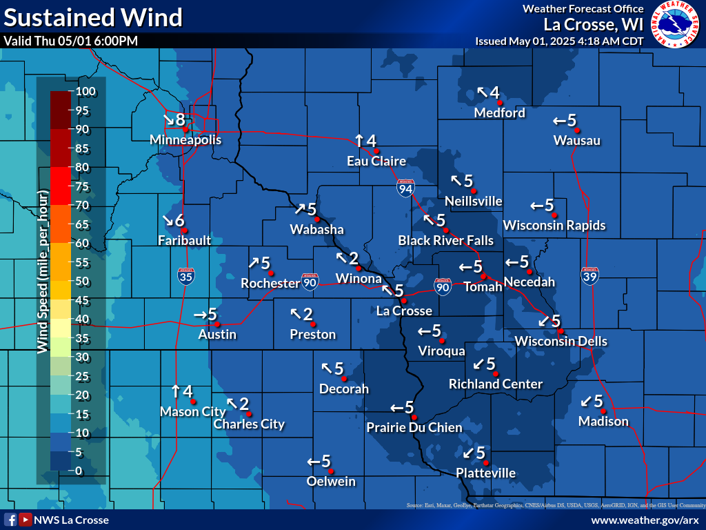
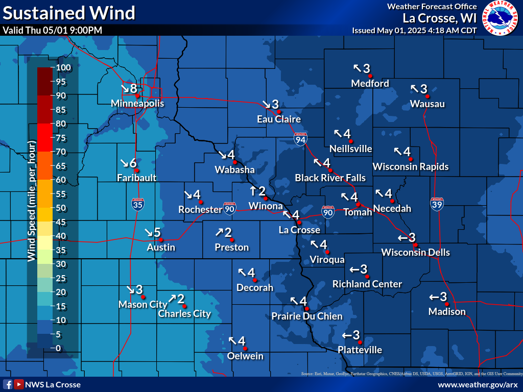
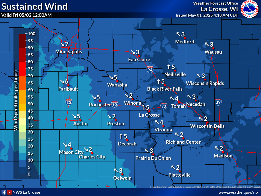
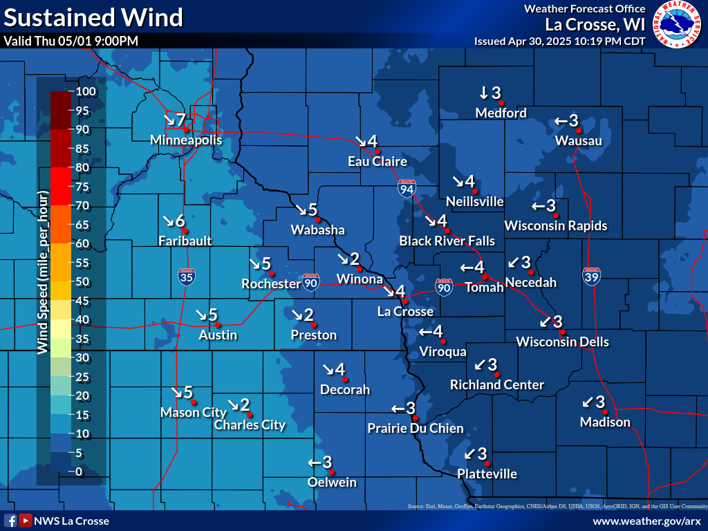
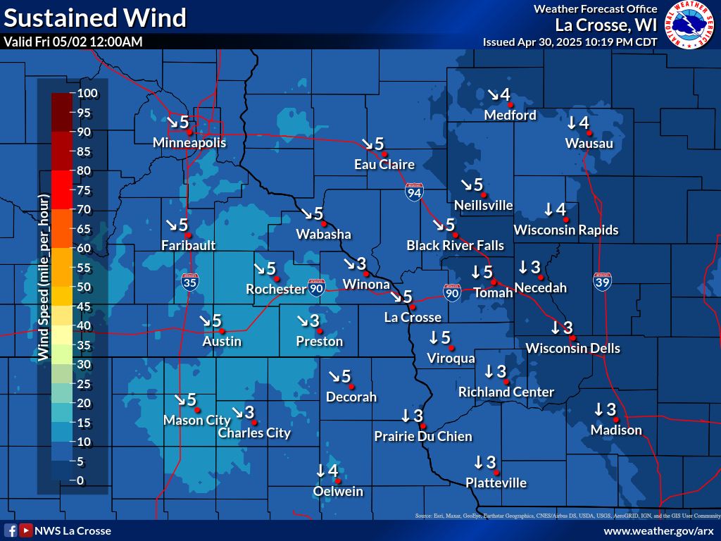
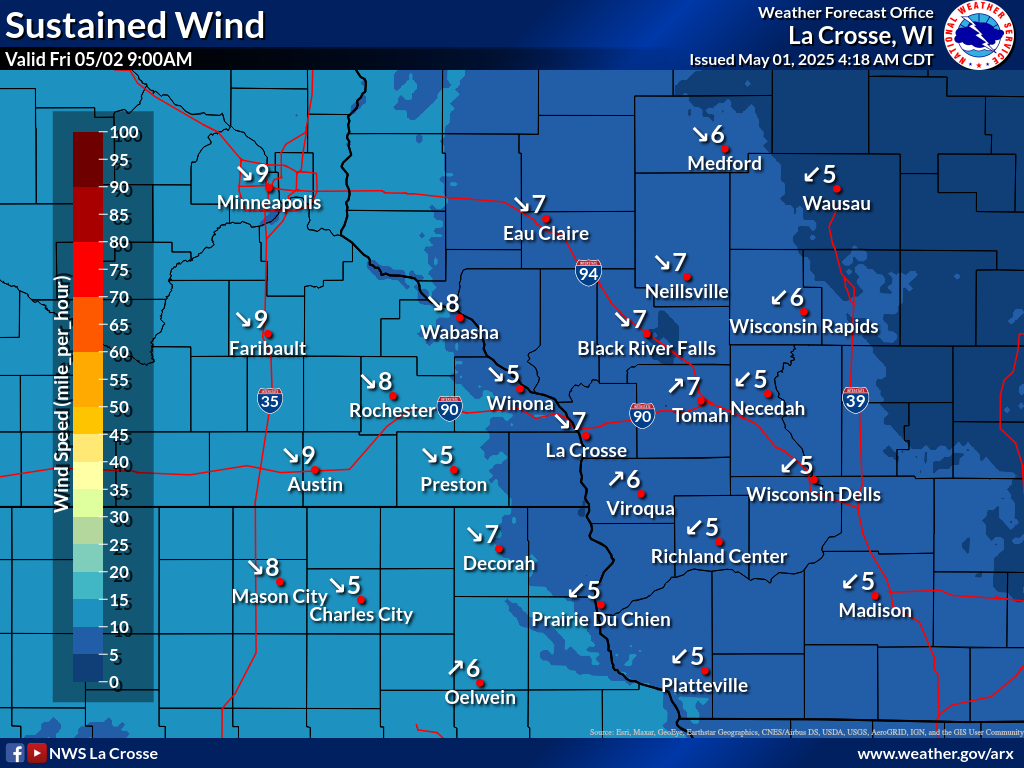
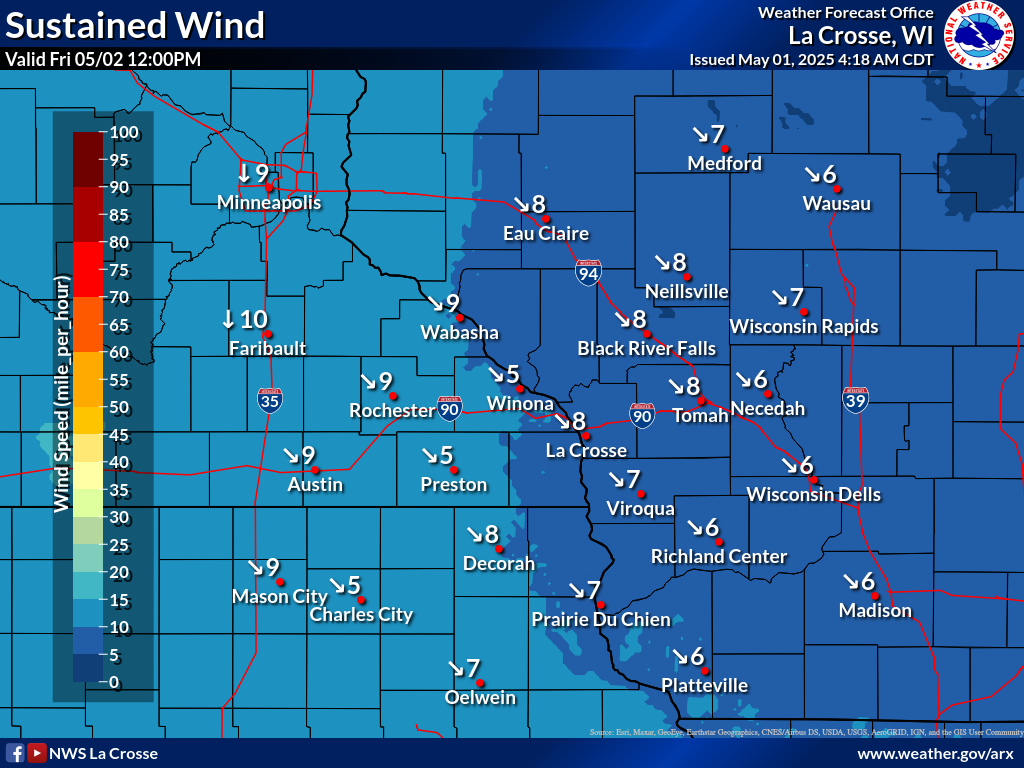
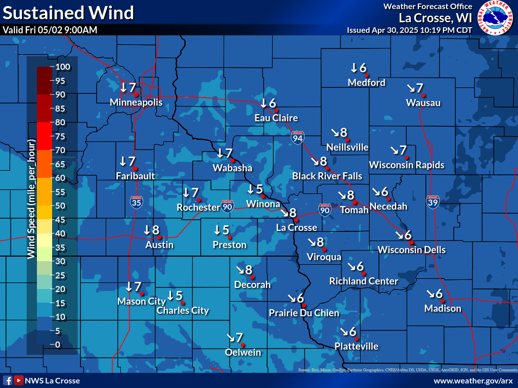
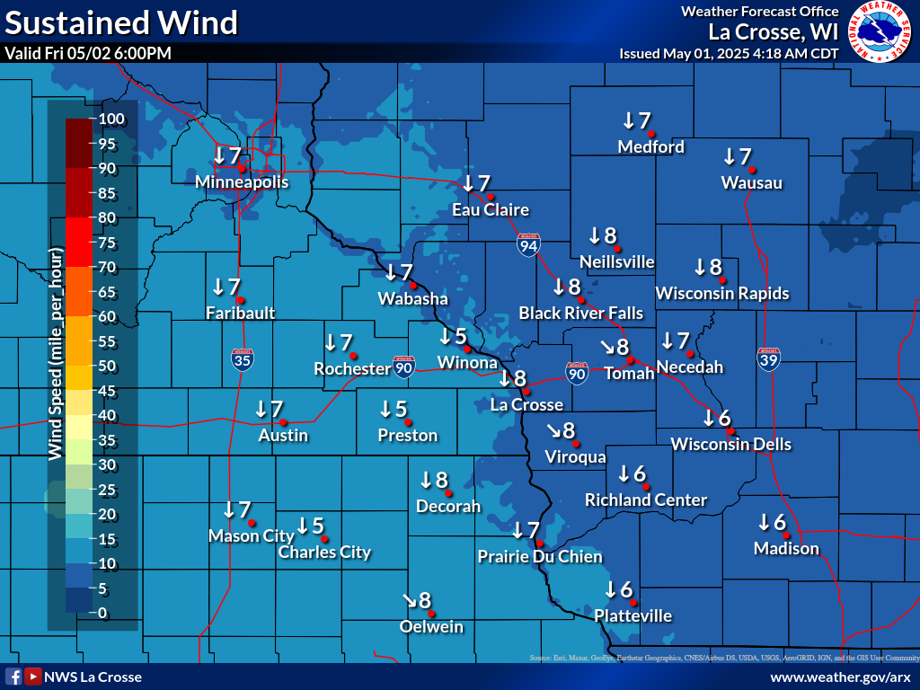
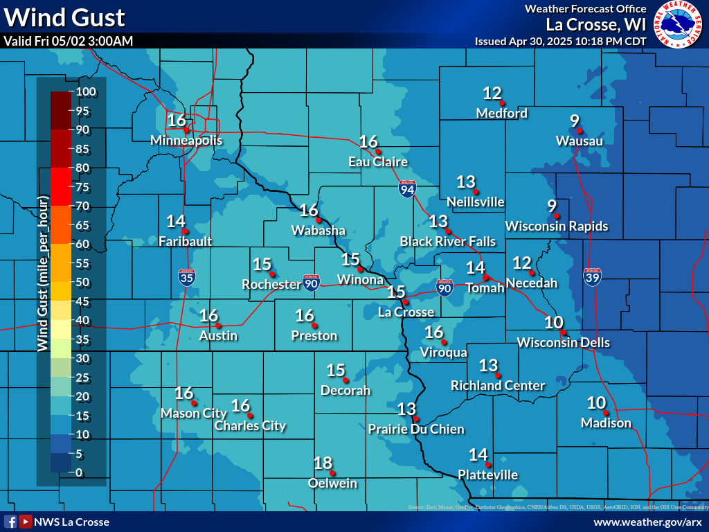
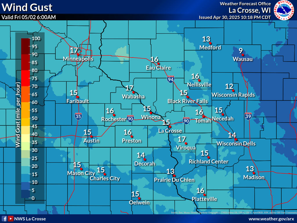
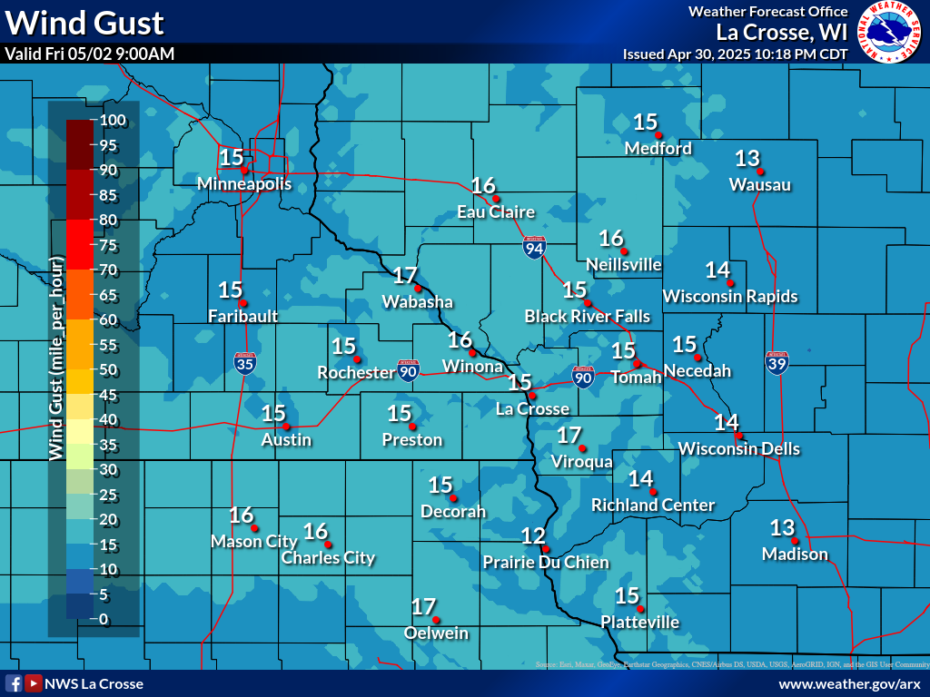
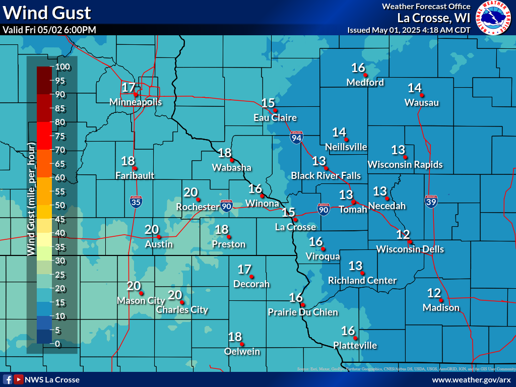
Wind Forecasts
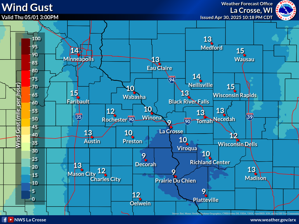
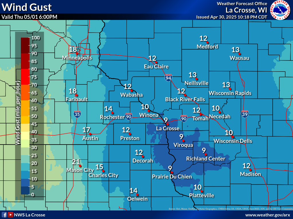
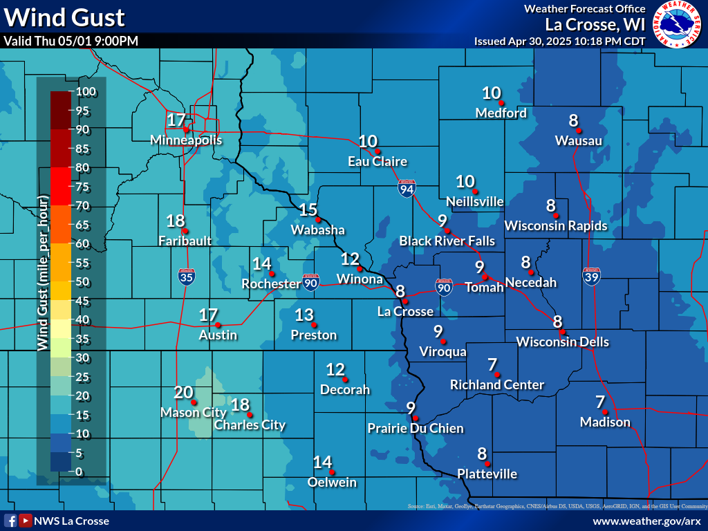
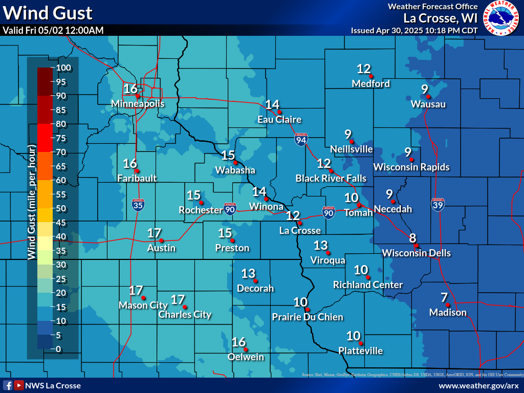
| 3-Hour Forecast Sustained Winds and Wind Gusts | ||||||||||||||||||||||||||||||||||||||||||||||||||||
|
||||||||||||||||||||||||||||||||||||||||||||||||||||
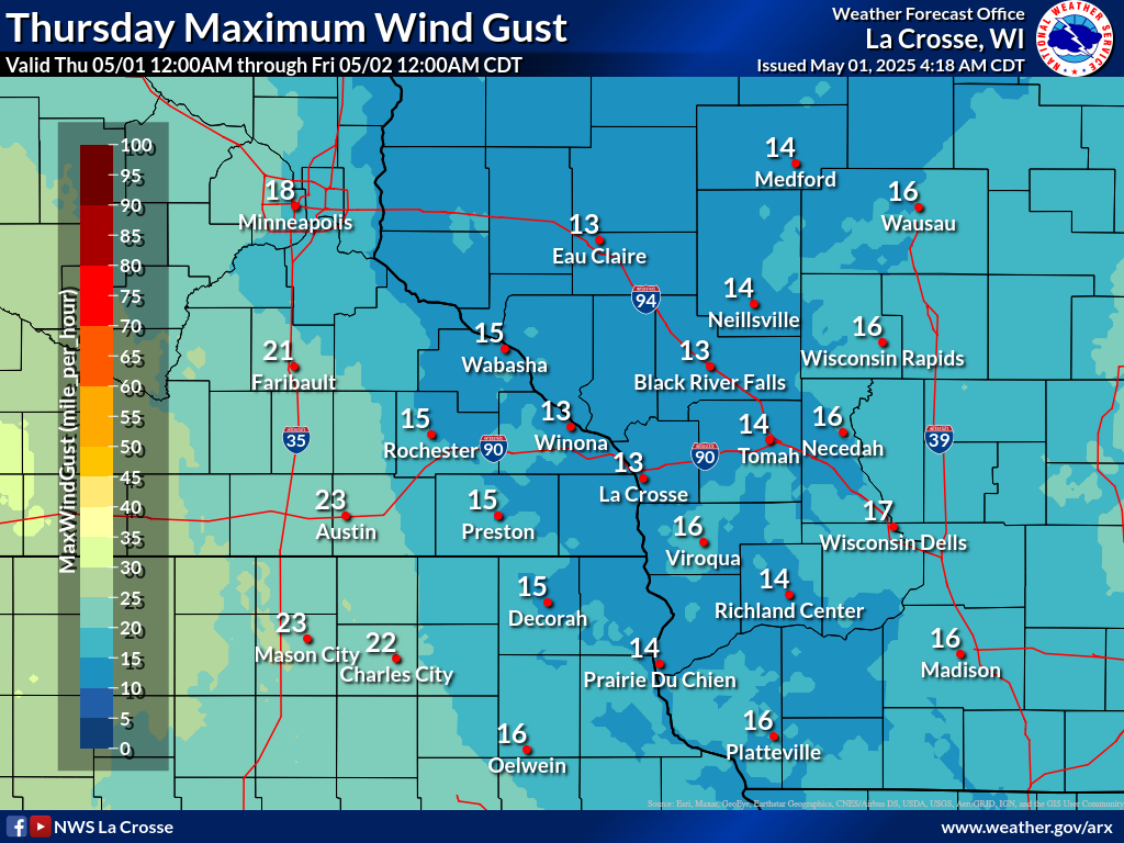
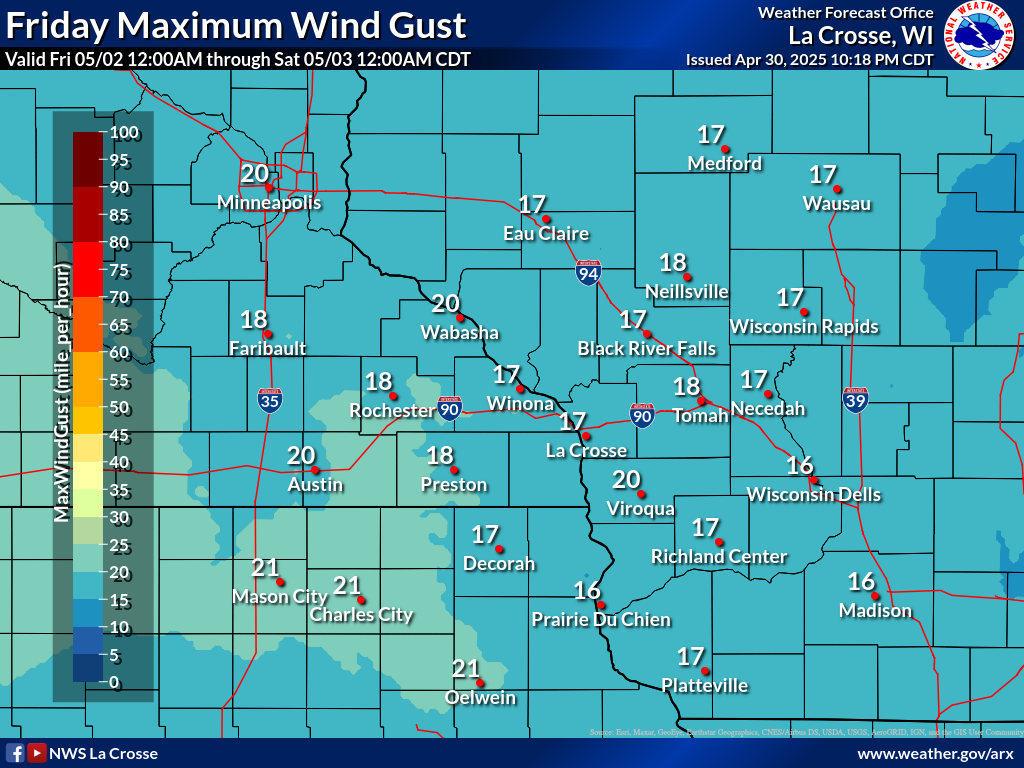
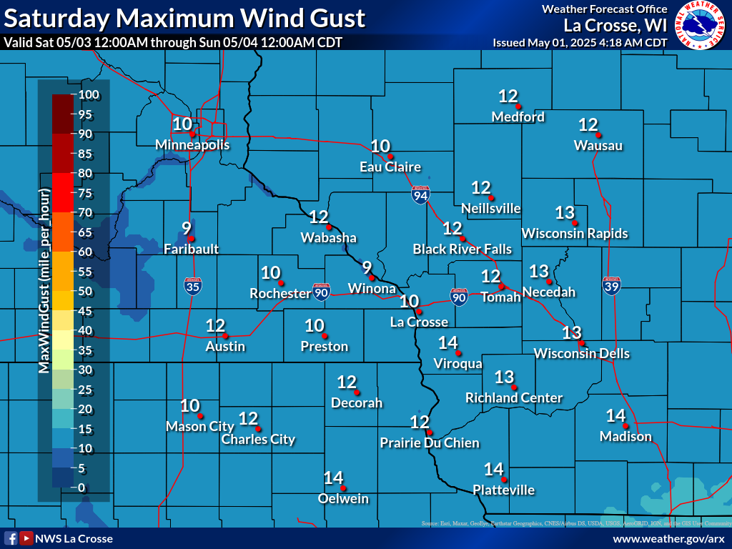
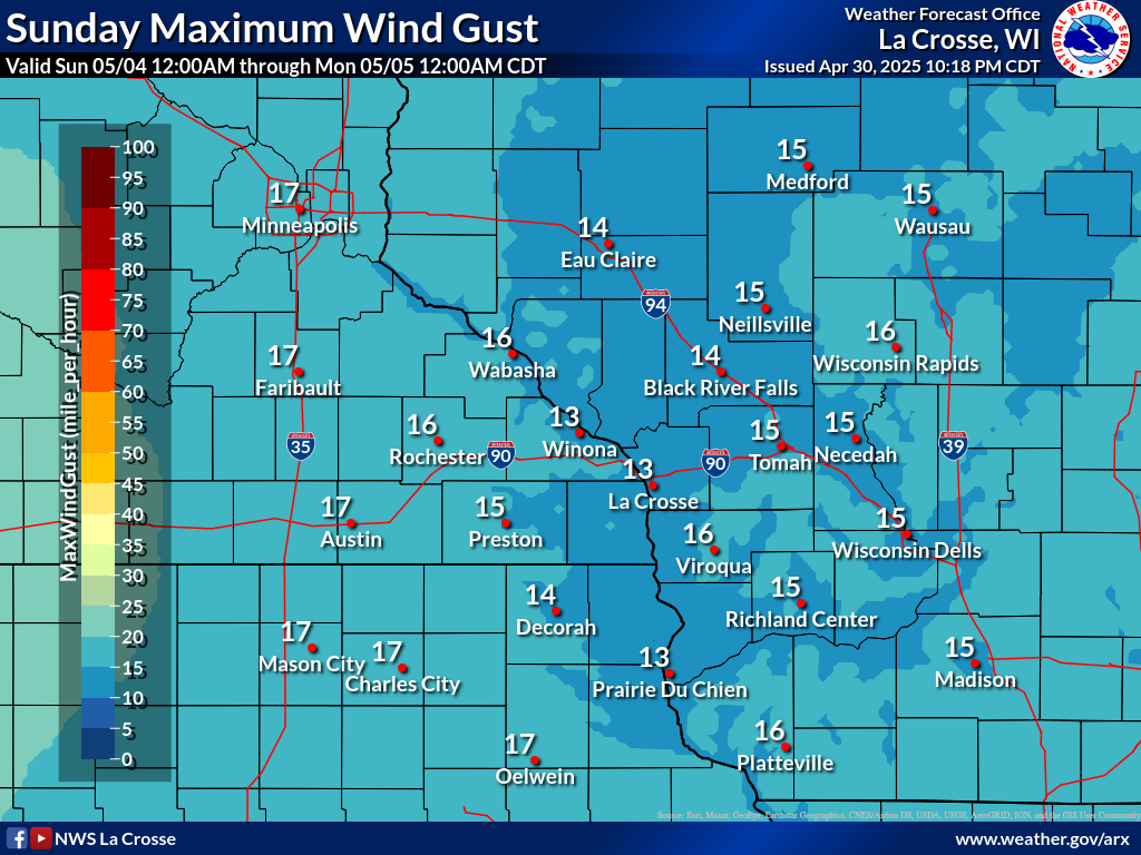
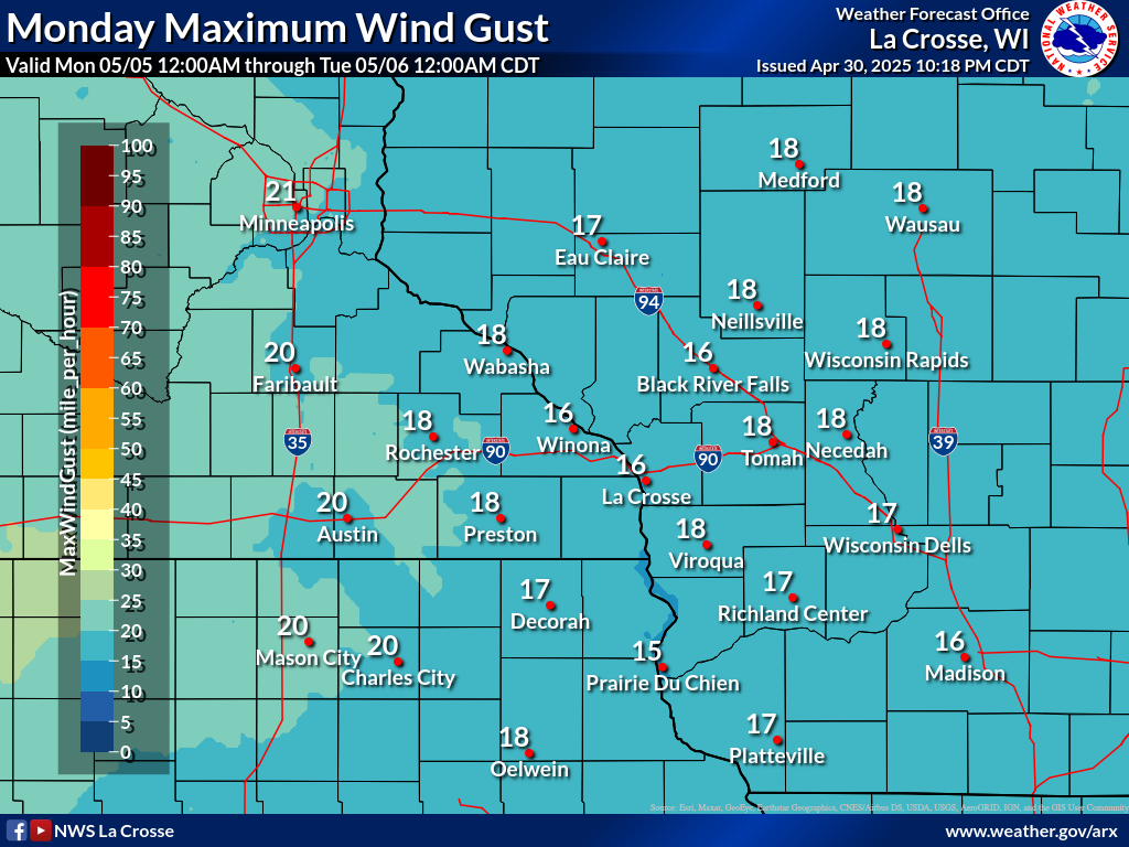
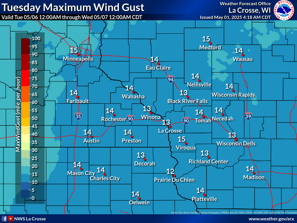
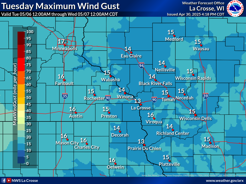
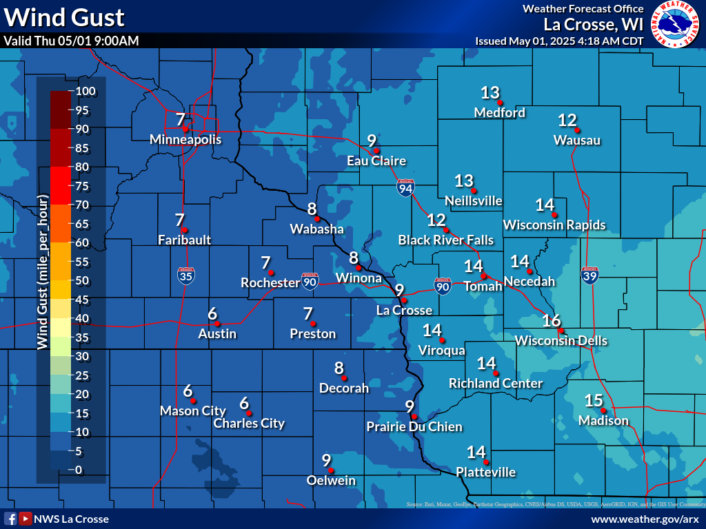
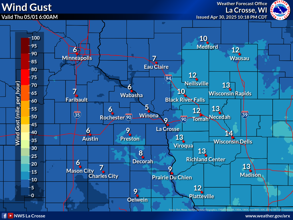
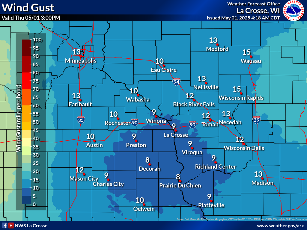
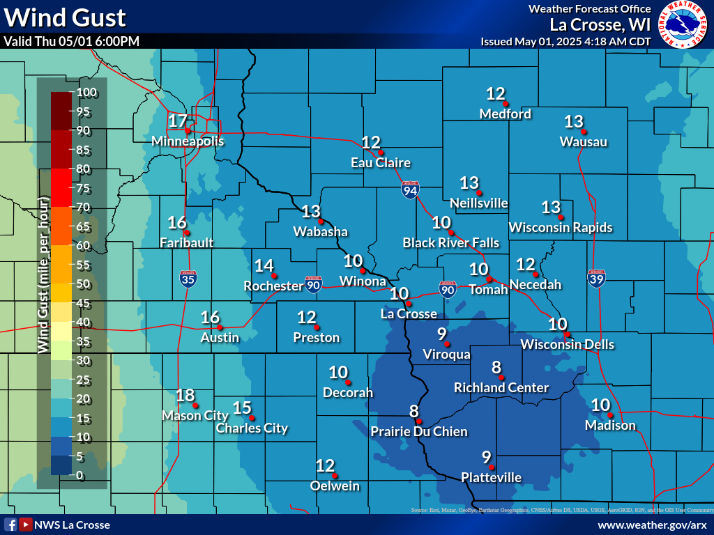
| Forecast Daily MAXIMUM Wind Gusts | ||||||
 |
 |
 |
 |
 |
 |
 |
| Day 1 | Day 2 | Day 3 | Day 4 | Day 5 | Day 6 | Day 7 |
Heat Index / Wet Bulb Globe Temperature Forecasts
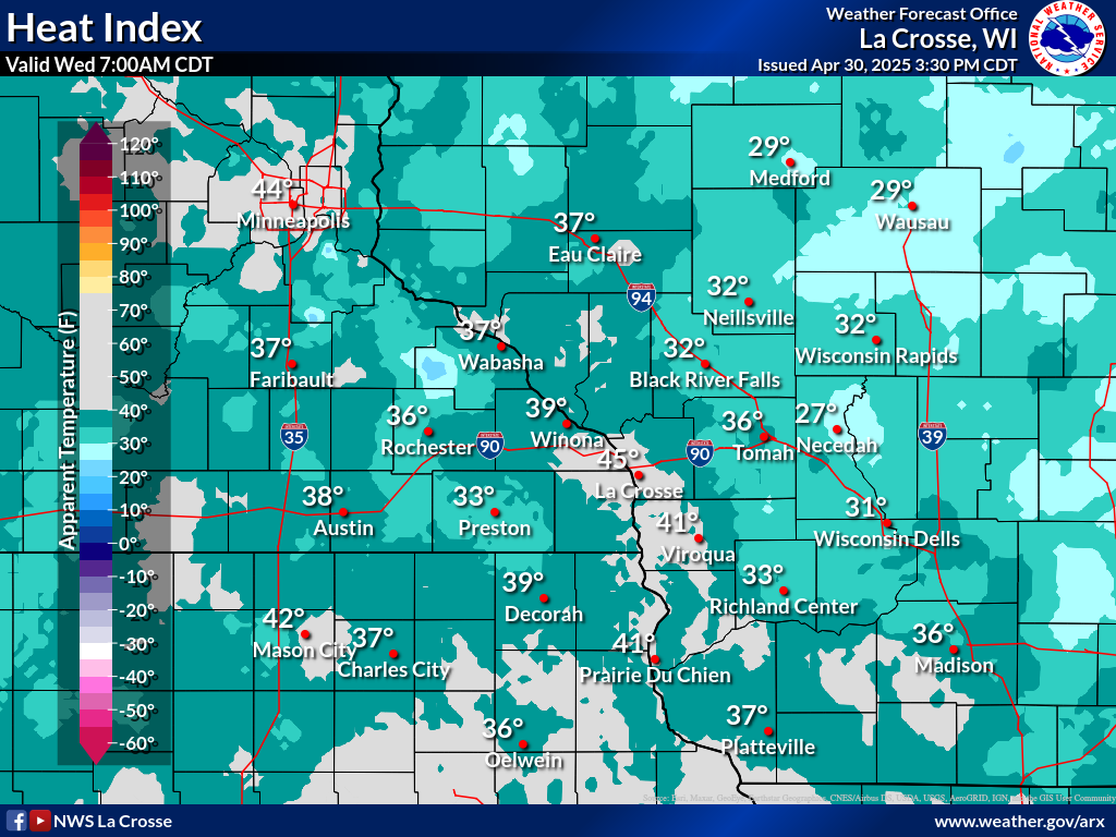
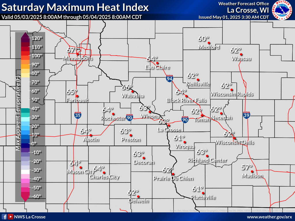
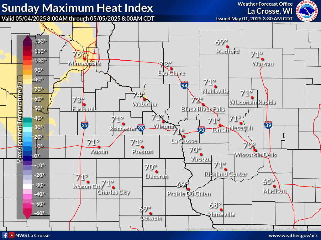
| Today's Forecast Heat Index | Forecast MAXIMUM Heat Index | |||||||
 |
 |
 |
 |
 |
 |
 |
 |
|
| 7 AM (CDT) | 10 AM (CDT) | 1 PM (CDT) | 4 PM (CDT) | 7 PM (CDT) | Tomorrow | Day 3 | Day 4 | |
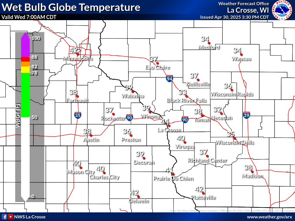
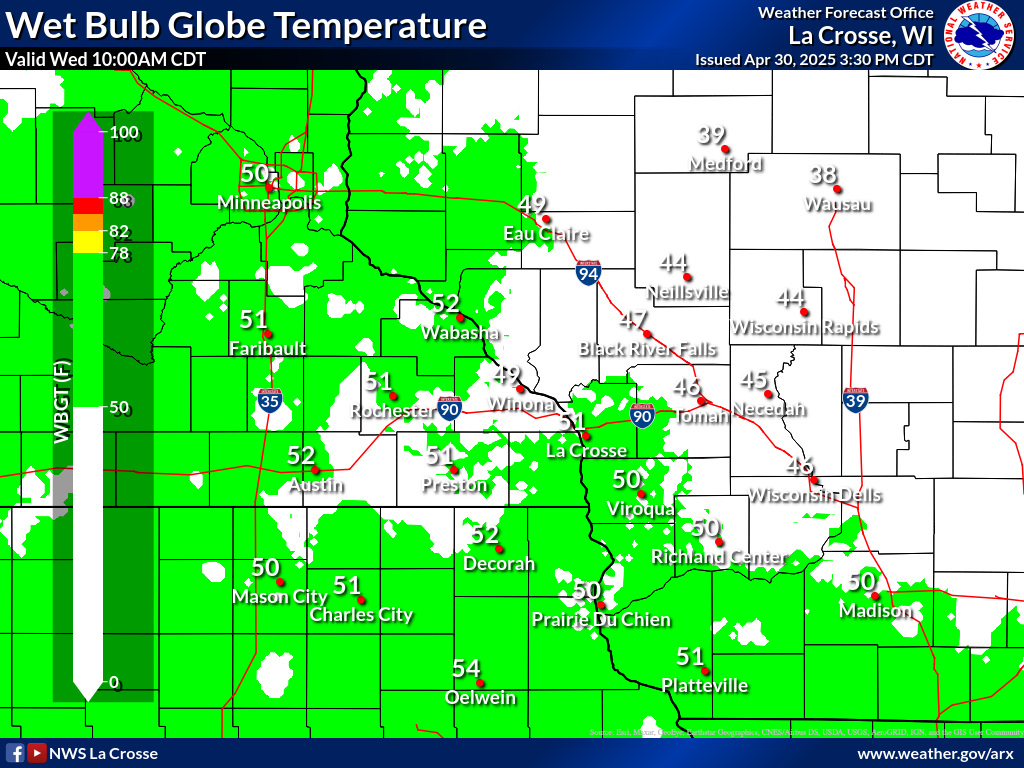
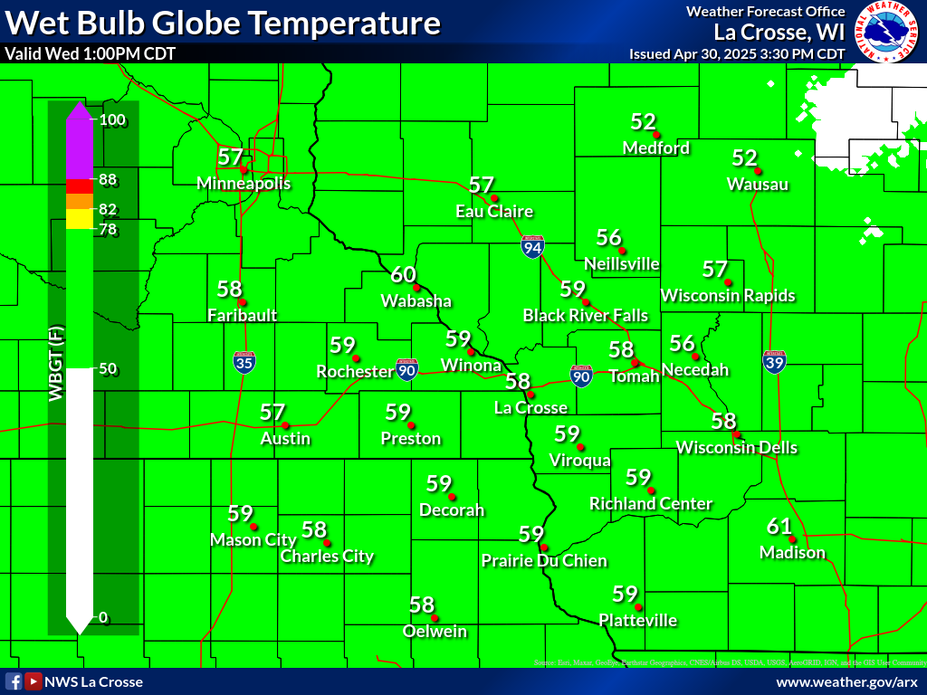
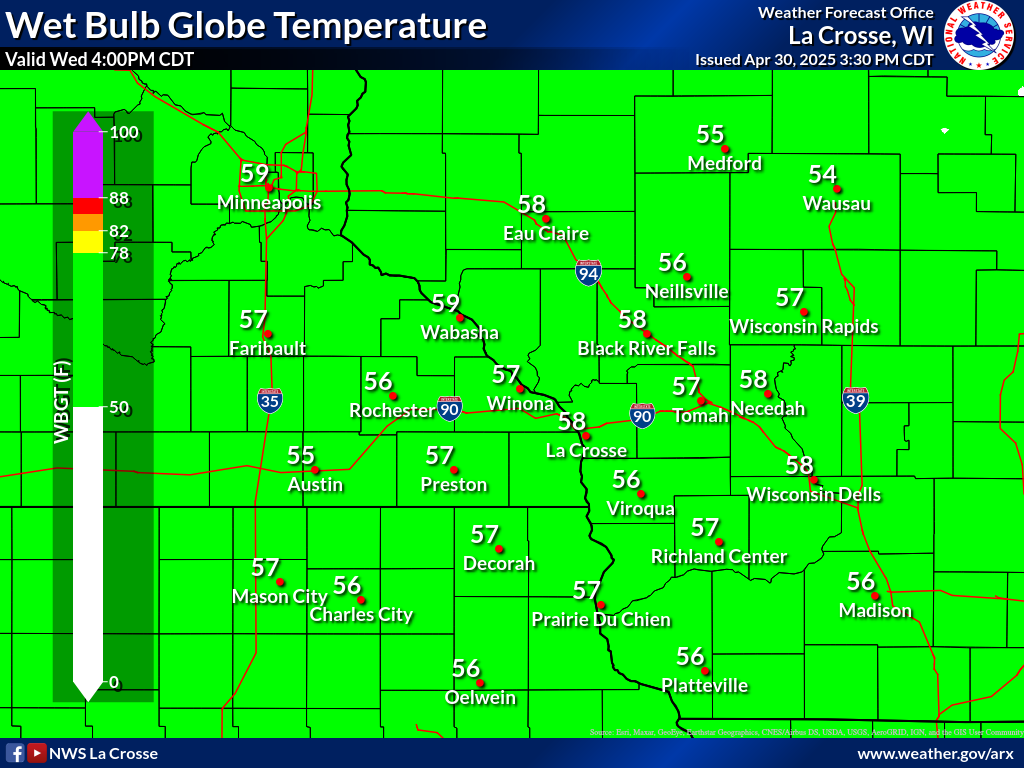
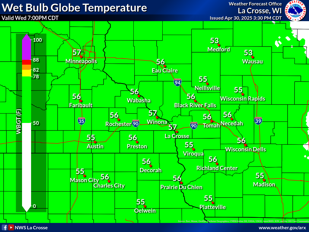
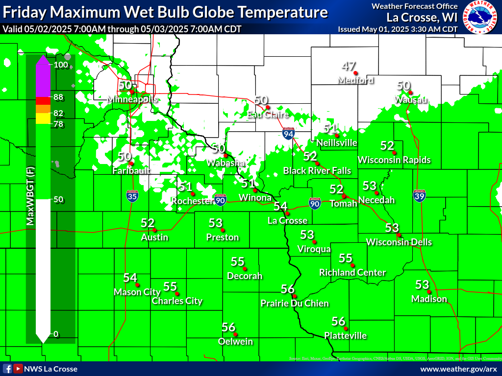
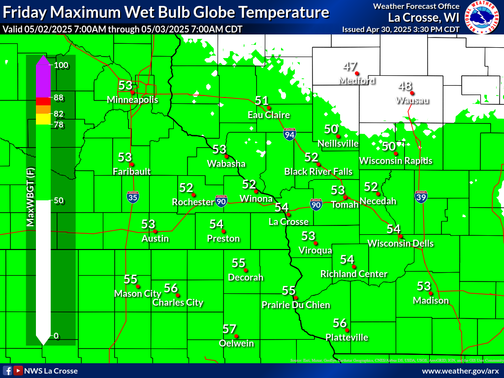
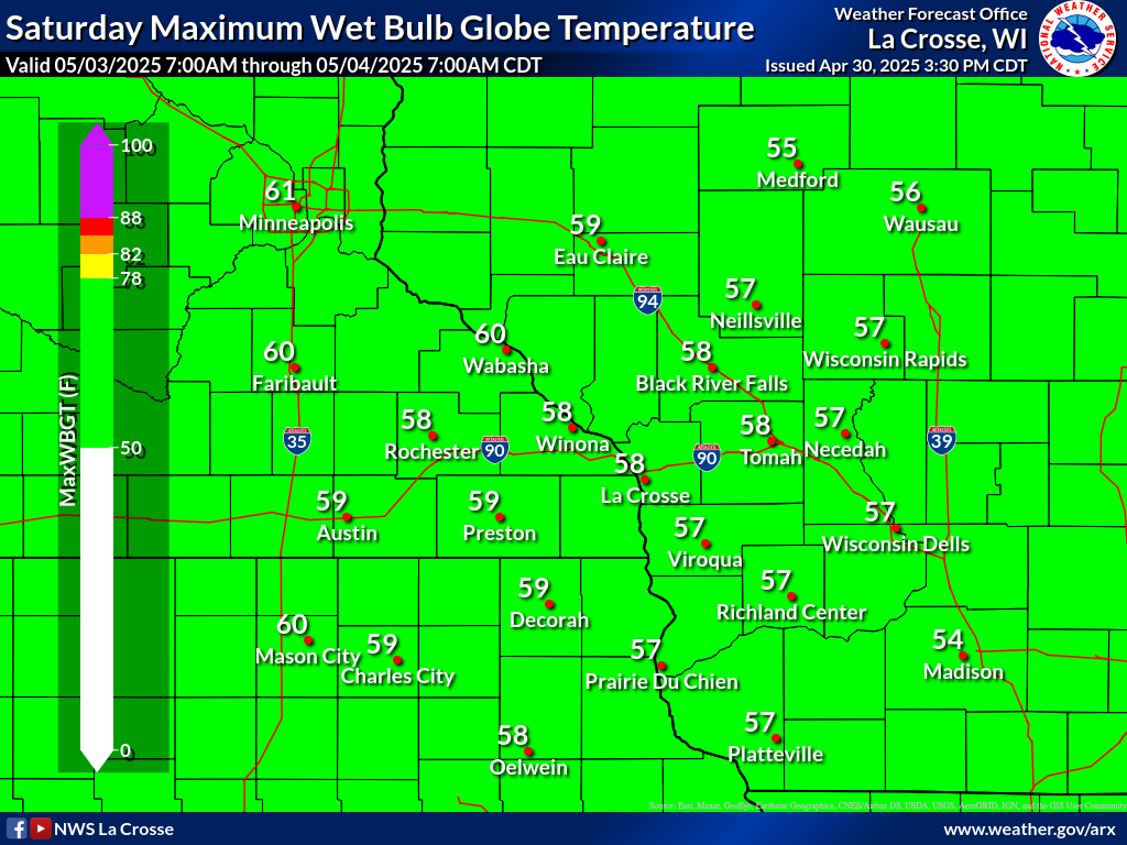
| Today's Forecast Wet Bulb Globe Temp | Forecast MAXIMUM Wet Bulb Globe Temp | |||||||
 |
 |
 |
 |
 |
 |
 |
 |
|
| 7 AM (CDT) | 10 AM (CDT) | 1 PM (CDT) | 4 PM (CDT) | 7 PM (CDT) | Tomorrow | Day 3 | Day 4 | |
| Heat Index & Wet Bulb Globe Temperature Resources | |||||
Heat Index Chart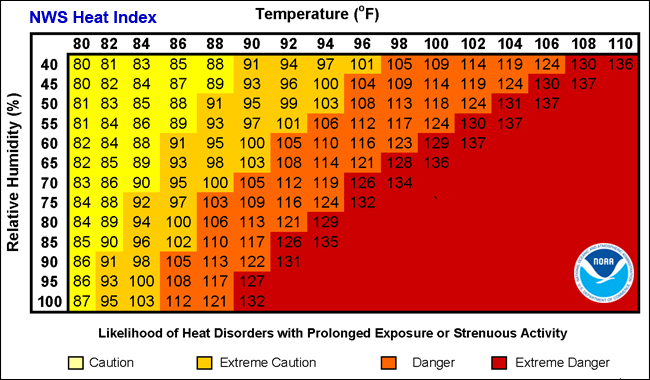 Note: Exposure to full sunshine can increase heat index values by up to 15°F. |
WBGT General Guidance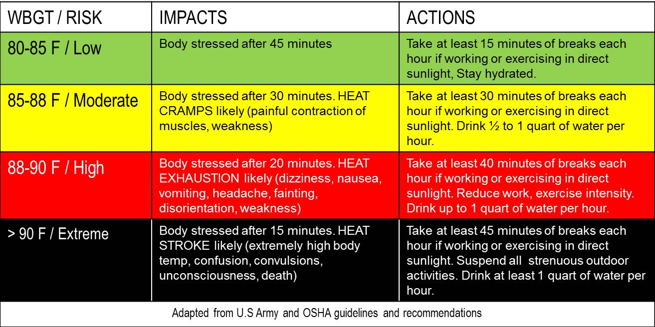 Note: WBGT is NOT directly comparable to temperature or heat index scales. |
|
|||
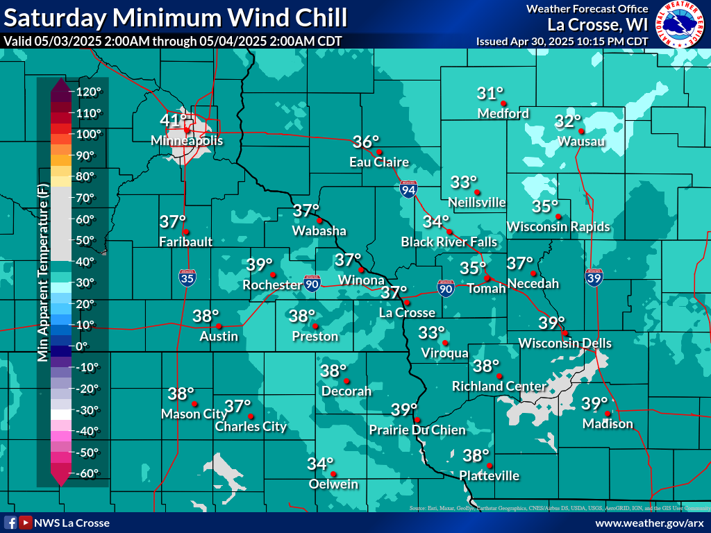
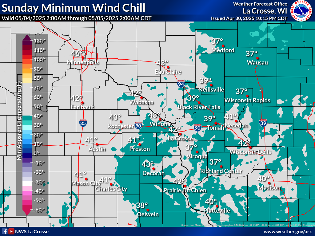
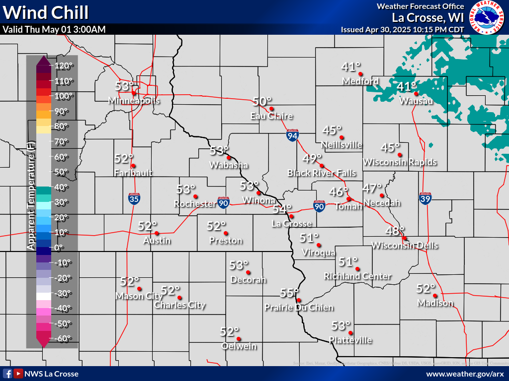
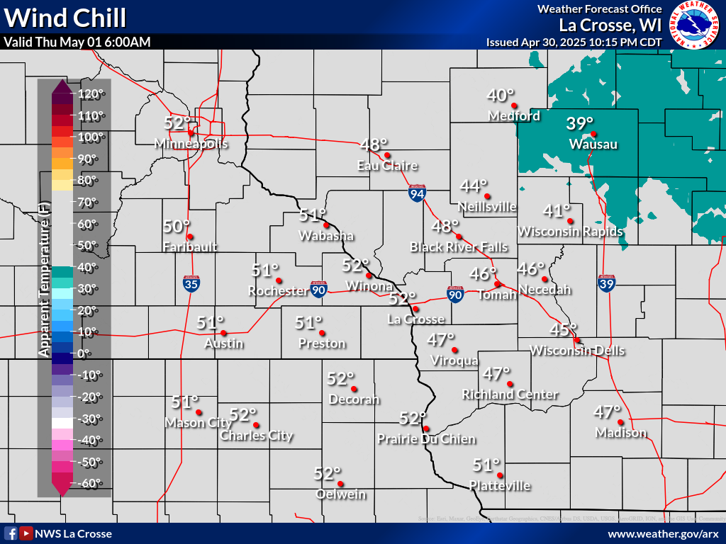
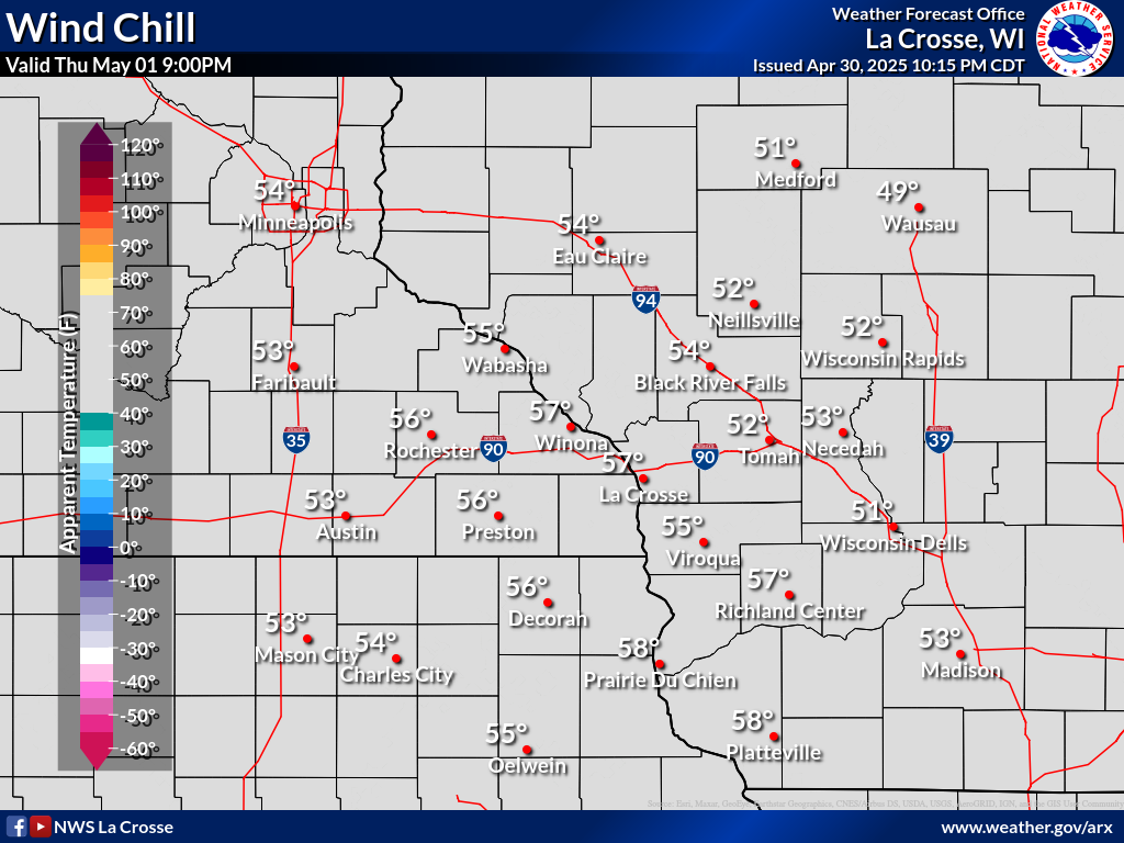
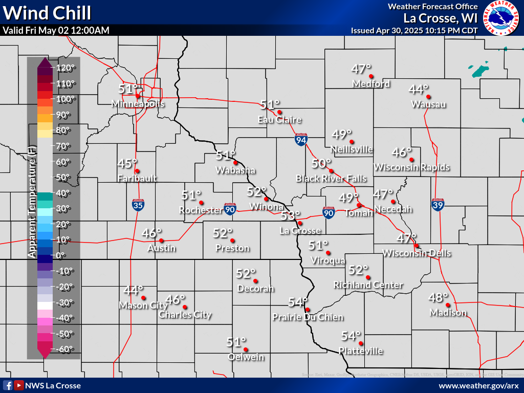
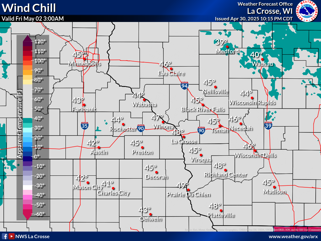
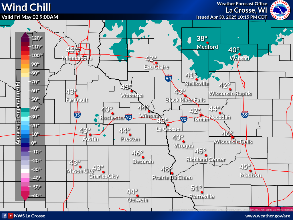
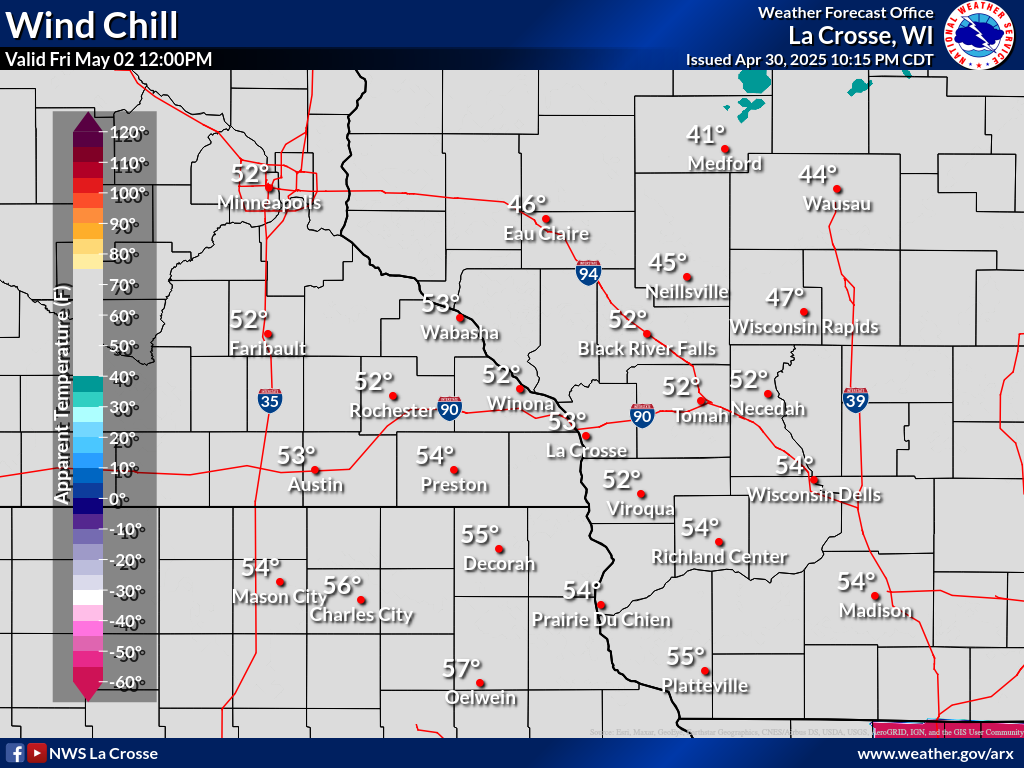
Wind Chill Forecasts (Available October - April)
| 3-Hour Forecast Wind Chills | |||||||||||||||||||||||||||||||||||||||
|
|||||||||||||||||||||||||||||||||||||||
| Forecast Daily MINIMUM Wind Chills | ||||||
 |
 |
 |
 |
 |
 |
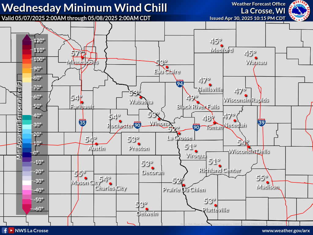 |
| Day 1 | Day 2 | Day 3 | Day 4 | Day 5 | Day 6 | Day 7 |
| Wind Chill Resources | ||||||
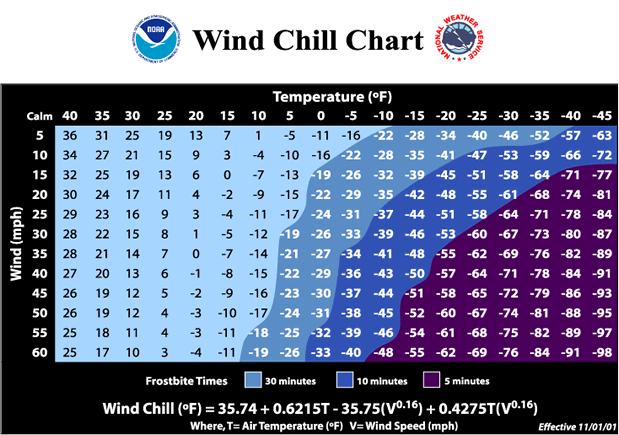 |
Wind Chill Calculator:
|
|||||
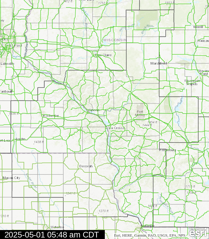
Winter Road Conditions
| Current Road Conditions | Latest Travel Information | ||||||||||
|
Disclaimer:
|
 |
 |
|
||||||||
Snow & Ice Forecasts
| Snow/Ice Amount Potential Over Next 72 Hours* | City Snowfall Probabilities | |||||
| *Snow/ice amount graphics below may occasionally depict total accumulations from multiple events over next 72 hours | ||||||
Expected Snowfall Official NWS Forecast |
Low End Snowfall Potential 90% Chance Snowfall Will Be Greater Than This |
High End Snowfall Potential 10% Chance Snowfall Will Be Greater Than This |
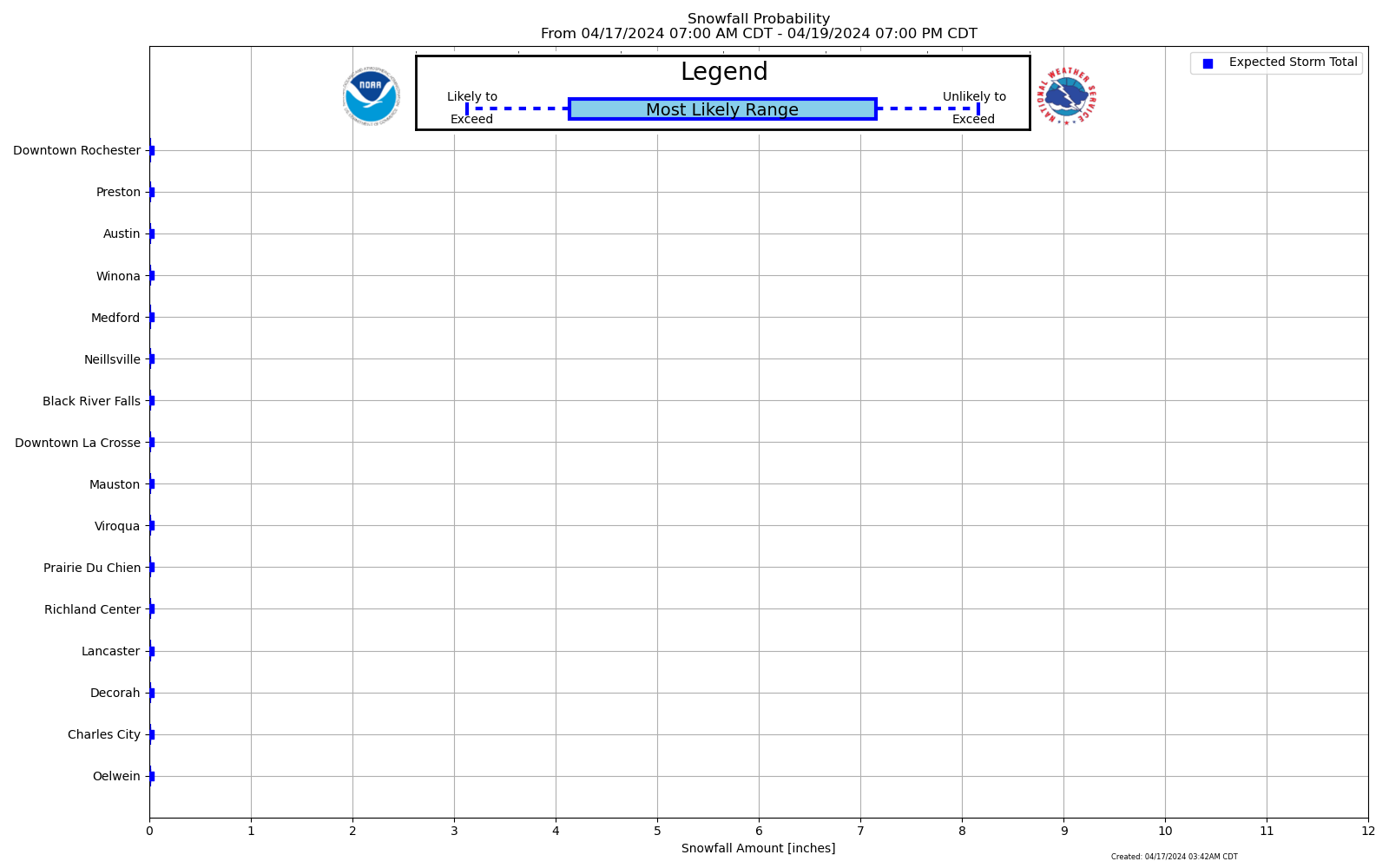 Forecast Snowfall Probability Ranges By City |
|||
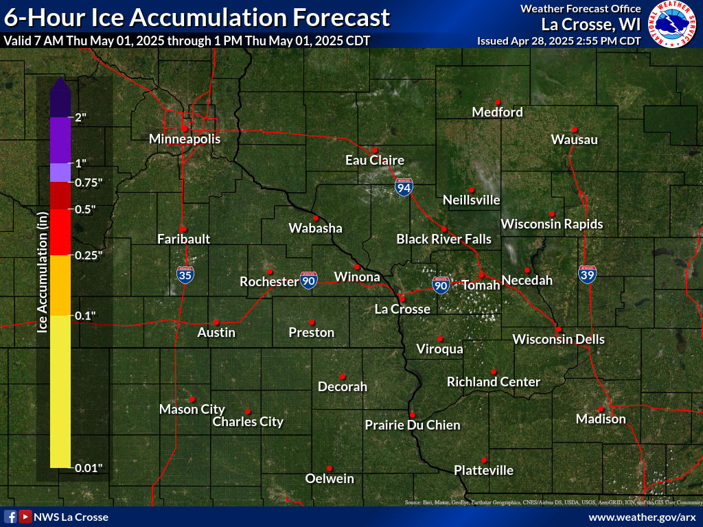
Expected Ice Accumulation Official NWS Forecast |
Low End Ice Accum Potential 90% Chance Icing Will Be Greater Than This |
High End Ice Accum Potential 10% Chance Icing Will Be Greater Than This |
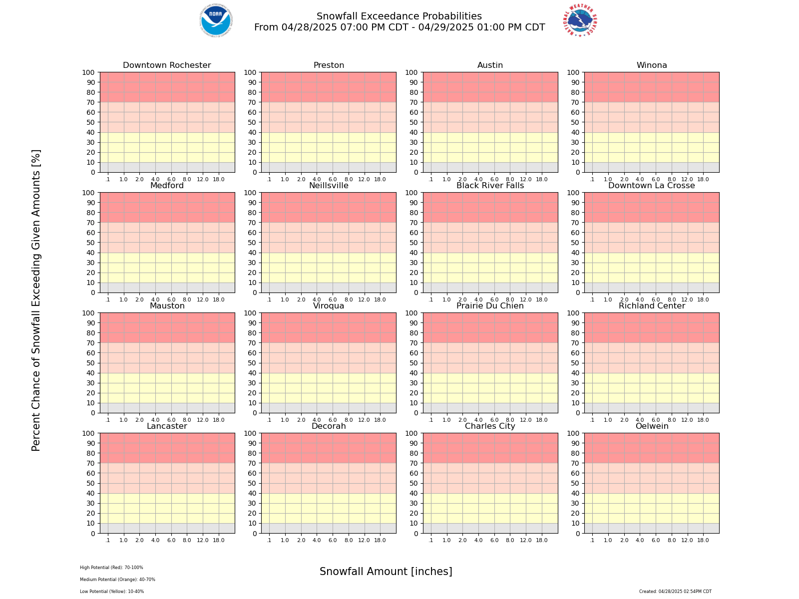 Probability of Snowfall Exceeding Certain Amounts |
|||
| Chance That Snow/Ice Amounts Over Next 72 Hours Will Be Greater Than Or Equal To... (More Details) | ||||||||
| SNOW | 0.1" |
1" |
2" |
4" |
6" |
8" |
12" |
18" |
| ICE | 0.01" |
0.1" |
0.25" |
0.5" |
0.75" |
1" |
1.25" |
1.5" |
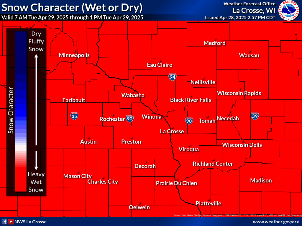
| 6-Hour Forecast Snow/Ice Amounts and Snow Type (Dry vs. Wet) | ||||||||||||||||||||||||||||||||||||||||||||||||||||||||||||||||||||||||||||||||||||||||||||||||||||||||||||||||||
|
||||||||||||||||||||||||||||||||||||||||||||||||||||||||||||||||||||||||||||||||||||||||||||||||||||||||||||||||||
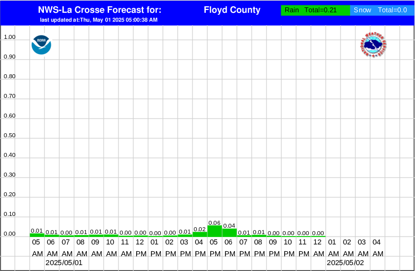
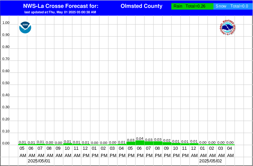
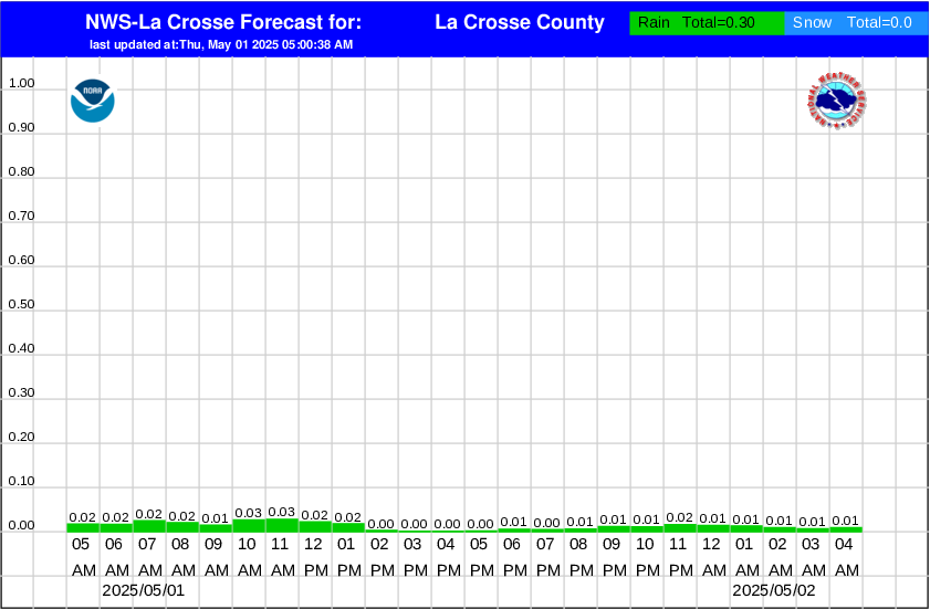
| Hourly Precipitation Amounts By County | ||
|
|
|
|
Snow and Sleet Legend
|
Risk Level
|
Hazard
|
Impacts/Actions
|
|
None
|
None
|
< 1" of snow or sleet
|
|
Limited
|
1 to 3 inches
|
Locally hazardous travel conditions on bridges, overpasses, and untreated or secondary roads
|
|
Elevated
|
3 to 6 inches
|
Be prepared to reduce travel speed for hazardous travel conditions - especially on bridges, overpasses, untreated and secondary roads
|
|
Significant
|
6 to 12 inches
|
Plan for hazardous travel conditions. Avoid travel if possible
|
|
Extreme
|
12 or more inches
|
Travel will be dangerous and may be impossible. Avoid travel unless it is an emergency
|
Ice Accumulation Legend
|
Risk Level
|
Hazard
|
Impacts/Actions
|
|
None
|
None
|
No freezing rain or drizzle
|
|
Limited
|
Very light freezing rain or drizzle with up to a thin glaze, or freezing fog
|
Locally hazardous travel conditions on bridges, overpasses, and untreated or secondary roads
|
|
Elevated
|
Freezing rain or drizzle with accumulation less than 1/4 inch
|
Be prepared to reduce travel speed for hazardous travel conditions - especially on bridges, overpasses, untreated and secondary roads
|
|
Significant
|
Freezing rain with accumulation of 1/4 to less than 1 inch
|
Plan for hazardous travel conditions. Power lines and trees may be damaged resulting in localized to scattered power outages. Avoid travel if possible and prepare for possible power outages
|
|
Extreme
|
Freezing rain with accumulation of greater than or equal to 1 inch
|
Travel will be dangerous and may be impossible. Power lines and trees likely damaged resulting in widespread power outages. Avoid travel unless it is an emergency and prepare for extended power outages
|
Winter Storm Severity Index (More Details)
| Today | |||||
 Overall Impacts |
 Blowing Snow |
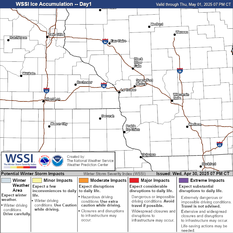 Ice Accumulation |
 Snow Amount |
 Snow Load |
|
| Tomorrow | |||||
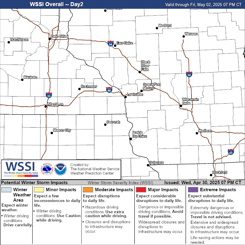 Overall Impacts |
 Blowing Snow |
 Ice Accumulation |
 Snow Amount |
 Snow Load |
|
| Day 3 | |||||
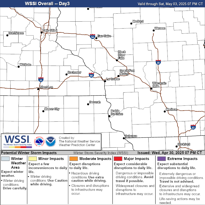 Overall Impacts |
 Blowing Snow |
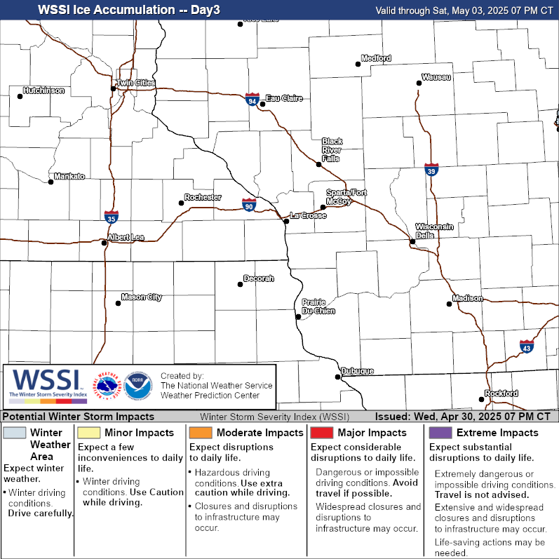 Ice Accumulation |
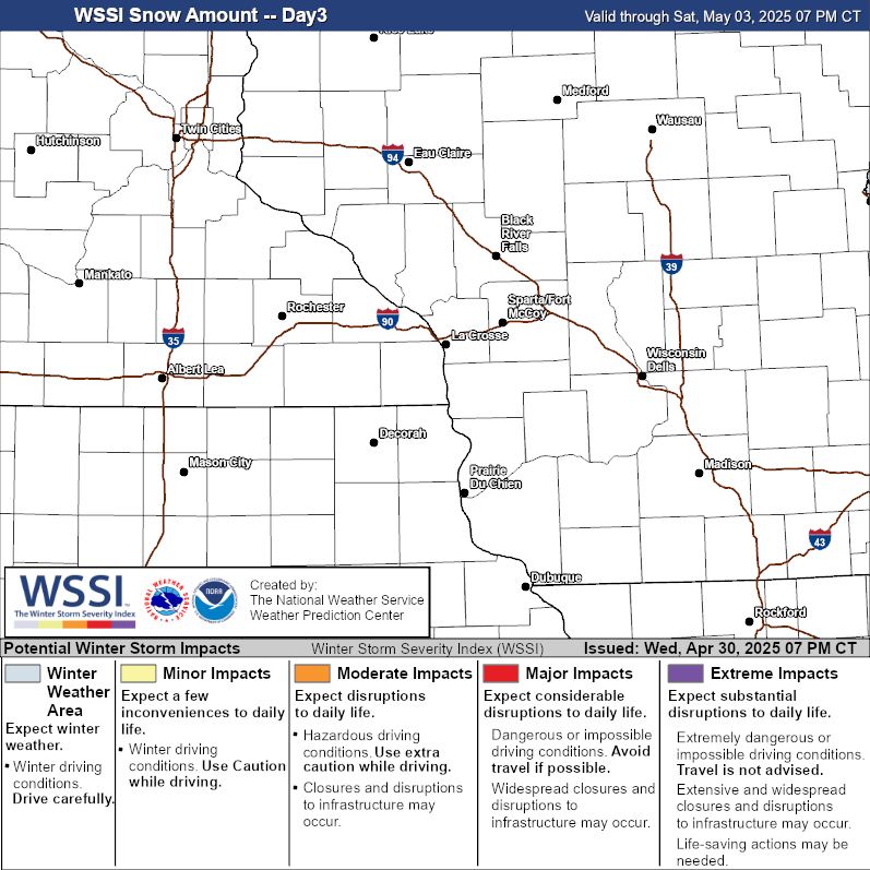 Snow Amount |
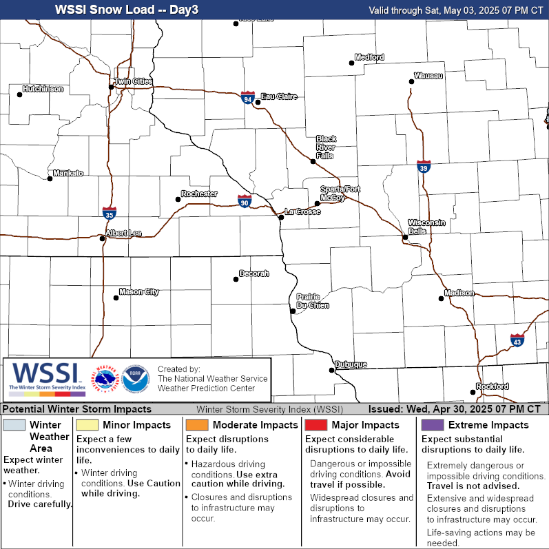 Snow Load |
|
National Outlooks
| Snow Outlooks (Probability for greater than 4") | Ice Outlooks (Probability for greater than 1/10") | |||||||||
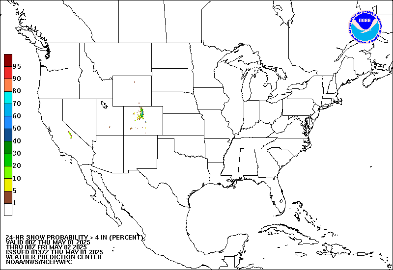 Day 1 |
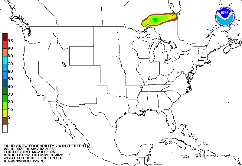 Day 2 |
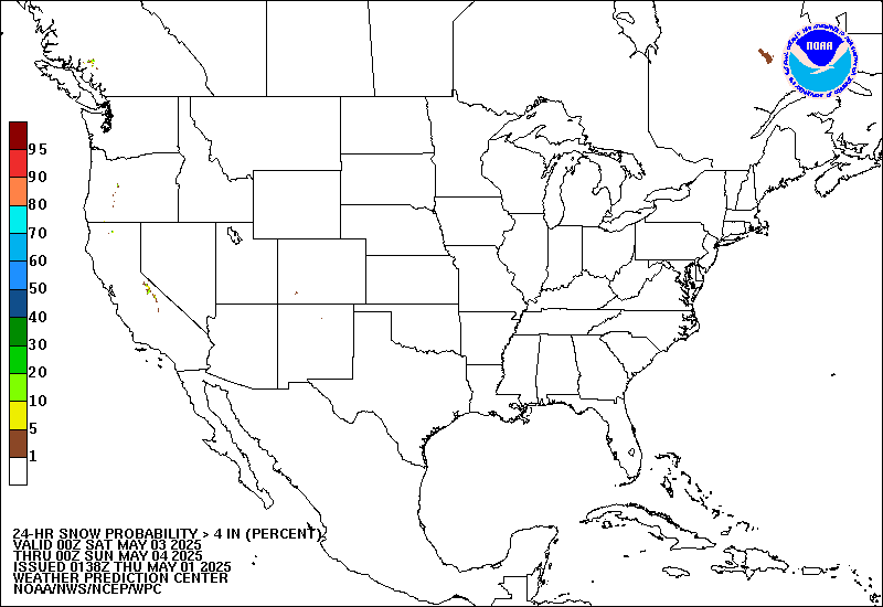 Day 3 |
 Day 1 |
 Day 2 |
 Day 3 |
|||||
| Extended Outlooks (Probability for impactful winter weather) | |||
 Day 4 |
 Day 5 |
 Day 6 |
 Day 7 |
Rivers / Precipitation
| River Information | ||||
 |
 |
 |
 |
 |
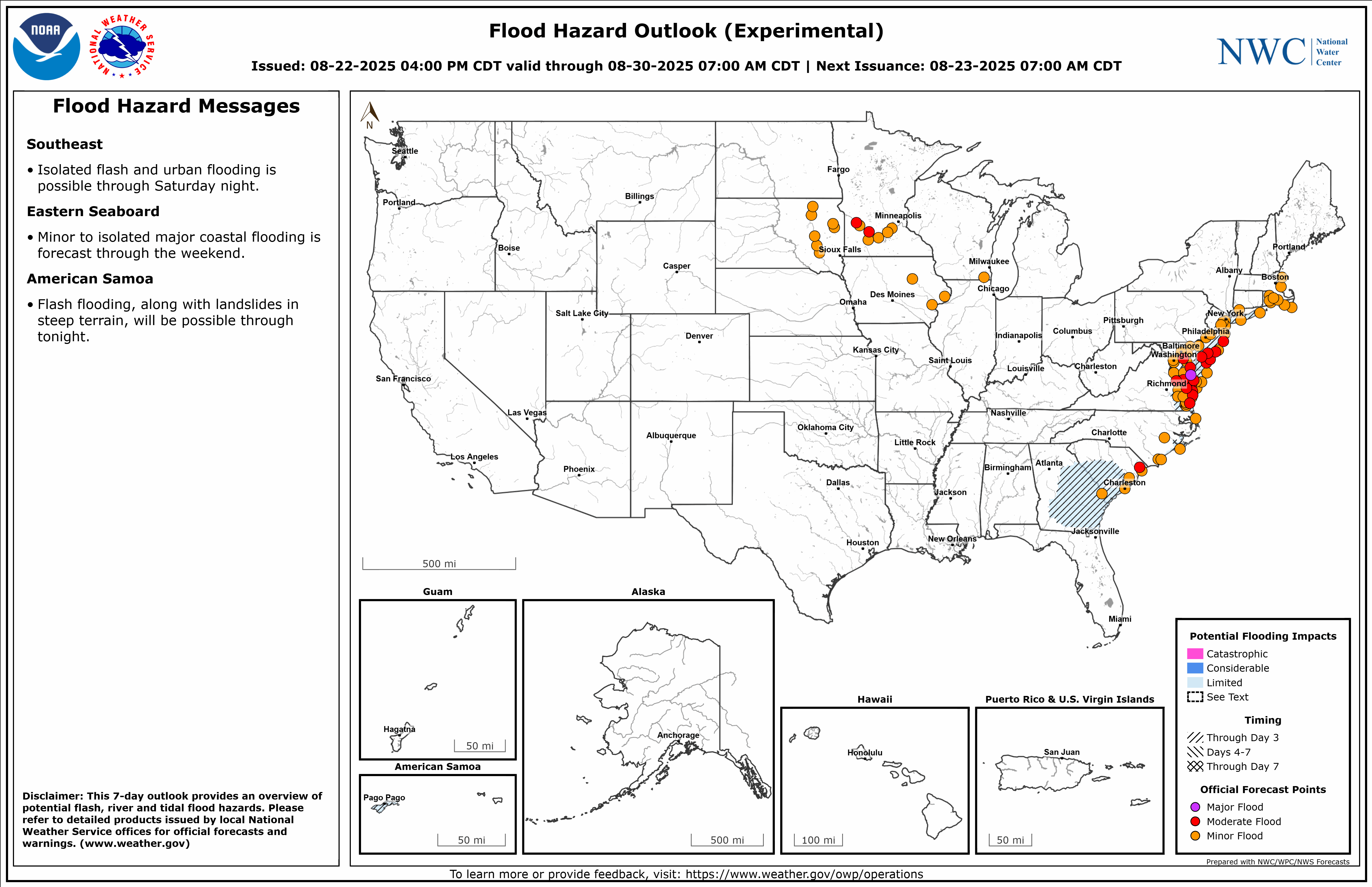
| Flood Hazard Outlook (experimental) |
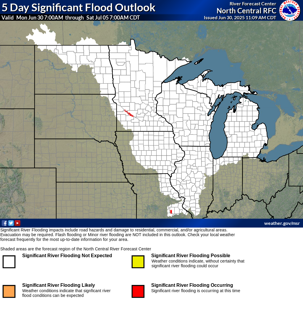
Significant River Flood Outlook |
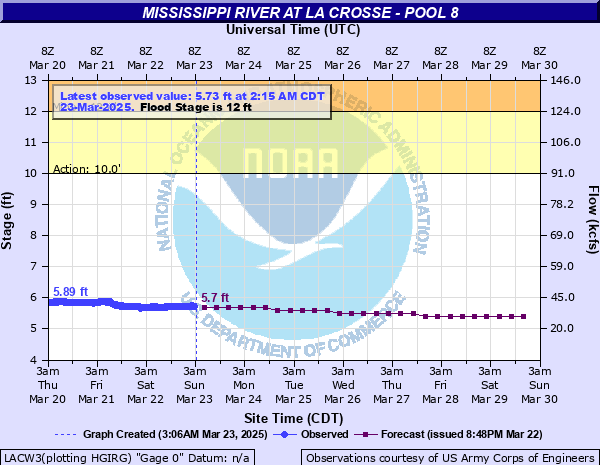
NWS La Crosse River Monitor Webpage |
Current River Levels and Forecasts |
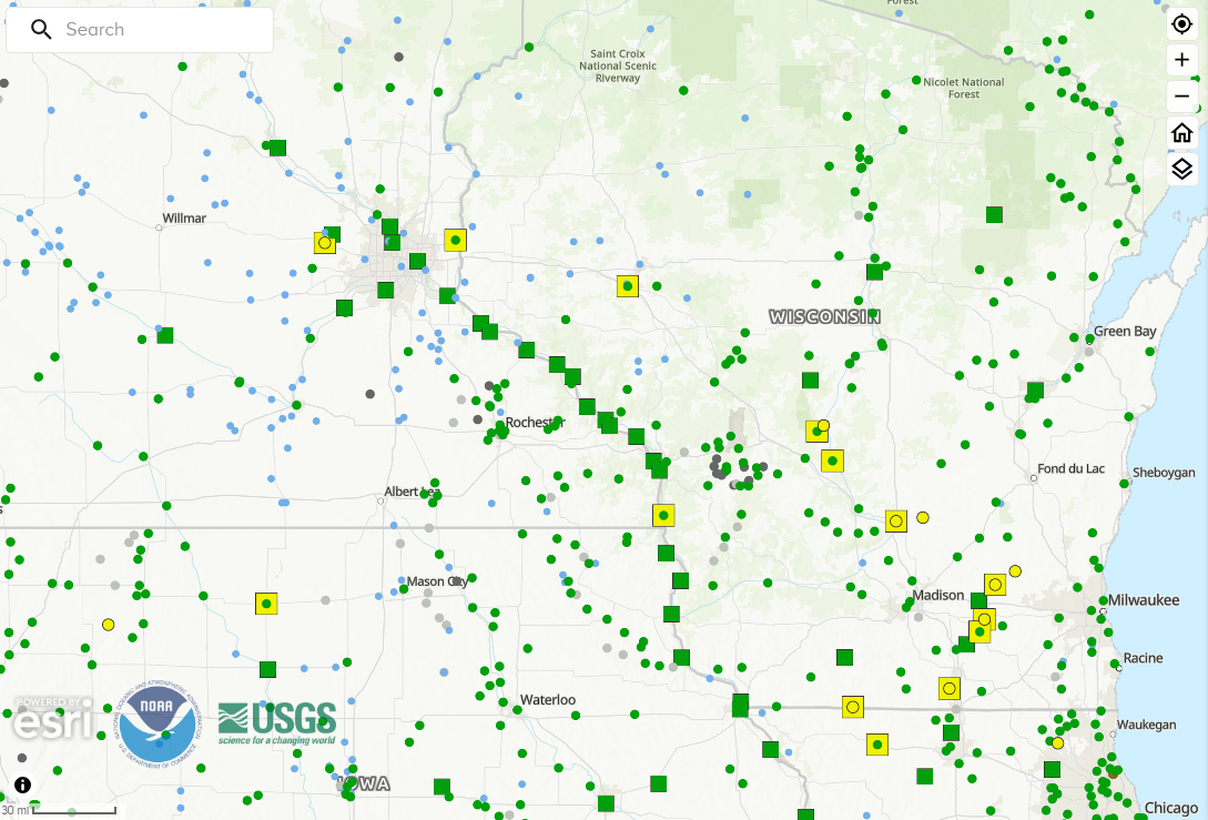
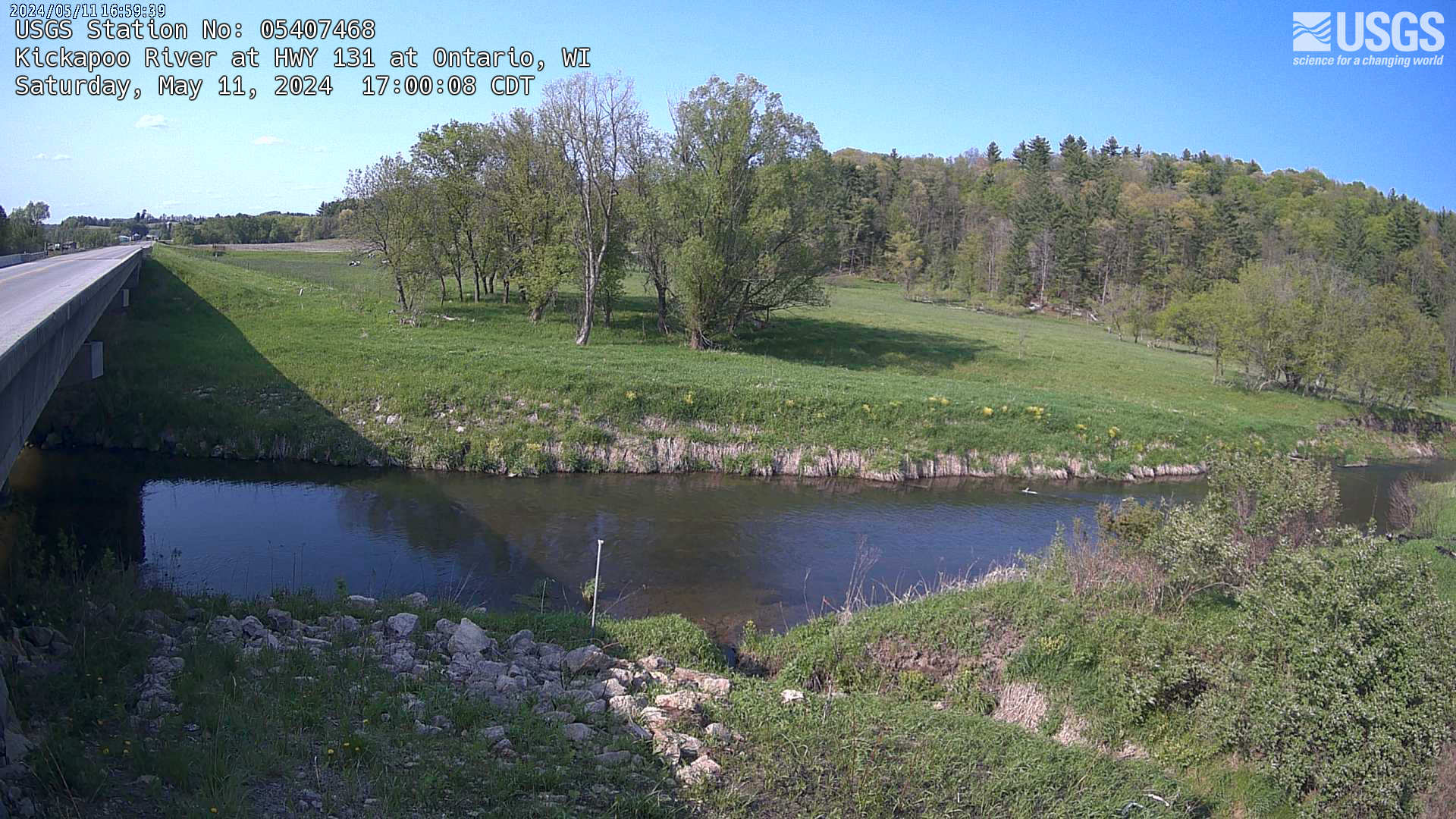
USGS River Gauge Webcams |
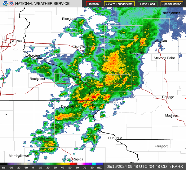
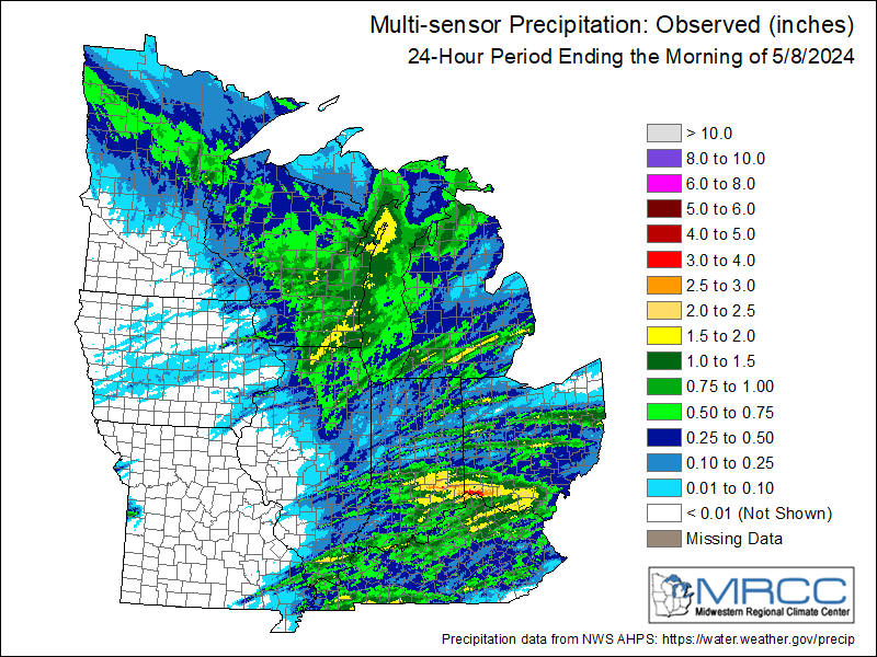
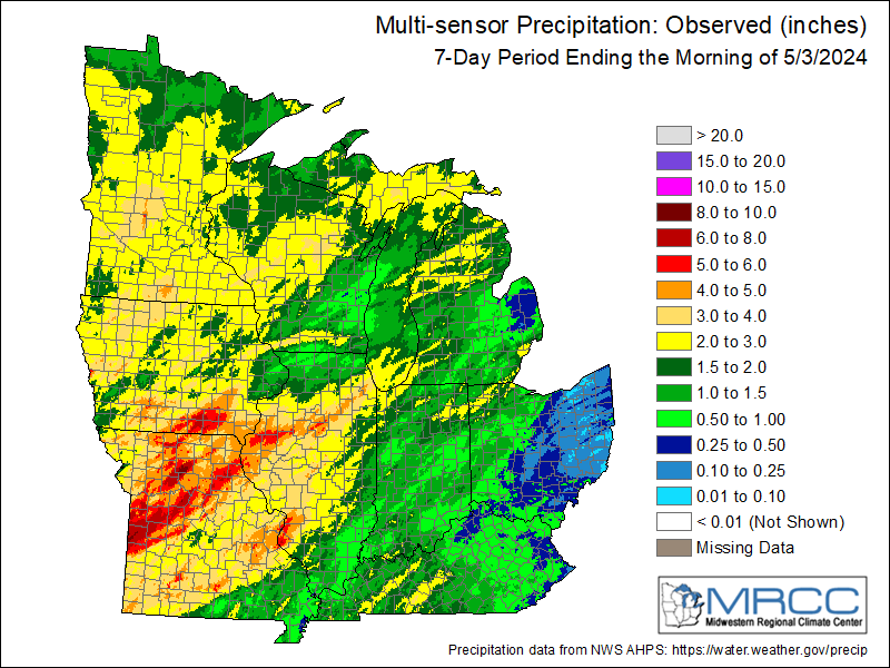
| Rainfall Information | ||||
 |
|
 |
 |
 |
| 1-hour Estimated Precip | Storm Total Estimated Precip | Rainfall Last 24 Hours | Rainfall Last 7 Days | Rainfall Last 30 Days |
| Precipitation Forecasts - Discussion | |||||
 |
 |
 |
 |
 |
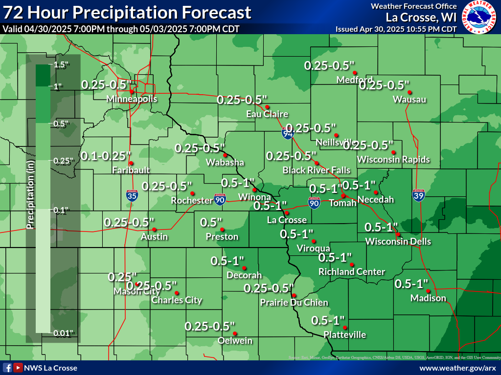 |
| Today | Tomorrow | Day 3 | Days 4-5 | Days 6-7 | Local 72-Hour Forecast |
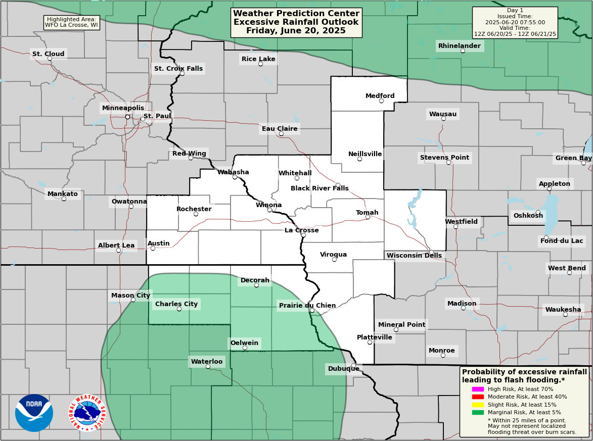
| National Excessive Rainfall Outlooks - Discussion | ||||
 |
 |
 |
 |
 |
| Today | Tomorrow | Day 3 | Day 4 | Day 5 |
| Local Excessive Rainfall Outlooks | ||||
 |
 |
 |
 |
 |
| Today | Tomorrow | Day 3 | Day 4 | Day 5 |
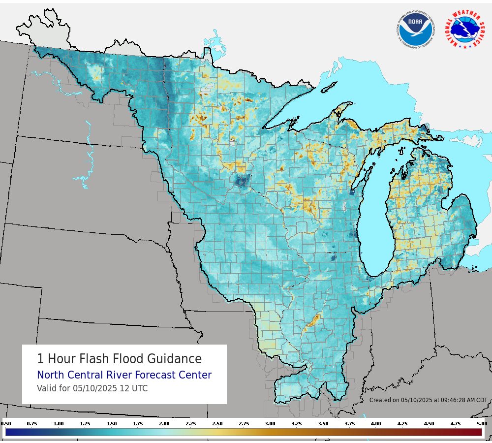
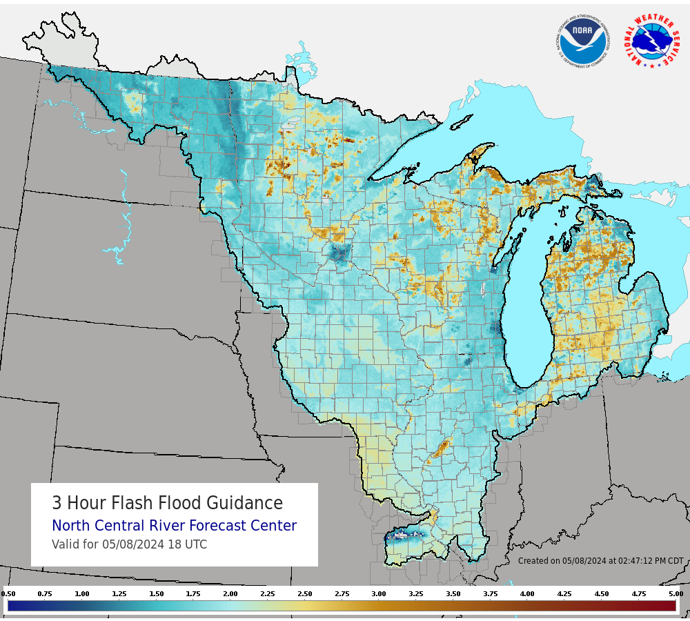
| Flash Flood Guidance (FFG) | ||||
 |
 |
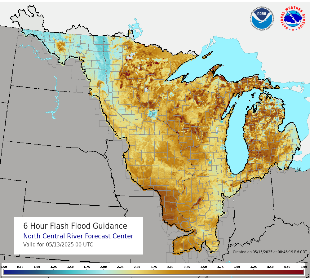 |
About Flash Flood Guidance (FFG):
|
|
| 1 Hour Flash Flood Guidance | 3 Hour Flash Flood Guidance | 6 Hour Flash Flood Guidance | ||
| Drought Information - More Information | ||||
 |
 |
 |
 |
|
| Midwest Drought Monitor (updated weekly) |
Midwest Drought Monitor Change From Previous Week |
U.S. Monthly Drought Outlook |
U.S. Seasonal Drought Outlook |
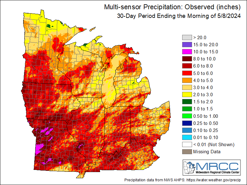
30-Day Observed Precipitation |
Additional Forecasts
| Weather Maps (Animation) | Forecast Radar (HRRR Model) | |
Next 48 hrs |
NOTE: This is model data and may not reflect current forecast |
Week 2-4 Outlooks
| 6-10 Day Temp & Precip Outlook | 8-14 Day Temp & Precip Outlook | Weeks 3-4 Temp & Precip Outlook | |||||
 |
 |
 |
 |
 |
 |
||
Other Hazard Outlooks
| Potential Hazards: Days 3-7 | Potential Hazards: Days 8-14 | |||||||||||
|
|
|||||||||||
Past Weather
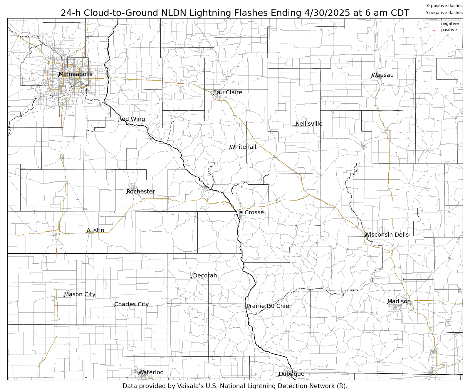
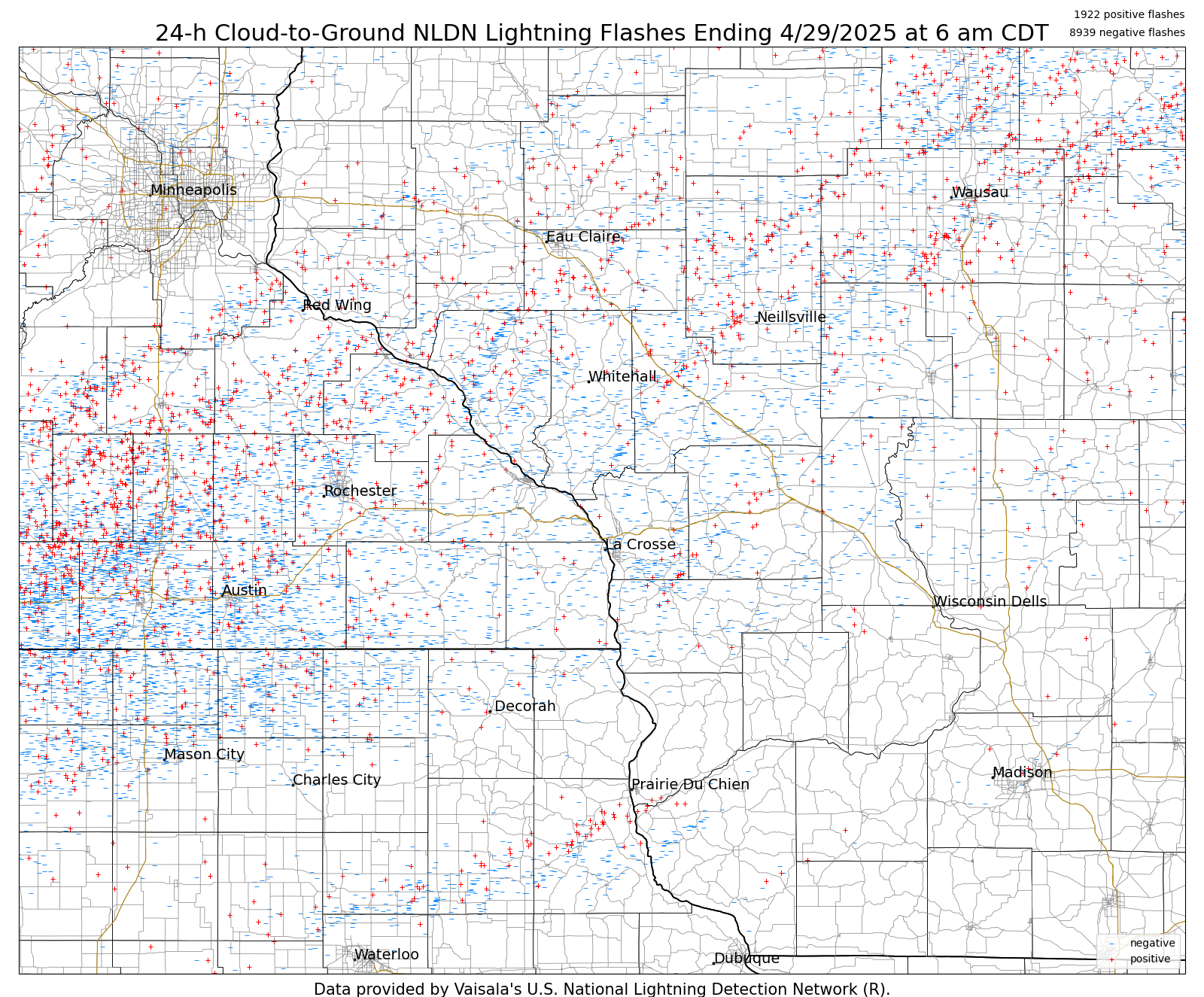
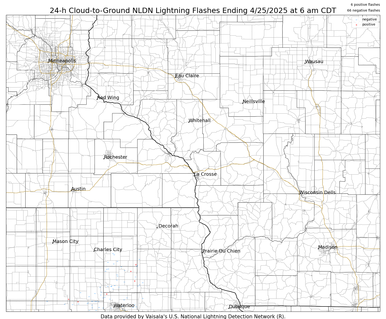
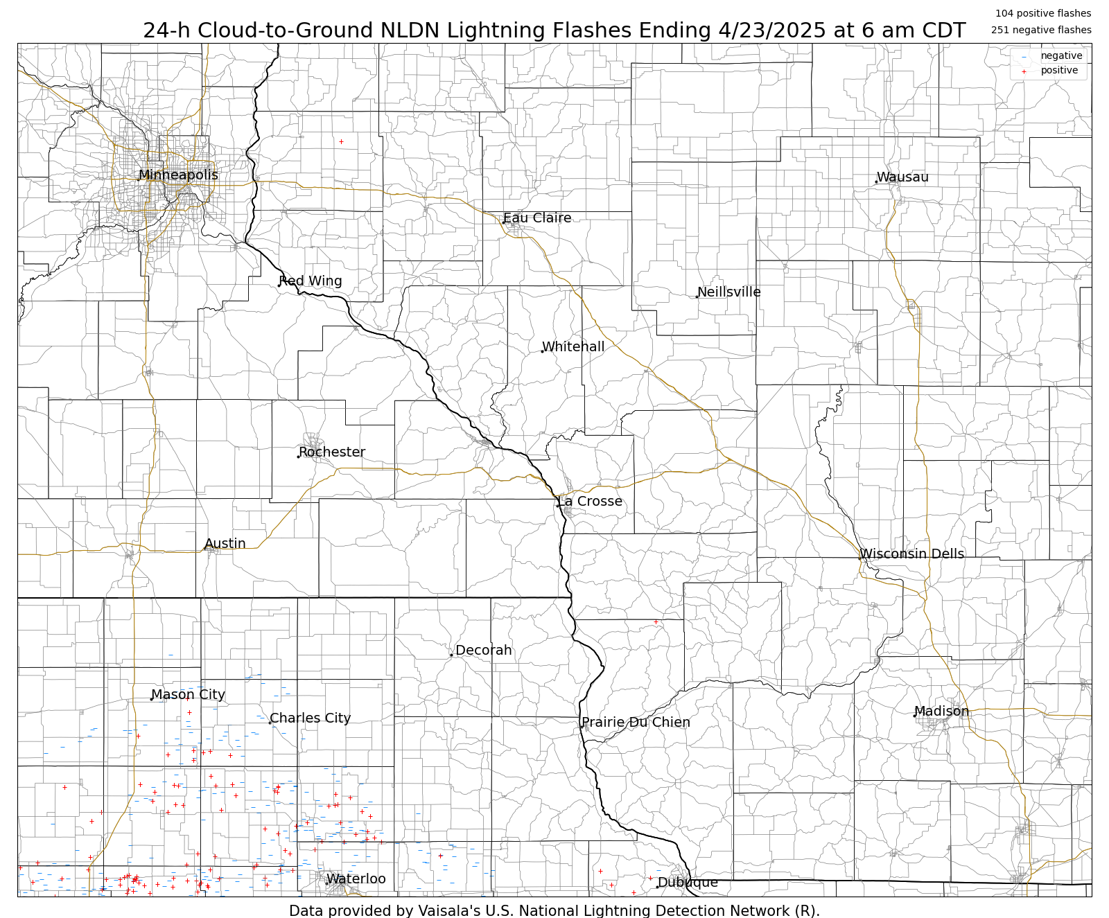
| Daily Lightning Strike Plots from the Past Week | ||||||||||||||||||||||||||||||||||
|
||||||||||||||||||||||||||||||||||
| Storm Reports Today | Storm Reports Yesterday | |
 |
 |
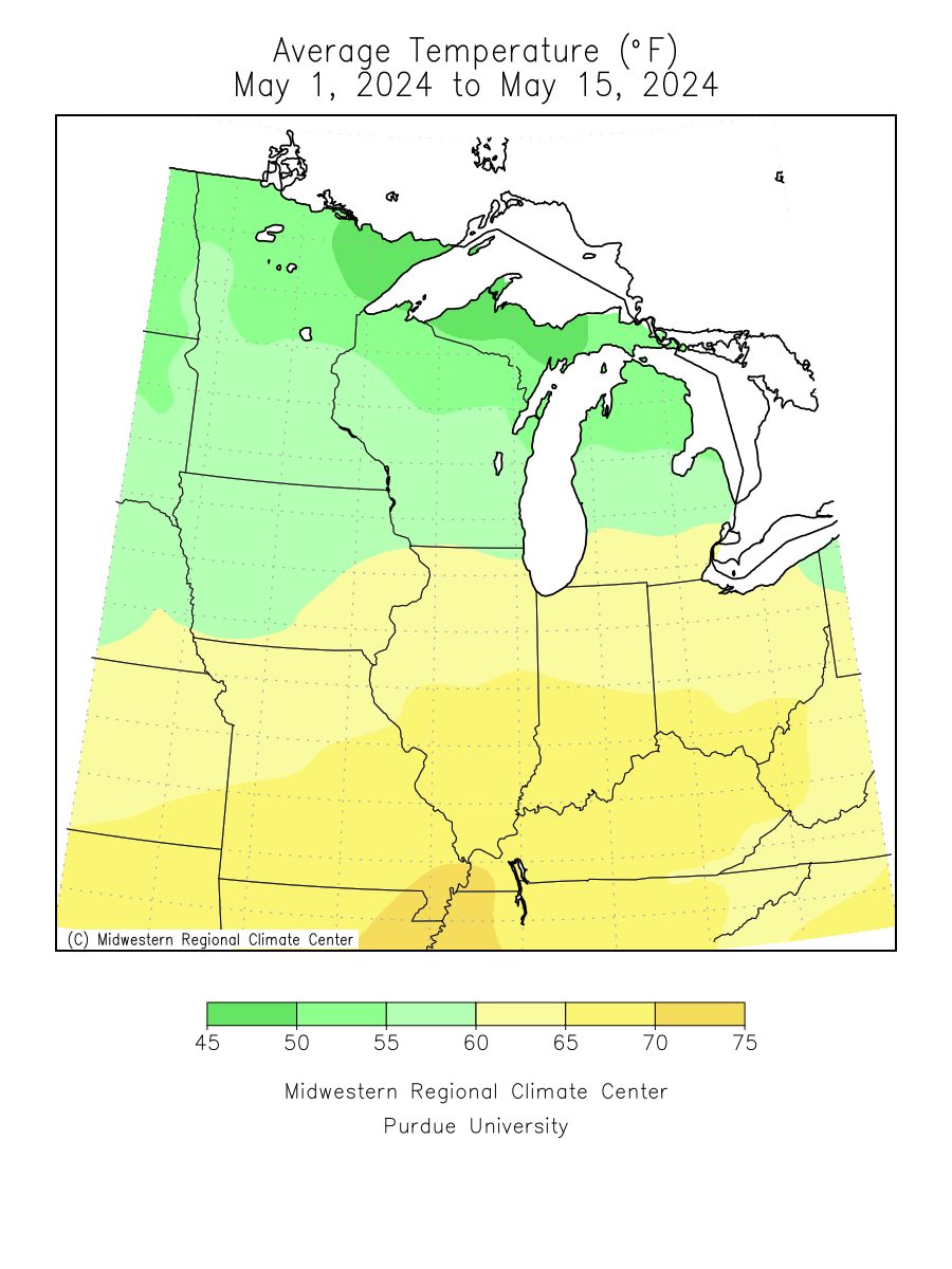
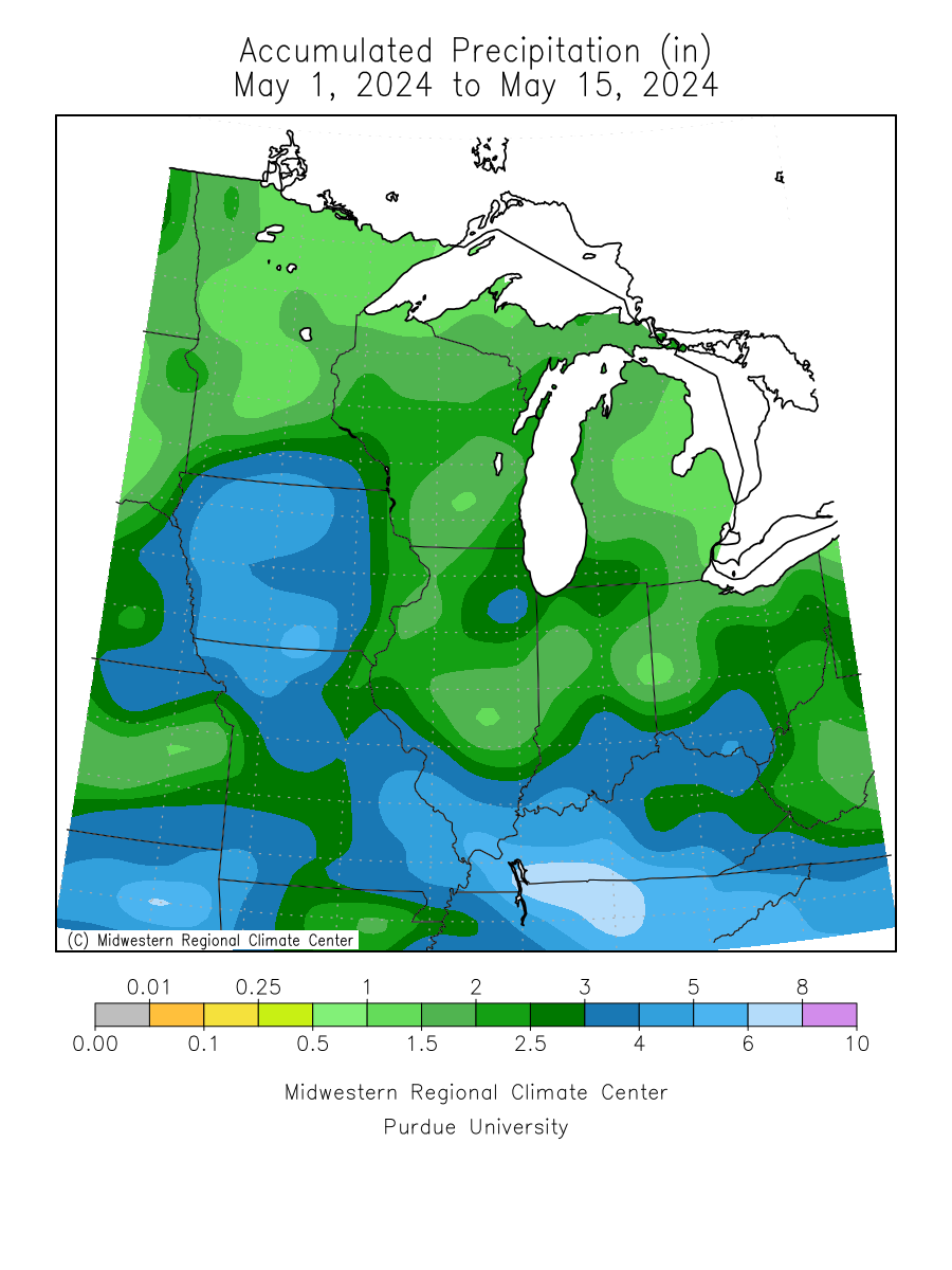
| Monthly Avg. Temperature | Monthly Total Precipitation | |
 |
 |
Reference Material
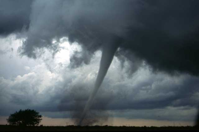
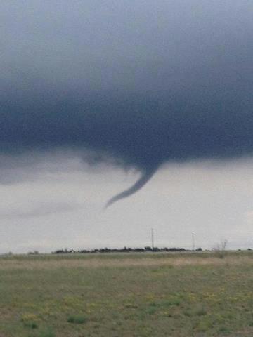
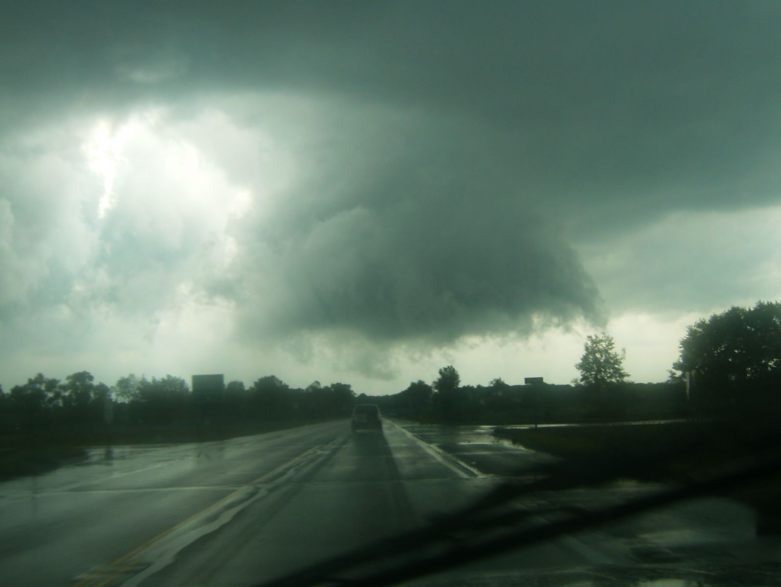
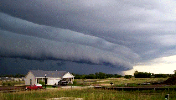
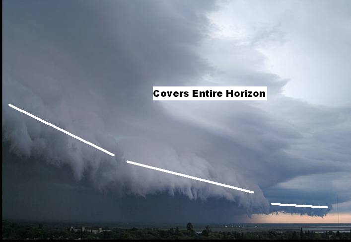
| Tornado / Funnel Clouds | ||||||
|
||||||
| Damaging Wind | ||||||
|
||||||
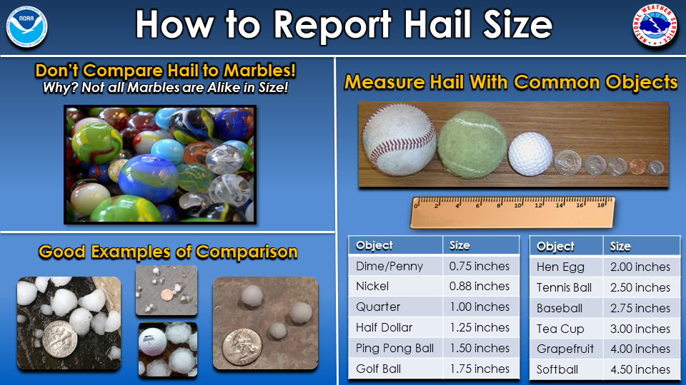
| Hail | ||||||
|
||||||
| Flood | ||||||
|
||||||
| Winter | ||||||
|
Informational Links
 |
Contact NWS La Crosse if you have any questions or need additional details: Send email or call 608-784-7294 |
|


 Weather Story
 Weather Map