
Multiple chances exist for severe thunderstorms Monday. The 1st round will be Monday AM as thunderstorms travel SE from ND through MN and into our area. The second round will be Monday afternoon and evening as a cold front drops south across the area and thunderstorms develop. How the morning thunderstorms evolve, will dictate who & when will receive thunderstorms in the afternoon. Read More >
| Click anywhere on the map for the forecast for that location. Turn "on and off" the various weather parameters using the display options. Hover over a highlighted area to see the hazard. | Map Display Options | ||
|
National Water Prediction Service Hazardous Weather Outlook Forecast Discussion Local Hydro Outlook
|
Any questions or comments regarding the information located here, or about the NWS La Crosse's hydrological service area? Please contact the NWS La Crosse Hydrology Team.
|
| La Crosse | Other Local Radars | ||||
STANDARD / ENHANCED |
Minneapolis |
Duluth |
Green Bay |
||
Des Moines |
Davenport |
Milwaukee |
|||
National  |
|||||
|
||||||||||||||||||||
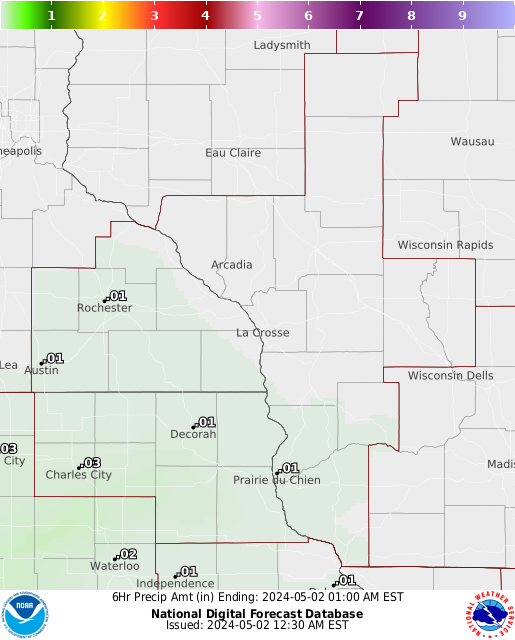
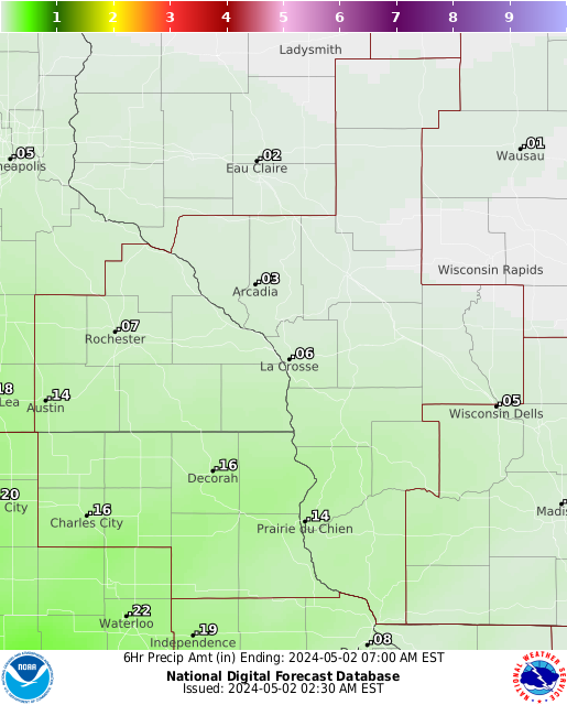
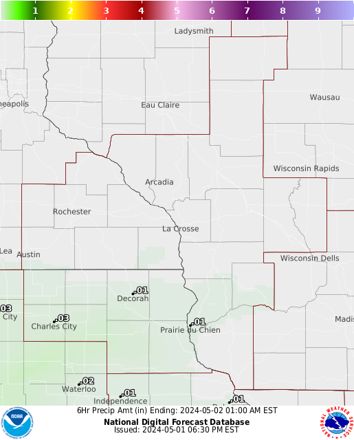
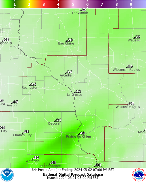
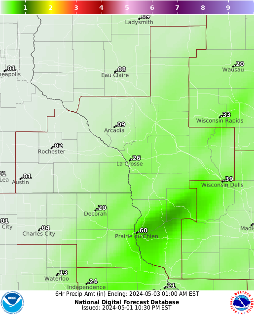
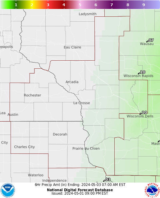
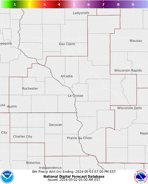
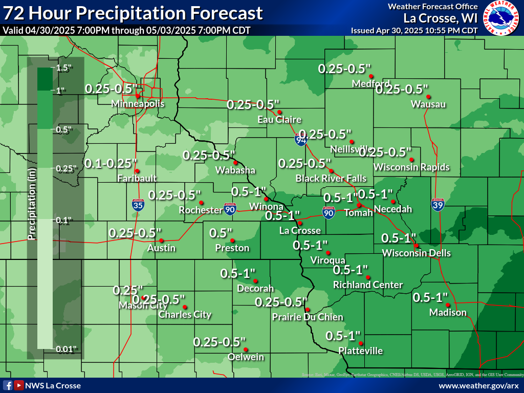
| Forecast Rainfall Amounts | |||||||
| The graphics below are for 6 hour rainfall amounts, from the most current time to 48 hours. | |||||||
 |
 |
 |
 |
 |
 |
 |
 |
| Most Current | 48 hours | ||||||
CURRENT CONDITIONS
 More Details |
 |
 |
 |


 Weather Story
 Weather Map