
Tropical Storm Bertha could bring tropical storm conditions to portions of the Florida Panhandle and Alabama coast through Wednesday, where a Tropical Storm Watch and Storm Surge Watch is in effect. Numerous severe thunderstorms with heavy rainfall are expected from the Ohio Valley into the Mid-Atlantic and Northeast Tuesday. Read More >
| Click anywhere on the map for the forecast for that location. Turn "on and off" the various weather parameters using the display options. Hover over a highlighted area to see the hazard. | Map Display Options (Click " > " for legend to display option) |
||
|
NWPS Hazardous Weather Outlook Forecast Discussion Local Hydro Outlook
Useful Links: Latest Soil Moisture Conditions Snow Water Equivalent Information
|
Any questions or comments regarding the information located here, or about the NWS La Crosse's hydrological service area? Please contact the NWS La Crosse Hydrology Team .
|
|
 Observations |
OUTLOOKS
| Weather Predicition Center: Rainfall Outlooks | |||||||
|
|
||||||
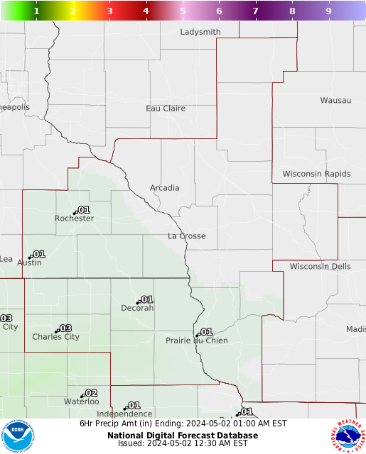
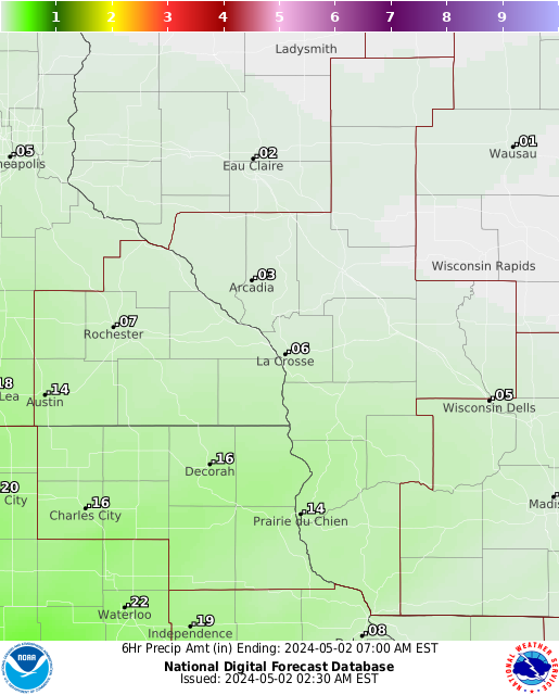
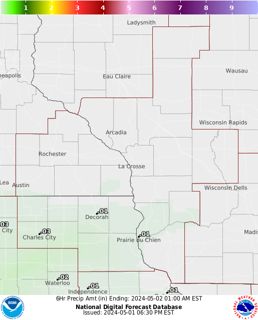
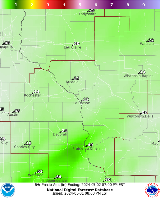
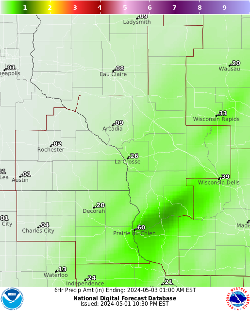
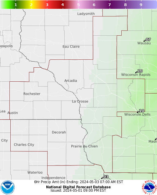
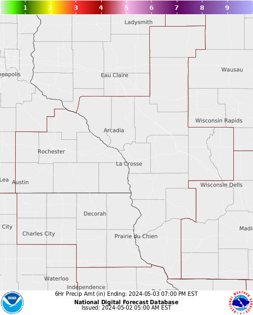
RAINFALL FORECASTS
|
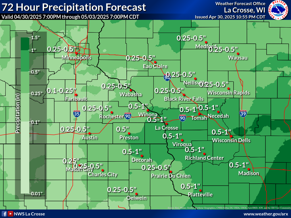 3 Day Total |
||||||||||||||||||||||||||||||||
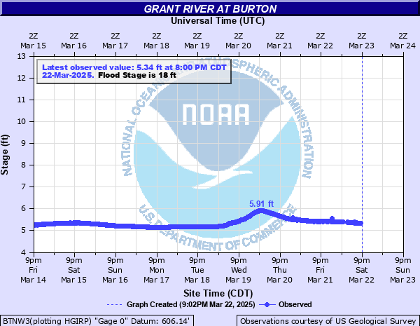
UPPER KICKAPOO RIVER
Tri Creek near Norwalk TCIW3 [Details] |
Tri Creek near Norwalk (Dam Outlet)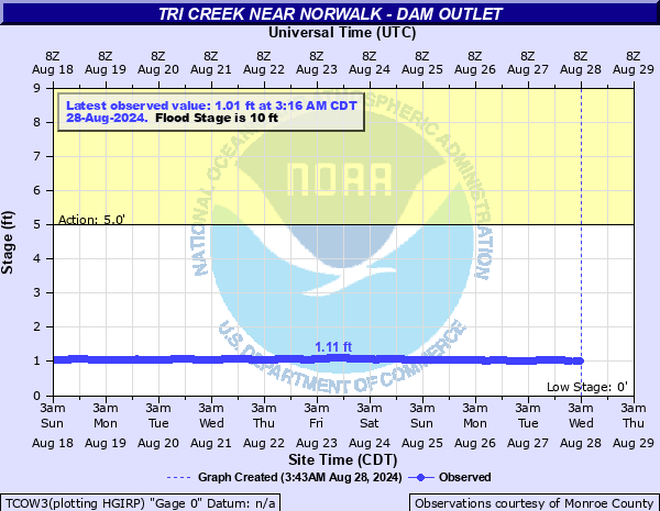 TCOW3 [Details] |
Moore Creek at Norwalk NWKW3 [Details] |
Kickapoo River near Wilton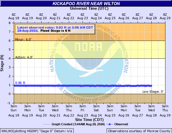 WKLW3 [Details] |
Sleighton Creek near Wilton (County Rd M)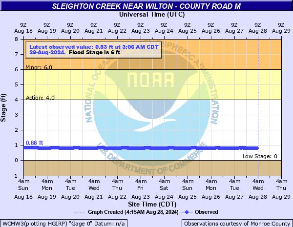 WCMW3 [Details] |
Poe Creek at County Road Z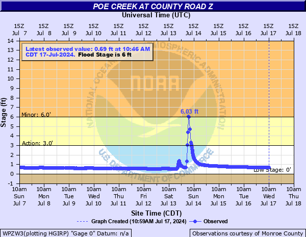 WPZW3 [Details] |
Moore Creek near Wilton (County Rd T) OCYW3 [Details] |
Cook Creek near Ontario (Niagara Ave) COOW3 [Details] |
Ontario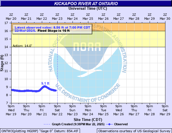 ONTW3 [Details] |
MIDDLE KICKAPOO RIVER
Upper Brush Creek near Cashton (Oneida Rd) UBCW3 [Details] |
Brush Creek Near Cashton (Nevada Rd)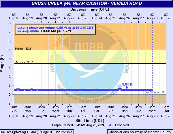 RNOW3 [Details] |
Brush Creek Near Cashton (Opal Rd)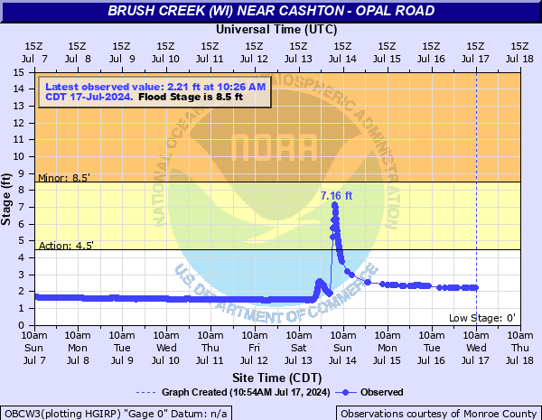 OBCW3 [Details] |
LOWER KICKAPOO RIVER
La Farge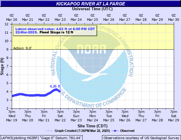 LAFW3 [Details] |
Viola VIOW3 [Details] |
Readstown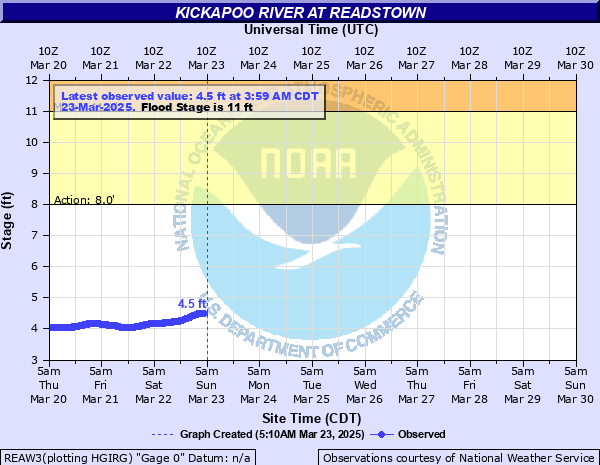 REAW3 [Details] |
Soldiers Grove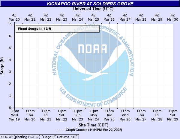 SOGW3 [Details] |
Gays Mills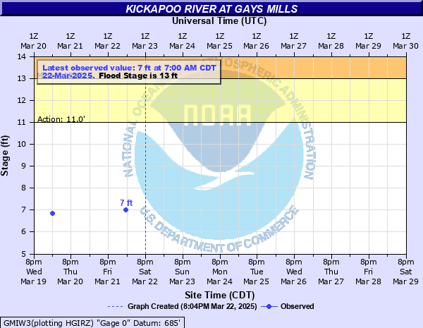 GMIW3 [Details] |
Steuben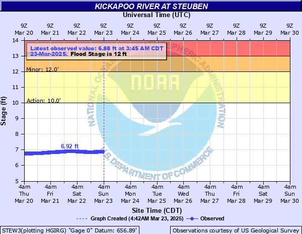 STEW3 [Details] |
Kickapoo River Webcams
At State Highway 131 - [Details]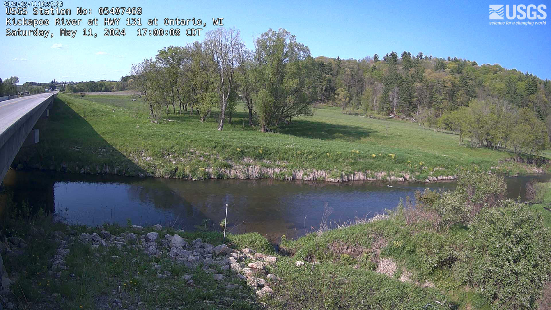 |
At La Farge - [Details]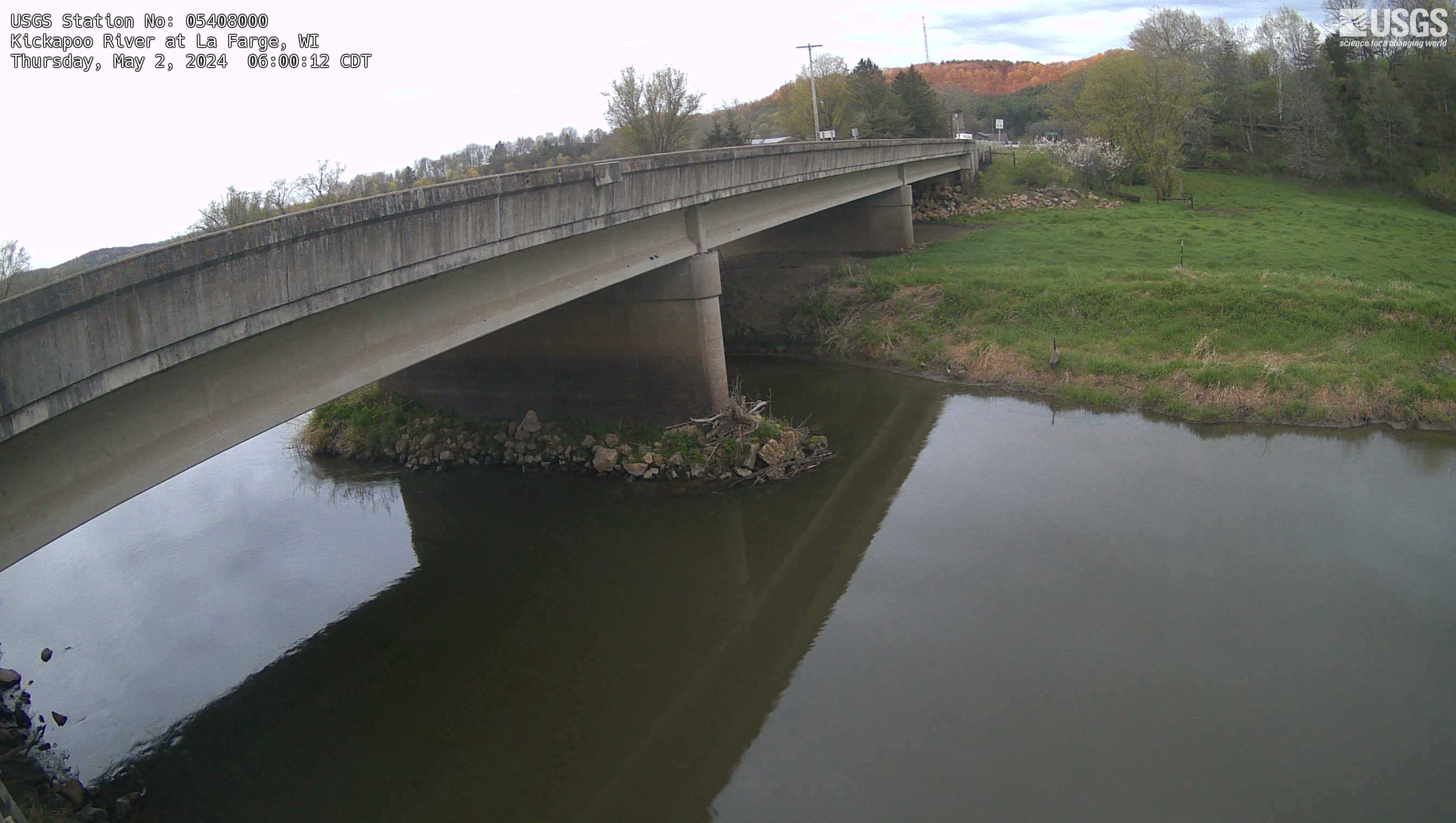 |
La Crosse River Basin
Coles Valley Creek Near Fort McCoy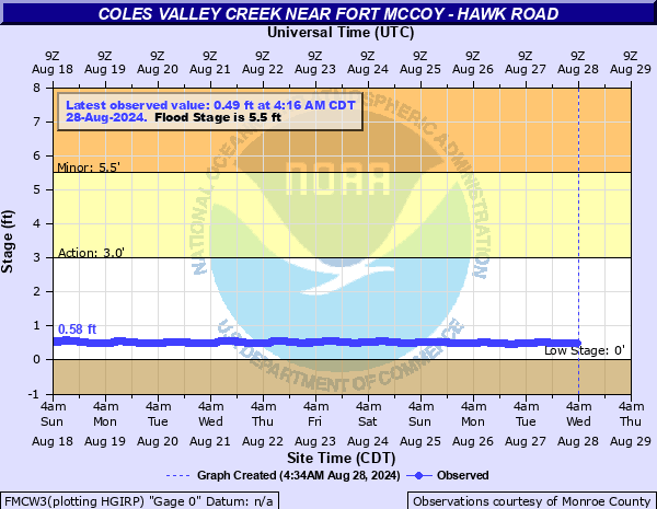 FMCW3 [Details] |
Fort Mc Coy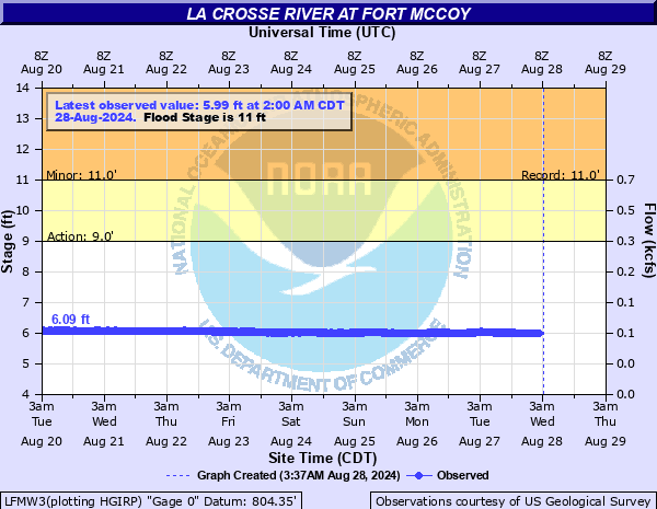 LFMW3 [Details] |
Beaver Creek near Sparta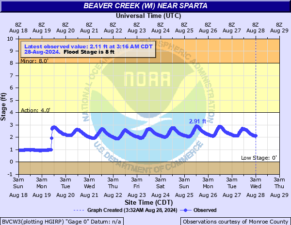 BVCW3 [Details] |
Sparta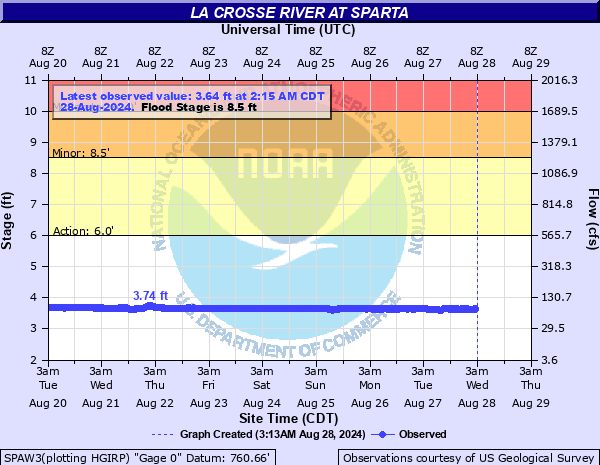 SPAW3 [Details] |
Big Creek near Rockland (Herman Rd)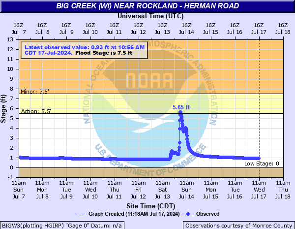 BIGW3 [Details] |
Lake Neshonoc Dam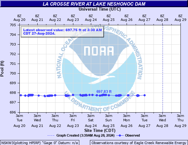 NSKW3 [Details] |
Near La Crosse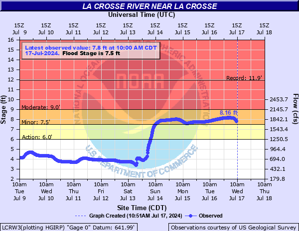 LCRW3 [Details] |
La Crosse River Webcams
Stillwell Creek at Yard Rd near Tomah - [Details]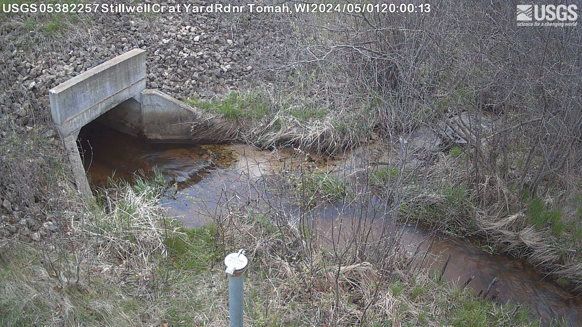 |
La Crosse River at County HWY BB near Tomah - [Details]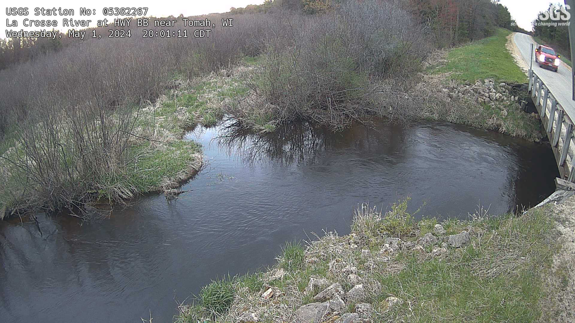 |
Silver Creek Near Angelo Hwy 21 - [Details]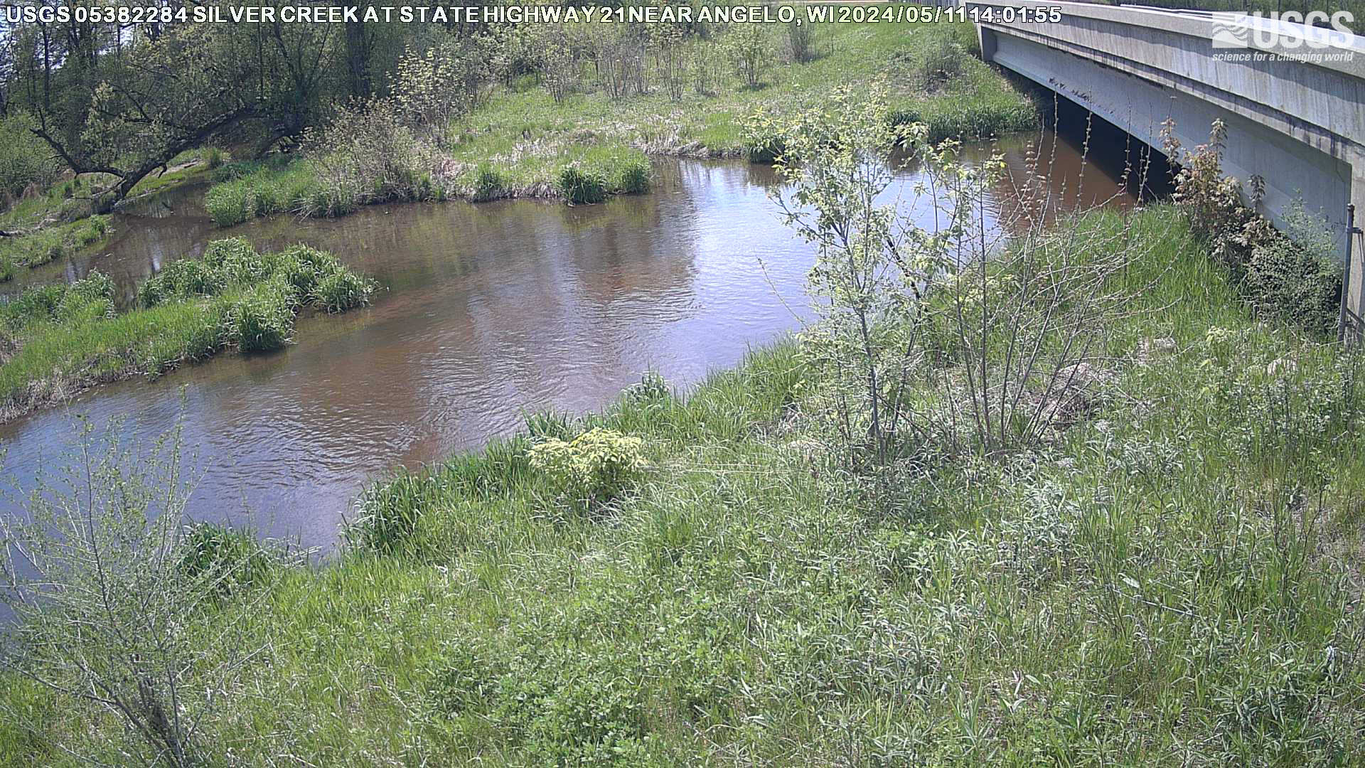 |
La Crosse River at Sparta - [Details]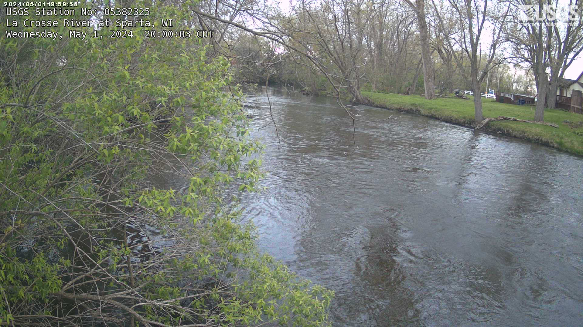 |
Little La Crosse River Basin
At Market Road MLVW3 [Details] |
Cannon Valley Creek near Cashton (Manna Ave)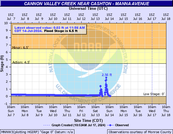 MNNW3 [Details] |
At Melvina (Country Rd F)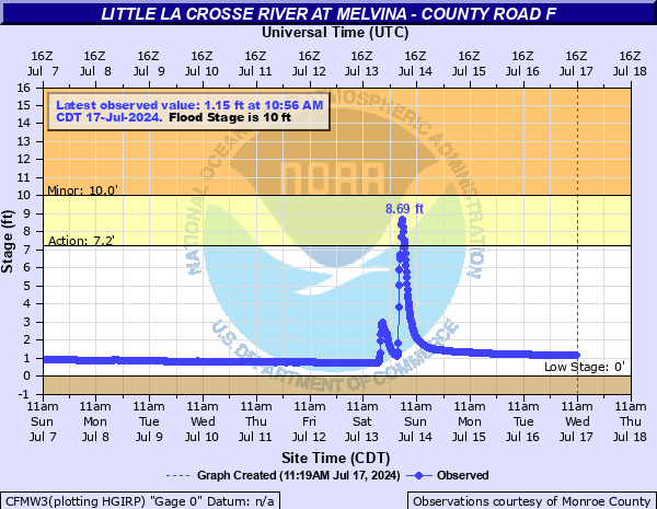 CFMW3 [Details] |
Halls Valley Creek near Melvina (Lamplighter S)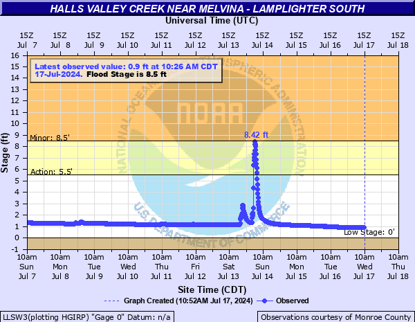 LLSW3 [Details] |
Lyon Valley Creek near Melvina (Lamplighter N)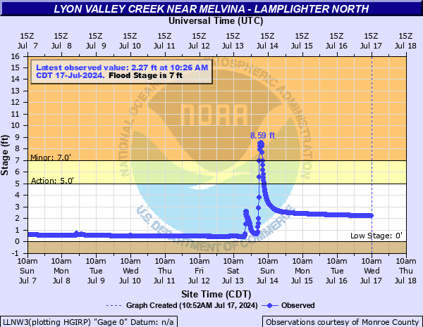 LLNW3 [Details] |
Creek 22-15 near Leon (Country Rd J)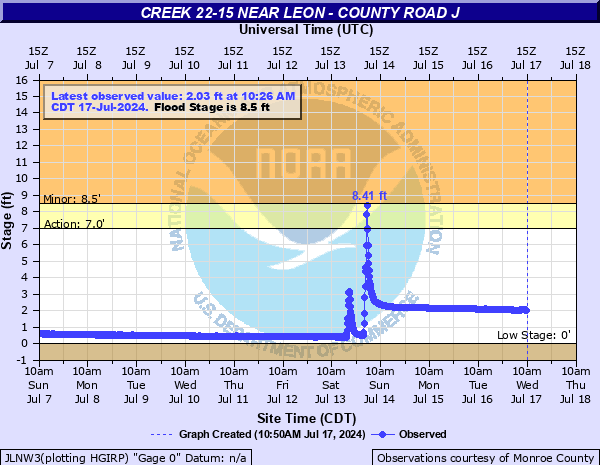 JLNW3 [Details] |
Little La Crosse River at Leon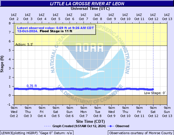 LENW3 [Details] |
Trempealeau River Basin
Pigeon Creek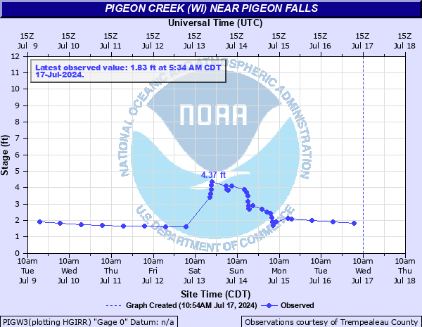 PIGW3 [Details] |
Trempealeau at Whitehall WHIW3 [Details] |
Elk Creek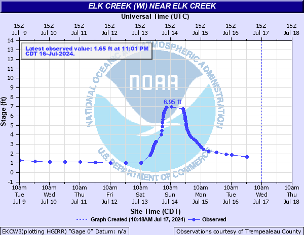 EKCW3 [Details] |
Trempealeau at Independence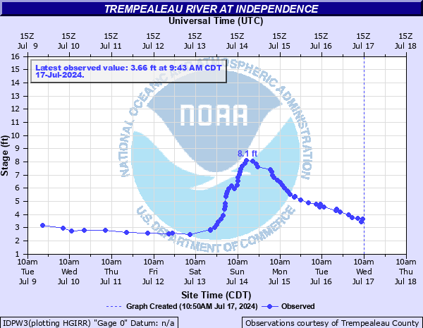 IDPW3 [Details] |
Trempealeau River at Arcadia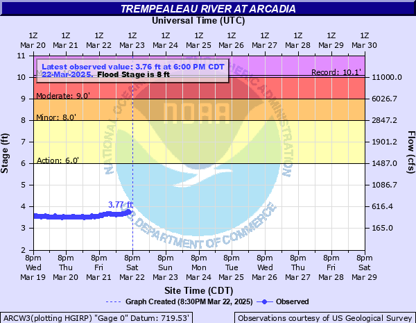 ARCW3 [Details] |
Trempealeau River at Dodge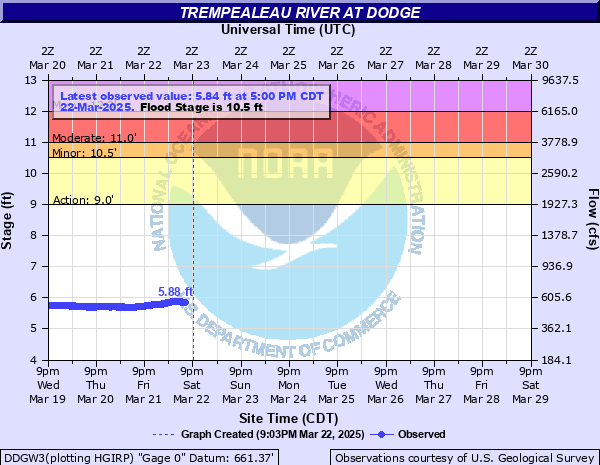 DDGW3 [Details] |
|
Trempealeau County Webcams
Trempealeau River Arcadia, WI - [Details]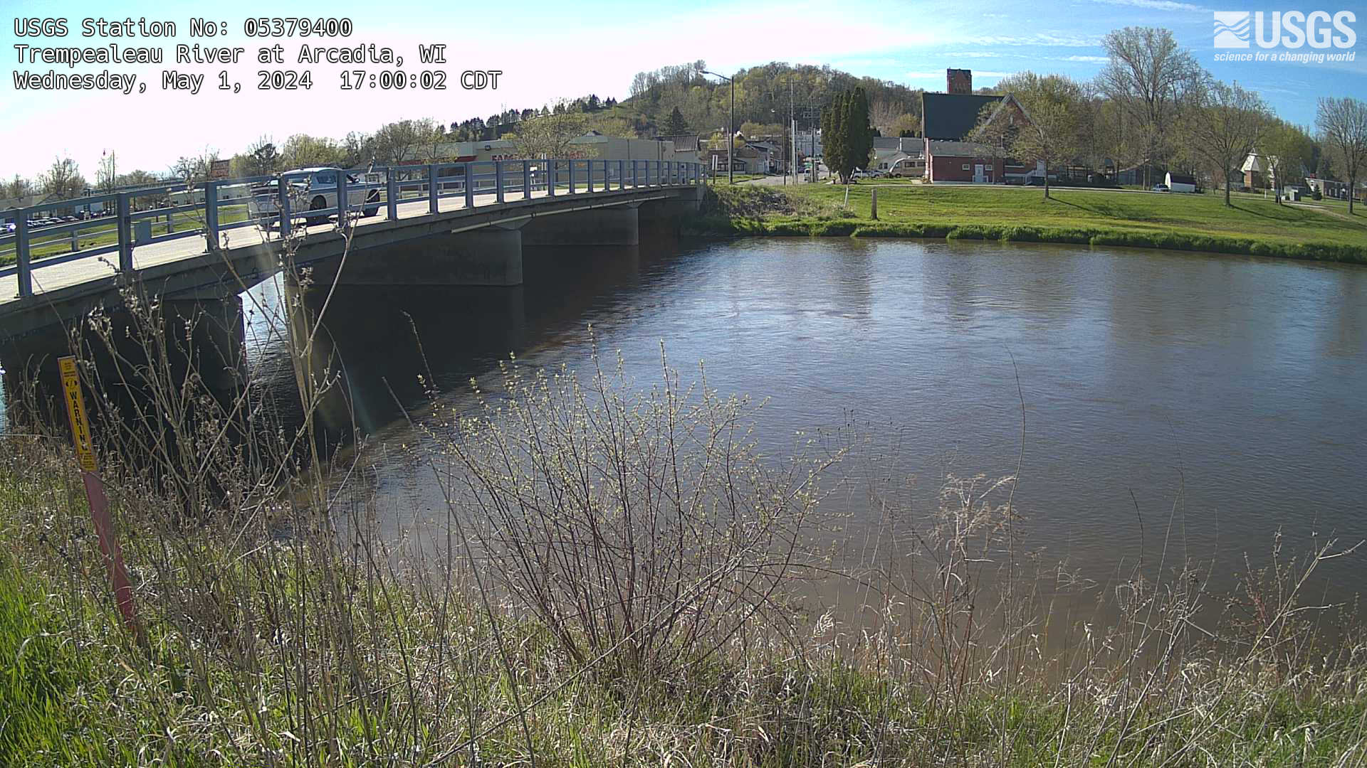 |
French Creek Ettrick, WI - [Details]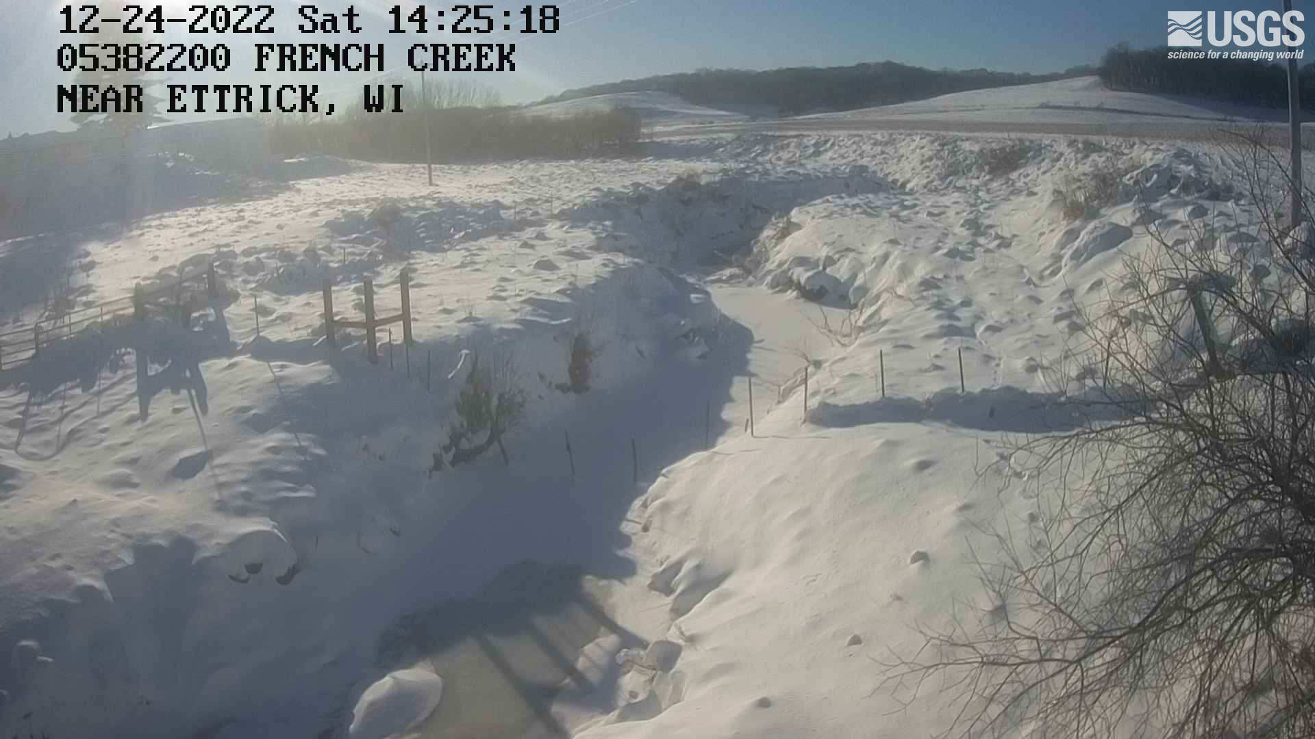 |
Black River
Neillsville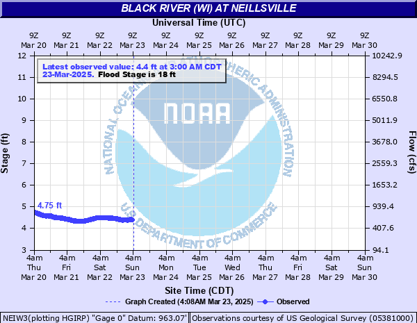 NEIW3 [Details] |
Highway 95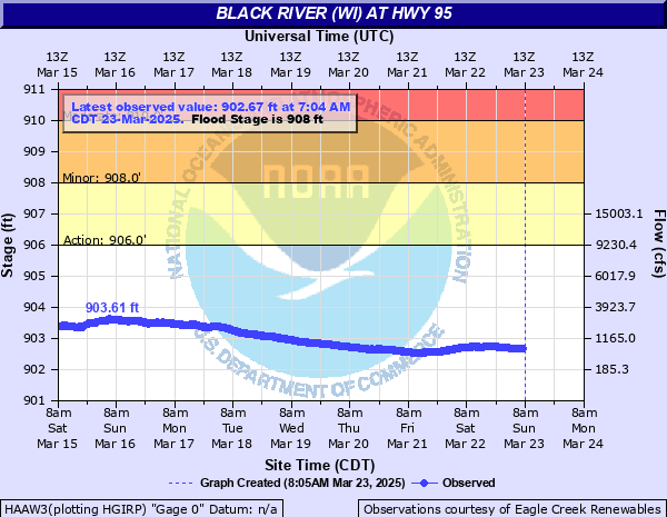 HAAW3 [Details] |
East Fork at East Fork Rd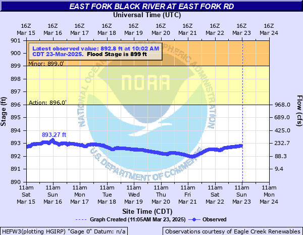 HEFW3 [Details] |
Hatfield Dam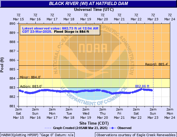 HABW3 [Details] |
Near Hatfield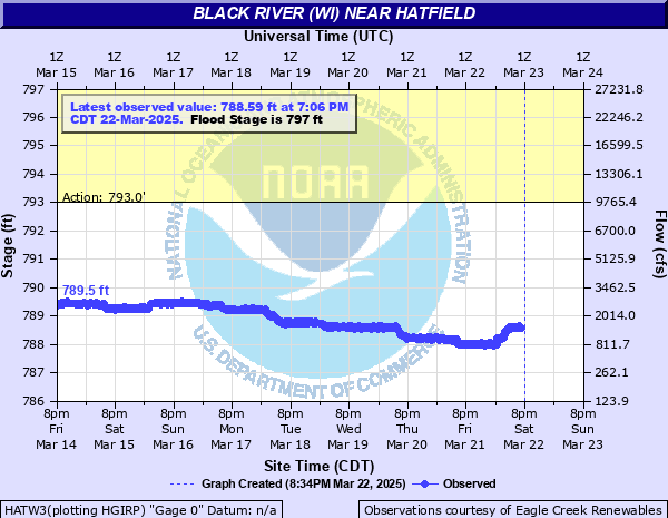 HATW3 [Details] |
Black River Falls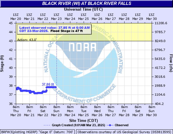 BRFW3 [Details] |
Galesville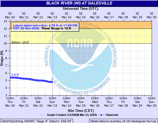 GALW3 [Details] |
Black River Webcams
Galesville, WI - [Details]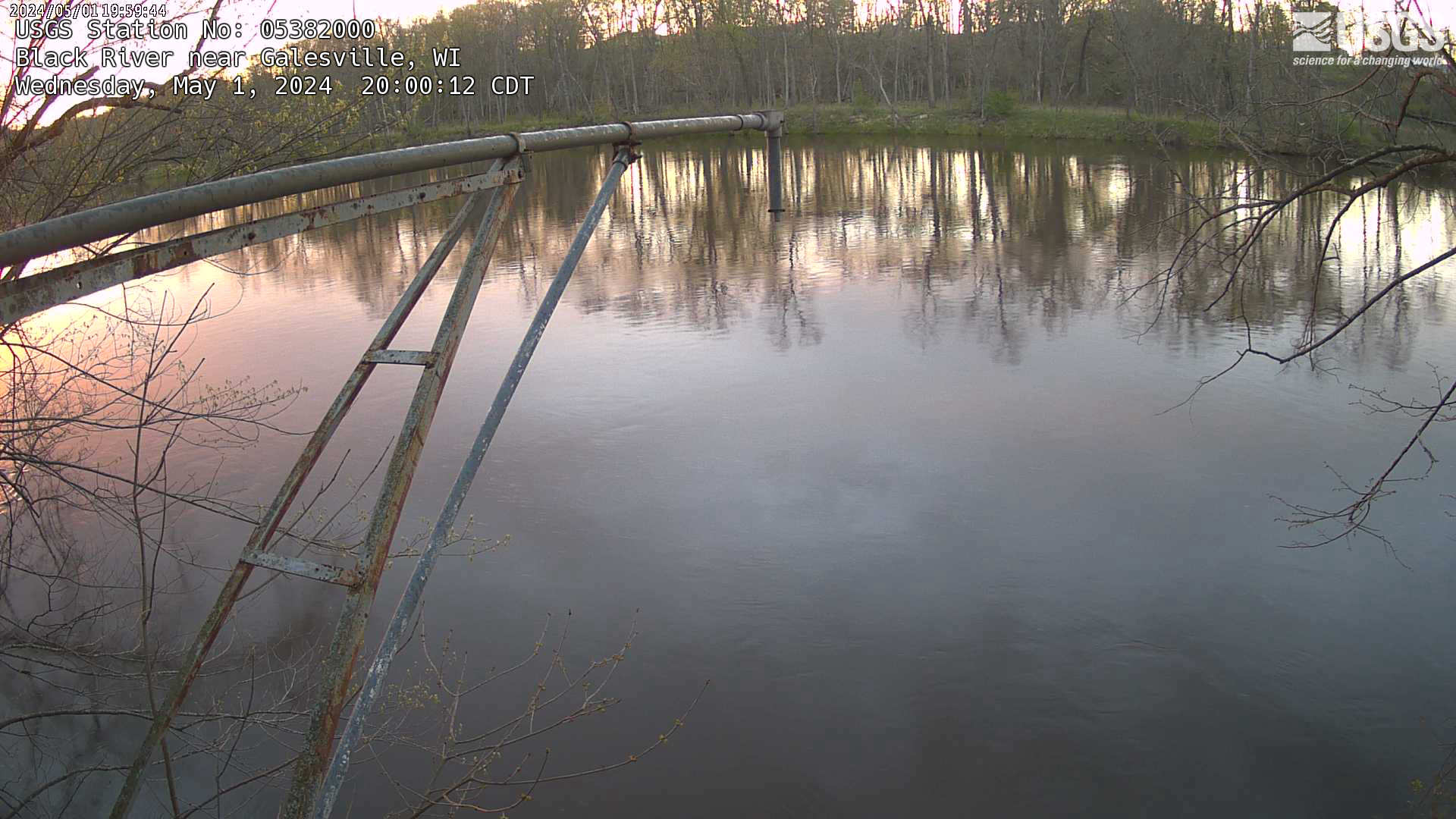 |
Wisconsin / Yellow / Lemonweir Rivers
Yellow River at Babcock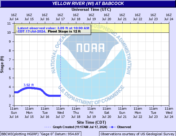 BBCW3 [Details] |
Yellow River at Necedah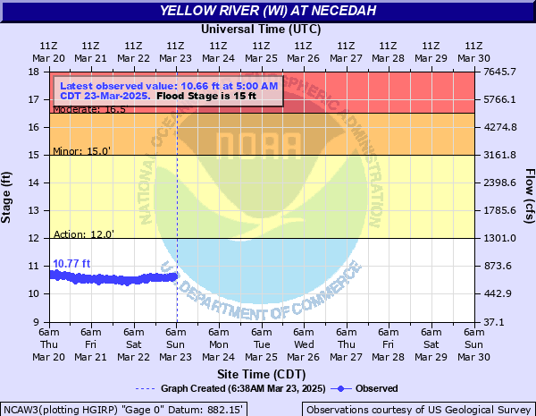 NCAW3 [Details] |
Wisconsin River at Petenwell Dam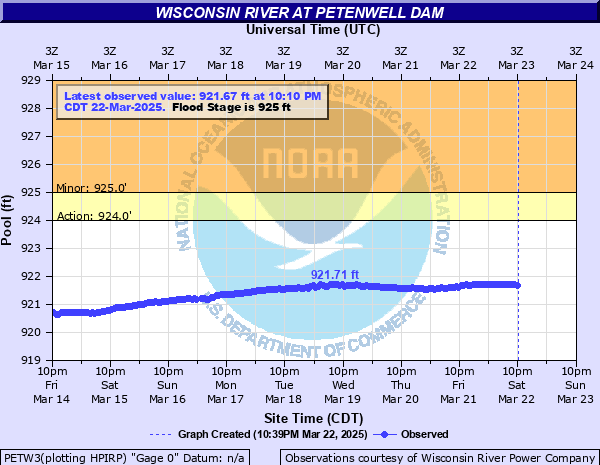 PETW3 [Details] |
Wisconsin River at Castle Rock Dam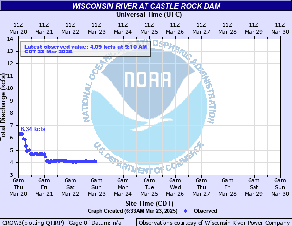 CROW3 [Details] |
Wisconsin River at Muscoda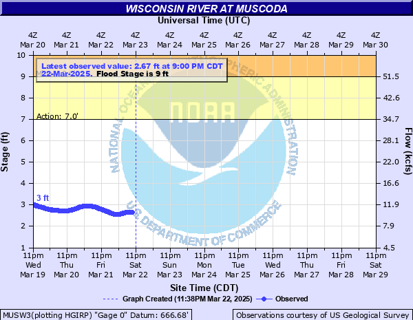 MUSW3 [Details] |
Lemonweir at New Lisbon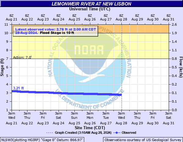 NLSW3 [Details] |
River Webcams
Yellow River at Necedah - [Details]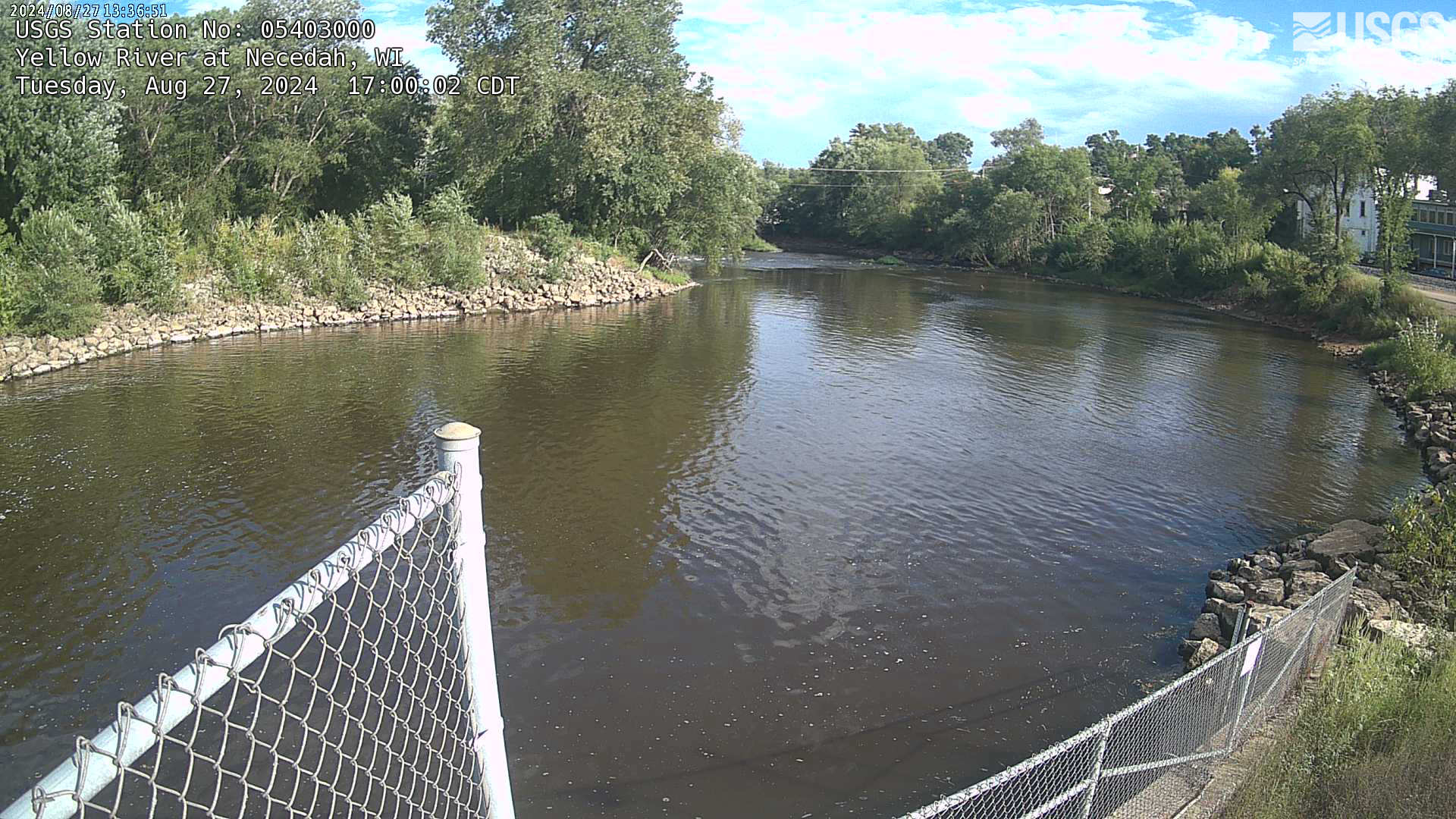 |
Lemonweir at New Lisbon - [Details]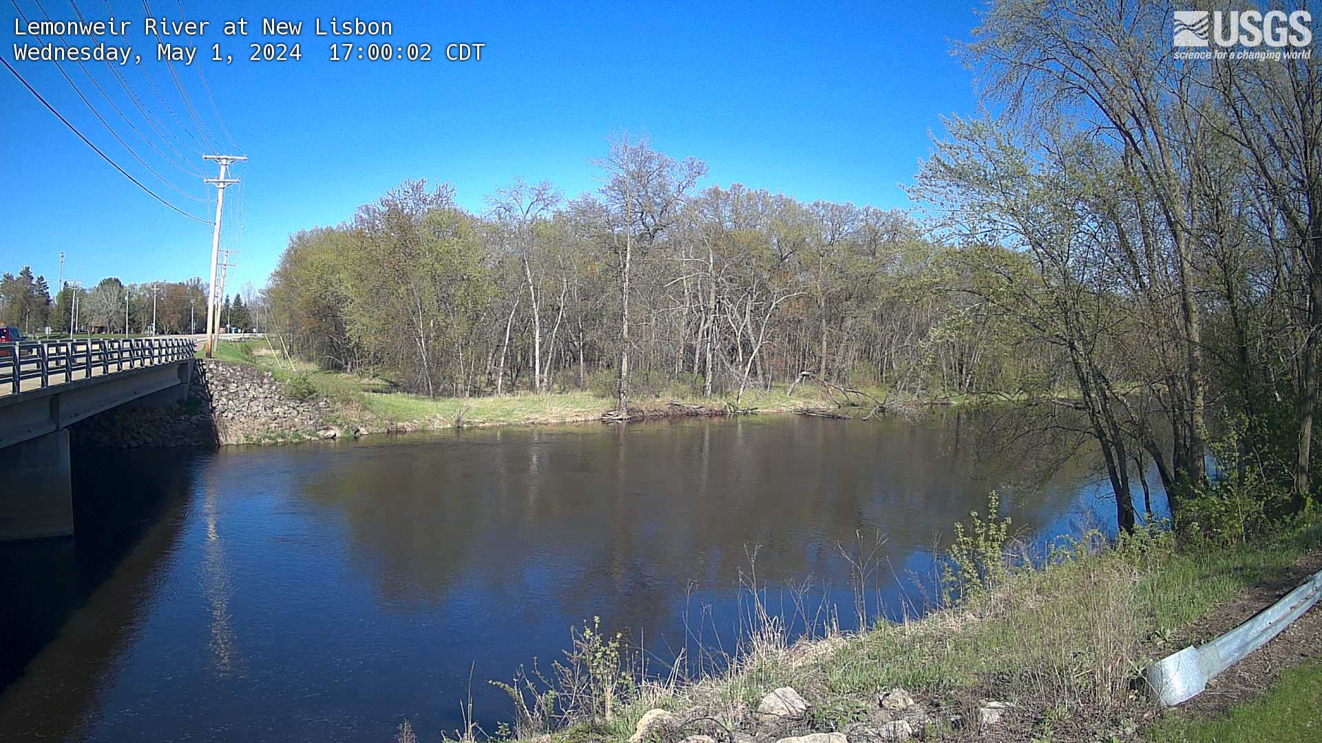 |
Wisconsin River at Muscoda - [Details]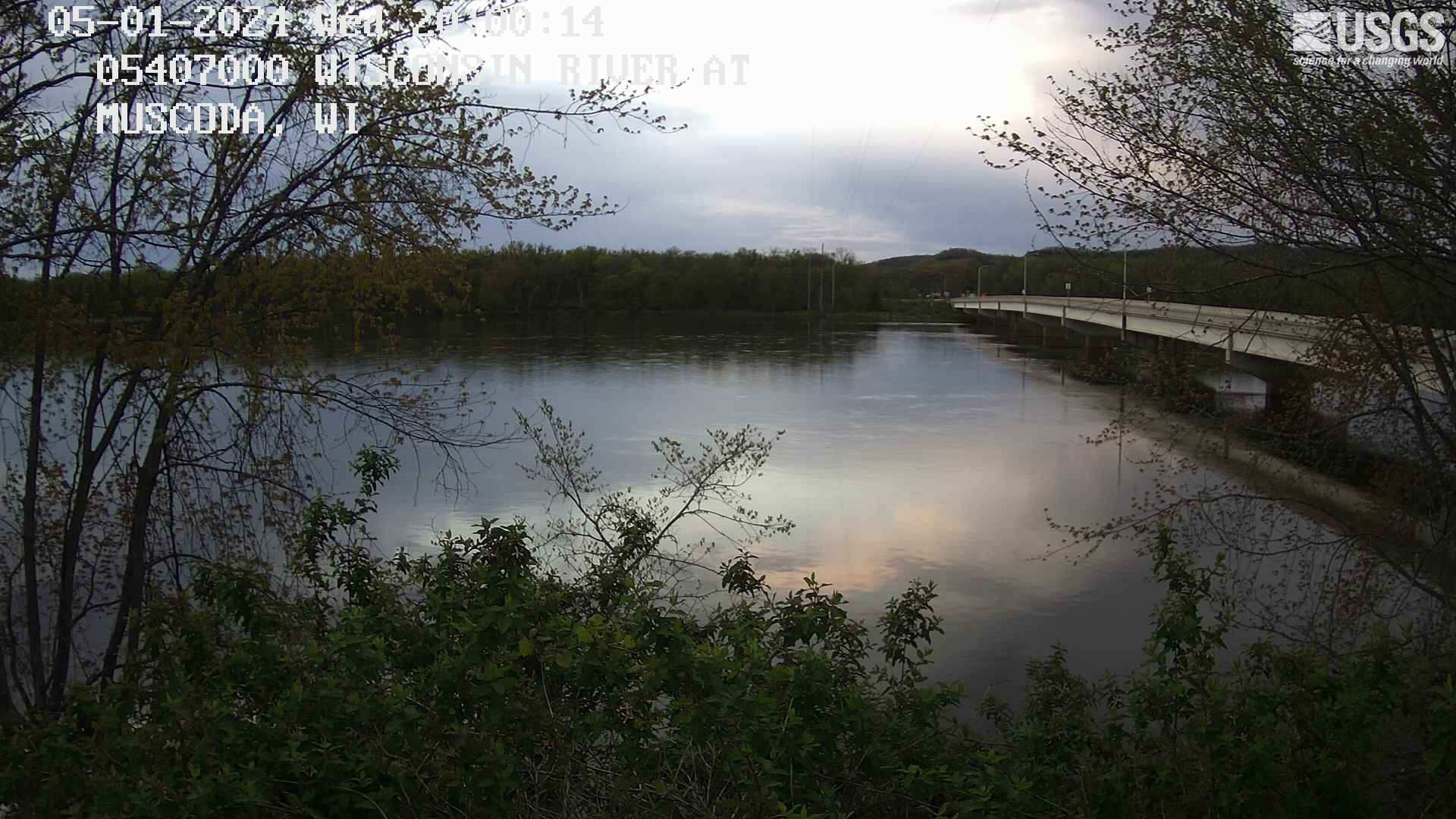 |
Baraboo River
Baraboo River at Kendall Village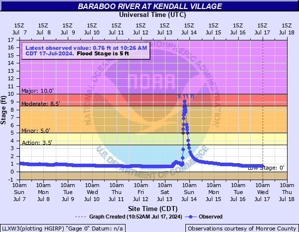 LLXW3 [Details] |
Coon Creek
Rullands Coulee Creek near Portland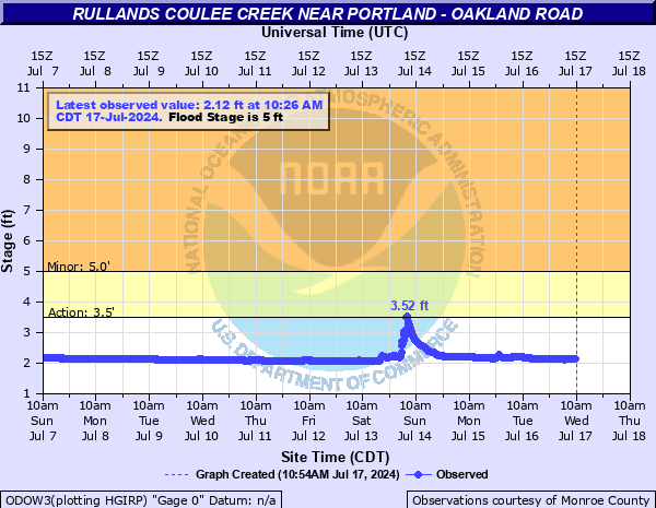 ODOW3 [Details] |


 Weather Story
 Weather Map
 Local Radar
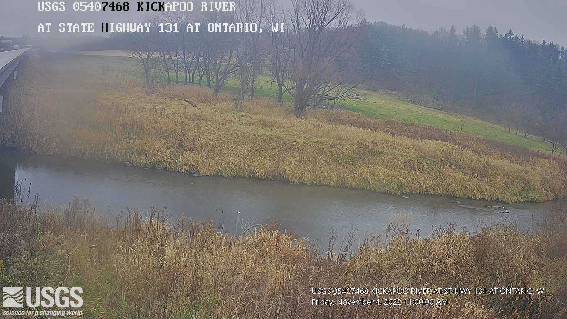