|
Dispatchers / Law Enforcement |
Contact NWS La Crosse via phone, radio, email at nws.lacrosse@noaa.gov, or NWSChat (online chat room) |
| Click anywhere on the map for the forecast. Turn the various weather parameters "on and off" using the display options at right. Hover over a highlighted area to see the hazard. |
Map Display Options |
|
Hourly Forecast Forecast Discussion Current Conditions Regional Hazards Storm Reports DSS Packet Hazardous Weather Outlook (Text) Hazardous Weather Outlook (Graphical) |
|
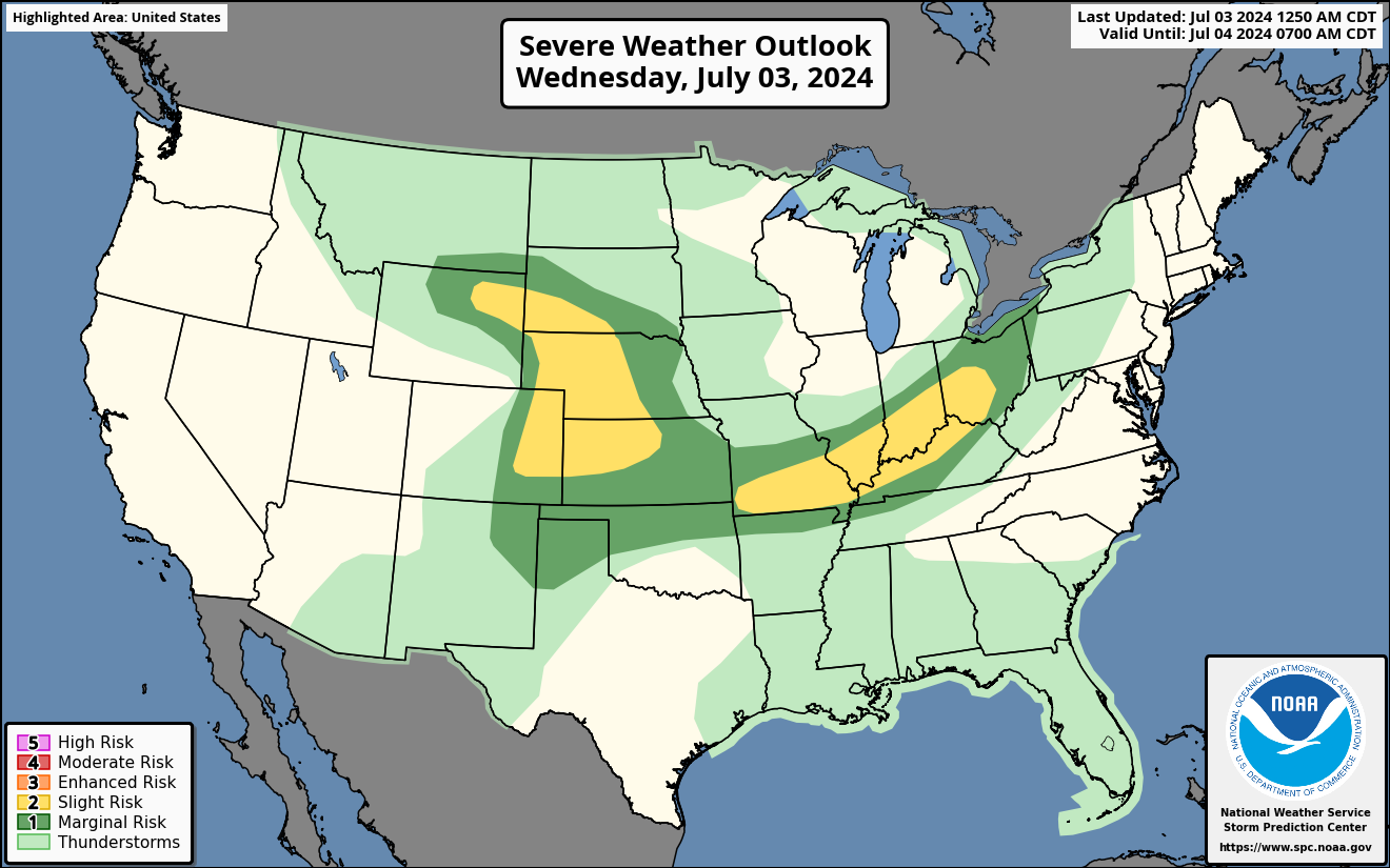
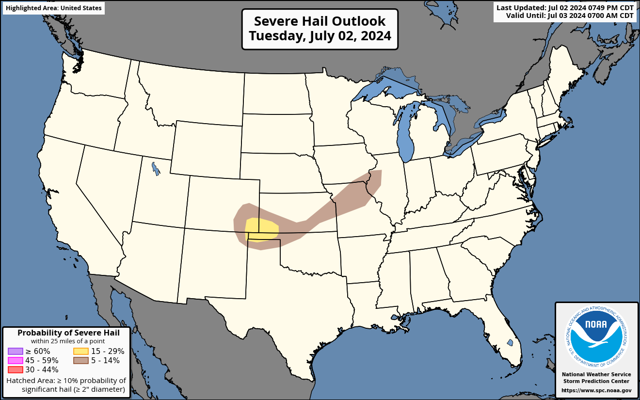
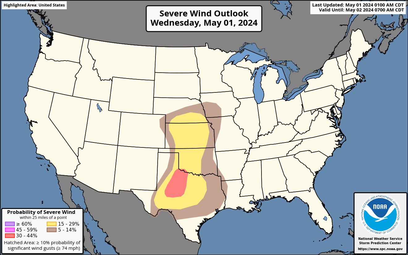
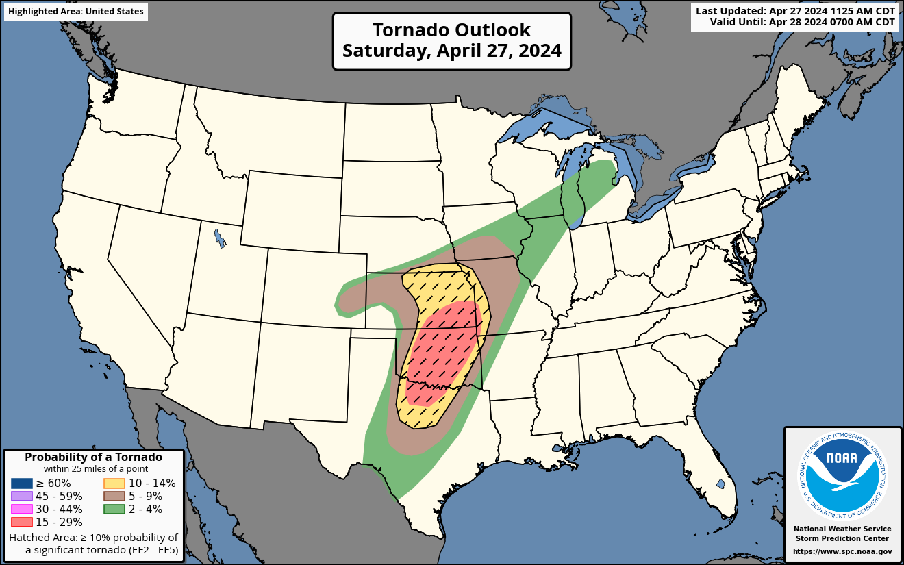
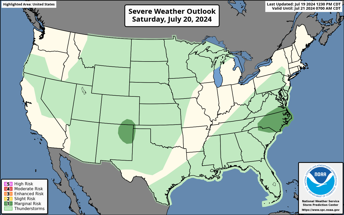
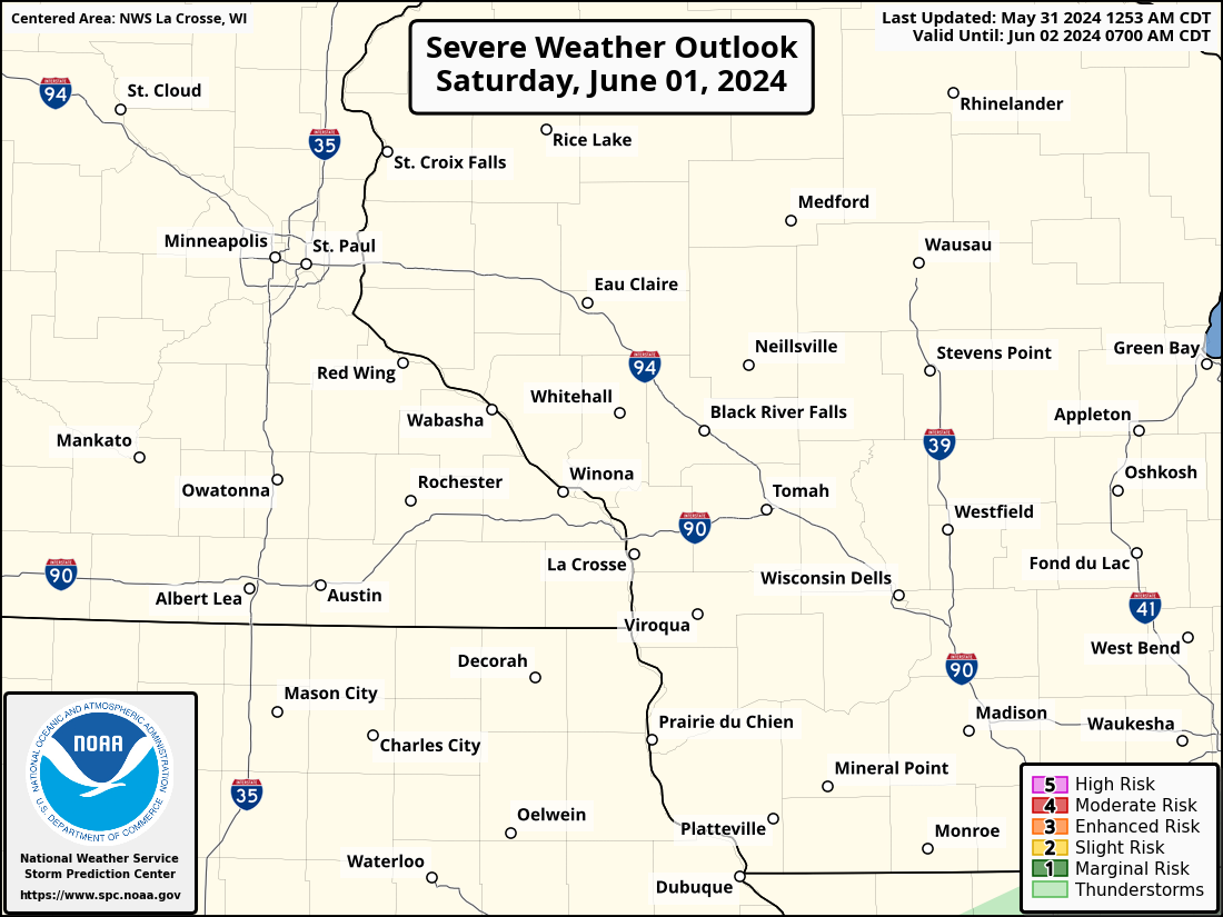
National Severe Weather Outlooks (Explanation of Risk Categories)
| Today / Tonight | Tomorrow / Tomorrow Night | Day 3 | Days 4-8 | ||||||||||||||||||||
|
|
|
 |
||||||||||||||||||||
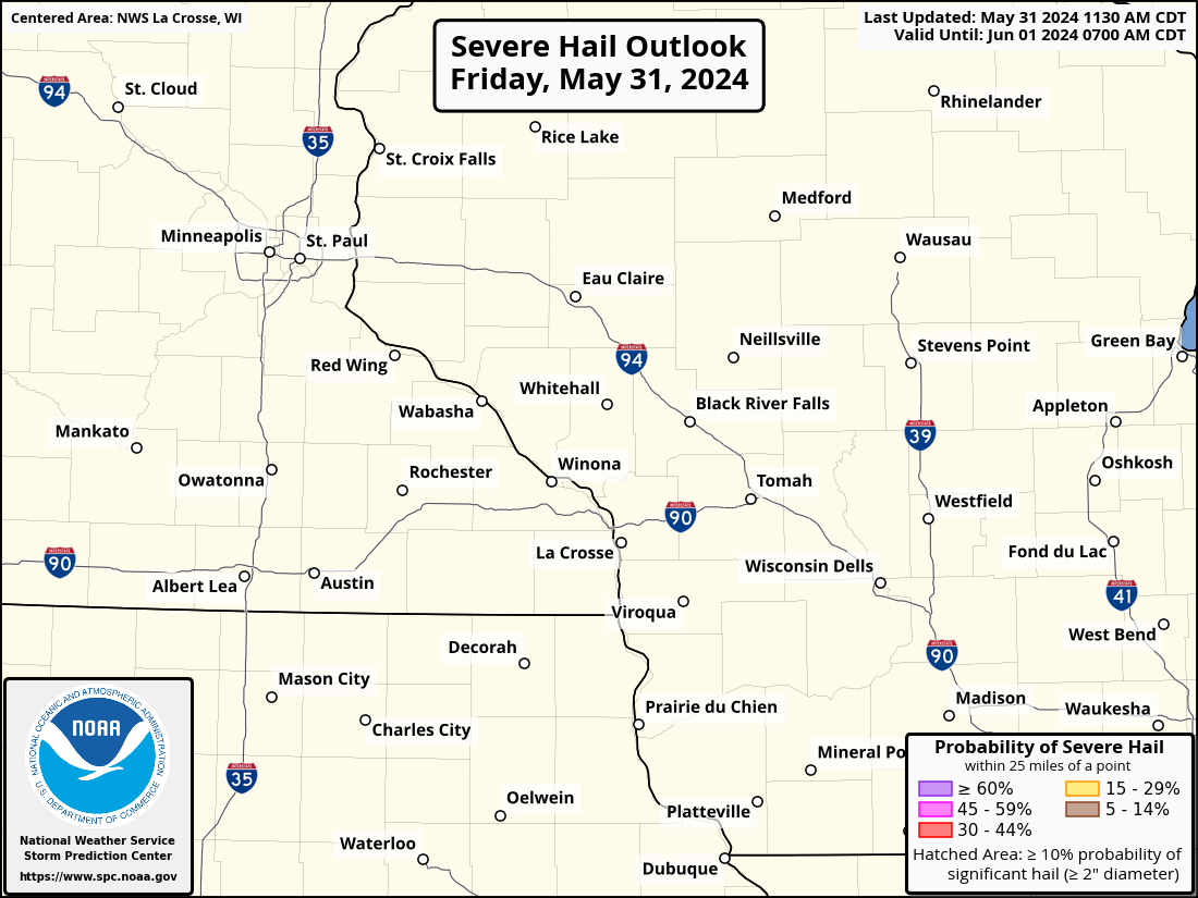
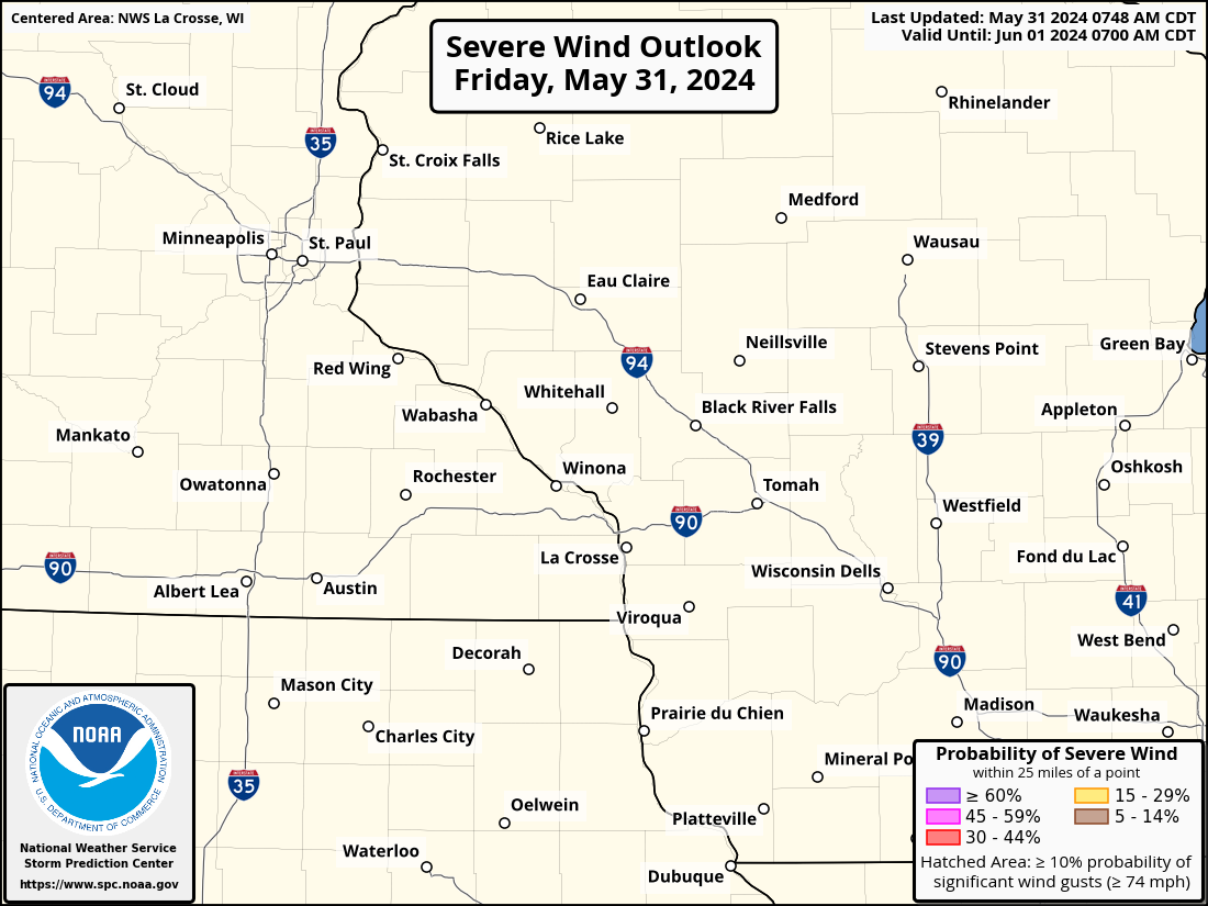
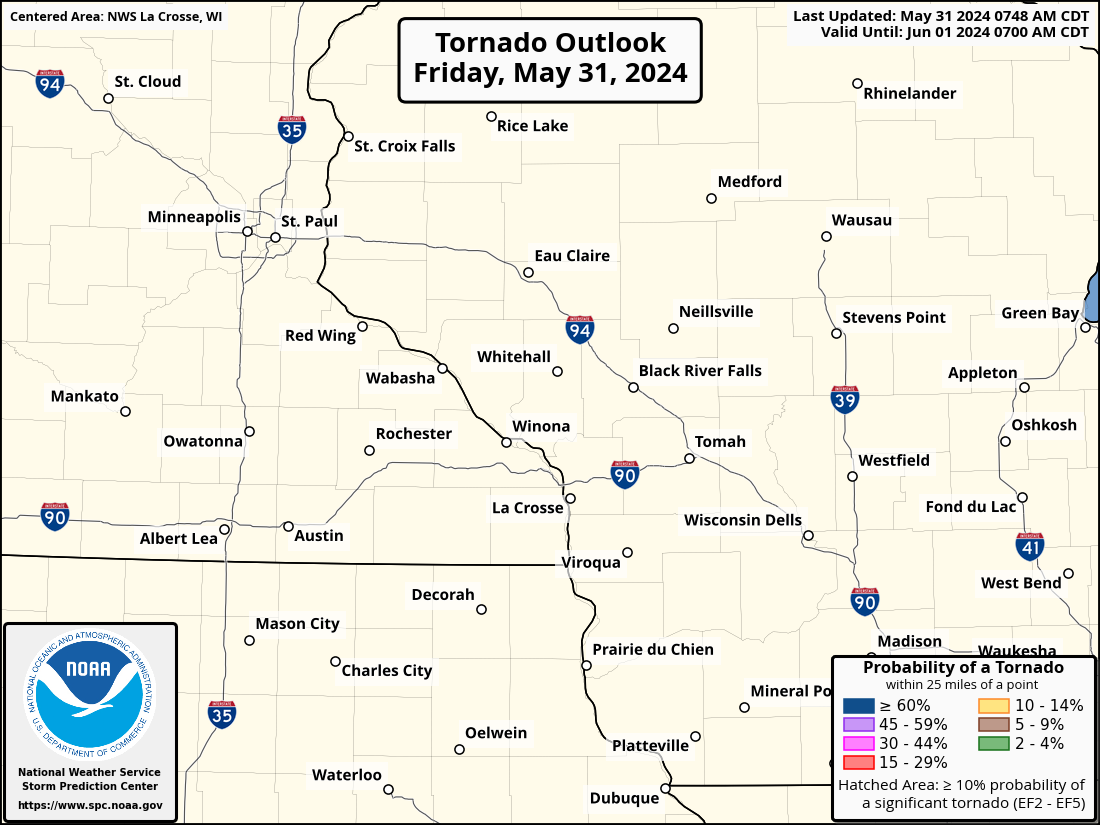
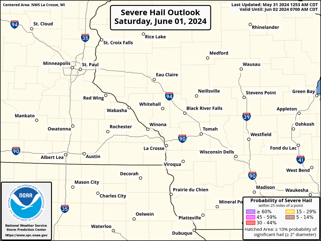
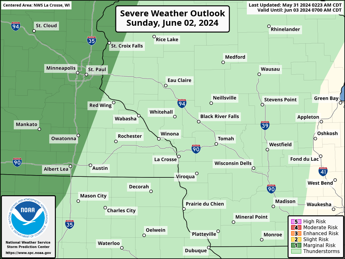
Local Severe Weather Outlooks
| Today / Tonight | Tomorrow / Tomorrow Night | Day 3 | |||||||||||||||||
|
|
|
|||||||||||||||||
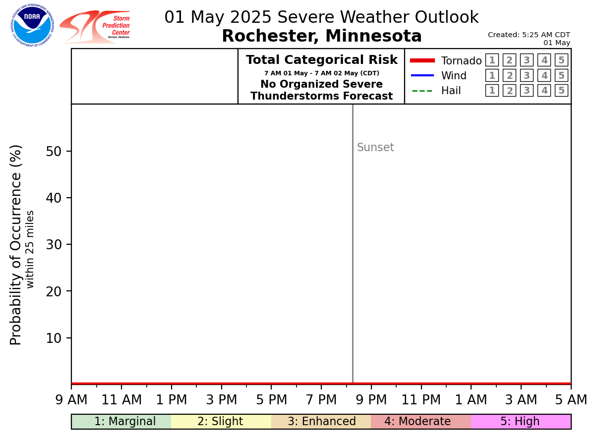
| Local Severe Weather Timing Guidance - TODAY | ||
|
|
|
|
| Local Severe Weather Timing Guidance - TOMORROW (images typically populate by 11 AM CDT) | ||
|
|
|
|
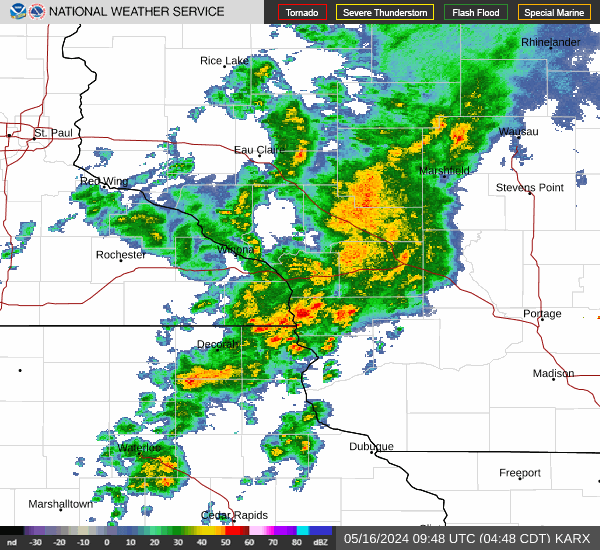
Regional Radar Imagery
| Local, Regional, & National Radar | ||||
La Crosse |
Regional Radar |
National Radar |
||
| Neighboring NWS Radars | ||||||||||
Duluth |
Twin Cities |
Des Moines |
Quad Cities |
Milwaukee |
Green Bay |
|||||
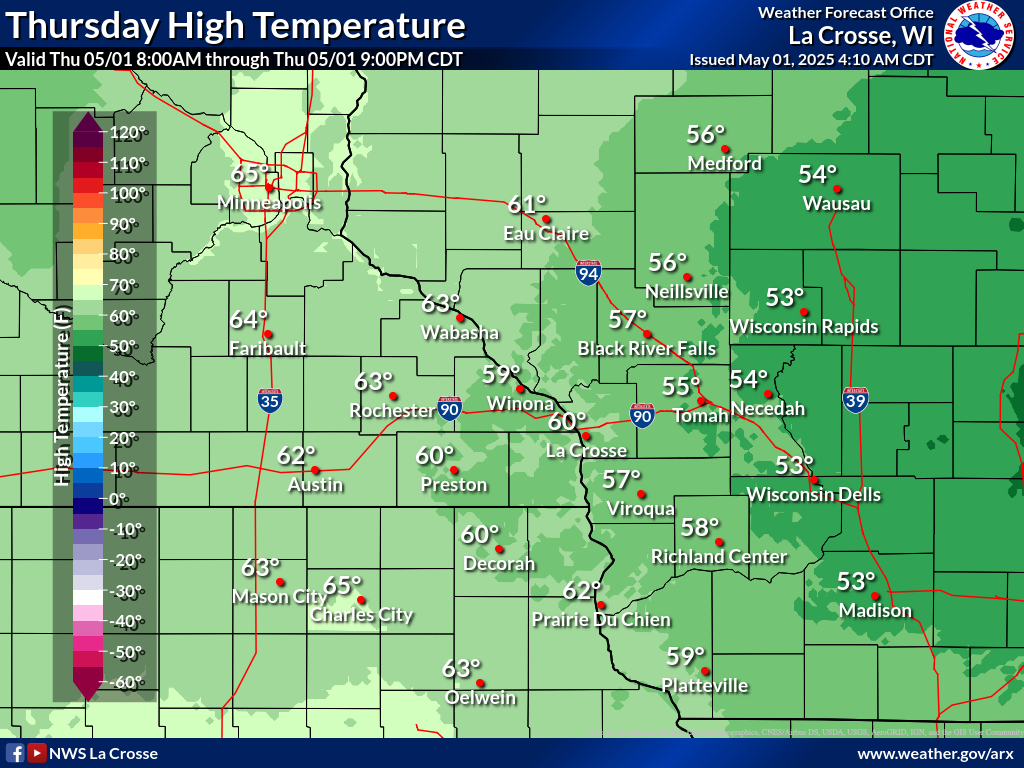
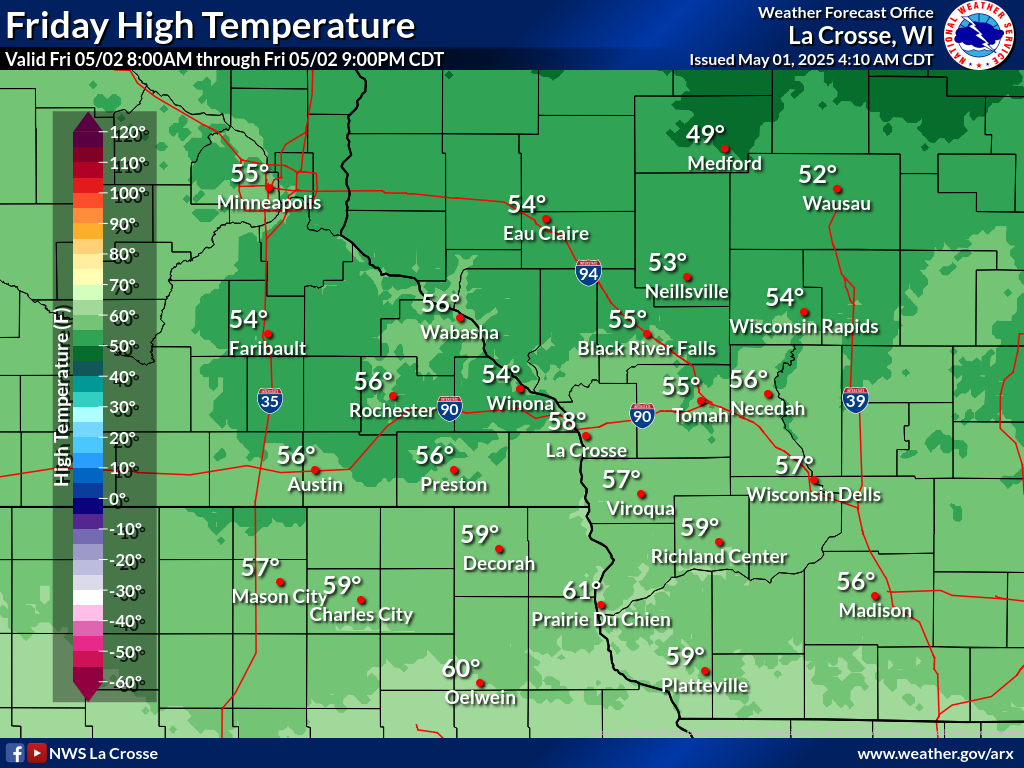
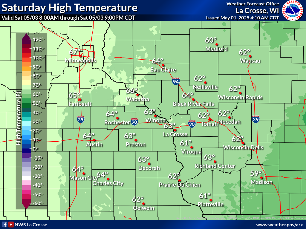
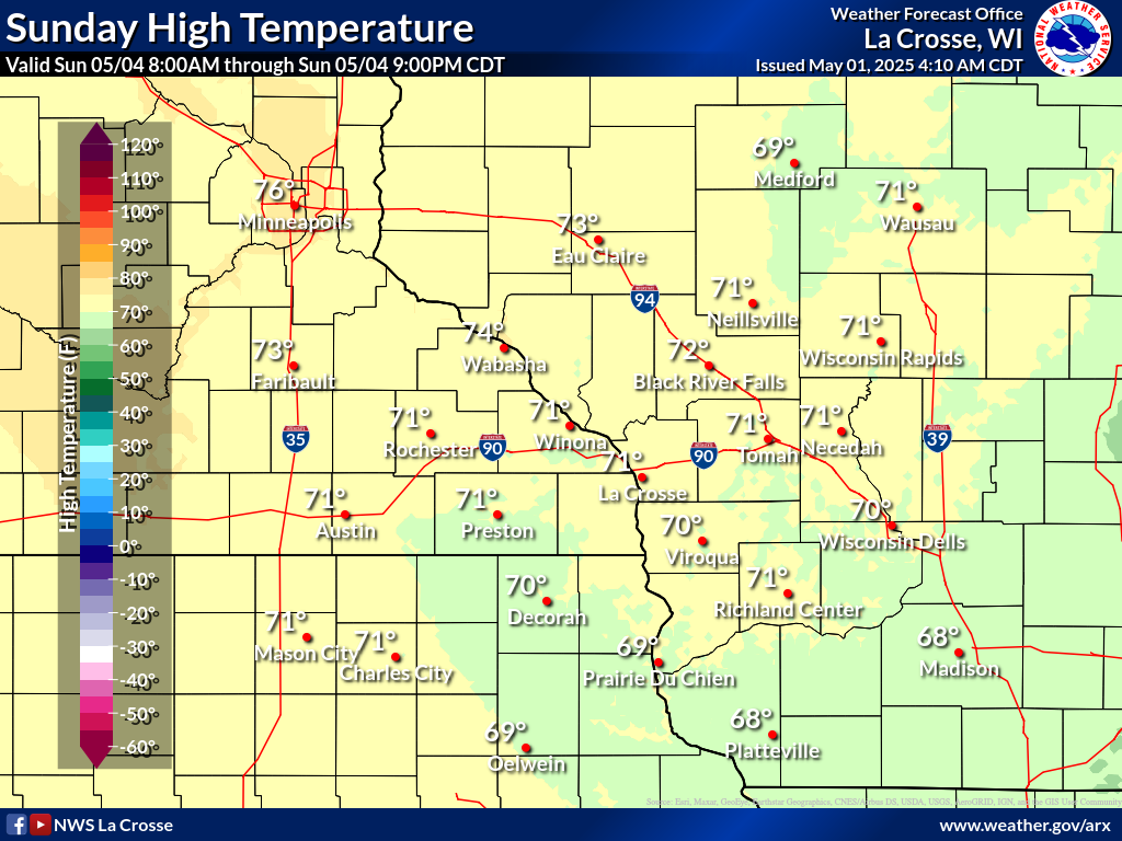
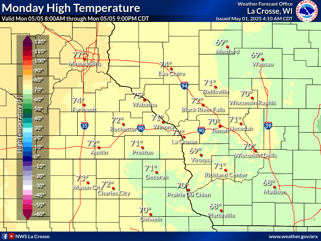
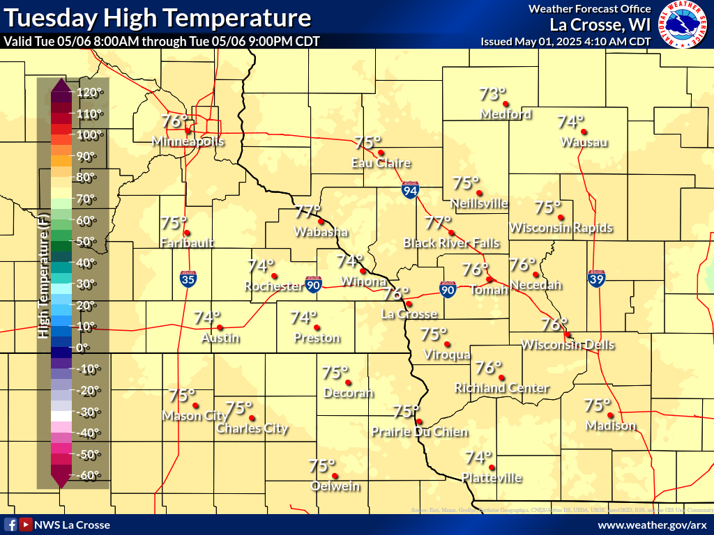
Temperature Forecasts
| Forecast Highs | ||||||
 |
 |
 |
 |
 |
 |
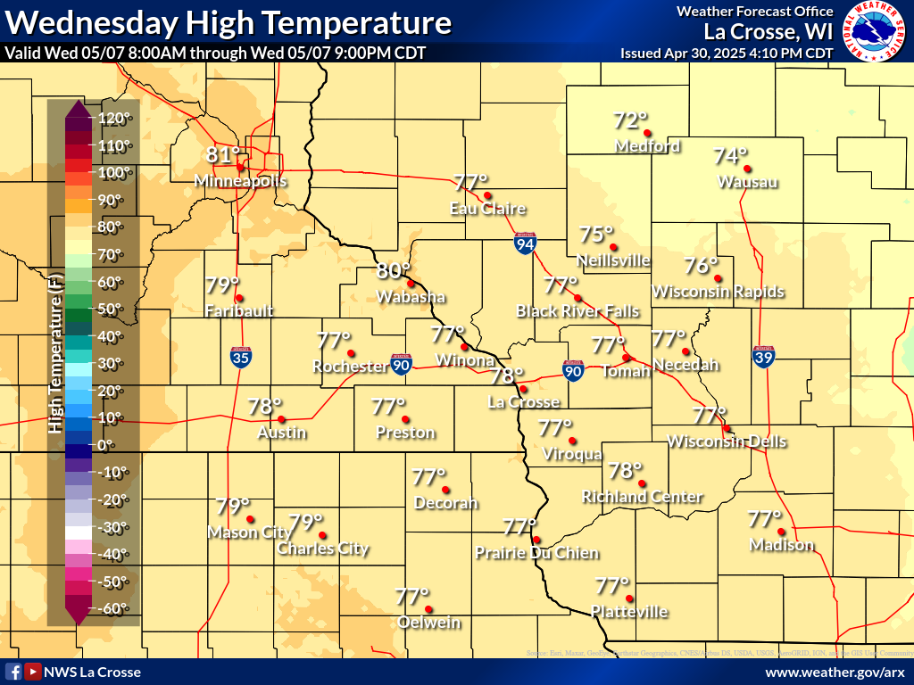 |
| Day 1 | Day 2 | Day 3 | Day 4 | Day 5 | Day 6 | Day 7 |
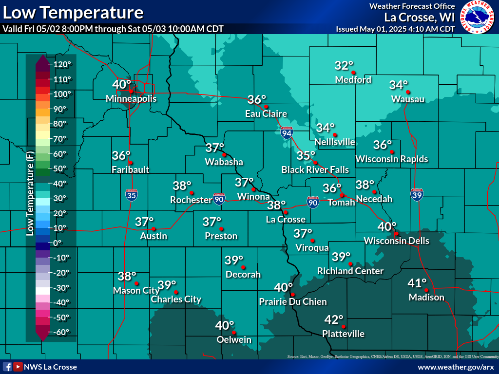
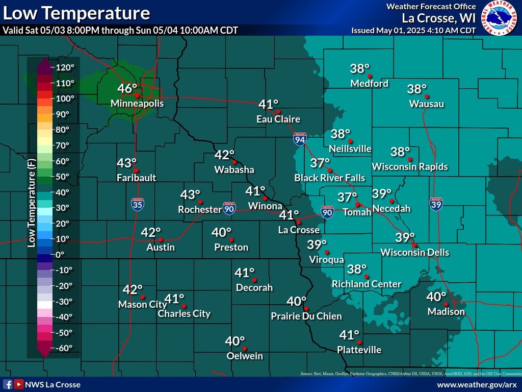
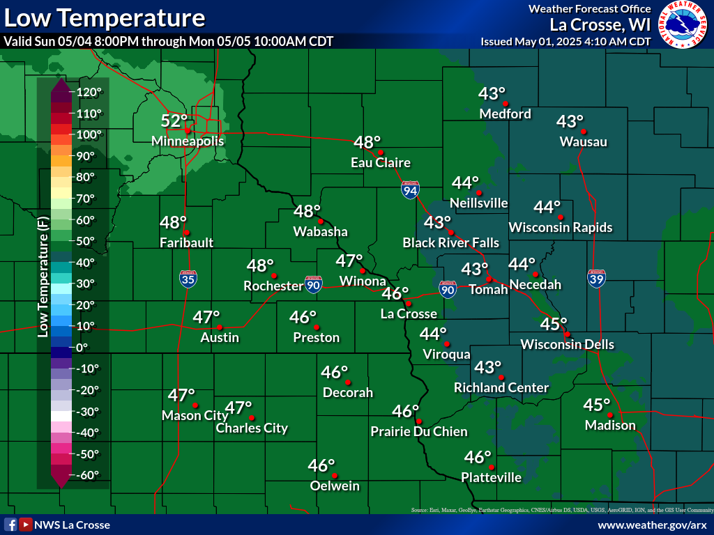
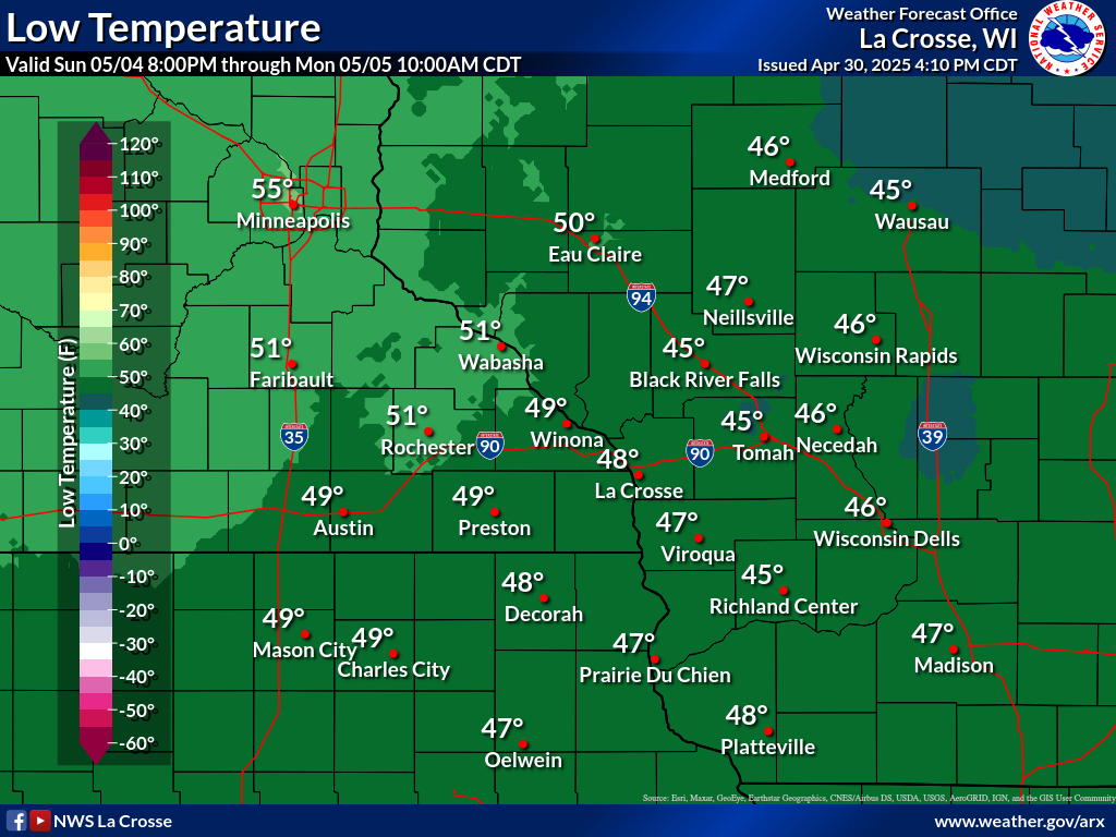
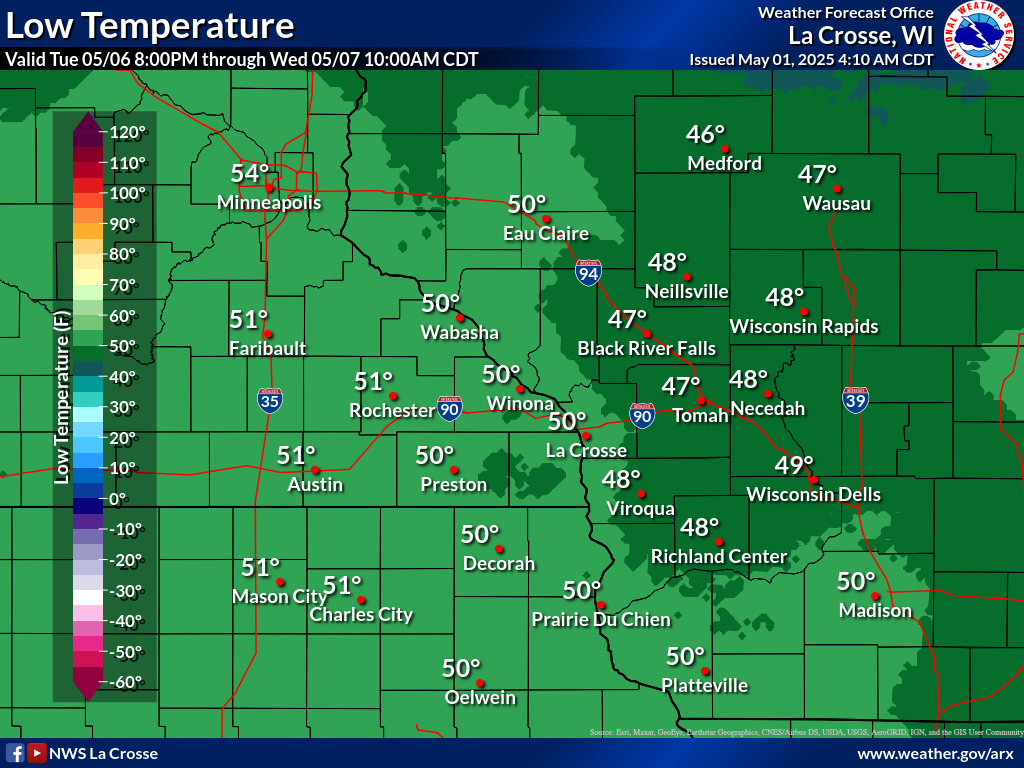
| Forecast Lows | ||||||
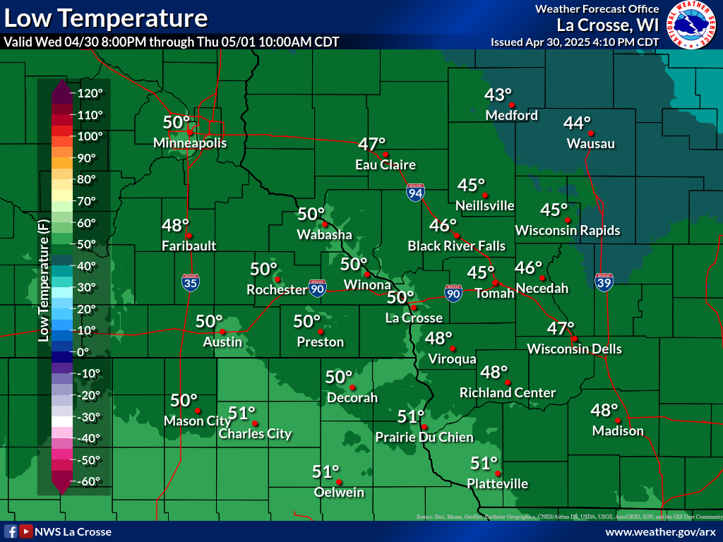 |
 |
 |
 |
 |
 |
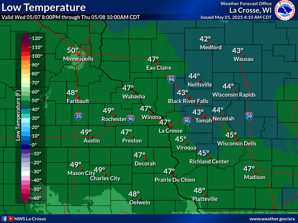 |
| Day 1 | Day 2 | Day 3 | Day 4 | Day 5 | Day 6 | Day 7 |
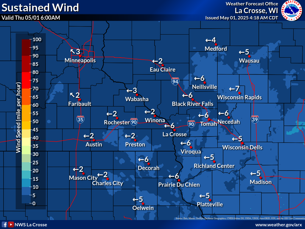
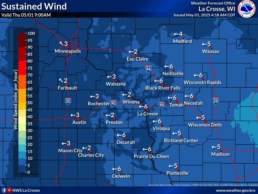
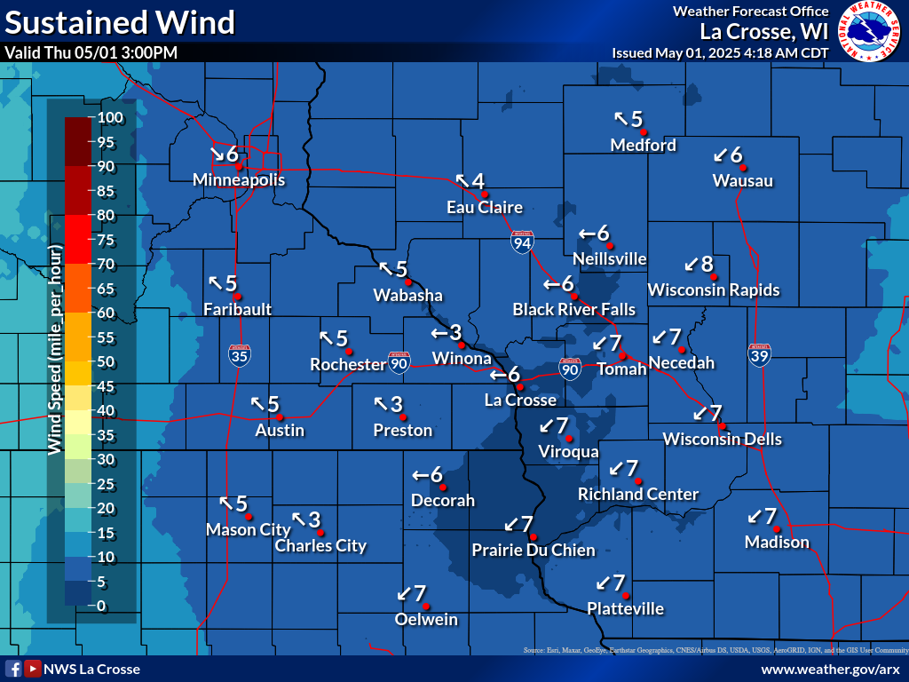
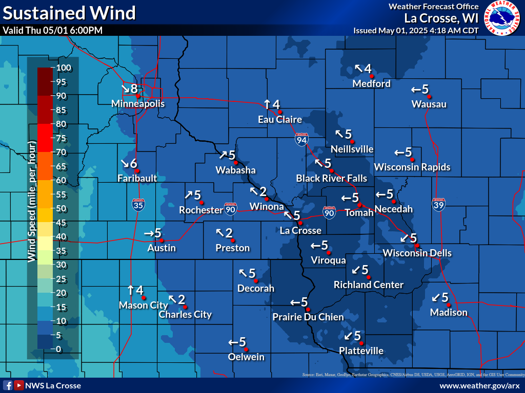
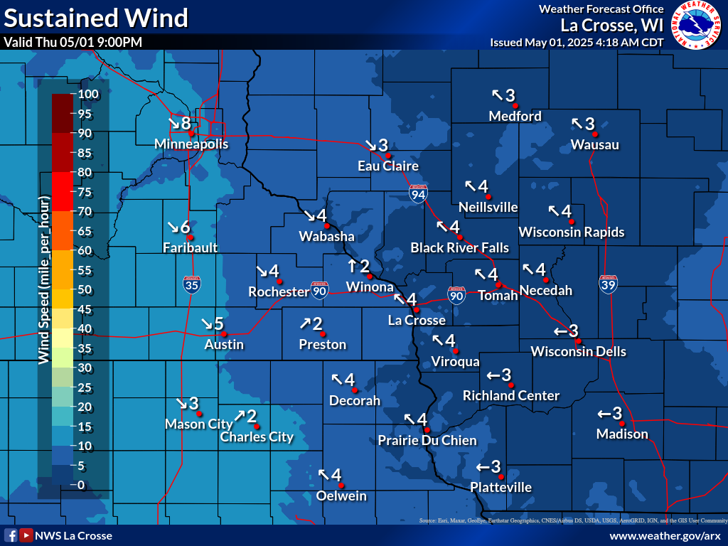
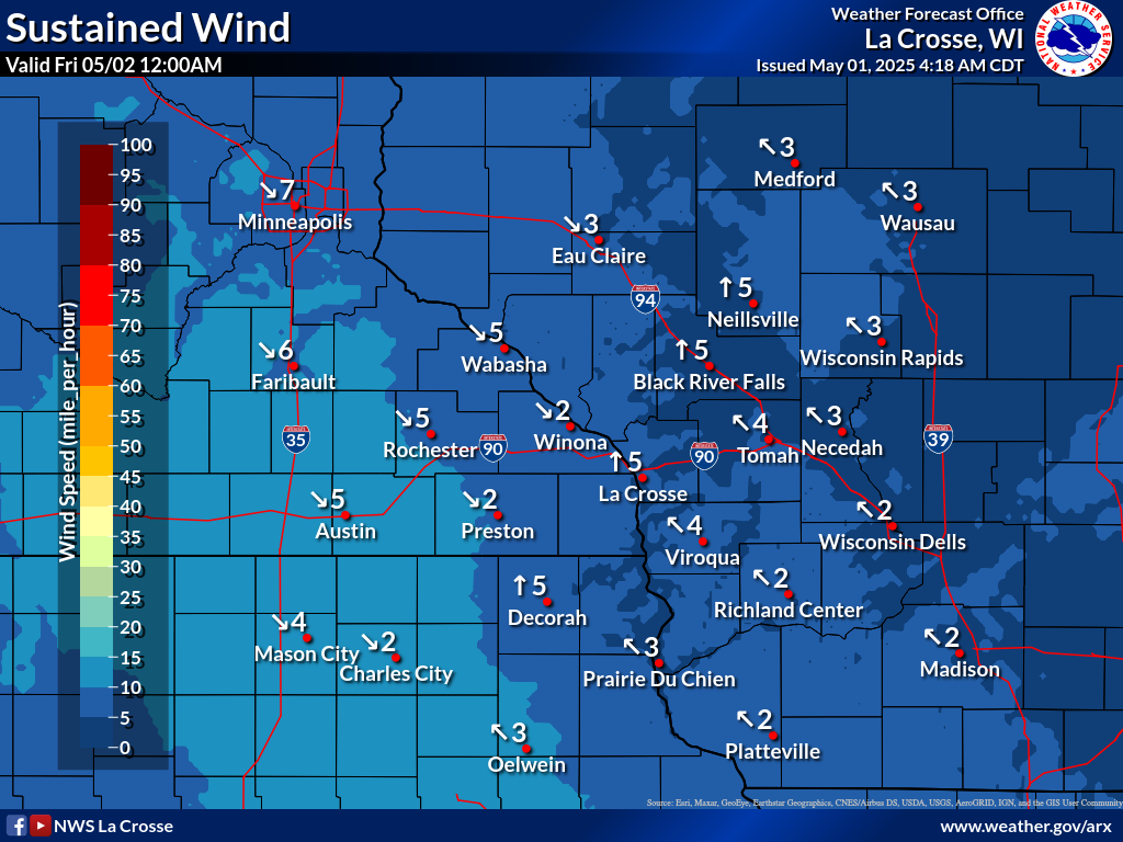
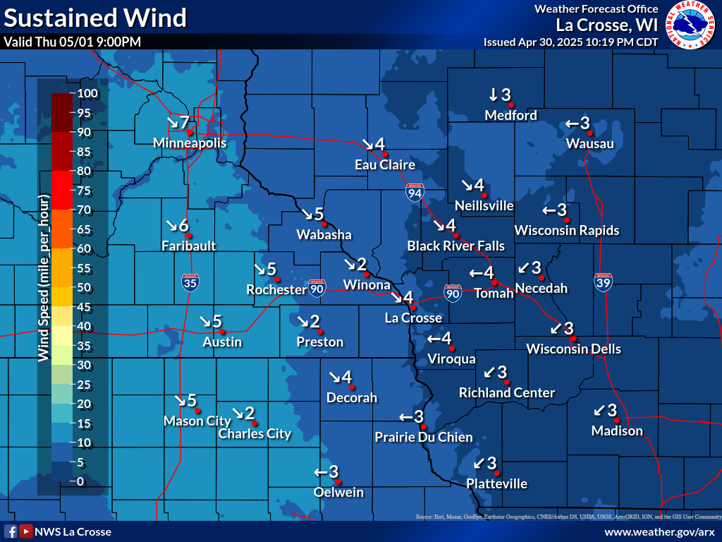
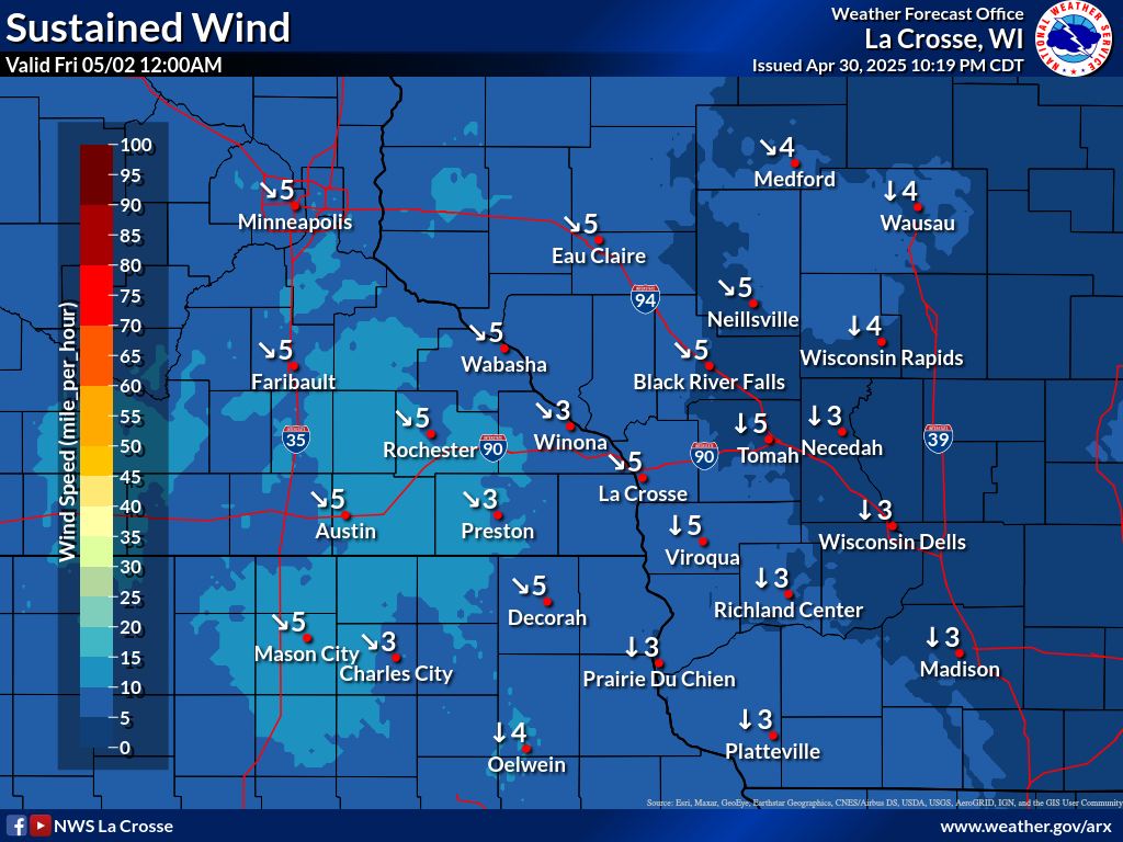
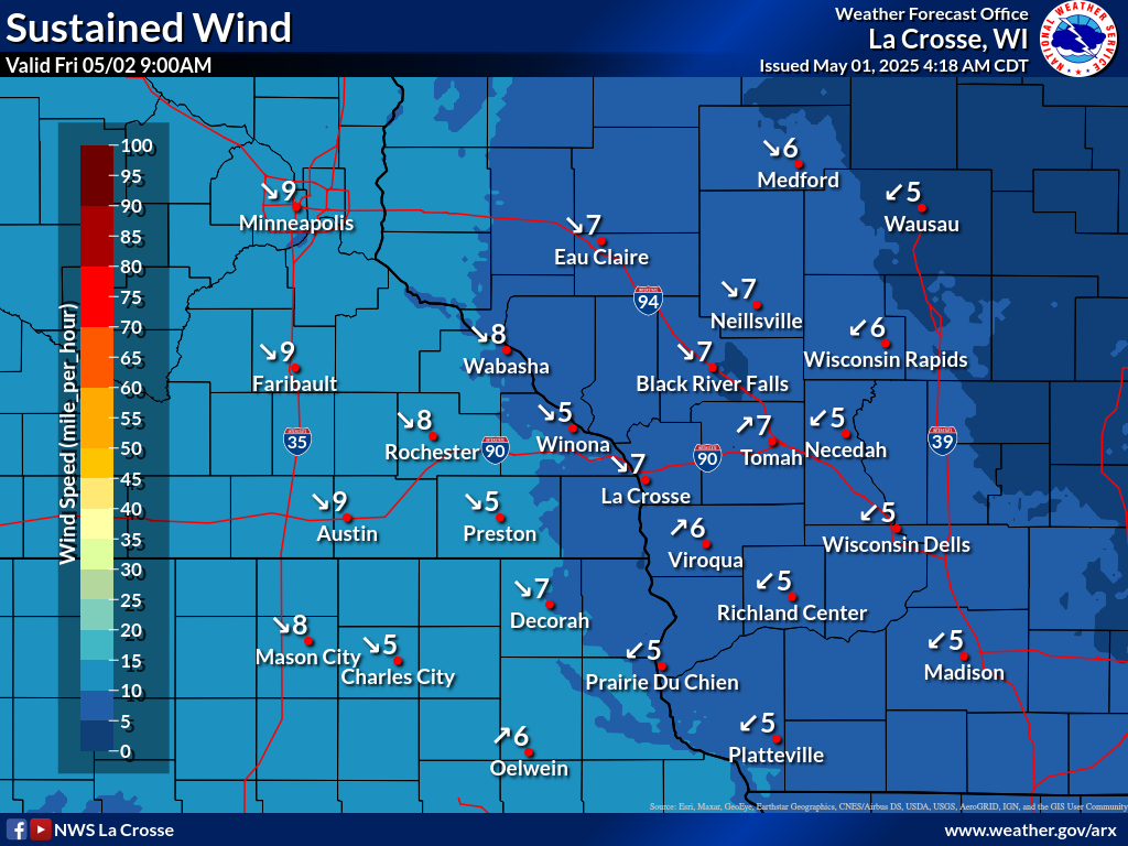
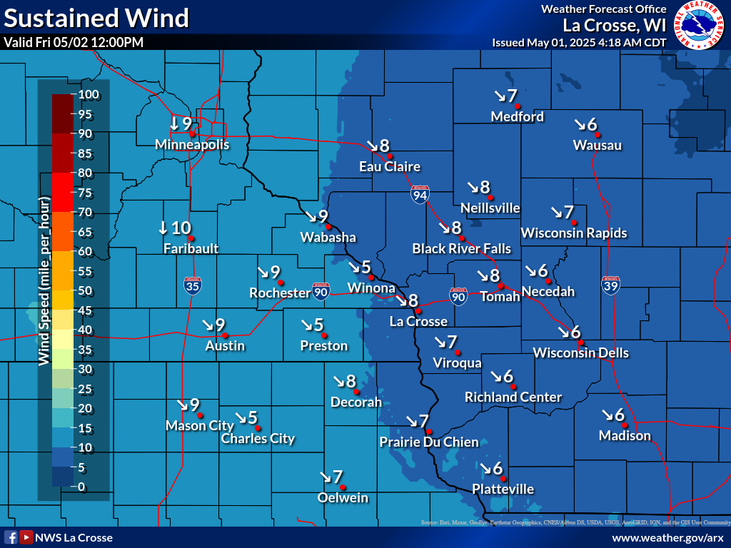
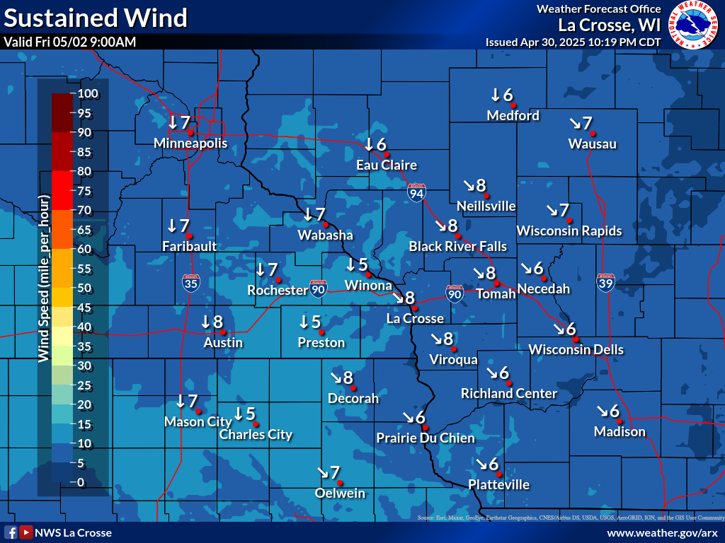
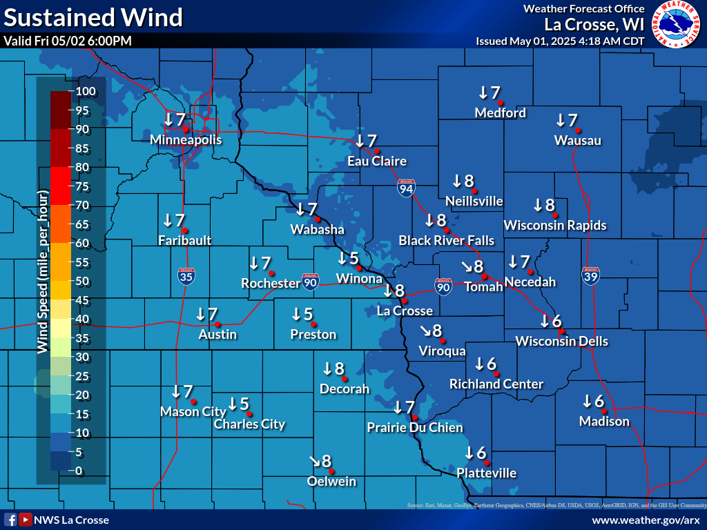
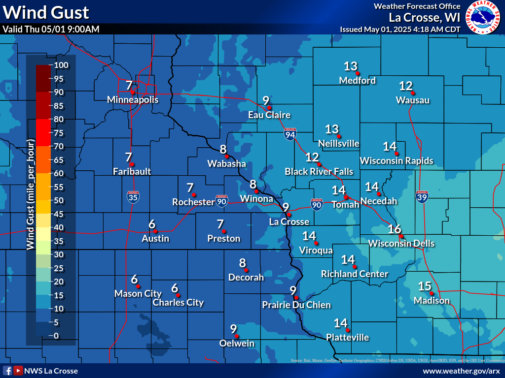
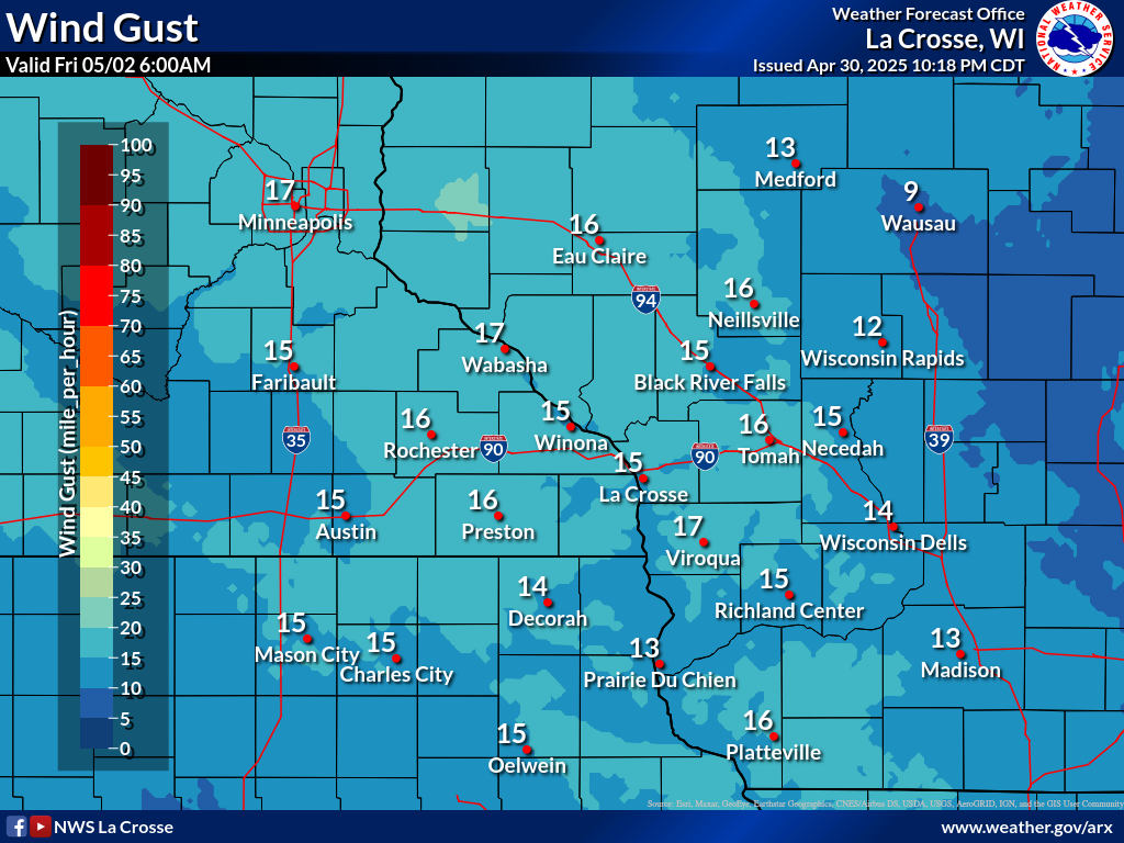
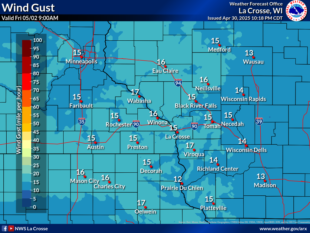
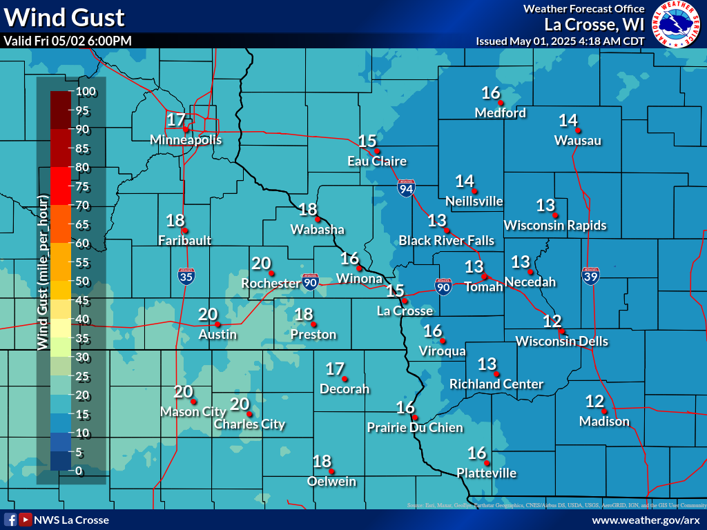
Wind Forecasts
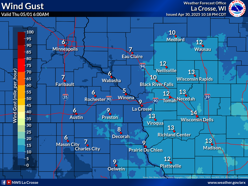
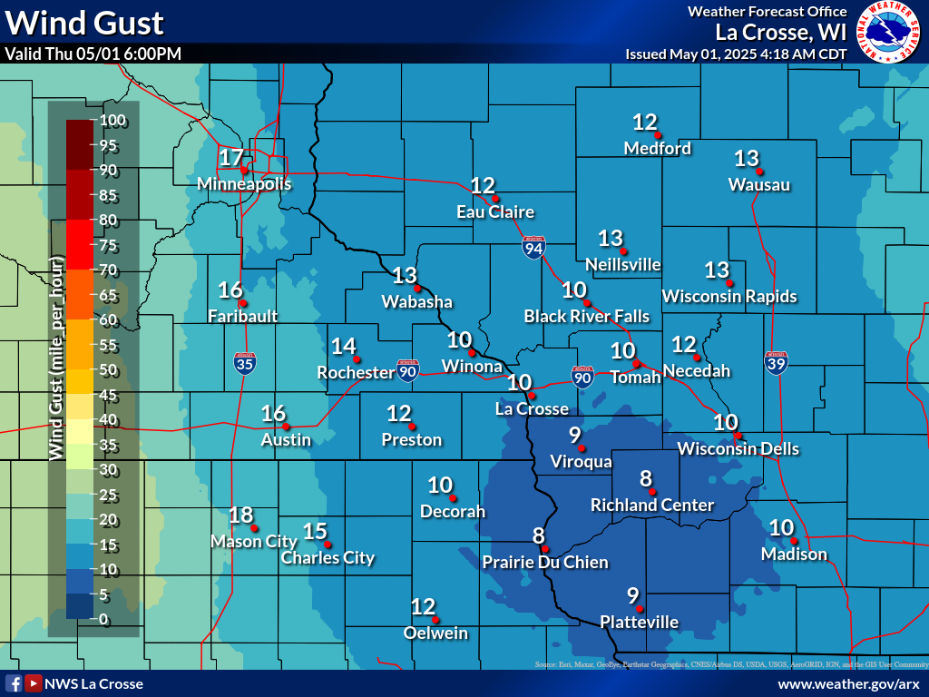
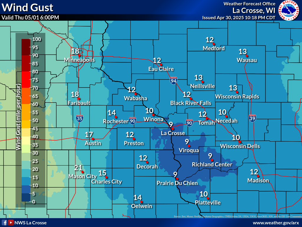
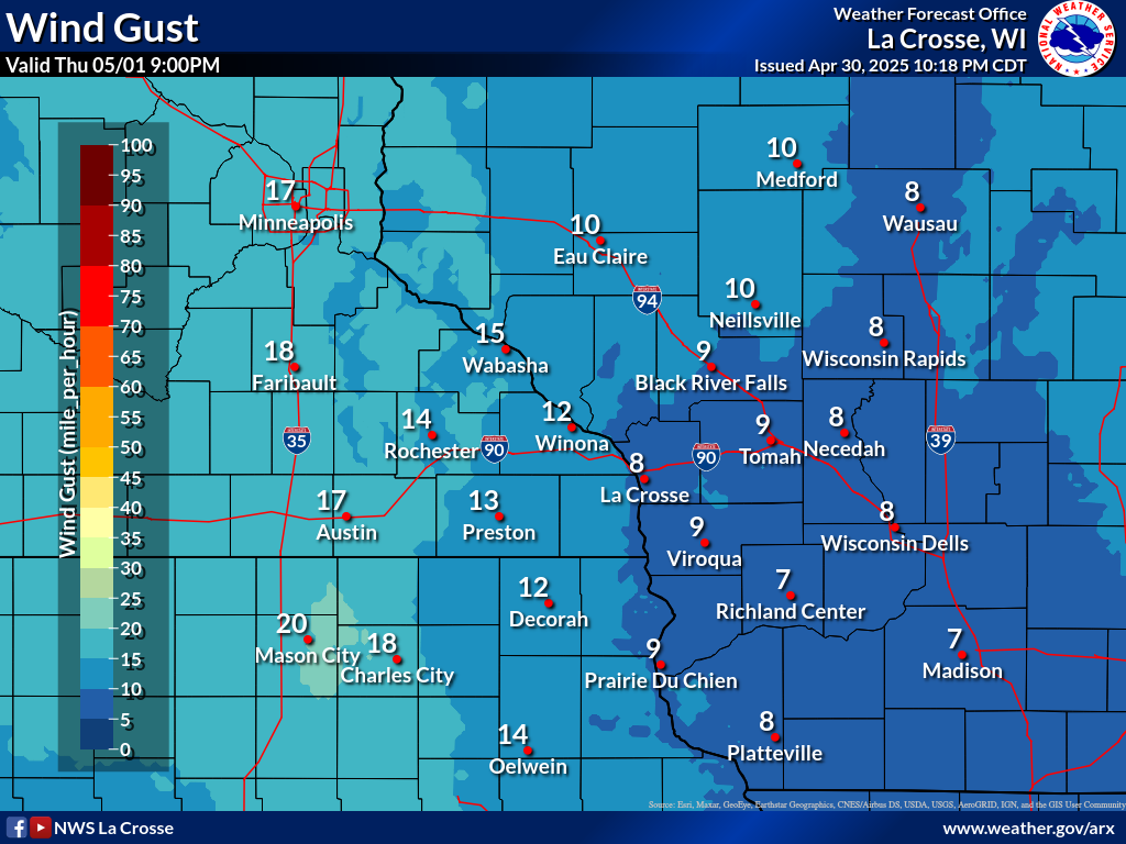
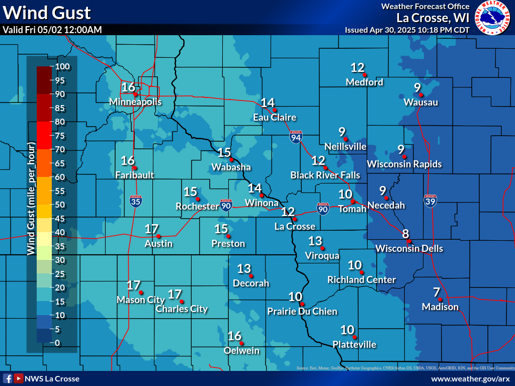
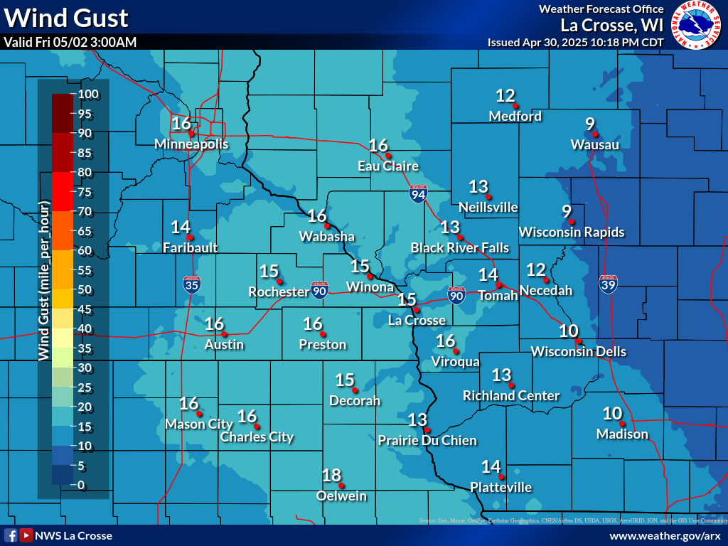
| 3-Hour Forecast Sustained Winds and Wind Gusts | ||||||||||||||||||||||||||||||||||||||||||||||||||||
|
||||||||||||||||||||||||||||||||||||||||||||||||||||
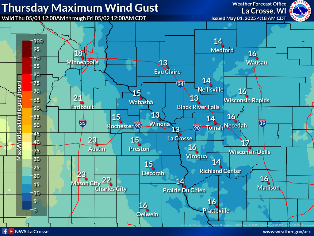
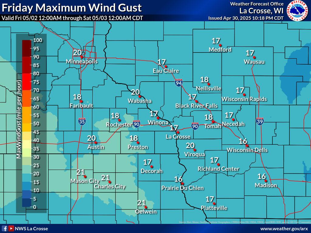
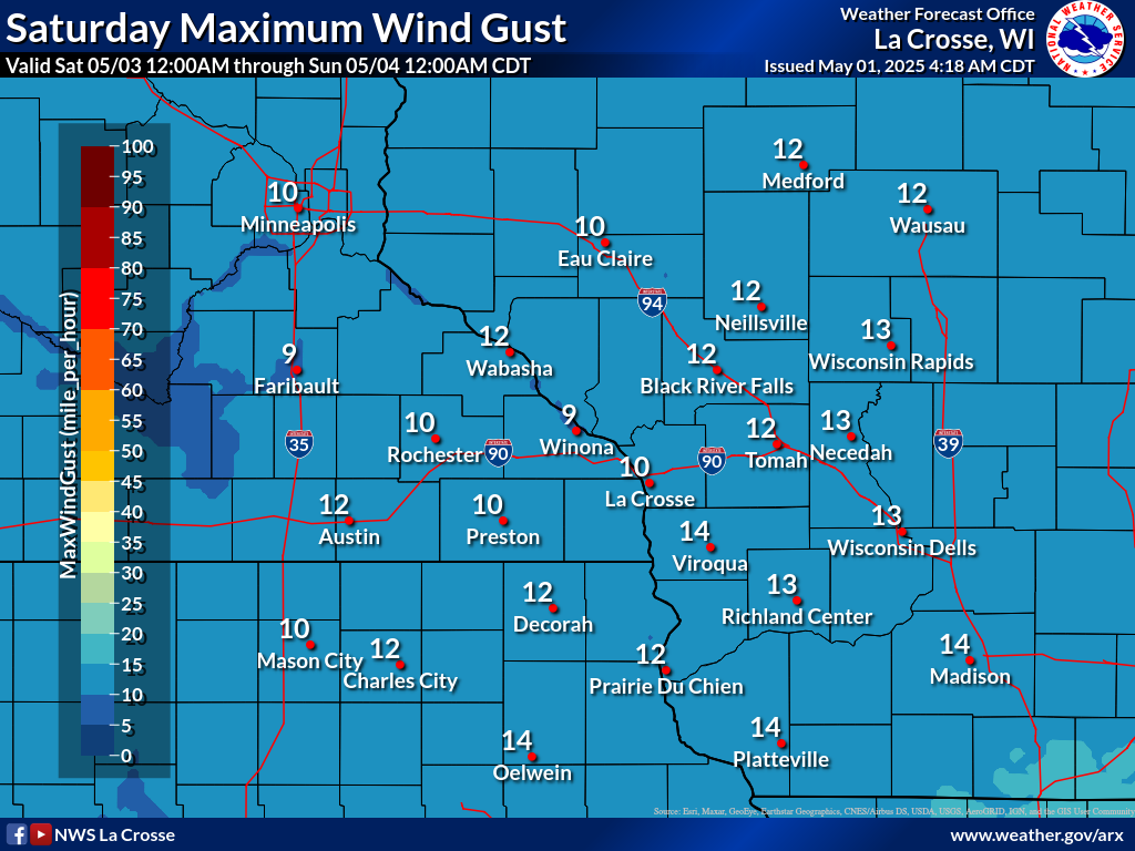
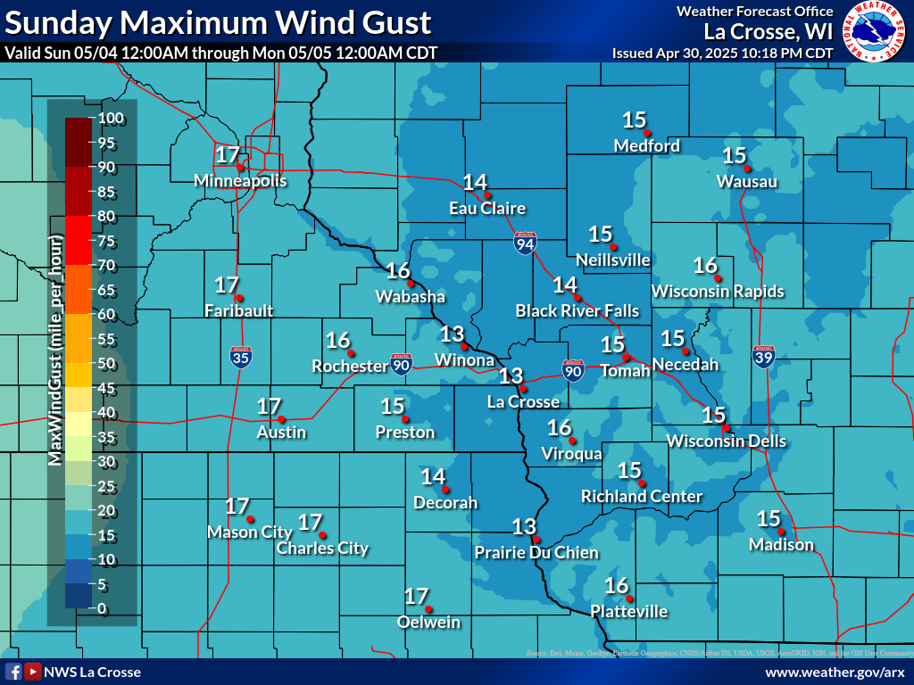
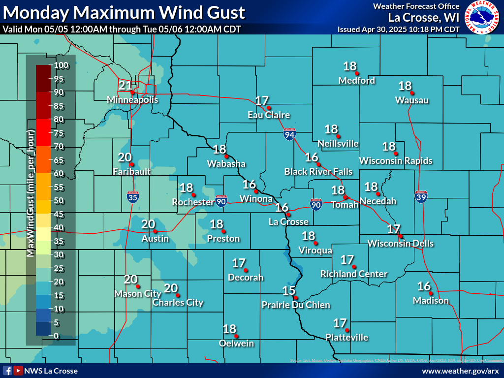
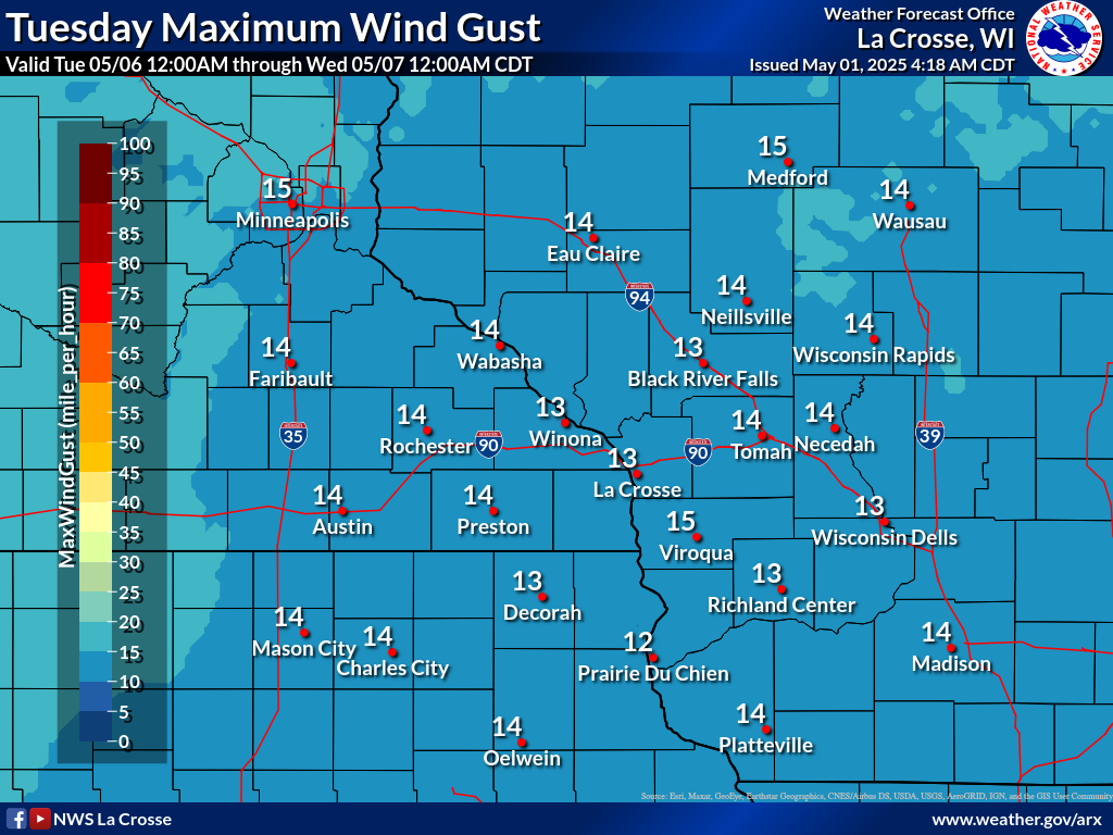
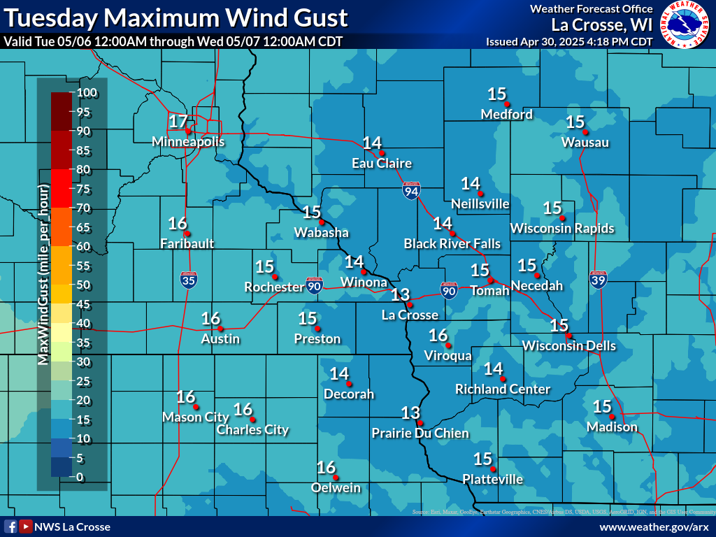
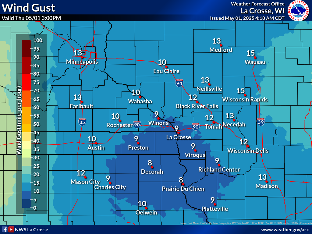
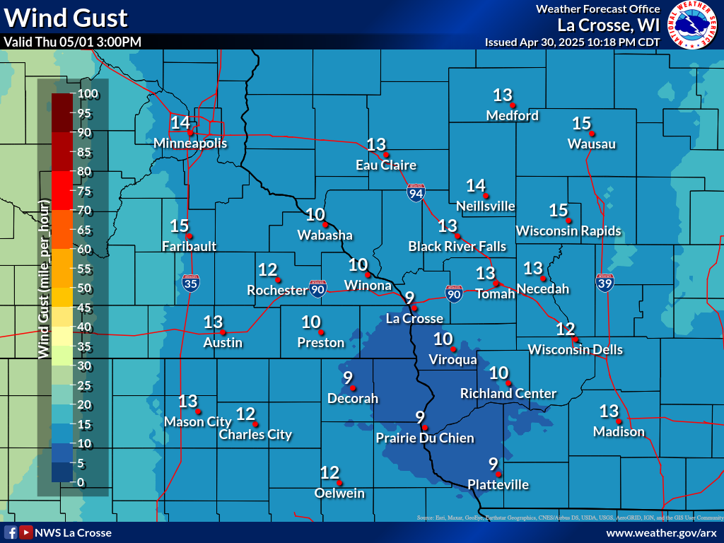
| Forecast Daily MAXIMUM Wind Gusts | ||||||
 |
 |
 |
 |
 |
 |
 |
| Day 1 | Day 2 | Day 3 | Day 4 | Day 5 | Day 6 | Day 7 |
Heat Index / Wet Bulb Globe Temperature Forecasts
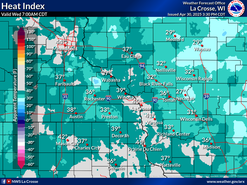
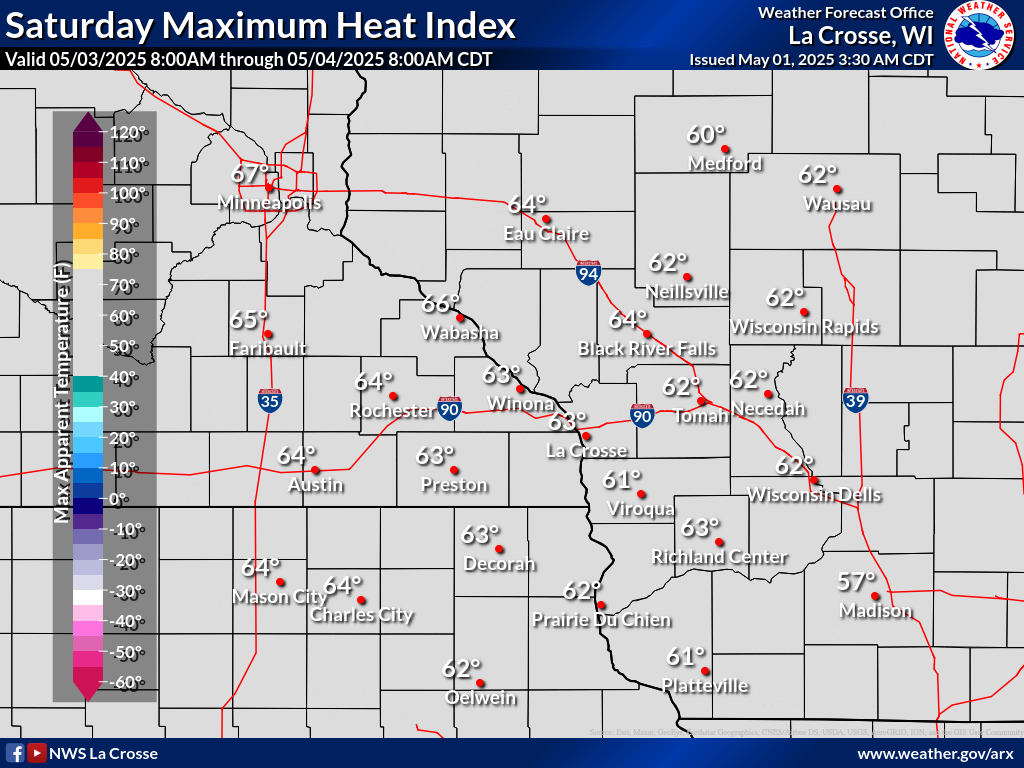
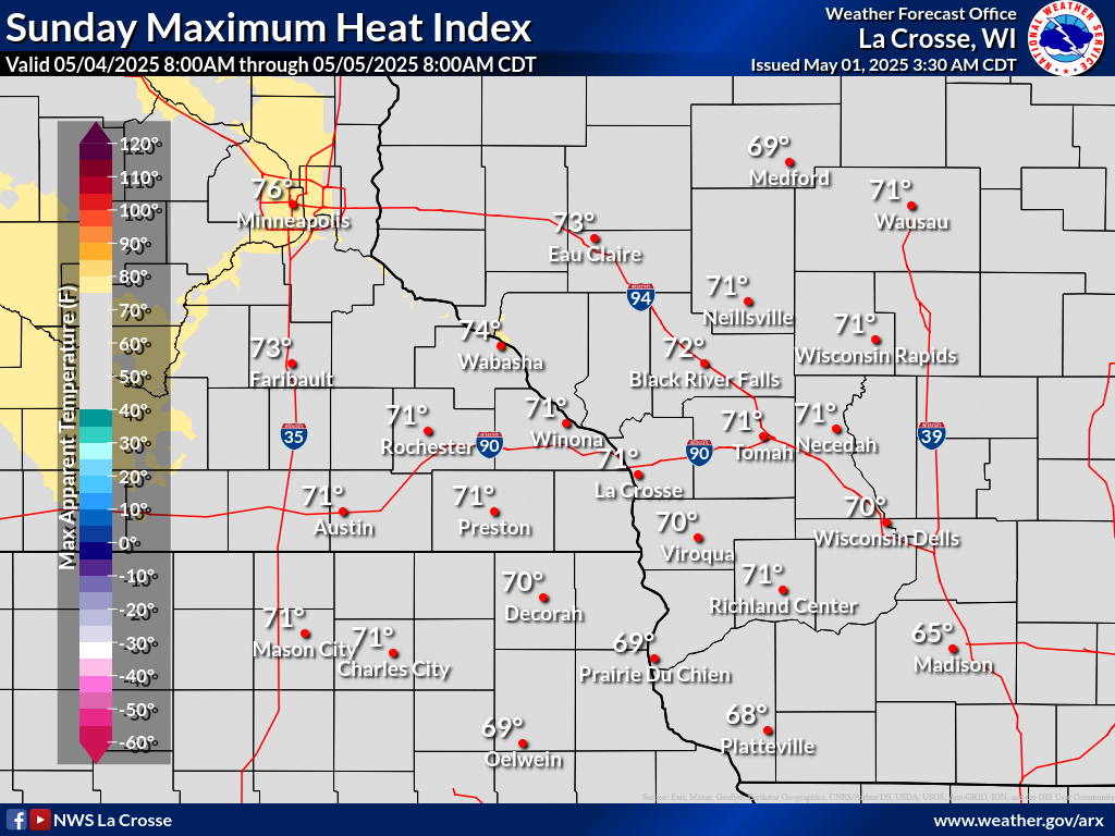
| Today's Forecast Heat Index | Forecast MAXIMUM Heat Index | |||||||
 |
 |
 |
 |
 |
 |
 |
 |
|
| 7 AM (CDT) | 10 AM (CDT) | 1 PM (CDT) | 4 PM (CDT) | 7 PM (CDT) | Tomorrow | Day 3 | Day 4 | |
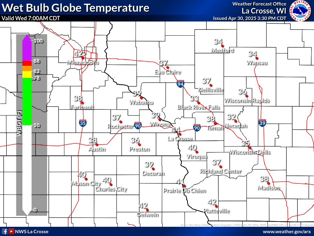
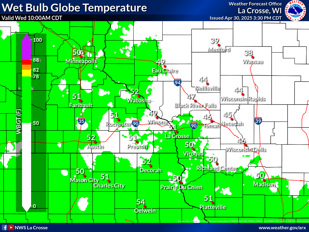
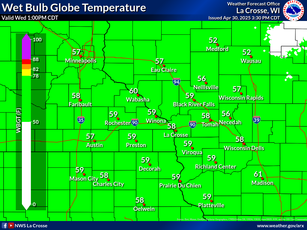
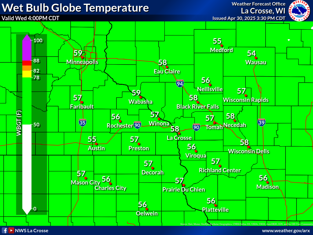
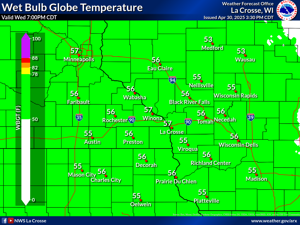
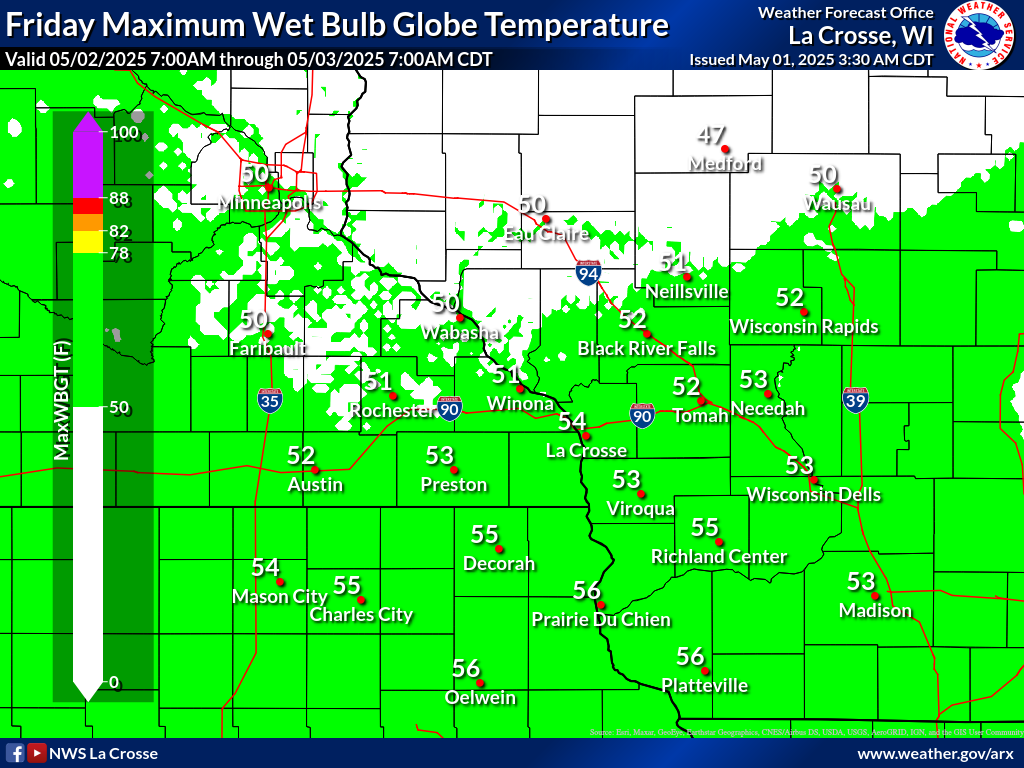
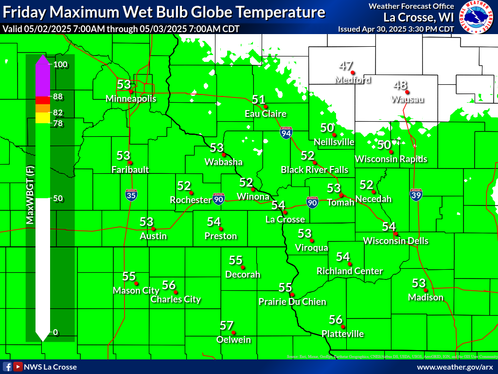
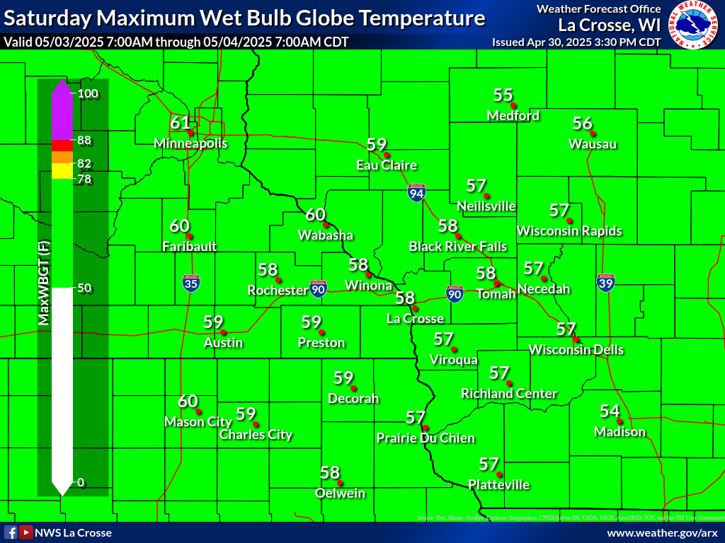
| Today's Forecast Wet Bulb Globe Temp | Forecast MAXIMUM Wet Bulb Globe Temp | |||||||
 |
 |
 |
 |
 |
 |
 |
 |
|
| 7 AM (CDT) | 10 AM (CDT) | 1 PM (CDT) | 4 PM (CDT) | 7 PM (CDT) | Tomorrow | Day 3 | Day 4 | |
| Heat Index & Wet Bulb Globe Temperature Resources | |||||
Heat Index Chart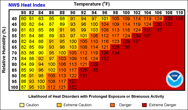 Note: Exposure to full sunshine can increase heat index values by up to 15°F. |
WBGT General Guidance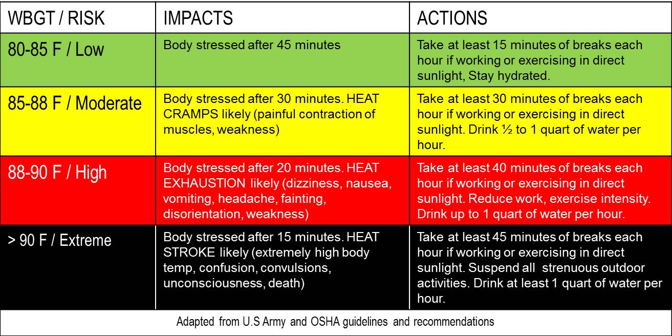 Note: WBGT is NOT directly comparable to temperature or heat index scales. |
|
|||
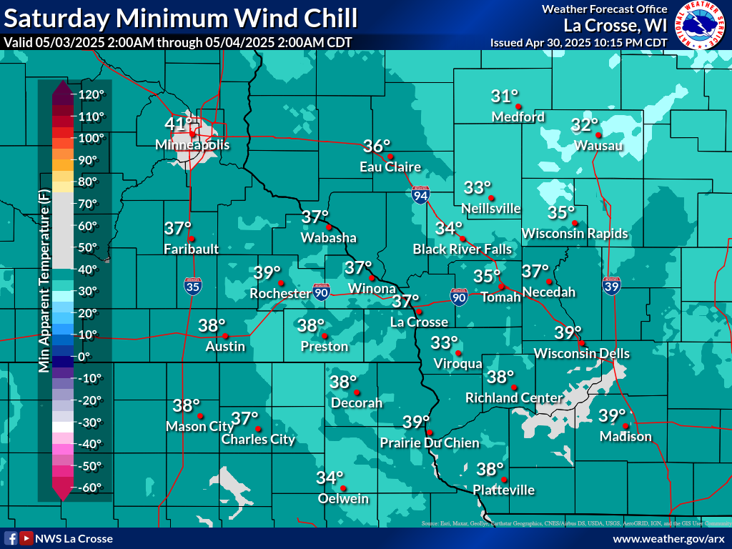
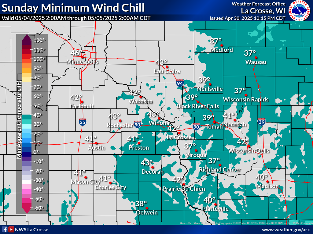
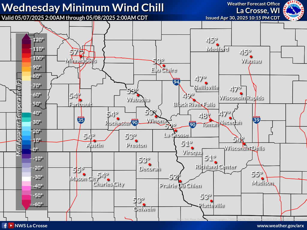
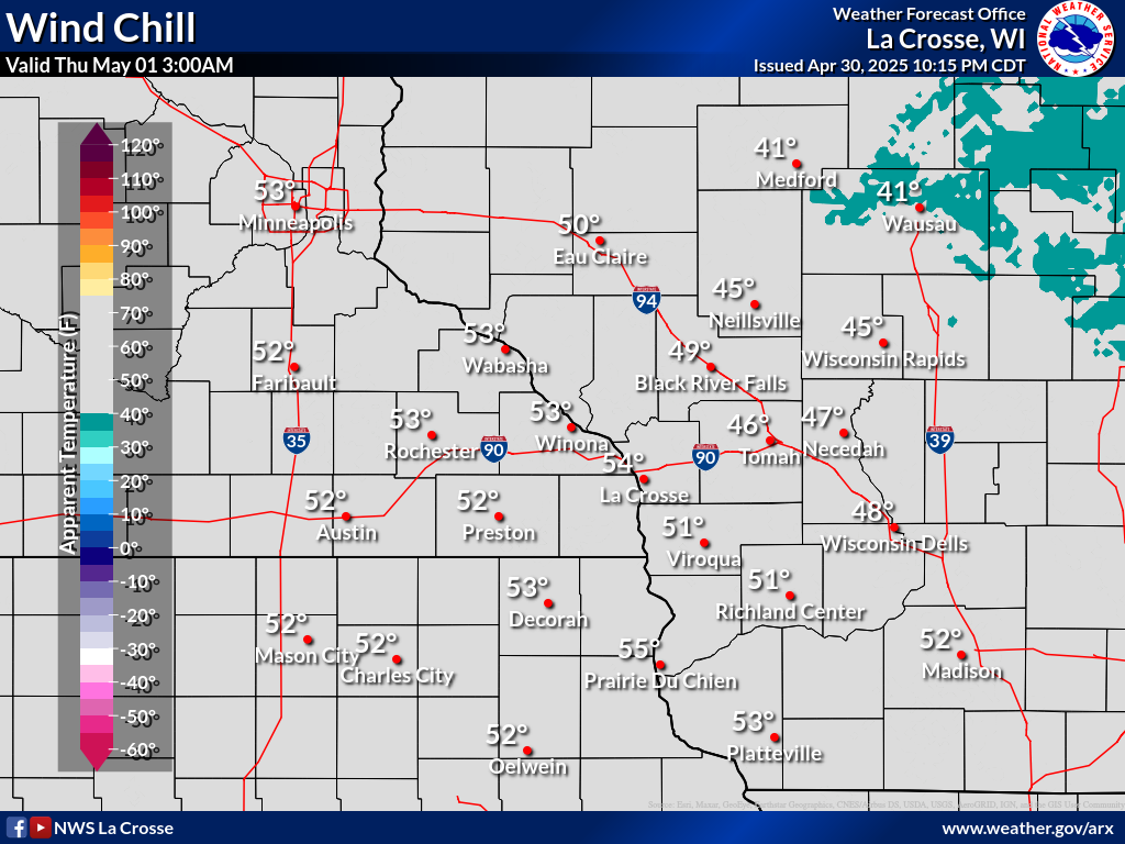
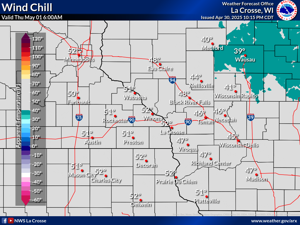
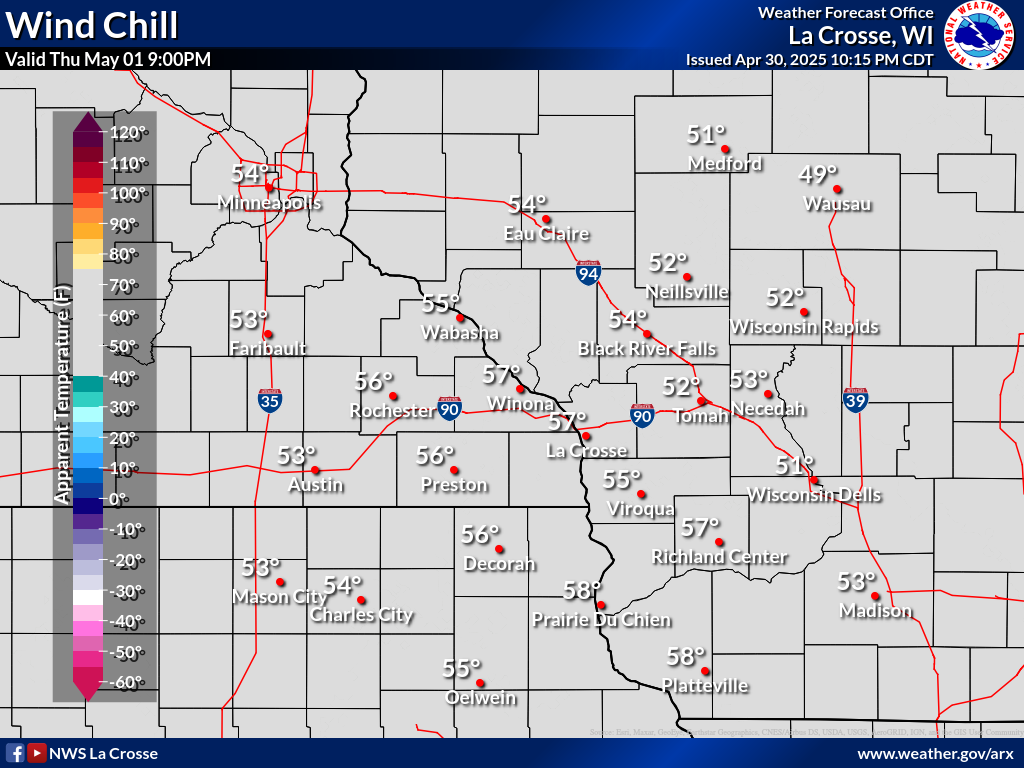
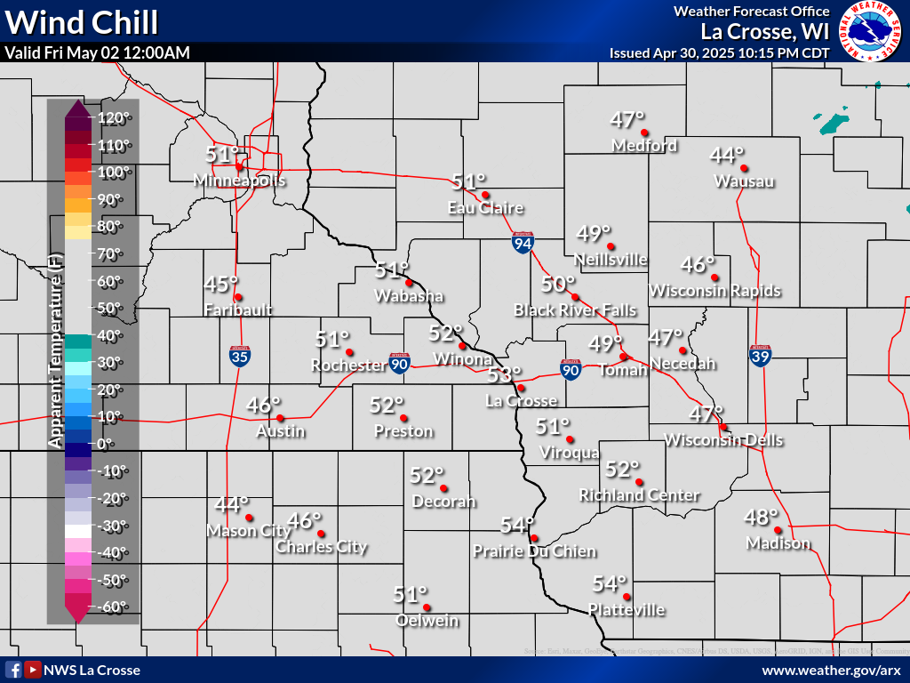
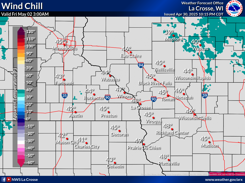
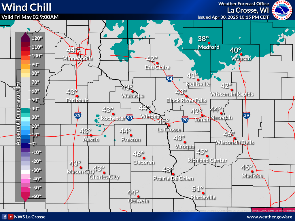
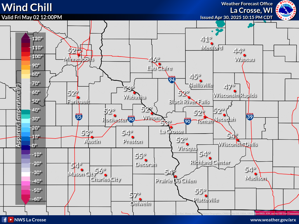
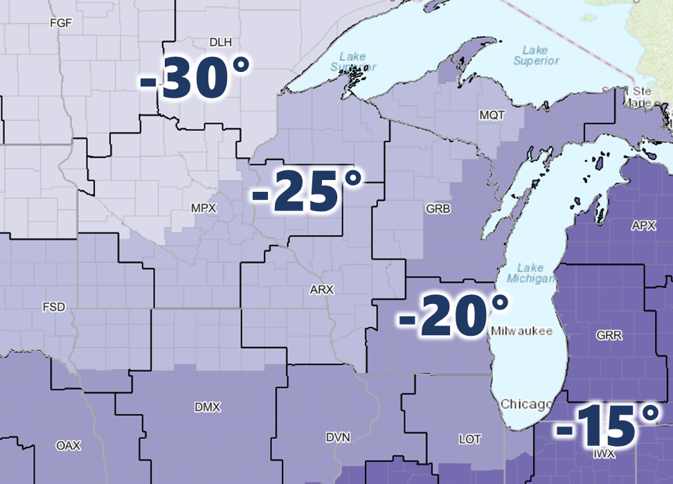
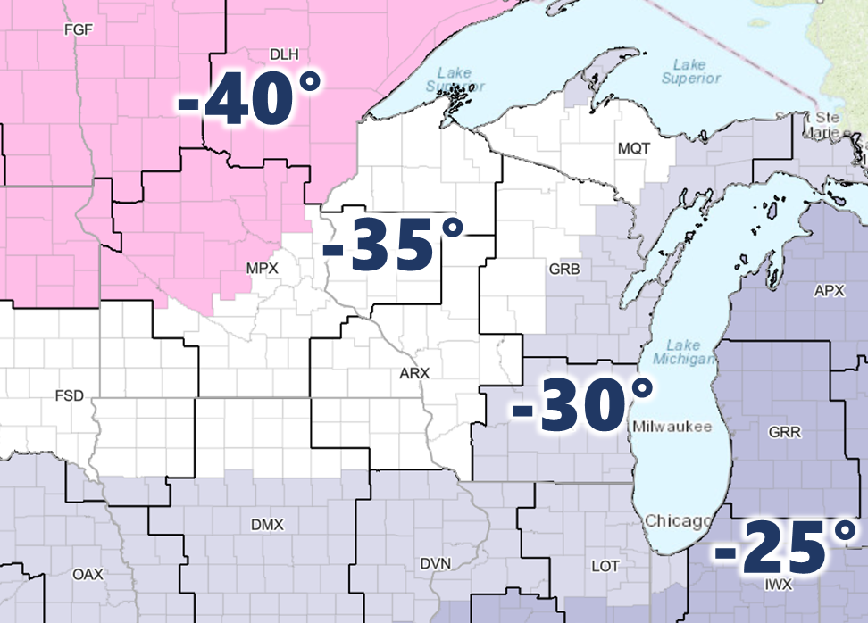
Wind Chill Forecasts (Available October - April)
| 3-Hour Forecast Wind Chills | |||||||||||||||||||||||||||||||||||||||
|
|||||||||||||||||||||||||||||||||||||||
| Forecast Daily MINIMUM Wind Chills | ||||||
 |
 |
 |
 |
 |
 |
 |
| Day 1 | Day 2 | Day 3 | Day 4 | Day 5 | Day 6 | Day 7 |
| Wind Chill Resources | ||||||
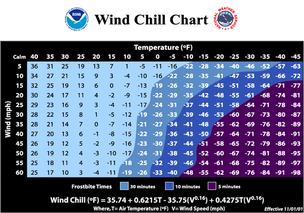 |
Wind Chill Calculator:
|
|||||
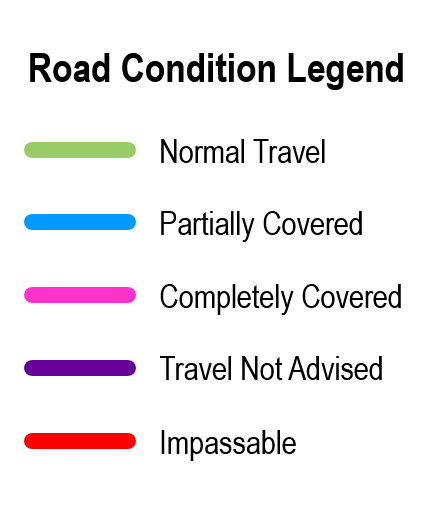
Winter Road Conditions
| Current Road Conditions | Latest Travel Information | ||||||||||
|
Disclaimer:
|
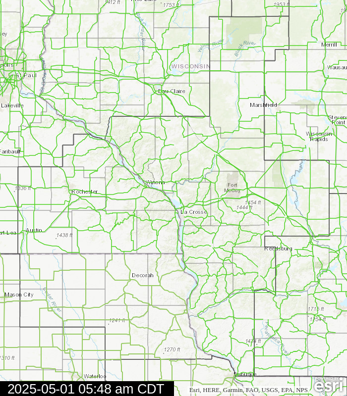 |
 |
|
||||||||
Snow & Ice Forecasts
| Snow/Ice Amount Potential Over Next 72 Hours* | City Snowfall Probabilities | |||||
| *Snow/ice amount graphics below may occasionally depict total accumulations from multiple events over next 72 hours | ||||||
Expected Snowfall Official NWS Forecast |
Low End Snowfall Potential 90% Chance Snowfall Will Be Greater Than This |
High End Snowfall Potential 10% Chance Snowfall Will Be Greater Than This |
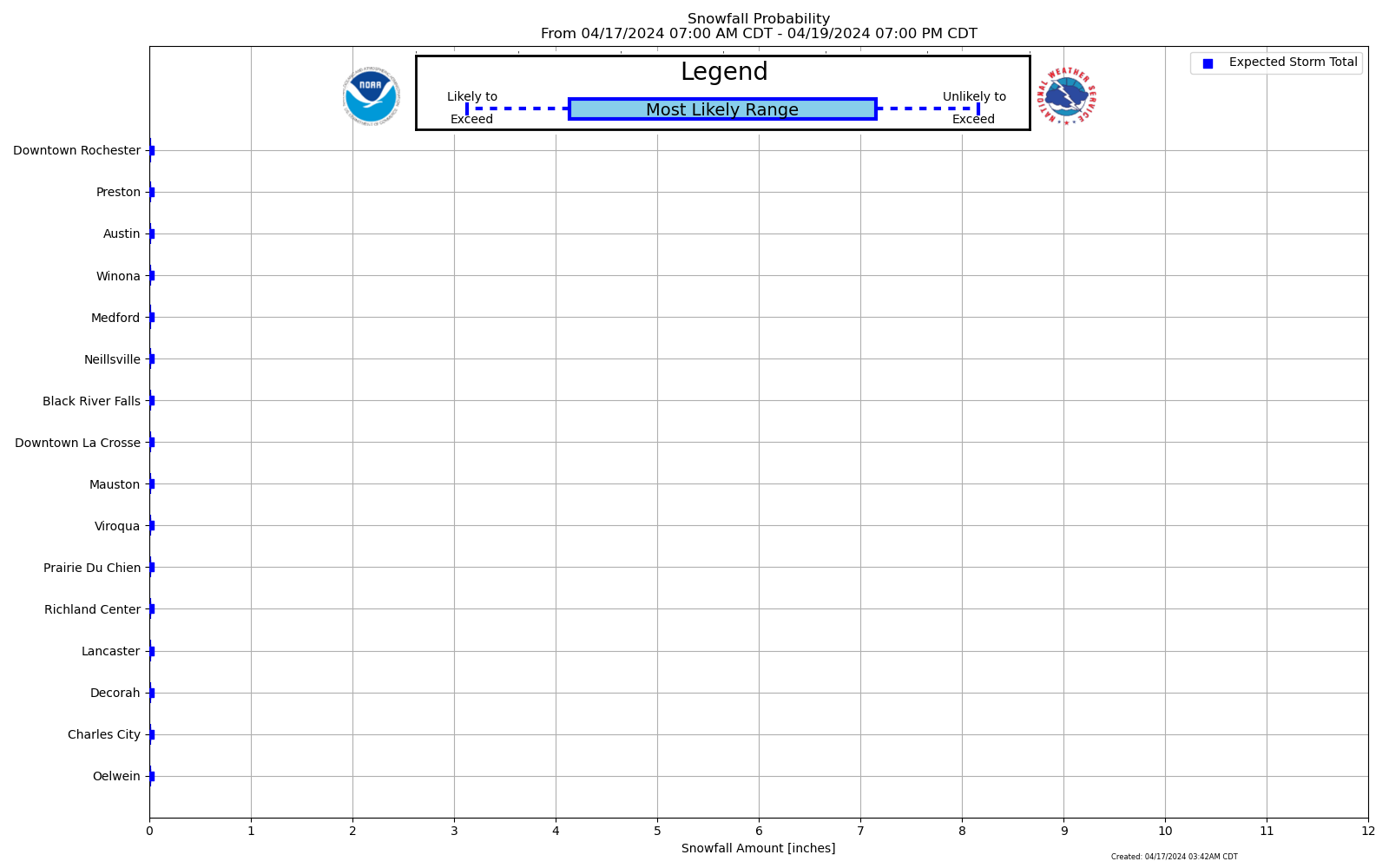 Forecast Snowfall Probability Ranges By City |
|||
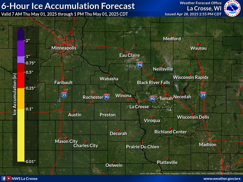
Expected Ice Accumulation Official NWS Forecast |
Low End Ice Accum Potential 90% Chance Icing Will Be Greater Than This |
High End Ice Accum Potential 10% Chance Icing Will Be Greater Than This |
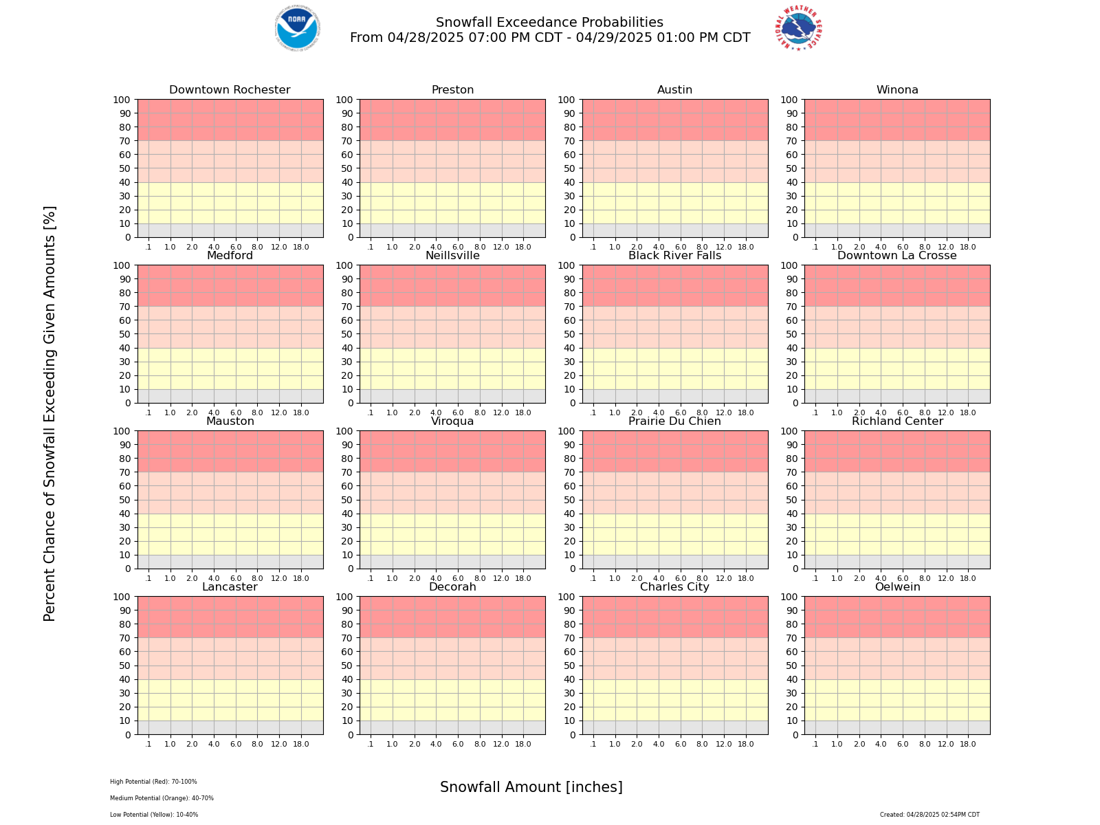 Probability of Snowfall Exceeding Certain Amounts |
|||
| Chance That Snow/Ice Amounts Over Next 72 Hours Will Be Greater Than Or Equal To... (More Details) | ||||||||
| SNOW | 0.1" |
1" |
2" |
4" |
6" |
8" |
12" |
18" |
| ICE | 0.01" |
0.1" |
0.25" |
0.5" |
0.75" |
1" |
1.25" |
1.5" |
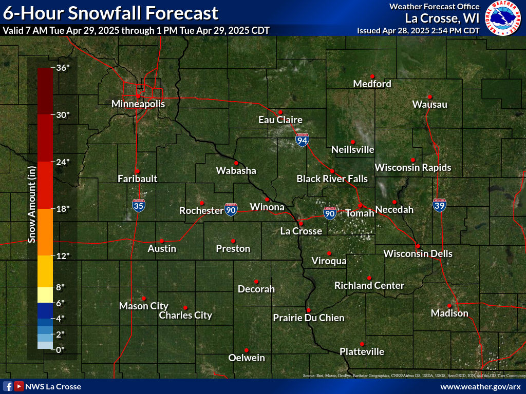
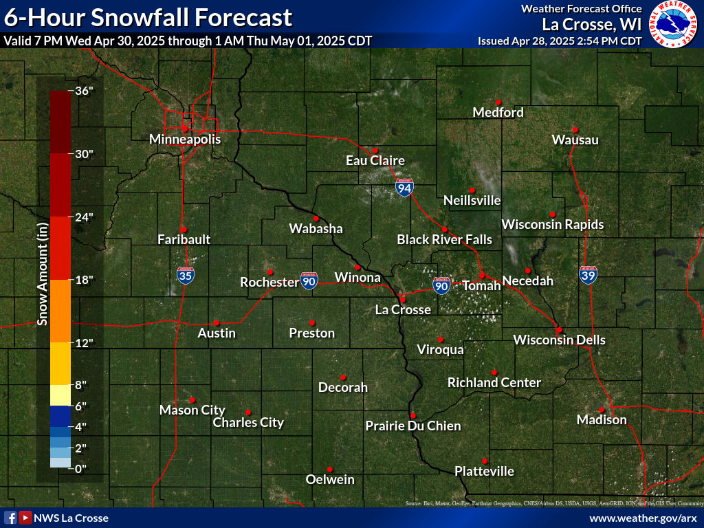
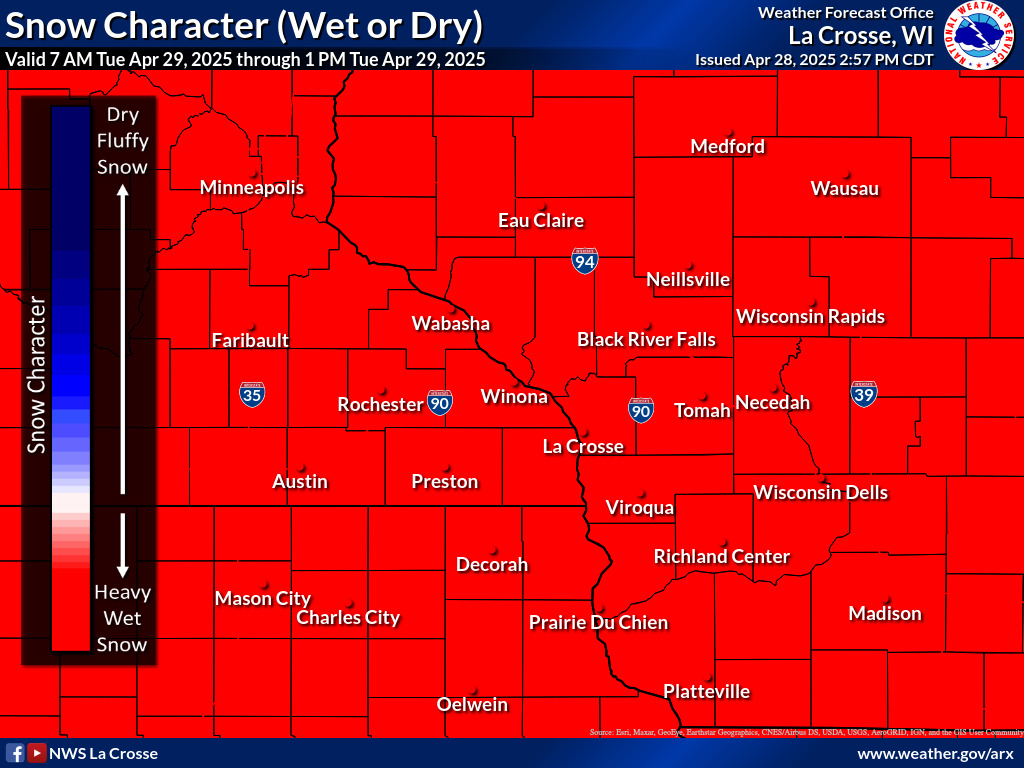
| 6-Hour Forecast Snow/Ice Amounts and Snow Type (Dry vs. Wet) | ||||||||||||||||||||||||||||||||||||||||||||||||||||||||||||||||||||||||||||||||||||||||||||||||||||||||||||||||||
|
||||||||||||||||||||||||||||||||||||||||||||||||||||||||||||||||||||||||||||||||||||||||||||||||||||||||||||||||||
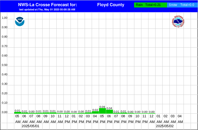
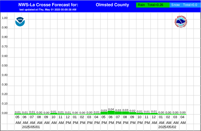
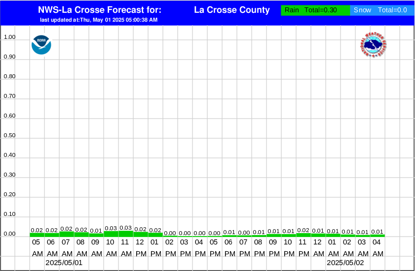
| Hourly Precipitation Amounts By County | ||
|
|
|
|
Winter Storm Severity Index (More Details)
| Today | |||||
 Overall Impacts |
 Blowing Snow |
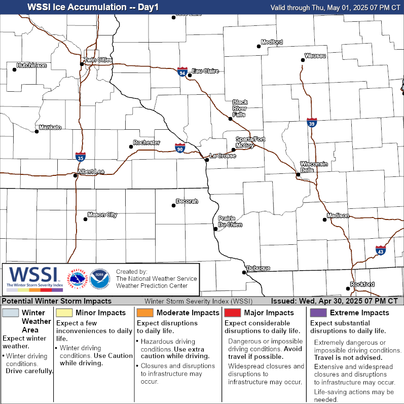 Ice Accumulation |
 Snow Amount |
 Snow Load |
|
| Tomorrow | |||||
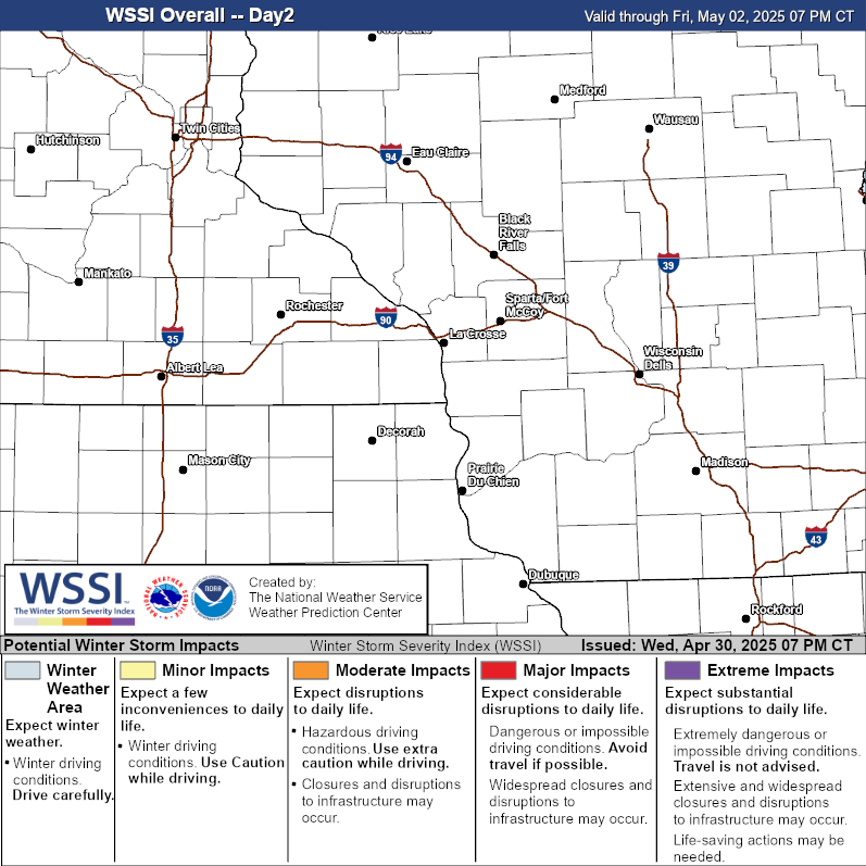 Overall Impacts |
 Blowing Snow |
 Ice Accumulation |
 Snow Amount |
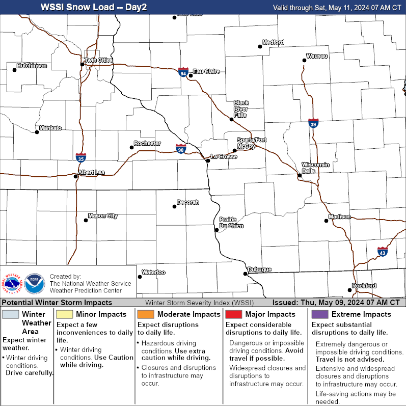 Snow Load |
|
| Day 3 | |||||
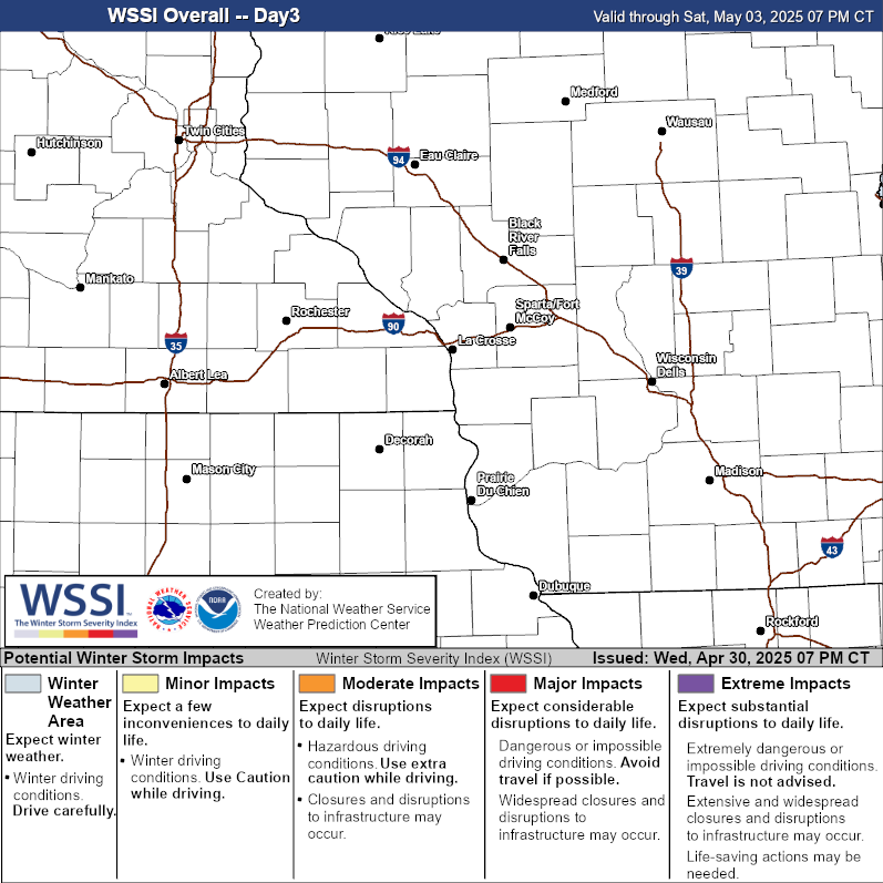 Overall Impacts |
 Blowing Snow |
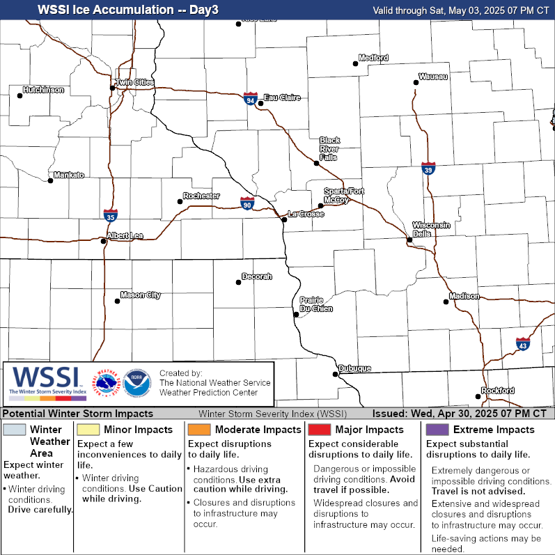 Ice Accumulation |
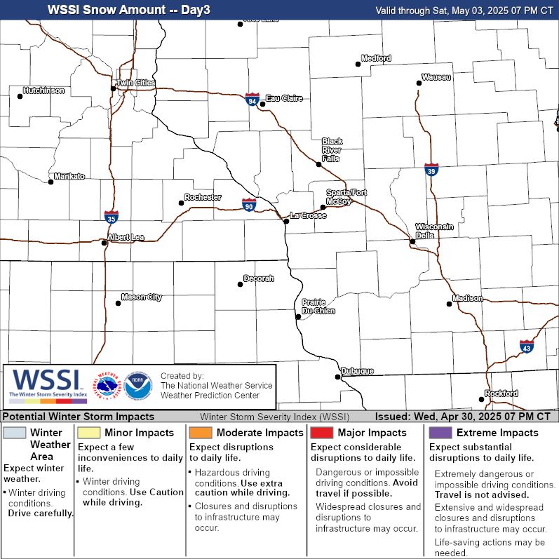 Snow Amount |
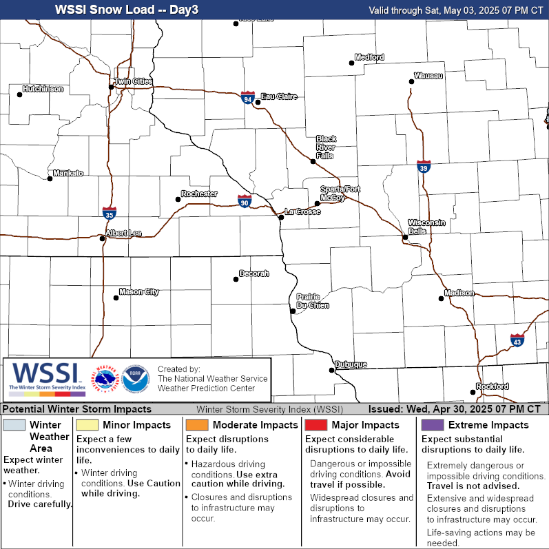 Snow Load |
|
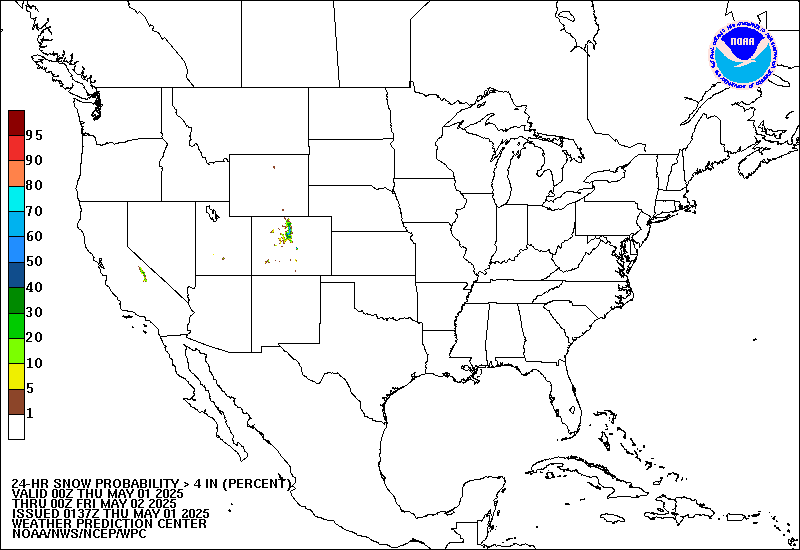
National Outlooks
| Snow Outlooks (Probability for greater than 4") | Ice Outlooks (Probability for greater than 1/10") | |||||||||
 Day 1 |
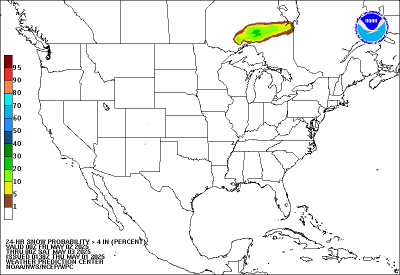 Day 2 |
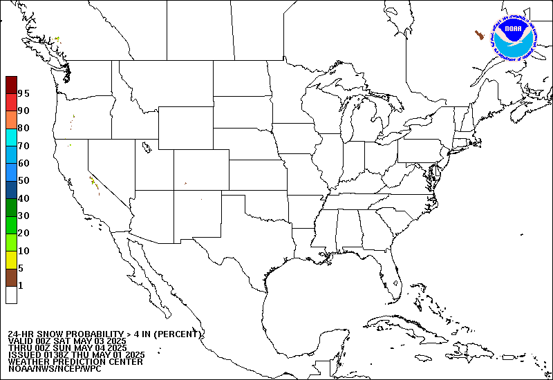 Day 3 |
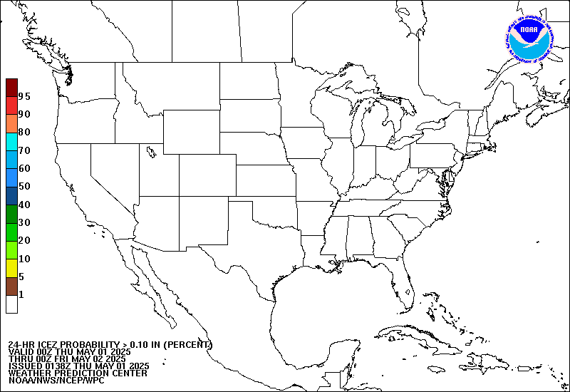 Day 1 |
 Day 2 |
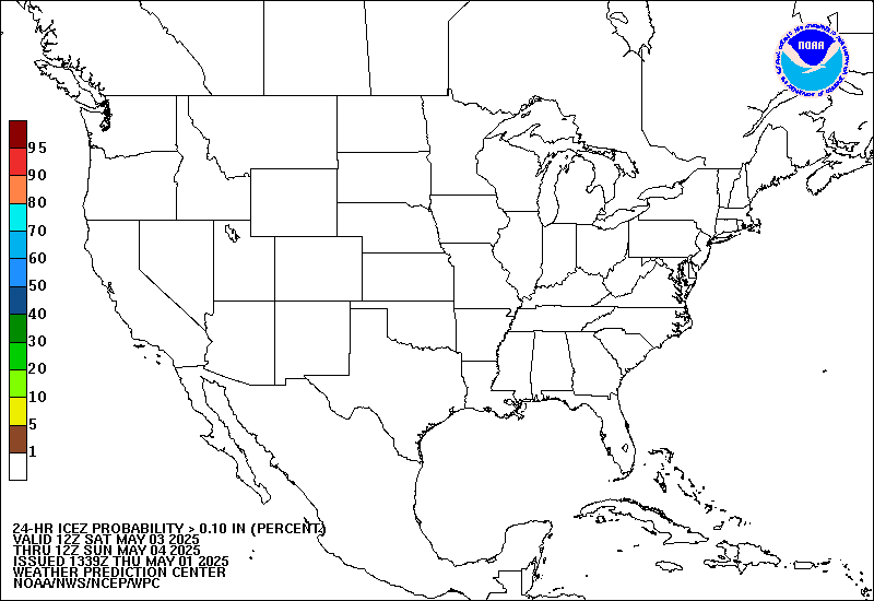 Day 3 |
|||||
| Extended Outlooks (Probability for impactful winter weather) | |||
 Day 4 |
 Day 5 |
 Day 6 |
 Day 7 |
Rivers / Precipitation
| River Information | ||||
 |
 |
 |
 |
 |
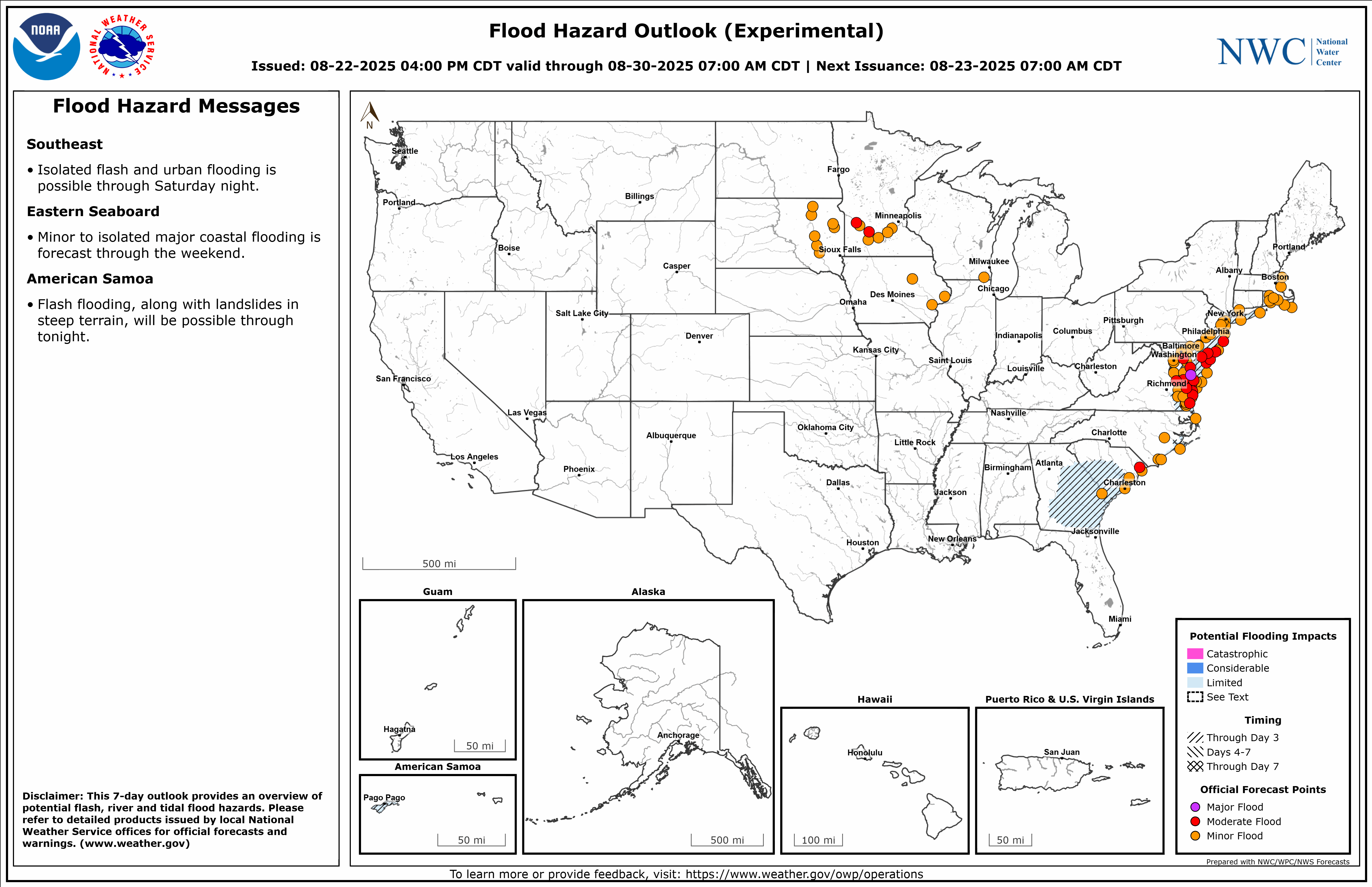
| Flood Hazard Outlook (experimental) |
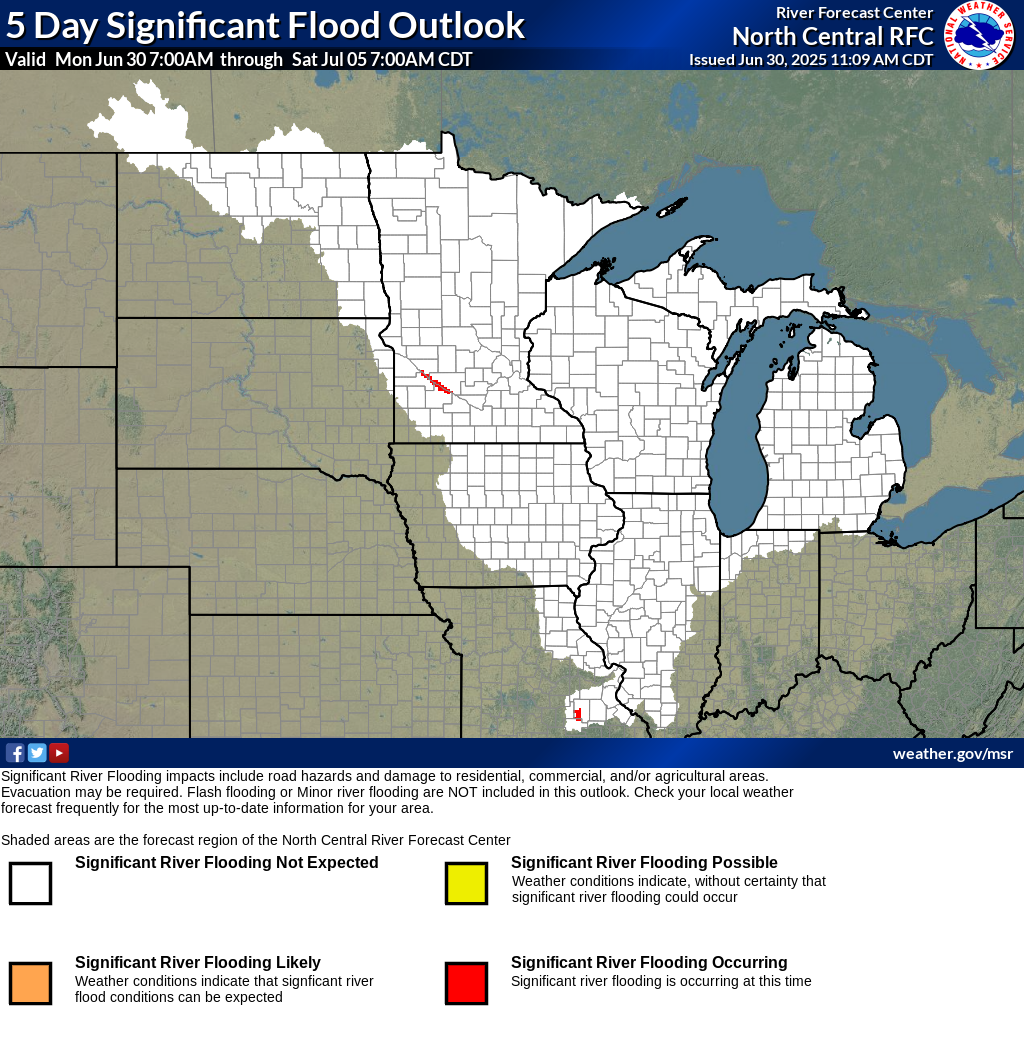
Significant River Flood Outlook |
NWS La Crosse River Monitor Webpage |
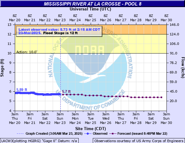
Current River Levels and Forecasts |
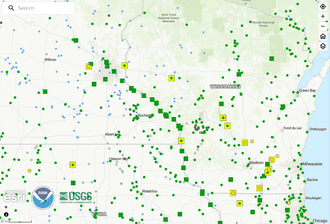
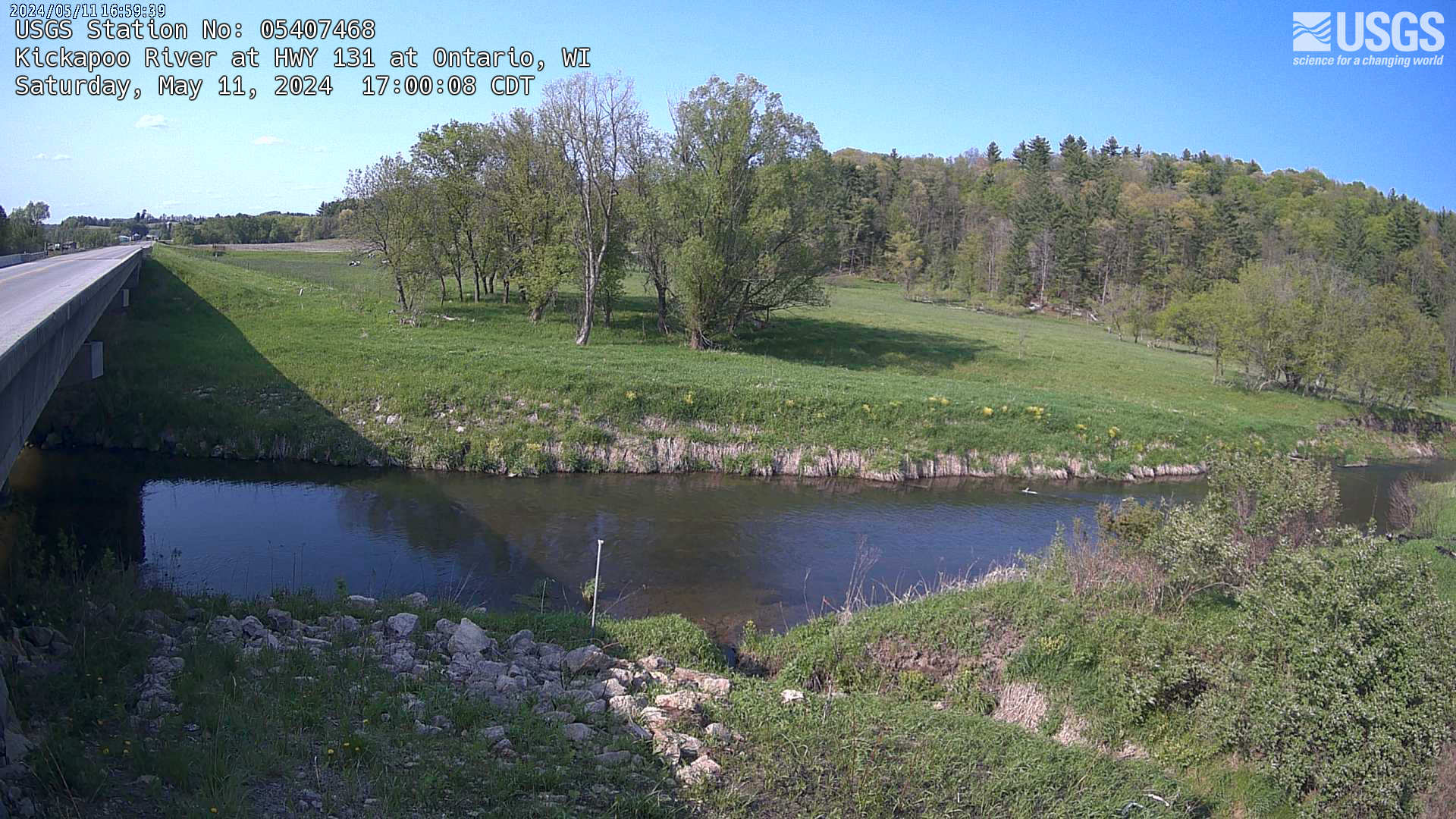
USGS River Gauge Webcams |
| Rainfall Information | ||||
 |
|
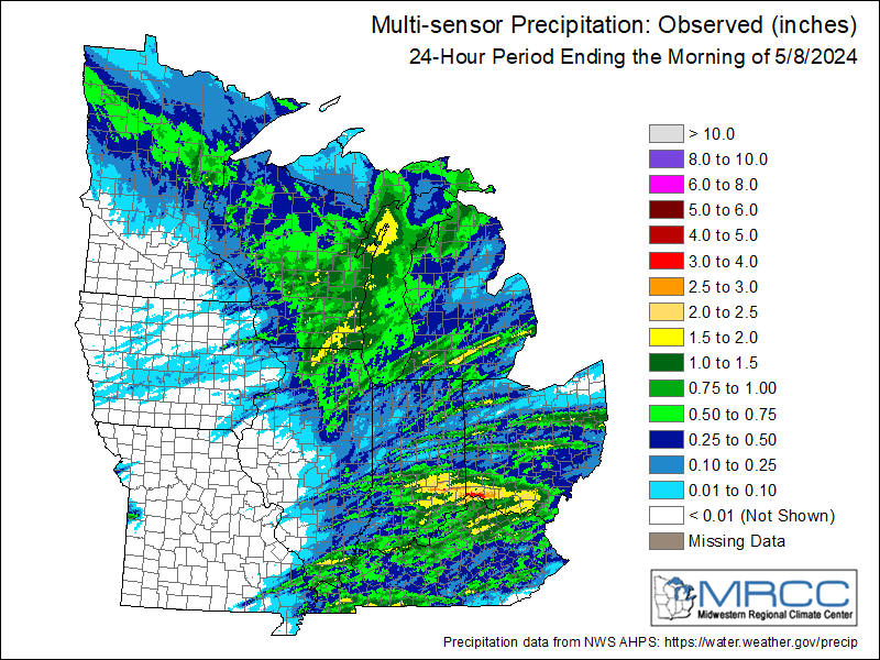 |
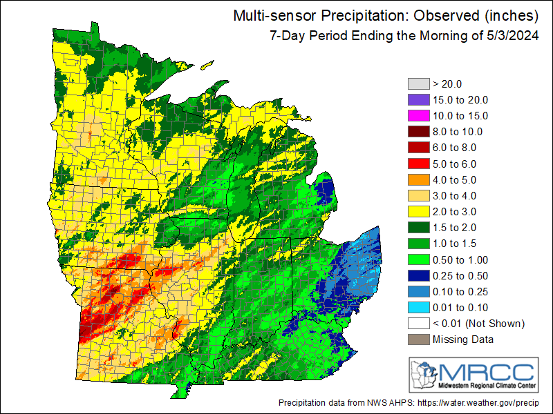 |
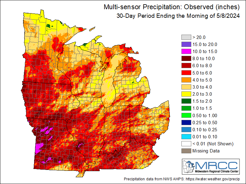 |
| 1-hour Estimated Precip | Storm Total Estimated Precip | Rainfall Last 24 Hours | Rainfall Last 7 Days | Rainfall Last 30 Days |
| Precipitation Forecasts - Discussion | |||||
 |
 |
 |
 |
 |
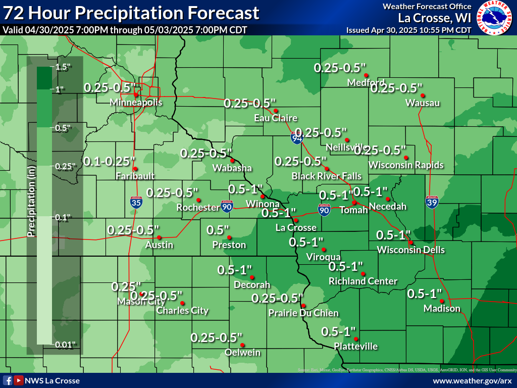 |
| Today | Tomorrow | Day 3 | Days 4-5 | Days 6-7 | Local 72-Hour Forecast |
| National Excessive Rainfall Outlooks - Discussion | ||||
 |
 |
 |
 |
 |
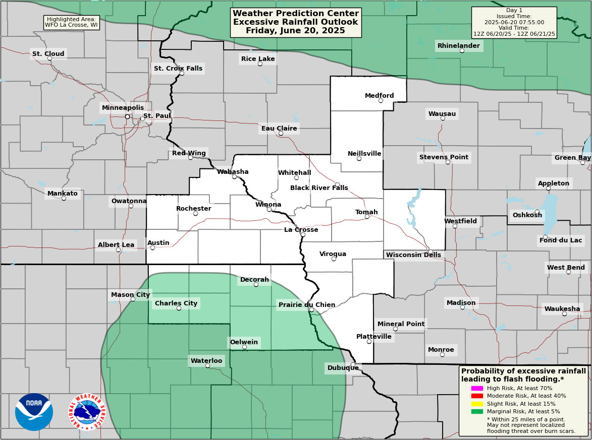
| Today | Tomorrow | Day 3 | Day 4 | Day 5 |
| Local Excessive Rainfall Outlooks | ||||
 |
 |
 |
 |
 |
| Today | Tomorrow | Day 3 | Day 4 | Day 5 |
Reference Material
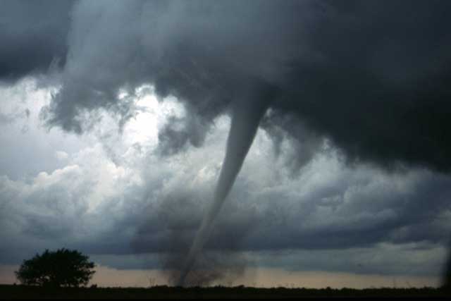
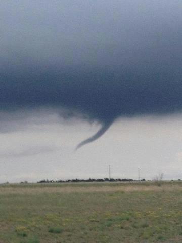
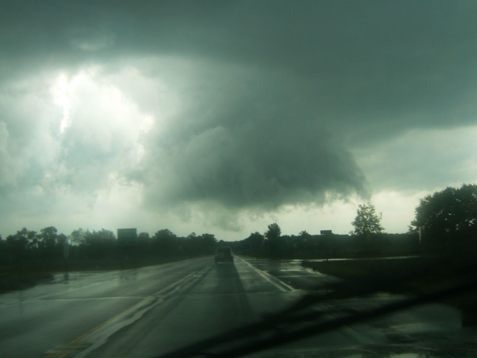
| Tornado / Funnel Clouds | ||||||
|
||||||
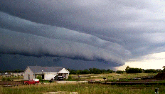
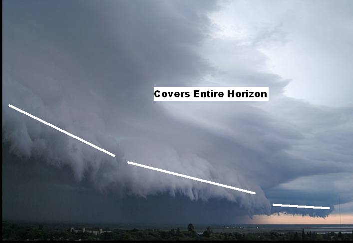
| Damaging Wind | ||||||
|
||||||
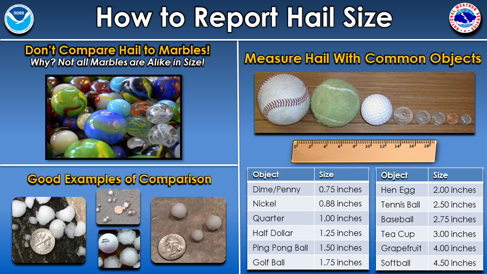
| Hail | ||||||
|
||||||
| Flood | ||||||
|
||||||
| Winter | ||||||
|
Informational Links
 |
Contact NWS La Crosse if you have any questions or need additional details: Send email or call 608-784-7294 |
|


 Weather Story
 Weather Map