| Click anywhere on the map for the forecast. Turn "on and off" the various weather parameters using the display options. Hover over a highlighted area to see the hazard. | Map Display Options |
|
Hazardous Weather Outlook Forecast Discussion Latest Conditions Submit Report |
|
RADAR
| Local, Regional, & National Radar | ||||||||
La Crosse |
Regional Radar |
National Radar |
||||||
| Neighboring NWS Radars | ||||||||||
Duluth |
Twin Cities |
Des Moines |
Quad Cities |
Milwaukee |
Green Bay |
|||||
CURRENT CONDITIONS
 More Details |
 |
 |
 |
 |
FORECAST SNOW / ICE
| Snow/Ice Amount Potential Over Next 72 Hours | City Snowfall Probabilities | |||||
Expected Snowfall Official NWS Forecast |
Low End Snowfall Potential 90% Chance Snowfall Will Be Greater Than This |
High End Snowfall Potential 10% Chance Snowfall Will Be Greater Than This |
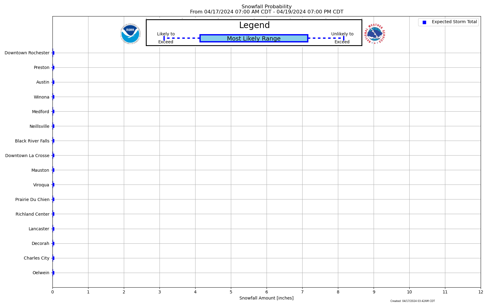 Forecast Snowfall Probability Ranges By City |
|||
Expected Ice Accumulation Official NWS Forecast |
Low End Ice Accum Potential 90% Chance Icing Will Be Greater Than This |
High End Ice Accum Potential 10% Chance Icing Will Be Greater Than This |
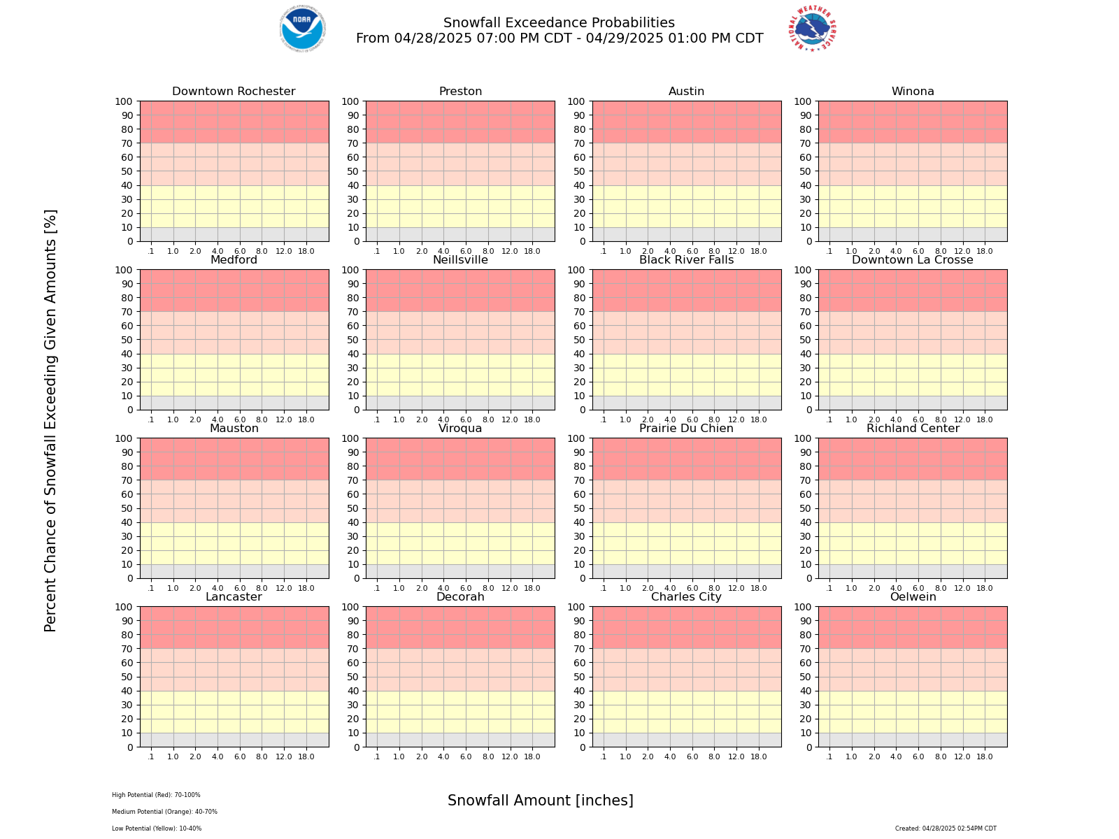 Probability of Snowfall Exceeding Certain Amounts |
|||
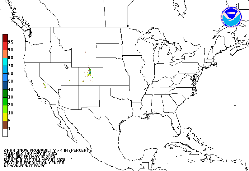
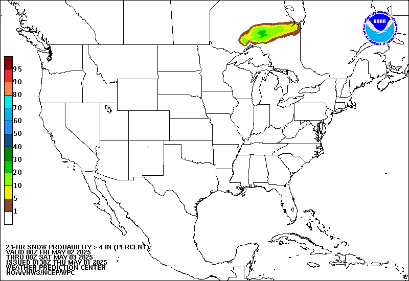
| Probabilistic Snow / Ice Forecasts Over Next 72 Hrs - More Details | ||||||||
| SNOW | 0.1" or more |
1" or more |
2" or more |
4" or more |
6" or more |
8" or more |
12" or more |
18" ore more |
| ICE | 0.01" or more |
0.1" or more |
0.25" or more |
0.5" or more |
0.75" or more |
1" or more |
1.25" or more |
1.5" or more |
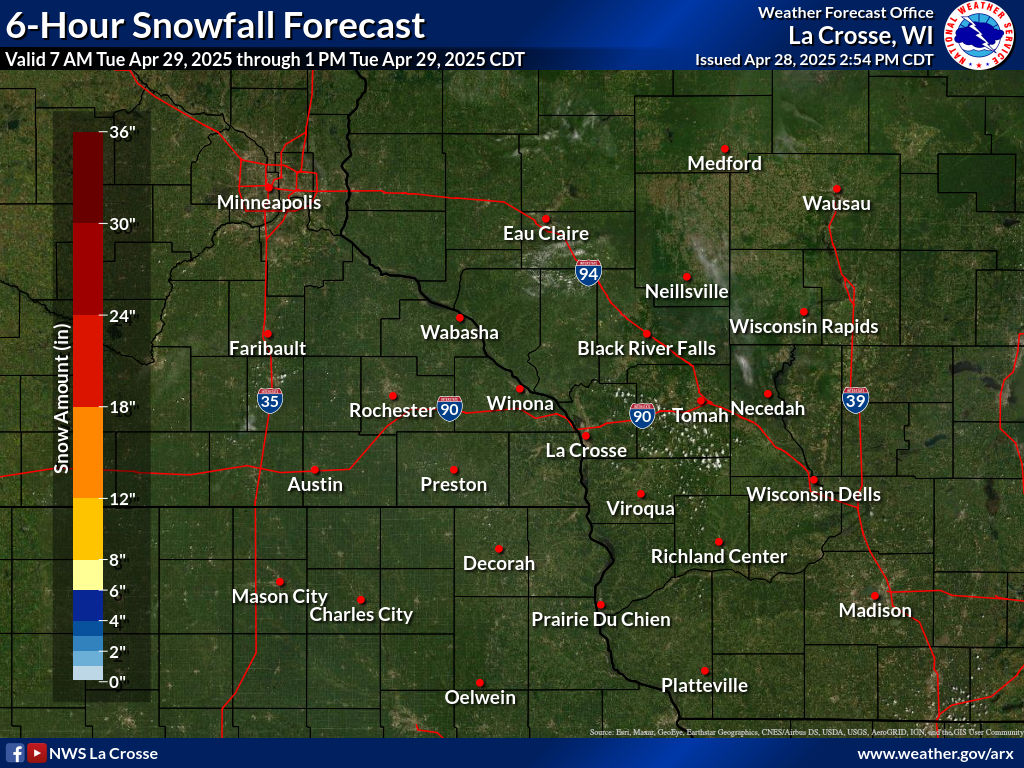
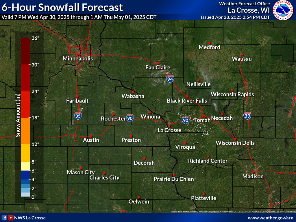
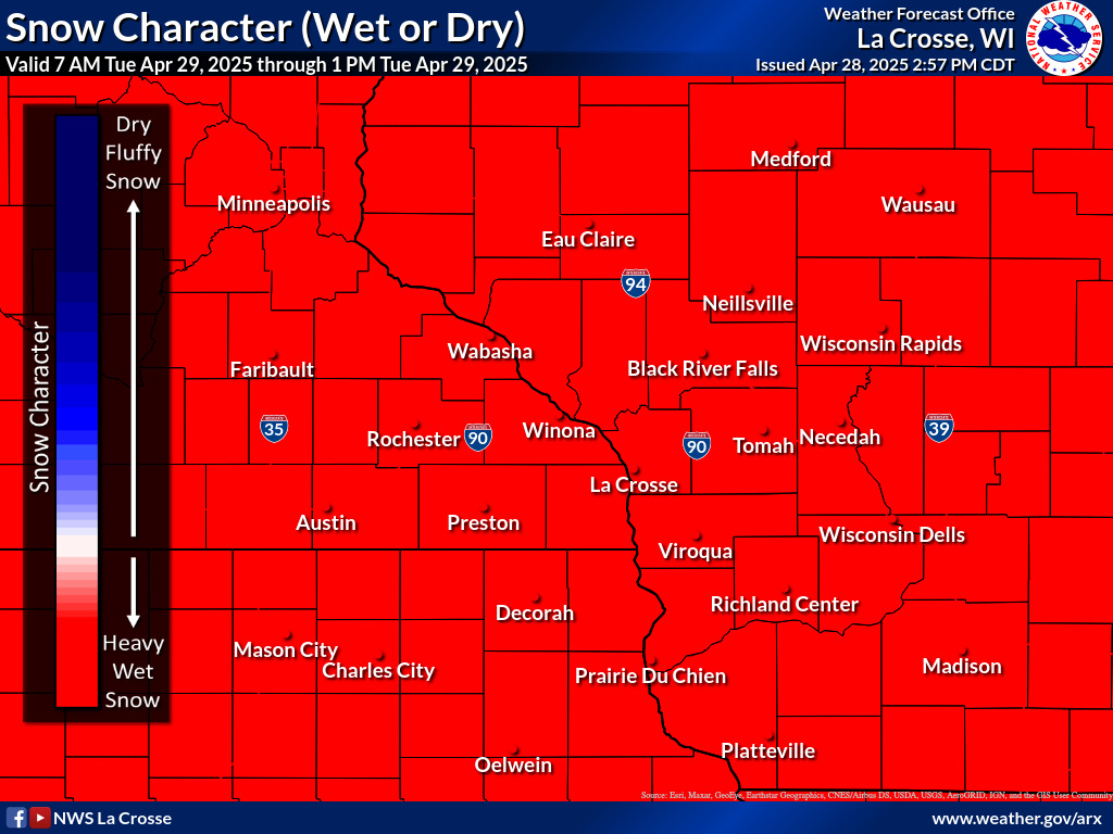
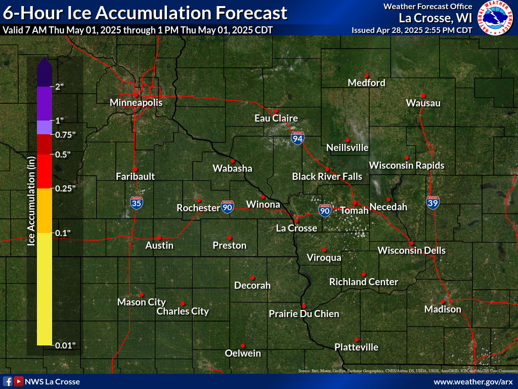
| 6 Hour Snow / Snow Type (wet or dry) / Ice Forecasts | ||||||||||||
| NOW | 24 hr | 48 hr | 72 hr | |||||||||
| SNOW |  |
 |
 |
 |
 |
 |
 |
 |
 |
 |
 |
 |
|---|---|---|---|---|---|---|---|---|---|---|---|---|
| TYPE |  |
 |
 |
 |
 |
 |
 |
 |
 |
 |
 |
 |
| ICE |  |
 |
 |
 |
 |
 |
 |
 |
 |
 |
 |
 |
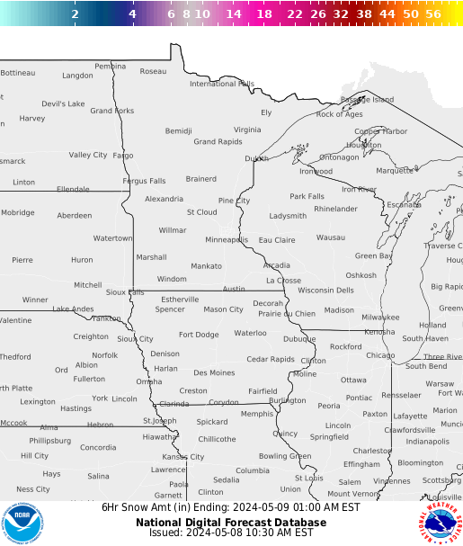
| Regional 6 Hour Snow Forecasts | |||||
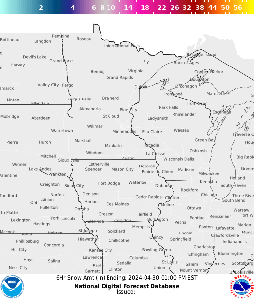 Most Current |
 |
 |
 |
 |
 36 Hours |
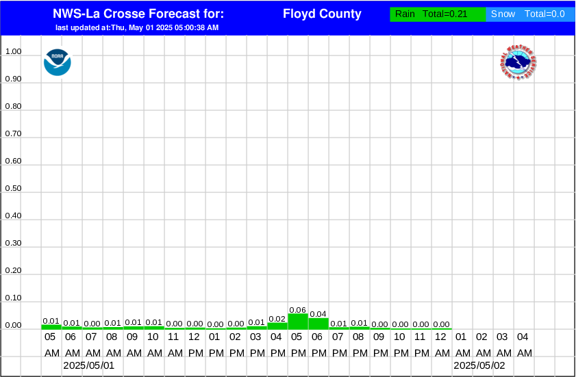
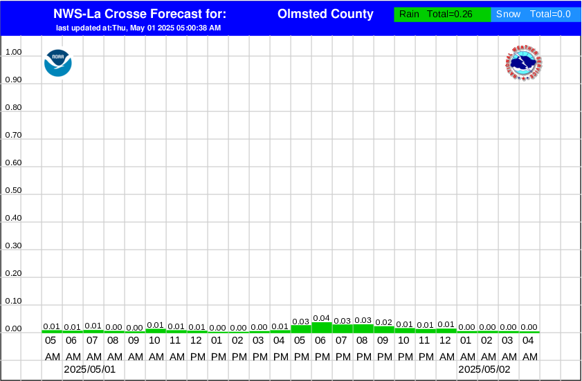
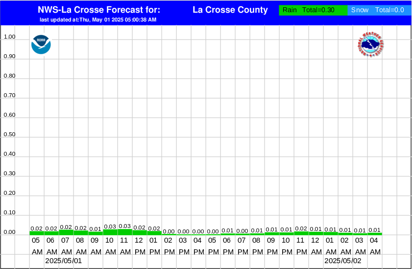
| Hourly Precipitation Graphs - by county | Probability Of Precip Type | |||
| Graphics only updated when precipitation in the forecast | ||||
|
|
|
|
||
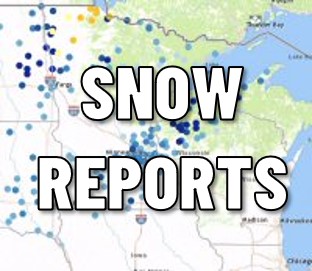
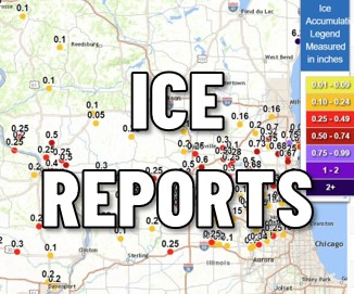
PAST ACCUMULATIONS
| Last 7 days - from MRCC | ||
 In-depth snow analysis from the National Operational Hydrologic Remote Sensing Center (NOHRSC) |
 Snowfall |
 Snow Depth |
|
HAZARDS |
More information available on the HAZARDS DASHBOARD Interested in Probabilistic Outlooks? |
The Experimental Enhanced Hazardous Weather Outlook is a decision support service that supports preparedness and response efforts prior to and during hazardous weather. This service provides decision makers with convenient access to potential weather hazard information by graphically depicting the risk of weather hazards out through seven days.
|
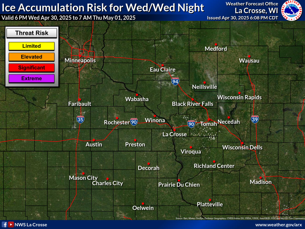
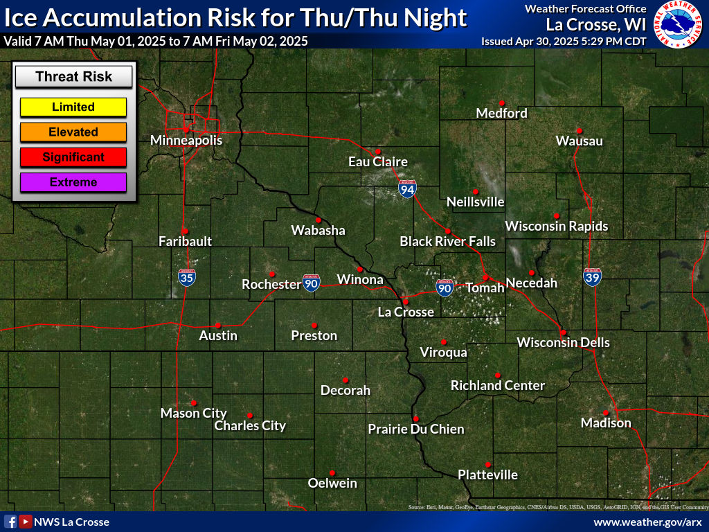
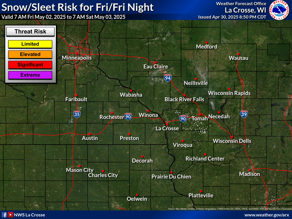
Snow / Sleet - Legend
|
Ice - Legend
|
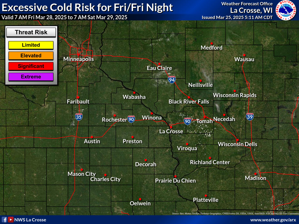
Extreme Cold - Legend
|
|||||
 |
 |
 |
 |
 |
 |
||
 |
 |
 |
 |
 |
 |
||
Snow and Sleet Legend
|
Risk Level
|
Hazard
|
Impacts/Actions
|
|
None
|
None
|
< 1" of snow or sleet
|
|
Limited
|
1 to 3 inches
|
Locally hazardous travel conditions on bridges, overpasses, and untreated or secondary roads
|
|
Elevated
|
3 to 6 inches
|
Be prepared to reduce travel speed for hazardous travel conditions - especially on bridges, overpasses, untreated and secondary roads
|
|
Significant
|
6 to 12 inches
|
Plan for hazardous travel conditions. Avoid travel if possible
|
|
Extreme
|
12 or more inches
|
Travel will be dangerous and may be impossible. Avoid travel unless it is an emergency
|
Ice Accumulation Legend
|
Risk Level
|
Hazard
|
Impacts/Actions
|
|
None
|
None
|
No freezing rain or drizzle
|
|
Limited
|
Very light freezing rain or drizzle with up to a thin glaze, or freezing fog
|
Locally hazardous travel conditions on bridges, overpasses, and untreated or secondary roads
|
|
Elevated
|
Freezing rain or drizzle with accumulation less than 1/4 inch
|
Be prepared to reduce travel speed for hazardous travel conditions - especially on bridges, overpasses, untreated and secondary roads
|
|
Significant
|
Freezing rain with accumulation of 1/4 to less than 1 inch
|
Plan for hazardous travel conditions. Power lines and trees may be damaged resulting in localized to scattered power outages. Avoid travel if possible and prepare for possible power outages
|
|
Extreme
|
Freezing rain with accumulation of greater than or equal to 1 inch
|
Travel will be dangerous and may be impossible. Power lines and trees likely damaged resulting in widespread power outages. Avoid travel unless it is an emergency and prepare for extended power outages
|
Excessive Cold Legend
|
Risk Level
|
Hazard
|
Impacts/Actions
|
|
None
|
Wind chills 10 F or warmer
|
Its cold, stay warm.
|
|
Limited
|
Wind chills < -4 F
|
Frostbite and hypothermia may occur with prolonged exposure without proper clothing. Have proper clothing for exposure and limit or eliminate exposure if possible.
|
|
Elevated
|
Wind chills < -19 F
|
Frostbite and hypothermia could occur within 30 minutes without proper clothing. Have proper clothing for exposure and limit or eliminate exposure if possible.
|
|
Significant
|
Wind chills < -29 F
|
Frostbite and hypothermia will likely occur within minutes without proper clothing. Have proper clothing for exposure and limit or eliminate exposure.
|
|
Extreme
|
Wind chills < -39 F
|
Frostbite and hypothermia will occur within minutes without proper clothing. Have proper clothing for exposure and limit or eliminate exposure.
|
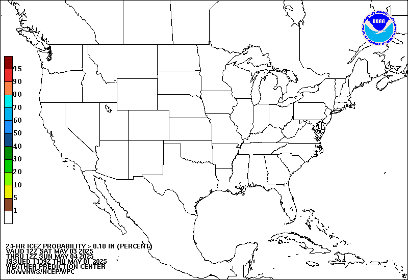
OUTLOOKS
| Outlooks from the Weather Prediction Center |
|
|
|
|
Days 4-7
|
||||
 |
 |
 |
 |
 |
|||
 |
 |
 |
 |
 |
|||
|
|||||||
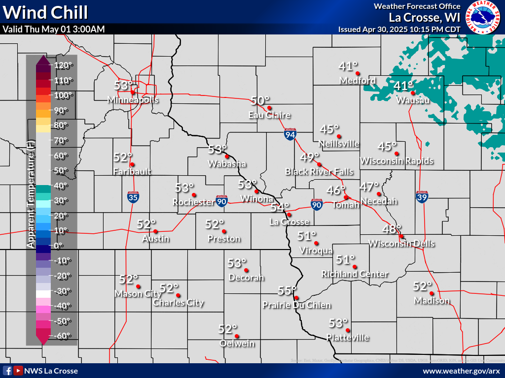
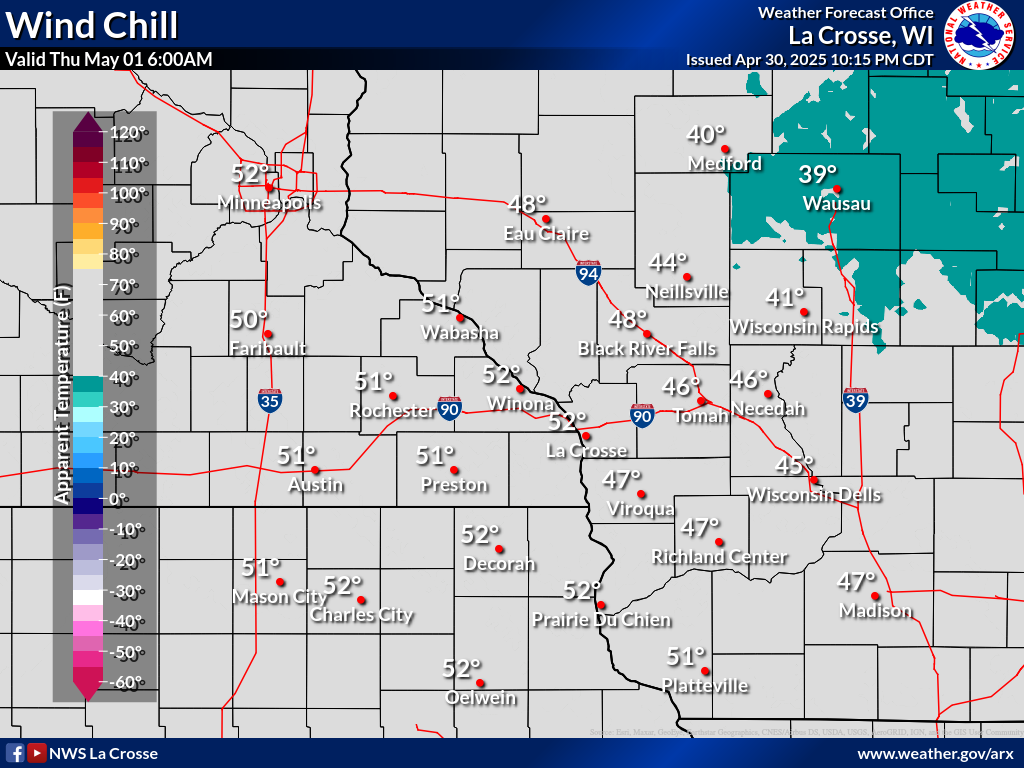
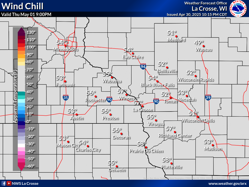
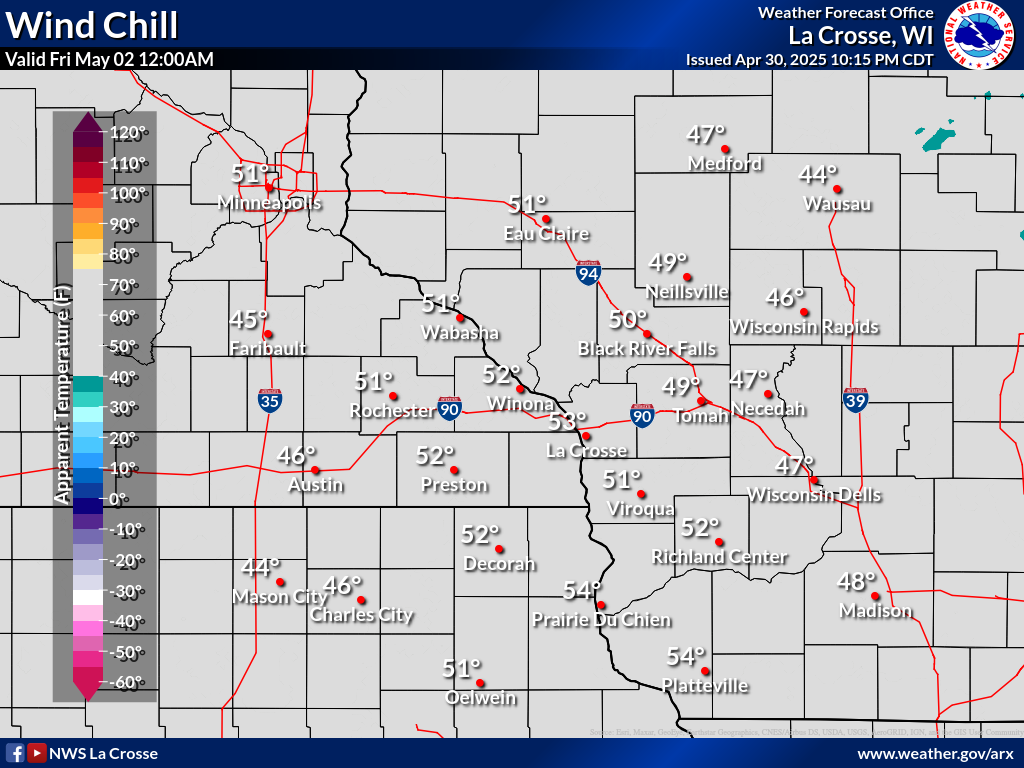
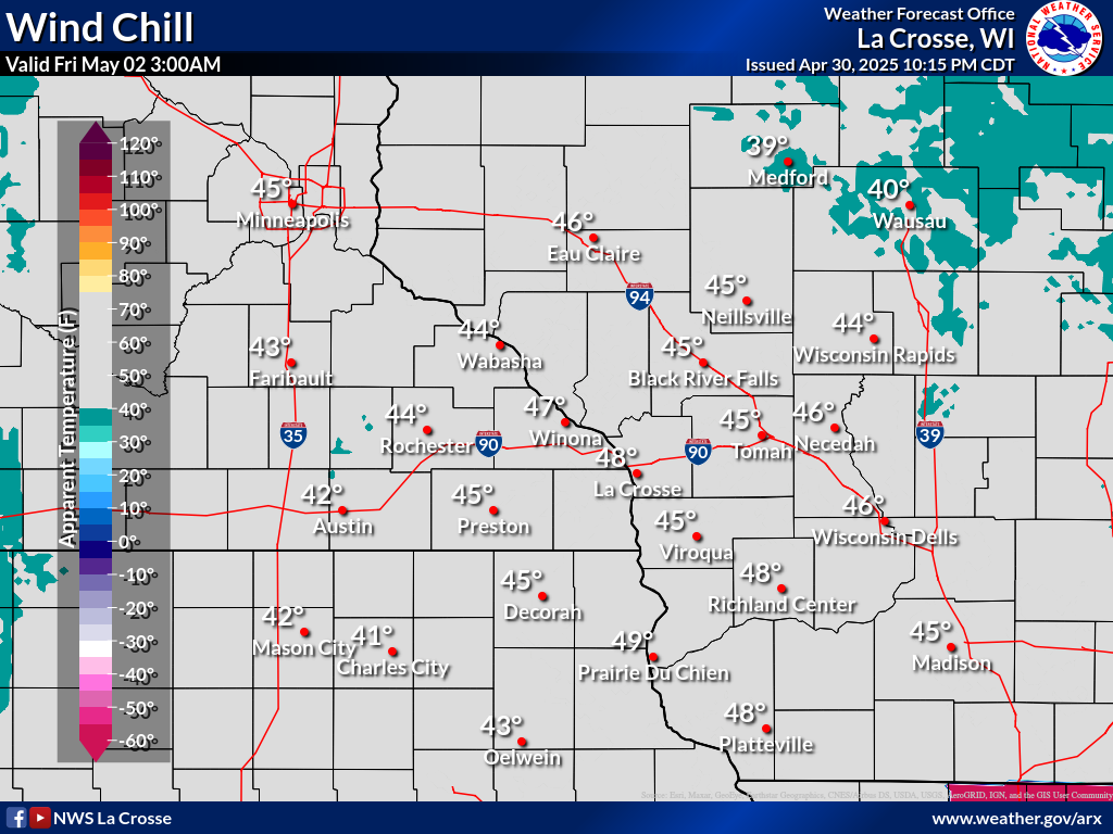
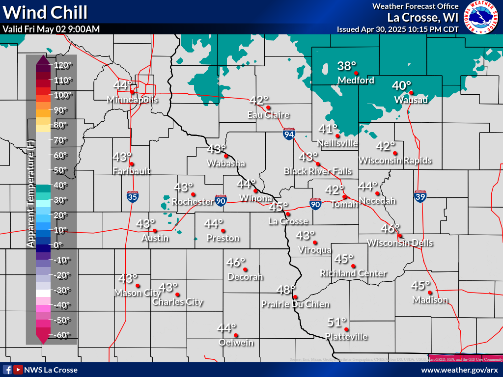
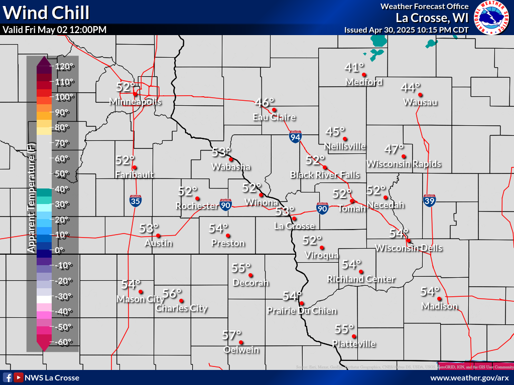
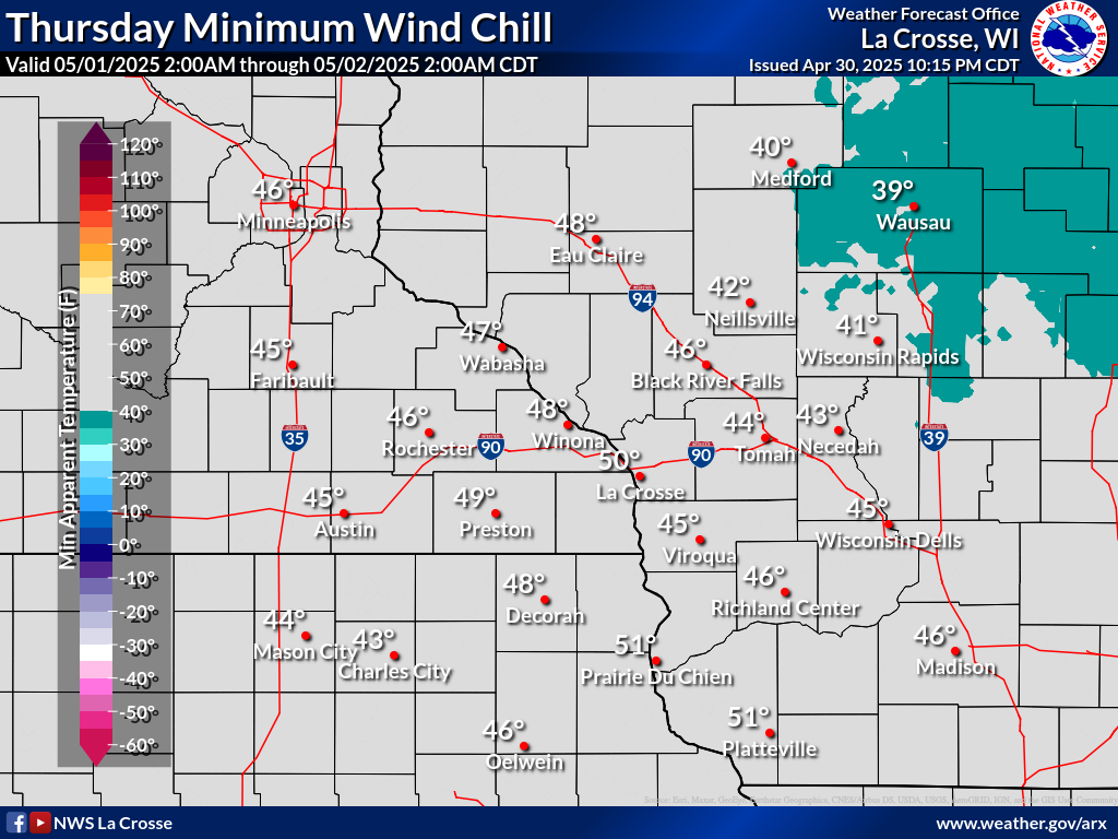
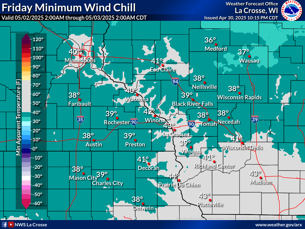
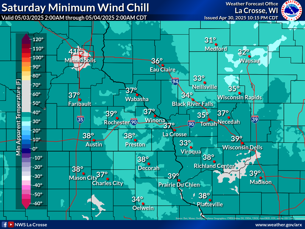
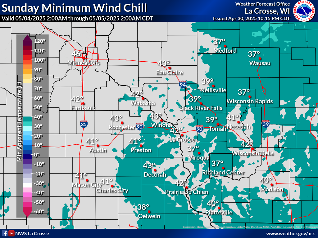
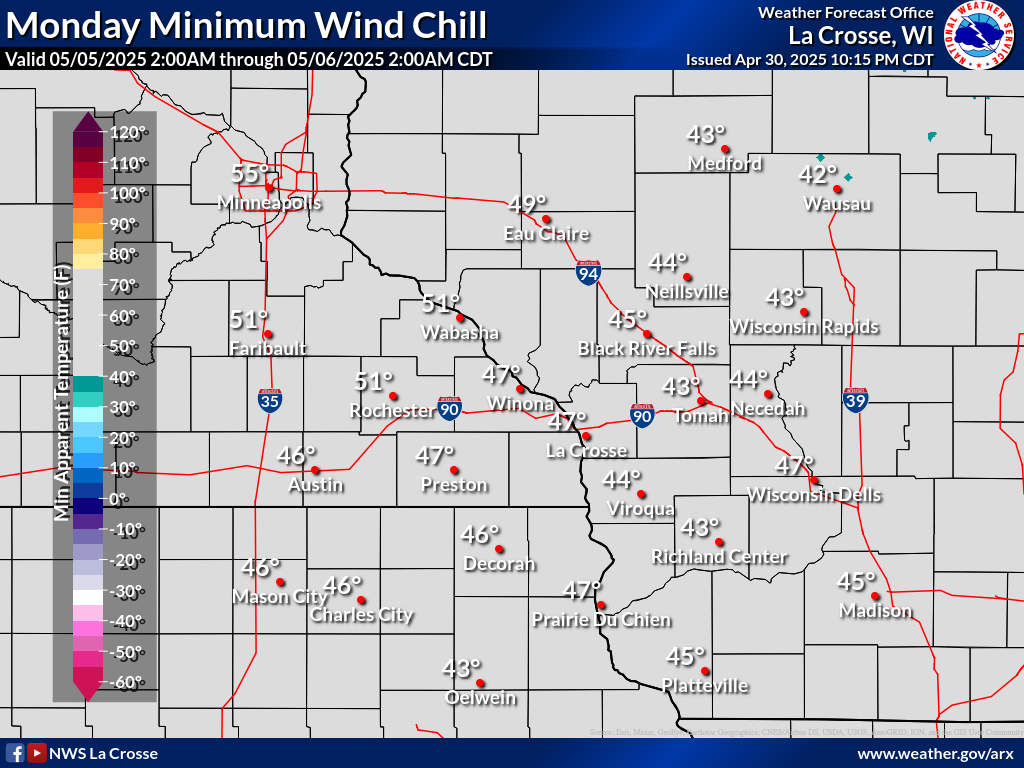
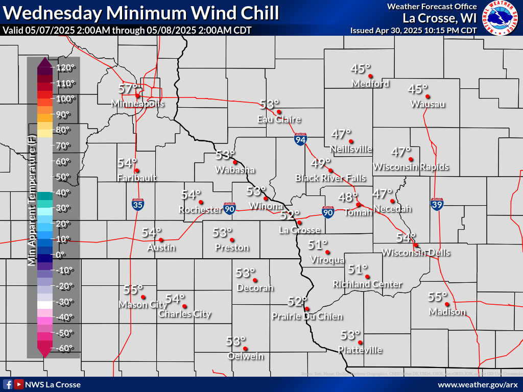
WINDCHILL
|
Daily Coldest Wind Chills Through 7 Days
|
Calculate the wind chill, or reference the wind chill chart: |
| Wind Chill Temperature 3 Hour Forecasts | ||||||||||||
| NOW | 6hr | 12hr | 18hr | 24hr | 30hr | 36hr | ||||||
 |
 |
 |
 |
 |
 |
 |
 |
 |
 |
 |
 |
 |
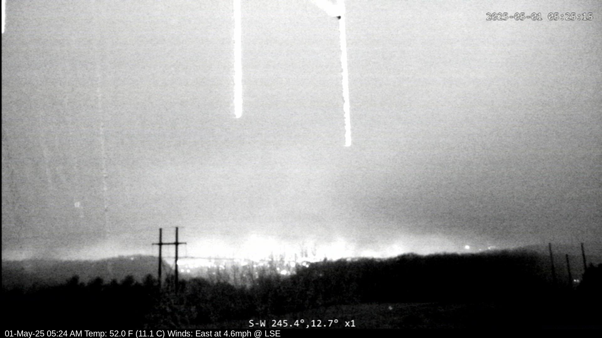
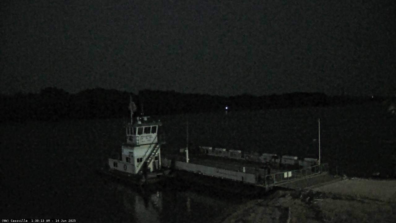
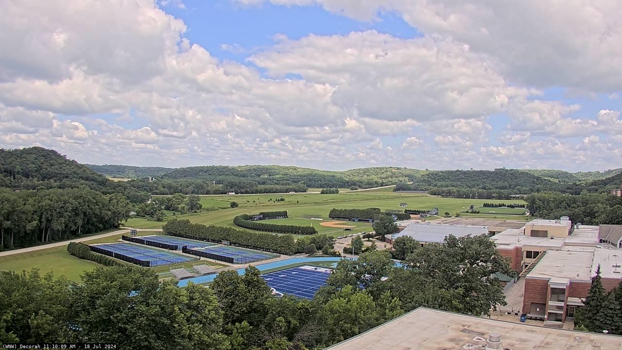
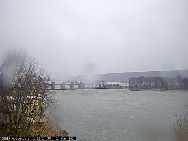
WEBCAMS
 |
 |
 |
 |
 |
| NWS La Crosse, WI | Prairie du Chien KCRG-TV |
La Crosse, WI Riverside Park |
Mauston, WI KCRG TV |
Marshfield, WI WSAW-TV |
 |
 |
 |
 |
 |
| Rochester, MN Downtown - KIMT TV |
Rochester, MN Northwest - KTTC TV |
Austin, MN KIMT TV |
Grand Meadow, MN KTTC TV |
Albert Lea, MN KIMT TV |
 |
 |
 |
 |
 |
| Decorah, IA KCRG-TV |
Guttenberg, IA KCRG-TV |
Cedar Falls, IA KCRG-TV |
Fayette, IA KCRG-TV |
Charles City, IA KIMT-TV |
ROADS
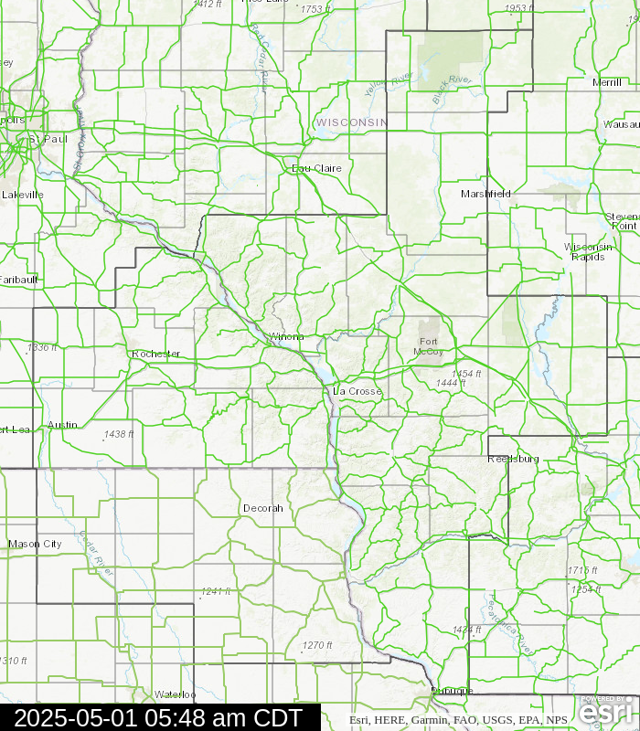
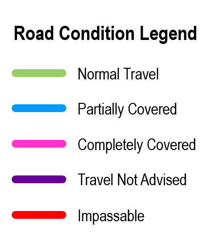
| Current Road Conditions | Latest Travel Information | ||||||||||
|
Disclaimer:
|
 |
 |
|
||||||||
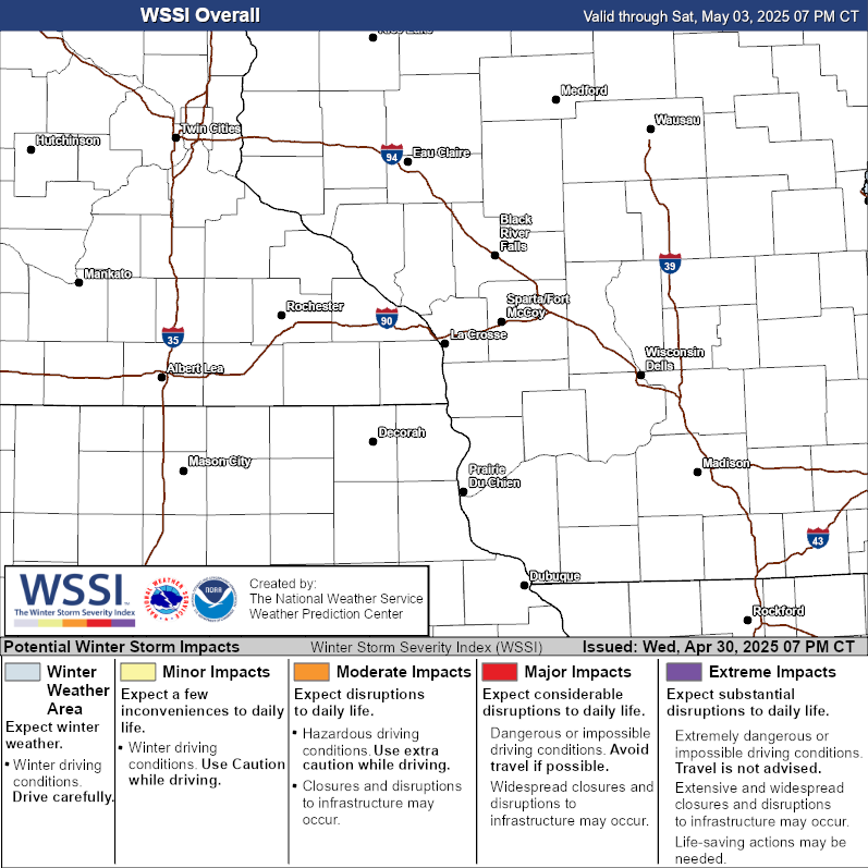
WINTER STORM SEVERITY INDEX
The Winter Storm Severity Index (WSSI) is a utility to provide information on the severity of winter weather and potential societal impacts (travel conditions, etc). The WSSI does not depict official watches, warnings or advisories, and should always be used in context with official forecasts. The WSSI uses NWS forecasts and typically updates every two hours. Always check the creation and valid times. Need more regional information? user guide?
| Overall Impact | By Weather Element | |||
 |
Snow Amount |
Ice Accumualation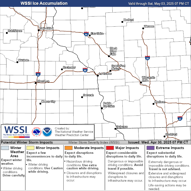 |
Blowing Snow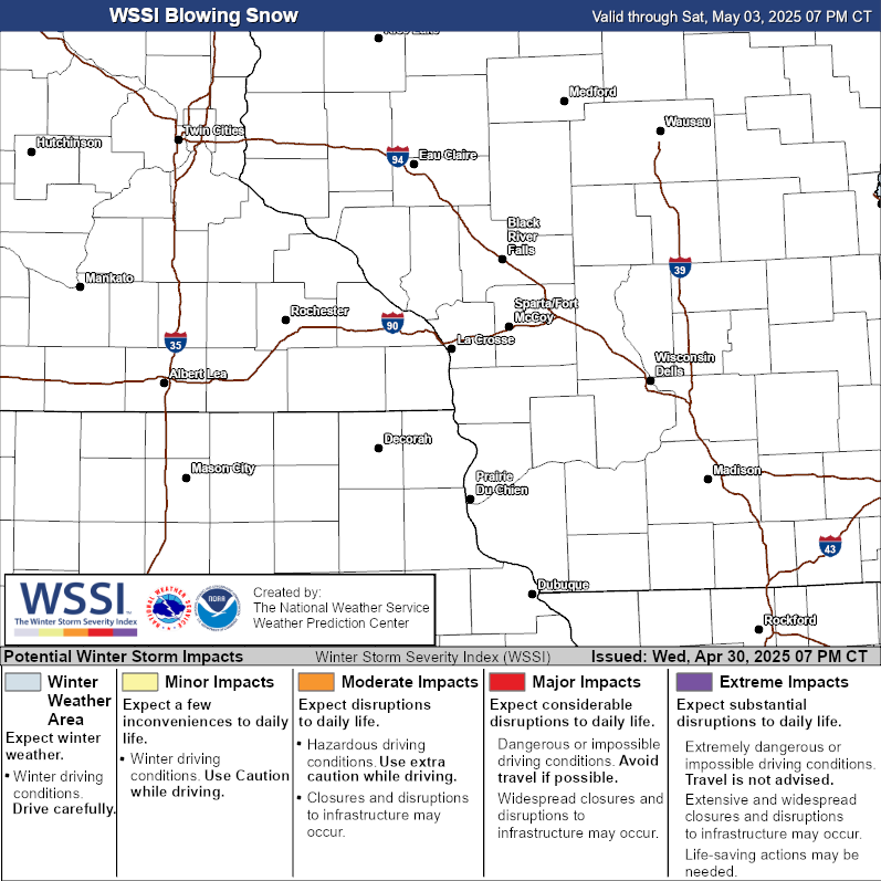 |
|
Flash Freeze |
Ground Blizzard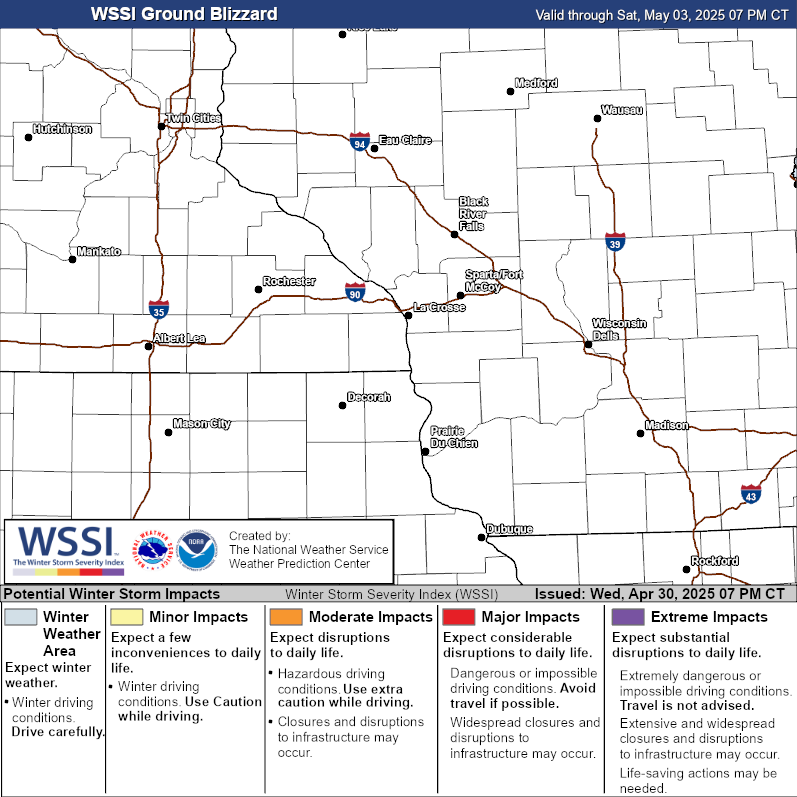 |
Snow Load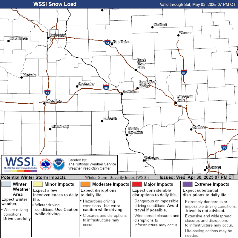 |
||


 Weather Story
 Weather Map