National Weather Service United States Department of Commerce


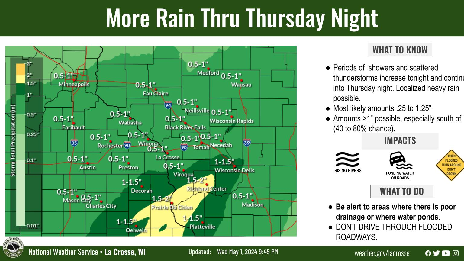
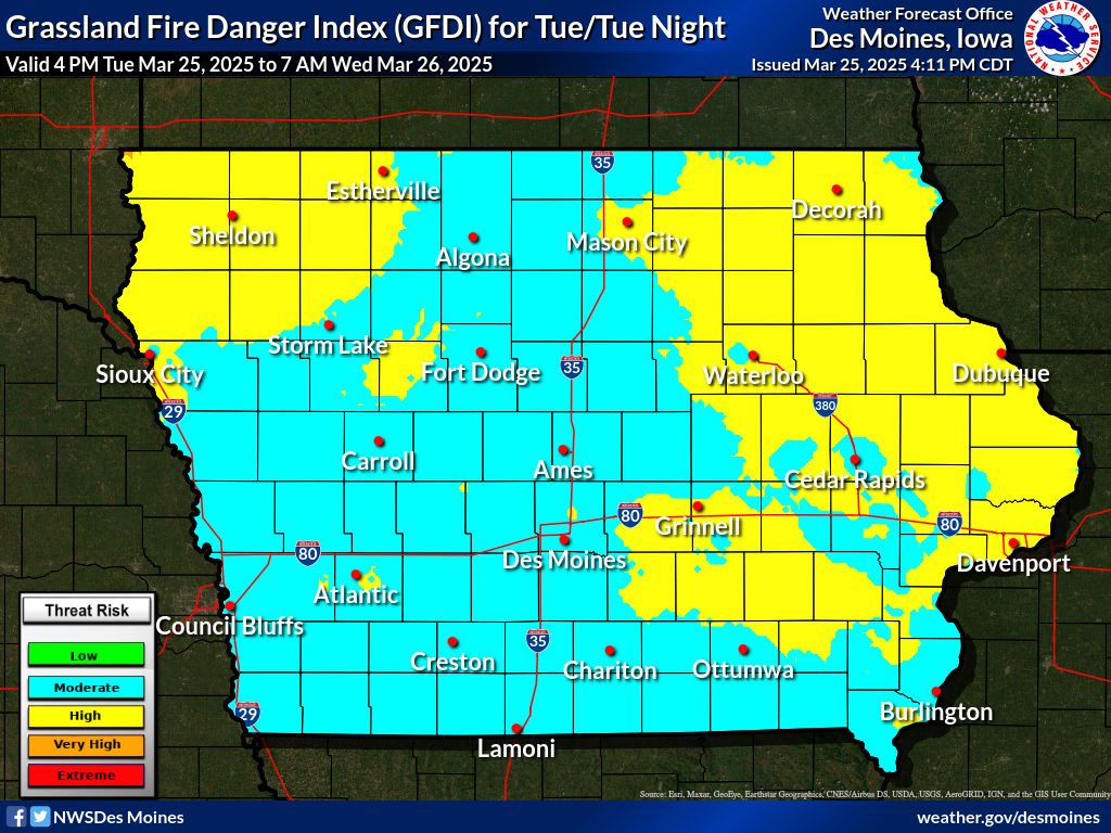
Strong south winds gusting from 30 to 45 mph, humidity as low as 20 to 30 percent, and dry grasses and other fuels has created critical to near-critical fire danger for the region,  especially parts of southeast MN and northeast IA.  

Any fires that start could spread rapidly and be hard to control. Avoid outdoor burning today. 

National Weather Service La Crosse on Facebook National Weather Service La Crosse on Twitter Email The National Weather Service La Crosse National Weather Service La Crosse on Youtube National Weather Service La Crosse on Instagram


Today: Elevated to Critical Fire Weather Conditions

  • What: Southwest winds gusting 30 to 45 mph, humidity from 20-30%, and dry fuels will create conditions for quick-starting, fast moving fires. 
  • Where: The highest fire danger will be over northeast Iowa and southeast Minnesota. 
  • Timing: Through 6 pm
  • Impacts: Fires will start very easily, moving quickly through dried grasses and dead leaves
  • ACTION: Avoid any outdoor burning
Forecast Wind Gust

Max Wind Gusts Today

  • Submit Report •
Fire WX Monitor
Hazardous Weather Outlook
Fire Weather Statement
Current Conditions


Weather Graphic

Weather Story

Composite Reflectivity

Radar