La Crosse, WI
Weather Forecast Office
|
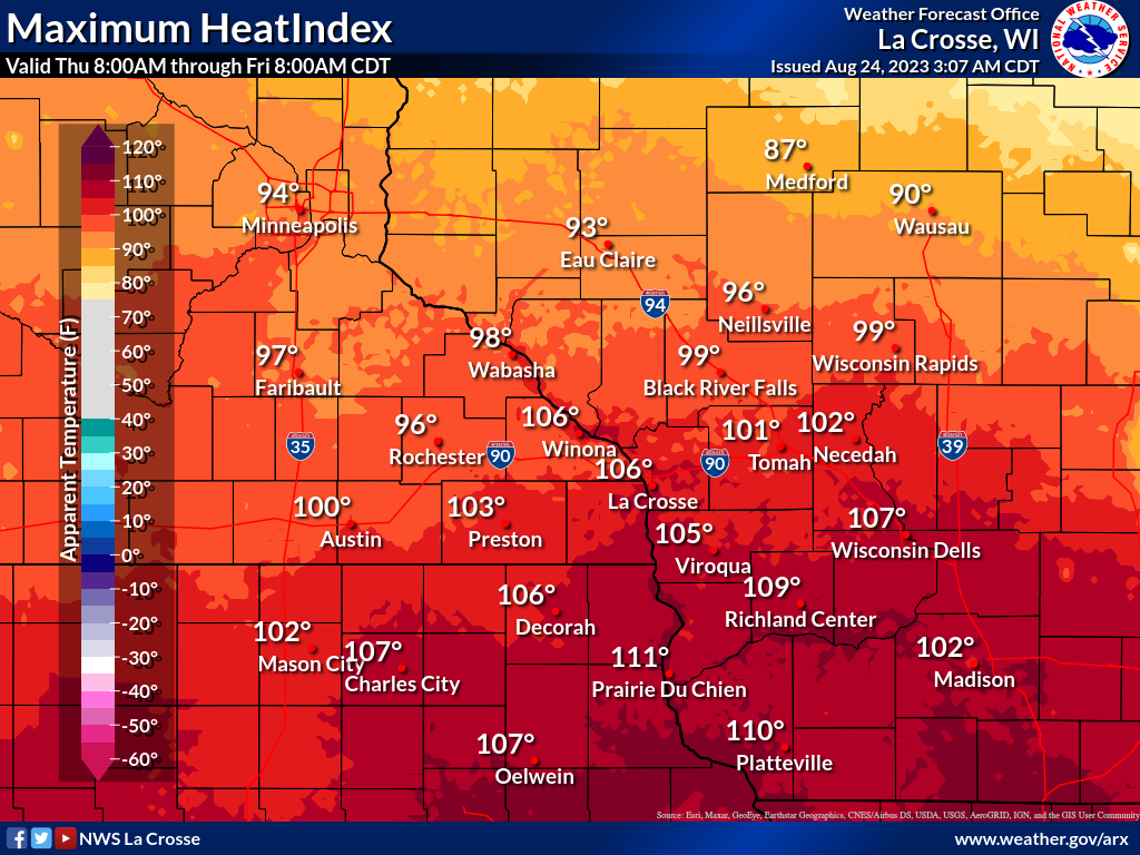
Dangerous heat persists for one more day today with afternoon heat indices from 95 to 110 expected. The hottest conditions will be along and south of Interstate 90. The weekend brings much cooler and less humid conditions will highs from the mid 70s to around 80. For those with outdoor activities, especially work related or sports, watch for any signs of heat related illnesses. Take frequent breaks, drink water regularly, and find locations to cool down in air conditioning if possible.     
Today: Dangerous Heat Continues
Additional Information:
|
• Submit Report • Hazardous Weather Outlook Heat Warnings/Adv Latest Reports Current Conditions

Weather Story 
Radar |
Our Office
Community Involvement
Station / Location Info
Follow Us On Social Media
Student Opportunities
Additional Information
Storm Summaries
Cooperative Observers
Educational Resources
Science / Research
Weather Phenomenon
Mayfly Tracking
Latest
Temp/Pcpn Summary
Precipitation Reports
Forecast Discussion
Hazardous Weather Outlook
Hourly Weather
Public Information Statement
Local Storm Report
Lightning Plot Archive
River Stages
Water Temp
Observations
Precipitation Plotter
Soil Temps
US Dept of Commerce
National Oceanic and Atmospheric Administration
National Weather Service
La Crosse, WI
711 County Road FA
La Crosse, WI 54601
608-784-7294
Comments? Questions? Please Contact Us.


 Weather Story
 Weather Map