Overview
|
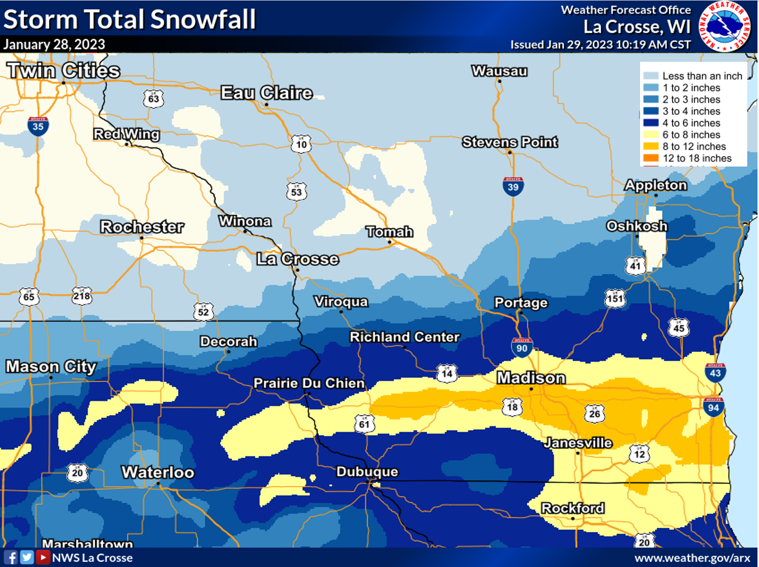
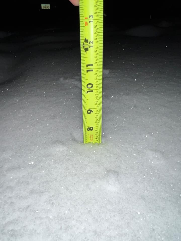
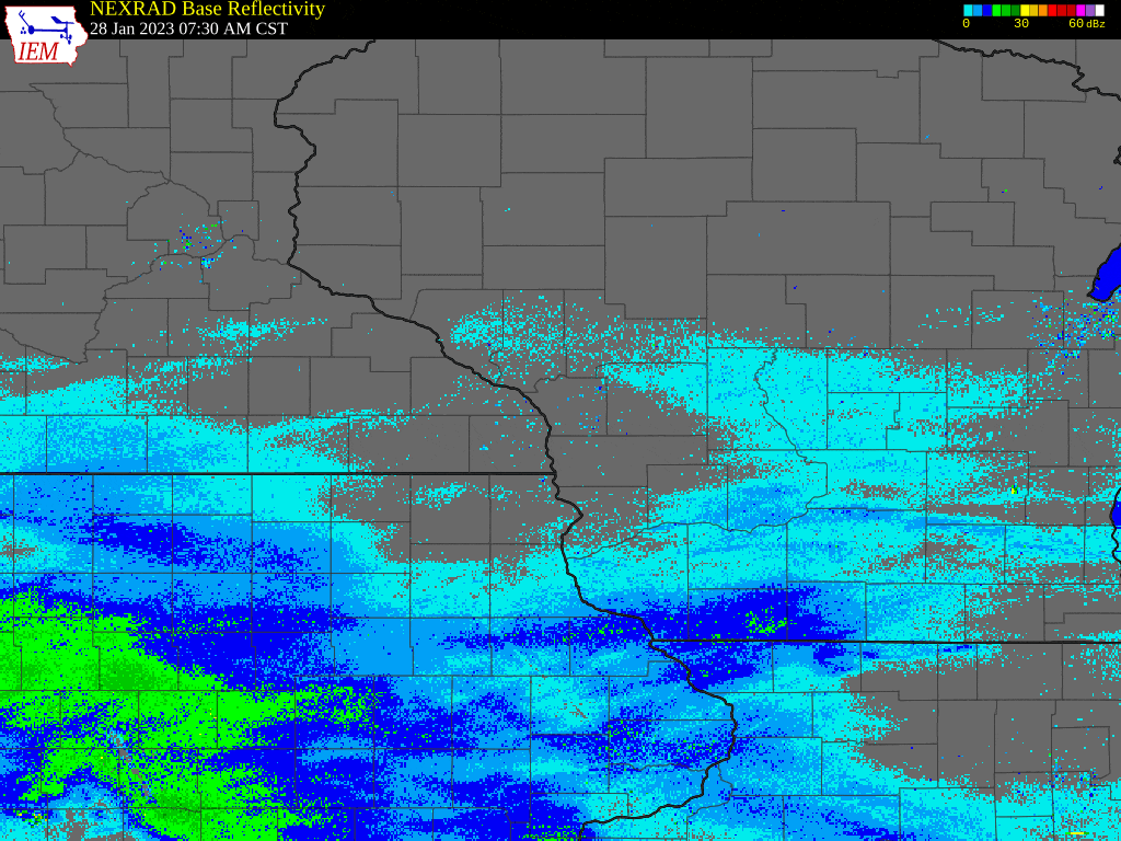
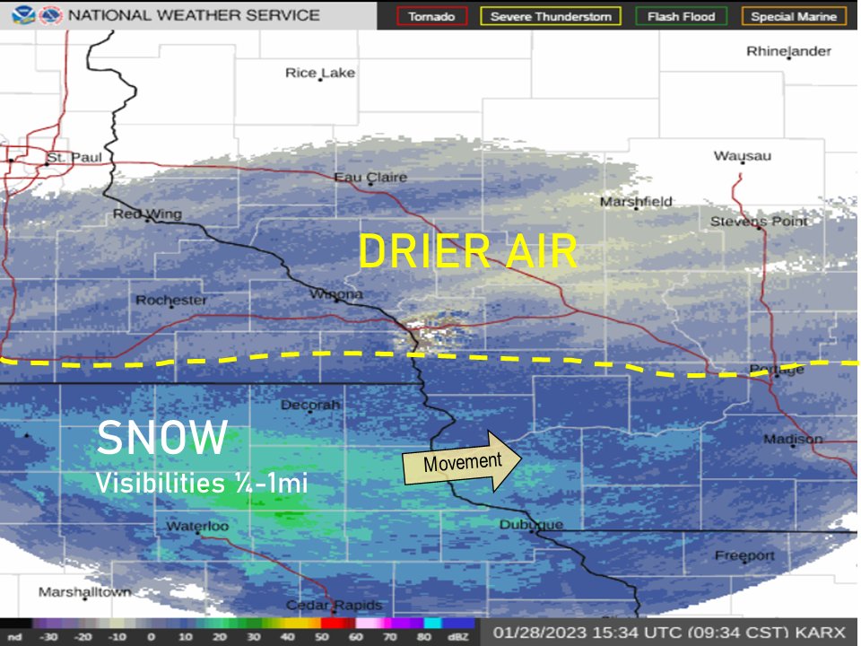
Snow PUBLIC INFORMATION STATEMENT NATIONAL WEATHER SERVICE LA CROSSE WI 1041 AM CST SUN JAN 29 2023 ...STORM TOTAL SNOWFALL REPORTS... LOCATION AMOUNT TIME/DATE LAT/LON ...IOWA... ...ALLAMAKEE COUNTY... POSTVILLE 5.5 NE 3.8 IN 0700 AM 01/29 43.14N/91.49W ...CHICKASAW COUNTY... FREDERICKSBURG 0.3 S 7.4 IN 0800 AM 01/29 42.96N/92.20W NEW HAMPTON 0.4 SW 5.8 IN 0700 AM 01/29 43.06N/92.32W 2 W IONIA 5.5 IN 1000 PM 01/28 43.04N/92.50W ...CLAYTON COUNTY... ELKADER 6.8 WSW 7.1 IN 0615 AM 01/29 42.81N/91.52W 1 NNW GUTTENBERG 7.0 IN 1021 AM 01/29 42.80N/91.11W ELKADER 6SSW 6.6 IN 0700 AM 01/29 42.78N/91.45W GUTTENBERG 6.5 IN 0501 PM 01/28 42.79N/91.11W GUTTENBERG DAM 10 6.0 IN 0800 AM 01/29 42.79N/91.10W FARMERSBURG 4.8 IN 0854 PM 01/28 42.96N/91.37W MCGREGOR 6.4 WNW 4.5 IN 0703 AM 01/29 43.07N/91.29W ...FAYETTE COUNTY... FAYETTE 7.5 IN 0645 AM 01/29 42.88N/91.83W 3 ENE RANDALIA 7.0 IN 1000 AM 01/29 42.89N/91.83W ...FLOYD COUNTY... 1 SSW CHARLES CITY 5.0 IN 1045 PM 01/28 43.06N/92.68W NORA SPRINGS 2.4 SSE 4.5 IN 0700 AM 01/29 43.11N/92.99W CHARLES CITY 4.0 IN 0830 PM 01/28 43.07N/92.67W ...MITCHELL COUNTY... OSAGE 2.5 IN 0715 AM 01/29 43.28N/92.81W ST ANSGAR 2.8 IN 0630 AM 01/29 43.38N/92.92W ...WINNESHIEK COUNTY... 7 ENE DECORAH 2.8 IN 0819 AM 01/29 43.34N/91.64W CALMAR 2.7 IN 0700 AM 01/29 43.19N/91.86W DECORAH 1.2 IN 0600 PM 01/28 43.30N/91.80W ...MINNESOTA... ...FILLMORE COUNTY... MABEL 0.8 IN 0610 AM 01/29 43.52N/91.76W CHATFIELD 9.0 ESE 0.3 IN 0700 AM 01/29 43.79N/92.03W LANESBORO 0.2 SSW 0.3 IN 0600 AM 01/29 43.72N/91.97W WYKOFF 3.1 NW 0.2 IN 0700 AM 01/29 43.74N/92.31W ...HOUSTON COUNTY... HOKAH 4 NW 1.1 IN 0700 AM 01/29 43.80N/91.43W 1 ENE MOUND PRAIRIE 1.1 IN 0700 AM 01/29 43.79N/91.42W CALEDONIA 0.4 IN 0845 AM 01/29 43.63N/91.50W ...MOWER COUNTY... AUSTIN 1.9 ENE T IN 0800 AM 01/29 43.68N/92.94W GRAND MEADOW T IN 0530 AM 01/29 43.71N/92.56W ...OLMSTED COUNTY... 2 NE ROCHESTER 0.2 IN 0530 AM 01/29 44.04N/92.44W ELGIN 2SSW 0.1 IN 0700 AM 01/29 44.10N/92.27W 2 NNW ROCHESTER 0.1 IN 0600 AM 01/29 44.05N/92.49W ROCHESTER 4.7 N 0.1 IN 0700 AM 01/29 44.08N/92.48W ...WABASHA COUNTY... THEILMAN 1 SSW T IN 0730 AM 01/29 44.28N/92.19W WABASHA 6.2 WNW T IN 0700 AM 01/29 44.39N/92.16W ...WISCONSIN... ...ADAMS COUNTY... OXFORD 4.0 W 2.6 IN 0700 AM 01/29 43.79N/89.64W 0.6 W FRIENDSHIP 0.6 IN 0700 AM 01/29 43.98N/89.83W ...CRAWFORD COUNTY... 2 N PRAIRIE DU CHIEN 7.3 IN 0834 AM 01/29 43.07N/91.14W GAYS MILLS 1.0 NE 4.2 IN 0700 AM 01/29 43.33N/90.84W STEUBEN 4SE 3.5 IN 0720 AM 01/29 43.13N/90.84W EASTMAN 3.1 IN 0742 AM 01/29 43.17N/91.02W 1 S DE SOTO 2.8 IN 1009 AM 01/29 43.41N/91.19W 1 N EASTMAN 1.7 IN 0400 PM 01/28 43.17N/91.02W ...GRANT COUNTY... 3 NE MOUNT HOPE 7.0 IN 1200 AM 01/29 43.00N/90.82W 3 WNW PLATTEVILLE 6.2 IN 0905 AM 01/29 42.75N/90.54W 3 SSW BLUE RIVER 6.0 IN 1101 PM 01/28 43.14N/90.59W FENNIMORE 6.0 IN 1033 PM 01/28 42.98N/90.66W MONTFORT 6.0 IN 0926 PM 01/28 42.97N/90.44W CASSVILLE 7.8 ENE 5.8 IN 0700 AM 01/29 42.75N/90.84W PATCH GROVE 0.1 NNW 5.0 IN 0700 AM 01/29 42.94N/90.97W 3 ENE WOODMAN 5.0 IN 0931 PM 01/28 43.11N/90.75W PLATTEVILLE 4.8 IN 0700 PM 01/28 42.74N/90.48W CUBA CITY 4.0 IN 0815 PM 01/28 42.60N/90.43W ...JACKSON COUNTY... MELROSE 3.6 W T IN 0700 AM 01/28 44.13N/91.07W ...JUNEAU COUNTY... 1.0 E MAUSTON 0.6 IN 0800 AM 01/29 43.79N/90.06W NEW LISBON 0.5 IN 0353 AM 01/29 43.88N/90.17W ...LA CROSSE COUNTY... ONALASKA 1.9 E 0.8 IN 0700 AM 01/29 43.89N/91.18W LA CROSSE 4NNW 0.6 IN 0730 AM 01/29 43.87N/91.27W ...MONROE COUNTY... WILTON 4.2 E 1.5 IN 0700 AM 01/29 43.81N/90.44W 0.5 SW SPARTA 0.4 IN 0800 AM 01/29 43.94N/90.82W WARRENS 4.7 WSW 0.2 IN 0700 AM 01/29 44.10N/90.59W ...TREMPEALEAU COUNTY... ETTRICK 4.0 WNW 0.8 IN 0820 AM 01/29 44.19N/91.34W ...VERNON COUNTY... 0.5 E VIROQUA 2.1 IN 0700 AM 01/29 43.56N/90.88W VIROQUA 0.8 ESE 2.1 IN 0700 AM 01/29 43.55N/90.87W LA FARGE 2.0 IN 0700 AM 01/29 43.57N/90.63W HILLSBORO 2 SW 1.5 IN 0700 AM 01/29 43.63N/90.38W 2 N VICTORY 1.0 IN 1035 PM 01/28 43.52N/91.21W STODDARD 1.5 NE 0.9 IN 0730 AM 01/29 43.67N/91.19W OBSERVATIONS ARE COLLECTED FROM A VARIETY OF SOURCES WITH VARYING EQUIPMENT AND EXPOSURES. WE THANK ALL VOLUNTEER WEATHER OBSERVERS FOR THEIR DEDICATION. NOT ALL DATA LISTED ARE CONSIDERED OFFICIAL.
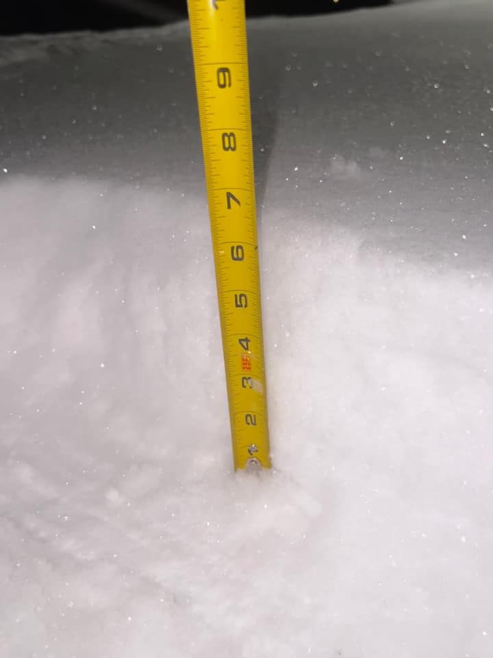
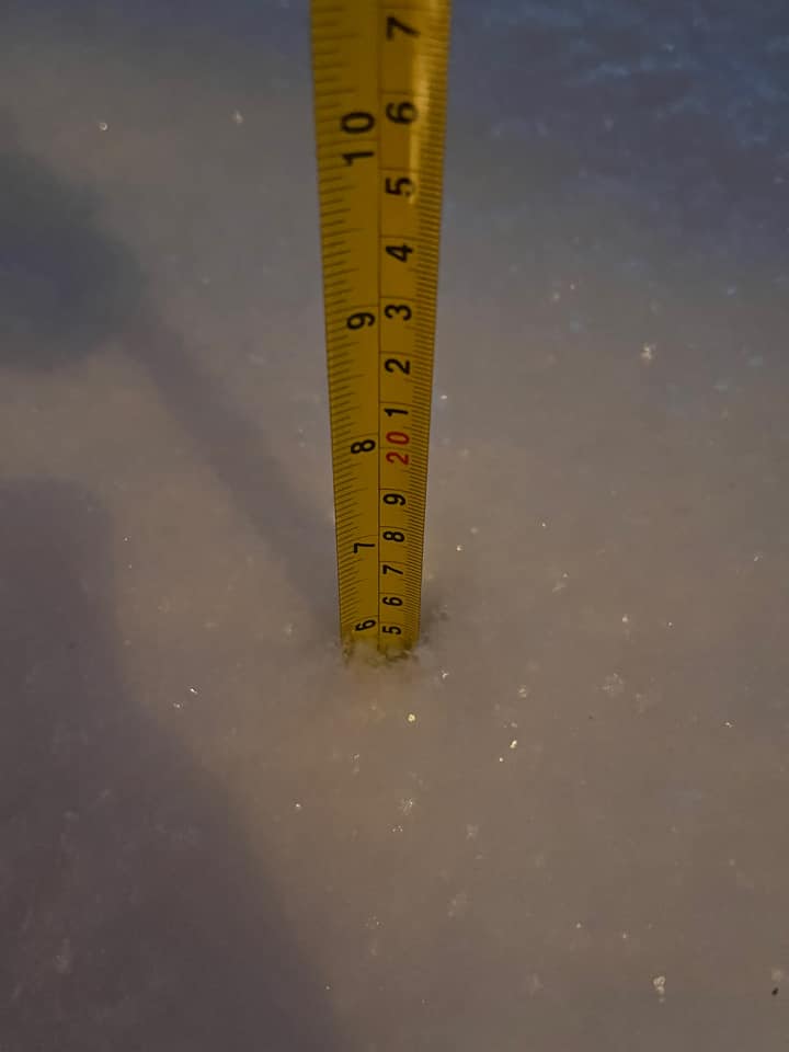
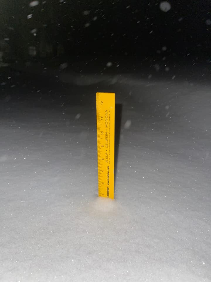
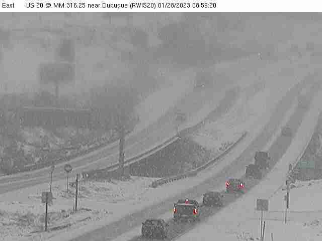
Photos:
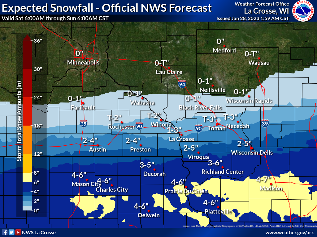
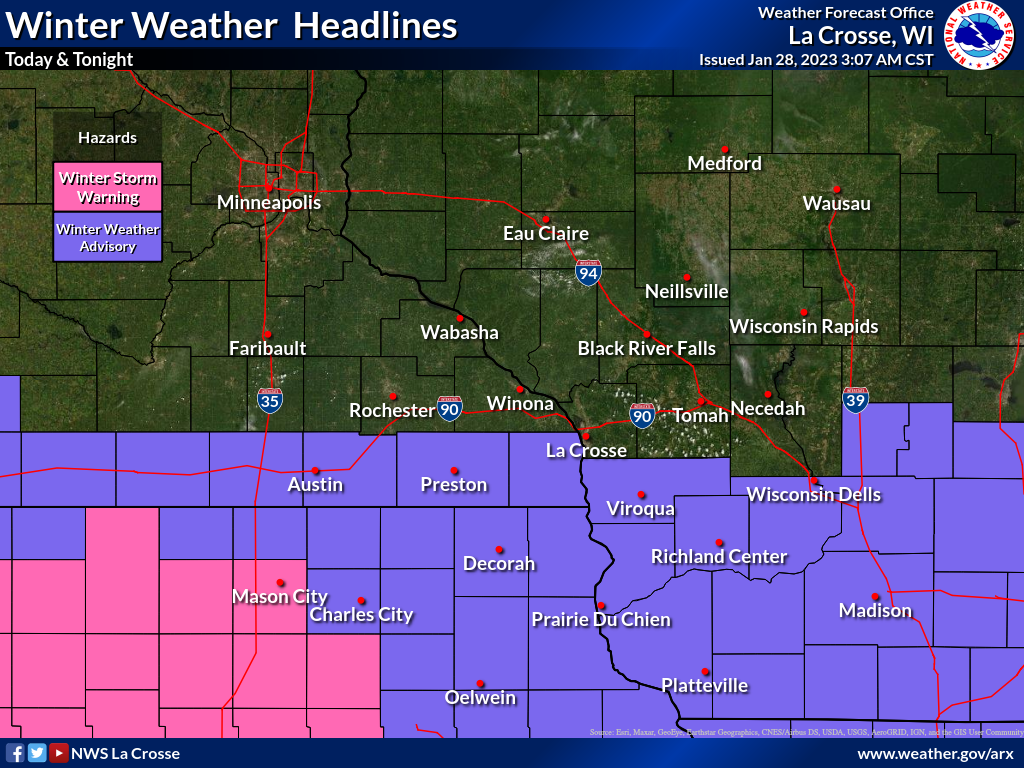
Graphics & Radar:
|


 Weather Story
 Weather Map
 Local Radar