
Strong to severe storms are expected to develop from mid afternoon through early evening. Damaging winds will be the main threat, but large hail and tornadoes are also possible. Have multiple ways to receive warnings and stay weather aware if you have outdoor plans. Read More >
La Crosse, WI
Weather Forecast Office
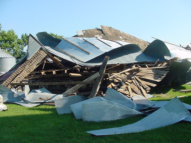
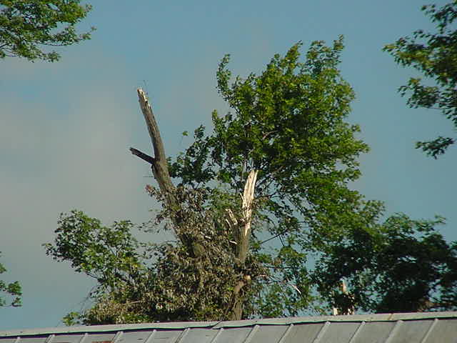
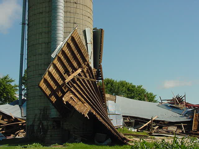
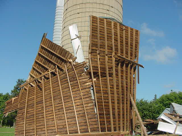
During the early morning hours of Monday, July 7th, a brief tornado touchdown occurred just southwest of New Hampton, IA. The approx. tornado touchdown time was 4:06 a.m. and was ranked an F0 on the Fujita Scale. This was the first tornado of the 2003 season for NWS La Crosse.
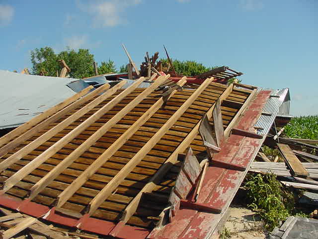
Damage was confined to a few farm buildings and trees on one particular farm about 1-2 miles south-southwest of New Hampton, Iowa. Click here for a map of the touchdown.
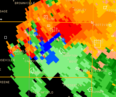
Doppler Radar imagery:
These damage photos courtesy of Chickasaw County Emergency Management.
 |
 |
 |
 |
 |
A Tornado Warning was issued by the La Crosse National Weather Service for Chickasaw County at 3:48 a.m. The warning was based on radar signatures and analysis of atmospheric conditions.
Our Office
Community Involvement
Station / Location Info
Follow Us On Social Media
Student Opportunities
Additional Information
Storm Summaries
Cooperative Observers
Educational Resources
Science / Research
Weather Phenomenon
Mayfly Tracking
Latest
Temp/Pcpn Summary
Precipitation Reports
Forecast Discussion
Hazardous Weather Outlook
Hourly Weather
Public Information Statement
Local Storm Report
Lightning Plot Archive
River Stages
Water Temp
Observations
Precipitation Plotter
Soil Temps
US Dept of Commerce
National Oceanic and Atmospheric Administration
National Weather Service
La Crosse, WI
711 County Road FA
La Crosse, WI 54601
608-784-7294
Comments? Questions? Please Contact Us.


 Weather Story
 Weather Map
 Local Radar
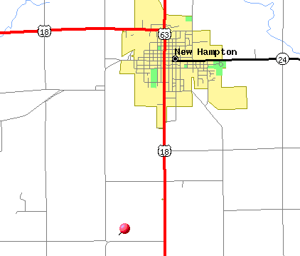