Record flooding took place along the Turkey River and its tributaries in northeast Iowa, Sunday May 16 into Monday May 17, 1999.
A large complex of thunderstorms developed over Nebraska early Sunday morning and moved east across northern Iowa. This was followed by the development of additional thunderstorms which repeatedly moved over the same area. This resulted in torrential rain with more than 5 inches of rain reported at several locations and radar estimates of up to 8 inches.
| Oelwein, IA | 8.30 |
| Fayette, IA | 6.30 |
| Elkader, IA | 5.54 |
| Strawberry Point, IA | 5.48 |
| Garber, IA | 3.67 |
| Guttenberg, IA | 3.30 |
| Clermont, IA | 2.96 |
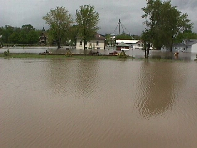
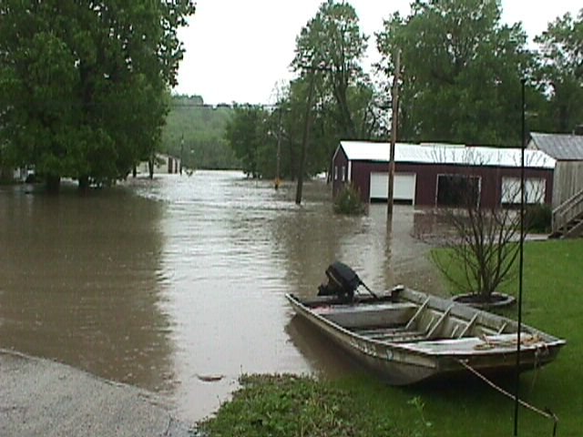
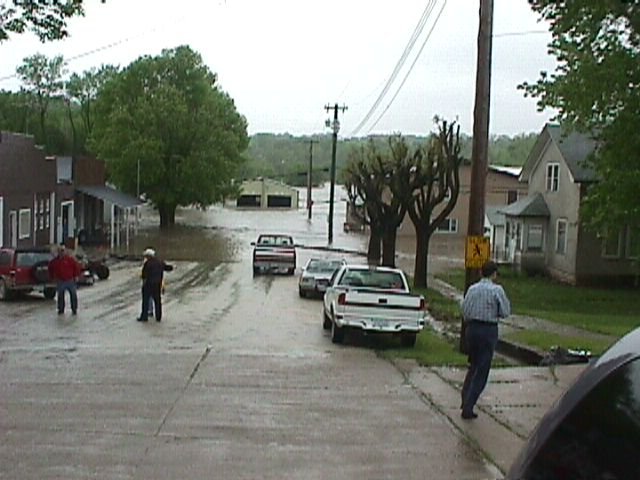
Major damage was done to the towns of Fayette and Oelwein, where water inundated homes, businesses, and roadways. Boat rescues needed to be done in these areas, and the high water caused some gas and fuel oil leaks.
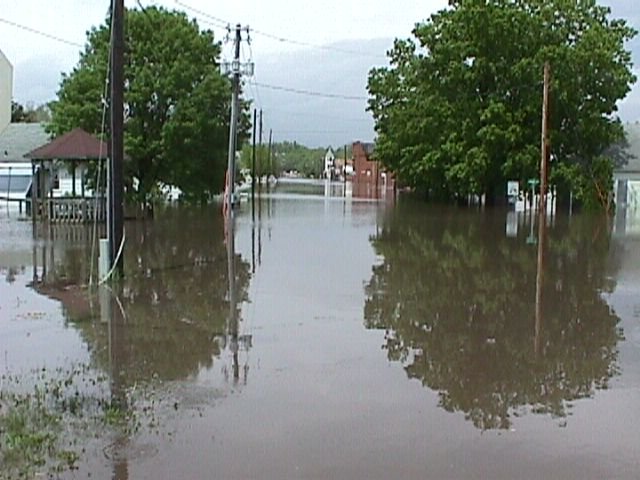
But the worst of the damage occurred along the Volga River from around Volga and Osborne, to Littleport and Elkport, and also along the Turkey River from near Elkader, down through Garber, and to near Osterdock. Staff from the National Weather Service at La Crosse traveled to the Garber, Osborne and Elkader areas on Monday, reviewing the damage. These photos are a result.
According to reports, many roads were flooded and some bridges were even swept away. Mudslides were also reported. As water continued to rise, entire towns were evacuated. Residents of the communities of Volga, Osborne, Littleport, Garber, and parts of Elkader and Osterdock were all forced from their homes. At one point, the town of Fayette was reported to be under 10 feet of water. Major damage was done to at least 70 homes around the area, with several destroyed. The water sewage treatment plant was out of operation in the town of Fayette.
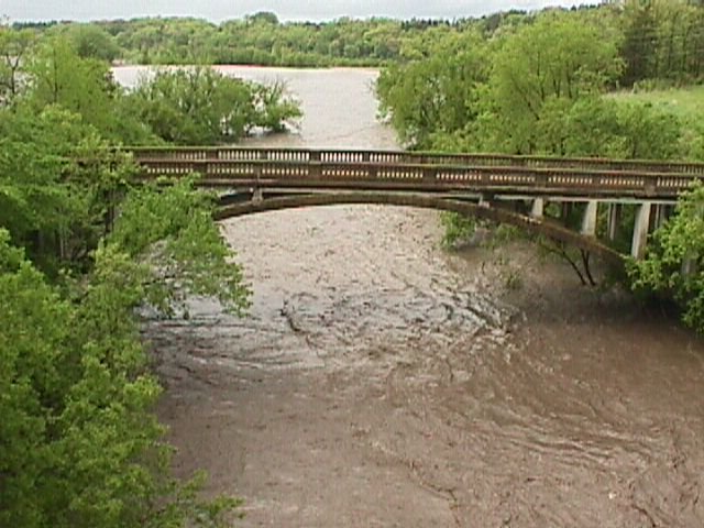
Major flooding occurred along both the Volga and Turkey Rivers, and a new record flood was established for the forecast point at Garber, IA. The crest topped out at 30.6 feet around noon Tuesday, while flood stage is 17 feet. The previous record was a level of 30.1 feet, on May 15, 1991.
Thankfully, no loss of life occurred with this severe flooding event. Injuries are unknown at this time, and damage estimates will be in the millions.

From road C24 on the south side of Volga. This is near the 2nd crest time, approx. 24 ft. Most of the south end of Volga is under water. |
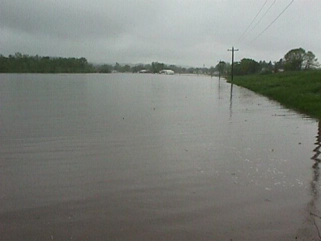
Main channel of Volga river. |
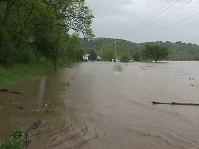
Looking north down Main St. in Volga. The river is about 1 mile wide just east of Volga. |
A closer look down Main St. Volga near the 2nd crest time. Residents say it was 2 feet higher than the flood of 1947. |
Volga river from high bridge (Evergreen Rd.) at Mederville. |
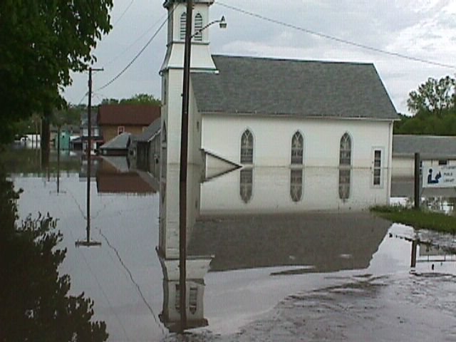
High water marks visible on church side. Residents reported river rose very fast and levee failed quickly. |
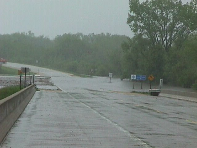
Road C21 bridge north of Littleport, down about 18 inches from crest. Debris jam on bridge includes propane tanks. |
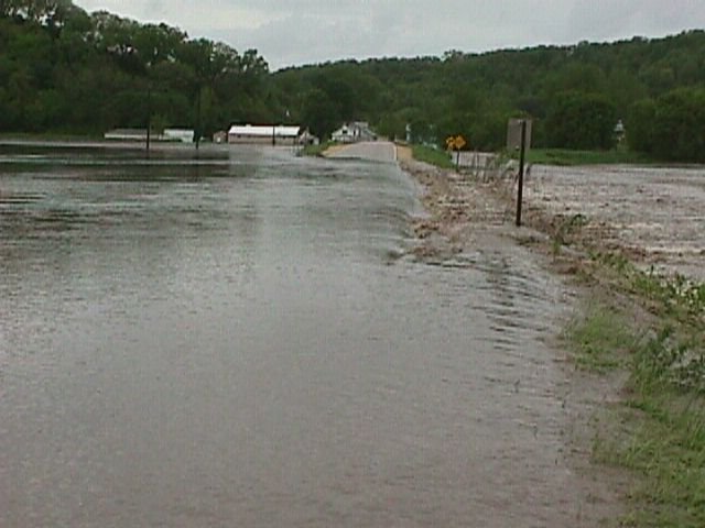
Turkey river at Osterdock X47 bridge. Road closed with 12-18 inches of water flowing over south approach. Worst flooding in 65 years reported by local residents. |
Volga river at HWY 13 in Osborne. Low steel of bridge damming the flow. |
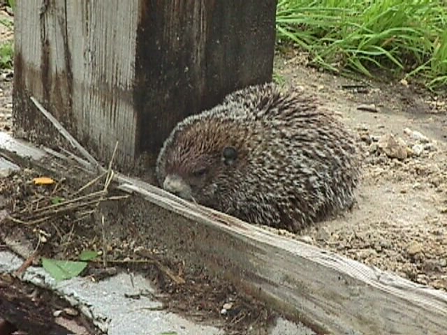
Furry flood victim (woodchuck) trapped near guardrail on south end of HWY 13 bridge over Volga river. Highway department personnel reported the critter had been there all day. |
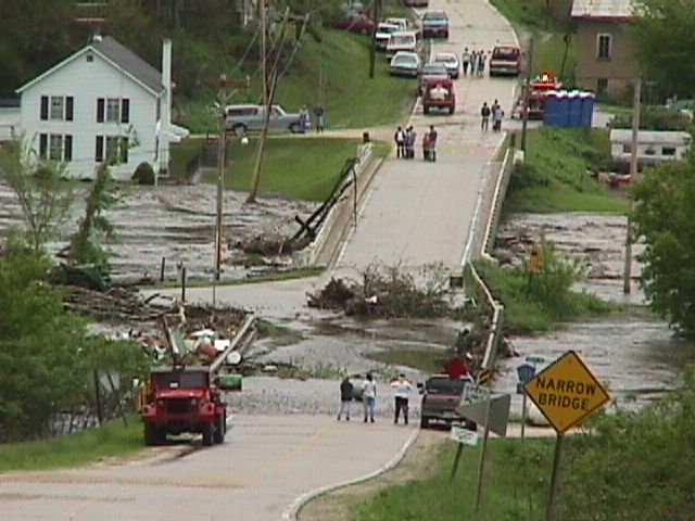
Downstream toward Garber on X41...south end of Garber under water. Stage is 30.3 feet. |
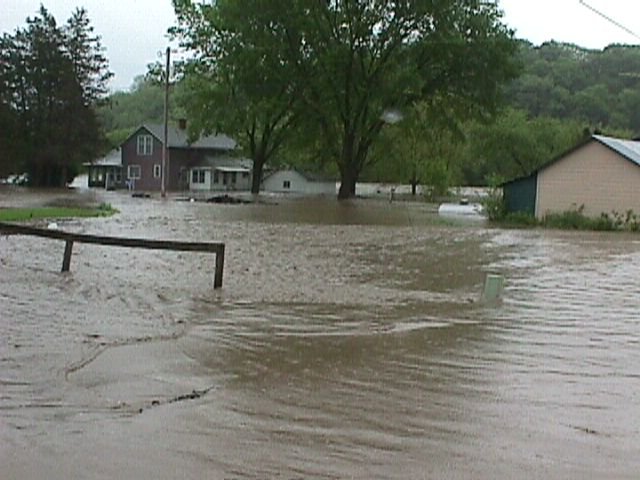
Southeast end of Garber from a street in town. |
South end of Garber. |
South end of Garber again. |
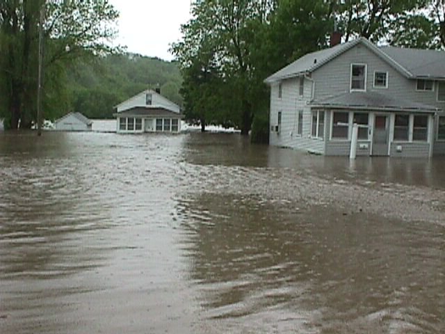
South end of Garber...post office in left center of picture, fire station distant center. |
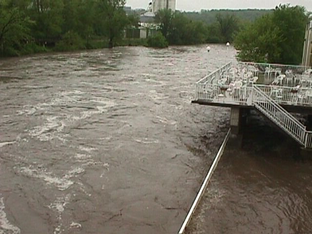
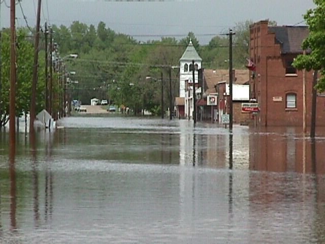
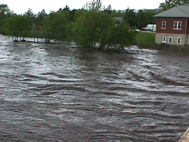
Turkey river in Elkader. Looking downstream from stone arch bridge. |
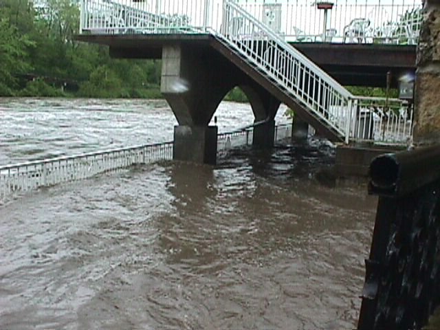
View from staircase near lower deck, just downstream of stone arch bridge. |
Volga river from road C2W bridge, looking toward Volga. River is about 1 mile wide here. |
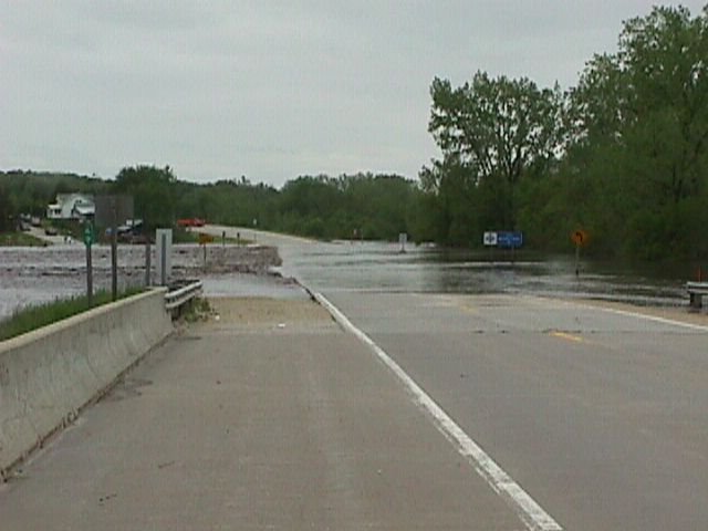
Volga river at HWY 13 bridge...6 to 12 inches of water over the road. |
Volga river at Wadena from road W51 bridge. Crest bottom of white on door of building in upper left of picture. River flowing muddy and fast here. |


 Weather Story
 Weather Map
 Local Radar