Binghamton, NY
Weather Forecast Office
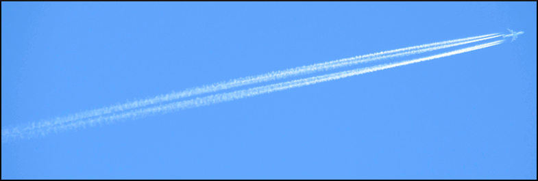
The image below shows an airplane producing a contrail in the sky over Binghamton, NY.

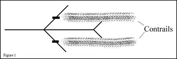
Condensation trails, commonly called contrails, are narrow cirrus cloud streamers that form behind high flying aircraft. Contrails are formed by two basic processes. The first method of formation relies on hot and humid engine exhaust mixing with air of low vapor pressure at low temperatures. As the added moisture and particulate matter from the exhaust mixes with the cold air, condensation occurs and the streamer is born (Figure 1). These types of contrails are sometimes called exhaust trails.

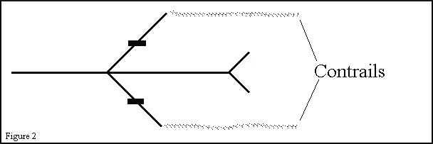
The second method of formation occurs when an airplane flies through air that is clear but has a relative humidity near 100 percent. The pressure change generated by the air flow over the wing tip causes a reduction in temperature and results in complete saturation of the air. The turbulent vortex generated by the wing tip completes the process and a contrail is generated behind the wing tips (Figure 2). These contrails are not as pronounced as those formed by engine exhaust and are comparatively rare. Contrails formed by this process are sometimes called aerodynamic trails.

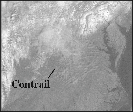
Under the right conditions contrails can persist for a prolonged period of time and sometimes evolve into a complete layer of cirrus. Contrails that become large enough can occasionally be seen by satellite. In the satellite picture below several contrails are visible embedded in a thin patch of cirrus near the Virginia/North Carolina border on January 26, 2001. Some transverse banding is also present in the patch of cirrus. The contrails can be distinguished from the parallel transverse bands because they are at irregular angles and intersect the transverse bands.

Current Hazards
Briefing
Drought
Fire Weather
Graphical Hazardous Weather Outlook
Hurricanes
Local Outlook
River Flooding
Space Weather
Thunderstorms
Winter
Current Conditions
Air Quality
Local Storm Reports
Observation (list)
Observations (Map)
More Surface Observations
Rainfall
Satellite
More Satellite
Upper Air
Radar
Local Enhanced Radar
Local Standard Radar (low bandwidth)
Regional/National Standard Radar (low bandwidth)
More Radar
Forecasts
Activity Planner
Aviation
Fire Weather
Forecaster's Discussion
HeatRisk
Hourly View
Map View
Model Data
NWS GIS Viewer
Space Weather
Text Products
Rivers and Lakes
River Observation/Forecasts (Map)
River Forecast Centers
County Flash Flood Guidance
Current Streamflow
Ensemble River Guidance
Flood Inundation Maps
US Dept of Commerce
National Oceanic and Atmospheric Administration
National Weather Service
Binghamton, NY
32 Dawes Drive
Johnson City, NY 13790
(607) 729-1597
Comments? Questions? Please Contact Us.

